Springerville, AZ Current Weather and Forecast
Springerville, AZ Weather Forecast
8:21 PM MST Wed Apr 24 2024
REST OF TONIGHT - Clear. Lows around 32 above 7000 feet - around
38 below 7000 feet. Southwest winds around 15 mph with gusts to
around 30 mph.
THURSDAY - Windy, cooler. Mostly sunny in the morning - partly
cloudy with a 20 percent chance of thunderstorms and snow showers
in the afternoon. No snow accumulation. Snow level 8500 feet in
the afternoon. Highs 48 to 56 above 7000 feet - 57 to 63 below
7000 feet. Southwest winds 15 to 20 mph with gusts to around
35 mph increasing to 20 to 30 mph with gusts to around 45 mph in
the late morning and afternoon.
THURSDAY NIGHT - Mostly clear. Lows around 30 above 7000 feet -
around 36 below 7000 feet. Southwest winds 15 to 20 mph. Gusts up
to 35 mph early in the evening.
FRIDAY - Windy. Mostly sunny in the morning then becoming partly
cloudy. Highs 53 to 63. Southwest winds around 15 mph increasing
to 20 to 30 mph in the afternoon. Gusts up to 45 mph.
FRIDAY NIGHT - Windy. Mostly cloudy with a 40 percent chance of
rain and snow showers. Snow level 8000 feet. Lows 29 to 37.
Southwest winds 20 to 30 mph. Gusts up to 45 mph in the evening.
SATURDAY - Windy, cooler. Mostly cloudy with a chance of rain
showers, snow showers and a slight chance of thunderstorms. Highs
41 to 49 above 7000 feet - 50 to 56 below 7000 feet. Chance of
precipitation 40 percent.
SATURDAY NIGHT - Partly cloudy. Lows 26 to 32 above 7000 feet -
around 35 below 7000 feet.
SUNDAY AND SUNDAY NIGHT - Mostly clear. Highs 53 to 61 above
7000 feet - 63 to 69 below 7000 feet. Lows 26 to 35 above
7000 feet - around 37 below 7000 feet.
MONDAY AND MONDAY NIGHT - Clear. Highs 61 to 69 above
7000 feet - 70 to 76 below 7000 feet. Lows 30 to 40 above
7000 feet - 38 to 47 below 7000 feet.
TUESDAY THROUGH WEDNESDAY - Breezy. Mostly clear. Highs 65 to
73 above 7000 feet - 74 to 80 below 7000 feet. Lows 35 to
42 above 7000 feet - 41 to 47 below 7000 feet.
National Weather Service Flagstaff AZ
Springerville, AZ Current Weather Conditions
ST JOHNS INDUSTRIAL AIRPRK, AZ, United States (KSJN) 34-31N 109-23W 1745M
Jun 10, 2022 - 03:54 PM EDT / 2022.06.10 1954 UTC
Wind: from the NW (310 degrees) at 7 MPH (6 KT):0
Visibility: 10 mile(s):0
Sky conditions: clear
Temperature: 93.9 F (34.4 C)
Dew Point: 26.1 F (-3.3 C)
Relative Humidity: 8%
Pressure (altimeter): 30.15 in. Hg (1020 hPa)
Data:
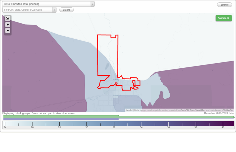
Snowfall Total (inches)
Temperature - Highest of record (°F)
Temperature - Lowest of record (°F)
Mean number of days with minimum temperature 32 °F or lower
Mean number of days with maximum temperature 90 °F or higher
Normal precipitation (inches)
Mean number of days with precipitation 0.01 inches or more
Maximum wind speed (MPH)
Normal daily mean temperature (°F)
Normal cooling degree days, Base 65 °F
Normal heating degree days, Base 65 °F
Normal daily maximum temperature (°F)
Normal daily minimum temperature (°F)
Average percent of possible sunshine (%)
Cloudiness - Mean number of days clear
Cloudiness - Mean number of days partly cloudy
Cloudiness - Mean number of days cloudy
Average relative humidity - Morning (%)
Average relative humidity - Evening (%)
Tornadoes in 1950-2018
Tornadoes in 1950-1954
Tornadoes in 1955-1959
Tornadoes in 1960-1964
Tornadoes in 1965-1969
Tornadoes in 1970-1974
Tornadoes in 1975-1979
Tornadoes in 1980-1984
Tornadoes in 1985-1989
Tornadoes in 1990-1994
Tornadoes in 1995-1999
Tornadoes in 2000-2004
Tornadoes in 2005-2009
Tornadoes in 2010-2014
Tornadoes in 2015-2018
Earthquakes in 2000
Earthquakes in 2001
Earthquakes in 2002
Earthquakes in 2003
Earthquakes in 2004
Earthquakes in 2005
Earthquakes in 2006
Earthquakes in 2007
Earthquakes in 2008
Earthquakes in 2009
Earthquakes in 2010
Earthquakes in 2011
Earthquakes in 2012
Earthquakes in 2013
Earthquakes in 2014
Earthquakes in 2015
Earthquakes in 2016
Earthquakes in 2017
Earthquakes in 2018
Earthquakes in 2019
Earthquakes in 2020
Earthquakes in 2000-2020
Snowfall Total (inches)
Temperature - Highest of record (°F)
Temperature - Lowest of record (°F)
Mean number of days with minimum temperature 32 °F or lower
Mean number of days with maximum temperature 90 °F or higher
Normal precipitation (inches)
Mean number of days with precipitation 0.01 inches or more
Maximum wind speed (MPH)
Normal daily mean temperature (°F)
Normal cooling degree days, Base 65 °F
Normal heating degree days, Base 65 °F
Normal daily maximum temperature (°F)
Normal daily minimum temperature (°F)
Average percent of possible sunshine (%)
Cloudiness - Mean number of days clear
Cloudiness - Mean number of days partly cloudy
Cloudiness - Mean number of days cloudy
Average relative humidity - Morning (%)
Average relative humidity - Evening (%)