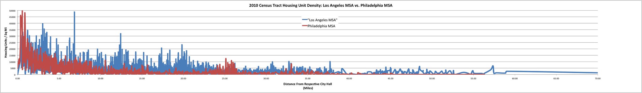
Thought some of you might find this interesting. I made this census tract housing density chart using 2010 census data and calculating the distance of each census tract from the "core" (in each case the census tract that contains the central city's City Hall). As you can see, outside the immediate 1 mile radius of City Hall (and a small mysterious 'bump' about 25 miles from Philly's City Center--any Philly people can tell me what this is? I guess I can look at my data..), Los Angeles is consistently a more built up urban area than Philadelphia is.
What this shows is that LA's basic central urban fabric of tightly-packed (but detached) single family houses with interspersed apartment buildings is equal or greater in structural density to Philly's basic rowhouse fabric.
 http://farm8.staticflickr.com/7274/7...47449591_k.jpg