Please register to participate in our discussions with 2 million other members - it's free and quick! Some forums can only be seen by registered members. After you create your account, you'll be able to customize options and access all our 15,000 new posts/day with fewer ads.
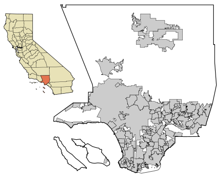
This is a map of Los Angeles County and the cities that make it up to reach 10 million residents. About 45% of the county is undeveloped mountains or deserts (the white areas). The two gray areas all alone surrounded by white in the top right of the map are the desert cities of Lancaster and Palmdale, some of the cheapest housing in Southern California. The gray that makes up the majority of the map contains the L.A. Basin, San Fernando Valley, and San Gabriel Valley. Catalina Island is also a part of Los Angeles County, containing the small towns of Avalon and Twin Harbors.
New York County is the densest at 72,000 people/sq. mi
Please register to post and access all features of our very popular forum. It is free and quick. Over $68,000 in prizes has already been given out to active posters on our forum. Additional giveaways are planned.
Detailed information about all U.S. cities, counties, and zip codes on our site: City-data.com.

 Please register to participate in our discussions with 2 million other members - it's free and quick! Some forums can only be seen by registered members. After you create your account, you'll be able to customize options and access all our 15,000 new posts/day with fewer ads.