Quote:
Originally Posted by assez

How bad is the flooding in the Oak Island/St James area? Is it very different on the ICW than in the marshy areas?
|
Lets think about this a second.
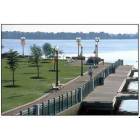
SJP is very near the ocean. Water is salty and there are tides. Tides change on average about 2-3 feet, some time a bit more depending on the wind, moon etc.
The ICW water level goes up and down with the tides. The major marsh land in SJP is called Polly Gully. The water in Polly Gully goes in and out with the tides. That should be pretty obvious that the water level in Polly Gully, the ICW and the ocean are all pretty much the same, e.g. sea level.
Along the water way and along the marsh land the Federal government says the 100 year flood plane is about 10-11 feet. That means that once every 100 years (or a 1% chance on any given year) the water level in the ocean, the ICW and around the marsh land will probably rise 10-11 feet above average. Again, if the moon and wind have their way it might possibly be a bit more.
So now the bottom line is, how high is your house above sea level.
The first part of that is, how high is the land you intend to build the house on. Most land in the area, except that right on the water, is at about 10-11 feet or about the same as the 100 year flood level. Property right on the water or marsh land may only be 3-4 feet above sea level.
Now you will see most houses on the water are built on pilings. It may not be immediately obvious at first because the owners like for their homes to look nice in SJP so they enclose the lower level of pilings so the lower level looks like the upper levels. On closer examination you will see the lower level, though enclosed, is actually just storage and garage. In many cases, on the inside you will not see any drywall or finishing or hot water heaters etc at ground level. The outside is just a facade to look nice. Then you will notice steps going up to a front porch and front door at the second floor level. This is where the real living space begins, on top of the pilings some 8 to 10 feet above the ground. So now the first floor is 3-4 feet (the ground level above sea level) plus another 8 to 10 up on pilings or possibly as much as 14 feet above sea level. If a 10-11 foot 100 year flood happens, the main house is safe and all that floods is the storage/garage space.
The same logic applies to homes a bit further away from the water front that may be on land that is 10-11 feet above sea level except to get above the 100 year flood plane they only need to raise their house 3-4 feet to be safe. Most foundations do this anyway.
Even further away from the water, in SJP up closer to 211, the land elevation is probably closer to 15 or 20 feet above sea level. Not much to worry about there.
Keep in mind that a lot of SJP is in a low lying area. There are many ponds and small lakes every where that make for nice scenery and more importantly, they provide a place for water to go. Heavy rains still cause standing water in the streets and swale's along the road edge. Usually the water runs off and drys up pretty quickly. No doubt there are a few problem areas but the POA seems to be pretty pro active in fixing these.
Finally SJP is about a mile as the crow flies from the ocean. There are hurricanes from time to time and mother nature in not a force to be reckoned with. In 1954 Hurricane Hazel hit Oak Island and only five buildings were left standing. No amount of planning, pilings, storm drains or ponds are going to matter much with a 18 foot storm surge that was recorded in Calabash. Hazel killed over 1,000 people. That is pretty sobering. We like to think we are smarter, better building codes, better weather forecasting and so on. A category 1 or 2 hurricane is generally not much to worry about. A category 3 is iffy, most people will just batten down and ride it out. I guarantee that should a category 4 or greater head toward SJP, I will be far away inland.

 Please register to participate in our discussions with 2 million other members - it's free and quick! Some forums can only be seen by registered members. After you create your account, you'll be able to customize options and access all our 15,000 new posts/day with fewer ads.


 D
D