Welcome to City-Data.com Forum!
U.S. CitiesCity-Data Forum Index
Go Back   City-Data Forum > General Forums > Weather > Hurricanes
 [Register]
Please register to participate in our discussions with 2 million other members - it's free and quick! Some forums can only be seen by registered members. After you create your account, you'll be able to customize options and access all our 15,000 new posts/day with fewer ads.
View detailed profile (Advanced) or search
site with Google Custom Search

Search Forums  (Advanced)
 
Old 10-06-2016, 11:51 AM
 
Location: Near the Coast SWCT
83,516 posts, read 75,307,397 times
Reputation: 16619

Advertisements

Radar, Satellite, Wind Gusts, and storm report loops last 4 hrs

Satellite getting glitchy


Closer up. HOLY WOW, I never remember seeing a spin like that with the rain at the core. Getting dizzy looking at it

Watch Nassau wind gust report vanish after the eye passes. Station must of gotten ripped apart, hasn't reported since.

Reply With Quote Quick reply to this message

 
Old 10-06-2016, 11:53 AM
 
Location: Near the Coast SWCT
83,516 posts, read 75,307,397 times
Reputation: 16619
In Georgia this afternoon


https://twitter.com/511Georgia/statu...711232/photo/1


Reply With Quote Quick reply to this message
 
Old 10-06-2016, 12:01 PM
 
Location: Near the Coast SWCT
83,516 posts, read 75,307,397 times
Reputation: 16619
https://twitter.com/NWS/status/78408...461248/photo/1


Reply With Quote Quick reply to this message
 
Old 10-06-2016, 12:05 PM
 
Location: Near the Coast SWCT
83,516 posts, read 75,307,397 times
Reputation: 16619
Still too far for severe stuff.. South of West Palm Beach getting lucky with Matthew as I said this morning. It's north of there that have to worry

Landfall (if any) still 15+ hrs away depending where. Main models barely scraping the coast with a landfall.

2 PM ET update raises the storm surge threat for east-central FL, NE FL, and SE GA. 7-11 FEET of catastrophic flooding possible.


https://twitter.com/LeeGoldbergABC7/...231360/photo/1
Reply With Quote Quick reply to this message
 
Old 10-06-2016, 12:06 PM
 
Location: New York
11,326 posts, read 20,332,923 times
Reputation: 6231
Quote:
Originally Posted by Infamous92 View Post
Good thing about Matthew is that while it is a Cat 4, those winds are concentrated around the core, not the case with Sandy so I don't see the damage being as extensive with Matthew.

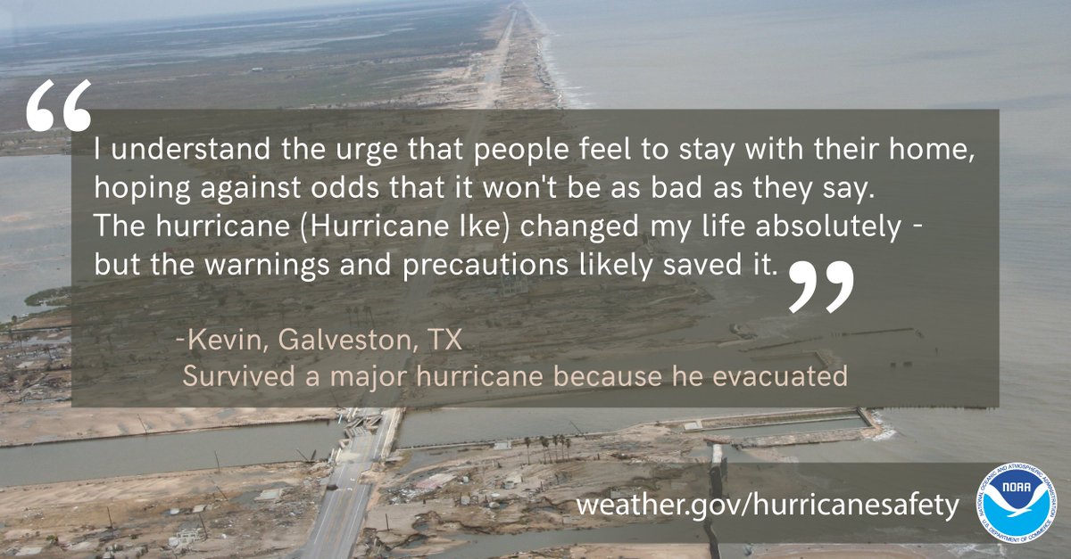
Storm surge is often an over looked aspect of hurricanes, even if you're spared the worst winds you may still have to deal with feet of water, I hope people are prepared.
I take that back, looking at the current projected path, if this thing heads inland it could possibly give Katrina and Sandy a run for their money. I hope it doesn't, many people will have evacuated only to still end up in the storm's path.
Reply With Quote Quick reply to this message
 
Old 10-06-2016, 12:11 PM
 
Location: Near the Coast SWCT
83,516 posts, read 75,307,397 times
Reputation: 16619
Euro Wind Gust projections....... You can see the closer you are to the coast and in those counties, the worse it will be. Drive 1-2 hours west and you will miss the brunt of it.

Storm this strong is going to push that Atlantic Ocean right into the coast. Not good. Almost as if Georgia/South Carolina coast will take the biggest hit with the surge the way it's coming in.


https://twitter.com/StuOstro/status/...812160/photo/1
Reply With Quote Quick reply to this message
 
Old 10-06-2016, 12:22 PM
 
29,522 posts, read 19,616,477 times
Reputation: 4542
https://twitter.com/MJVentrice/statu...89662180687884
Reply With Quote Quick reply to this message
 
Old 10-06-2016, 12:23 PM
 
4,948 posts, read 3,053,228 times
Reputation: 6752
[quote=Cambium;45731402]Radar, Satellite, Wind Gusts, and storm report loops last 4 hrs

Closer up. HOLY WOW, I never remember seeing a spin like that with the rain at the core. Getting dizzy looking at it

12 years ago:

https://www.youtube.com/watch?v=Yx73iOdVFOo

Mathew is about the same size and intensity,
Reply With Quote Quick reply to this message
 
Old 10-06-2016, 12:28 PM
 
Location: Miami,FL
2,886 posts, read 4,107,053 times
Reputation: 715
Quote:
Originally Posted by Cambium View Post
Euro Wind Gust projections....... You can see the closer you are to the coast and in those counties, the worse it will be. Drive 1-2 hours west and you will miss the brunt of it.

Storm this strong is going to push that Atlantic Ocean right into the coast. Not good. Almost as if Georgia/South Carolina coast will take the biggest hit with the surge the way it's coming in.


https://twitter.com/StuOstro/status/...812160/photo/1
Seriously wind gusts of 40-50 is The most I have to look forward to those are supposed to be the sustained winds
Reply With Quote Quick reply to this message
 
Old 10-06-2016, 12:30 PM
 
Location: Near the Coast SWCT
83,516 posts, read 75,307,397 times
Reputation: 16619
NWS office in Melbourne employees are ready to assist people with forecasts and messages.

https://twitter.com/NWSMelbourne/sta...96924043452417
Reply With Quote Quick reply to this message
Please register to post and access all features of our very popular forum. It is free and quick. Over $68,000 in prizes has already been given out to active posters on our forum. Additional giveaways are planned.

Detailed information about all U.S. cities, counties, and zip codes on our site: City-data.com.


Reply
Please update this thread with any new information or opinions. This open thread is still read by thousands of people, so we encourage all additional points of view.

Quick Reply
Message:


Over $104,000 in prizes was already given out to active posters on our forum and additional giveaways are planned!

Go Back   City-Data Forum > General Forums > Weather > Hurricanes

All times are GMT -6. The time now is 02:33 AM.

© 2005-2024, Advameg, Inc. · Please obey Forum Rules · Terms of Use and Privacy Policy · Bug Bounty

City-Data.com - Contact Us - Archive 1, 2, 3, 4, 5, 6, 7, 8, 9, 10, 11, 12, 13, 14, 15, 16, 17, 18, 19, 20, 21, 22, 23, 24, 25, 26, 27, 28, 29, 30, 31, 32, 33, 34, 35, 36, 37 - Top