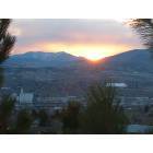
Road Trip - Dry Camping in Idaho? (Pocatello, Soda Springs: how much, homes)
Please register to participate in our discussions with 2 million other members - it's free and quick! Some forums can only be seen by registered members. After you create your account, you'll be able to customize options and access all our 15,000 new posts/day with fewer ads.
Hmmm, the only way up to CDA from Boise that is in Idaho, is via Whitebird that I can see? I wanted to see the Grangeville area and Orofino as well...is is just a steep grade cause we do that in the Sierra sometimes up Hwy 88 and other camping areas around here, or is it cliffs and narrow crazy stuff? :O
I do want to see Bonners Ferry if possible, but can come back down to Sandpoint and travel 200 to Montana..although I thought seeing the Flathead area of MT might be interesting....
Is there a decent trailer pulling route from Cody through Yellowstone? Only because I wanted to check out the Idaho Falls area, but really want to see Pocatello and Preston...I know someone who says there is great fishing in these areas? Although, the Riverton route was my first instinct lol...and I really wish I could sneak into Salmon ID as well.....
Yep, 95 is it if you want to go north through Idaho. The White Bird grade is only hair-raising because of the steep grade, no scary cliffs. It is a well-maintained highway, so if you don't mind a steep grade, go for it. It is a gorgeous area, and the history is worth knowing, a cavalry vs Nez Perce battle which didn't go too well for the cavalry (look up Battle of White Bird Canyon, https://en.wikipedia.org/wiki/Battle...te_Bird_Canyon). Orofino is in a beautiful setting along the Clearwater, but you have to get off 95 and go on 12 in order to see it, and that is a narrow, winding road. Grangeville is on top of the plateau, and not especially fascinating, IMO (sorry, Grangeville). Good for an overnight stop. Super 8 and Subway.
The Flathead area of MT is interesting, and the lake is beautiful. You can go up 93 from 200 along the lake and get to Kalispell that way. But the Bonners-Troy-Libby-Kalispell route is fine, too, along the Kootenai River where The River Wild was filmed, at the Falls.
You can see where I'm going, can't you? One trip is not enough.
If you get to Polson, by Flathead Lake, don't miss the Miracle of America Museum! I hope it is still open in these pandemic times. It is the most amazing collection of everything--uniforms, pop music industry, tractors, Western artifacts, old buildings, you name it. All kinds of trivia. We could have spent days there. And it's all based on one man's hobby as a collector.
Last edited by Clark Fork Fantast; 08-21-2020 at 07:05 PM..
Reason: Added Miracle of America Museum
Whitebird is a very long, very steep exposed grade that winds its way up Whitebird Hill. Grangeville lies at the top.
It's a hard pull when hauling a trailer, but if the vehicle is well rigged for pulling, Whitebird's OK, except in the dead of winter.
Yellowstone's roads are in bad shape. If you're going from Cody through the Park, I suggest exiting through West Yellowstone. That will put you onto US 20, and once in Idaho (maybe 10 miles), 20 will take you straight to Idaho Falls by way of Island Park. The Ashton grade is steep, but not like Whitebird, and much shorter.
From Idaho Falls going north, you can leave I-15 at Terreton and head to Salmon on ID 20. That will take you over the Lost Trail pass into Montana's Bitterroot country, then back into Idaho at Lolo, Mt. on US 12. This will take you down the Lolo Pass to Lewiston, then up to Moscow and on to C d'A.
This route will bypass Whitebird, which you can drive going back south. That route leads to Boise, then Twin Falls and from Twin, on to Pocatello, all Interstate. (Or not- most of the old 2-lanes still exist, and they are slower to drive.)
This is the route I would choose if I was coming from California and wanted to see the entire state. Northward on the east side, across the state at Lolo, then return south going down the west side. It's a long beautiful cruise.
Idaho is populated around the edges of the state became the center is too mountainous to be populated. That's why you see so few highways running east to west on a map. It's also why the Interstates loop around the state instead of going straight through it.
Every route will be scenic, but different. Passes are a given. Bring some extra water, and make sure the radiator is full. Load a sweater or a jacket- it can get cold here at night, even in summer's heat.
I know one trip isn't enough, and I am looking to possibly move when we finally totally retire...so I am looking around for possible options while we travel. I did read about some of the history of Whitebird grade when I looked it up online and found it fascinating, love to know about the history as we travel.
Where I currently reside is historically amazing and beautiful and I love my little city, so it will be hard to match.
Some of the criteria I am looking for in a locale for possible relocation are lots of lakes, rivers and mountains. Lots of public land and trails for hiking and biking. Lots of fishing nearby. Dog friendly and not too frigid and frozen of a winter, although I am fine with the winters where I live and we can have long, hard winters here...but it's sunny usually and the snow melts off pretty fast for the most part...and nice housing options on at least an acre....
The route Mike noted through Yellowstone is most logical if you are planning on a visit to Idaho Falls. Sylvan pass is an easy pull for any vehicle pulling a trailer and that starts after entering the east entrance. There is some construction just before Fishing Bridge, set up with a light/flagman and a "Follow" truck. Moves pretty good, don't believe I have ever been held up for more than five minutes.
Biggest hangup with traffic in Yellowstone will be the people who want to get out and pet the Bison, fondle a bear, or sneak up on a Moose. Keep the video going it makes for some interesting films at time with people go flying into the air due to a large set of horns meeting their rear end. How long it takes also depends on the time of the year. I always do the reverse from west to east a few days or week after labor day; I have run into snow but nothing that stops the traffic. But this year due to the Wuhan virus it is hard to say how traffic would be.
Locals from both ID and WY who drive through from east to west will say take the southern loop road cause the northern one means Hayden valley (usually full of animals); however, I've always had better luck with the northern route. Southern is a bit longer in miles, but usually has less animals roaming the road. That is unless you are behind me than any route will have bison roaming the road and slowing traffic.
Highway 20 is great easy trip from W. Yellowstone to ID falls, just watch for Elk, Moose especially just north of Island park and south to Ashton.
If you leave ID falls and head through Terreton (and beautiful mud lake) you will drive through Leadore. Silver dollar restaurant has great pie, Stage stop has pretty good subs, and an old fashioned mechanical fuel pump but if fuel is needed fill up in Terreton/Mud Lake or when you get to Salmon. They charge you pretty good to use that old fashioned pump.
Some great places to do dispersed camping to the north of Leadore up at Hawley Creek. And this summer I discovered a great Free FS campground just southeast of Hamilton MT which if you head north out of Salmon you wlll travel through. (Black Bear Campground, off Skalkaho Hwy.)
I always thought the lake was prettier than it's name.
Mud Lake is good for fishing and great for bird hunting and watching.
The pioneers called it Market Lake because the wildlife was so plentiful.
It was a good place to stop, rest and fatten their teams and fill their larders w/ meat before the long hard push into Oregon.
When I was young, there were still a few traces of those old pioneer camps around the lakeshore, but time has erased them all now.
The wild waterfowl are still thick there during their seasonal migrations, along with all the other far-flying land birds that follow them. Much of the lake is now protected because it's such an important migration stop. Bird watchers have spotted many extremely rare birds there who were blown off course over the years.
The lake is warm and shallow, so it's a great place for the birds to eat up and rest too, but that shallowness can be a danger when canoeing; a storm can whip the lake up really fast, and the waters can swamp a small boat quickly. Life jackets are a must on it.
Many years ago, a Boy Scout troop was decimated by a sudden storm on Mud Lake. There were about 6 boys who were lost.
Same goes for Henry's Lake, up in Island Park. Henry's is about the same size and depth, but is a lot colder because it's fed by a huge spring that lies just offshore on the western side. A really good lake for trout, but really dangerous in a thunderstorm in a small fishing boat.
That's where I was when the Hebgen quake occurred; my uncle owned one of the lodges at Henry's at the time and he hired me to wrangle the dude string of horses he owned and to be a boat boy when I wasn't wrangling the dudes. I got to know every back trail on Mt. Sawtelle that summer, leading the string.
Great summer job for a 14-year old kid; I sure caught a lot of fish that summer! (and cleaned many more than I caught). The earthquake ended that summer very suddenly; as soon as it happened, everyone just wanted to clear out and go back home.
Last edited by banjomike; 08-22-2020 at 03:20 AM..
Honestly, never seen the lake; it's just a pass through bump in the road between here and there (plus last chance for fuel until Salmon or before I15 depending on direction of travel.
I have visited Earthquake lake up in MT that was created by the '59 earthquake. Beautiful area!
Sounds like the lakes up that way are very unique!
I love that about the Sierra Range..every lake has it's own special qualities, beaches or wave action, fish species and I love all the wild lands. It is shocking sometimes to find out that a 'lake' way up in a difficult to hike to pass in the high Sierra is actually a reservoir from when cattle or sheep herders built rock walls to dam up the water for their animals....or you find a beautiful cabin in the middle of nowhere so far deep in the forest, a mine out in a deep, rocky mountain ravine in the high desert...it's humbling as well...to find the artifacts of those who have enjoyed the natural resources before you..imagine their lives...
Bear Lake's color is unique; the phosphate deposits in the area make the water a bright turquoise blue.
The phosphate is a natural fertilizer, and Bear Lake raspberries are famous for their intense flavor.
Bear Lake is also home to the Cisco, a small tasty fish that lives deep in the water all year, then comes up to the surface in the winter briefly to spawn. They can only be fished for those few days, mostly by netting them, and it's a big deal.
The Cisco are native to the lake, and aren't threatened; they just can't be caught at any other time of year because they school so deeply.
Yes, I was looking at that lake online because it looked a bit like a Lake Tahoe type of lake in that it was big, deep and at a higher elevation...but also it looks like the desert lakes in the Great Basin. I might try and visit it on the way home from the Pocatello/Preston area....
Please register to post and access all features of our very popular forum. It is free and quick. Over $68,000 in prizes has already been given out to active posters on our forum. Additional giveaways are planned.
Detailed information about all U.S. cities, counties, and zip codes on our site: City-data.com.

 Please register to participate in our discussions with 2 million other members - it's free and quick! Some forums can only be seen by registered members. After you create your account, you'll be able to customize options and access all our 15,000 new posts/day with fewer ads.