Please register to participate in our discussions with 2 million other members - it's free and quick! Some forums can only be seen by registered members. After you create your account, you'll be able to customize options and access all our 15,000 new posts/day with fewer ads.
WOW Great map bookmarked it for sure just to explore.
We heard on the news last night that Cambridge,10 miles up the highway from us was the largest growing city in Idaho. Seems odd because we do not remember that many new houses being built. Course this is over several years.
LOL Once when we lived in challis some one left town and on the way out took duct tape and changed the population number on the road sign. Every one had a pretty good laugh over that until the tape fell off. See us Idaho folks know how to have fun.
Copied from Chanel 7 news link
"CAMBRIDGE - Whenever new Census Bureau numbers are released, a debate is sparked in Idaho from two sides...the side that thinks the gem state should continue to promote growth and the side that thinks growth will ruin the state.
The latest numbers out dont go very far to satisfy either side....unless you live in Cambridge.
The Census Bureau estimates that half of Idaho's population growth of nearly 30-thousand to the current 1.5 million occurred in 12 of the largest cities.
The other half came in many, much smaller communities....
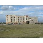
Like Cambridge....the number one fastest growing city in Idaho.
This title doesn’t come with a plaque or a trophy...but it is something they are talking about in the Washington County community.
The community where 73-percent of it's citizens commute to work for an average salary of 31-thousand dollars a year has a population of 380....that’s up 7.3-percent from the last census bureau numbers of 354....Cambridge picked up 26 citizens!
Not exactly a population boom but it is making a difference in this small rural city located 71 miles north of Boise.
Again -- Cambridge jumped by seven point three percent.
Here's a look at other population changes in Idaho.
Caldwell -- saw a six point four percent jump.
In Star -- six point three.
Nampa -- one point eight.
And Boise -- just one point two bringing the capital city to 202,736.
But that was just enough to bump the City of Trees up another spot in the national rankings.
One bit of feedback to users, and certainly you are not responsible for this, elousv, since this interactive map goes back to 1980s, there are only two major metros represented: Boise and Pocatello. That simply isn't the case anymore.
If would be great if there were a 2000-2009 interactive map. A few more metros would show up for ID, including both Couer d'Alene and Idaho Falls. There use to be one like this on CDF, not sure what happened to it. Does anyone know?
Still, if one clicks on the individual counties and realizes in 1980, things were different than they are now for most areas, it is a great tool to use.
This reminds me of sitting in an ESRI presentation where Jack Dangermond was trying to show urban sprawl in Idaho Falls. He showed a map of "growth" in the area. He tried to make it look like Idaho Falls was totally urbanized from Firth to Rigby. I had to laugh. Not saying that someday it won't be though.
Please register to post and access all features of our very popular forum. It is free and quick. Over $68,000 in prizes has already been given out to active posters on our forum. Additional giveaways are planned.
Detailed information about all U.S. cities, counties, and zip codes on our site: City-data.com.

 Please register to participate in our discussions with 2 million other members - it's free and quick! Some forums can only be seen by registered members. After you create your account, you'll be able to customize options and access all our 15,000 new posts/day with fewer ads.