Please register to participate in our discussions with 2 million other members - it's free and quick! Some forums can only be seen by registered members. After you create your account, you'll be able to customize options and access all our 15,000 new posts/day with fewer ads.
Location: northern Vermont - previously NM, WA, & MA
10,721 posts, read 23,638,873 times
Reputation: 14561
2 hours west around North Adams (Mt. Greylock), but really you might as well go up to NH for that effect. There's really nothing east of Worcester County that rises over 1,000 feet.
2 hours west around North Adams (Mt. Greylock), but really you might as well go up to NH for that effect. There's really nothing east of Worcester County that rises over 1,000 feet.
I did Greylock, thunderbolt trail recently... If that doesnt really challenge you, you may not be human.
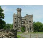
Your only 'urban' option is going to be Blue Hills. It's a nice take, but you'll be completely bored if you're looking for something like cathedral ledge or a true mountain peak trail. That said, it's a nice view of hte city,a nd feels miles further away from the city than you actually are.
I think it's worth it to just take one weekend day and drive up to NH for a good hike, even if it takes up all your Saturdays for the entire summer. Big Blue really is the next-best thing around here, but it's not really comparable. My husband has been leaving around 5 a.m. (and we live on the South Shore) on Saturdays, will hike Mt. Washington and be back in time to enjoy a nice dinner in the city. I think it's completely worth it.
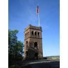
Mt . Greylock at 3,491 FT., however, is the highest-point in the Commonwealth of Massachusetts... and the Reservation led to the establishment of the state forest and park system within Massachusetts in 1898. There are over 70 miles of hiking trails, which comprise the Massachusetts section of the Appalachian Trail. The Massachusetts War Memorial Tower stands as a memorial to Massachusetts veterans of war, as well as the iconic symbol of the states highest peak. The major state funded project for improvements to Mt. Greylock State Reservation, included a new auto road (May - October) for easy access to the summit in Adams. Also, be sure to visit the Mt. Greylock Visitor's Center in Lanesborough. Other-points of interest, in nearby North Adams, include the 4.74 mile long Hoosac Tunnel. The tunnel is the longest railroad tunnel in New England, a project funded by the Commonwealth... could easily be considered western Massachusetts' Big Dig. Due to cost and length of time in construction, from 1850 - 1874. The lives of 195 miners perished during it's construction. For more information on the Hoosac Tunnel, visit Western Gateway Heritage State Park in North Adams.
Greylock is certainly a mountain, but if you're in Eastern Mass. it's not that much closer than Mt. Washington. Even then, it's not above the real treeline so it's just not the same. Anything you can start from Franconia Notch is going to be that much closer because driving straight up 93 really cuts down on the travel time (from Boston it's 2h16m, vs. 2h56m for Mt. Greylock and 3h36m for Mt. Washington, according to google).
There are some monadnocks around here (Wachusett, Monadnock, Kearsarge, from south to north) but nothing like the rocky, above-the-tree-line hiking you'd find on Mt. Washington. Blue Hill is very close to Boston and it's a great place for hiking, but it's not like the White Mountains.
Well, the AT enters Mass at the Connecticut line so Greylock hardly comprises the whole trail within Massachusetts. Greylock is a great hike and in an area that may seem less developed and more rural-pastoral than the White Mountains, which are undeveloped of course within the national forest but just outside thick with shopping outlets, second homes, traffic, etc. The northern Berkshires are really rustic! And, if you have time on the way home, take Route 2 over Whitcomb summit and down through the Deerfield valley. Route 2 becomes pretty dull east of the Connecticut River but west of Greenfield it's really scenic.
I know many trails around here but they are too easy because they are mostly flat terrain.
Does anyone know of any trails in eastern massachusetts where I can find trails similar to those in Mt Washington? (ie: a nice mountain around here?)
How far west do I need to travel in order to find something similar?
Gee... just look at a topographical map of eastern Massachusetts. We don't have any elevations as high as Mt. Washington around here. And since you mention Mt. Washington, it leads me to believe that you want to hike on trails with some descent steepness to them.
Please register to post and access all features of our very popular forum. It is free and quick. Over $68,000 in prizes has already been given out to active posters on our forum. Additional giveaways are planned.
Detailed information about all U.S. cities, counties, and zip codes on our site: City-data.com.

 Please register to participate in our discussions with 2 million other members - it's free and quick! Some forums can only be seen by registered members. After you create your account, you'll be able to customize options and access all our 15,000 new posts/day with fewer ads.