Please register to participate in our discussions with 2 million other members - it's free and quick! Some forums can only be seen by registered members. After you create your account, you'll be able to customize options and access all our 15,000 new posts/day with fewer ads.
I'm looking for a a more detailed (county or zoom-able) map showing where the snow belt of the WV and MD mountains is located. Anyone know of a better map than these?
The best thing to use would be GIS and you can download data sets from NOAA or USGS if you're really serious about it. If it's just curiosity, I can't find too much
That map definitely doesn't get into the wide variances within counties. Theee are parts of a Preston County that I'm certain should be above the 20-40 range.
That map definitely doesn't get into the wide variances within counties. Theee are parts of a Preston County that I'm certain should be above the 20-40 range.
As shown on the national map, Preston County is in the 20-40'' range.
As shown on the national map, Preston County is in the 20-40'' range.
Precisely what I mean. Terra Alta, for instance, averages something like 160" of snow annually. This map is perhaps useful for lookin at snowfall nationally, but not locally.
Precisely what I mean. Terra Alta, for instance, averages something like 160" of snow annually. This map is perhaps useful for lookin at snowfall nationally, but not locally.
The data for Preston Co. is probably just plain wrong, I can't imagine any part of it getting less than 40in of snow a year.
This map was found be typing in "Snowfall map by county" into Google. It was the best I could find on a whim. Being an Imgur map, it was probably created by someone from some kind of raw data set.
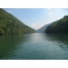
The difference is immediately noticeable as soon as you climb Cheat Mountain on the other side of Cheat Lake, the first mountain on the western side of the Alleghenies. There is more and more snow as you get to the High Alleghenies ... Terra Alta, Red House, McHenry, Davis, Thomas, etc.
Please register to post and access all features of our very popular forum. It is free and quick. Over $68,000 in prizes has already been given out to active posters on our forum. Additional giveaways are planned.
Detailed information about all U.S. cities, counties, and zip codes on our site: City-data.com.

 Please register to participate in our discussions with 2 million other members - it's free and quick! Some forums can only be seen by registered members. After you create your account, you'll be able to customize options and access all our 15,000 new posts/day with fewer ads.