Please register to participate in our discussions with 2 million other members - it's free and quick! Some forums can only be seen by registered members. After you create your account, you'll be able to customize options and access all our 15,000 new posts/day with fewer ads.
Obviously, NJ doesn't publicize most of their outdoor activities very well.
My favorite place to hike in NJ is Turkey Mountain, which is part of Pyramid Mountain. I know there is a trail called Kincaid Woods, which I heard can connect to the Pyramid Mountain side, but I never knew where. I hiked a little bit of Kincaid before and I don't have time to hike much. Is Kincaid the same as the Kinnelon-Butler trail. All the maps on the internet confuse me and NJ doesn't have great documentation of hiking trails unless you are local or hike these areas often.
You can get paper maps at www.nynjtc.org; it's $10 for the Jersey Highlands trails. Kinnelon-Butler is the white-blazed trail on the Pyramid Mountain side. The only place official trails cross to Turkey Mountain is near the visitor's center, and the reservoir is in the way for a lot of the length. There's a road across which appears to be some rich guy's driveway, probably with dogs and automatic machine gun emplacements.
The Kincaid trail is the yellow-blazed tail which leads west where the Mennen trail (blue blaze) meets the white. It turns southwest and then west again, ending on Powerville Road near Kincaid road.
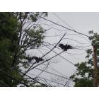
I looked on that satellite image link, and I realized that the trail has to cross the powerline, then curves to the right to Pyramid Mountain, because there are people's houses in the way.
Please register to post and access all features of our very popular forum. It is free and quick. Over $68,000 in prizes has already been given out to active posters on our forum. Additional giveaways are planned.
Detailed information about all U.S. cities, counties, and zip codes on our site: City-data.com.

 Please register to participate in our discussions with 2 million other members - it's free and quick! Some forums can only be seen by registered members. After you create your account, you'll be able to customize options and access all our 15,000 new posts/day with fewer ads.