Please register to participate in our discussions with 2 million other members - it's free and quick! Some forums can only be seen by registered members. After you create your account, you'll be able to customize options and access all our 15,000 new posts/day with fewer ads.
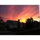
Arlington Village is not so far away. But it looks so dead, I thought it was vacant! It had been featured on a Rap video sometime ago too.
I've been here since the bad ol' crack days, i've seen my neighborhood come a long long way just like the rest of NYC. Don't get me wrong it's still the hood but the crime/neglect/quality of life issues are less than 1/10 of what it was then. At it's height it was like 125 murders in one year, 2013 saw 18, still too many murders but the crime rate continues to drop and ENY is a larger neighborhood (land and population wise) than most in NY so it's tough to compare stats to other smaller neighborhoods like Clinton Hill, Fort Greene or Park Slope.
Most of it is vacant, it has weird down south projects look to it. They had an issue with squatters a few years ago. It's like 4 blocks worth of land, ripe for development, it's insane how that and the burned down Blueridge factory (another 3 or 4 blocks worth) has sat like that for so long.
I would add in anything around the projects on Pitkin and Pennsylvania ave., especially in the summer.
Most of Linden blvd. I avoid.
the immediate area around the Cypress Hills houses on Sutter ave. once you get a block or so away it's pretty quiet.
Crescent st. Between Atlantic and Liberty ave. is pretty sketchy especially at night.
Arlington Village on Atlantic ave. near the White Castle looks like something out of the wire.
The border blocks near Brownsville have a sketchier feel as well but it's the far end of the neighborhood.
These are all South of Atlantic, I would say all of Cypress Hills and most of the area around City line is purely residential so they tend to be quiet compared to the areas listed above.
I was referring to DoomDan's post about where he said that City Line has ok blocks and bad blocks...so I was asking him what other blocks besides Linden Plaza and Pink Houses were bad....actually I was asking him kind of sarcastically because besides those 2 and Spring Creek (those buildings past Pink Houses on Loring Avenue), I don't think City Line has any really bad blocks. I know ENY pretty well. Arlington Village is considered City Line? I figured the end of City Line would be Crescent Street.
__________________
"The man who sleeps on the floor, can never fall out of bed." -Martin Lawrence
Depends on peoples definition of City Line. My definition is south of Atlantic Ave and north of the Conduit, the end of City Line to the west would be Euclid Ave.
However, there are people who add "The Hole" as part of City Line too and the area west of that. Pretty much adding Linden Plaza to the south as part of it. Ending at Euclid again and Linden Blvd.
There are plenty of maps out there which agree with both perspectives. But I'd say the Conduit forms a perfect boundary/divider.
I was referring to DoomDan's post about where he said that City Line has ok blocks and bad blocks...so I was asking him what other blocks besides Linden Plaza and Pink Houses were bad....actually I was asking him kind of sarcastically because besides those 2 and Spring Creek (those buildings past Pink Houses on Loring Avenue), I don't think City Line has any really bad blocks. I know ENY pretty well. Arlington Village is considered City Line? I figured the end of City Line would be Crescent Street.
I don't think anyone in the neighborhood actually refers to that section as City Line, When people say city line it's really just the commercial strip along Liberty ave. Starting at the at the Mcdonalds in Ozone Park and going west to Crescent st. I think when it was first developed thats what it was called, when brooklyn was it's own city and that was the border. I guess you can say ENY proper but no one actually refers to it that way, I guess it never had a name but realtors are playing with the borders of Cypress Hills and referring to parts of this section by the subsection it's closest to, I've seen listings south of atlantic as Cypress Hills and the area around Pitkin and the conduit as City Line.
It's funny Notorious BIG always said he was from Bed-Stuy but today the area he grew up in is Clinton Hill, I have a feeling eventually Cypress Hills will become it's own neighborhood to remove it from the overall ENY stigma.
Depends on peoples definition of City Line. My definition is south of Atlantic Ave and north of the Conduit, the end of City Line to the west would be Euclid Ave.
However, there are people who add "The Hole" as part of City Line too and the area west of that. Pretty much adding Linden Plaza to the south as part of it. Ending at Euclid again and Linden Blvd.
There are plenty of maps out there which agree with both perspectives. But I'd say the Conduit forms a perfect boundary/divider.
Some might just think of all of zip code 11208 as City Line.
11208 covers the eastern half of Cypress Hills and goes through New Lots all the way to Spring creek which is definitely it's on section. 11207 which is the western half also includes part of Bushwick so it can't be based on zip.
Depends on peoples definition of City Line. My definition is south of Atlantic Ave and north of the Conduit, the end of City Line to the west would be Euclid Ave.
However, there are people who add "The Hole" as part of City Line too and the area west of that. Pretty much adding Linden Plaza to the south as part of it. Ending at Euclid again and Linden Blvd.
There are plenty of maps out there which agree with both perspectives. But I'd say the Conduit forms a perfect boundary/divider.
Whats funny is the worst blocks in "the Hole" are actually in Lindenwood Queens but everyone attributes it to ENY. I have a feeling the neglect was intentional to create a buffer between them and the "Hood", I mean the Pink houses are just a few blocks away.
So they envision an affordable version of Downtown Brooklyn and Williamsburg?? losing confidence in this idea now.
Please register to post and access all features of our very popular forum. It is free and quick. Over $68,000 in prizes has already been given out to active posters on our forum. Additional giveaways are planned.
Detailed information about all U.S. cities, counties, and zip codes on our site: City-data.com.

 Please register to participate in our discussions with 2 million other members - it's free and quick! Some forums can only be seen by registered members. After you create your account, you'll be able to customize options and access all our 15,000 new posts/day with fewer ads.