Please register to participate in our discussions with 2 million other members - it's free and quick! Some forums can only be seen by registered members. After you create your account, you'll be able to customize options and access all our 15,000 new posts/day with fewer ads.
San Pedro Park is second in age only to the Boston Common, which was established in 1630. Our San Pedro Park dates back to 1709. I didn’t even know that fact until a couple of years ago when I wrote a story that included the Boston Common, and learned that San Pedro Park is second in age only to its counterpart in Boston. A few views of San Pedro Park:
Our mother would often tell us stories about when she was growing up near San Pedro Park with the rest of her large family. She told us about Uncle Arthur, who liked to be tied up and thrown into the swimming pool at San Pedro Park, apparently in an effort to prove Houdini had nothing on him. He always came back to the surface, but never went on tour like Houdini, so he missed his calling in the entertainment world.
When I was a teenager, which was quite a while ago - back in the 1950s - there was a favorite restaurant hangout for some of us. It wasn’t quite like that place called Arnold’s in the TV series Happy Days, because lots of adults went there too. The place was most famous for their fried chicken, their chicken-fried steak, and their pies, although they had just about every kind of food imaginable for a traditional American type establishment.
As a teenager, I was at the point where I thought it was great to learn from the old hands all the clever new tricks like loosening the tops on salt shakers and sugar dispensers so that when the next person tried to use them, they would be in for a big surprise. Another trick my mentors taught me was how to invert a full glass of water on the table so that the glass couldn’t be removed without a big spill. Looking back on all that, it seems quite ridiculous that I ever pulled those infantile stunts, but I guess we all have to grow up sometimes.
The restaurant, called Earl Abel’s, was built in 1933 so it had quite a few years of operating experience before I first stepped into it in about 1956 or so. I’m sure they had learned to deal with juvenile delinquents like me turning glasses of water upside down.
Earl Abel’s was recently demolished to make way for a new high-rise condominium in the relentless march of progress. But here’s what it looked like before it was demolished, in a post card which shows the exterior sandwiched between two interior views.
La Fonda on Main Avenue is the Mexican restaurant where we went most often when I was growing up. There was a nice-looking man to greet us at the door, and he was always immaculately dressed in a beautiful suit. He took our names to place us in the waiting list, which he kept in a stenographer’s notebook, and there were always a lot of names because it was a very popular place. I still watch eBay every now and then to see if one of those notebooks will turn up. I was able to get a La Fonda menu on eBay – it dates from about 1950 based on the prices – but no steno notebooks showing who was waiting in line at La Fonda on any particular day.
Anyway, we had to wait in the waiting room, sitting quietly on the wickerwork furniture that was painted green, for what always seemed like hours before they called our name. But it was probably just a few minutes because none of us ever starved to death, or even came close.
Here’s what La Fonda looks like, and I’m happy to say looks rather than looked because, thankfully, it’s still there and thriving, although under new management:
And then there was Christie’s, on Broadway, which is the seafood restaurant where I always got the fried shrimp dinner for $1.10 – that came with French fries and a wedge of iceberg lettuce with Thousand Island dressing on it. But that was in the 1950s so it’s not really as cheap as it sounds. And those shrimp were really big too! Either that, or I was really little. It was so long ago that I don’t remember which of those it was. But I’ve never found a place that can match Christie’s for fried shrimp.
Sadly, the restaurant is now long gone. Its unique sign showing a fish in a frying pan was kept in place years after the restaurant closed, but now the sign is gone too. Here’s what it all looked like back when we used to go there:
We used to go to Tai Shan on Broadway occasionally, and I remember that my sister liked it a lot. I had a mental block against Chinese food at that time, and Tai Shan in particular, although Chinese is one of my favorites now. The reason I resisted liking it back then was the waiter we had my first trip there to Tai Shan. I don’t know exactly what it was, but there was something wrong with one of his eyes that made me shiver. He should have had a patch covering it, and it wasn’t just a temporary stye or something, although I can’t remember exactly what it was.
The San Antonio Library System was always great about sending bookmobiles around town, and I was elated that one would come about a block from our house. But these bookmobiles had very limited selections, and I always looked forward to being able to go downtown to the Central Library on Market Street. It was a big thrill when I was allowed to take the bus downtown by myself, probably when I was about twelve. I was then able to go to the library without having anyone in the family telling me we had to leave. I remember that we weren’t allowed to go through the stacks at this library, but instead, we would give the librarian a piece of paper listing the books we wanted. Here’s the library, and I’m pretty sure there was a single lion immortalized in stone out front, but it’s masked by the black car in this post card:
When the library moved to larger quarters in 1968, the building became the Hertzberg Circus Museum, all the wonderful books were replaced by displays and memorabilia from various circuses. And the lion statue was replaced with one of an elephant. Fortunately, I had left town by then and didn’t have to see my beloved library sullied in this way.
Next up: The Transit Tower (or Tower-Life Building to you younger folks), the Nix Hospital, the Bexar County Courthouse, City Hall, San Fernando Cathedral, and the Shrine of the Little Flower.
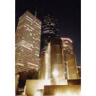
We in San Antonio didn’t have the Empire State Building or the Woolworth Building that New York had. What we do have is what I still call the Transit Tower because I’m so old. But it was also once called the Smith-Young Tower, before it became the Transit Tower, and it’s currently called the Tower-Life Building.
It was completed in 1929, and with 30 floors, it was the most recognizable part of the San Antonio skyline for almost 40 years. Whenever returning to San Antonio by plane, I always watched for the Transit Tower to welcome me home, and it always did so in a grand way.
The Tower of the Americas, which reaches even higher, came along in 1968. It has a more distinctive shape to it than the Transit Tower. But it wasn’t there during my youth, nor were all the newer structures that are coming along now in the unrelenting march of time. But none of these have the same feel as the stately old Transit Tower.
The building is visible from all kinds of directions because of its height, but it looks particularly good from the river:
All of my siblings and I were born at the Nix Hospital, which opened in 1930, and is another downtown landmark. Its architecture is described as art deco. It looks best from the river:
The Bexar County Courthouse was completed in 1896, and I’ve always found it to be a very unique building. I believe that over its history, the natural red brick was painted white at least once, but was eventually restored to its better-looking natural state. I’ve never been inside it, so I don’t know if the interior matches the exterior in looking great.
San Antonio’s City Hall is a classic building near the County Courthouse. So far, I haven’t been able to find any history on it, but I do know that it started out as a three-story building, and that a fourth was added many years after the initial construction. Here’s what the building looked like originally, in two old post cards:
And here’s what it looks like now, with the added level at the top replacing the three ornamental headpieces that used to adorn the top of the structure:
Right near City Hall stands the beautiful San Fernando Cathedral, which was started in 1738, almost 100 years before the Battle of the Alamo which took place a few blocks away. It was completed in 1749 and the original walls still stand today. This is the oldest surviving structure in Texas. The only United States cathedral older than San Fernando is the Baltimore Basilica. While the Catholic Basilica of Saint Augustine in Florida is the oldest parish in the country, its current structure wasn’t built until 1793, so it’s newer than San Fernando.
San Fernando Cathedral is still used for services, and over 5,000 people attend weekend mass each week. There must be several masses held, because the seating capacity is quite limited.
Its exterior looks like this, but I’m taking the San Fernando website’s statement that the building was begun in 1738 to be more accurate than this post card’s 1734:
Another active church in San Antonio is the Basilica of the National Shrine of the Little Flower. It’s one of very few in the country that bear the papal designation of minor basilica. The cornerstone was laid in 1929, and construction was completed in 1931. The church is exceptionally beautiful both outside and inside. And to top that all off, it’s now getting a thorough refurbishment.
The great novelist Thomas Wolfe once said there are very few buildings vast enough to capture the sound of time, and most of them are railroad stations. He probably never visited San Antonio, and even if he had, he wouldn’t have put any of our three train stations into that category anyway. None of ours could really be called vast, nor could any of them match New York City’s Pennsylvania Station or Grand Central Station. Even I would concede that point.
While our three stations can’t compete with the mammoth stations of New York or Philadelphia or Washington, DC, ours are all classics in their own more humble ways. I am lucky enough to have used all three San Antonio stations, and I love them all - even the one that’s gone now. Two of them have façades shaped to look like the Alamo, the traditional symbol of our city, and the one that is gone now was fashioned after a Spanish mission. We’ll check out each of them individually.
We’ll start with the Southern Pacific Station, sometimes called the Sunset Station because of the train route called the Sunset Limited, which runs from New Orleans through San Antonio and on to Los Angeles. It is made of brick and adobe, and its façade is shaped with the Alamo’s curvature. It was completed in 1902, but it looks as good now as it ever did, thanks to two recent restorations – one in the late 1980s and another in the late 1990s. Here’s the north side, which is the main façade:
And here’s a closer look at the stained glass window you noticed in the first view on the north side of the building – it shows the Southern Pacific’s logo for its Sunset Limited route, with rails heading into the setting sun, bringing the train towards Los Angeles. The window is 16 feet in diameter:
Once each year of the 1980s decade, I brought my children from Arlington, Virginia to visit my family in San Antonio, and we always came by train, and the train always used the Southern Pacific Station. In this way, we got to see the SP Station both before and after its restoration, and I can vouch firsthand for what a wonderful a job the restorers did. For example, here’s the magnificent interior – the first time I saw this in the late 1980s after its major restoration, I was flabbergasted:
The staircase you see in the photo immediately above is on the south side of the building. Remember that the window with the Sunset logo was on the north side, so it’s behind the photographer taking this interior picture. The staircase on the south side has its own glorious stained glass window, which looks like this:
The Sunset Station is now used as an entertainment complex for weddings and other special events, rather than as a railroad station, and the railroad function has been shifted to another location nearby. That’s fine with me, because they keep the place looking as majestic as it ever has, and that’s the most important consideration. Here’s a website if you would be interested in what the Sunset Station is doing today, along with more pictures:
The second masterpiece was initially called the International - Great Northern Station, but it was subsequently taken over by the Missouri Pacific Railroad, and changed its name accordingly. It was opened in 1908, and looked like this in its early days, as shown in an old post card – even more grand than the Southern Pacific Station:
You can see that this station used the facade of the Alamo as a model, just as was done for the Southern Pacific Station.
For just one of our visits to San Antonio during the 1980s, our train arrived at the Southern Pacific Station, but for some reason we were taken by bus to the Missouri Pacific Station to meet those who were picking us up. The MP Station was in pretty sad shape at that time, but fortunately our arrival after midnight prevented us from seeing exactly how sad it was.
You may have noticed the Indian with a bow and arrow at the top of the station’s dome in the previous post card view. Well, when we saw the station in all its degraded glory, the Indian wasn’t even there. Apparently, the figure was taken by some mysterious individual, but was later brought back and re-installed in a restored condition. The mystery has never been solved.
In 1988, the entire building was restored and put back into service as a bank, so it will be kept in good shape now. On one of my later visits to San Antonio, we made it a point to stop in and see the bank that had once been a railroad station. Here’s a watercolor my sister made of the station converted to a bank, with modern lighting fixtures and a parking lot:
And here’s the Indian stained glass window that is situated over a staircase, just like the window over the staircase that we discussed before in the Southern Pacific Station:
This beautiful Indian window was re-created entirely by San Antonio native Joe Juarez, using old photographs, because the original window had disappeared when the station was abandoned. Mr. Juarez is a good friend of my high school Latin teacher, John Michel, who was so instrumental in my life many years ago when I was wrestling with those translations of Caesar’s Gallic Wars, as well as non-academic items that teenagers typically struggle with.
The third masterpiece was the Missouri-Kansas-Texas Station, abbreviated as MKT, which led to the nickname Katy. Some railroad station aficionados consider the Katy Depot to be the most beautiful station ever built in the South. It was completed in 1917 and was patterned after a Spanish mission in San Antonio – which we’ll visit in the next episode. The station was often mistaken for a church, and you can see why in this picture from a post card:
The interior walls were Moorish tile in a southwestern mosaic design. Apparently nobody can come up with photographs of the interior, other than what’s shown on this post card which has both the exterior and the interior. I’m sure interior photos exist somewhere, but they aren’t posted on the internet.
As a 12-year old child in 1954, I went with my family to visit relatives in Chicago. This was the only time I traveled outside of Texas until I eventually left the state to go off to college. We took the MKT and used this station, and I remember it pretty well. In fact, I think I remember the station as well as I remember our day at Wrigley Field in Chicago, where we saw the Cubs play the New York Giants in the first major league game I had ever seen in person.
The Katy Depot was demolished in 1969 and was replaced by a hotel.
Here’s an interesting website that has further information on each of the San Antonio railroad stations for anybody who would like more than what I’ve summarized here:
The Alamo is just one of the Spanish missions that adorn the San Antonio landscape, and it is better known than the others only because of the battle that was fought there. The other four missions are San José, Concepción, San Juan Capistrano, and Espada. Despite being almost 300 years old, they all remain as active parishes even today and they continue to say mass every week. Together, they provide the greatest concentration of missions in the country. California has many missions also, but they are more widely scattered.
We’ll go over each of the San Antonio missions individually.
Mission San José was founded in 1720 and is the largest of the missions in San Antonio. On Sundays, the mission holds a mariachi mass.
The most famous single feature of San José is its Rose Window. Here’s a distant view so you can see where it is in the building – this is the same side as we saw in the previous shot, just a little closer:
Mission Concepción’s full name is Mission Nuestra Señora de la Purísima Concepción de Acuña, but that’s quite a mouthful so we just call it Mission Concepción. It started out in East Texas in 1716, but moved to San Antonio in 1731. It is considered the best preserved of the Texas Missions.
This building provided the inspiration for the design of the Katy Depot that we discussed in the previous episode. Note the twin towers in the following views, and remember that the Katy Depot used to have twin towers before some genius turned it into a pile of rubble and carted the debris off to a dump somewhere:
Just like Mission Mission Concepción, San Juan Capistrano started out in East Texas, but moved to San Antonio in 1731. Note that there is another mission with that same name in California, the one to which swallows return on a certain date every year – but that one has absolutely nothing to do with our San Antonio mission.
A triple belltower is the mission’s most distinctive feature:
But I can’t find any good interior photos of this mission, so we’ll move on to the last of the four.
Mission San Francisco de la Espada was first established elsewhere, but moved to San Antonio in 1731. We just call it Mission Espada. That must have been a very good year for mission-moving companies because this makes the third mission to re-locate to San Antonio in that same year.
This mission also has a triple belltower, just like San Juan Capistrano’s, but Espada’s is on its narrow façade. Capistrano’s belltower is on its wider façade:
Before the land now known as Texas became a part of the United States, it went through lots of hands with respect to countries who controlled it. One of the earlier owners was Spain, and the Spanish Governor’s Palace in San Antonio remains as one of the sites that local schoolchildren have to see on their field trips. And lots of tourists go there too. The National Geographic Society has called the place “the most beautiful building in San Antonio,” but I think there are lots of buildings that are much much better. Maybe National Geographic was delirious or was speaking of the situation in 1730 or something. The palace was built in 1722 when Spain still controlled this area.
The palace is a simple one-story building made of masonry and stucco with ten rooms, as well as a courtyard with a garden and fountain. Some people think the fountain is haunted by a former resident but I never personally encountered any ghosts in the few times I went there.
No Spanish Governors have ever lived here, although Spanish government officials did. Nobody seems to know how the name of the building came to be what it is.
The palace’s front, so you can see it’s relatively simple:
Lots of cities have famous clocks that actually achieve fame by serving as meeting places. All you have to do if you live in one of those cities is say “Meet me under the clock at 2 PM” and you’re all set. There is even a 1945-vintage movie starring Judy Garland, about a clock that was used as a rendezvous point. The movie’s name is The Clock, referring to a timepiece located in New York City’s Pennsylvania Station, which fortunately was still standing at the time the movie was filmed. It didn’t get leveled until many years later, and I don’t know what happened to Penn Station’s clock during the demolition process.
Well, these big cities with special rendezvous clocks have nothing on San Antonio, as we have our Hertzberg Clock, and it’s still there and it’s still working. It has been situated at the corner of St. Mary’s and Houston Streets since 1910. The clock was made in 1878 and started out on Commerce Street before moving to Houston Street. It is entirely mechanical and has to be wound by hand, despite today’s technology which allows batteries to keep things going. It belonged to the Herzberg Jewelry Company, and despite the fact that the company is no longer in business, the clock is still owned and maintained by Hertzberg family members. Here’s where you had to be if someone said “Meet me under the clock.”
The King William Historic District is just south of San Antonio’s downtown area. It was established in the 1840s by German immigrants. The name came along after the district’s development was pretty far along and it honors Kaiser Wilhelm I, who was King of Prussia in the 1870s. In fact, the main entry street was initially called Kaiser Wilhelm Avenue, but during the Great War it was changed to Pershing Avenue. A few years after the war the street’s name went back to King William Street, the Americanized version of the Kaiser’s name.
This area is filled with beautiful homes, but in the 1920s, residents for some reason started moving out of the district and to other parts of the city. During the 1930s and ‘40s, the neighborhood really went downhill. In the 1950s, people started waking up to the fact that there were some very nice houses here, and to make it even better, the neighborhood was very conveniently located just a few minutes from downtown. In 1967, the King William District became the first area to be designated as a Historic Neighborhood District in the entire state, and improvements started rolling.
Here are some of the magnificent houses, all of which are well maintained now:
Anybody who has reached this point in this ongoing story, has already figured out that I really like buildings. And our two newspaper buildings are no exception. We don’t have the New York Times or the Washington Post, but in San Antonio we always had the San Antonio Express, the San Antonio News, and the San Antonio Light. Well, the Light shut down in 1992 and the Express and News, which were always in the same family, finally joined at the hip and became one in the mid-1980s. From then on, it was called the Express-News.
The San Antonio Express-News Building was completed in 1929, which must have been the best single year for landmark construction the city has ever seen. In that same year, the Majestic Theater and the Smith-Young Tower (later called the Transit Tower, and even later than that, the Tower-Life Building) were both built.
The Express-News Building was supposed to be a scaled down copy of the Chicago Tribune Building. The building sits behind the Alamo Plaza Post Office and Courthouse that we looked at in the first episode. Most of the Express-News Building is five stories, but there is a two-story octagonal spire at the forward corner, and a penthouse with a two-story ceiling capped by an octagonal clerestory on top of that spire. Here’s what the building looks like:
You might have noticed over the main entrance there’s some artwork. It’s a frieze entitled The Enlightening of the Press, by a sculptor named Pompeo Coppini. This is the same scultor who created the Alamo Centotaph that we visited in the first episode. Here’s a closer view, but we’ll get even closer in the next shot after this.
Getting a little closer in the picture below, we can see that there are six figures, which represent labor, education, knowledge, enlightenment, truth, and justice, proceeding from left to right.
Battersby Ornamental, the company we discussed earlier, who helped restore the Majestic and Aztec Theaters, also restored the conference room ceiling in the newspaper building. The conference room walls are decorated with front page plates from newspapers around the world for October 29, 1929, often called Black Tuesday, which was the worst single day of the drawn-out New York Stock Exchange crash that eventually brought on the Great Depression.
The original ornate coffered conference room ceiling was hidden by a new false ceiling in the 1960s to route electrical wires and piping/ducting systems. Accommodating new technology such as computers and air conditioning is often a problem with classical old buildings, and this kind of crime – hiding old beautiful features so that cables and pipes can be installed – is unfortunately a common practice. But with ingenuity, other ways can be found to accommodate the cables and pipes, and Battersby Ornamental restored the ceiling in 1999.
Here is a before restoration picture of one of the ceiling panels, alongside an after restoration version of that same panel, with an explanation of what was done during the work:
My favorite of all our school field trips in the early 1950s, even more so than the Spanish missions or the Butter Krust Bakery or the WOAI television station, was our visit to the San Antonio Express-News building. We got to see how incoming news was received via teletype from the wire services, how the linotype machines set the type, and how the pages were laid out. Then we got to see the huge printing machines with the endless rolls of paper feeding through, and the bundling machines that wrapped up about fifty papers into a single bundle. And at the end of the tour, we watched the bundles get loaded onto trucks for distribution, and we watched these trucks drive off into the city.
The San Antonio Light was our other paper, but it closed down in 1992. It also had a beautiful building that still stands, but I can only find the following two pictures of it on the internet, and one of these is really tiny.
The San Antonio Museum of Art opened in 1981, using the former Lone Star Brewery complex of buildings, thanks to funding provided by local citizens and businesses. At first, the museum specialized in the art of North, Central, and South America, with an emphasis on Spanish Colonial and Latin American folk art. There were also some 18th, 19th, and 20th century American and European art. In 1985, the holdings expanded significantly when former US Vice President Nelson Rockefeller and Robert K. Winn contributed their collections of Latin American folk art to the museum. The museum has steadily expanded since its inception, and now includes a comprehensive collection of Egyptian, Greek, Roman, and Chinese artworks, and an Asian art wing has been added.
The former brewery buildings are actually attractive – they look better in person than in this photo, at least I think they do:
Just one example of the work on display here is an oil painting with intriguing colors and details, called Passing Storm over Sierra Nevadas by Albert Bierstadt:
I won’t go over any other specific artwork in this discussion, but below is the museum’s website, so you can explore for yourself what the museum offers, and go into depth on anything that interests you.
The Witte Museum is the only museum that I remember from my youth. We didn’t have the San Antonio Museum of Art, as it didn’t come along until 1981. The Witte’s permanent collections feature about 200,000 objects. There are history and science exhibits, traveling exhibits on loan from other museums, as well as lots of family events and live performances. The museum has an excellent anthropology collection with Native American objects, and lots of archaeological relics from different portions of Texas. There is also an extensive history collection of art, furniture, firearms, western memorabilia, and photographs.
The Hertzberg Circus Museum collection which was formerly displayed in the old library on Market Street downtown is now at the Witte, as the old library is currently being renovated to hold the Briscoe Western Art Museum. The Hertzberg collection has everything a circus featured over the years, but without live performers and without popcorn. There are old circus posters, calliopes cranking out circus music, Tom Thumb’s miniature carriage, a miniature circus, lion tamers’ chairs and whips, swords that used to be swallowed, and old photographs.
Here is the museum and its grounds as shown in a post card:
The McNay Art Institute is housed in a former mansion in the Spanish-Mediterranean style. It has artworks from America and Europe, spanning the 19th and 20th centuries. It has lovely landscaping too, with Japanese gardens, fountains, streams, and goldfish ponds. The works include many by foreign artists such as van Gogh, Rodin, Degas, Cezanne, Matisse, and Picasso. There are also several American artists’ works on display, including Edward Hopper and Georgia O’Keefe. By checking the museum’s website, which we’ll point out later, you can see a listing of the works now on display, along with typical samples of paintings right there on your computer screen.
This watercolor by my sister is better than any of the exterior photos I can find on the internet. She is very good with lots of subjects, but I like her San Antonio scenes the best:
There is currently a display called Architecture in Print, featuring artworks that highlight buildings – one of my favorite topics. An example of the current exhibition is The Apse of Notre Dame of Paris by Charles Meryon:
The University of the Incarnate Word is an outgrowth of a mission that has been in San Antonio since 1869 – a mission that brought the Sisters of Charity of the Incarnate Word to the city. The Sisters’ work led to the first hospital in the city – one that still exists – Santa Rosa Hospital. In 1900, the Academy of the Incarnate Word was moved to Alamo Heights, where it remains today. The institution achieved university status in 1996. Being Jewish, I was never heavily involved in Incarnate Word’s activities, but I always admired its beautiful buildings. Here is what they look like on a old post card:
Near the campus sits a beautiful old home called Fernridge, which was once the home of Colonel George W. Brackenridge and his sister Eleanor. The colonel had successfully drilled artesian water wells in San Antonio late in the 19th century and eventually became owner and president of the city’s waterworks, as well as a director of the San Antonio Express Publishing Company. He donated lots of land to the city, which includes the San Antonio Zoo and Brackenridge Park. The house now belongs to Incarnate Word, who continues to maintain it. Here’s what it looks like:
The Argyle House is another fixture in Alamo Heights. It was first a private residence, and then it became a hotel. Now it’s the home of the highly exclusive Argyle Club. The building was constructed in 1859 as a private home – and the headquarters for a horse ranch. It has been described as a “Calcutta-like club” because of its large white portico and spacious verandas framed by tall white columns. Here’s what it looks like in one of my sister’s watercolors:
Alamo Stadium is the closest thing we have to Chicago’s Soldier Field – it’s where the San Antonio Independent School District schools play their football games – and also where the nearby Trinity University’s team plays. Here’s what it looks like in an old post card:
Situated a block or two from the stadium was a small Mexican food takeout place that was always one of our favorites. It was called Teka Molino and I always loved their tacos, tamales, and tortillas. You could watch the ladies making the tortillas right there – kneading the dough and rolling the tortillas out on stones. I think our mother had gone to school with the owner and always had a nice chat with him when we would stop in for some food.
I eventually learned during one of my visits back home after I moved away, that the place expanded and relocated to San Pedro. We went to the new place a few times, but they were making tortillas in a more modern way and everything was a lot more elaborate in the new place than it had been in the old one. I liked the old place better.
The Olmos Dam was built in 1927 because of a serious flood that the city suffered a few years earlier. In the 1940s and ‘50s we would drive across it, and look down at a golf course on one side, and wide open spaces on the other side. The golf course isn’t there any more. Here are two post cards that give a pretty good shot of what we would see when viewing the dam – a view I always loved:
Just a few blocks down Broadway from Incarnate Word moving away from town, you come to the Mobil Gas Station at the corner of Broadway and the Austin Highway. The building is still there, although nobody comes racing out to fill up your tank, whisk-broom out your car, or offer to check your oil and water like they used to when you would drive in. But the Flying Horse is still there. Here it is in a night-time photograph:
And if you proceed from the Mobil Station back up Broadway toward town, you would pass Earl Abel’s, Christie’s Seafood Restaurant, Kiddieland Park, and Playland Park, all of which were discussed in previous episodes. And right after Playland Park on your left, you would see the Butter Krust Bakery building on the right.
Almost all San Antonio natives remember going here as a school field trip. Even though we saw all this magnificent breakmaking machinery, the best part of the tour was the samples they gave us at the end. Now these samples weren't regular bread like they put in the packages we bought at the grocery, but very thick slices. They were warm and had real butter - I think at that time we were only using margarine at home. Back then, it was Sun Valley margarine, which wasn't easily confused with butter like the margarine today can be sometimes. At least they didn't have any commercials that said 'tastes like butter,' nor should they have. The margarine back then tasted more like plastic than anything else.
At the Butter Krust place, they gave out souvenirs to take home, in addition to the samples that we ate. I remember getting pencils, a wooden ruler and several book covers, the classy ones with plastic coating that looked so much better than the brown ones we usually made from grocery bags. The Butter Krust book covers had the blue and white gingham pattern on them.
I remember seeing their delivery trucks in the parking lot of this bakery in the mid-‘90s, and these trucks were identical to their trucks from the mid-‘50s. I never understood how they could continue getting the same trucks over such a long timespan. This building ceased operations in 1997, and the building still sits empty and idle, along with an empty and idle parking lot.
For my first three years of school, I went to the Alamo Heights Cambridge Elementary School a block off Broadway, although I have since learned that ‘off Broadway’ in San Antonio is different from ‘off Broadway’ in New York City. This school has the most beautiful façade of any school in San Antonio that I attended. For the first two years, I was in the little two-room building across the street, so I got to see this façade every day. Then for my third year, I was actually in this building:
Next up: the Freeman Coliseum, Cool Crest Miniature Golf Course, the San Pedro Drive-In Theater, and the Monte Vista neighborhood – some of the city’s most beautiful homes.
The Freeman Coliseum was the place we always associated with the rodeo, as the San Antonio Rodeo and Stock Exposition comes here every year. Here’s the building:
I always enjoyed the rodeo, probably almost as much as I enjoyed the circus that was held at the Municipal Auditorium, which we already discussed in an earlier episode. The rodeo clowns were great, although we didn’t realize they were putting their lives on the line to save the riders who were thrown from their mounts. We thought they were just being funny.
Actually, we could watch rodeo events almost year-round, even when the big one at the Coliseum was not in session. Near the airport, on what used to be called Loop 13 (it has since been changed to Loop 410 so it won’t be unlucky), there was a large fenced-in area where rodeo performers learned and practiced their events. Back then the area on Loop 13 looked like the wide open spaces, and we could stop the car on the side of the loop overlooking the rodeo activity below, and watch for as long as we liked. If you tried that same thing today, in the same place, you’d be run over by cars moving at high speeds before you could even come to a full stop.
While the Coliseum was most closely associated with the rodeo, the rodeo wasn’t the only thing that happened here. For example, there was the fateful night that my Boy Scout troop ran in the chariot race during the annual Boy Scout Exposition. It must have been 1956 or ’57, and I’m figuring that since Ben Hur came out in 1959, the producer must have gotten the idea for the movie’s chariot race from ours. We had spent several weekends making our chariot at the home of one of the scouts. And we were very careful to make sure that its wheels, which had come from someone’s old bicycle, would rotate freely on the chariot’s axle.
The night of the big race we were all dressed up like Romans in togas as we pulled our chariot to the starting line. We were off and running at the starting gun and pulled into an early lead. Coming around the final turn approaching the finish we still had a very large lead, but about 50 yards from the finish line, one of our wheels came off! We kept going anyway, dragging our now lopsided one-wheeled chariot, but our speed went down to nothing and most of the other chariots passed us.
The Cool Crest Miniature Golf Course was the best in the world. I think so even today, some 50 years after my first visit to Cool Crest, and I’ve seen miniature golf courses all over the country. It’s been there on Fredericksburg Road since 1937.
Other miniature golf courses have absolutely no trees or any kind of decorations – they just have straight golf holes, and you can see all 18 of them at the same time. At Cool Crest, you only see the one you’re playing, the last one you played, and maybe the one you’re going to play next. There is constant music coming from speakers in the trees all over the course. The only thing about Cool Crest I didn’t like was the fact that when you sink your final putt on the 18th hole, your ball goes back to the office. Not only did I have the pleasure of playing there during my youth, I was able to bring my kids to play there when we came back to town for a visit.
There were lots of drive-in movies in San Antonio, but we always went to the San Pedro Drive-In Theater, which wasn’t very far from our house. When we went as toddlers, we had a convertible with a large cavern behind the back seat for the convertible’s top to be stored. But as long as the top was up, there was enough room for three of us to squeeze into that storage spot. I guess our mother was guilty of teaching us to be criminals, because when we were hiding like that, she didn’t have to pay for us. I don’t remember exactly how many times we accidentally tried driving off before putting the speaker back onto its rack, but it was more than once.
And as teenagers, my brother and I would just ride our bikes over to the theater, park them in the tall grass in the vacant lot behind the theater, and find a way to sneak in the back. We only did that a couple of times though. I can’t find any pictures of the drive-in.
There is an area of about 100 blocks called the Monte VistaNational Historic District, between San Pedro and McCullough a little north of downtown. The district still survives almost intact from San Antonio’s Gilded Age, when newly-prosperous San Antonio residents built the finest neighborhood in the entire state – at least at that time. These houses were built in the late 19th century and in the early 20th.
Here’s a site with pictures and a discussion of a few of the houses:
We didn’t go to Woodlawn Lake for activities, because we lived pretty far from it. However, we did drive by and see it every now and then, while our mother told us about how much she had enjoyed it as a young girl. Her family lived seven blocks from the lake when she was growing up, and she told us how they would see movies and other entertainment on a raft out in the middle of the lake. She remembers that when she was about six years old, she would fall asleep before the show finished, and her older sister would carry her all the way back home – the entire seven blocks.
Here’s the skyline of the city as seen from Woodlawn Lake. The three gold domes you see belong to the National Shrine of the Little Flower:
I’m not sure, but I think this might be the pavilion near the lake. If it is, this pavilion was restored in about 1999 or so. During one of my visits to San Antonio, we stopped by there and mother told us all about the great events that took place there in her day – in the 1920s and ‘30s. She even talked to a man her age who knew the pavilion from back then:
The novelist Katherine Ann Porter lived near Woodlawn Lake for just one year when she was a child - back in 1901 – long before our mother was even born. Miss Porter wrote some fantastic fiction – including Ship of Fools. When I was in college I wrote her a letter telling her how much I enjoyed that book. She even answered me – on a rickety old typewriter with all kinds of typos and strikeovers in the letter. I wish I could find the letter now, but it has disappeared.
Fort Sam Houston has played a major role in San Antonio’s history, and the city is quite proud of that. The Army has had a presence here since 1845, but the current site started in 1876. Between 1910 and World War II, Fort Sam was the largest Army installation in the country. Dwight Eisenhower was stationed here upon graduation from West Point in 1915, and he met his wife here. This is the home of the Fifth Army.
Here’s the Quadrangle, the oldest building on the post having been built in 1877. The headquarters building contains an acre and a half of indoor space.
We were members of Temple Beth El when I was growing up, and most of my memories of the place are quite fond. The congregation has existed since 1870, and the first building was finished in 1876. The current building was completed in 1927, and is somewhat of a city landmark due to its bright red brick dome. Here’s a closeup of the dome:
And here is the altar where I stood for my Bar Mitzvah – note that in this picture, the only one I can find on the internet, it’s set up for a wedding instead:
When I first stumbled upon the following picture while searching the internet, my first impression was to ignore it because of all the intervening wires and other extraneous things. I figured there would be other pictures to show the Temple’s dome – other pictures that didn’t show all these wires. However, it then struck me that the steep hill looking downward toward the railroad car is Ashby Place. Take a quick look at the photo first, and then I’ll tell you why this was important to me:
Well, I learned to drive in a standard transmission auto – a 1955 Plymouth Belvedere if you’re interested – and stopping/re-starting on this very hill was a nightmare for me. We had to go up the hill to visit our grandmother, and I don’t think I ever made it through the traffic light at the top of the hill without having to stop at the light. I still shudder when I think about how hard it was for a new driver such as myself to get the car going again when the light turned green, without rolling back and into the car right behind us.
Across the street from Temple is the beautiful Koehler Cultural Center, which was originally a private mansion, built in 1902. Otto Koehler was one of the organizers of what came to be known as the Pearl Brewing Company. Mr. Koehler is said to have selected this spot – many years before the Temple was there – because it had an unobstructed view of his brewery. He thought he could tell how hard his employees were working based on the color of the smoke coming from the smokestack, but this sounds like fiction to me. Here is the house, which now belongs to San Antonio College.
Another beautiful former home near Temple Beth El is the Woman’s Club of San Antonio on San Pedro a few blocks away. I always admired this house when we were going to Temple, or coming back home from it. The building was once called the Woodward House, having been built as a private residence by David Woodward in 1906. It was a birthday present for his wife. I don’t know if maybe he forgot his wife’s birthday the previous year, or what, but this seems to be a pretty elaborate birthday present.
The Fairmount Hotel in downtown San Antonio was built in 1906 and was recently renovated. It’s a classical Victorian structure and is located downtown, just a few blocks from the Alamo and the Riverwalk. It has 37 rooms, all of which are decorated differently and in very good taste.
In 1985, the entire building was moved five blocks to its present location on South Alamo Street. The move is said to hold the record for the largest structure ever moved on wheels, as there were 3.2 million pounds that had to move without disintegrating. I hope the place does well financially, so it would justify the decision to move and modernize the old classic rather than demolish it and put up a sterile modern structure with the character of a turnip. The hotel re-opened in 1986.
Here’s the hotel’s website if you want more information, including something about its resident dog, whose name is Luke Tips. Apparently, if you miss your dog, you can have Luke sleep with you overnight, and you can get a T-shirt that says “I slept with Luke at the Fairmount.” There’s also a photo gallery in which you can see some of the beautiful rooms and other interior features:
There are lots of colleges in San Antonio – we already discussed Incarnate Word in an earlier episode. Here we’ll go over two of the others - Our Lady of the Lake and Saint Mary’s.
Our Lady of the Lake University was founded in 1895 by a Roman Catholic religious order that was begun in eighteenth century France. College-level classes were originally a two-year curriculum, and the program was expanded to four years in 1919. Our Lady of the Lake was the first San Antonio institution of higher learning to attain regional accreditation. In 1969 it became coeducational, having been limited to women before. In 1975 the school was upgraded from a college to a university. There are about 2,300 students enrolled.
The school has some beautiful buildings, as shown in this distant perspective:
Our Lady of the Lake had a very tragic fire recently. The fire, which was huge, and televised, was confined to the main building, but many priceless artifacts were destroyed, as well as one of the beautiful spires.The spire will be rebuilt, but it's going to cost a fortune, and of course they can't replace the artifacts.
Saint Mary’s University is the oldest Roman Catholic institution in Texas and the Southwest, having begun operation in 1852. The school has an enrollment of about 4,000 students, and is strong in business, engineering, medicine, and liberal arts.
Here’s an old post card showing an earlier picture of the lovely buildings:
The Olmos Pharmacy on McCullough is renowned for two things at the present - its landmark sign with a clock over the main entrance, and its soda fountain, which I believe is still operating:
The main entrance with the name of the place, and the clock:
San Antonio has been a mainstay of the Air Force even before that branch of the armed services came into existence on its own - it started out as a branch of the Army. We used to have four major bases. Back in my days, the Air Force personnel would always wear their uniforms in town, so you could readily visualize the large impact on the city’s economy that the Air Force provided. I don’t know if they still wear uniforms when they are on liberty.
We’ll go over Randolph and Lackland, as the other two bases were shut down as an economy measure, and their functions were transferred to Randolph and Lackland.
Randolph Air Force Base has been located right outside San Antonio since 1930, back when the nation’s flying military service was known as the Army Air Corps. It is the home of the Air Education and Training Command. Here is the Headquarters of the 12th Flying Training Wing, a building affectionately known as The Taj Mahal, or simply as The Taj.
The base is known as the Showplace of the Air Force because of the Spanish Colonial Revival Style architecture used for all buildings on the base – including hangars. Here’s an example:
Lackland Air Force Base provides basic military training for all new recruits. The base has been there since 1941, but it didn’t get its current name until 1948. The new recruits are the guys we always used to see walking around town in uniform. Here they are in a parade on the base:
I’m sure the new recruits now include lots of ladies, too.
Lackland didn’t have a flying mission until Kelly Air Force Base was shut down in 2001 as an economy measure. They now have a two-mile runway that is a joint-use facility between Lackland and San Antonio. Also, Wilford Hall Medical Center at Lackland is the Air Force’s largest medical facility.
This run-through the sights of San Antonio as I remember them has been limited to those places I recall from personal contact, before I left in 1961. Obviously much in the way of new development has happened in the last 48 years, but I’m confining this piece to what I had first-hand knowledge of. By the time HemisFair was launched in 1968, I had been away for seven years, so it isn’t included here.
The grocery stores I remember best, Handy Andy and Piggly Wiggly, are now gone. H.E.B. seems to have taken their places, growing leaps and bounds from the small H.E.B. that I remember from when I was still there. But at least I do remember H.E.B. There are lots of other grocery stores with new names that I never heard of before.
San Pedro, Broadway, and McCullough still look about the same inside Loop 410 as they did in my day, although many of the buildings are occupied by different businesses now, and a few of the landmarks are gone. I always find it comforting to take a ride up and down these thoroughfares when I visit, just to feel that continuity with the past. I like stopping by the Municipal Auditorium and its neighbor the Telephone Building, and I love visiting downtown.
I have to admit that it is somewhat painful to see an empty Houston Street instead of the bustling one I remember so well, with all those people walking from store to store, as well as to and from the classic movie theaters. I’m sure there are actually more people now, thanks to the revived Riverwalk and much-increased tourist activity, but they are a few blocks away, and Houston Street itself seems almost silent compared to what it was 50 years ago.
I don’t really like seeing the new high-rise buildings that are starting to take over the skyline, but I certainly realize the need for progress. I’m just not sure that putting up sterile-looking boxes devoid of any character represents progress. I mean, if the new buildings don’t come close to matching what the older buildings have always had, is it called progress, or is it called regression, regardless of what comes inside the new boxes?
The city has grown tremendously - as it should have - over all this time. When I first got my mother’s permission to take the bus to town by myself in 1954, she had to drop me at the corner of San Pedro and Basse Road, because that was as far north as the busses ran at the time. We were a few miles north of that point, and were considered ‘out in the sticks’ for being that far out.
I’m sure it’s necessary for the city to continue growing, and I accept that fact. But I’m thankful that so much of my hometown has stayed the same as it was so long ago, and hopefully it always will. And I am also grateful to those artists who have restored the Majestic and Aztec Theaters, the Municipal Auditorium, the Southern Pacific and Missouri Pacific Depots, the Express-News Building, and the Fairmount Hotel. And of course, thanks also to those who keep all the other old buildings that I treasure in such great shape.
If you’ve come this far in these recollections, which got a lot longer than I originally anticipated, I should say thanks for taking the time to read them.
THE END
Please register to post and access all features of our very popular forum. It is free and quick. Over $68,000 in prizes has already been given out to active posters on our forum. Additional giveaways are planned.
Detailed information about all U.S. cities, counties, and zip codes on our site: City-data.com.

 Please register to participate in our discussions with 2 million other members - it's free and quick! Some forums can only be seen by registered members. After you create your account, you'll be able to customize options and access all our 15,000 new posts/day with fewer ads.