Please register to participate in our discussions with 2 million other members - it's free and quick! Some forums can only be seen by registered members. After you create your account, you'll be able to customize options and access all our 15,000 new posts/day with fewer ads.
I thought it would be cool to see transit maps overlaid onto satellite images (Google Earth/maps is the easiest source), to see where the routes go relative to the various neighbourhoods and suburbs.
I think it would be easier to start with rail only (commuter rail, heavy rail, light rail and streetcars) since those are the important ones and they have fewer routes.
Here's Vancouver:
Light blue is the current Skytrain network which is more or less elevated light rail. Pink is the West Coast Express (commuter rail). Purple are proposed additions to the Skytrain network, and green is a proposed downtown streetcar network. The biggest suburbs (Surrey, Burnaby and Richmond) have at least some rail service, but some of the smaller ones, especially those outside the urban area like Langley and White Rock don't. North Vancouver does not get any rail service, but they do have the Sea Bus.
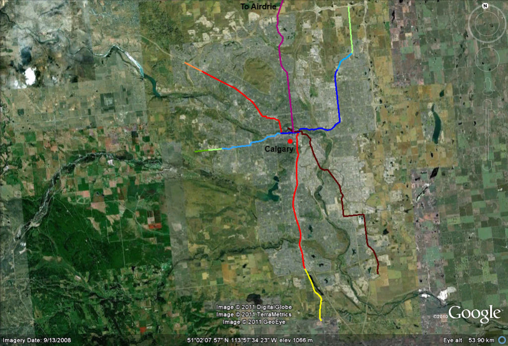
Here's Calgary's C-Train (light rail):
The red and dark blue are the current lines. Light blue and orange are under construction and should be ready within a year or two. The rest are various proposals that could be built within the next 10-20 years (and for which I'm not sure of the exact alignments). You can see the urban area pretty well, and it is the same as the City of Calgary. Calgary's metro has few municipalities outside the city proper, and they're all outside the urban area and most are not shown (ex Airdrie).
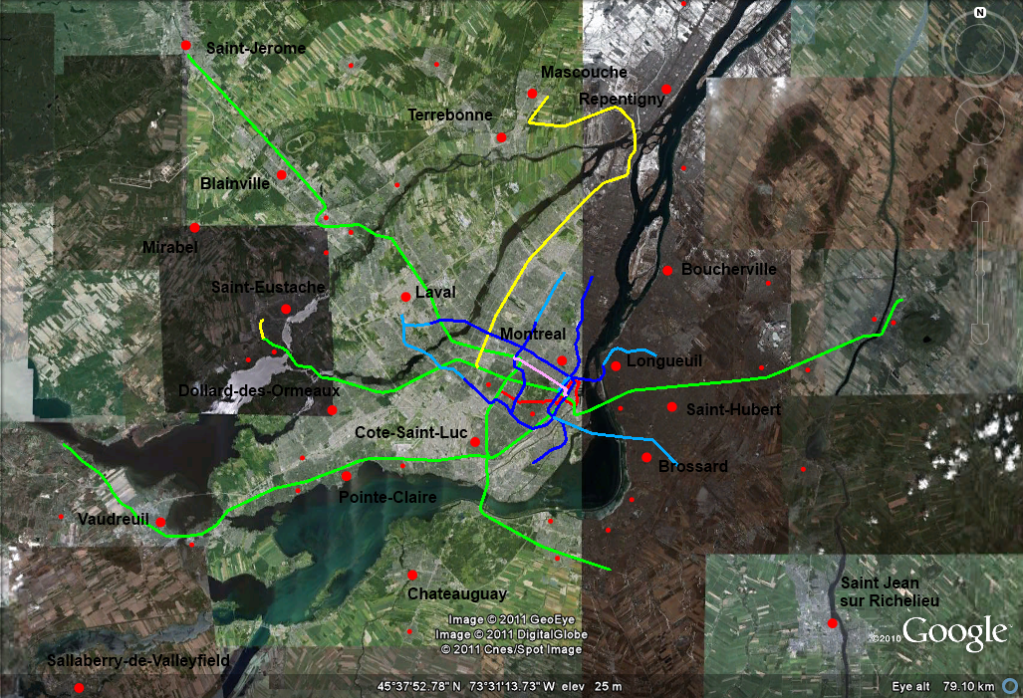
Montreal:
Green is the commuter rail network and yellow are planned additions. Dark blue is the metro/subway with additions in light blue and red/pink are proposed tramway lines. The labelled large red dots are towns of above 30,000 and the small ones are 10,000-30,000.
I made them. I just make a folder in "Places" (right click --> add --> places) and then right click --> add --> path. GE does show transit stations though, as well as rail lines, but it doesn't seem to show underground rail or streetcars. I'm working on Toronto next.
I did a quick one for Boston, MA. Didn't put in the Silver Line though - (BRT). The colors match the lines, Green Line is light rail the rest are subway heavy rail. I ran out of room on the southern end of the red line, but it splits off with the eastern side continuing to Braintree and the western side connecting to the mattapan line.
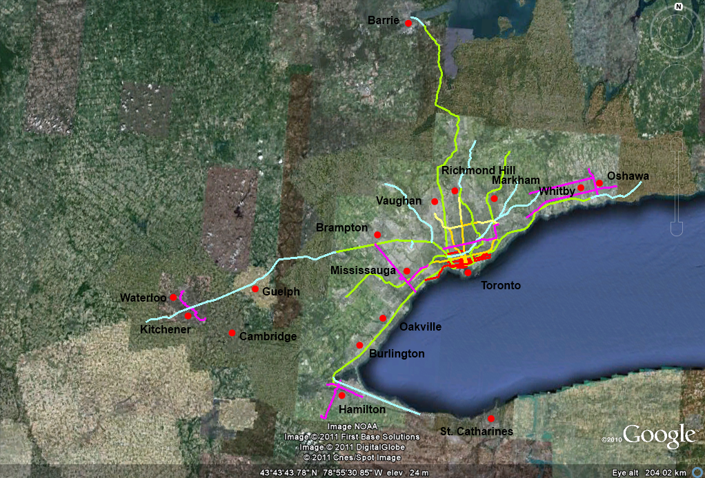
I made two images for Toronto. First one is Toronto and the Golden Horseshoe:
Green is commuter rail, and aqua are extensions and new lines proposed for the commuter rail, some of which are under construction and some of which are still pretty far from being built. Yellow-Orange is the subway, and light yellow are planned extensions. Red are streetcars. Pink are planned LRT lines (there are none currently built). Except for the LRT lines in the East (around Oshawa/Whitby), many of these will likely begin construction soon. Some people consider two of the streetcar lines LRT though (St. Clair and Spadina), they have their own rights of way. I've shown all the cities and suburbs with 100,000 people or more.
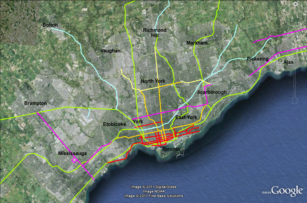
This is a more zoomed in map of the Toronto area, mostly to see the streetcar lines better.
The legend is the same, and I've also shown smaller suburbs (Ajax & Pickering) and the former suburbs/boroughs of Toronto.
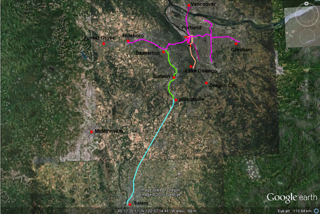
Portland
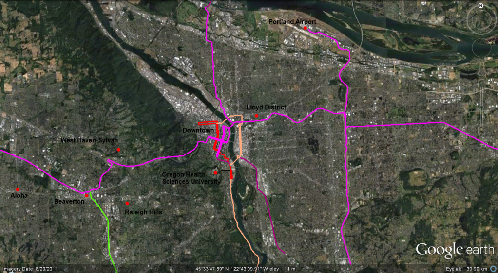
Green is the Westside Express (commuter rail) with the proposed expansion to Salem in aqua. Pink is MAX (light rail) with proposed expansions in purple. Red is the Portland Streetcar with proposed expansions in salmon. Black is the Portland Aerial Tram. Where there are two lines very close to each other, those are parallel one way routes that are part of the same line. And I tried to make the expansions as accurate as I could, but they might have been a little off. Here's the map more zoomed in on the core:
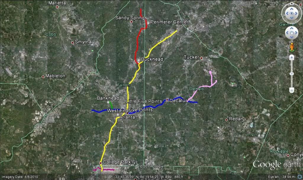
Red-North South
Gold-Northeast-South
Blue-East West
Green Bankhead-Candler Park
Pink-Memorial BRT
Purple Atlanta Skytrain, ATL Airport People Mover
Please register to post and access all features of our very popular forum. It is free and quick. Over $68,000 in prizes has already been given out to active posters on our forum. Additional giveaways are planned.
Detailed information about all U.S. cities, counties, and zip codes on our site: City-data.com.

 Please register to participate in our discussions with 2 million other members - it's free and quick! Some forums can only be seen by registered members. After you create your account, you'll be able to customize options and access all our 15,000 new posts/day with fewer ads.