Please register to participate in our discussions with 2 million other members - it's free and quick! Some forums can only be seen by registered members. After you create your account, you'll be able to customize options and access all our 15,000 new posts/day with fewer ads.
The satellite view looks a bit more urban to me since I don't see anywhere with much space between the buildings or trees. Perhaps since the climate can't support greenery there's less incentive to spread out development?
The streetviews don't look particularly urban to me at all.
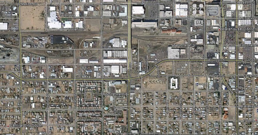
Here is other view of Phoenix .
short blocks, narrower streets ,grid system, street-facing retail and side-walk at the stree
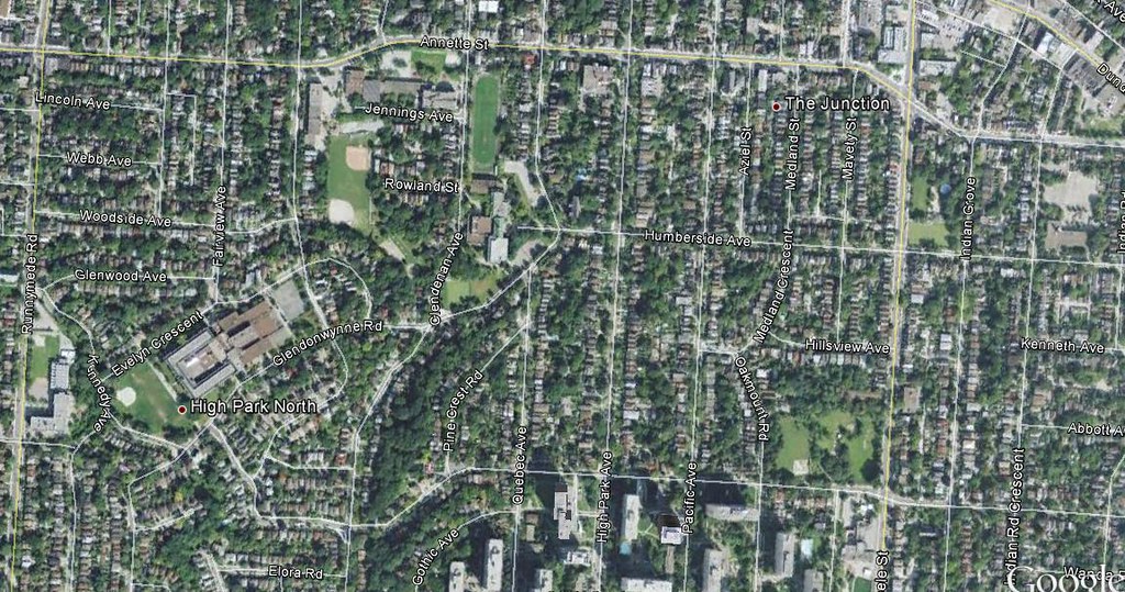
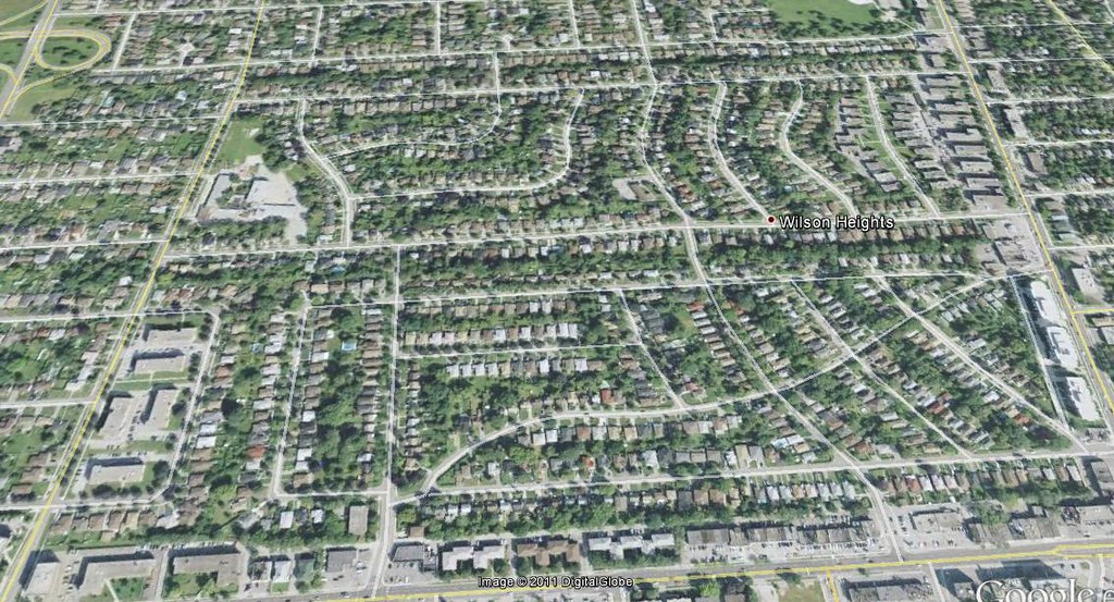
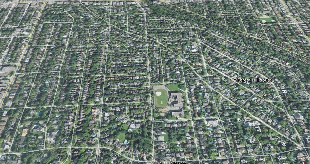
A view of Toronto.
Do to the area has high- rise apartments , mix use where people live above the store .
But you got suburb street hierarchy.In the suburbs it is really bad.
Those parts of Toronto are like that mostly because of ravines though. Most of the neighbourhoods in Toronto that don't have a very gridded street pattern have ravines going through them or are hilly, like along the former shoreline of glacial Lake Iroquois. If you look at neighbourhoods like Willowdale, Kennedy Park and Alderwood East of Browns Line, those are quite far from downtown but still largely grid based.
When you got short blocks, narrower streets ,grid system, street-facing retail and side-walk at the stree it is urban .
The suburbs are more pulled back and are anti-short blocks, narrower streets ,grid system.
The areas does not connect do other areas do to street hierarchy.The suburbs are also about more green and space.
Sometimes street patterns were just laid out in a grid because it is simpler, and it diverges less because the land is very flat--such as in the middle of a desert. With that availability of open space often comes wider streets, whether or not they are warranted.
"Green" applies to places with water. Which is not what you find in the desert, where Phoenix is located. So even in very suburban places, there isn't much green.
The main arteries have mix use where by people live above a store and there are highrise apartments but in the subdivisions are mostly homes or townhoues.
And the area is anti-grid system.
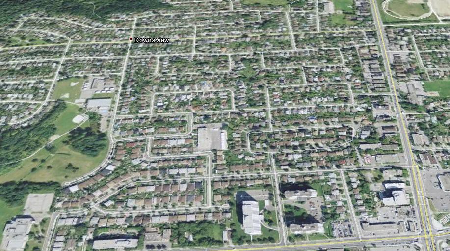
Most 90% or more of Toronto is anti-grid system.And if you take on the GTA area it would be more .
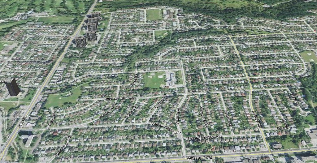
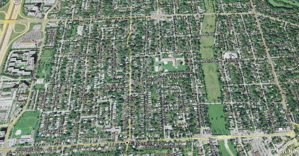
This area could been on a grid system
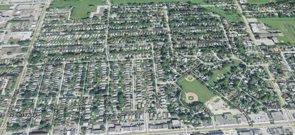
Okay may be this area could not do to hill but many streets could still be.
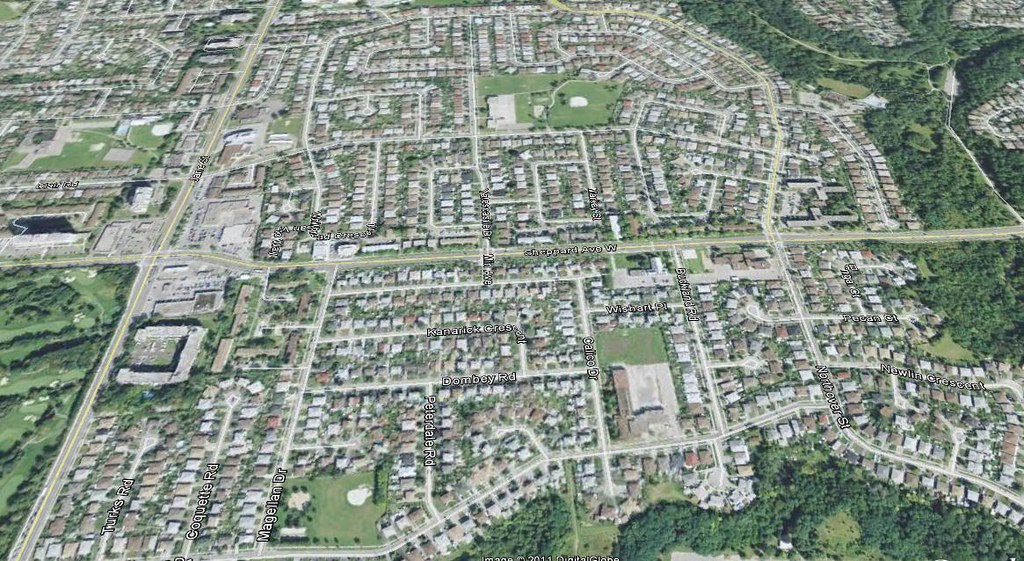
Okay may be not all this area do to hill and all those trees!! But the streets could of been much more on a grid system with in that area .
This area could easy be on grid system
Other area if not all of it at least with in the area
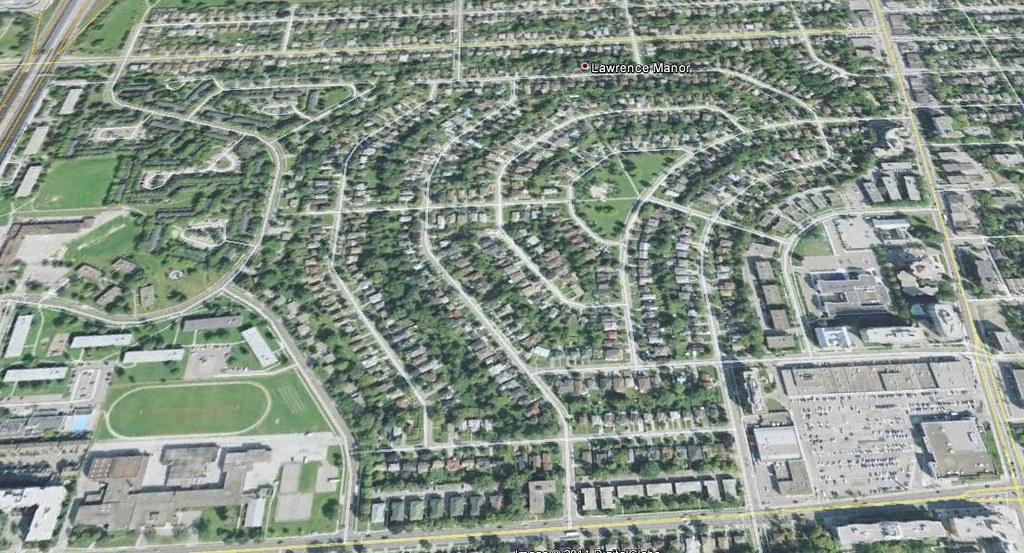
This aea at least to east could easy be on grid system
This area could be much better.
This area looks like it was on grid system and they tried to do away with it.
Like I say I have seen old maps showing areas built in the 30's and 40's not on a grid systm that goes to show the mindset of people in Toronto.
Most other cities in Canada are on a grid system .
And here is Phoenix population
Phoenix population 1900 5,544
Phoenix population 1920 29,053
Phoenix population 1940 65,414
Phoenix population 1950 106,818
Phoenix population 1960 439,170
Phoenix population 2010 1,445,632
So no idea why Toronto is not more on a grid system and Phoenix is.
Well Phoenix having lower density sprawl there should be areas like that in Toronto if you look at the time line of population.So no idea why that not the case.
I can see cities like New York, San Francisco, Boston, Washington, Chicago that are old cities and built long ago but not Toronto.In way Toronto should look more like Phoenix no idea why it is not.
Except for Forest Hill South and The Junction, I'm pretty sure those Toronto neighbourhoods were built in the 50s and 60s.
Toronto's big apartment tower boom was in the 70s. In 1960, Toronto had less than 100 highrises, all in downtown, and then several hundred apartment buildings were built outside of downtown by 1980, so those apartment towers are a feature of the post-WWII era.
sweat209: Street grids alone do not promote density. It is one of a number of factors, including climate, terrain, economics, technology, transportation infrastructure etcetera. Take a look at the total size of the city limits: a lot of eastern cities did not annex much nearby land, because it was already split up and occupied, but cities in the western US expanded geographically to grow their populations. The city where I live was 4 square miles a century ago, with a population of 40,000, now it is almost 100 square miles with a population of 500,000, due to annexation.
Toronto was much smaller until 1998; it underwent a major annexation (more of a merger). About 676,000 people and 37 square miles before, 2.5 million and 243 square miles today.
sweat209: Street grids alone do not promote density.
I think there is an overemphasis on street grids as a marker for urbanity in this forum and many "urbanists". I suspect this might be due to the fact the older sections of most American cities (especially the midwest and west) are gridded, so it's assumed more grid = more walkable and urban.
I think a grid form is ideal for city centers and central business district, but once you get to residential neighborhoods have some form of street hiearchary is best.
No part of Boston (or really any part of the metro area) is gridded, and much of it is urban and walkable.
Street grids are an important part of the equation, but they're just part of it--the point is the interconnectedness of blocks, and the comprehensibility of the city's organization. Boston's old city core was built when there was no transportation option but walkability (on two feet or four) and the city's design had to reflect that philosophy. Street hierarchy does not have to sacrifice a good interconneted street network--and if linear forms of transit are to be part of the mixture, it's critical. But, you are correct, simply putting down a grid-shaped street doesn't guarantee walkability if the other factors aren't in place. Fire requires fuel, heat and oxygen--deprive the reaction of any one of those three elements and combustion does not occur.
While not an expert on Phoenix's history, a lot of places in the Southwest are laid out on grids just because it's extraordinarily simple--counties, townships, even entire states are just rectangles on a map, so why not city blocks too?
Please register to post and access all features of our very popular forum. It is free and quick. Over $68,000 in prizes has already been given out to active posters on our forum. Additional giveaways are planned.
Detailed information about all U.S. cities, counties, and zip codes on our site: City-data.com.

 Please register to participate in our discussions with 2 million other members - it's free and quick! Some forums can only be seen by registered members. After you create your account, you'll be able to customize options and access all our 15,000 new posts/day with fewer ads.