Your City's Iron Curtain (map, suburban, highway, downtown)
Please register to participate in our discussions with 2 million other members - it's free and quick! Some forums can only be seen by registered members. After you create your account, you'll be able to customize options and access all our 15,000 new posts/day with fewer ads.
Where is your city's Iron Curtain, or "wall" of separation between different parts of the city (either industrial or rural or economic) at?
This question got me thinking when I drive around Nashville every day. To me, it's clear that this "line" is I-65 where it splits half of the city between large lots and more forested and higher elevation land (Green Hills, Belle Meade) and east where there is smaller lots, industrial zoning, and more commercial retail.
I'm sure some of these lines you can see on a topographic map or a regular map, but maybe you can't. Maybe this is more of a "feel" thing in some place.
Philadelphia is an interesting case. Gentrification is widespread and happening rapidly, so picking out economic/demographic iron curtains is a little harder these days. Physically, I'd probably say Broad Street and the big arterial streets like Washington Ave and Spring Garden St.
It's probably the 580 freeway or a street called MAcArthur, that runs parallel to the freeway. That is basically the line between the "haves" and "have-nots" for areas below downtown. Above downtown, the lines are a bit more complicated. It is the 980 freeway for downtown. And the 24 freeway for North Oakland.
It isn't an Iron curtain, but typically the "line" falls within a couple of blocks of those freeways. As someone mentioned somewhere else, Oakland is a city of overpasses. And most of those freeways are elevated, so it creates a dead zone around their borders.
Kitchener-Waterloo does have some wealthier and some more working class areas, but the transitions are pretty gradual in most cases.
For Toronto it depends on what scale you're looking at. There are some sharp transitions at the scale of individual developments (ex St James Town, next to Rosedale). There are favoured quarters too, but the transition isn't too sharp. Maybe in the case of The Beaches (upper middle class) the Lakeshore East GO line is a pretty sharp boundary with the areas around East Danforth/Crescent Town. Allen Road sort of as well between wealthier to the East and more blue collar to the West, but it's not that sharp.
I dont live in a big city right now so I'll just use cities Ive lived in and cities im closest to......
Boston: the orange MBTA line
DC: it USED to be 16th ST NW. Since the have-alls wanna take over the whole district via gentrification, as of right now the closest to an iron curtain u really have is the anacostia river (all the pro gentrification morons @ the DC forums want that extended to the PG County line.) But even then its not fully an iron curtain b/c east of Bladensburg RD gentrification is damn near non existent. Going east youll hit bladensburg before youll hit the river.
St Louis: I-44 is roughly the dividing line, both class and race wise. Most of the poor and most of hte blacks live north of it while most middle class and most white residents live south of it.
Denver: In north Denver, I-25 is a divider, though not an "iron curtain". I-25 is also US Highway 87, which it replaced. The road follows the valley of the S. Platte River, hence the old name "Valley Highway". There is a pretty steep bank on the west side of the river in north Denver. The road is on the west side of the river at that point. I-25 crosses the river just north of Colfax Ave (15th Ave) and from there south through Denver is less of a divider. https://www.google.com/maps/place/In...96dd439e2c1afb Interstate 25 in Colorado - Wikipedia, the free encyclopedia
IMO Philadelphia doesn't have one; though it has several natural and artificial barriers, the various parts of the city don't respect them. At various times, Spring Garden, Fairmount, and Girard have separated the gentrifying from the not-so-much, but as arjo points out, it's been fairly fluid.
Manhattan at one time had 96th street east of the park (the dividing line between East Harlem and the Upper East Side), but even East Harlem is being gentrified now. On the west side, 10th avenue once separated industrial from residential/retail (and I believe 9th avenue did so before that), but this is no longer so.
The most clear one I know of is Washington, D.C.: the Anacostia river.
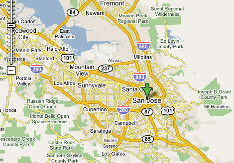
San Jose is an odd one though for it's concrete curtains. (For simplicity, the neighboring towns count as part of San Jose. Mostly because they could easily mistaken as part of the city.)
The clearest lines would be Highway 87 as there are major differences between the areas it divides. The North side of the City isolates businesses well (except west of Great America where residential exists) by 101 and 880, with 237 passing on the North, isolating Alviso. (It's said that area has not changed at all since the 1950s.)
But then it becomes very muddy for the other areas. Driving on some roads for a few miles and the neighborhood quickly changes every block. Then you have areas such as the East Side bisected by 680 that act as if the freeway wasn't there.
Please register to post and access all features of our very popular forum. It is free and quick. Over $68,000 in prizes has already been given out to active posters on our forum. Additional giveaways are planned.
Detailed information about all U.S. cities, counties, and zip codes on our site: City-data.com.

 Please register to participate in our discussions with 2 million other members - it's free and quick! Some forums can only be seen by registered members. After you create your account, you'll be able to customize options and access all our 15,000 new posts/day with fewer ads.