Create you own city! (Dallas, metro, largest, crime)
Please register to participate in our discussions with 2 million other members - it's free and quick! Some forums can only be seen by registered members. After you create your account, you'll be able to customize options and access all our 15,000 new posts/day with fewer ads.
City name: Zenith City population: 2,700,000 Metro population: 5,650,000 White %: 35% African-American %: 30% Hispanic %: 20% Asian %: 15% 10 tallest buildings heights in feet: 1) First Bank of Zenith, 1,117ft 2) 978 Nozick Ave, 965 ft 3) Geno Building, 920 ft 4) East Geno Annex, 870 ft 5) 76 Silverstein St, 860 6) 258 21 St, 765 ft 7) Marsh Building, 720 ft 8) Jefferson Tower, 702 ft 9) 416 89 St, 680 ft 10) Cyan Tower, 678 ft
History: Zenith was founded in 1867 by a rag-tag group of Quakers, Mormons, freed slaves, agrarian socialists, Freethinkers, Irish immigrants, and Jews. The several groups at first despised each other and violence was not uncommon among the different groups as each wanted their own basis for the community and their own name (Solemn, Deseret, Freetown, Hope Commune, Reasonville, New Cork, and New Zion). The one day Joshua Silverstein, one of the leaders from the Jewish camp, suggested that since they never would see eye to eye as their tastes and beliefs were all so different that the mere existence of the others would destroy the goal of the new settlement. He suggested a new reason for the settlement, one not based on religion or race or ethnicity or even specific political goals, but rather one that would be follow one simple philosophy: "If it doesn't directly and measurably harm another person, you can do it. Yes, that includes marrying a couple of inexplicably hot woman who for some reason want to marry some middle-aged guy with magic underwear and it is also includes being a non-violent pansy who will flee the second some Indians raid us and it includes being shifty Negro and it includes running some bulls--t commune that will collapse in less generation like almost all previous ones have in the past and it includes being a G-dless heathen who's mere existence is an insult to H-m and it includes the right of the Irish to preserve their proud heritage of perpetual alcoholism and unemployment and it includes our right to to reject your lord, I have no idea why some cult leader in an obscure town ever got to be so respected, he was no prophet and certainly never the son of G-d." This philosophy is known as "bigoted tolerance", you may hate your neighbors race, religion (or lack thereof), or lifestyle, but you still tolerate it and your neighbor because he has the decency to tolerate you despite the fact you are damn Buddhist, vegan, honky.
Because of the city's unique outlook to society, the city has developed a rather odd quilt work pattern of neighborhoods with almost every ethnicity and lifestyle represented. Few cities can you find a cross-dressing, chain-smoking, Black Panther playing paintball with nudist, conservative, Catholic, WASP in a public park. And the only sign of their resentment towards each other are the excessive amounts of shots aimed at the groin.
City name: New Great City City population: 10,000,000 Metro population: 20,000,000 White %: 90 African-American %: 0.1 Hispanic %: 5.9 Asian %: 5 Sports teams: soccer, swimming etc. Yearly weather averages (average high-low, rain, snow): Jan 30/45 / July 85/63 25" of precipitation a year, and 10" of snow.
City Name: Noyausita (essentially a bastardisation of Core City in french & italian) City Population: 250,000 Metro Population: 250,000 Ethnicity: N/A (a colourblind society has no need for these statistics) 10 Tallest Buildings- 1,640ft (central building), 100ft (ring building), all others 100ft or less Sports Teams: Whatever can fit in the stadium that the people want Yearly weather averages: city is located in a coastal temperate zone Average high: 65 Average low: 45 Average rain: 100inches Average snow: 3 inches Cloudy days %: 28 Sunny days %: 72
Unemployment: Low Poverty: Low Crime: very low, due to the highly libertarian government that does not legislate morality, and instead focuses on personal harm and property harm crimes Schools: very good. The "child" schools (roughly K-8) are evenly dispersed throughout the city. This is to further nurturing and bing close to home. The large "adult" school (roughly 9-12 & univ.) is in the Central Building. This is to further integration into the general populous by having all students from all areas of the city be in one place. School grades are more fluid, and change within a monthly basis (year-round schools) instead of on a yearly basis. Testing is a common occurance and is used to determine placement, not age. This better supports learning outside of the classroom.
City layout:
The city is layed-out in a circular pattern (think of a bulls-eye), with the city boundary 5 miles radius from the Central Building at the zero-point. http://i159.photobucket.com/albums/t...l_building.jpg The Central building houses all government offices, the adult school, the central library, and the transportation hub, complete with massive underground parking structure. From the central building to 1 mile radius is parkland. From 1 mile to 4 miles radius is the main part of the city, which doesn't except cookie-cutter designs for buildings & houses. Domes are greatly encouraged, as are architecturally-pleasing buildings. From 4 miles to 5 miles radius is parkland, with the exception of the 100ft. tall Ring Building, which greatly resembles Stonehenge, which fully encompasses the city. Yes, that means it is a 27.xx mile long building!
Transportation: Ring routes: At every 1 mile radius is a sunken 4-lane freeway with parkland berms on each side and a light-rail line running down the middle I-210-style (Pasadena, CA). At the 1.5, 2.5, & 3.5 mile radii are Embarcadero-style (san Francisco, CA) boulevards with light-rail running down the middle of them. Radial routes: At each of the 4 cardinal compass points is a 4-lane freeway (with light-rail in the middle) starting at the 1-mile radius freeway and heading out of the city. Being a coast city, 1 of these will head to the coast / port, depending on which side faces the ocean. Inside the 1-mile freeway is a freeway/rail stub that connects directly with the Central Building's transportation hub. At the secondary compass points are Embarcadero-style boulevards (yes, you guessed it... light-rail in the middle of them) running from 1-mile freeway to 5-mile freeway. Other boulevards between these 8 radial routes can be planned for depending upon need. Special: The Central Building has the transportation hub that intergrates the vehicle systems (car & rail) with the large elevator/ people mover (think horizontal escalators) systems.
The Ring Building has an underground parking structure under it's entire length, with a tram system underground in the middle of the structure, and a people mover system on the lowest floor of the cross section on the top.
Boulevard to freeway interchanges will be 2-level roundabouts, with the main lines of the freeway under the roundabout. http://www.cbrd.co.uk/reference/inte...roundabout.gif
Freeway to freeway interchanges will be 3-level roundabouts, with one main line under the roundabout, and the other main line above. http://www.cbrd.co.uk/reference/inte...img/3round.gif
If traffic getts too busy for a 3-level roundabout, they can be upgraded into a whirlpool interchange. http://www.cbrd.co.uk/reference/inte.../whirlpool.gif
City name: Sumeris City population: 150,000 Metro population: 150,000 (It is a walled city) White %: 74 African-American %: 1 Hispanic %: 5 Asian %: 20 10 tallest buildings heights in feet: 500, 150, 100, 80, 70, ... Buldings >950 feet tall: 0 >800 feet tall: 0 >650 feet tall:0 >500 feet tall: 1
The 500 ft building is a monument/temple in the center of the city. The rest of the city is comprised of dense low rise buildings
Sports teams: NFL, MLB, Soccer, Gladiator-style arena death matches Yearly weather averages : Jan: 77/60 July: 82/65
Avg precip: 90"
Sunny Days: 357 (There is an odd weather pattern where it tends to rain only at night, and hard, then clear up by day break). This keeps everything lush green like a rain-forest
Crime: almost unheard of. Violent criminals are punished with immediate death by guillotine upon conviction with indisputable evidence. Misdemeanor convictions yield long imprisonment then banishment from the city. Petty crimes (stealing, vandalism) result in loss of limbs/ appendages or a set # of lashes.
-There are no guns allowed in this city, any crime with a gun is immediate death for the perpetrator.
-Children caught committing petty crimes will be forced into performing civic improvement work(city beatification/trash cleanup/manual labor) Transport: There are no cars. There are only electric trolley, rail, and bicycles.
-The city is laid out similar to an old medieval city except with a more park/lush forest like setting with modern conveniences and architecture.
-Economy- The city is completely self-sufficient. Many citizens earn a living through agriculture, having very fertile land and plenty of rains. Knowledge/science and high-tech manufacturing are the next leading industries. Citizens of Sumeris must take their education seriously because once you reach 18yrs old you must take a citizenship test for the city, which is similar to an IQ test. You get three tries, or risk sterilization or banishment from the city.
Last edited by KingSingh; 08-04-2009 at 11:39 PM..
City name: The City Of ArchView City population: 4,000,000 Metro population: 8,0000 White %: 65 African-American %: 5 (ghetto) Hispanic %: 25 Asian %: 5(chinatown) 10 tallest buildings heights in feet: 1,800...1,456...1,110... Buldings >950 feet tall: 6 >800 feet tall: 10 >650 feet tall: 15 >500 feet tall: 25 Sports teams: all major league Yearly weather averages 78 all year except Christmas then it would be 30 Deg. with at least a foot of snow for two weeks before and after.
Delmar is a vibrant neighborhood that is located on the cities northeast side. The neighborhood is known for its great festivals which many people to each one. It is home to about half of the University of New Emporis which is a private college with an enrollment of 20,000. It was ranked the 15th best college in the world by the Princeton Review, which also ranked the medical department 10th best in the world. Neighborhood: Delmar Area: 5 sq. miles Population Density: 20,000 per sq. mile Population: 100,000 White %: 48% Black %: 18% Hispanic %: 6% Asian %: 25% 8 tallest buildings heights in feet: 400-325-275-250-230-215-205-200 % of Resident's With a Bachelor's Degree or Higher: 65% Median Household Income: $100,000 Median House Value: $800,000 % of Individuals Below Poverty Level: 3% % of Foreign Born Residents: 12% % of Residents That Speak Language Other Than English at Home: 18% % of Residents 65 Years and Older: 15% Central West End, Saint Louis, MO - City Skyline Photography Prints, Canvas, Digital Stock - Black & White or Color Digital Stock Art
Washington is a very important neighborhood on the cities near east side. Nicknamed "The Brooklyn of New Emporis", the neighborhood has the urban feel of Brooklyn with the diversity of Queens and is the main cultural and ethnic melting pot in New Emporis. Most of the cities ethnic enclaves of New Emporis can be found here, including Little Italy, Chinatown, Little Ethiopia and Little Bosnia. About 66% of white residents are immigrants from another country, mainly Italy, Russia, German, Bosnia, and West India. And about 40% of black residents are from another country, mainly Jamaica, Cuba, Dominican Republic, Ethiopia, and some of West Africa. The neighborhoods International Festival attracts people from all around the US and is the largest ethnic festival in the US. The neighborhoods skyline consists of many 6-18 story lofts, townhouses and walk-up houses, which are the main housing units in the neighborhood. Neighborhood: Washington Area: 8 sq. miles Population Density: 50,000 per sq. mile Population: 400,000 White %: 25% African-American %: 22% Hispanic %: 23% Asian %: 20% 8 tallest buildings heights in feet: 260-240-240-220-220-220-200-200-200-200 % of Resident's With a Bachelor's Degree or Higher: 22% (US average: 27%) Median Household Income: $30,000 (US average: $50,007) Median House Value: $180,000 (US average: $181,800) % of Individuals Below Poverty Level: 20% (US average: 13.3%) % of Foreign Born Residents: 66% (US average: 12.5%) % of Residents That Speak Language Other Than English at Home: 75% (US average: 19.5%) % of Residents 65 Years and Older: 10% (US average: 12.5%) Washington Avenue, Saint Louis, MO - City Skyline Photography Prints, Canvas, Digital Stock - Black & White or Color Digital Stock Art
San Luis is a prominent majority Hispanic neighborhood on the cities southwest side. The neighborhood boasts many great mexican restaurants, including the regionally renowned La Vallesana, which has won the Best Mexican Restaurant award given by the New Emporis Review five years in a row. The San Luis High School soccer team placed second in national's last year. Also, in the schools 59 years of existence, 11 students ended up playing for the their respective countries national team. Also, the cities all Spanish newspaper, the Espanol de Hoy, is printed in San Luis. Neighborhood: San Luis Area: 5 sq. miles Population Density: 30,000 per sq. mile Population: 150,000 White %: 15% African-American %: 5% Hispanic %: 73% Asian %: 5% 8 tallest buildings heights in feet: 180-160-160-140-140-140-120-120-120-120 % of Resident's With a Bachelor's Degree or Higher: 20% (US average: 27%) Median Household Income: $33,000 (US average: $50,007) Median House Value: $198,000 (US average: $181,800) % of Individuals Below Poverty Level: 18% (US average: 13.3%) % of Foreign Born Residents: 60% (US average: 12.5%) % of Residents That Speak Language Other Than English at Home: 66% (US average: 19.5%) % of Residents 65 Years and Older: 12% (US average: 12.5%) http://blogs.csmonitor.com/photos/uncategorized/mercado.jpg
San Fernando is a wealthy, upperclass, suburban style neighborhood on the cities far northwest side. San Fernando is basically Beverly Hills without palm trees. The neighborhood almost only consists of large and expensive houses and is where most "celebrities" in the area live. The neighborhood centers around the Fernandez Lake, which is named after the neighborhoods founder. Most of the houses are within three blocks of the 2 square mile lake. Neighborhood: San Fernando Area: 10 sq. miles Population Density: 2,000 per sq. mile Population: 20,000 White %: 75% African-American %: 8% Hispanic %: 4% Asian %: 12% % of Resident's With a Bachelor's Degree or Higher: 36% (US average: 27%) Median Household Income: $200,000 (US average: $50,007) Median House Value: 1,600,000 (US average: $181,800) % of Individuals Below Poverty Level: 1% (US average: 13.3%) % of Foreign Born Residents: 6% (US average: 12.5%) % of Residents That Speak Language Other Than English at Home: 9% (US average: 19.5%) % of Residents 65 Years and Older: 18% (US average: 12.5%) http://mikelopez.info/wp-content/uploads/2007/01/mansion.jpg
Lincoln is the neighborhood directly south of mid-sized Lincoln Park in South New Emporis. It is also adjacent to the Lincoln business district, which is known for having a wide variety of ethnic restaurants, coffee shops, and bars, and nightclubs. The neighborhood has been developing steadily, with many homes and buildings being rehabbed and new businesses opening over the past 10-15 years. Nearby Lincoln Park is host to the cities Gay Pride Parade. Lincoln is also flooded with young professionals, and is a hot spot for yuppies. Neighborhood: Lincoln Park Area: 4 sq. miles Population Density: 10,000 per sq. mile Population: 40,000 White %: 32% Black %: 40% Hispanic %: 16% Asian %: 8% % of Resident's With a Bachelor's Degree or Higher: 60% Median Household Income: $45,000 Median House Value: $270,000 % of Individuals Below Poverty Level: 12% % of Foreign Born Residents: 18% % of Residents That Speak Language Other Than English at Home: 24% % of Residents 65 Years and Older: 6%
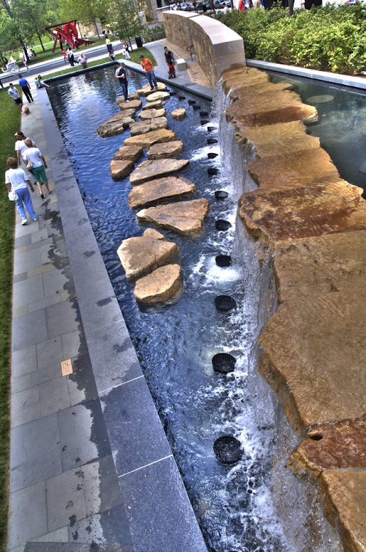
Urban St. Louis - View topic - City Garden (http://www.urbanstl.com/viewtopic.php?t=7271 - broken link)
This image has been resized. Click this bar to view the full image. The original image is sized 1024x683 and weights 393KB.
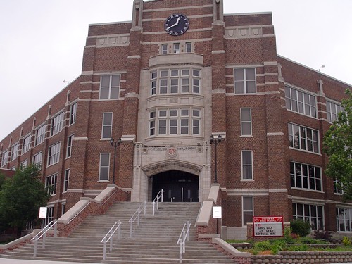
Urban St. Louis - View topic - Winter in Tower Grove Park (http://www.urbanstl.com/viewtopic.php?t=5125 - broken link)
Urban St. Louis - View topic - STL visit Part Six :: Is it the South Side? (http://www.urbanstl.com/viewtopic.php?t=4430 - broken link)
Urban St. Louis - View topic - STL visit Part Six :: Is it the South Side? (http://www.urbanstl.com/viewtopic.php?t=4430 - broken link)
Marina Beach is a historic neighborhood located on the west side of New Emporis. It is known for its canals, beaches, and Lakefront Pier, which stretches 1000 feet over Lake Montebello and features performers, fortune tellers, games, and vendors. Lake Montebello is the largest of the three lakes in New Emporis, at 10 sq. miles. It is connected to the Fernandez Lake by a three mile long canal, which is where most residents live along. Because of its attractive location, just north of Lake Montebello and south of the Fernandez Lake, Marina Beach is a hot spot for boating, fishing, parties, and beachlife. The neighborhood is so historic because it was home to early Beat Poets and artists in New Emporis, and in the 1960's was one of the centers of hippie culture in America. Neighborhood: Marina Beach Area: 5 sq. miles Population Density: 8 per sq. mile Population: 40,000 White %: 70% African-American %: 8% Hispanic %: 16% Asian %: 4% % of Resident's With a Bachelor's Degree or Higher: 20% (US average: 27%) Median Household Income: $45,000 (US average: $50,007) Median House Value: $300,000 (US average: $181,800) % of Individuals Below Poverty Level: 18% (US average: 13.3%) % of Foreign Born Residents: 10% (US average: 12.5%) % of Residents That Speak Language Other Than English at Home: 15% (US average: 19.5%) % of Residents 65 Years and Older: 8% (US average: 12.5%)
Suburb: St. Catherine Population: 48,360 White %: 92% Black %: 3% Hispanic %: 2% Asian %: 4% % of Resident's With a Bachelor's Degree or Higher: 59% Median Household Income: $69,269 Median House Value: $184,500 % of Individuals Below Poverty Level: 3%
St. Catherine was incorporated as a city in 1896. In it's early days it was a streetcar suburb of Arcadia Falls with several coal mines. The coal mines closed by the end of the 1930's, and streetcar service ended in 1944.
After WWII, St. Catherine began to grow rapidly as many GI Bill students at Arcadia State began to make their homes there. St. Catherine had a population of 3,200 in 1940, but by 1970 the population there had jumped to 16,600. St. Catherine became a hub of local retail in 1996 with the opening of Spring Hill Town Center, a super-regional shopping mall. Fearing that the new retail might hurt retail closer to the city center, the local leadership began an extensive urban renewal project of the old town center.
Most recently, a proposal to uncover and redevelop the old street car line to ease congestion has been discussed by the city council.
Add something . I'm working on New Emporis County and should have it posted in the next few days.
Please register to post and access all features of our very popular forum. It is free and quick. Over $68,000 in prizes has already been given out to active posters on our forum. Additional giveaways are planned.
Detailed information about all U.S. cities, counties, and zip codes on our site: City-data.com.

 Please register to participate in our discussions with 2 million other members - it's free and quick! Some forums can only be seen by registered members. After you create your account, you'll be able to customize options and access all our 15,000 new posts/day with fewer ads.


 This image has been resized. Click this bar to view the full image. The original image is sized 1024x683 and weights 393KB.


 . It needs to be revived.

