Please register to participate in our discussions with 2 million other members - it's free and quick! Some forums can only be seen by registered members. After you create your account, you'll be able to customize options and access all our 15,000 new posts/day with fewer ads.
A piece of the polar vortex would bring rain in the winter?
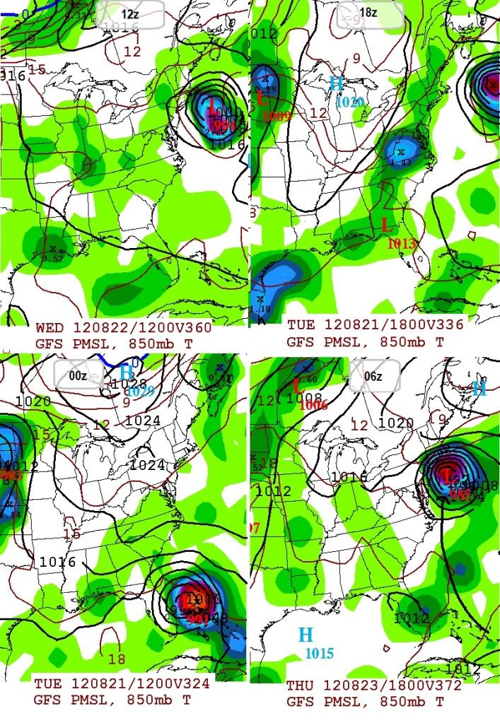
The frontside of a low pressure system brings rain more often than snow where he lives.
As for the polar storm, it has the potential to really do a number on the arctic sea ice. Then again the sea ice may have other tricks up its sleeve, such as an unusually early minimum, so it will have to be monitored over the next 2 months until it reaches its minimum. It's only uphill from there for the cold weather fan (for the entire N.H. - in October we can watch the sea ice bulk up, Siberian snow cover, and even the first snows in the U.S. (October 2011 was great, probably the best month of the whole winter relative to the time of year)).
As for the storm influencing weather, it seems to be pushing the polar vortex towards our side of the world. That would stimulate cool shots here as opposed to Eurasia. Other factors can override such a distant and weak indicator, but it appears to be connected.
A piece of the polar vortex would bring rain in the winter?
.
I would be on the warm side of this setup with the storm going to the great lakes, it would draw warm air up from the south on the far East side of it. You too I believe. But its always fun to watch weather it snows or not. :-) Frustrating, but fun. lol
On another note...
Sooner or later the GFS has to be right. it continues to show a Tropical system affecting the lower 48. Some runs shows Maine, some shows Florida, some OTS, and the last one had Irene Flashbacks.
These are the last 4 runs. Long range here so so soak in the overall consistancy rather than location and strength.
THE FORECAST FOR THE TWIN PORTS ARE IS IN THE UPPER
60S...AND AN INTERESTING TID BIT IS THAT DULUTH HAS NOT HAD A HIGH TEMPERATURE IN THE 60S SINCE MID JUNE. CLOUD COVER WILL BE ON THE
DECREASE THROUGH THE DAY...SO AT LEAST MUCH OF THE NORTHERN FA
SHOULD SEE SOME SUNSHINE LATER IN THE AFTERNOON AND EARLY EVENING.
LONG TERM...[THURSDAY NIGHT - TUESDAY]
AN ELONGATED REGION OF CANADIAN HIGH PRESSURE WILL CENTER OVER THE
NRN MN/LK SUPERIOR REGION THURSDAY NIGHT. THE HIGH WILL RESULT IN
CLEARING SKIES...LIGHT WINDS...COOL TEMPS AND CONDITIONS FAVORABLE
FOR FOG. HAVE CONTINUED TREND TO LOWER TEMPS THURSDAY NIGHT MAINLY IN THE 40S...
That tropical storm looks interesting, and if it holds there is a possibility for something to develop. If the tropical storm follows that general track, it would be what I call an "East Coast Grazer". They're the best kind. The sort of hurricane that menaces the coast, tracks up the coast, puts its outer rainbands on shore, then moves on out to sea, continuing on its way (instead of making landfall and dissipating).
It's still 2 weeks from now, anything could happen. For all we know this system may never even exist. But if the scenario were to occur, it might not be as bad as Irene since the center will be a bit offshore. Then again, it will be as bad or maybe worse if it's an intense hurricane. Looks kinda like Earl of 2010 except a little closer. In around a week to 10 days we should get a better picture of this.
As for the polar storm, it has the potential to really do a number on the arctic sea ice. Then again the sea ice may have other tricks up its sleeve, such as an unusually early minimum, so it will have to be monitored over the next 2 months until it reaches its minimum. It's only uphill from there for the cold weather fan (for the entire N.H. - in October we can watch the sea ice bulk up, Siberian snow cover, and even the first snows in the U.S. (October 2011 was great, probably the best month of the whole winter relative to the time of year)).
Looks like there was some damage especially north of Siberia:
watch this animation. There's some error during the storm so to get the most accurate numbers we need to wait a bit. Further discussion on the storm and sea ice is here:
Looks like there was some damage especially north of Siberia:
watch this animation. There's some error during the storm so to get the most accurate numbers we need to wait a bit. Further discussion on the storm and sea ice is here:
I hope all this melting Ice doesn't mean we will get another mild winter.
I'm actually looking into it. It "might" mean we could have some decent blocking this winter.
Please register to post and access all features of our very popular forum. It is free and quick. Over $68,000 in prizes has already been given out to active posters on our forum. Additional giveaways are planned.
Detailed information about all U.S. cities, counties, and zip codes on our site: City-data.com.

 Please register to participate in our discussions with 2 million other members - it's free and quick! Some forums can only be seen by registered members. After you create your account, you'll be able to customize options and access all our 15,000 new posts/day with fewer ads.