Please register to participate in our discussions with 2 million other members - it's free and quick! Some forums can only be seen by registered members. After you create your account, you'll be able to customize options and access all our 15,000 new posts/day with fewer ads.
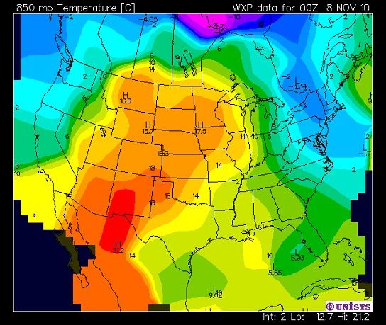
What does that mean exactly? Many times weather maps are posted and I'm not completely sure what to make of them. Might be an interesting thread. For example, what does a 500 mb temperature map tell us? 850 mb? A pressure height map?
It would be a nice information thread but it would go way off topic like most threads here I noticed. Sometimes conversations go off topic and its hard to move the posts into the right thread.
Without going too off topic here.. The 540 line is the thickess of the air. In short below 540 supports snow, above 540 does not, but one cannot use this as the sole indicator. So to see the 540 line that far south that early is rare..
I'm going to be talking alot about these numbers as winter gets closer since its a winter weather tool.
Should we start a thread called "Technical Weather Info"? PM me to go over some rules and details.
Alright, I think it's time for some Canadian prairie weather here.
First off, some nice cold temperatures The temperature here normally hits -40 at some point every winter, however in January 2004 we got down to -45 and I don't think we've hit that mark again since:
Now, here we have the infamous "Blizzard of '07". It took place on January 10th, 2007 and was the worst blizzard in several decades in the area. It affected large parts of southern Saskatchewan, as well as parts of BC, Alberta, and Manitoba. It dumped 25 cm (9.8 inches) of snow on us, had zero visibility for seven hours, and had 90 km/h (55mph) winds, with gusts as high as 130km/h (80mph) at the peak of the storm. Schools were let out early, buses stopped running by 6:00PM, highways were closed, and the airport was shut down. Commute times were doubled, tripled, or more (my Dad's normally 20 minute drive home from work took him two and a half hours that evening). Some people were flat out stuck and had to spend the night in shopping malls, schools, and other businesses. The next day it was bright and sunny, but temperatures plummeted to -40 (with the windchill being -47°C (-53°F) overnight) and they declared it a snow day, the first time school was cancelled due to snow in over twenty years (since 1984, if I remember correctly).
First, here's a taste of the "view" we had from our house:
Our basement windows, almost completely covered up by snow already:
Alright, I think it's time for some Canadian prairie weather here.
First off, some nice cold temperatures The temperature here normally hits -40 at some point every winter, however in January 2004 we got down to -45 and I don't think we've hit that mark again since:
Now, here we have the infamous "Blizzard of '07". It took place on January 10th, 2007 and was the worst blizzard in several decades in the area. It affected large parts of southern Saskatchewan, as well as parts of BC, Alberta, and Manitoba. It dumped 25 cm (9.8 inches) of snow on us, had zero visibility for seven hours, and had 90 km/h (55mph) winds, with gusts as high as 130km/h (80mph) at the peak of the storm. Schools were let out early, buses stopped running by 6:00PM, highways were closed, and the airport was shut down. Commute times were doubled, tripled, or more (my Dad's normally 20 minute drive home from work took him two and a half hours that evening). Some people were flat out stuck and had to spend the night in shopping malls, schools, and other businesses. The next day it was bright and sunny, but temperatures plummeted to -40 (with the windchill being -47°C (-53°F) overnight) and they declared it a snow day, the first time school was cancelled due to snow in over twenty years (since 1984, if I remember correctly).
Great story and pics, I don't like winter but that storm looked fun.
I often wonder how people survive in such extreme conditions.
Although I'm sure it seems like an extremely hostile and foreign environment for people from warmer climates, we're used to it and life goes on like normal when winter rolls around. They don't issue windchill warnings here unless the windchill hits the -40 mark, and even as little kids in elementary school we never got to spend recess indoors unless the windchill was below -25°C (-13°F). Of course, as I mentioned, this blizzard was a once in several decades thing (and the first snow day in over 20 years), so this was extreme even for us.
But despite the severity of this blizzard only three people died.
Quote:
Originally Posted by Infamous92
Great story and pics, I don't like winter but that storm looked fun.
Yeah, it certainly breaks up the monotony of winter and makes things interesting.
Epic blizzard! Must not be fun for commuting to say the least, but I'd love to experience such a thing at least once. Saskatoon is already another level of cold compared to Minneapolis.
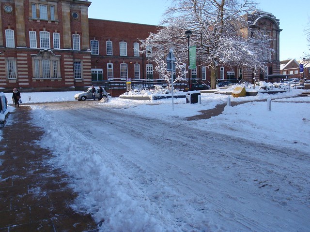
It's not distant history, but here a some photos I took from the last few winters in Paris suburbs and the region south of it to Orleans. For some reason I have nothing from 2009-2010, the coolest of the bunch with 2008-2009...
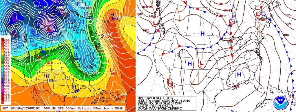
Why was this one interesting to me? Not because it was our first snow of the season but because the storm was moving North to South. Thats very rare around here. I'm still not sure why. Maybe there was some big High in the Atlantic it had to go around?
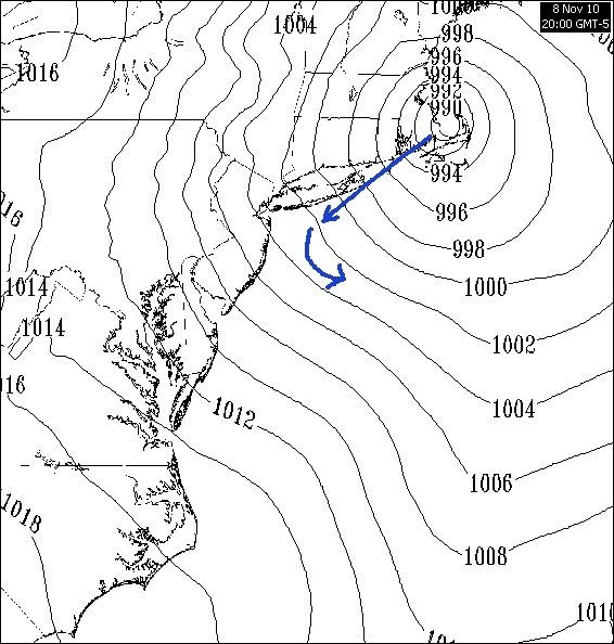
HPC Discussion.
0955 PM CST SUN NOV 07 2010
CONCERNING...WINTER MIXED PRECIPITATION
WV IMAGERY AND RUC ANALYSIS INDICATE A STRONG VORT MAX PIVOTING NWWD
TOWARD SRN NEW ENGLAND. STRONG PRESSURE FALLS OFF THE NEW ENGLAND
COAST ARE ASSOCIATED WITH A SURFACE LOW DEEPENING IN RESPONSE TO
AGEOSTROPHIC FORCING ACCOMPANYING THE VORT MAX. THE ISALLOBARIC
RESPONSE IS RESULTING IN NLY FLOW AND COLD ADVECTION NEAR THE
SURFACE. WET BULB TEMPERATURE PROFILES INDICATE A WINTRY MIX SHOULD TRANSITION TO
FREEZING RAIN OVER WRN MAINE AS WARM ADVECTION IN THE 850-700 MB
LAYER INCREASES. FARTHER WEST ACROSS NH PRECIPITATION MAY BEGIN AS A
MIX OF SNOW AND SLEET AFTER 05Z BEFORE TRANSITIONING TO FREEZING
RAIN AFTER 09Z. WET BULB TEMPERATURES FROM 30-32 F ARE SOMEWHAT
MARGINAL FOR A MORE SIGNIFICANT FREEZING RAIN EVENT. FREEZING RAIN
WILL BE MORE LIKELY AND PERSISTENT WITHIN THE VALLEYS WHERE COLD AIR
COULD REMAIN TRAPPED.
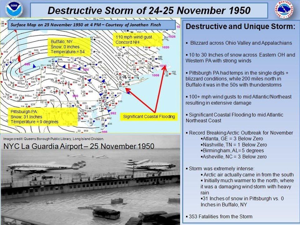
On November 24, 25 1950, a destructive storm struck much of the Eastern United States during the Thanksgiving Holiday weekend. It is arguably one of the most unique storms ever to hit the country.
The storm had it all from blizzard conditions, to destructive winds, heavy rain, coastal flooding, and an arctic outbreak on top. In fact many locations smashed their all time record lows for November by more than 10 degrees. What is also very unique is that the storm became so powerful, arctic air moved in from the south! Pittsburgh, PA received 31 inches of snow, while 200 miles to the north Buffalo, NY just saw rain.
As you can see I don't really take too many pictures.
Please register to post and access all features of our very popular forum. It is free and quick. Over $68,000 in prizes has already been given out to active posters on our forum. Additional giveaways are planned.
Detailed information about all U.S. cities, counties, and zip codes on our site: City-data.com.

 Please register to participate in our discussions with 2 million other members - it's free and quick! Some forums can only be seen by registered members. After you create your account, you'll be able to customize options and access all our 15,000 new posts/day with fewer ads.


 The temperature here normally hits -40 at some point every winter, however in January 2004 we got down to -45 and I don't think we've hit that mark again since: