Please register to participate in our discussions with 2 million other members - it's free and quick! Some forums can only be seen by registered members. After you create your account, you'll be able to customize options and access all our 15,000 new posts/day with fewer ads.
Also, October 30th had one of the wackiest reverse temperature contrasts between north and south I've seen:
Warm air wrapping around the storm to the north of Pennsylvania precluded snowfall even at high elevations in New York and New England. In fact, a daily record high of 70° was recorded in Burlington, Vermont on October 30th while it was 27° and snowing in Hot Springs, Virginia!
As I mentioned, 6288 feet on New Hampshire's highest peak it was above freezing enough to be rain with no chance of snow while the Central Appalachians were experiencing snow at much lower elevations. Maximum snowfall 36" at only 2200 feet in Richwood, WV.
Sun has peaked out from time to time the past couple days, but generally it's been pretty cloudy for over a week now. November is off to a chilly start as well.
Quite cold in Upstate NY. Currently 33 F with snow in Saranac Lake. Monday is forecasted to not even reach the freezing mark:
Tonight: A chance of snow showers. Cloudy, with a low around 29. Northwest wind 5 to 8 mph. Chance of precipitation is 30%. Total nighttime snow accumulation of less than a half inch possible.
Sunday: A chance of snow showers, mainly before 9am. Cloudy, with a high near 34. Northwest wind 5 to 8 mph. Chance of precipitation is 30%. New snow accumulation of less than a half inch possible.
Sunday Night: Mostly cloudy, with a low around 17. North wind around 5 mph becoming calm in the evening.
Monday: Mostly sunny, with a high near 30. Calm wind becoming northwest around 6 mph in the afternoon.
Monday Night: Mostly clear, with a low around 14. North wind 3 to 5 mph.
Tuesday: Sunny, with a high near 36.
Tuesday Night: Mostly clear, with a low around 15.
Wednesday: A chance of rain and snow. Partly sunny, with a high near 40. Chance of precipitation is 30%.
Wednesday Night: Rain and snow likely. Mostly cloudy, with a low around 27. Chance of precipitation is 60%.
Thursday: Rain and snow likely. Cloudy, with a high near 38. Chance of precipitation is 60%.
Thursday Night: Snow likely. Mostly cloudy, with a low around 31. Chance of precipitation is 60%.
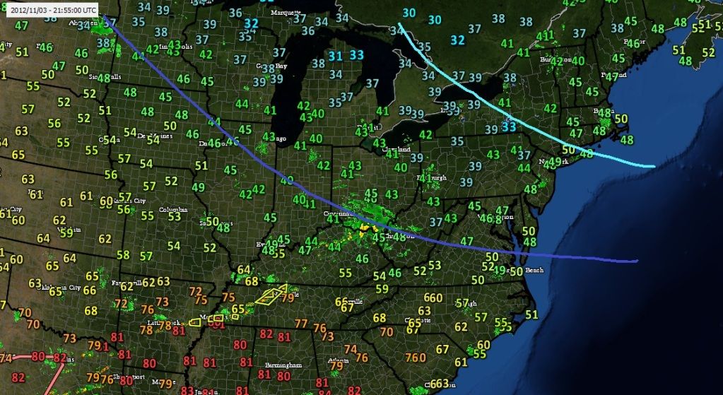
Current temps... Pretty much in line with what Im thinking for winter as far as where the cold goes. Light blue line is where it would get fridgid. But look at the current below normal temps vs the above normal in the south
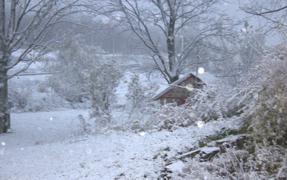
We have just had the first snow of the season in my locale. Drove through a moderate snow shower on the way to work. Quite large flakes. It was settling on the heathland but not on the road.
That seems like alot of tree damage from Sandy when your so far from the coast (I'm guessing more than 60 miles inland).
I'm only a few blocks from the beach and my tree damage was not much different than yours . Although you were closer to the center of the hurricane than I was, still a bit shocked to see trees down up there.
Please register to post and access all features of our very popular forum. It is free and quick. Over $68,000 in prizes has already been given out to active posters on our forum. Additional giveaways are planned.
Detailed information about all U.S. cities, counties, and zip codes on our site: City-data.com.

 Please register to participate in our discussions with 2 million other members - it's free and quick! Some forums can only be seen by registered members. After you create your account, you'll be able to customize options and access all our 15,000 new posts/day with fewer ads.