Fall 2012 Thread (September - November) (Oklahoma, snowing, warm, average)
Please register to participate in our discussions with 2 million other members - it's free and quick! Some forums can only be seen by registered members. After you create your account, you'll be able to customize options and access all our 15,000 new posts/day with fewer ads.
70f is not autum weather. Anything above 50 is warm for October sorry.
I mean it hasn't been that temperature here since august.
For you...not for us.
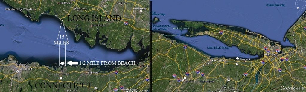
For us in the NYC metro anything below 50 F (for highs) is way too cold for fall. Our normal high in October is in the 60's ....and many days crack 70 F. This Friday, some of the Tri-State area might hit upper 70's to 80 F (NYC maybe). Next week should see 60's and some 70's again.
For us in the NYC metro anything below 50 F (for highs) is way too cold for fall. Our normal high in October is in the 60's ....and many days crack 70 F. This Friday, some of the Tri-State area might hit upper 70's to 80 F (NYC maybe). Next week should see 60's and some 70's again.
I don't see any 70s in next week's forecast. After Friday, it looks likes it'll be slightly below to near average in NYC. Where I live, highs are generally forecasted to be 5-10 F below average.
I don't see any 70s in next week's forecast. After Friday, it looks likes it'll be slightly below to near average in NYC. Where I live, highs are generally forecasted to be 5-10 F below average.
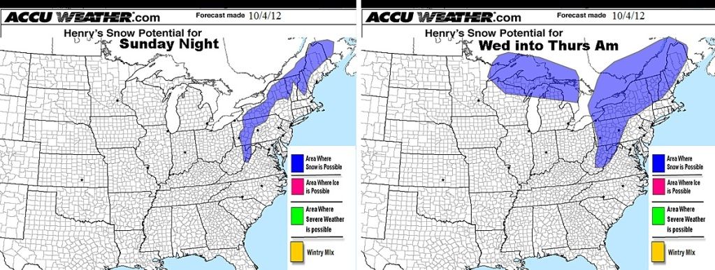
Looking cold, even after the 1 day warmup. lol
SHORT TERM /FRIDAY NIGHT THROUGH SUNDAY/...
STRONG COLD ADVECTION WITH THE PASSAGE OF THE FRONT AND THE
SECONDARY WAVE WITH THE LATTER SHORTWAVE LOOK TO BRING TEMPERATURES
FROM ABOVE NORMAL FRIDAY TO 5-10 DEGREES BELOW NORMAL SATURDAY AND SUNDAY GIVING THE REGION A MORE WINTER LIKE FEELING.
&&
.LONG TERM /SUNDAY NIGHT THROUGH THURSDAY/...
PER RECENT GFS AND ECMWF MODEL OUTPUT...HAVE CONTINUED FORECAST OF
POST SYSTEM SHOWERS ENDING BY LATE SUNDAY NIGHT. HAVE INCLUDED
MENTION OF A POSSIBLE CHANGE TO LIGHT SNOW SHOWERS ACROSS THE NORTH
AND HIGHER MOUNTAINS LATE AS THE SURFACE LAYER COOLS TO NEAR THE FREEZING POINT.
BASED ON RECENT GFS AND ECMWF MOS...FORECASTED TEMPERATURES TO BE ABOUT 10 DEGREES COLDER THAN NORMAL MONDAY...THEN MODERATE TO NEAR
NORMAL VALUES BY TUESDAY...BEFORE GOING TO ABOUT 5 DEGREES COLDER THAN NORMAL WEDNESDAY
I don't see any 70s in next week's forecast. After Friday, it looks likes it'll be slightly below to near average in NYC. Where I live, highs are generally forecasted to be 5-10 F below average.
Hmm...not sure about that:
According to EA...it’s warm everywhere in the eastern USA on Friday, places like NYC and Philly should be near 80 F….then the front comes through this weekend and it cools down (and humidity goes way down). Monday will be cool but sunny (highs in the 60’s in most of the Northeast). After that, the return flow quickly changes to WSW again, giving sunny skies and normal to above normal temps for much of the eastern USA next week. NYC should hit near 70 F by Thursday. So I think it would be hard to see temps 5 to 10 below normal. See 2.49 in the video graphics:
Some bright object appeared in the sky today at around 5 PM, I have no idea what it was.
Please register to post and access all features of our very popular forum. It is free and quick. Over $68,000 in prizes has already been given out to active posters on our forum. Additional giveaways are planned.
Detailed information about all U.S. cities, counties, and zip codes on our site: City-data.com.

 Please register to participate in our discussions with 2 million other members - it's free and quick! Some forums can only be seen by registered members. After you create your account, you'll be able to customize options and access all our 15,000 new posts/day with fewer ads.