Posting this here too for the Eastern U.S Peeps.
I'll keep this simple...
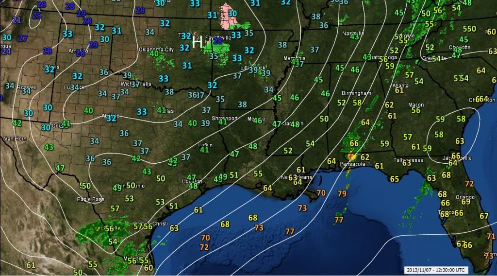
1. VERY warm morning out there near 60. which is 15-20 above normal. Warm Day.
2. Cold front coming through today which is still over PA (Little rain)
3. Temps will drop into the 30s in spots by Friday 7pm. Stay in 40s on Saturday
4. Quick warmup on Sunday
5. The fun begins
Temps might stay in the 30s during the day on Tuesday or Wednesday.
THE EURO HAS AGREED WITH GFS AND CANADIAN MODELS. (That's a first huh?)
We should be seeing our first snowflakes of the season including south of us (the mid Atlantic). No point in mentioning how much yet but the setup is amazing to see.
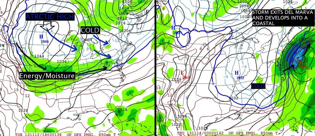
Here's a graphic to explain what's happening.
Left image is for Tuesday. Cold air already over us thanks to the Arctic High dropping down. That green blob along the blue line is moisture riding under the High along the Jet stream.
Right image is the storm exiting around the Mid Atlantic and then developing and moving up the coast. Enough cold air around to throw down snow.
There are so many updates from now till then, this scenario wont be "exact". But the general idea is there.
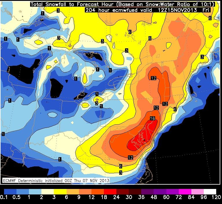
As far as what is being shown for snow totals...... well.... See below but re-read my last sentence before this.
The scenario is believable
NOT>>>>NOT this snowfall total. Use it as eye candy only but consider the fact that snow could be in the forecast next week. Lets see what happens as the days go on.

 Please register to participate in our discussions with 2 million other members - it's free and quick! Some forums can only be seen by registered members. After you create your account, you'll be able to customize options and access all our 15,000 new posts/day with fewer ads.