Welcome to City-Data.com Forum!
U.S. CitiesCity-Data Forum Index
Go Back   City-Data Forum > General Forums > Weather
 [Register]
Please register to participate in our discussions with 2 million other members - it's free and quick! Some forums can only be seen by registered members. After you create your account, you'll be able to customize options and access all our 15,000 new posts/day with fewer ads.
View detailed profile (Advanced) or search
site with Google Custom Search

Search Forums  (Advanced)
Reply Start New Thread
 
Old 02-03-2014, 05:33 AM
 
Location: South Jersey
14,497 posts, read 9,425,330 times
Reputation: 5251

Advertisements

Up to the minute radar indicating a changeover to freezing rain/sleet/wintry mix. Not seeing it yet. Looks like snow isn't too far from here. As far as I can tell, northeast Philly is getting snow, while Philadelphia International Airport (south Philly) is still getting rain.
Reply With Quote Quick reply to this message

 
Old 02-03-2014, 05:45 AM
 
Location: Near the Coast SWCT
83,495 posts, read 75,206,563 times
Reputation: 16619
Quote:
Originally Posted by snj90 View Post
Up to the minute radar indicating a changeover to freezing rain/sleet/wintry mix. Not seeing it yet. Looks like snow isn't too far from here. As far as I can tell, northeast Philly is getting snow, while Philadelphia International Airport (south Philly) is still getting rain.
Yup, you were right! Nice catch. Here's the PA OBS sheet. National Weather Service Text Product Display


Current temps and radar. Shaded colors are temps at 4000feet.

The freezing line up there now dropping south of Philly hence the changeovers in the areas. You can see the actual metars and who's reporting snow and rain. (Light rain not added to avoid the clutter)

Attached Thumbnails
February 2014 Northeast/MidAtlantic Winter Storms-map8.jpg   February 2014 Northeast/MidAtlantic Winter Storms-obs2.jpg  
Reply With Quote Quick reply to this message
 
Old 02-03-2014, 07:29 AM
 
Location: Near the Coast SWCT
83,495 posts, read 75,206,563 times
Reputation: 16619
Everyone is out and about. Pines getting weighed down. We're near 7:1 ratios. Almost 3" now.

I took these pics not long ago.
Reply With Quote Quick reply to this message
 
Old 02-03-2014, 07:34 AM
 
Location: South Jersey
14,497 posts, read 9,425,330 times
Reputation: 5251
Nice pics, Cambium. I wish it looked like that here. So far this is feeling like a total bust for my area. I hope I'm wrong and it changes.
Reply With Quote Quick reply to this message
 
Old 02-03-2014, 07:36 AM
 
Location: Near the Coast SWCT
83,495 posts, read 75,206,563 times
Reputation: 16619
Quote:
Originally Posted by snj90 View Post
Nice pics, Cambium. I wish it looked like that here. So far this is feeling like a total bust for my area. I hope I'm wrong and it changes.
Just looked at radar, wow! I wonder if the shift north just screwed you out of those totals you were supposed to get. Still raining south of Philly. Cold air didn't filter in fast enough! Should change soon? Interesting.
Reply With Quote Quick reply to this message
 
Old 02-03-2014, 07:46 AM
 
Location: Near the Coast SWCT
83,495 posts, read 75,206,563 times
Reputation: 16619
9:40am Radar & Metars. Everyone south of Philly & Winchester VA is still Rain. 850s above freezing there. If temps at 4000 feet are above freezing you're not going to get snow. That level of the atmosphere has to crash down more.

Reply With Quote Quick reply to this message
 
Old 02-03-2014, 07:49 AM
 
Location: South Jersey
14,497 posts, read 9,425,330 times
Reputation: 5251
Quote:
Originally Posted by Cambium View Post
Just looked at radar, wow! I wonder if the shift north just screwed you out of those totals you were supposed to get. Still raining south of Philly. Cold air didn't filter in fast enough! Should change soon? Interesting.
Just need the temperature to drop a little bit. It's been around 33-34 all morning. Cold enough to see a few snowflakes at times, but mostly just rain. At this point I'd be happy enough with an inch by the end of the day. If it starts snowing decently, I think it may be already too little, too late for the higher totals, as were forecast. So much precious moisture already wasted.
Reply With Quote Quick reply to this message
 
Old 02-03-2014, 07:53 AM
 
Location: South Jersey
14,497 posts, read 9,425,330 times
Reputation: 5251
Ooh, ice pellets now. Kind of neat. Heard them first then went outside to check. Little bits of slush accumulating in my hair while outside, slushy stuff accumulating on my car.
Reply With Quote Quick reply to this message
 
Old 02-03-2014, 07:59 AM
 
Location: South Jersey
14,497 posts, read 9,425,330 times
Reputation: 5251
Wow, I honestly can't remember anything like this. Grounds getting a light coating of white stuff, but it's not snow, just ice. Slush all over the cars (and all over my hair, lol!) pavements, including the road, getting a little slippery.

But that stopped and now it looks like snow. I'd have to go outside again to gauge the type of precip.
Reply With Quote Quick reply to this message
 
Old 02-03-2014, 08:07 AM
 
Location: Fishers, IN
4,970 posts, read 6,263,122 times
Reputation: 4945
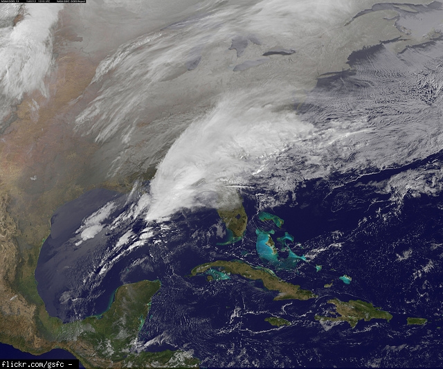
We missed out on the storm yesterday, the one hitting the east coast now. The one coming in tomorrow is gunning for us, though. It looks like Indianapolis will be just north of the ice line. Current forecasts are for snow to move in late afternoon tomorrow and be heavy overnight with 5-9 inches along and north of the I-70 corridor and 3-6 inches south with some freezing rain and sleet mixed in, with .25 to .5 inches of ice with a few inches of snow across the southern part of Indiana. I'll take the 5-9 inches of snow as opposed to the ice. Still concern for this system to weaken as a new storm forms off the East Coast and sucks the energy away. Models still trending a bit further south. And a couple models still trying to show a dry slot working it. Currently, a Winter Storm Watch is up from just south of I-70 north to the Indiana/Michigan state line from 1PM tomorrow until 1PM Wednesday.

Latest update from the National Weather Service:

FORECAST FOCUS IS ON SIGNIFICANT STORM TO IMPACT THE AREA TUESDAY- WEDNESDAY. MODELS ARE COMING INTO BETTER AGREEMENT ON THE TRACK OF THE LOW...BUT ARE STILL SHOWING SOME DECENT CHANGES RUN TO RUN ON THE PROGRESSION OF THE SURFACE LOW AND IT/S ENERGY TRANSFER TO A COASTAL SYSTEM WEDNESDAY. THUS STILL MODERATE UNCERTAINTY ON HOW THIS WILL PLAY OUT. WHILE THE NAM IS MOVING CLOSER TO OTHER MODELS...IT STILL IS RUNNING A BIT MORE NORTH AND WARMER THAN THE MAJORITY OF THE SUITE. THUS WILL STICK WITH MORE OF AN ECMWF AND GFS CONSENSUS.

FOR TONIGHT HIGH PRESSURE WILL BE OVER THE AREA LEADING TO MOSTLY CLEAR SKIES AND GOOD COOLING. WITH SNOW COVER IN THE NORTH COULD SEE A DECENT TEMPERATURE GRADIENT FOR LOWS ACROSS THE AREA. THE RAW MODEL CONSENSUS NUMBERS CAPTURED THIS BETTER THAN MOS.

TUESDAY THERE IS GENERAL AGREEMENT THAT THE MORNING WILL BE DRY. BY AFTERNOON THE SYSTEM STARTS TO PULL OUT OF THE GULF AND A WARM FRONT TAKES SHAPE OVER THE TENNESSEE VALLEY. ISENTROPIC LIFT RAMPS UP AT 18Z AND FRONTOGENESIS BAND STARTS SETTING UP ACROSS THE AREA. BY 0Z THIS BAND IS STRONG AND SOME INSTABILITY IS COLLOCATED WITH IT ALOFT WHICH COULD LEAD TO BANDING. BETWEEN 0Z AND 6Z FORCING ALOFT ARRIVES AS EVIDENCED BY GOOD Q VECTOR CONVERGENCE AS WELL AS SIGNIFICANT PRESSURE ADVECTION ON 1.5 PV SURFACE. MODELS ARE SHOWING MOST FORCING COMING TO A HALT BY 12Z WEDNESDAY BUT THE LATEST RUNS ARE STILL SHOWING A LITTLE QPF HANGING AROUND INTO THE MORNING. ALSO WIND GUSTS AROUND 20 KTS SHOULD REMAIN THROUGH THE MORNING AS THE LOW TRANSFERS ENERGY TO THE EAST COAST SYSTEM AND THESE GUSTS ALONG WITH THE FRESH SNOW COULD CAUSE BLOWING SNOW TO CONTINUE TO BE AN ISSUE EVEN AFTER ACCUMULATING SNOW HAS ENDED. TOTAL SNOWFALL AMOUNTS BY WEDNESDAY MORNING LOOKING LIKE 5-9 INCHES FROM I-70 NORTH WITH THE HIGHEST AMOUNTS NORTH OF A CRAWFORDSVILLE TO ANDERSON LINE. ISSUED A WINTER STORM WATCH FOR THIS AREA.

MODELS ARE FAIRLY CONSISTENT IN AREA ALONG AND NORTH OF I-70 REMAINING SNOW THROUGHOUT THE EVENT. SOUTHERN COUNTIES ARE SHOWING MORE VARIABILITY IN SOLUTIONS THOUGH. FORECAST SOUNDINGS SHOW THE POTENTIAL FOR SLEET AND PERHAPS SOME FREEZING RAIN TO MIX IN...ALTHOUGH AT THIS TIME GFS SOUNDINGS FAVOR SLEET AND WENT IN THIS DIRECTION. THIS MIXTURE SHOULD KEEP SNOWFALL AMOUNTS LOWER HERE AND MORE IN THE 2-4 INCH RANGE. THUS WITH LOWER SNOWFALL AMOUNTS IN THE SOUTH AND UNCERTAINTY ABOUT FREEZING RAIN POTENTIAL LEFT SOUTHERN COUNTIES OUT OF WATCH.


The good news for us is the storm system for this coming weekend is looking much further south and east.

THE 00Z ECMWF AND GFS ARE KEEPING A VERY STRONG HIGH PRESSURE RIDGE FROM THE SOUTHERN PLAINS TO EASTERN CANADA WHICH SHOULD KEEP THE DEEPER MOISTURE SOUTH AND EAST OF CENTRAL INDIANA AS THE LOW TRACKS NORTHEAST. THE BLEND WOULD RESULT IN THE BULK OF ANY SNOWFALL BEING EAST OF THE AREA THIS WEEKEND. THE 00Z GFS AND AND ECMWF BOTH SUGGEST A NOREASTER...ALTHOUGH THE ECMWF IS MUCH QUICKER TO PULL THE SYSTEM OUT...A FULL 24 HOURS FASTER IN TAKING THE DEEPENING SYSTEM TO THE CANADIAN MARITIMES. THE 00Z GEFS MEAN IS MUCH WEAKER AND SLOWER THAN THE OPERATIONAL GFS OWING TO THE LACK OF CLUSTERING WITH EACH PERTURBATION IN THE ENSEMBLE. SO...ALTHOUGH TIMING IS IN QUESTION...AGAIN IT IS LOOKING MORE LIKE THE BULK OF THE PRECIPITATION SHOULD STAY AWAY FROM CENTRAL INDIANA. SO...LOWERED REGIONAL ALLBLEND POPS SLIGHTLY. AT THIS POINT...BUFKIT SOUNDINGS AND PARTIAL CANADIAN THICKNESSES CONTINUE TO SUGGEST ANY PRECIPITATION THAT DOES FALL SHOULD BE SNOW.
Reply With Quote Quick reply to this message
Please register to post and access all features of our very popular forum. It is free and quick. Over $68,000 in prizes has already been given out to active posters on our forum. Additional giveaways are planned.

Detailed information about all U.S. cities, counties, and zip codes on our site: City-data.com.


Reply
Please update this thread with any new information or opinions. This open thread is still read by thousands of people, so we encourage all additional points of view.

Quick Reply
Message:

Over $104,000 in prizes was already given out to active posters on our forum and additional giveaways are planned!

Go Back   City-Data Forum > General Forums > Weather
Similar Threads

All times are GMT -6. The time now is 07:05 PM.

© 2005-2024, Advameg, Inc. · Please obey Forum Rules · Terms of Use and Privacy Policy · Bug Bounty

City-Data.com - Contact Us - Archive 1, 2, 3, 4, 5, 6, 7, 8, 9, 10, 11, 12, 13, 14, 15, 16, 17, 18, 19, 20, 21, 22, 23, 24, 25, 26, 27, 28, 29, 30, 31, 32, 33, 34, 35, 36, 37 - Top