Please register to participate in our discussions with 2 million other members - it's free and quick! Some forums can only be seen by registered members. After you create your account, you'll be able to customize options and access all our 15,000 new posts/day with fewer ads.
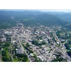
The only ways to get from Waynesville to Brevard is to cross the Pisgah Forest. That means either taking Rt. 215 out of Waynesville down to Rt. 64 near Rosman. Or, taking Rt. 276 out of Waynesville and when you get to the BRP, you take a right and come down to Rt. 280. Rt. 215 from Waynesville is a longer drive than 276.
The BRP is Rt. 151. Simply Google Waynesville NC and you will see where the roads traverse. You can also go to the BRP website and see where the mileposts are, and the entrances/exits and check the elevations.
Yes, the altitudes are high, and icy road conditions are prevalent in the winter, falling rocks, etc. That is why they close the parkway at some of the mileposts.
You should drive it in good weather, that is the only way you will know where you are going and how long it takes.
Here is an excerpt I copied for you from our RV travels and the Cradle of Forestry Discovery Center site:
"U.S. Rt. 276 within the Pisgah Forest has very significant grades and curves. There are warning signs posted for truckers. Caution is advised for RVer’s approaching the area from the west on Rt. 276 via Caruso and Waynesville, you will find rock outcroppings and trees very close to the right side of the rig and very tight curves on this two-lane road. There are no passing lanes or long pullouts once you start the ascent within the forest. Approaching the area from the east via Brevard area is somewhat easier with more pullouts and somewhat easier curves. Access from the Blue Ridge Pkwy down the East Side of the summit is a four mile 7-8% grade with moderate curves. Entrance to the Cradle of Forestry is via a large driveway marked with large signs mounted on top of large logs. (Do not confuse with the entrance to the nearby “Pink Beds” recreational area parking lot) There is adequate parking at the Cradle on the lower parking lot marked for RV parking.
Volunteers are utilized extensively at the Cradle for most of the visitor service positions. Secluded RV sites with three-way hookups are provided at the Cradle for Workampers Staff only. Telephone hookups are now available. Prospective volunteers should contact Barbara Merrell at 828-877-3130 during business hours or via barbmerrel@aol.com."
WRONG! You go get on I-26, travel to the I-40 junction and follow I-40 to Waynesville. About 40 minutes. Much shorter than either of the ways you mentioned. Remain relatively clear during the winter barring any freak storms. Unbelievable!
I suppose being here 9 plus years would qualify me to say I'm pretty familiar with the area and my profession required me to be 100% familiar with the roads; probably know them better than some of the natives. You are correct of course that 276 is a way to get down to Greenville, but I sure can't see it being a piece of cake if you need to get to work or get to Whole Foods market, or a real mall. It is a very windy narrow road, hope you're not doing more than 35 to 45 on it when you meet bubba coming down his half of the road which he takes out of the middle! I've been in traffic on that road near Cedar Mountain, backed up 3 miles because of an accident, and the only way to get the injured out of there was by helicopter.
It's not my intention to lead people on by letting them think certain roads are a piece of cake when they may have different reasons other than cruising to need to get to a place ... and back. 276 from Brevard to Greenville is a lovely "Sunday ride".
Rt. 64 to Franklin is another nice leisurely ride on a sunny day.
Did not read the thread, but being on any of the "best places to live" list is frequently the kiss of death. Hang in there Brevard lovers!
You've got that right LLN! It's all marketing. They can go to any "best of" lists and get a myriad of choices that some marketing person conjured up with no knowledge whatsoever.
Everyone has a dream spot, or a dream house, in their mind, that many times turns out to be a nightmare == and quite often they go from one extreme to another.
Another good example is all the "store front" development communities that went belly up in this area when tourists stopped drinking the Kool Aid and decided $200K was more than they should pay for the dirt left after scraping off the side of a mountain. Those eyesores are vacant and in foreclosure now. There is no "best", just what's best for you after sensible and unemotional balance of options.
For business reasons that have just come up, we've decided to stay put here in Hiawassee for the near future and wait until spring/summer to get in a few visits to Brevard.
Who knows where we'll ultimately live? Not me.
On a related note, how is the section of Highway 64 from Cashiers to Brevard? I've been on the rest of it except that section. I know it's supposed to be the scariest part.
I would be waiting until winter was over, but is that section really harrowing?
It's not "scary" at all, it is a beautiful drive from Brevard to Highlands and back, especially at the Toxaway Dam I can't resist getting out to see it if it is "rushing". Good decision to stay put until spring.
It's not "scary" at all, it is a beautiful drive from Brevard to Highlands and back, especially at the Toxaway Dam I can't resist getting out to see it if it is "rushing". Good decision to stay put until spring.
64 to Highlands is one of the worst roads around. It is two lane. It is full of hairpin curves (that stupid tractor trailer drivers continually get stuck in). And to make matters worse, you will have the "tourists" that are driving 20 mph just making that backup worse. I have sat in traffic on my way to Lake Toxaway for hours while waiting for a stuck truck to be pulled out on many, many occasions. While it is not scary if you know where you are going and are familiar with the road, it most assuredly can be scary to flatlanders that are not used to or comfortable with driving mountain roads.
Last edited by Green Irish Eyes; 11-29-2010 at 12:56 PM..
Reason: Deleted rude comments.
Please register to post and access all features of our very popular forum. It is free and quick. Over $68,000 in prizes has already been given out to active posters on our forum. Additional giveaways are planned.
Detailed information about all U.S. cities, counties, and zip codes on our site: City-data.com.

 Please register to participate in our discussions with 2 million other members - it's free and quick! Some forums can only be seen by registered members. After you create your account, you'll be able to customize options and access all our 15,000 new posts/day with fewer ads.


 Not me.