Please register to participate in our discussions with 2 million other members - it's free and quick! Some forums can only be seen by registered members. After you create your account, you'll be able to customize options and access all our 15,000 new posts/day with fewer ads.
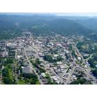
My wife and I are going to be heading over to Asheville this week, and we're really looking forward to enjoying some of the natural beauty of the mountains with some side-trips in to the countryside. I know many in Asheville have been disturbed by the amount of building going up on the mountains. I guess my question is--are there suggestions of places where we can get out and really enjoy pure nature without seeing mansions scattered about the landscape? Or has that been soiled by all the growth? I saw some recent pictures of Grandfater Mountain, and couldn't believe the development allowed below the mountain!
Any suggestions are greatly appreciated. Thank you!
There are families that are using conservation easements to protect their land from future development. The municipalities that are paying them for these easements are interested in protecting watersheds and viewsheds. Your best bet is to look for areas with several conservation easements, as well as National Forest land. These are the only areas that are protected from development. The rest is fair game.
Get on the Blueridge Parkway (right in Asheville) and go either North or South and you can't go wrong!
Very scenic!
Happy Holidays!
That would be my recommendation also, The speed limit is 45 MPH (less in places) and allows you to see a wide variety of the mountain topology. Heed that speed limit, speeding is a federal offense on the parkway, and can cost you $1,500.00 or more.
That would be my recommendation also, The speed limit is 45 MPH (less in places) and allows you to see a wide variety of the mountain topology. Heed that speed limit, speeding is a federal offense on the parkway, and can cost you $1,500.00 or more.
That would be my recommendation also, The speed limit is 45 MPH (less in places) and allows you to see a wide variety of the mountain topology. Heed that speed limit, speeding is a federal offense on the parkway, and can cost you $1,500.00 or more.
Due to budget cutbacks, the number of Rangers on the BRP is severely limited. I heard that there was only one law enforcement Ranger with authority to arrest between Asheville and Boone!!!!!
Due to budget cutbacks, the number of Rangers on the BRP is severely limited. I heard that there was only one law enforcement Ranger with authority to arrest between Asheville and Boone!!!!!
I've seen State Troopers on the section of the parkway that loops around Asheville. Probably because it's become a convenient shortcut to avoiding increasing traffic on the main roads, people hop on there and treat it more like a beltway than a tourist road
The initiative for higher fines can be blamed, to a large extent, on the bikers who abuse the road http://www.motorcycle.com/news/news1764.html
Being a rider who has done the parkway from end-to-end, this isn't a general slam against bikers, just those who give the rest of us a bad name
To the original OP, IMO the section of the BRP north of Asheville up thru Craggy Gardens and on to Mt. Mitchell (highest point east of the Mississippi) is really pretty, as is the entire route from Asheville to the parkway terminus at Cherokee. Going south you drive thru (IIRC) 17 tunnels and will reach the highest point on the parkway: 6000+ feet. That's kinda neat, plus the most dramatic, unspoiled views can be seen. Check the NPS site for a map to download http://www.nps.gov/blri/planyourvisit/maps.htm
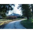
If you take the southern route, not far south of Mt. Pisgah is 276. Take that toward Brevard (or the Cradle of Forestry) and you'll come to Looking Glass Falls. I don't know what it looks like; what with the drought and all; but the times I've viewed it were quite wonderful http://www.ncwaterfalls.com/looking_glass1.htm
Just note that there is no gas along the BRP. Mt Pisgah Inn used to have a station, but that has been closed. Also, it might be pretty cold up there - especially if you go up to Mt. Mitchell. And don't consider it just a short drive. Either direction ought to be considered a day trip to give you time to appreciate the views.
This time of year you also need to check on which sections are closed. The parkway does not clear snow and ice, they just close the road. Even without snow and ice on the road some sections close due to huge icicles that form in the tunnels, some large enough to crush a car flat.
We had a bit of snow in the northern counties a day or so ago, and I'd venture stretches are closed and will remain so until we have a warm spell.
Great suggestions, everyone! Thanks for the help. Looking forward to getting on the parkway--I'll be driving slow and enjoying the scenery!
Please register to post and access all features of our very popular forum. It is free and quick. Over $68,000 in prizes has already been given out to active posters on our forum. Additional giveaways are planned.
Detailed information about all U.S. cities, counties, and zip codes on our site: City-data.com.

 Please register to participate in our discussions with 2 million other members - it's free and quick! Some forums can only be seen by registered members. After you create your account, you'll be able to customize options and access all our 15,000 new posts/day with fewer ads.