Akron, Ohio Neighborhood Map - Income, House Prices, Occupations, Boundaries
Settings
X

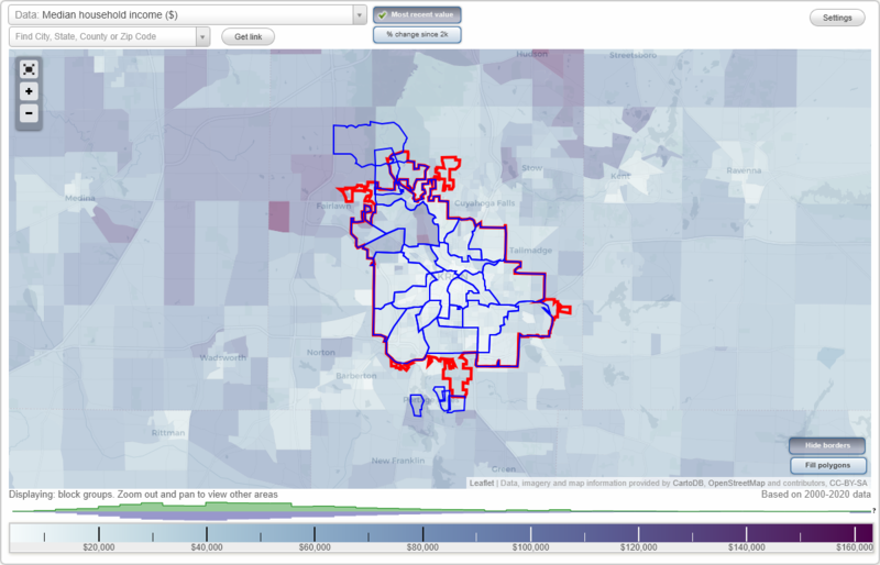
- City boundary
- Neighborhood boundaries
Business Search - 14 Million verified businesses
Neighborhoods:
Botzum, Chapel Hill, Cottage Grove, Coventry, Downtown, East Akron, Elizabeth Park Valley, Ellet, Fairlawn Heights, Firestone Park, Goodyear Heights, Highland Square, Infant of Prague Villa, Ira, Kenmore, Lakeview, Lane-Wooster, Merriman Valley, Middlebury, North Hill, Northwest Akron, Rolling Acres, South Akron, Summit Lake, University, Wallhaven, West AkronBotzum neighborhood in Akron statistics: (Find on map)
Area: 2.395 square miles
Population: 4,469
Population density:
Median household income in 2021:
Median rent in in 2021:
Male vs Females
Median age
Average estimated value of detached houses in 2021 (11.1% of all units):
Most popular occupations of males: service occupations (33.7%); sales and office occupations (7.8%); production occupations (7.6%); construction, extraction, and maintenance occupations (4.5%); material moving occupations (4.4%); management occupations (except farmers) (4.1%); arts, design, entertainment, sports, and media occupations (3.9%)
Most popular occupations of females: service occupations (35.0%); sales and office occupations (22.7%); healthcare practitioners and technical occupations (10.2%); material moving occupations (6.3%); education, training, and library occupations (6.2%); architecture and engineering occupations (4.3%); production occupations (4.0%)
Roads and streets: Riverview Rd; W Bath Rd; Sand Run Rd; Sourek Trl; Akron Peninsula Rd; Brookwood Dr; Sand Hill Dr; Eagles Chase Dr; Yellow Creek Rd; Sand Run Knoll Dr; Rock Hill Ln; Lynnhaven Ln; Kubic Dr; Sturbridge Dr; Sutton Pl; Bent Bow Dr; Indian Hills Trl; Pilgrim Way; Bretton Pl; Deerfield Dr; Williamston Ct; Hanover; Cranberry Ln; Hanover Ct; Wellsley Ln; Saxony Dr; Knollcrest Ct; Bridgewood Dr; Kingsbridge Ct; Cynthia Cir; Pinehurst Ln; Knightsbridge Dr; Foxhollow Ct; Kenton Ct; Gavington Pl; Stonegate Dr; Stratford Ln; Fordham Ct; Foxhollow Dr; Briarcliff Ct.
Railroad features: Cuyahoga Valley Scenic RR.
Other features: Cuyahoga Riv; Yellow Crk; Woodward Crk; Nt Creek 1.
Botzum neighborhood detailed profile
Area: 2.395 square miles
Population: 4,469
Population density:
| Botzum (Bottsom): | 1,866 people per square mile |
| Akron: | 3,051 people per square mile |
Median household income in 2021:
| Botzum (Bottsom): | $80,817 |
| Akron: | $41,628 |
Median rent in in 2021:
| Botzum (Bottsom): | $785 |
| Akron: | $641 |
Male vs Females
| Males: | 2,301 |
| Females: | 2,167 |
Median age
| Males: | 47.4 years |
| Females: | 49.0 years |
Average estimated value of detached houses in 2021 (11.1% of all units):
| Botzum (Bottsom): | $362,811 |
| Ohio: | $228,722 |
Most popular occupations of males: service occupations (33.7%); sales and office occupations (7.8%); production occupations (7.6%); construction, extraction, and maintenance occupations (4.5%); material moving occupations (4.4%); management occupations (except farmers) (4.1%); arts, design, entertainment, sports, and media occupations (3.9%)
Most popular occupations of females: service occupations (35.0%); sales and office occupations (22.7%); healthcare practitioners and technical occupations (10.2%); material moving occupations (6.3%); education, training, and library occupations (6.2%); architecture and engineering occupations (4.3%); production occupations (4.0%)
Roads and streets: Riverview Rd; W Bath Rd; Sand Run Rd; Sourek Trl; Akron Peninsula Rd; Brookwood Dr; Sand Hill Dr; Eagles Chase Dr; Yellow Creek Rd; Sand Run Knoll Dr; Rock Hill Ln; Lynnhaven Ln; Kubic Dr; Sturbridge Dr; Sutton Pl; Bent Bow Dr; Indian Hills Trl; Pilgrim Way; Bretton Pl; Deerfield Dr; Williamston Ct; Hanover; Cranberry Ln; Hanover Ct; Wellsley Ln; Saxony Dr; Knollcrest Ct; Bridgewood Dr; Kingsbridge Ct; Cynthia Cir; Pinehurst Ln; Knightsbridge Dr; Foxhollow Ct; Kenton Ct; Gavington Pl; Stonegate Dr; Stratford Ln; Fordham Ct; Foxhollow Dr; Briarcliff Ct.
Railroad features: Cuyahoga Valley Scenic RR.
Other features: Cuyahoga Riv; Yellow Crk; Woodward Crk; Nt Creek 1.
Botzum neighborhood detailed profile
Chapel Hill neighborhood in Akron statistics: (Find on map)
Area: 2.459 square miles
Population: 6,033
Population density:
Median household income in 2021:
Median rent in in 2021:
Male vs Females
Median age
Housing prices:
Average estimated value of detached houses in 2021 (40.1% of all units):
Average estimated value of housing units in 2-unit structures in 2021 (8.6% of all units):
Most popular occupations of males: production occupations (30.7%); service occupations (18.9%); material moving occupations (12.0%); sales and office occupations (7.7%); construction, extraction, and maintenance occupations (3.7%); healthcare practitioners and technical occupations (2.4%); management occupations (except farmers) (1.9%)
Most popular occupations of females: service occupations (32.4%); sales and office occupations (27.7%); healthcare practitioners and technical occupations (9.2%); production occupations (7.7%); transportation occupations (6.5%); education, training, and library occupations (4.8%); material moving occupations (4.2%)
Highways in this neighborhood: State Rte 261 (E Tallmadge Ave); State Rte 8 (State Rte 59).
Roads and streets: Independence Ave; Brittain Rd; Belden Ave; Home Ave; Annapolis Ave; Gorge Blvd; Evans Ave; Alphada Ave; Jean Ave; Easton Dr; Devalera St (de Valera Ave); Creighton Ave; Moe Dr; Yorkshire Dr; Longstone Ave; Breiding Rd; Betana Ave; Emory Ave; Hyde Park Ave; Success Rd; Buchholzer Blvd; Industrial Pkwy; Howe Rd; Gurley Ave; Vane Ave; Bettes Ave; Hogue Ave; Hilltop Dr; Midway St (Midway Ave); Beatrice Dr; Viogross Ave (Vicgross Ave); Alice Ave; Piedmont Ave; Grand Park Ave; Brownstone Ave; Shirley Ave; Scenic Way; Westpoint Ave; Freedom Ave; Kimlyn Cir; Blackstone Ave; Anaconda Rd; Jeanie J Ave; Herkender Ave; Ocean Ave; Sorin Ave; Climax Ave; Cato Ave; Whitestone Ave; Upton Ave; Wade Park Ave; Kessel Ave; Norita St; Brittian Cir; Bluestone Ave; Tower St (Tower Dr); Corwin St; Yellowstone Ave; Shreve Rd; Jennifer Ln; Donova Ln; Redstone Ave; Gurley Cir; Franzen Ln; Garner Ave; Buddy Ln; Harden Ave (Harden Dr); Kyle Ln; Layden Ave; Marne St; Graystone Ave; Keller St; Brittain Woods Dr (Brittain Woods Rd); Midway Plz.
Railroad features: Csx RR; Chessie RR.
Chapel Hill neighborhood detailed profile
Area: 2.459 square miles
Population: 6,033
Population density:
| Chapel Hill: | 2,453 people per square mile |
| Akron: | 3,051 people per square mile |
Median household income in 2021:
| Chapel Hill: | $41,293 |
| Akron: | $41,628 |
Median rent in in 2021:
| Chapel Hill: | $686 |
| Akron: | $641 |
Male vs Females
| Males: | 3,004 |
| Females: | 3,028 |
Median age
| Males: | 32.4 years |
| Females: | 39.7 years |
Housing prices:
Average estimated value of detached houses in 2021 (40.1% of all units):
| Chapel Hill: | $83,550 |
| Ohio: | $228,722 |
Average estimated value of housing units in 2-unit structures in 2021 (8.6% of all units):
| This neighborhood: | $97,926 |
| Ohio: | $143,395 |
Most popular occupations of males: production occupations (30.7%); service occupations (18.9%); material moving occupations (12.0%); sales and office occupations (7.7%); construction, extraction, and maintenance occupations (3.7%); healthcare practitioners and technical occupations (2.4%); management occupations (except farmers) (1.9%)
Most popular occupations of females: service occupations (32.4%); sales and office occupations (27.7%); healthcare practitioners and technical occupations (9.2%); production occupations (7.7%); transportation occupations (6.5%); education, training, and library occupations (4.8%); material moving occupations (4.2%)
Highways in this neighborhood: State Rte 261 (E Tallmadge Ave); State Rte 8 (State Rte 59).
Roads and streets: Independence Ave; Brittain Rd; Belden Ave; Home Ave; Annapolis Ave; Gorge Blvd; Evans Ave; Alphada Ave; Jean Ave; Easton Dr; Devalera St (de Valera Ave); Creighton Ave; Moe Dr; Yorkshire Dr; Longstone Ave; Breiding Rd; Betana Ave; Emory Ave; Hyde Park Ave; Success Rd; Buchholzer Blvd; Industrial Pkwy; Howe Rd; Gurley Ave; Vane Ave; Bettes Ave; Hogue Ave; Hilltop Dr; Midway St (Midway Ave); Beatrice Dr; Viogross Ave (Vicgross Ave); Alice Ave; Piedmont Ave; Grand Park Ave; Brownstone Ave; Shirley Ave; Scenic Way; Westpoint Ave; Freedom Ave; Kimlyn Cir; Blackstone Ave; Anaconda Rd; Jeanie J Ave; Herkender Ave; Ocean Ave; Sorin Ave; Climax Ave; Cato Ave; Whitestone Ave; Upton Ave; Wade Park Ave; Kessel Ave; Norita St; Brittian Cir; Bluestone Ave; Tower St (Tower Dr); Corwin St; Yellowstone Ave; Shreve Rd; Jennifer Ln; Donova Ln; Redstone Ave; Gurley Cir; Franzen Ln; Garner Ave; Buddy Ln; Harden Ave (Harden Dr); Kyle Ln; Layden Ave; Marne St; Graystone Ave; Keller St; Brittain Woods Dr (Brittain Woods Rd); Midway Plz.
Railroad features: Csx RR; Chessie RR.
Chapel Hill neighborhood detailed profile
Cottage Grove neighborhood in Akron statistics: (Find on map)
Area: 0.593 square miles
Population: 1,869
Population density:
Median household income in 2021:
Median rent in in 2021:
Male vs Females
Median age
Housing prices:
Average estimated value of detached houses in 2021 (72.6% of all units):
Average estimated value of townhouses or other attached units in 2021 (8.8% of all units):
Most popular occupations of males: service occupations (16.9%); sales and office occupations (16.7%); production occupations (12.3%); material moving occupations (11.7%); management occupations (except farmers) (7.1%); transportation occupations (5.4%); computer and mathematical occupations (4.6%)
Most popular occupations of females: sales and office occupations (22.9%); healthcare practitioners and technical occupations (19.0%); service occupations (18.6%); education, training, and library occupations (13.0%); business and financial operations occupations (8.6%); management occupations (except farmers) (6.9%); community and social services occupations (2.9%)
Roads and streets: Killian Rd; Bender Ave; Daisy Ave; Cottage Grove Rd; Conlin Dr; Jarvis Rd; Minor Ave; Vista Ave; Iris Ave; Magnet St; Hyacinth Ct (Hyacinth Ave); Cope Ave; Finland Ave; Lakeway St; Lemar Ave; Linda St; S Jasmine Ave; Polonia Ave; Colopy St; Klinger St; Needle St; Elmo St; Buttercup Ave; Forget Me Not St; Cosmos Ave; Elderberry Ave; Willowedge Dr; N Jasmine Ave; St Ann Dr; Plateau St; Olivet St.
Cottage Grove neighborhood detailed profile
Area: 0.593 square miles
Population: 1,869
Population density:
| Cottage Grove: | 3,151 people per square mile |
| Akron: | 3,051 people per square mile |
Median household income in 2021:
| Cottage Grove: | $76,904 |
| Akron: | $41,628 |
Median rent in in 2021:
| Cottage Grove: | $653 |
| Akron: | $641 |
Male vs Females
| Males: | 842 |
| Females: | 1,026 |
Median age
| Males: | 41.1 years |
| Females: | 46.8 years |
Housing prices:
Average estimated value of detached houses in 2021 (72.6% of all units):
| Cottage Grove: | $166,136 |
| Ohio: | $228,722 |
Average estimated value of townhouses or other attached units in 2021 (8.8% of all units):
| This neighborhood: | $60,147 |
| Ohio: | $203,882 |
Most popular occupations of males: service occupations (16.9%); sales and office occupations (16.7%); production occupations (12.3%); material moving occupations (11.7%); management occupations (except farmers) (7.1%); transportation occupations (5.4%); computer and mathematical occupations (4.6%)
Most popular occupations of females: sales and office occupations (22.9%); healthcare practitioners and technical occupations (19.0%); service occupations (18.6%); education, training, and library occupations (13.0%); business and financial operations occupations (8.6%); management occupations (except farmers) (6.9%); community and social services occupations (2.9%)
Roads and streets: Killian Rd; Bender Ave; Daisy Ave; Cottage Grove Rd; Conlin Dr; Jarvis Rd; Minor Ave; Vista Ave; Iris Ave; Magnet St; Hyacinth Ct (Hyacinth Ave); Cope Ave; Finland Ave; Lakeway St; Lemar Ave; Linda St; S Jasmine Ave; Polonia Ave; Colopy St; Klinger St; Needle St; Elmo St; Buttercup Ave; Forget Me Not St; Cosmos Ave; Elderberry Ave; Willowedge Dr; N Jasmine Ave; St Ann Dr; Plateau St; Olivet St.
Cottage Grove neighborhood detailed profile
Coventry neighborhood in Akron statistics: (Find on map)
Area: 0.492 square miles
Population: 898
Population density:
Median household income in 2021:
Median rent in in 2021:
Male vs Females
Median age
Most popular occupations of males: service occupations (15.1%); sales and office occupations (14.3%); arts, design, entertainment, sports, and media occupations (13.8%); business and financial operations occupations (13.6%); healthcare practitioners and technical occupations (7.6%); production occupations (6.2%); construction, extraction, and maintenance occupations (5.6%)
Most popular occupations of females: service occupations (41.4%); sales and office occupations (14.3%); business and financial operations occupations (11.5%); education, training, and library occupations (8.6%); healthcare practitioners and technical occupations (6.5%); material moving occupations (5.3%); community and social services occupations (3.4%)
Roads and streets: E State Rd (State St); State Mill Rd; Jolson Ave; Fowler Ave; Wild Cherry Dr; Woodedge Blvd; Point Dr; Rook Dr; Isle View Dr; Roe Dr; Random Dr; Queen Anne Dr; Powell Ave; Surfside Dr; Surfside Ct; Alma Ave; Ronald Ave; Ace Dr.
Coventry neighborhood detailed profile
Area: 0.492 square miles
Population: 898
Population density:
| Coventry: | 1,826 people per square mile |
| Akron: | 3,051 people per square mile |
Median household income in 2021:
| Coventry: | $65,072 |
| Akron: | $41,628 |
Median rent in in 2021:
| Coventry: | $903 |
| Akron: | $641 |
Male vs Females
| Males: | 379 |
| Females: | 519 |
Median age
| Males: | 39.4 years |
| Females: | 53.1 years |
Most popular occupations of males: service occupations (15.1%); sales and office occupations (14.3%); arts, design, entertainment, sports, and media occupations (13.8%); business and financial operations occupations (13.6%); healthcare practitioners and technical occupations (7.6%); production occupations (6.2%); construction, extraction, and maintenance occupations (5.6%)
Most popular occupations of females: service occupations (41.4%); sales and office occupations (14.3%); business and financial operations occupations (11.5%); education, training, and library occupations (8.6%); healthcare practitioners and technical occupations (6.5%); material moving occupations (5.3%); community and social services occupations (3.4%)
Roads and streets: E State Rd (State St); State Mill Rd; Jolson Ave; Fowler Ave; Wild Cherry Dr; Woodedge Blvd; Point Dr; Rook Dr; Isle View Dr; Roe Dr; Random Dr; Queen Anne Dr; Powell Ave; Surfside Dr; Surfside Ct; Alma Ave; Ronald Ave; Ace Dr.
Coventry neighborhood detailed profile
Downtown neighborhood in Akron statistics: (Find on map)
Area: 1.794 square miles
Population: 5,712
Population density:
Median household income in 2021:
Median rent in in 2021:
Male vs Females
Median age
Average estimated value of detached houses in 2021 (8.9% of all units):
Most popular occupations of males: service occupations (24.7%); sales and office occupations (18.9%); construction, extraction, and maintenance occupations (10.2%); production occupations (9.3%); management occupations (except farmers) (8.8%); education, training, and library occupations (7.6%); transportation occupations (3.9%)
Most popular occupations of females: service occupations (20.6%); education, training, and library occupations (20.3%); sales and office occupations (19.5%); management occupations (except farmers) (17.0%); production occupations (8.3%); computer and mathematical occupations (3.9%); transportation occupations (3.6%)
Limited-access highways (interstate or state) in this neighborhood: I- 76 (I- 77).
Highways in this neighborhood: State Rte 59 (Martin Luther King Blvd, Innerbelt); State Rte 261 (W Bowery St); S Maple St (State Rte 162); State Rte 18 (E Market St); State Rte 162 (Glendale Ave); State Rte 261 (Opportunity Pkwy); State Rte 18 (W Market St); State Rte 261 (N Main St).
Roads and streets: S Main St; S Broadway St; S High St; Dart Ave; Sweitzer Ave; Rand St; Miami St; Locust St; Steiner Ave; W Thornton St; W Cedar St; Water St; Wabash Ave; Maiden Ln; W Bartges St; Bellows St; E Voris St; W Exchange St; E Thornton St; Wolf Ledges Pkwy; E Miller Ave; E South St; W State St; E Crosier St; W Falor St; W Center St; E Mill St; la Salle Dr; Wooster Ave; Wheeler Ln; Journal Aly; Wills Ave; E Bowery St; University Ave; Ash St; McCoy St; W Buchtel Ave; Gregory Ave; Furnace Run Dr (Furnace Run Rd); N Summit St; W Mill St; First Merit Cir; Oak Park Dr; Abel St; Pier Dr; Pine St; Getz St; E State St; Aspen St; E Buchtel Ave; E Exchange St; E Cedar St; Selle St; S Summit St; Park St; Livingston St; S Highbrook St; E Bartges St; Fleming Dr; Dorothy O Jackson Ter; Callis Dr; Perfida Pl; Andrus St; Marcy St; Spring St; Gault St; Morning Star Dr; King Dr; Cole Pl; S Prospect St; S Walnut St; Cascade Mills Dr; Cross St; Dunbar Dr; Callis Oval; S Bates St; Palmyra Ave; Grant St; Limestone Aly; Quaker St; Basin Ter; St Clair Dr; Orleans Ave; Church St; W Chestnut St; Pleasant Pl; N Prospect St; Goodrich Ave; Tate Ter; N High St; Calico Dr; Dawes Ave; Jeanette Ave (Jeanette Ct); Oviatt Pl; Quarry Dr; Trimble Dr; Curtis St; Cascade Plz; Star St; Lock Tender Dr; Adeline St; Washington St; St Ambrose Dr; Bell St; Ogle Ter; Wicket Dr; Firestone Pkwy; Wybell Ct; Tandy Ln; N Broadway St; Van Ct; Walnut Ter; Botzum Ct; Wesley Pl; Perkins Sq; Christie St.
Railroad features: Csx RR; Akron and Barberton Belt RR.
Other features: Ohio Cnl.
Downtown neighborhood detailed profile
Area: 1.794 square miles
Population: 5,712
Population density:
| Downtown: | 3,184 people per square mile |
| Akron: | 3,051 people per square mile |
Median household income in 2021:
| Downtown: | $26,844 |
| Akron: | $41,628 |
Median rent in in 2021:
| Downtown: | $551 |
| Akron: | $641 |
Male vs Females
| Males: | 3,251 |
| Females: | 2,461 |
Median age
| Males: | 33.6 years |
| Females: | 38.4 years |
Average estimated value of detached houses in 2021 (8.9% of all units):
| Downtown: | $111,048 |
| Ohio: | $228,722 |
Most popular occupations of males: service occupations (24.7%); sales and office occupations (18.9%); construction, extraction, and maintenance occupations (10.2%); production occupations (9.3%); management occupations (except farmers) (8.8%); education, training, and library occupations (7.6%); transportation occupations (3.9%)
Most popular occupations of females: service occupations (20.6%); education, training, and library occupations (20.3%); sales and office occupations (19.5%); management occupations (except farmers) (17.0%); production occupations (8.3%); computer and mathematical occupations (3.9%); transportation occupations (3.6%)
Limited-access highways (interstate or state) in this neighborhood: I- 76 (I- 77).
Highways in this neighborhood: State Rte 59 (Martin Luther King Blvd, Innerbelt); State Rte 261 (W Bowery St); S Maple St (State Rte 162); State Rte 18 (E Market St); State Rte 162 (Glendale Ave); State Rte 261 (Opportunity Pkwy); State Rte 18 (W Market St); State Rte 261 (N Main St).
Roads and streets: S Main St; S Broadway St; S High St; Dart Ave; Sweitzer Ave; Rand St; Miami St; Locust St; Steiner Ave; W Thornton St; W Cedar St; Water St; Wabash Ave; Maiden Ln; W Bartges St; Bellows St; E Voris St; W Exchange St; E Thornton St; Wolf Ledges Pkwy; E Miller Ave; E South St; W State St; E Crosier St; W Falor St; W Center St; E Mill St; la Salle Dr; Wooster Ave; Wheeler Ln; Journal Aly; Wills Ave; E Bowery St; University Ave; Ash St; McCoy St; W Buchtel Ave; Gregory Ave; Furnace Run Dr (Furnace Run Rd); N Summit St; W Mill St; First Merit Cir; Oak Park Dr; Abel St; Pier Dr; Pine St; Getz St; E State St; Aspen St; E Buchtel Ave; E Exchange St; E Cedar St; Selle St; S Summit St; Park St; Livingston St; S Highbrook St; E Bartges St; Fleming Dr; Dorothy O Jackson Ter; Callis Dr; Perfida Pl; Andrus St; Marcy St; Spring St; Gault St; Morning Star Dr; King Dr; Cole Pl; S Prospect St; S Walnut St; Cascade Mills Dr; Cross St; Dunbar Dr; Callis Oval; S Bates St; Palmyra Ave; Grant St; Limestone Aly; Quaker St; Basin Ter; St Clair Dr; Orleans Ave; Church St; W Chestnut St; Pleasant Pl; N Prospect St; Goodrich Ave; Tate Ter; N High St; Calico Dr; Dawes Ave; Jeanette Ave (Jeanette Ct); Oviatt Pl; Quarry Dr; Trimble Dr; Curtis St; Cascade Plz; Star St; Lock Tender Dr; Adeline St; Washington St; St Ambrose Dr; Bell St; Ogle Ter; Wicket Dr; Firestone Pkwy; Wybell Ct; Tandy Ln; N Broadway St; Van Ct; Walnut Ter; Botzum Ct; Wesley Pl; Perkins Sq; Christie St.
Railroad features: Csx RR; Akron and Barberton Belt RR.
Other features: Ohio Cnl.
Downtown neighborhood detailed profile
East Akron neighborhood in Akron statistics: (Find on map)
Area: 3.441 square miles
Population: 9,885
Population density:
Median household income in 2021:
Median rent in in 2021:
Male vs Females
Median age
Housing prices:
Average estimated value of detached houses in 2021 (69.2% of all units):
Average estimated value of townhouses or other attached units in 2021 (4.9% of all units):
Average estimated value of housing units in 2-unit structures in 2021 (7.0% of all units):
Average estimated '21 value of housing units in 5-or-more-unit structures (10.4% of all units):
Most popular occupations of males: production occupations (18.5%); sales and office occupations (15.0%); service occupations (13.2%); construction, extraction, and maintenance occupations (12.6%); material moving occupations (11.0%); transportation occupations (9.0%); education, training, and library occupations (3.3%)
Most popular occupations of females: service occupations (36.1%); sales and office occupations (26.9%); healthcare practitioners and technical occupations (9.4%); production occupations (8.4%); management occupations (except farmers) (4.5%); material moving occupations (4.1%); business and financial operations occupations (3.5%)
Limited-access highways (interstate or state) in this neighborhood: I- 76; I- 77.
Highways in this neighborhood: Triplett Blvd (State Rte 764); State Rte 18 (E Market St); Massillon Rd (State Rte 241).
Roads and streets: E Archwood Ave; Kelly Ave; S Arlington St; McKinley Ave; 5th Ave; Inman St; Wyley Ave; S Seiberling St (Seiberling St); Englewood Ave; Lovers Ln; Cole Ave; Ardella Ave; Hammel St; Clifford Ave; Merton Ave; Coventry St; E Crosier St; Chittenden St; Baird St; Austin Ave; Bertha Ave; 7th Ave; Talbot Ave; Eva Ave; Georgia Ave; S Martha Ave; Welton Ave; Forbes Ave; Tech Way Dr; Rosemary Blvd; Fuller St; Milton St; Exeter Rd; Minordy Pl; Reed Ave; Neville Ave; Concord Ave; Allendale Ave; Ericsson Ave; Sylvan Ave; Joy Ave; Hudson Ave; Hunt St; Bittaker St; Baltimore Ave; Whitney Ave; Winans Ave; Delos St; Elbon Ave; Lindsay Ave; Virginia Ave; 6th Ave; Staeger St; Van Everett Ave; Roscoe Ave; Clement St; Anderson Ave; Duane Ave; Weeks St; Clark St; Hart St; Lumiere St; Corice St; Morgan Ave; Kipling St; Lafollette St; Jenkins Blvd; Edge St; Alexander St; Erskine Ave; Spencer Ave; Toby Ter; Dahlgren Dr; Bulger St; Eugene St; Santee Ave; Stroman Ave; Kromer Ave; Robert St; Lucy St; Ravenswood St; Homestead St; Clara Ave; Pardee Ave; Huber St; Landon Ave (Landon St); Eva Walk; Brittain Rd; Ada St; Columbus Ave; Chesapeake Dr; Cumberland Dr; Settlement St; Wildon Ave; Shakespeare Ave; 9th Ave; Richmond St; League St; Twain Ave; Darwin Ave; 4th Ave; Druid Walk; Arden Pl; Ray St; Alicia Walk; 8th Ave; Becker Ln; Fremont Ave; Colette Dr; Poe Ave; Fenton St (Fenton Ave); Fernette Ave; Craig St; Spade Ave; E Waterloo Rd; Hobart Ave; Wren Walk; Rowe St; Edmeyer Ct; Salem Ave; Gridley Ave (Gridley St); Maywood Ave; Markle St; Crane Walk; Kelly Ct; Tham Ave; Martin Ave; Willet St; Catskill Dr; Detroit St; General St; Coley Path; Weehawken Pl; Ak St 3; Nada Ct; Hilbish Ave; Patapsco Pl; Akers Ave; Black St; Cario Pl; Tarson Ter; Tecumseh Pl; Cambridge Ave; Darkow St; Terrace Ct; Miles Ave (Miles St); Cairo Pl; Underwood Ave; McCracken; Keys Pl; Underwood St.
Railroad features: Akron and Barberton Belt RR; Csx RR.
Other features: Little Cuyahoga Riv.
Other features: Haley Ditch.
East Akron neighborhood detailed profile
Area: 3.441 square miles
Population: 9,885
Population density:
| East Akron: | 2,873 people per square mile |
| Akron: | 3,051 people per square mile |
Median household income in 2021:
| East Akron: | $44,606 |
| Akron: | $41,628 |
Median rent in in 2021:
| East Akron: | $603 |
| Akron: | $641 |
Male vs Females
| Males: | 4,772 |
| Females: | 5,113 |
Median age
| Males: | 38.8 years |
| Females: | 38.1 years |
Housing prices:
Average estimated value of detached houses in 2021 (69.2% of all units):
| East Akron: | $67,346 |
| Ohio: | $228,722 |
Average estimated value of townhouses or other attached units in 2021 (4.9% of all units):
| This neighborhood: | $137,500 |
| Ohio: | $203,882 |
Average estimated value of housing units in 2-unit structures in 2021 (7.0% of all units):
| This neighborhood: | $71,667 |
| Ohio: | $143,395 |
Average estimated '21 value of housing units in 5-or-more-unit structures (10.4% of all units):
| East Akron: | $41,954 |
| Ohio: | $175,875 |
Most popular occupations of males: production occupations (18.5%); sales and office occupations (15.0%); service occupations (13.2%); construction, extraction, and maintenance occupations (12.6%); material moving occupations (11.0%); transportation occupations (9.0%); education, training, and library occupations (3.3%)
Most popular occupations of females: service occupations (36.1%); sales and office occupations (26.9%); healthcare practitioners and technical occupations (9.4%); production occupations (8.4%); management occupations (except farmers) (4.5%); material moving occupations (4.1%); business and financial operations occupations (3.5%)
Limited-access highways (interstate or state) in this neighborhood: I- 76; I- 77.
Highways in this neighborhood: Triplett Blvd (State Rte 764); State Rte 18 (E Market St); Massillon Rd (State Rte 241).
Roads and streets: E Archwood Ave; Kelly Ave; S Arlington St; McKinley Ave; 5th Ave; Inman St; Wyley Ave; S Seiberling St (Seiberling St); Englewood Ave; Lovers Ln; Cole Ave; Ardella Ave; Hammel St; Clifford Ave; Merton Ave; Coventry St; E Crosier St; Chittenden St; Baird St; Austin Ave; Bertha Ave; 7th Ave; Talbot Ave; Eva Ave; Georgia Ave; S Martha Ave; Welton Ave; Forbes Ave; Tech Way Dr; Rosemary Blvd; Fuller St; Milton St; Exeter Rd; Minordy Pl; Reed Ave; Neville Ave; Concord Ave; Allendale Ave; Ericsson Ave; Sylvan Ave; Joy Ave; Hudson Ave; Hunt St; Bittaker St; Baltimore Ave; Whitney Ave; Winans Ave; Delos St; Elbon Ave; Lindsay Ave; Virginia Ave; 6th Ave; Staeger St; Van Everett Ave; Roscoe Ave; Clement St; Anderson Ave; Duane Ave; Weeks St; Clark St; Hart St; Lumiere St; Corice St; Morgan Ave; Kipling St; Lafollette St; Jenkins Blvd; Edge St; Alexander St; Erskine Ave; Spencer Ave; Toby Ter; Dahlgren Dr; Bulger St; Eugene St; Santee Ave; Stroman Ave; Kromer Ave; Robert St; Lucy St; Ravenswood St; Homestead St; Clara Ave; Pardee Ave; Huber St; Landon Ave (Landon St); Eva Walk; Brittain Rd; Ada St; Columbus Ave; Chesapeake Dr; Cumberland Dr; Settlement St; Wildon Ave; Shakespeare Ave; 9th Ave; Richmond St; League St; Twain Ave; Darwin Ave; 4th Ave; Druid Walk; Arden Pl; Ray St; Alicia Walk; 8th Ave; Becker Ln; Fremont Ave; Colette Dr; Poe Ave; Fenton St (Fenton Ave); Fernette Ave; Craig St; Spade Ave; E Waterloo Rd; Hobart Ave; Wren Walk; Rowe St; Edmeyer Ct; Salem Ave; Gridley Ave (Gridley St); Maywood Ave; Markle St; Crane Walk; Kelly Ct; Tham Ave; Martin Ave; Willet St; Catskill Dr; Detroit St; General St; Coley Path; Weehawken Pl; Ak St 3; Nada Ct; Hilbish Ave; Patapsco Pl; Akers Ave; Black St; Cario Pl; Tarson Ter; Tecumseh Pl; Cambridge Ave; Darkow St; Terrace Ct; Miles Ave (Miles St); Cairo Pl; Underwood Ave; McCracken; Keys Pl; Underwood St.
Railroad features: Akron and Barberton Belt RR; Csx RR.
Other features: Little Cuyahoga Riv.
Other features: Haley Ditch.
East Akron neighborhood detailed profile
Elizabeth Park Valley neighborhood in Akron statistics: (Find on map)
Area: 2.093 square miles
Population: 5,935
Population density:
Median household income in 2021:
Median rent in in 2021:
Male vs Females
Median age
Average estimated value of detached houses in 2021 (53.3% of all units):
Most popular occupations of males: production occupations (15.5%); management occupations (except farmers) (13.8%); service occupations (11.3%); sales and office occupations (10.3%); material moving occupations (9.3%); construction, extraction, and maintenance occupations (8.9%); education, training, and library occupations (6.3%)
Most popular occupations of females: service occupations (47.6%); sales and office occupations (20.4%); material moving occupations (14.9%); healthcare practitioners and technical occupations (10.6%); business and financial operations occupations (2.1%); transportation occupations (1.9%); production occupations (1.0%)
Highways in this neighborhood: State Rte 8 (State Rte 59); All American Brg (State Rte 261); Martin Luther King Blvd (State Rte 59, Innerbelt); State Rte 59 (Perkins St); State Rte 261 (N Main St); State Rte 261.
Roads and streets: E North St; Hickory St; Cuyahoga St; W North St; Furnace St; N Howard St; Memorial Pkwy; E Lods St; E Glenwood Ave; Dan St; Hollibaugh Ave; Home Ave; Charles St; Elizabeth Pkwy; Villa Ave; Carpenter St; Victoria Ave; Gardendale Ave; Moraine Ave; Bluff St; Shelby Ave; N High St; Silver St; E Spring Ct; Lookout Ave; N Maple St; Spaulding St; Edward Ave; Turner St; Garfield St; N Valley St; W Glenwood Ave; W Tallmadge Ave; Winfield Way; Putnam St; Eastwood Ave; Frederick Ave; Damon St; Davis St; Winfield Way E; Tryon Ave; Division St; King Ct; Smith St; Ridge St; Weller Ave; Ravine St; Otto St; Mustill St; Pine Knolls Dr; Evers St (Evers Ave); Vesper Dr (Vesper St); Julien Ave; Dean St; Ferndale St; N Arlington St; Tarbell St; N Walnut St; Osage Aly; West St; Selzer St; Stuber St; N College St; Oak St; Spring St; Harris St; Boder St; N Canal St; Bungalow Way; Vesper St; Dayton St; Bass Ave; N Broadway St (All American Brg); Thorpe St; Bailey Ct; Blinn St; Gold St; Beech St; Reid Ter; N Summit St; Alberti Ct; Rosalind Ct; Belmont St; Albert Pl; Parkview Ave; Plymouth Ave; Wood St; Aetna St; Sommers Ct; Hubbard St; Spaulding Ct; Blanding Ave; Overlook Pl; Southampton St; Howard Ct; W Lods St; Mustill Ct; N Bank Aly; Carter Ter; Cascade Ct; Young St; Gotham Ct; Springdale St (Springdale Dr); Butler Ave; Cascade St; Doyle St; Nickel St; N Prospect St; Lods Ct; Rugby Pl; Zents Ct; Flower Ct; N Forge St; Cherry N.
Railroad features: Csx RR; Wheeling and Lake Erie RR; Chessie RR; Cuyahoga Valley Scenic RR (Cuyahoga Valley National Recreation RR).
Other features: Little Cuyahoga Riv.
Other features: Ohio Cnl.
Elizabeth Park Valley neighborhood detailed profile
Area: 2.093 square miles
Population: 5,935
Population density:
| Elizabeth Park Valley: | 2,836 people per square mile |
| Akron: | 3,051 people per square mile |
Median household income in 2021:
| Elizabeth Park Valley: | $47,032 |
| Akron: | $41,628 |
Median rent in in 2021:
| Elizabeth Park Valley: | $703 |
| Akron: | $641 |
Male vs Females
| Males: | 2,752 |
| Females: | 3,182 |
Median age
| Males: | 34.0 years |
| Females: | 39.3 years |
Average estimated value of detached houses in 2021 (53.3% of all units):
| Elizabeth Park Valley: | $79,642 |
| Ohio: | $228,722 |
Most popular occupations of males: production occupations (15.5%); management occupations (except farmers) (13.8%); service occupations (11.3%); sales and office occupations (10.3%); material moving occupations (9.3%); construction, extraction, and maintenance occupations (8.9%); education, training, and library occupations (6.3%)
Most popular occupations of females: service occupations (47.6%); sales and office occupations (20.4%); material moving occupations (14.9%); healthcare practitioners and technical occupations (10.6%); business and financial operations occupations (2.1%); transportation occupations (1.9%); production occupations (1.0%)
Highways in this neighborhood: State Rte 8 (State Rte 59); All American Brg (State Rte 261); Martin Luther King Blvd (State Rte 59, Innerbelt); State Rte 59 (Perkins St); State Rte 261 (N Main St); State Rte 261.
Roads and streets: E North St; Hickory St; Cuyahoga St; W North St; Furnace St; N Howard St; Memorial Pkwy; E Lods St; E Glenwood Ave; Dan St; Hollibaugh Ave; Home Ave; Charles St; Elizabeth Pkwy; Villa Ave; Carpenter St; Victoria Ave; Gardendale Ave; Moraine Ave; Bluff St; Shelby Ave; N High St; Silver St; E Spring Ct; Lookout Ave; N Maple St; Spaulding St; Edward Ave; Turner St; Garfield St; N Valley St; W Glenwood Ave; W Tallmadge Ave; Winfield Way; Putnam St; Eastwood Ave; Frederick Ave; Damon St; Davis St; Winfield Way E; Tryon Ave; Division St; King Ct; Smith St; Ridge St; Weller Ave; Ravine St; Otto St; Mustill St; Pine Knolls Dr; Evers St (Evers Ave); Vesper Dr (Vesper St); Julien Ave; Dean St; Ferndale St; N Arlington St; Tarbell St; N Walnut St; Osage Aly; West St; Selzer St; Stuber St; N College St; Oak St; Spring St; Harris St; Boder St; N Canal St; Bungalow Way; Vesper St; Dayton St; Bass Ave; N Broadway St (All American Brg); Thorpe St; Bailey Ct; Blinn St; Gold St; Beech St; Reid Ter; N Summit St; Alberti Ct; Rosalind Ct; Belmont St; Albert Pl; Parkview Ave; Plymouth Ave; Wood St; Aetna St; Sommers Ct; Hubbard St; Spaulding Ct; Blanding Ave; Overlook Pl; Southampton St; Howard Ct; W Lods St; Mustill Ct; N Bank Aly; Carter Ter; Cascade Ct; Young St; Gotham Ct; Springdale St (Springdale Dr); Butler Ave; Cascade St; Doyle St; Nickel St; N Prospect St; Lods Ct; Rugby Pl; Zents Ct; Flower Ct; N Forge St; Cherry N.
Railroad features: Csx RR; Wheeling and Lake Erie RR; Chessie RR; Cuyahoga Valley Scenic RR (Cuyahoga Valley National Recreation RR).
Other features: Little Cuyahoga Riv.
Other features: Ohio Cnl.
Elizabeth Park Valley neighborhood detailed profile
Ellet neighborhood in Akron statistics: (Find on map)
Area: 6.019 square miles
Population: 15,745
Population density:
Median household income in 2021:
Median rent in in 2021:
Male vs Females
Median age
Housing prices:
Average estimated value of detached houses in 2021 (72.3% of all units):
Average estimated value of townhouses or other attached units in 2021 (4.3% of all units):
Average estimated '21 value of housing units in 5-or-more-unit structures (18.7% of all units):
Average estimated value of mobile home in 2021 (2.3% of all units):
Most popular occupations of males: production occupations (25.8%); service occupations (15.9%); sales and office occupations (13.9%); management occupations (except farmers) (10.9%); construction, extraction, and maintenance occupations (7.7%); material moving occupations (6.9%); transportation occupations (6.1%)
Most popular occupations of females: sales and office occupations (38.1%); service occupations (16.6%); management occupations (except farmers) (11.7%); healthcare practitioners and technical occupations (7.9%); production occupations (7.9%); education, training, and library occupations (6.7%); business and financial operations occupations (3.3%)
Limited-access highways (interstate or state) in this neighborhood: I- 76.
Highways in this neighborhood: State Rte 764 (Triplett Blvd); State Rte 241 (Massillon Rd); Canton Rd (State Rte 91); State Rte 241 (George Washington Blvd); E Market St (State Rte 18); US Hwy 224; State Rte 91 (N Canton Rd).
Roads and streets: Hilbish Ave; State Rte 526 (Mogadore Rd); E Waterloo Rd; Albrecht Ave; Cramer Ave; Quayle Dr; Emmitt Rd; Springfield Center Rd; Wedgewood Dr; Shelburn Ave; Ellet Ave; High Grove Blvd; Stevenson Ave; Pauline Ave; Daniels Ave; Fulmer Ave; Robindale Ave; Springfield Lake Blvd; Derbydale Rd; Stull Ave; Trenton Rd; Hillman Rd; Woolf Ave; Service Rd; Priscilla Ave; Stephens Rd; Ripley Ave; Bellfield Ave; Dennison Ave; Alpha Ave; Stetler Ave; Berne St; Baker Ave; Pitt Rd; Baldwin Rd; Gibbs Rd; Faye Rd; Oakes Dr; Windemere Ave; Ansel Ave; Davenport Ave; Stanley Rd; Lansing Rd; Abington Rd; Exeter Rd; Ardwell Ave; Benton St (Benton Ave); Paxton Ave; Eastholm Ave; Harding Ave; Hawk Ave; Eastgate Ave; Eastgate Commons Dr; Pfeiffer Ave; Graham Ave; Morrison St; S Arlington St; Wirth Ave; Herbert Rd; Aircraft Svc Rd; Sieber Ave; Yerrick Rd; Mohawk Dr; Starlight Dr; Spade Ave; Cherry Wood Ln; Ogden Ave; Leland Ave; Municipal Service Center Rd; Ardendale Ave; Tyrone St; Homewood Ave; Forest Oak Dr; Bridge Rd; Wells Creek Run; Prairie Dr; Tudor Ave; Pocantico Ave; Middlefield Dr; Essex St; Plainfield Rd; Berwyck Dr; Gleason Ave; Woodstock Rd; Kreiner Ave; Fremont Ave; Abbey Rd; Acoma Dr; Emerald Dr; Akers Ave; Thorlone Ave; Seiberling St (S Seiberling St); Emmons Ave; Forest Park Blvd; Devonshire Dr; Evelyn Ln; Terrace Ave; Edgebrook Ave; Penthley Ave; Highpoint Ave; Salem Ave; Utica Ave; Doty Dr; Woodmere Ave; Kelly Ave; Edmund Ave; Dolton Rd; Canadian Ave; Schrop Ave; Carlton Dr; Robinwood Blvd; Zesiger Ave; Burnside St; Cora Ave; Cedar Creek; Boylston Rd; Edgehill Dr; Beverly Dr (Beverly Ave); Lynn Dr; Verdun Dr; Hoover Ave; Caine Rd; Englewood Ave; Trent Dr; Rea Ave; Glaser Pkwy; Mill Race Run; Safer Plz; Arlington Cir; Dellenberger Ave; Garden Ct S; Tritt Ave; Bruce Rd; Fair Ln; Wildon Ave; Guss Ave; Hobart Ave; Toombs Dr; Dawn Dr; Jack Ave; Bender Ave; Verndale Dr; Beverly Dr; St St; Auburn Pl; Anton Dr; Amberwood Dr; Bennett Ave; Ingalls Rd; Horton Ave; Pamona Pl; Garden Ct N; Merrill Ave; Field Circle Ave; Urban Dr; Eagles Ln; Lawn Dr; Yerrick Cir; Gilchrist Rd; Derby Downs; Apple Ct; Marben Rd; Shadybrook Dr; Archwood Ave; Melville Ave; Cheney Ave; Fair Ct; Coleman Ave; Quarry Rd; N Graham Cir; Isaac Trl; Delaware Ave; Mohawk Trl; Beach Dr; Cottonwood Cir; Devon Ct; Betz Rd (Betz Dr); Kelty Ct; Alfred Rd; Millbrook Rd; Davenport Cir; Wedgewood Cir N; Ellet Ct; Joseph Ave; Die Gem Way; Shannon Ct; S Graham Cir.
Railroad features: Csx RR; Wheeling and Lake Erie RR; Akron and Barberton Belt RR.
Other features: Springfield Lk Out; Little Cuyahoga Riv.
Other features: Pontius Ditch.
Other features: St Creek 1; St Creek 2.
Ellet neighborhood detailed profile
Area: 6.019 square miles
Population: 15,745
Population density:
| Ellet: | 2,616 people per square mile |
| Akron: | 3,051 people per square mile |
Median household income in 2021:
| Ellet: | $53,805 |
| Akron: | $41,628 |
Median rent in in 2021:
| Ellet: | $698 |
| Akron: | $641 |
Male vs Females
| Males: | 7,961 |
| Females: | 7,784 |
Median age
| Males: | 42.3 years |
| Females: | 44.5 years |
Housing prices:
Average estimated value of detached houses in 2021 (72.3% of all units):
| Ellet: | $109,701 |
| Ohio: | $228,722 |
Average estimated value of townhouses or other attached units in 2021 (4.3% of all units):
| This neighborhood: | $141,429 |
| Ohio: | $203,882 |
Average estimated '21 value of housing units in 5-or-more-unit structures (18.7% of all units):
| Ellet: | $41,954 |
| Ohio: | $175,875 |
Average estimated value of mobile home in 2021 (2.3% of all units):
| Ellet: | $8,729 |
| Ohio: | $100,200 |
Most popular occupations of males: production occupations (25.8%); service occupations (15.9%); sales and office occupations (13.9%); management occupations (except farmers) (10.9%); construction, extraction, and maintenance occupations (7.7%); material moving occupations (6.9%); transportation occupations (6.1%)
Most popular occupations of females: sales and office occupations (38.1%); service occupations (16.6%); management occupations (except farmers) (11.7%); healthcare practitioners and technical occupations (7.9%); production occupations (7.9%); education, training, and library occupations (6.7%); business and financial operations occupations (3.3%)
Limited-access highways (interstate or state) in this neighborhood: I- 76.
Highways in this neighborhood: State Rte 764 (Triplett Blvd); State Rte 241 (Massillon Rd); Canton Rd (State Rte 91); State Rte 241 (George Washington Blvd); E Market St (State Rte 18); US Hwy 224; State Rte 91 (N Canton Rd).
Roads and streets: Hilbish Ave; State Rte 526 (Mogadore Rd); E Waterloo Rd; Albrecht Ave; Cramer Ave; Quayle Dr; Emmitt Rd; Springfield Center Rd; Wedgewood Dr; Shelburn Ave; Ellet Ave; High Grove Blvd; Stevenson Ave; Pauline Ave; Daniels Ave; Fulmer Ave; Robindale Ave; Springfield Lake Blvd; Derbydale Rd; Stull Ave; Trenton Rd; Hillman Rd; Woolf Ave; Service Rd; Priscilla Ave; Stephens Rd; Ripley Ave; Bellfield Ave; Dennison Ave; Alpha Ave; Stetler Ave; Berne St; Baker Ave; Pitt Rd; Baldwin Rd; Gibbs Rd; Faye Rd; Oakes Dr; Windemere Ave; Ansel Ave; Davenport Ave; Stanley Rd; Lansing Rd; Abington Rd; Exeter Rd; Ardwell Ave; Benton St (Benton Ave); Paxton Ave; Eastholm Ave; Harding Ave; Hawk Ave; Eastgate Ave; Eastgate Commons Dr; Pfeiffer Ave; Graham Ave; Morrison St; S Arlington St; Wirth Ave; Herbert Rd; Aircraft Svc Rd; Sieber Ave; Yerrick Rd; Mohawk Dr; Starlight Dr; Spade Ave; Cherry Wood Ln; Ogden Ave; Leland Ave; Municipal Service Center Rd; Ardendale Ave; Tyrone St; Homewood Ave; Forest Oak Dr; Bridge Rd; Wells Creek Run; Prairie Dr; Tudor Ave; Pocantico Ave; Middlefield Dr; Essex St; Plainfield Rd; Berwyck Dr; Gleason Ave; Woodstock Rd; Kreiner Ave; Fremont Ave; Abbey Rd; Acoma Dr; Emerald Dr; Akers Ave; Thorlone Ave; Seiberling St (S Seiberling St); Emmons Ave; Forest Park Blvd; Devonshire Dr; Evelyn Ln; Terrace Ave; Edgebrook Ave; Penthley Ave; Highpoint Ave; Salem Ave; Utica Ave; Doty Dr; Woodmere Ave; Kelly Ave; Edmund Ave; Dolton Rd; Canadian Ave; Schrop Ave; Carlton Dr; Robinwood Blvd; Zesiger Ave; Burnside St; Cora Ave; Cedar Creek; Boylston Rd; Edgehill Dr; Beverly Dr (Beverly Ave); Lynn Dr; Verdun Dr; Hoover Ave; Caine Rd; Englewood Ave; Trent Dr; Rea Ave; Glaser Pkwy; Mill Race Run; Safer Plz; Arlington Cir; Dellenberger Ave; Garden Ct S; Tritt Ave; Bruce Rd; Fair Ln; Wildon Ave; Guss Ave; Hobart Ave; Toombs Dr; Dawn Dr; Jack Ave; Bender Ave; Verndale Dr; Beverly Dr; St St; Auburn Pl; Anton Dr; Amberwood Dr; Bennett Ave; Ingalls Rd; Horton Ave; Pamona Pl; Garden Ct N; Merrill Ave; Field Circle Ave; Urban Dr; Eagles Ln; Lawn Dr; Yerrick Cir; Gilchrist Rd; Derby Downs; Apple Ct; Marben Rd; Shadybrook Dr; Archwood Ave; Melville Ave; Cheney Ave; Fair Ct; Coleman Ave; Quarry Rd; N Graham Cir; Isaac Trl; Delaware Ave; Mohawk Trl; Beach Dr; Cottonwood Cir; Devon Ct; Betz Rd (Betz Dr); Kelty Ct; Alfred Rd; Millbrook Rd; Davenport Cir; Wedgewood Cir N; Ellet Ct; Joseph Ave; Die Gem Way; Shannon Ct; S Graham Cir.
Railroad features: Csx RR; Wheeling and Lake Erie RR; Akron and Barberton Belt RR.
Other features: Springfield Lk Out; Little Cuyahoga Riv.
Other features: Pontius Ditch.
Other features: St Creek 1; St Creek 2.
Ellet neighborhood detailed profile
Fairlawn Heights neighborhood in Akron statistics: (Find on map)
Area: 1.459 square miles
Population: 3,482
Population density:
Median household income in 2021:
Median rent in in 2021:
Male vs Females
Median age
Housing prices:
Average estimated value of detached houses in 2021 (90.9% of all units):
Average estimated value of townhouses or other attached units in 2021 (4.5% of all units):
Most popular occupations of males: service occupations (19.6%); management occupations (except farmers) (16.5%); sales and office occupations (10.6%); architecture and engineering occupations (8.4%); legal occupations (7.7%); construction, extraction, and maintenance occupations (7.6%); production occupations (6.5%)
Most popular occupations of females: sales and office occupations (22.2%); management occupations (except farmers) (13.1%); service occupations (11.4%); business and financial operations occupations (10.9%); education, training, and library occupations (9.2%); community and social services occupations (8.3%); healthcare practitioners and technical occupations (7.4%)
Limited-access highways (interstate or state) in this neighborhood: I- 77.
Highways in this neighborhood: W Market St (State Rte 18).
Roads and streets: Ridgewood Rd; S Frank Blvd; Stockbridge Rd; Schocalog Rd; Hampshire Rd; Inverness Rd; Ely Rd; Fairlawn Blvd; Covington Rd; Brice Rd; Lancaster Rd; Fairlawn Blvd W; S Pershing Ave; Somerset Rd; Ayers Ave; White Pond Dr; Chatham Rd; Wolcott Rd; Fairlawn Blvd E; Amesbury Rd; Tinkham Rd; N Revere Rd; Lownsdale Ave; Halifax Rd; Southwood Rd; Quaker Ridge Dr; S Meadowcroft Dr; Addyston Rd; Banbury Rd; Audubon Rd; Wyant Rd; Burnham Rd; Holgate Rd; Sandhurst Rd; Sagamore Rd; Thompson Dr; Teeple Dr; Lorena Ave; Pembroke Rd; Worthington Rd; Durward Rd; S Wheaton Rd; Barnstable Rd; Annetta Ave; Falmouth Rd; Rentham Rd; Kimberly Rd; Parker Rd; Grafton Rd; Mowbray Rd; Yarmouth Rd; S Revere Rd; Wembley Rd (Wembley Dr); Denby Ave; Romney Rd; Dow Dr; Audubon Spr; Sand Run Rd.
Other features: Schocalog Run.
Fairlawn Heights neighborhood detailed profile
Area: 1.459 square miles
Population: 3,482
Population density:
| Fairlawn Heights: | 2,386 people per square mile |
| Akron: | 3,051 people per square mile |
Median household income in 2021:
| Fairlawn Heights: | $85,726 |
| Akron: | $41,628 |
Median rent in in 2021:
| Fairlawn Heights: | $672 |
| Akron: | $641 |
Male vs Females
| Males: | 1,624 |
| Females: | 1,858 |
Median age
| Males: | 41.1 years |
| Females: | 43.5 years |
Housing prices:
Average estimated value of detached houses in 2021 (90.9% of all units):
| Fairlawn Heights: | $279,258 |
| Ohio: | $228,722 |
Average estimated value of townhouses or other attached units in 2021 (4.5% of all units):
| This neighborhood: | $108,542 |
| Ohio: | $203,882 |
Most popular occupations of males: service occupations (19.6%); management occupations (except farmers) (16.5%); sales and office occupations (10.6%); architecture and engineering occupations (8.4%); legal occupations (7.7%); construction, extraction, and maintenance occupations (7.6%); production occupations (6.5%)
Most popular occupations of females: sales and office occupations (22.2%); management occupations (except farmers) (13.1%); service occupations (11.4%); business and financial operations occupations (10.9%); education, training, and library occupations (9.2%); community and social services occupations (8.3%); healthcare practitioners and technical occupations (7.4%)
Limited-access highways (interstate or state) in this neighborhood: I- 77.
Highways in this neighborhood: W Market St (State Rte 18).
Roads and streets: Ridgewood Rd; S Frank Blvd; Stockbridge Rd; Schocalog Rd; Hampshire Rd; Inverness Rd; Ely Rd; Fairlawn Blvd; Covington Rd; Brice Rd; Lancaster Rd; Fairlawn Blvd W; S Pershing Ave; Somerset Rd; Ayers Ave; White Pond Dr; Chatham Rd; Wolcott Rd; Fairlawn Blvd E; Amesbury Rd; Tinkham Rd; N Revere Rd; Lownsdale Ave; Halifax Rd; Southwood Rd; Quaker Ridge Dr; S Meadowcroft Dr; Addyston Rd; Banbury Rd; Audubon Rd; Wyant Rd; Burnham Rd; Holgate Rd; Sandhurst Rd; Sagamore Rd; Thompson Dr; Teeple Dr; Lorena Ave; Pembroke Rd; Worthington Rd; Durward Rd; S Wheaton Rd; Barnstable Rd; Annetta Ave; Falmouth Rd; Rentham Rd; Kimberly Rd; Parker Rd; Grafton Rd; Mowbray Rd; Yarmouth Rd; S Revere Rd; Wembley Rd (Wembley Dr); Denby Ave; Romney Rd; Dow Dr; Audubon Spr; Sand Run Rd.
Other features: Schocalog Run.
Fairlawn Heights neighborhood detailed profile
Firestone Park neighborhood in Akron statistics: (Find on map)
Area: 3.370 square miles
Population: 16,953
Population density:
Median household income in 2021:
Median rent in in 2021:
Male vs Females
Median age
Average estimated value of detached houses in 2021 (81.4% of all units):
Most popular occupations of males: sales and office occupations (23.6%); service occupations (16.3%); production occupations (13.4%); material moving occupations (7.4%); transportation occupations (7.2%); construction, extraction, and maintenance occupations (7.1%); management occupations (except farmers) (6.1%)
Most popular occupations of females: sales and office occupations (35.0%); service occupations (32.2%); management occupations (except farmers) (8.7%); production occupations (6.5%); education, training, and library occupations (5.0%); healthcare practitioners and technical occupations (5.0%); business and financial operations occupations (2.7%)
Limited-access highways (interstate or state) in this neighborhood: I- 77.
Highways in this neighborhood: State Rte 764 (E Wilbeth Rd); State Rte 764 (W Wilbeth Rd); S Arlington St (State Rte 764).
Roads and streets: E Waterloo Rd; Palmetto Ave; N Firestone Blvd; Reed Ave; E Catawba Ave; Clinton Ave; E Archwood Ave; S Firestone Blvd; S Main St; E Woodsdale Ave; Brown St; Firestone Pkwy; Wayne Ave; Mission Dr; Thornapple Ave; Allendale Ave; E Ido Ave; Selden Ave; E Dresden Ave; Hammel St; Virginia Ave; Triplett Blvd; Coventry St; E Ralston Ave; Diamond Dr; Barbara Ave; Girard St; Glenmount Ave; Evergreen Ave; Sylvan Ave; W Waterloo Rd; Highview Ave; Redwood Ave; E Linwood Ave; Clairmont Ave; Sunset Ave; Donald Ave; Minota Ave; Lindsay Ave; Georgia Ave; Austin Ave; Davies Ave; Cypress Ave; Marigold Ave; Beardsley St; Palm Ave; E Mapledale Ave; Oakwood Ave; E Brookside Ave; E Firestone Blvd; E Rosewood Ave; Sycamore St; Inman St; Aster Ave; Lindenwood Ave; W Dartmore Ave; Crescent Dr; Lurie Ave; Jenkins Blvd N; Dallas Ave; W Ralston Ave; W Woodsdale Ave; Neptune Ave; Burkhardt Ave; Rowe St; Ada St; Brighton Dr; E Dartmore Ave; Moore St; W Boxwood Ave; Jonathan Ave; Sweitzer Ave; Prentiss Ave; Linwood Ave; Herberich Ave; Dietz Ave; Hackberry St; E Boxwood Ave; Catawba Ave; Ina Ave; Carter Ave; Cooper Ave; Thoreau Ave; Youtz Ave; Eller Ave; Bellows St; Greenlawn Ave; Hemlock St; Grant St; Rockford St; Kalman Ln; Birch St; W Rosewood Ave; W Emerling Ave; Gless Ave; Larch St; Mulberry St; W Linwood Ave; W Dresden Ave; Elder Ave; Lauby Ave; Holly Ave; Eldridge Ave; W Firestone Blvd; Jenkins Blvd S; W Brookside Ave; W Catawba Ave; W Mapledale Ave; W Archwood Ave; Ina Ct; Ivy Pl; Canfield Ave; Elbur Ave; Thane Ave; Wilmich Dr; Nemes Dr; Ireland St (Ireland Ave); Wilbur Ave; Sage Ave; Alonby Dr; N Jenkins Blvd; Basswood Ave; Celia Pl; Brewster Creek Dr (Brewster Creek Rd); Seth Roberts Dr; Evergreen Cir; Chaffin Rd; Catawba Cir.
Railroad features: Akron and Barberton Belt RR; Conrail RR; Csx RR.
Other features: Brewster Run.
Other features: Ohio Cnl.
Firestone Park neighborhood detailed profile
Area: 3.370 square miles
Population: 16,953
Population density:
| Firestone Park: | 5,030 people per square mile |
| Akron: | 3,051 people per square mile |
Median household income in 2021:
| Firestone Park: | $50,999 |
| Akron: | $41,628 |
Median rent in in 2021:
| Firestone Park: | $702 |
| Akron: | $641 |
Male vs Females
| Males: | 8,295 |
| Females: | 8,657 |
Median age
| Males: | 39.4 years |
| Females: | 38.6 years |
Average estimated value of detached houses in 2021 (81.4% of all units):
| Firestone Park: | $94,280 |
| Ohio: | $228,722 |
Most popular occupations of males: sales and office occupations (23.6%); service occupations (16.3%); production occupations (13.4%); material moving occupations (7.4%); transportation occupations (7.2%); construction, extraction, and maintenance occupations (7.1%); management occupations (except farmers) (6.1%)
Most popular occupations of females: sales and office occupations (35.0%); service occupations (32.2%); management occupations (except farmers) (8.7%); production occupations (6.5%); education, training, and library occupations (5.0%); healthcare practitioners and technical occupations (5.0%); business and financial operations occupations (2.7%)
Limited-access highways (interstate or state) in this neighborhood: I- 77.
Highways in this neighborhood: State Rte 764 (E Wilbeth Rd); State Rte 764 (W Wilbeth Rd); S Arlington St (State Rte 764).
Roads and streets: E Waterloo Rd; Palmetto Ave; N Firestone Blvd; Reed Ave; E Catawba Ave; Clinton Ave; E Archwood Ave; S Firestone Blvd; S Main St; E Woodsdale Ave; Brown St; Firestone Pkwy; Wayne Ave; Mission Dr; Thornapple Ave; Allendale Ave; E Ido Ave; Selden Ave; E Dresden Ave; Hammel St; Virginia Ave; Triplett Blvd; Coventry St; E Ralston Ave; Diamond Dr; Barbara Ave; Girard St; Glenmount Ave; Evergreen Ave; Sylvan Ave; W Waterloo Rd; Highview Ave; Redwood Ave; E Linwood Ave; Clairmont Ave; Sunset Ave; Donald Ave; Minota Ave; Lindsay Ave; Georgia Ave; Austin Ave; Davies Ave; Cypress Ave; Marigold Ave; Beardsley St; Palm Ave; E Mapledale Ave; Oakwood Ave; E Brookside Ave; E Firestone Blvd; E Rosewood Ave; Sycamore St; Inman St; Aster Ave; Lindenwood Ave; W Dartmore Ave; Crescent Dr; Lurie Ave; Jenkins Blvd N; Dallas Ave; W Ralston Ave; W Woodsdale Ave; Neptune Ave; Burkhardt Ave; Rowe St; Ada St; Brighton Dr; E Dartmore Ave; Moore St; W Boxwood Ave; Jonathan Ave; Sweitzer Ave; Prentiss Ave; Linwood Ave; Herberich Ave; Dietz Ave; Hackberry St; E Boxwood Ave; Catawba Ave; Ina Ave; Carter Ave; Cooper Ave; Thoreau Ave; Youtz Ave; Eller Ave; Bellows St; Greenlawn Ave; Hemlock St; Grant St; Rockford St; Kalman Ln; Birch St; W Rosewood Ave; W Emerling Ave; Gless Ave; Larch St; Mulberry St; W Linwood Ave; W Dresden Ave; Elder Ave; Lauby Ave; Holly Ave; Eldridge Ave; W Firestone Blvd; Jenkins Blvd S; W Brookside Ave; W Catawba Ave; W Mapledale Ave; W Archwood Ave; Ina Ct; Ivy Pl; Canfield Ave; Elbur Ave; Thane Ave; Wilmich Dr; Nemes Dr; Ireland St (Ireland Ave); Wilbur Ave; Sage Ave; Alonby Dr; N Jenkins Blvd; Basswood Ave; Celia Pl; Brewster Creek Dr (Brewster Creek Rd); Seth Roberts Dr; Evergreen Cir; Chaffin Rd; Catawba Cir.
Railroad features: Akron and Barberton Belt RR; Conrail RR; Csx RR.
Other features: Brewster Run.
Other features: Ohio Cnl.
Firestone Park neighborhood detailed profile
Goodyear Heights neighborhood in Akron statistics: (Find on map)
Area: 4.799 square miles
Population: 19,669
Population density:
Median household income in 2021:
Median rent in in 2021:
Male vs Females
Median age
Housing prices:
Average estimated value of detached houses in 2021 (85.6% of all units):
Average estimated value of townhouses or other attached units in 2021 (4.3% of all units):
Average estimated '21 value of housing units in 5-or-more-unit structures (16.7% of all units):
Most popular occupations of males: production occupations (19.4%); sales and office occupations (16.1%); construction, extraction, and maintenance occupations (13.7%); service occupations (12.3%); material moving occupations (7.4%); transportation occupations (5.8%); architecture and engineering occupations (4.3%)
Most popular occupations of females: sales and office occupations (34.3%); service occupations (24.2%); management occupations (except farmers) (9.3%); education, training, and library occupations (7.3%); healthcare practitioners and technical occupations (6.6%); material moving occupations (4.3%); community and social services occupations (3.9%)
Limited-access highways (interstate or state) in this neighborhood: I- 76.
Highways in this neighborhood: State Rte 91 (N Canton Rd).
Roads and streets: Eastwood Ave; Newton St; Eastland Ave; Brittain Rd; Tonawanda Ave; Goodyear Blvd; Morningview Ave; Congo St; Hillside Ter; Honodle Ave; Darrow Rd; Malasia Rd; Ottawa Ave; Preston Ave; Pilgrim St; Onondago Ave; Eastlawn Ave; Cooledge Ave; Watson St; Adelaide Blvd; Hampton Rd; Income Dr; Hazel St; Arnold Ave; Brewer Ave (Brewer St); Malacca St; The Brooklands St; Sumatra Ave; Tyro Ave; Mohawk Ave; Chapman Dr; E Park Blvd; Briner Ave; Alaho St; St Leger Ave (Saint Leger Ave); Brandon Ave; Laffer Ave; Savoy Ave; Pondview Ave; Flint Ave; Tioga Ave; Marks Ave; Chippewa Ave; Shaw Ave; Scotland Dr; Osage Ave; Moody St; Niagara Ave; Gilchrist Rd; Huguelet St; Ruckel Rd; Slusser Rd; Kennebec Ave; Bronson Rd; Pioneer St; Cree Ave; Ford Ave; Caddo Ave; Leonora Ave; Indianola Ave; Multnoma Ave; Seminola Ave; Wyandot Ave; Burbank Ave; para Ave; Yuma Ave; Tallkron Dr; Simcoe Ave; Sparhawk Ave; Kickapoo Ave; Wellington Ave; Ute Ave; Shawnee Path; Nicholas Ave; Chinook Ave; Montgomery St; Manitou Ave; Smithfarm Ave; Emerson St; Garry Rd; Goodview Ave; Shoshone Ave; Ellen Ave; Teddy Ave; Danmead Ave; Sanford Ave; Strader Rd; Romona Rd; Kline Ave; Frazier Ave; Dorset St; Leeds St; Sagamore Ave; N Seiberling St; Battery B St; Kermit Ave; Juniata Rd; Cluster Ave; Iroquois Ave; Grifton Ave; Bauer Blvd; Sarcee Ave; Seaman Ave; Sullivan Ave; Larkin Ave; Boyd Ave; Newell Ave; Lamont Ave (Lamont St); Meade Ave; Tompkins Ave; Beechview Dr; Crystal St; Mohican Ave; Rutland Ave (Rutland St); Warwick St; Kryder Ave; Hazelwood Ave; Woodlawn Reserve Rd; Nutwood Rd; Sobul Ave; Johnland Ave; Bethany Ave; Melrose St; Frase Ave; Lindell St; Carver St; Grandview Ave; Lodi St; Pilmore St; Olalla Ave; Sprague St; Heights View Dr; Plum Ave (Plum St); Bowmanville St; Litchfield Rd; Hollis St; Newton Cir; Kinzie St (Kinzie Ave); Maryville Ave; Cutler Pkwy; Colony Cres; Glenway Dr; Emerson Walk; Kerns Dr; Watkins Ave; Vaniman St; Drury Ave; Lola St; Barder Ave; Java Ave; Cameroon Ct; Norledge Rd; Nedra Ave; Hallie Ave; Bingham Path; Dundee Ave; Tomahawk Dr (Tomahawk St); Beacon Walk; Foxboro Ave; Madeira St; Morningview; Keck St; Beni Ct; Booth Ave; Nanaula Dr; Sara Ave; Wingfoot Way; Tyredale Ave; High Ave; Elko Ave; Killingly St; Primewood Rd; Mitchell Ct; Genoa Ave; N Martha Ave; Bee Bee Cir; Roosevelt Dr; McKenna; Village St; Madeira Walk; Arnold Ct; Myra Ave (Myra St); Mack St; Monteray Dr; Nanaula Cir; Eric Dr; Shadow Fax; Village Pkwy; Congress Dr; Colony Park Dr; Elinor Ave; Sperry Dr; Otoe Ave.
Railroad features: Wheeling and Lake Erie RR; Port Authority of Summit County RR; Akron and Barberton Belt RR; Csx RR.
Other features: Roosevelt Ditch.
Other features: Little Cuyahoga Riv.
Goodyear Heights neighborhood detailed profile
Area: 4.799 square miles
Population: 19,669
Population density:
| Goodyear Heights: | 4,099 people per square mile |
| Akron: | 3,051 people per square mile |
Median household income in 2021:
| Goodyear Heights: | $54,118 |
| Akron: | $41,628 |
Median rent in in 2021:
| Goodyear Heights: | $658 |
| Akron: | $641 |
Male vs Females
| Males: | 9,437 |
| Females: | 10,231 |
Median age
| Males: | 40.9 years |
| Females: | 42.7 years |
Housing prices:
Average estimated value of detached houses in 2021 (85.6% of all units):
| Goodyear Heights: | $84,582 |
| Ohio: | $228,722 |
Average estimated value of townhouses or other attached units in 2021 (4.3% of all units):
| This neighborhood: | $148,143 |
| Ohio: | $203,882 |
Average estimated '21 value of housing units in 5-or-more-unit structures (16.7% of all units):
| Goodyear Heights: | $41,954 |
| Ohio: | $175,875 |
Most popular occupations of males: production occupations (19.4%); sales and office occupations (16.1%); construction, extraction, and maintenance occupations (13.7%); service occupations (12.3%); material moving occupations (7.4%); transportation occupations (5.8%); architecture and engineering occupations (4.3%)
Most popular occupations of females: sales and office occupations (34.3%); service occupations (24.2%); management occupations (except farmers) (9.3%); education, training, and library occupations (7.3%); healthcare practitioners and technical occupations (6.6%); material moving occupations (4.3%); community and social services occupations (3.9%)
Limited-access highways (interstate or state) in this neighborhood: I- 76.
Highways in this neighborhood: State Rte 91 (N Canton Rd).
Roads and streets: Eastwood Ave; Newton St; Eastland Ave; Brittain Rd; Tonawanda Ave; Goodyear Blvd; Morningview Ave; Congo St; Hillside Ter; Honodle Ave; Darrow Rd; Malasia Rd; Ottawa Ave; Preston Ave; Pilgrim St; Onondago Ave; Eastlawn Ave; Cooledge Ave; Watson St; Adelaide Blvd; Hampton Rd; Income Dr; Hazel St; Arnold Ave; Brewer Ave (Brewer St); Malacca St; The Brooklands St; Sumatra Ave; Tyro Ave; Mohawk Ave; Chapman Dr; E Park Blvd; Briner Ave; Alaho St; St Leger Ave (Saint Leger Ave); Brandon Ave; Laffer Ave; Savoy Ave; Pondview Ave; Flint Ave; Tioga Ave; Marks Ave; Chippewa Ave; Shaw Ave; Scotland Dr; Osage Ave; Moody St; Niagara Ave; Gilchrist Rd; Huguelet St; Ruckel Rd; Slusser Rd; Kennebec Ave; Bronson Rd; Pioneer St; Cree Ave; Ford Ave; Caddo Ave; Leonora Ave; Indianola Ave; Multnoma Ave; Seminola Ave; Wyandot Ave; Burbank Ave; para Ave; Yuma Ave; Tallkron Dr; Simcoe Ave; Sparhawk Ave; Kickapoo Ave; Wellington Ave; Ute Ave; Shawnee Path; Nicholas Ave; Chinook Ave; Montgomery St; Manitou Ave; Smithfarm Ave; Emerson St; Garry Rd; Goodview Ave; Shoshone Ave; Ellen Ave; Teddy Ave; Danmead Ave; Sanford Ave; Strader Rd; Romona Rd; Kline Ave; Frazier Ave; Dorset St; Leeds St; Sagamore Ave; N Seiberling St; Battery B St; Kermit Ave; Juniata Rd; Cluster Ave; Iroquois Ave; Grifton Ave; Bauer Blvd; Sarcee Ave; Seaman Ave; Sullivan Ave; Larkin Ave; Boyd Ave; Newell Ave; Lamont Ave (Lamont St); Meade Ave; Tompkins Ave; Beechview Dr; Crystal St; Mohican Ave; Rutland Ave (Rutland St); Warwick St; Kryder Ave; Hazelwood Ave; Woodlawn Reserve Rd; Nutwood Rd; Sobul Ave; Johnland Ave; Bethany Ave; Melrose St; Frase Ave; Lindell St; Carver St; Grandview Ave; Lodi St; Pilmore St; Olalla Ave; Sprague St; Heights View Dr; Plum Ave (Plum St); Bowmanville St; Litchfield Rd; Hollis St; Newton Cir; Kinzie St (Kinzie Ave); Maryville Ave; Cutler Pkwy; Colony Cres; Glenway Dr; Emerson Walk; Kerns Dr; Watkins Ave; Vaniman St; Drury Ave; Lola St; Barder Ave; Java Ave; Cameroon Ct; Norledge Rd; Nedra Ave; Hallie Ave; Bingham Path; Dundee Ave; Tomahawk Dr (Tomahawk St); Beacon Walk; Foxboro Ave; Madeira St; Morningview; Keck St; Beni Ct; Booth Ave; Nanaula Dr; Sara Ave; Wingfoot Way; Tyredale Ave; High Ave; Elko Ave; Killingly St; Primewood Rd; Mitchell Ct; Genoa Ave; N Martha Ave; Bee Bee Cir; Roosevelt Dr; McKenna; Village St; Madeira Walk; Arnold Ct; Myra Ave (Myra St); Mack St; Monteray Dr; Nanaula Cir; Eric Dr; Shadow Fax; Village Pkwy; Congress Dr; Colony Park Dr; Elinor Ave; Sperry Dr; Otoe Ave.
Railroad features: Wheeling and Lake Erie RR; Port Authority of Summit County RR; Akron and Barberton Belt RR; Csx RR.
Other features: Roosevelt Ditch.
Other features: Little Cuyahoga Riv.
Goodyear Heights neighborhood detailed profile
Highland Square neighborhood in Akron statistics: (Find on map)
Area: 1.606 square miles
Population: 10,445
Population density:
Median household income in 2021:
Median rent in in 2021:
Male vs Females
Median age
Housing prices:
Average estimated value of detached houses in 2021 (49.7% of all units):
Average estimated value of townhouses or other attached units in 2021 (4.2% of all units):
Average estimated '21 value of housing units in 5-or-more-unit structures (47.3% of all units):
Most popular occupations of males: service occupations (15.7%); sales and office occupations (14.7%); management occupations (except farmers) (13.7%); production occupations (10.7%); material moving occupations (7.1%); construction, extraction, and maintenance occupations (5.4%); transportation occupations (4.9%)
Most popular occupations of females: sales and office occupations (26.2%); service occupations (23.2%); healthcare practitioners and technical occupations (11.8%); management occupations (except farmers) (8.5%); business and financial operations occupations (5.7%); arts, design, entertainment, sports, and media occupations (5.6%); legal occupations (4.5%)
Highways in this neighborhood: W Market St (State Rte 18).
Roads and streets: Crosby St; Jefferson Ave; W Exchange St; Aqueduct St; Merriman Rd; Grand Ave; S Rose Blvd; Mull Ave; Bloomfield Ave; Edgerton Rd; N Highland Ave; Casterton Ave; Weber Ave; S Portage Path; S Balch St; Oakdale Ave; Marvin Ave; N Portage Path; Rhodes Ave; Beck Ave; Woodland Ave; Westwood Ave; Borton Ave; N Rose Blvd; Ardmore Ave; Conger Ave; Hillsdale Ave; Gale St; Byers Ave; Hereford Dr; Amelia Ave; Emma Ave; Storer Ave; Elmore Ave; Memorial Pkwy; Colfax Pl; Crestwood Ave; Dodge Ave; Everett Ave; Fairfield Ave; Payne Ave; Charlotte St; Hawthorne Ave; Morningside Dr; Bittman St; Corson Ave; Metlin Ave; Mayfield Ave; Maplewood Ave; Pasadena Ave; Mount View Ave; Afton Ave; Kuder Ave; Hurlburt Ave; Wye Dr; Doris Ave; Burton Ave; Hollinger Ave; Cloverdale Ave; Belvidere Way; Chitty Ave; Wellesley Ave; Evergreen Dr; Barwell St; Dorchester Rd; Evers Dr; Dopler St; Breiner Ct; Sillars Ave; Metz Ave; Portage Dr; Noble Ave; Hall St; Gordon Dr; S Highland Ave; Marshall Ave; Delaware Pl; N Balch St; Crown St; Kathleen St; Sherwood Dr; Edgerton Ct; Rhodes Aly; Woodrow St; Grove St; Orchard Rd; Clemmer Ave; Augusta Ave; Rockwell Ct; Stratford Ave; Gale Pl; S Valley St; S Maple St; Burt Ct; Neal Ct; Bailey Ave; Westmoreland Ter; Oakdale Ct; Myrtle Pl; Dick Ave; Paige Ave; Alhambra Way; Ambrose Ct; Eleanor Ter; Richmond Pl; Florida Pl; Mineola Ave; Elmwood Ct; Westwood Pl; Stewart Way; Westwood Aly; Evelyn Ct; Putnam Rd; Primrose Pl; Vivian Pl; Hyde Ave; Olive Ct.
Railroad features: Wheeling and Lake Erie RR.
Highland Square neighborhood detailed profile
Area: 1.606 square miles
Population: 10,445
Population density:
| Highland Square: | 6,504 people per square mile |
| Akron: | 3,051 people per square mile |
Median household income in 2021:
| Highland Square: | $69,879 |
| Akron: | $41,628 |
Median rent in in 2021:
| Highland Square: | $690 |
| Akron: | $641 |
Male vs Females
| Males: | 5,057 |
| Females: | 5,387 |
Median age
| Males: | 43.6 years |
| Females: | 46.9 years |
Housing prices:
Average estimated value of detached houses in 2021 (49.7% of all units):
| Highland Square: | $154,972 |
| Ohio: | $228,722 |
Average estimated value of townhouses or other attached units in 2021 (4.2% of all units):
| This neighborhood: | $237,742 |
| Ohio: | $203,882 |
Average estimated '21 value of housing units in 5-or-more-unit structures (47.3% of all units):
| Highland Square: | $115,009 |
| Ohio: | $175,875 |
Most popular occupations of males: service occupations (15.7%); sales and office occupations (14.7%); management occupations (except farmers) (13.7%); production occupations (10.7%); material moving occupations (7.1%); construction, extraction, and maintenance occupations (5.4%); transportation occupations (4.9%)
Most popular occupations of females: sales and office occupations (26.2%); service occupations (23.2%); healthcare practitioners and technical occupations (11.8%); management occupations (except farmers) (8.5%); business and financial operations occupations (5.7%); arts, design, entertainment, sports, and media occupations (5.6%); legal occupations (4.5%)
Highways in this neighborhood: W Market St (State Rte 18).
Roads and streets: Crosby St; Jefferson Ave; W Exchange St; Aqueduct St; Merriman Rd; Grand Ave; S Rose Blvd; Mull Ave; Bloomfield Ave; Edgerton Rd; N Highland Ave; Casterton Ave; Weber Ave; S Portage Path; S Balch St; Oakdale Ave; Marvin Ave; N Portage Path; Rhodes Ave; Beck Ave; Woodland Ave; Westwood Ave; Borton Ave; N Rose Blvd; Ardmore Ave; Conger Ave; Hillsdale Ave; Gale St; Byers Ave; Hereford Dr; Amelia Ave; Emma Ave; Storer Ave; Elmore Ave; Memorial Pkwy; Colfax Pl; Crestwood Ave; Dodge Ave; Everett Ave; Fairfield Ave; Payne Ave; Charlotte St; Hawthorne Ave; Morningside Dr; Bittman St; Corson Ave; Metlin Ave; Mayfield Ave; Maplewood Ave; Pasadena Ave; Mount View Ave; Afton Ave; Kuder Ave; Hurlburt Ave; Wye Dr; Doris Ave; Burton Ave; Hollinger Ave; Cloverdale Ave; Belvidere Way; Chitty Ave; Wellesley Ave; Evergreen Dr; Barwell St; Dorchester Rd; Evers Dr; Dopler St; Breiner Ct; Sillars Ave; Metz Ave; Portage Dr; Noble Ave; Hall St; Gordon Dr; S Highland Ave; Marshall Ave; Delaware Pl; N Balch St; Crown St; Kathleen St; Sherwood Dr; Edgerton Ct; Rhodes Aly; Woodrow St; Grove St; Orchard Rd; Clemmer Ave; Augusta Ave; Rockwell Ct; Stratford Ave; Gale Pl; S Valley St; S Maple St; Burt Ct; Neal Ct; Bailey Ave; Westmoreland Ter; Oakdale Ct; Myrtle Pl; Dick Ave; Paige Ave; Alhambra Way; Ambrose Ct; Eleanor Ter; Richmond Pl; Florida Pl; Mineola Ave; Elmwood Ct; Westwood Pl; Stewart Way; Westwood Aly; Evelyn Ct; Putnam Rd; Primrose Pl; Vivian Pl; Hyde Ave; Olive Ct.
Railroad features: Wheeling and Lake Erie RR.
Highland Square neighborhood detailed profile
Infant of Prague Villa neighborhood in Akron statistics: (Find on map)
Area: 0.374 square miles
Population: 1,263
Population density:
Median household income in 2021:
Median rent in in 2021:
Male vs Females
Median age
Housing prices:
Average estimated value of detached houses in 2021 (80.7% of all units):
Average estimated value of townhouses or other attached units in 2021 (5.3% of all units):
Most popular occupations of males: management occupations (except farmers) (15.5%); sales and office occupations (14.4%); service occupations (13.0%); production occupations (9.3%); construction, extraction, and maintenance occupations (6.7%); transportation occupations (5.8%); material moving occupations (4.4%)
Most popular occupations of females: sales and office occupations (29.4%); healthcare practitioners and technical occupations (17.7%); management occupations (except farmers) (10.8%); education, training, and library occupations (10.7%); service occupations (10.6%); computer and mathematical occupations (4.9%); community and social services occupations (4.9%)
Roads and streets: S Main St; Killian Rd; Whitefriars Dr; Willowedge Dr.
Infant of Prague Villa neighborhood detailed profile
Area: 0.374 square miles
Population: 1,263
Population density:
| Infant of Prague Villa: | 3,379 people per square mile |
| Akron: | 3,051 people per square mile |
Median household income in 2021:
| Infant of Prague Villa: | $71,881 |
| Akron: | $41,628 |
Median rent in in 2021:
| Infant of Prague Villa: | $684 |
| Akron: | $641 |
Male vs Females
| Males: | 592 |
| Females: | 671 |
Median age
| Males: | 44.8 years |
| Females: | 48.8 years |
Housing prices:
Average estimated value of detached houses in 2021 (80.7% of all units):
| Infant of Prague Villa: | $170,431 |
| Ohio: | $228,722 |
Average estimated value of townhouses or other attached units in 2021 (5.3% of all units):
| This neighborhood: | $60,147 |
| Ohio: | $203,882 |
Most popular occupations of males: management occupations (except farmers) (15.5%); sales and office occupations (14.4%); service occupations (13.0%); production occupations (9.3%); construction, extraction, and maintenance occupations (6.7%); transportation occupations (5.8%); material moving occupations (4.4%)
Most popular occupations of females: sales and office occupations (29.4%); healthcare practitioners and technical occupations (17.7%); management occupations (except farmers) (10.8%); education, training, and library occupations (10.7%); service occupations (10.6%); computer and mathematical occupations (4.9%); community and social services occupations (4.9%)
Roads and streets: S Main St; Killian Rd; Whitefriars Dr; Willowedge Dr.
Infant of Prague Villa neighborhood detailed profile
Ira neighborhood in Akron statistics: (Find on map)
Area: 5.788 square miles
Population: 1,906
Population density:
Median household income in 2021:
Median rent in in 2021:
Male vs Females
Median age
Housing prices:
Average estimated value of detached houses in 2021 (100.0% of all units):
Most popular occupations of males: sales and office occupations (32.5%); management occupations (except farmers) (24.5%); service occupations (11.4%); healthcare practitioners and technical occupations (7.1%); business and financial operations occupations (6.3%); education, training, and library occupations (2.5%); farming, fishing, and forestry occupations (2.2%)
Most popular occupations of females: sales and office occupations (25.3%); management occupations (except farmers) (18.2%); service occupations (12.8%); production occupations (10.1%); computer and mathematical occupations (8.6%); healthcare practitioners and technical occupations (7.7%); material moving occupations (7.3%)
Limited-access highways (interstate or state) in this neighborhood: State Rte 21 (I- 77).
Roads and streets: Shade Rd; W Bath Rd; Riverview Rd; Ira Rd; N Revere Rd; Akron Peninsula Rd; Martin Rd; Kemery Rd; Shade Park Dr; Glengary Rd; Lakeview Dr; Canterbury Rd; Banning Rd; Harmony Rd; Four Seasons Dr; Yellow Creek Rd; Brentwood Dr; Deepwood Dr; Acacia Dr; Kensington Rd; Boltz Rd; Towpath Blvd; Smokerise Dr; Tonkin Dr; Solar Cir; Laurel Valley Dr; Deerfield Dr; Cynthia Cir; Deepridge Cir.
Railroad features: Cuyahoga Valley Scenic RR.
Other features: Cuyahoga Riv; Yellow Crk; Ba Creek 4; Ba Creek 2.
Ira neighborhood detailed profile
Area: 5.788 square miles
Population: 1,906
Population density:
| Ira: | 329 people per square mile |
| Akron: | 3,051 people per square mile |
Median household income in 2021:
| Ira: | $124,423 |
| Akron: | $41,628 |
Median rent in in 2021:
| Ira: | $1,432 |
| Akron: | $641 |
Male vs Females
| Males: | 862 |
| Females: | 1,043 |
Median age
| Males: | 44.8 years |
| Females: | 49.0 years |
Housing prices:
Average estimated value of detached houses in 2021 (100.0% of all units):
| Ira: | $362,811 |
| Ohio: | $228,722 |
Most popular occupations of males: sales and office occupations (32.5%); management occupations (except farmers) (24.5%); service occupations (11.4%); healthcare practitioners and technical occupations (7.1%); business and financial operations occupations (6.3%); education, training, and library occupations (2.5%); farming, fishing, and forestry occupations (2.2%)
Most popular occupations of females: sales and office occupations (25.3%); management occupations (except farmers) (18.2%); service occupations (12.8%); production occupations (10.1%); computer and mathematical occupations (8.6%); healthcare practitioners and technical occupations (7.7%); material moving occupations (7.3%)
Limited-access highways (interstate or state) in this neighborhood: State Rte 21 (I- 77).
Roads and streets: Shade Rd; W Bath Rd; Riverview Rd; Ira Rd; N Revere Rd; Akron Peninsula Rd; Martin Rd; Kemery Rd; Shade Park Dr; Glengary Rd; Lakeview Dr; Canterbury Rd; Banning Rd; Harmony Rd; Four Seasons Dr; Yellow Creek Rd; Brentwood Dr; Deepwood Dr; Acacia Dr; Kensington Rd; Boltz Rd; Towpath Blvd; Smokerise Dr; Tonkin Dr; Solar Cir; Laurel Valley Dr; Deerfield Dr; Cynthia Cir; Deepridge Cir.
Railroad features: Cuyahoga Valley Scenic RR.
Other features: Cuyahoga Riv; Yellow Crk; Ba Creek 4; Ba Creek 2.
Ira neighborhood detailed profile
Kenmore neighborhood in Akron statistics: (Find on map)
Area: 3.825 square miles
Population: 20,042
Population density:
Median household income in 2021:
Median rent in in 2021:
Male vs Females
Median age
Housing prices:
Average estimated value of detached houses in 2021 (79.4% of all units):
Most popular occupations of males: service occupations (16.8%); sales and office occupations (15.2%); production occupations (13.1%); material moving occupations (12.1%); management occupations (except farmers) (9.3%); transportation occupations (9.0%); construction, extraction, and maintenance occupations (6.4%)
Most popular occupations of females: service occupations (34.8%); sales and office occupations (27.0%); production occupations (7.3%); healthcare practitioners and technical occupations (7.1%); management occupations (except farmers) (4.9%); material moving occupations (4.5%); education, training, and library occupations (3.8%)
Limited-access highways (interstate or state) in this neighborhood: US Hwy 224 (I- 76); US Hwy 224 (I- 277).
Highways in this neighborhood: Manchester Rd (State Rte 93); Manchester Rd Byp (State Rte 93); State Rte 93 (S Manchester Rd Byp).
Roads and streets: W Waterloo Rd; Kenmore Blvd; W Wilbeth Rd; Carnegie Ave; Florida Ave; Nesmith Lake Blvd; 13th St SW; Hancock Ave; East Ave; 9th St SW; Harrison Ave; Chester Ave; Silvercrest Ave; Edwin Ave; Sutherland Ave; 12th St SW; 18th St SW; Flora Ave; Iona Ave; 6th St SW; Stanwood Ave; Kohler Ave; Battles Ave; 16th St SW; Indian Trl; Flanders Ave; Witner Ave; 17th St SW; 8th St SW; Clearview Ave; Polk Ave; Cory Ave; Pelton Ave; Lakewood Blvd; Wingate Ave; 11th St SW; Ivor Ave; Koerber Ave; 7th St SW; Winston St; 19th St SW; Nesbitt Ave; Tampa Ave; 27th St SW; 22nd St SW (W I- 76 Expy); California Ave; 14th St SW; Harpster Ave; 26th St SW; Christensen Ave; Lockwood St; Rexford St; 10th St SW; Eckard Ave; Allenford St; 25th St SW; McIntosh Ave; Maryland Ave; 15th St SW; Chandler Ave; Conrad Ave; National Ave; Carey Ave; Nestor Ave; Stanford St; Weiser Ave; Sharon St; 4th St SW; Celtic St; Stockton St; Welsh Ave; Fritch Ave; Westmoreland St; 30th St SW; 5th St SW; Clearfield Ave; 24th St SW; Pikes Ave; Marie Ave; Jason Ave; Brenneman Blvd; 20th St SW; 28th St SW; Saxon Ave; Sarlson Ave; Kentucky Ave; Rockaway St; Leighton Ave; Lakemont Ave; Hillcrest St; Overlook Dr; Sevilla Ave; Fillmore Ave; Breckenridge St; Oregon Ave; Redfern Ave; Marmax Ave; 21st St SW; Maringo Ave; Wyoming Ave; Cordelia Ave; Montana Ave; Shoreline Dr; Millbrook St; Unclmorse Ave; Waterford St; Janis Ave; Hite St; Hope Ave; 23rd St SW; Viewland Ter; Childs Ave; Rosedale Ave; Kansas Ave; Louisiana Ave; Woodridge Ave (Woodridge St); Nancy Ave; Idaho Ave; 21st St; Saralee Ave; 29th St SW; Verde Ave; Kimball Ct; Summit View Ave; 31st St SW; Harvey Ave; Lakeview Ave; Steiner Ave; Gaugler Ave; Alta St; Taft Ave; Everglade Dr; Conway St; Short St; Summit Lake Blvd; Popham St; Millway St; Wintergreen Ave; Derby St; Gilbert St; Larue Ave; New York St; Fairview Ave; Robin St; 20th St; Mila Ct; Trail Ave; Ella Ct; Courtland Dr; Hancock Cir; Lumber St; 22nd St; Manister Ct; Kohler Ln; Filmore Ave.
Railroad features: Akron and Barberton Belt RR; Csx RR.
Other features: Ohio Cnl.
Kenmore neighborhood detailed profile
Area: 3.825 square miles
Population: 20,042
Population density:
| Kenmore: | 5,239 people per square mile |
| Akron: | 3,051 people per square mile |
Median household income in 2021:
| Kenmore: | $47,893 |
| Akron: | $41,628 |
Median rent in in 2021:
| Kenmore: | $636 |
| Akron: | $641 |
Male vs Females
| Males: | 9,242 |
| Females: | 10,800 |
Median age
| Males: | 40.1 years |
| Females: | 40.6 years |
Housing prices:
Average estimated value of detached houses in 2021 (79.4% of all units):
| Kenmore: | $84,260 |
| Ohio: | $228,722 |
Most popular occupations of males: service occupations (16.8%); sales and office occupations (15.2%); production occupations (13.1%); material moving occupations (12.1%); management occupations (except farmers) (9.3%); transportation occupations (9.0%); construction, extraction, and maintenance occupations (6.4%)
Most popular occupations of females: service occupations (34.8%); sales and office occupations (27.0%); production occupations (7.3%); healthcare practitioners and technical occupations (7.1%); management occupations (except farmers) (4.9%); material moving occupations (4.5%); education, training, and library occupations (3.8%)
Limited-access highways (interstate or state) in this neighborhood: US Hwy 224 (I- 76); US Hwy 224 (I- 277).
Highways in this neighborhood: Manchester Rd (State Rte 93); Manchester Rd Byp (State Rte 93); State Rte 93 (S Manchester Rd Byp).
Roads and streets: W Waterloo Rd; Kenmore Blvd; W Wilbeth Rd; Carnegie Ave; Florida Ave; Nesmith Lake Blvd; 13th St SW; Hancock Ave; East Ave; 9th St SW; Harrison Ave; Chester Ave; Silvercrest Ave; Edwin Ave; Sutherland Ave; 12th St SW; 18th St SW; Flora Ave; Iona Ave; 6th St SW; Stanwood Ave; Kohler Ave; Battles Ave; 16th St SW; Indian Trl; Flanders Ave; Witner Ave; 17th St SW; 8th St SW; Clearview Ave; Polk Ave; Cory Ave; Pelton Ave; Lakewood Blvd; Wingate Ave; 11th St SW; Ivor Ave; Koerber Ave; 7th St SW; Winston St; 19th St SW; Nesbitt Ave; Tampa Ave; 27th St SW; 22nd St SW (W I- 76 Expy); California Ave; 14th St SW; Harpster Ave; 26th St SW; Christensen Ave; Lockwood St; Rexford St; 10th St SW; Eckard Ave; Allenford St; 25th St SW; McIntosh Ave; Maryland Ave; 15th St SW; Chandler Ave; Conrad Ave; National Ave; Carey Ave; Nestor Ave; Stanford St; Weiser Ave; Sharon St; 4th St SW; Celtic St; Stockton St; Welsh Ave; Fritch Ave; Westmoreland St; 30th St SW; 5th St SW; Clearfield Ave; 24th St SW; Pikes Ave; Marie Ave; Jason Ave; Brenneman Blvd; 20th St SW; 28th St SW; Saxon Ave; Sarlson Ave; Kentucky Ave; Rockaway St; Leighton Ave; Lakemont Ave; Hillcrest St; Overlook Dr; Sevilla Ave; Fillmore Ave; Breckenridge St; Oregon Ave; Redfern Ave; Marmax Ave; 21st St SW; Maringo Ave; Wyoming Ave; Cordelia Ave; Montana Ave; Shoreline Dr; Millbrook St; Unclmorse Ave; Waterford St; Janis Ave; Hite St; Hope Ave; 23rd St SW; Viewland Ter; Childs Ave; Rosedale Ave; Kansas Ave; Louisiana Ave; Woodridge Ave (Woodridge St); Nancy Ave; Idaho Ave; 21st St; Saralee Ave; 29th St SW; Verde Ave; Kimball Ct; Summit View Ave; 31st St SW; Harvey Ave; Lakeview Ave; Steiner Ave; Gaugler Ave; Alta St; Taft Ave; Everglade Dr; Conway St; Short St; Summit Lake Blvd; Popham St; Millway St; Wintergreen Ave; Derby St; Gilbert St; Larue Ave; New York St; Fairview Ave; Robin St; 20th St; Mila Ct; Trail Ave; Ella Ct; Courtland Dr; Hancock Cir; Lumber St; 22nd St; Manister Ct; Kohler Ln; Filmore Ave.
Railroad features: Akron and Barberton Belt RR; Csx RR.
Other features: Ohio Cnl.
Kenmore neighborhood detailed profile
Lakeview neighborhood in Akron statistics: (Find on map)
Area: 0.282 square miles
Population: 1,089
Population density:
Median household income in 2021:
Median rent in in 2021:
Male vs Females
Median age
Housing prices:
Average estimated value of detached houses in 2021 (91.0% of all units):
Average estimated value of townhouses or other attached units in 2021 (4.6% of all units):
Most popular occupations of males: management occupations (except farmers) (16.5%); service occupations (15.9%); construction, extraction, and maintenance occupations (11.2%); sales and office occupations (11.1%); arts, design, entertainment, sports, and media occupations (8.0%); production occupations (7.7%); business and financial operations occupations (1.9%)
Most popular occupations of females: sales and office occupations (26.6%); management occupations (except farmers) (14.5%); education, training, and library occupations (14.4%); computer and mathematical occupations (13.2%); production occupations (8.3%); healthcare practitioners and technical occupations (7.4%); community and social services occupations (5.6%)
Roads and streets: Lakota Ave; Portage Lakes Dr; S Main St; Falcon Ave; Wymore Ave; Radnor Ave; Waterside Dr; Flowerdale Dr; Roland Dr; Kingsley Dr; Prosser Ave; Weil Ave; Organ Ave; Ostend Ave; Olivet Ave; Raceside Dr; N Turkeyfoot Rd; Mound Dr; W Bellisle Dr; Ramp Ave; Muskoka Dr; Falcon Ct; Melba St; Winimac Ave; Radnor Ct; Cv St.
Lakeview neighborhood detailed profile
Area: 0.282 square miles
Population: 1,089
Population density:
| Lakeview: | 3,855 people per square mile |
| Akron: | 3,051 people per square mile |
Median household income in 2021:
| Lakeview: | $71,881 |
| Akron: | $41,628 |
Median rent in in 2021:
| Lakeview: | $889 |
| Akron: | $641 |
Male vs Females
| Males: | 592 |
| Females: | 496 |
Median age
| Males: | 44.8 years |
| Females: | 48.8 years |
Housing prices:
Average estimated value of detached houses in 2021 (91.0% of all units):
| Lakeview: | $176,086 |
| Ohio: | $228,722 |
Average estimated value of townhouses or other attached units in 2021 (4.6% of all units):
| This neighborhood: | $60,147 |
| Ohio: | $203,882 |
Most popular occupations of males: management occupations (except farmers) (16.5%); service occupations (15.9%); construction, extraction, and maintenance occupations (11.2%); sales and office occupations (11.1%); arts, design, entertainment, sports, and media occupations (8.0%); production occupations (7.7%); business and financial operations occupations (1.9%)
Most popular occupations of females: sales and office occupations (26.6%); management occupations (except farmers) (14.5%); education, training, and library occupations (14.4%); computer and mathematical occupations (13.2%); production occupations (8.3%); healthcare practitioners and technical occupations (7.4%); community and social services occupations (5.6%)
Roads and streets: Lakota Ave; Portage Lakes Dr; S Main St; Falcon Ave; Wymore Ave; Radnor Ave; Waterside Dr; Flowerdale Dr; Roland Dr; Kingsley Dr; Prosser Ave; Weil Ave; Organ Ave; Ostend Ave; Olivet Ave; Raceside Dr; N Turkeyfoot Rd; Mound Dr; W Bellisle Dr; Ramp Ave; Muskoka Dr; Falcon Ct; Melba St; Winimac Ave; Radnor Ct; Cv St.
Lakeview neighborhood detailed profile
Lane-Wooster neighborhood in Akron statistics: (Find on map)
Area: 1.751 square miles
Population: 10,389
Population density:
Median household income in 2021:
Median rent in in 2021:
Male vs Females
Median age
Average estimated value of detached houses in 2021 (72.9% of all units):
Most popular occupations of males: sales and office occupations (17.7%); service occupations (15.0%); production occupations (13.4%); management occupations (except farmers) (11.6%); material moving occupations (8.5%); construction, extraction, and maintenance occupations (8.0%); transportation occupations (7.9%)
Most popular occupations of females: service occupations (35.3%); sales and office occupations (20.8%); community and social services occupations (9.1%); management occupations (except farmers) (8.3%); computer and mathematical occupations (6.0%); education, training, and library occupations (6.0%); healthcare practitioners and technical occupations (4.9%)
Limited-access highways (interstate or state) in this neighborhood: I- 76 (I- 77).
Highways in this neighborhood: State Rte 59 (Innerbelt, Martin Luther King Blvd); Vernon Odom Blvd (State Rte 261); Opportunity Pkwy (State Rte 261).
Roads and streets: Russell Ave; East Ave; W Thornton St; Rhodes Ave; Diagonal Rd; Fess Ave; Rand St; Dart Ave; Raymond St; Bellevue Ave; Easter Ave; Longview Ave; Howe St; Bisson Ave; Euclid Ave; Superior Ave; White Ave; W Exchange St; Manchester Rd; Campbell St; Sheridan Ave (Sheridan St); W Bartges St; Biruta St; Moon St; la Croix Ave; Rosamond Ave; Blanche St; Mallison Ave; Douglas St; Lane St; Bishop St; Nathan St; Laurel Ave; Snyder St; Herman Ave; Haynes St; Bell St; W Bowery St; Pontiac Ave (Pontiac St); Winton Ave; W Cedar St; Fultz St; Fern St; Leonard St; Dover Ave; Diana Ave; Berry Ave; Moeller Ave; Maxen Dr; la Belle Ave; Tyler St; Belleflower Rd; Andrew Ave (Andrew St); Mistletoe Rd; Roslyn Ave; Westerly Rd; Zemil Ave; Hartford Ave; Cedar St; Schumacher St (Schumacher Ave); Taylor St; Roselle Ave; Curl Ave; Scheck St; Parkdale Dr; South St; Courtland Ave; Sunrise Dr; Warner Ct; Bristol Ter; Washburn St (Washburn Ave); Rentar Ln; Dorothy Ave; Hardesty Blvd; Ruth Ave; Edgewood Ave; Hite St; Claudia Ave; Norka St (Norka Ave); Manning Ave; City View Dr (City View Ave); Albert Aly; Harmon Ave; Stevenson Pointe; Leroy Ave; Delba St; Mercer Ave; Hillcrest St; Tressel Ave; Tupelo Ave; Raasch Ave; Channelwood Cir; Celina Ave; Bonnie Brae Ave; Blake Pl; Gem Ave; W Cedarwood St; Everton Dr; Arbutus Ct (Arbutus St); Ivy Ct; Lillian St; Keifer Ct; Willow St; Springhill Ter; April Ct; Bernice St; Crestview Ave; Mallison Ct; Berry Ct; Magennis Ave; Krause Ct; Portage Pl; Monroe St; Roulac Cir; W Thornton St Exd; Greenwood Ave; Cedar Ct; Rudd St; Parsons Ct; Rhoda Ct; Abbott Ave; Susan Ct; Martin Pl; Galat Way; School St; Innerbelt.
Other features: Ohio Cnl.
Lane-Wooster neighborhood detailed profile
Area: 1.751 square miles
Population: 10,389
Population density:
| Lane-Wooster: | 5,933 people per square mile |
| Akron: | 3,051 people per square mile |
Median household income in 2021:
| Lane-Wooster: | $27,663 |
| Akron: | $41,628 |
Median rent in in 2021:
| Lane-Wooster: | $667 |
| Akron: | $641 |
Male vs Females
| Males: | 4,534 |
| Females: | 5,855 |
Median age
| Males: | 34.0 years |
| Females: | 36.3 years |
Average estimated value of detached houses in 2021 (72.9% of all units):
| Lane-Wooster: | $60,137 |
| Ohio: | $228,722 |
Most popular occupations of males: sales and office occupations (17.7%); service occupations (15.0%); production occupations (13.4%); management occupations (except farmers) (11.6%); material moving occupations (8.5%); construction, extraction, and maintenance occupations (8.0%); transportation occupations (7.9%)
Most popular occupations of females: service occupations (35.3%); sales and office occupations (20.8%); community and social services occupations (9.1%); management occupations (except farmers) (8.3%); computer and mathematical occupations (6.0%); education, training, and library occupations (6.0%); healthcare practitioners and technical occupations (4.9%)
Limited-access highways (interstate or state) in this neighborhood: I- 76 (I- 77).
Highways in this neighborhood: State Rte 59 (Innerbelt, Martin Luther King Blvd); Vernon Odom Blvd (State Rte 261); Opportunity Pkwy (State Rte 261).
Roads and streets: Russell Ave; East Ave; W Thornton St; Rhodes Ave; Diagonal Rd; Fess Ave; Rand St; Dart Ave; Raymond St; Bellevue Ave; Easter Ave; Longview Ave; Howe St; Bisson Ave; Euclid Ave; Superior Ave; White Ave; W Exchange St; Manchester Rd; Campbell St; Sheridan Ave (Sheridan St); W Bartges St; Biruta St; Moon St; la Croix Ave; Rosamond Ave; Blanche St; Mallison Ave; Douglas St; Lane St; Bishop St; Nathan St; Laurel Ave; Snyder St; Herman Ave; Haynes St; Bell St; W Bowery St; Pontiac Ave (Pontiac St); Winton Ave; W Cedar St; Fultz St; Fern St; Leonard St; Dover Ave; Diana Ave; Berry Ave; Moeller Ave; Maxen Dr; la Belle Ave; Tyler St; Belleflower Rd; Andrew Ave (Andrew St); Mistletoe Rd; Roslyn Ave; Westerly Rd; Zemil Ave; Hartford Ave; Cedar St; Schumacher St (Schumacher Ave); Taylor St; Roselle Ave; Curl Ave; Scheck St; Parkdale Dr; South St; Courtland Ave; Sunrise Dr; Warner Ct; Bristol Ter; Washburn St (Washburn Ave); Rentar Ln; Dorothy Ave; Hardesty Blvd; Ruth Ave; Edgewood Ave; Hite St; Claudia Ave; Norka St (Norka Ave); Manning Ave; City View Dr (City View Ave); Albert Aly; Harmon Ave; Stevenson Pointe; Leroy Ave; Delba St; Mercer Ave; Hillcrest St; Tressel Ave; Tupelo Ave; Raasch Ave; Channelwood Cir; Celina Ave; Bonnie Brae Ave; Blake Pl; Gem Ave; W Cedarwood St; Everton Dr; Arbutus Ct (Arbutus St); Ivy Ct; Lillian St; Keifer Ct; Willow St; Springhill Ter; April Ct; Bernice St; Crestview Ave; Mallison Ct; Berry Ct; Magennis Ave; Krause Ct; Portage Pl; Monroe St; Roulac Cir; W Thornton St Exd; Greenwood Ave; Cedar Ct; Rudd St; Parsons Ct; Rhoda Ct; Abbott Ave; Susan Ct; Martin Pl; Galat Way; School St; Innerbelt.
Other features: Ohio Cnl.
Lane-Wooster neighborhood detailed profile
Merriman Valley neighborhood in Akron statistics: (Find on map)
Area: 5.214 square miles
Population: 6,720
Population density:
Median household income in 2021:
Median rent in in 2021:
Male vs Females
Median age
Average estimated value of detached houses in 2021 (22.8% of all units):
Most popular occupations of males: sales and office occupations (18.9%); service occupations (13.8%); transportation occupations (8.7%); business and financial operations occupations (8.2%); management occupations (except farmers) (7.0%); computer and mathematical occupations (6.4%); life, physical, and social science occupations (5.1%)
Most popular occupations of females: sales and office occupations (29.5%); service occupations (21.8%); healthcare practitioners and technical occupations (11.6%); management occupations (except farmers) (11.3%); education, training, and library occupations (6.2%); business and financial operations occupations (5.2%); production occupations (4.1%)
Roads and streets: Cuyahoga St; Smith Rd; Theiss Rd; Akron Peninsula Rd; Peck Rd; Honeywell Dr; Hampton Ridge Rd; Gardner Rd; Merriman Rd; Riverview Rd; Barcelona Dr; Brookwood Dr; Waters Edge Dr; Hilton Dr; Sackett Hills Dr; E Waterford Ct; Eagles Chase Dr; Sackett Ave; N Portage Path; Portage Trl; Treetop Trl; Hemlock Hills Dr; Rocky Brook Dr; Weathervane Ln; Ellsworth Dr; Northampton Rd; Endicott Dr; Dolphin Dr; Jennifer St; Canyon Pkwy; Cramer Ct (Cramer Dr); Middlecoff Dr; N Howard St; Rock Hill Ln; Amber Hills Dr; Madrid Dr; Karen Dr; Circle Dr; Holland Dr; Lynnhaven Ln; Village Dr; Kevin Dr; Sturbridge Dr; Hardy Rd; Sutton Pl; Selzer St; Galsworthy Dr (Galsworthy Cir); Hampton Knoll Dr; Bent Bow Dr; Indian Hills Trl; White Pine Dr; N Point Dr; Sand Run Knoll Dr; Lynndale Dr; Heron Crest Dr; Uhler Ave; Sidney Ln; Moonlit Trl; Stansberry Cir; Skylark Dr; N Main St; Bretton Pl; Hampton Ridge Dr; Williamston Ct; Hanover; Wild Brook Dr; W Waterford Ct; Cranberry Ln; Snowfall Spr; Wycliff Ln; Hanover Ct; Wellsley Ln; Emerald Trl; Sourek Trl; Horizon Dr; Saxony Dr; Knollcrest Ct; Sand Run Pkwy; Bridgewood Dr; Shultz St; Pinehurst Ln; Knightsbridge Dr; Coral Dr; Foxhollow Ct; Heron Lakes Cir; Kenton Ct; Stonegate Dr; Stratford Ln; Fordham Ct; Foxhollow Dr; Briarcliff Ct; Armante Ct; Coleridge Ln; Rosa Ct.
Railroad features: Cuyahoga Valley Scenic RR (Cuyahoga Valley National Recreation RR).
Other features: Cuyahoga Riv; Woodward Crk; Mud Brk.
Merriman Valley neighborhood detailed profile
Area: 5.214 square miles
Population: 6,720
Population density:
| Merriman Valley: | 1,289 people per square mile |
| Akron: | 3,051 people per square mile |
Median household income in 2021:
| Merriman Valley: | $68,975 |
| Akron: | $41,628 |
Median rent in in 2021:
| Merriman Valley: | $829 |
| Akron: | $641 |
Male vs Females
| Males: | 3,488 |
| Females: | 3,231 |
Median age
| Males: | 41.8 years |
| Females: | 41.6 years |
Average estimated value of detached houses in 2021 (22.8% of all units):
| Merriman Valley: | $113,791 |
| Ohio: | $228,722 |
Most popular occupations of males: sales and office occupations (18.9%); service occupations (13.8%); transportation occupations (8.7%); business and financial operations occupations (8.2%); management occupations (except farmers) (7.0%); computer and mathematical occupations (6.4%); life, physical, and social science occupations (5.1%)
Most popular occupations of females: sales and office occupations (29.5%); service occupations (21.8%); healthcare practitioners and technical occupations (11.6%); management occupations (except farmers) (11.3%); education, training, and library occupations (6.2%); business and financial operations occupations (5.2%); production occupations (4.1%)
Roads and streets: Cuyahoga St; Smith Rd; Theiss Rd; Akron Peninsula Rd; Peck Rd; Honeywell Dr; Hampton Ridge Rd; Gardner Rd; Merriman Rd; Riverview Rd; Barcelona Dr; Brookwood Dr; Waters Edge Dr; Hilton Dr; Sackett Hills Dr; E Waterford Ct; Eagles Chase Dr; Sackett Ave; N Portage Path; Portage Trl; Treetop Trl; Hemlock Hills Dr; Rocky Brook Dr; Weathervane Ln; Ellsworth Dr; Northampton Rd; Endicott Dr; Dolphin Dr; Jennifer St; Canyon Pkwy; Cramer Ct (Cramer Dr); Middlecoff Dr; N Howard St; Rock Hill Ln; Amber Hills Dr; Madrid Dr; Karen Dr; Circle Dr; Holland Dr; Lynnhaven Ln; Village Dr; Kevin Dr; Sturbridge Dr; Hardy Rd; Sutton Pl; Selzer St; Galsworthy Dr (Galsworthy Cir); Hampton Knoll Dr; Bent Bow Dr; Indian Hills Trl; White Pine Dr; N Point Dr; Sand Run Knoll Dr; Lynndale Dr; Heron Crest Dr; Uhler Ave; Sidney Ln; Moonlit Trl; Stansberry Cir; Skylark Dr; N Main St; Bretton Pl; Hampton Ridge Dr; Williamston Ct; Hanover; Wild Brook Dr; W Waterford Ct; Cranberry Ln; Snowfall Spr; Wycliff Ln; Hanover Ct; Wellsley Ln; Emerald Trl; Sourek Trl; Horizon Dr; Saxony Dr; Knollcrest Ct; Sand Run Pkwy; Bridgewood Dr; Shultz St; Pinehurst Ln; Knightsbridge Dr; Coral Dr; Foxhollow Ct; Heron Lakes Cir; Kenton Ct; Stonegate Dr; Stratford Ln; Fordham Ct; Foxhollow Dr; Briarcliff Ct; Armante Ct; Coleridge Ln; Rosa Ct.
Railroad features: Cuyahoga Valley Scenic RR (Cuyahoga Valley National Recreation RR).
Other features: Cuyahoga Riv; Woodward Crk; Mud Brk.
Merriman Valley neighborhood detailed profile
Middlebury neighborhood in Akron statistics: (Find on map)
Area: 1.540 square miles
Population: 6,075
Population density:
Median household income in 2021:
Median rent in in 2021:
Male vs Females
Median age
Housing prices:
Average estimated value of detached houses in 2021 (78.6% of all units):
Average estimated value of housing units in 2-unit structures in 2021 (5.6% of all units):
Most popular occupations of males: service occupations (25.7%); sales and office occupations (15.5%); construction, extraction, and maintenance occupations (11.8%); material moving occupations (9.9%); production occupations (8.9%); management occupations (except farmers) (5.5%); transportation occupations (4.8%)
Most popular occupations of females: service occupations (37.4%); sales and office occupations (20.5%); healthcare practitioners and technical occupations (11.1%); management occupations (except farmers) (10.6%); production occupations (6.1%); material moving occupations (4.9%); education, training, and library occupations (2.8%)
Limited-access highways (interstate or state) in this neighborhood: I- 76.
Highways in this neighborhood: State Rte 18 (E Market St); State Rte 8; State Rte 59 (Perkins St).
Roads and streets: Johnston St; N Arlington St; Hazel St; N Adams St; N Forge St; Arch St; Laird St; River St; Upson St; Goodyear Blvd; E Buchtel Ave; Bank St; Crouse St; Willard St; 2nd Ave; N Union St; Jewett St; Kelly Ave; Fulton St; Ackley St; Kent St; N Adolph Ave; Park St; E Exchange St; N Case Ave; Fountain St; S Arlington St; N Johns Ave; S Case Ave; Hart St; Goodkirk St; Black St; Cleveland St; Carroll St; Corley St; Elinor Ave; Clark St; Fairbanks Pl; McGowan St; McNaughton St; 1st Ave; Gage St; Dublin St; Broad St; Wilmot St; Parkwood Ave; Philip Ave; Ohio St; Mary Ave; 3rd Ave; Chittenden St; N Martha Ave; Middlebury Ave; Roswell St; Nieman St; Henry St; Myers Ave; Eber Ave; Cotter Ave; Day St; Berman Ave; Berkley St; Windsor St; Ames Ct; Roger Ave; Agate Pl; Margaret St; Williams St; Kent Ct; Lorain St; Cook St; Nebraska St; Norton St; Beaver St; Fuller St; Miles St (Miles Ave); Union Pl; Lee Dr; Dudley St; Buckingham St; Champlain St; Bruner St; Miriam St; Dorcas Ave; Corbett Ave; Manton Ct; Forrest St; Roselawn Ave; Cambridge St; Kent Pl; Richards Ct; Cobb Aly; Irvin St; Munson St; Irene Ave; Elm Dr; N Fir St; Spellman Ct; Arlington Pl; Downing Pl; Salida St; Maxine Pl; Boone St; Comstock Ct; Harter Ave; Simon Dr; Hansen Ct; Stone St; Flint Dr; Marie Ter; Matthews St; Denver St; Public Aly; Factory St; Joliet Pl; Hugill Ct; Forrest Dr; Shaker Dr; Lease St; Adams Ct; Gibbs Pl; Allies St; Oak Ter; Bank Ct; Elwell Ct; Akers Ct; McFarland Ct; Simmons Ct; Seneca Pl; Barder Ave; Williams Ct; Griffin Ct; Wing St; McGowan Ct; Leo St; Bloom Ct.
Railroad features: Csx RR; Wheeling and Lake Erie RR; Akron and Barberton Belt RR; Port Authority of Summit County RR; Erie-Lackawanna RR.
Other features: Little Cuyahoga Riv.
Middlebury neighborhood detailed profile
Area: 1.540 square miles
Population: 6,075
Population density:
| Middlebury: | 3,944 people per square mile |
| Akron: | 3,051 people per square mile |
Median household income in 2021:
| Middlebury: | $30,288 |
| Akron: | $41,628 |
Median rent in in 2021:
| Middlebury: | $650 |
| Akron: | $641 |
Male vs Females
| Males: | 2,707 |
| Females: | 3,367 |
Median age
| Males: | 34.8 years |
| Females: | 34.2 years |
Housing prices:
Average estimated value of detached houses in 2021 (78.6% of all units):
| Middlebury: | $43,106 |
| Ohio: | $228,722 |
Average estimated value of housing units in 2-unit structures in 2021 (5.6% of all units):
| This neighborhood: | $71,667 |
| Ohio: | $143,395 |
Most popular occupations of males: service occupations (25.7%); sales and office occupations (15.5%); construction, extraction, and maintenance occupations (11.8%); material moving occupations (9.9%); production occupations (8.9%); management occupations (except farmers) (5.5%); transportation occupations (4.8%)
Most popular occupations of females: service occupations (37.4%); sales and office occupations (20.5%); healthcare practitioners and technical occupations (11.1%); management occupations (except farmers) (10.6%); production occupations (6.1%); material moving occupations (4.9%); education, training, and library occupations (2.8%)
Limited-access highways (interstate or state) in this neighborhood: I- 76.
Highways in this neighborhood: State Rte 18 (E Market St); State Rte 8; State Rte 59 (Perkins St).
Roads and streets: Johnston St; N Arlington St; Hazel St; N Adams St; N Forge St; Arch St; Laird St; River St; Upson St; Goodyear Blvd; E Buchtel Ave; Bank St; Crouse St; Willard St; 2nd Ave; N Union St; Jewett St; Kelly Ave; Fulton St; Ackley St; Kent St; N Adolph Ave; Park St; E Exchange St; N Case Ave; Fountain St; S Arlington St; N Johns Ave; S Case Ave; Hart St; Goodkirk St; Black St; Cleveland St; Carroll St; Corley St; Elinor Ave; Clark St; Fairbanks Pl; McGowan St; McNaughton St; 1st Ave; Gage St; Dublin St; Broad St; Wilmot St; Parkwood Ave; Philip Ave; Ohio St; Mary Ave; 3rd Ave; Chittenden St; N Martha Ave; Middlebury Ave; Roswell St; Nieman St; Henry St; Myers Ave; Eber Ave; Cotter Ave; Day St; Berman Ave; Berkley St; Windsor St; Ames Ct; Roger Ave; Agate Pl; Margaret St; Williams St; Kent Ct; Lorain St; Cook St; Nebraska St; Norton St; Beaver St; Fuller St; Miles St (Miles Ave); Union Pl; Lee Dr; Dudley St; Buckingham St; Champlain St; Bruner St; Miriam St; Dorcas Ave; Corbett Ave; Manton Ct; Forrest St; Roselawn Ave; Cambridge St; Kent Pl; Richards Ct; Cobb Aly; Irvin St; Munson St; Irene Ave; Elm Dr; N Fir St; Spellman Ct; Arlington Pl; Downing Pl; Salida St; Maxine Pl; Boone St; Comstock Ct; Harter Ave; Simon Dr; Hansen Ct; Stone St; Flint Dr; Marie Ter; Matthews St; Denver St; Public Aly; Factory St; Joliet Pl; Hugill Ct; Forrest Dr; Shaker Dr; Lease St; Adams Ct; Gibbs Pl; Allies St; Oak Ter; Bank Ct; Elwell Ct; Akers Ct; McFarland Ct; Simmons Ct; Seneca Pl; Barder Ave; Williams Ct; Griffin Ct; Wing St; McGowan Ct; Leo St; Bloom Ct.
Railroad features: Csx RR; Wheeling and Lake Erie RR; Akron and Barberton Belt RR; Port Authority of Summit County RR; Erie-Lackawanna RR.
Other features: Little Cuyahoga Riv.
Middlebury neighborhood detailed profile
North Hill neighborhood in Akron statistics: (Find on map)
Area: 2.256 square miles
Population: 22,054
Population density:
Median household income in 2021:
Median rent in in 2021:
Male vs Females
Median age
Housing prices:
Average estimated value of detached houses in 2021 (69.4% of all units):
Average estimated value of housing units in 2-unit structures in 2021 (18.4% of all units):
Most popular occupations of males: material moving occupations (18.7%); production occupations (17.3%); service occupations (11.7%); sales and office occupations (10.5%); construction, extraction, and maintenance occupations (10.1%); transportation occupations (9.2%); management occupations (except farmers) (5.0%)
Most popular occupations of females: service occupations (29.4%); sales and office occupations (26.2%); production occupations (10.3%); healthcare practitioners and technical occupations (6.7%); business and financial operations occupations (5.3%); transportation occupations (5.2%); management occupations (except farmers) (4.8%)
Highways in this neighborhood: State Rte 261 (N Main St); State Rte 59 (State Rte 8).
Roads and streets: Dayton St; E Cuyahoga Falls Ave; Riverside Dr; Patterson Ave; N Howard St; E Glenwood Ave; E York St; E Tallmadge Ave; Oakland Ave; Woodward Ave; Wall St; Berwin St; Avon St; Pitkin Ave; Iuka Ave; Carlysle St; Collinwood Ave; Sawyer Ave; Fouse Ave; Chalker St; Aberdeen St; Big Falls Ave; Murray Ave; Mount Vernon Ave; Oxford Ave; Columbia Ave; Lexington Ave; Linden Ave; Elma St; Evans Ave; Clifton Ave; Schiller Ave; Thayer St; E Mildred Ave; E Burns Ave; Nevin St; Blaine Ave; Uhler Ave; Davis St; Ranney St; Creston Ave; E Lowell Ave; Damon St; Marview Ave; Magnolia Ave; W Salome Ave; W Cuyahoga Falls Ave; E Salome Ave; Carpenter St; W Mildred Ave; W Dalton Ave; Alfaretta Ave; E Dalton Ave; Delmar Ave; Medford Ave; Dan St; Garfield St; Colonial Hills Dr; Frances Ave; W Tallmadge Ave; Olive St; W Lowell Ave; Dayton Pl; Juniper Ave; W Burns Ave; Lucille Ave; Central Way; Jesse Ave; Mosser Pl; Edward Ave; Home Ave; Gorge Blvd; Clyde St; Blanding Ave; Bannock St; Springdale Dr (Springdale St); Frederick Ave; Phoenix Ave; Iredell St; Way St; Keeney St; Vesper St; Ontario St; Birchwood Ave; Cornell St; Lombard St; Perdue Ave; Boyle St; W York St; Hillier Ave; Royal Pl; Butler Ave; Lorenz Ave; Cranz Pl; Norman St; Ralph St; Floyd St; Singley Ave; Shelby Ave; Zeller Ave; Julien Ave; Drexel Ave; Adelford Ave; Argonne Ave; Montrose Ave; Winnipeg St; Elmwood Ave; Newton Pl; Julien Cir; Robinette Ct; Viers Ct; Woodward Ct; Harold St; Luedella Ct; Cassidy Ct; Riverside Pl; Benn Ct; Woodrow Ct; Sullivan Pl; Croft Pl; Oak Way; Geraldine Ave; Katherine Ave; Fisher Pl; Julien Ct; Penfield Ave; Leila St; Helen Ave; Butler Ct; Naples St; Glenwood Village Dr; Gaylan Dr; York St; Critchfield; Harris Ct.
North Hill neighborhood detailed profile
Area: 2.256 square miles
Population: 22,054
Population density:
| North Hill: | 9,776 people per square mile |
| Akron: | 3,051 people per square mile |
Median household income in 2021:
| North Hill: | $38,794 |
| Akron: | $41,628 |
Median rent in in 2021:
| North Hill: | $636 |
| Akron: | $641 |
Male vs Females
| Males: | 10,181 |
| Females: | 11,873 |
Median age
| Males: | 34.2 years |
| Females: | 37.2 years |
Housing prices:
Average estimated value of detached houses in 2021 (69.4% of all units):
| North Hill: | $105,917 |
| Ohio: | $228,722 |
Average estimated value of housing units in 2-unit structures in 2021 (18.4% of all units):
| This neighborhood: | $97,926 |
| Ohio: | $143,395 |
Most popular occupations of males: material moving occupations (18.7%); production occupations (17.3%); service occupations (11.7%); sales and office occupations (10.5%); construction, extraction, and maintenance occupations (10.1%); transportation occupations (9.2%); management occupations (except farmers) (5.0%)
Most popular occupations of females: service occupations (29.4%); sales and office occupations (26.2%); production occupations (10.3%); healthcare practitioners and technical occupations (6.7%); business and financial operations occupations (5.3%); transportation occupations (5.2%); management occupations (except farmers) (4.8%)
Highways in this neighborhood: State Rte 261 (N Main St); State Rte 59 (State Rte 8).
Roads and streets: Dayton St; E Cuyahoga Falls Ave; Riverside Dr; Patterson Ave; N Howard St; E Glenwood Ave; E York St; E Tallmadge Ave; Oakland Ave; Woodward Ave; Wall St; Berwin St; Avon St; Pitkin Ave; Iuka Ave; Carlysle St; Collinwood Ave; Sawyer Ave; Fouse Ave; Chalker St; Aberdeen St; Big Falls Ave; Murray Ave; Mount Vernon Ave; Oxford Ave; Columbia Ave; Lexington Ave; Linden Ave; Elma St; Evans Ave; Clifton Ave; Schiller Ave; Thayer St; E Mildred Ave; E Burns Ave; Nevin St; Blaine Ave; Uhler Ave; Davis St; Ranney St; Creston Ave; E Lowell Ave; Damon St; Marview Ave; Magnolia Ave; W Salome Ave; W Cuyahoga Falls Ave; E Salome Ave; Carpenter St; W Mildred Ave; W Dalton Ave; Alfaretta Ave; E Dalton Ave; Delmar Ave; Medford Ave; Dan St; Garfield St; Colonial Hills Dr; Frances Ave; W Tallmadge Ave; Olive St; W Lowell Ave; Dayton Pl; Juniper Ave; W Burns Ave; Lucille Ave; Central Way; Jesse Ave; Mosser Pl; Edward Ave; Home Ave; Gorge Blvd; Clyde St; Blanding Ave; Bannock St; Springdale Dr (Springdale St); Frederick Ave; Phoenix Ave; Iredell St; Way St; Keeney St; Vesper St; Ontario St; Birchwood Ave; Cornell St; Lombard St; Perdue Ave; Boyle St; W York St; Hillier Ave; Royal Pl; Butler Ave; Lorenz Ave; Cranz Pl; Norman St; Ralph St; Floyd St; Singley Ave; Shelby Ave; Zeller Ave; Julien Ave; Drexel Ave; Adelford Ave; Argonne Ave; Montrose Ave; Winnipeg St; Elmwood Ave; Newton Pl; Julien Cir; Robinette Ct; Viers Ct; Woodward Ct; Harold St; Luedella Ct; Cassidy Ct; Riverside Pl; Benn Ct; Woodrow Ct; Sullivan Pl; Croft Pl; Oak Way; Geraldine Ave; Katherine Ave; Fisher Pl; Julien Ct; Penfield Ave; Leila St; Helen Ave; Butler Ct; Naples St; Glenwood Village Dr; Gaylan Dr; York St; Critchfield; Harris Ct.
North Hill neighborhood detailed profile
Northwest Akron neighborhood in Akron statistics: (Find on map)
Area: 4.888 square miles
Population: 11,987
Population density:
Median household income in 2021:
Median rent in in 2021:
Male vs Females
Median age
Housing prices:
Average estimated value of detached houses in 2021 (74.5% of all units):
Average estimated value of townhouses or other attached units in 2021 (10.4% of all units):
Average estimated '21 value of housing units in 5-or-more-unit structures (29.0% of all units):
Most popular occupations of males: management occupations (except farmers) (14.4%); sales and office occupations (14.3%); service occupations (13.9%); computer and mathematical occupations (9.4%); production occupations (7.5%); business and financial operations occupations (6.3%); material moving occupations (6.2%)
Most popular occupations of females: sales and office occupations (25.3%); service occupations (18.4%); healthcare practitioners and technical occupations (14.4%); education, training, and library occupations (10.4%); business and financial operations occupations (8.5%); management occupations (except farmers) (8.3%); community and social services occupations (5.5%)
Roads and streets: N Portage Path; Merriman Rd; Wiltshire Rd; Thurmont Rd; Sand Run Pkwy; Garman Rd; Kingsley Ave; Ganyard Rd; N Hawkins Ave; Castle Blvd; Brookshire Rd; Stabler Rd; Overwood Rd; Delaware Ave; Shatto Ave; Sunnyside Ave; Palisades Dr; Cliffside Dr; Winhurst Dr; N Pershing Ave; Goodhue Dr; Tanglewood Dr; Thornhill Dr; Garnette Rd; Sand Run Rd; Mentor Rd; Hollywood Ave; Treaty Line Rd; Treesite Dr; Larchmont Rd; Ridgecrest Rd; Walton Dr; Liberty Dr; Kenilworth Dr; Shanabrook Dr; Greenvale Ave; Monmouth Dr; Riverwoods Dr; Winston Rd; Malvern Rd; Mayfair Rd; Letchworth Dr; Western Ave; Kingswood Dr; Lisa Ann Dr; Dewitt Dr; Eaton Ave; Lafayette Dr; Burlington Rd; Bastogne Dr; Upper Merriman Dr; Fairfax Rd; Margate Dr; Wyndham Rd; Romayne Dr; Keith Ave; Burning Tree Dr; Cromwell Dr; Rocky Hollow Dr; Tamiami Trl; Braewick Dr; N Wheaton Rd; Rowles Dr; Royal Ave; Kenwood Ave; Ecton Rd; Twin Oaks Rd; Nob Hill Dr; Deering Dr; Canyon Trl; Eaglenest Ave; St Andrews Dr; Reynolds Ave; Fairhill Dr; Neil Evan Dr; Stoddard Ave; Woodside Dr; Woodview Dr (Woodsview Dr); Genesee Rd; Newport Rd; Country Club Dr; Auburndale Ave; Birdwood Rd; Winslow Ave; Menlo Park Dr; Mardon Ave; Perry Dr; Ardleigh Dr; Megglen Ave; Mark Dr; Brookfield Dr; Newcastle Dr; Trentwood Dr; Shullo Dr; Oakridge Dr; Tremont Rd; Zahn Dr; Dickemery Dr; Waldorf Dr; Rampart Ave; Clearbrook Dr; Foursome Ave; Dogwood; Dominion Dr; McPherson Ave; Belleau Wood Dr; Shady Ledge Dr (Ledge Dr); Courtleigh Dr; Westgrove Rd; Harriett Way; Ashford Ln; Parkside Dr; Breezewood Dr; Northwood Dr; Karg Dr; Sovereign Rd; Bond St; Dearborn Dr; Berendo Ave; Heather Ln; Mayview Dr; Poulsen Dr; Fairlawn Knolls Dr; Saddlewood Ave; Wedgemere Ave; Culpepper Dr; Stonewood Dr; Ravine View Dr; Molane Ave; Stonecliff Dr; Ashwood Dr; Vosello Ave; Greencrest Ter; Gilpin Rd; Bennington Rd; Nokomis Dr; Hessel Dr; Cazenovia Ave; Bellcrest Dr; Rocky Ridge Dr; Rockwood Dr; Bonita Dr; Cromwell Ter; Commonwealth Dr; Bell Ridge Rd; Dartmouth Ave; Radcliff Ave; Zahn Ct; Oneida Ave; Manderly Dr; Buckeye; Devon Ln; Yardley Ln; Wednesbury Cir; Memorial Pkwy; Woodledge Dr; Nottoway Ct; Marmont Dr; Newcastle Cir; Charlada Way; Randel Ave; Judith Ave; Lafayette Cir; Belhar Dr; Berkshire Ct; Suffolk Way; Gloucester Ct; Eaton Park Ln; Garland Ave; Braewick Cir; Delcon Cir; Stafford Way; Tiffany Cir; Cliffside Cir; Aspen; Fairlawn Knolls Cir; Poulsen Spr; Alberta Rd (Alberta Ave); Merridge Rd; Maplewood; Beechwood; Hemlock; Ravineview.
Railroad features: Wheeling and Lake Erie RR; Cuyahoga Valley National Recreation RR (Cuyahoga Valley Scenic RR).
Northwest Akron neighborhood detailed profile
Area: 4.888 square miles
Population: 11,987
Population density:
| Northwest Akron: | 2,452 people per square mile |
| Akron: | 3,051 people per square mile |
Median household income in 2021:
| Northwest Akron: | $79,028 |
| Akron: | $41,628 |
Median rent in in 2021:
| Northwest Akron: | $679 |
| Akron: | $641 |
Male vs Females
| Males: | 5,466 |
| Females: | 6,521 |
Median age
| Males: | 41.1 years |
| Females: | 44.2 years |
Housing prices:
Average estimated value of detached houses in 2021 (74.5% of all units):
| Northwest Akron: | $241,894 |
| Ohio: | $228,722 |
Average estimated value of townhouses or other attached units in 2021 (10.4% of all units):
| This neighborhood: | $237,742 |
| Ohio: | $203,882 |
Average estimated '21 value of housing units in 5-or-more-unit structures (29.0% of all units):
| Northwest Akron: | $115,009 |
| Ohio: | $175,875 |
Most popular occupations of males: management occupations (except farmers) (14.4%); sales and office occupations (14.3%); service occupations (13.9%); computer and mathematical occupations (9.4%); production occupations (7.5%); business and financial operations occupations (6.3%); material moving occupations (6.2%)
Most popular occupations of females: sales and office occupations (25.3%); service occupations (18.4%); healthcare practitioners and technical occupations (14.4%); education, training, and library occupations (10.4%); business and financial operations occupations (8.5%); management occupations (except farmers) (8.3%); community and social services occupations (5.5%)
Roads and streets: N Portage Path; Merriman Rd; Wiltshire Rd; Thurmont Rd; Sand Run Pkwy; Garman Rd; Kingsley Ave; Ganyard Rd; N Hawkins Ave; Castle Blvd; Brookshire Rd; Stabler Rd; Overwood Rd; Delaware Ave; Shatto Ave; Sunnyside Ave; Palisades Dr; Cliffside Dr; Winhurst Dr; N Pershing Ave; Goodhue Dr; Tanglewood Dr; Thornhill Dr; Garnette Rd; Sand Run Rd; Mentor Rd; Hollywood Ave; Treaty Line Rd; Treesite Dr; Larchmont Rd; Ridgecrest Rd; Walton Dr; Liberty Dr; Kenilworth Dr; Shanabrook Dr; Greenvale Ave; Monmouth Dr; Riverwoods Dr; Winston Rd; Malvern Rd; Mayfair Rd; Letchworth Dr; Western Ave; Kingswood Dr; Lisa Ann Dr; Dewitt Dr; Eaton Ave; Lafayette Dr; Burlington Rd; Bastogne Dr; Upper Merriman Dr; Fairfax Rd; Margate Dr; Wyndham Rd; Romayne Dr; Keith Ave; Burning Tree Dr; Cromwell Dr; Rocky Hollow Dr; Tamiami Trl; Braewick Dr; N Wheaton Rd; Rowles Dr; Royal Ave; Kenwood Ave; Ecton Rd; Twin Oaks Rd; Nob Hill Dr; Deering Dr; Canyon Trl; Eaglenest Ave; St Andrews Dr; Reynolds Ave; Fairhill Dr; Neil Evan Dr; Stoddard Ave; Woodside Dr; Woodview Dr (Woodsview Dr); Genesee Rd; Newport Rd; Country Club Dr; Auburndale Ave; Birdwood Rd; Winslow Ave; Menlo Park Dr; Mardon Ave; Perry Dr; Ardleigh Dr; Megglen Ave; Mark Dr; Brookfield Dr; Newcastle Dr; Trentwood Dr; Shullo Dr; Oakridge Dr; Tremont Rd; Zahn Dr; Dickemery Dr; Waldorf Dr; Rampart Ave; Clearbrook Dr; Foursome Ave; Dogwood; Dominion Dr; McPherson Ave; Belleau Wood Dr; Shady Ledge Dr (Ledge Dr); Courtleigh Dr; Westgrove Rd; Harriett Way; Ashford Ln; Parkside Dr; Breezewood Dr; Northwood Dr; Karg Dr; Sovereign Rd; Bond St; Dearborn Dr; Berendo Ave; Heather Ln; Mayview Dr; Poulsen Dr; Fairlawn Knolls Dr; Saddlewood Ave; Wedgemere Ave; Culpepper Dr; Stonewood Dr; Ravine View Dr; Molane Ave; Stonecliff Dr; Ashwood Dr; Vosello Ave; Greencrest Ter; Gilpin Rd; Bennington Rd; Nokomis Dr; Hessel Dr; Cazenovia Ave; Bellcrest Dr; Rocky Ridge Dr; Rockwood Dr; Bonita Dr; Cromwell Ter; Commonwealth Dr; Bell Ridge Rd; Dartmouth Ave; Radcliff Ave; Zahn Ct; Oneida Ave; Manderly Dr; Buckeye; Devon Ln; Yardley Ln; Wednesbury Cir; Memorial Pkwy; Woodledge Dr; Nottoway Ct; Marmont Dr; Newcastle Cir; Charlada Way; Randel Ave; Judith Ave; Lafayette Cir; Belhar Dr; Berkshire Ct; Suffolk Way; Gloucester Ct; Eaton Park Ln; Garland Ave; Braewick Cir; Delcon Cir; Stafford Way; Tiffany Cir; Cliffside Cir; Aspen; Fairlawn Knolls Cir; Poulsen Spr; Alberta Rd (Alberta Ave); Merridge Rd; Maplewood; Beechwood; Hemlock; Ravineview.
Railroad features: Wheeling and Lake Erie RR; Cuyahoga Valley National Recreation RR (Cuyahoga Valley Scenic RR).
Northwest Akron neighborhood detailed profile
Rolling Acres neighborhood in Akron statistics: (Find on map)
Area: 1.682 square miles
Population: 6,195
Population density:
Median household income in 2021:
Median rent in in 2021:
Male vs Females
Median age
Average estimated value of detached houses in 2021 (75.0% of all units):
Most popular occupations of males: production occupations (35.4%); management occupations (except farmers) (20.3%); sales and office occupations (12.8%); healthcare practitioners and technical occupations (9.1%); material moving occupations (7.2%); community and social services occupations (2.2%); arts, design, entertainment, sports, and media occupations (1.7%)
Most popular occupations of females: sales and office occupations (49.0%); business and financial operations occupations (17.5%); service occupations (17.2%); management occupations (except farmers) (8.2%); education, training, and library occupations (8.0%); production occupations (8.0%); community and social services occupations (5.3%)
Limited-access highways (interstate or state) in this neighborhood: I- 76; I- 77.
Highways in this neighborhood: Vernon Odom Blvd (State Rte 261).
Roads and streets: Romig Rd; Morse St; S Hawkins Ave; East Ave; Bigelow St; Leeser Ave; Jason Ave; Nordica Ave; Newdale Ave; Kendale Dr; Chester Ave; Samuel Ave; Saxon Ave; Knox Ave; Sherwood Ave; Woodbirch Ave; Carey Ave; Iona Ave; 32nd St SW; Kellogg Ave; Rock Cliff Dr; McArthur Dr (Home Care Pl); Kingsport Way; Clearview Ave; Kilgore St; Kensington Pl; Belcher Ave; Fawler Ave.
Other features: Mud Run.
Rolling Acres neighborhood detailed profile
Area: 1.682 square miles
Population: 6,195
Population density:
| Rolling Acres: | 3,682 people per square mile |
| Akron: | 3,051 people per square mile |
Median household income in 2021:
| Rolling Acres: | $55,785 |
| Akron: | $41,628 |
Median rent in in 2021:
| Rolling Acres: | $714 |
| Akron: | $641 |
Male vs Females
| Males: | 2,492 |
| Females: | 3,703 |
Median age
| Males: | 42.4 years |
| Females: | 45.3 years |
Average estimated value of detached houses in 2021 (75.0% of all units):
| Rolling Acres: | $76,407 |
| Ohio: | $228,722 |
Most popular occupations of males: production occupations (35.4%); management occupations (except farmers) (20.3%); sales and office occupations (12.8%); healthcare practitioners and technical occupations (9.1%); material moving occupations (7.2%); community and social services occupations (2.2%); arts, design, entertainment, sports, and media occupations (1.7%)
Most popular occupations of females: sales and office occupations (49.0%); business and financial operations occupations (17.5%); service occupations (17.2%); management occupations (except farmers) (8.2%); education, training, and library occupations (8.0%); production occupations (8.0%); community and social services occupations (5.3%)
Limited-access highways (interstate or state) in this neighborhood: I- 76; I- 77.
Highways in this neighborhood: Vernon Odom Blvd (State Rte 261).
Roads and streets: Romig Rd; Morse St; S Hawkins Ave; East Ave; Bigelow St; Leeser Ave; Jason Ave; Nordica Ave; Newdale Ave; Kendale Dr; Chester Ave; Samuel Ave; Saxon Ave; Knox Ave; Sherwood Ave; Woodbirch Ave; Carey Ave; Iona Ave; 32nd St SW; Kellogg Ave; Rock Cliff Dr; McArthur Dr (Home Care Pl); Kingsport Way; Clearview Ave; Kilgore St; Kensington Pl; Belcher Ave; Fawler Ave.
Other features: Mud Run.
Rolling Acres neighborhood detailed profile
South Akron neighborhood in Akron statistics: (Find on map)
Area: 0.904 square miles
Population: 6,068
Population density:
Median household income in 2021:
Median rent in in 2021:
Male vs Females
Median age
Average estimated value of detached houses in 2021 (87.4% of all units):
Most popular occupations of males: sales and office occupations (19.7%); service occupations (19.0%); production occupations (14.5%); material moving occupations (10.4%); management occupations (except farmers) (7.0%); transportation occupations (6.9%); construction, extraction, and maintenance occupations (6.4%)
Most popular occupations of females: service occupations (37.4%); sales and office occupations (31.7%); production occupations (6.6%); management occupations (except farmers) (5.7%); material moving occupations (5.2%); education, training, and library occupations (3.6%); transportation occupations (3.2%)
Limited-access highways (interstate or state) in this neighborhood: I- 77; I- 77 (I- 76).
Roads and streets: Cole Ave; Stanton Ave; Burkhardt Ave; Beardsley St; Morgan Ave; Brown St; Sherman St; Neptune Ave; Grant St; Baird St; E Crosier St; E Emerling Ave; Lovers Ln; Clifford Ave; Kling St; Eva Ave; Dietz Ave; Herberich Ave; E South St; Andrus St; Wilbur Ave; Marcy St; Curtis St; Sweitzer Ave; Atwood Ave; Moore St; McKinley Ave; Corice St; Kipling St; Lafollette St; Clay Dr; Tulip St; Lily St; Galena Ave; Jewell Dr; Adkins Ave; S Main St; Bellows St; Clay St; Sumner St; Allyn St; Leora St (Leora Ave); Upland Ave; Girard St; Gottwalt St; Berghoff St; E Archwood Ave; Ashland Ave; Welton Pl; S Highbrook St; Gilbert St; Getz St; Highbrook St; Guy St; Nicholas Ct; Bessie St (Bessie Ct); Lockert Ct; Hinman Ct; Knecht Ct; Koons Ct.
Railroad features: Akron and Barberton Belt RR.
South Akron neighborhood detailed profile
Area: 0.904 square miles
Population: 6,068
Population density:
| South Akron: | 6,713 people per square mile |
| Akron: | 3,051 people per square mile |
Median household income in 2021:
| South Akron: | $33,903 |
| Akron: | $41,628 |
Median rent in in 2021:
| South Akron: | $689 |
| Akron: | $641 |
Male vs Females
| Males: | 2,860 |
| Females: | 3,207 |
Median age
| Males: | 34.4 years |
| Females: | 33.9 years |
Average estimated value of detached houses in 2021 (87.4% of all units):
| South Akron: | $68,740 |
| Ohio: | $228,722 |
Most popular occupations of males: sales and office occupations (19.7%); service occupations (19.0%); production occupations (14.5%); material moving occupations (10.4%); management occupations (except farmers) (7.0%); transportation occupations (6.9%); construction, extraction, and maintenance occupations (6.4%)
Most popular occupations of females: service occupations (37.4%); sales and office occupations (31.7%); production occupations (6.6%); management occupations (except farmers) (5.7%); material moving occupations (5.2%); education, training, and library occupations (3.6%); transportation occupations (3.2%)
Limited-access highways (interstate or state) in this neighborhood: I- 77; I- 77 (I- 76).
Roads and streets: Cole Ave; Stanton Ave; Burkhardt Ave; Beardsley St; Morgan Ave; Brown St; Sherman St; Neptune Ave; Grant St; Baird St; E Crosier St; E Emerling Ave; Lovers Ln; Clifford Ave; Kling St; Eva Ave; Dietz Ave; Herberich Ave; E South St; Andrus St; Wilbur Ave; Marcy St; Curtis St; Sweitzer Ave; Atwood Ave; Moore St; McKinley Ave; Corice St; Kipling St; Lafollette St; Clay Dr; Tulip St; Lily St; Galena Ave; Jewell Dr; Adkins Ave; S Main St; Bellows St; Clay St; Sumner St; Allyn St; Leora St (Leora Ave); Upland Ave; Girard St; Gottwalt St; Berghoff St; E Archwood Ave; Ashland Ave; Welton Pl; S Highbrook St; Gilbert St; Getz St; Highbrook St; Guy St; Nicholas Ct; Bessie St (Bessie Ct); Lockert Ct; Hinman Ct; Knecht Ct; Koons Ct.
Railroad features: Akron and Barberton Belt RR.
South Akron neighborhood detailed profile
Summit Lake neighborhood in Akron statistics: (Find on map)
Area: 1.085 square miles
Population: 3,408
Population density:
Median household income in 2021:
Median rent in in 2021:
Male vs Females
Median age
Average estimated value of detached houses in 2021 (56.4% of all units):
Most popular occupations of males: service occupations (22.8%); production occupations (16.5%); construction, extraction, and maintenance occupations (15.6%); sales and office occupations (12.1%); transportation occupations (9.2%); material moving occupations (8.8%); education, training, and library occupations (3.8%)
Most popular occupations of females: service occupations (49.7%); sales and office occupations (28.8%); education, training, and library occupations (5.7%); management occupations (except farmers) (4.6%); community and social services occupations (3.5%); production occupations (2.4%); business and financial operations occupations (1.9%)
Limited-access highways (interstate or state) in this neighborhood: I- 77 (I- 76).
Highways in this neighborhood: Martin Luther King Blvd (State Rte 59, Innerbelt).
Roads and streets: W Miller Ave; Ira Ave; Princeton St; W South St; W Crosier St; Kenmore Blvd; W Long St; Lake St; Lake Shore Blvd; Russell Ave; Victory St; Paris Ave; S Main St; Edison Ave; S Broadway St; Bachtel Ave; Yale St; Dart Ave; Summit Lake Blvd; Feeman Ln; 2nd St SW; Bowdoin Ln; Vincent St; Theodore St; Lloyd St; Owen Ave; Marion Pl; Kenyon St; Yeager Way; Amherst St; Sutter Pl; Harvard St; Sibley Ln; May St; Shaefer St; Lewis St; Beulah Ave; E Crosier St; Penn Ave; E South St; Beth St; Oberlin St; Shaefer Ct; E Miller Ave; Lakeside Ct; 1st St SW; Harvey Ave; Oberlin Ct; Socrates Pl; Old Main St (S Old Main St); Rhodes Ave; Mangold St; Bittner Pl; Coburn St; E Long St; May Ct; Golda Pl; Manila Pl; Plato Ln; Akins Ave; Wellman Ct; Argonne Ct; Caroline Ct; Brutus Pl; Ritzman Ct; Front St; Botnick Plz; Boulevard St; Ridgeway Dr; Penn Ct; Alice Ct; Cicero Plz.
Railroad features: Csx RR.
Other features: Ohio Cnl.
Summit Lake neighborhood detailed profile
Area: 1.085 square miles
Population: 3,408
Population density:
| Summit Lake: | 3,140 people per square mile |
| Akron: | 3,051 people per square mile |
Median household income in 2021:
| Summit Lake: | $28,464 |
| Akron: | $41,628 |
Median rent in in 2021:
| Summit Lake: | $489 |
| Akron: | $641 |
Male vs Females
| Males: | 1,447 |
| Females: | 1,961 |
Median age
| Males: | 35.4 years |
| Females: | 35.7 years |
Average estimated value of detached houses in 2021 (56.4% of all units):
| Summit Lake: | $72,377 |
| Ohio: | $228,722 |
Most popular occupations of males: service occupations (22.8%); production occupations (16.5%); construction, extraction, and maintenance occupations (15.6%); sales and office occupations (12.1%); transportation occupations (9.2%); material moving occupations (8.8%); education, training, and library occupations (3.8%)
Most popular occupations of females: service occupations (49.7%); sales and office occupations (28.8%); education, training, and library occupations (5.7%); management occupations (except farmers) (4.6%); community and social services occupations (3.5%); production occupations (2.4%); business and financial operations occupations (1.9%)
Limited-access highways (interstate or state) in this neighborhood: I- 77 (I- 76).
Highways in this neighborhood: Martin Luther King Blvd (State Rte 59, Innerbelt).
Roads and streets: W Miller Ave; Ira Ave; Princeton St; W South St; W Crosier St; Kenmore Blvd; W Long St; Lake St; Lake Shore Blvd; Russell Ave; Victory St; Paris Ave; S Main St; Edison Ave; S Broadway St; Bachtel Ave; Yale St; Dart Ave; Summit Lake Blvd; Feeman Ln; 2nd St SW; Bowdoin Ln; Vincent St; Theodore St; Lloyd St; Owen Ave; Marion Pl; Kenyon St; Yeager Way; Amherst St; Sutter Pl; Harvard St; Sibley Ln; May St; Shaefer St; Lewis St; Beulah Ave; E Crosier St; Penn Ave; E South St; Beth St; Oberlin St; Shaefer Ct; E Miller Ave; Lakeside Ct; 1st St SW; Harvey Ave; Oberlin Ct; Socrates Pl; Old Main St (S Old Main St); Rhodes Ave; Mangold St; Bittner Pl; Coburn St; E Long St; May Ct; Golda Pl; Manila Pl; Plato Ln; Akins Ave; Wellman Ct; Argonne Ct; Caroline Ct; Brutus Pl; Ritzman Ct; Front St; Botnick Plz; Boulevard St; Ridgeway Dr; Penn Ct; Alice Ct; Cicero Plz.
Railroad features: Csx RR.
Other features: Ohio Cnl.
Summit Lake neighborhood detailed profile
University neighborhood in Akron statistics: (Find on map)
Area: 1.333 square miles
Population: 6,072
Population density:
Median household income in 2021:
Median rent in in 2021:
Male vs Females
Median age
Housing prices:
Average estimated value of detached houses in 2021 (47.0% of all units):
Average estimated value of housing units in 2-unit structures in 2021 (23.6% of all units):
Most popular occupations of males: service occupations (18.6%); production occupations (16.3%); construction, extraction, and maintenance occupations (12.5%); sales and office occupations (11.0%); material moving occupations (10.2%); transportation occupations (6.5%); management occupations (except farmers) (5.7%)
Most popular occupations of females: service occupations (36.0%); sales and office occupations (18.5%); education, training, and library occupations (15.7%); arts, design, entertainment, sports, and media occupations (6.9%); architecture and engineering occupations (4.7%); management occupations (except farmers) (4.5%); production occupations (4.5%)
Limited-access highways (interstate or state) in this neighborhood: I- 77 (I- 76); I- 77.
Highways in this neighborhood: State Rte 8.
Roads and streets: E Exchange St; E Buchtel Ave; Spicer St; Carroll St; Brown St; Goodkirk St; Sherman St; Wheeler St; Sumner St; Allyn St; Fountain St; Kling St; Cross St; E Thornton St; Power St; Johnston St; E Voris St; Crouse St; Annadale Ave; S Forge St; Beacon St; Excelsior Ave; Vine St; Beaver St; S Union St; E Mill St; Lumiere St; Grant St; Fir Hill; S College St; Torrey St; Wolf Ledges; Wolf Ledges Pkwy; Nash St; Gage St; Hammel St; Bettie St; Hazel Pl; Kirn Ave; Hill St; S Adolph Ave; University Ave; Buchtel Mall; Rentschler St; Johnston Ct; Wilson St; Hedden Ave; Hamilton Ave; Lincoln St; Rankin St; Tyner St; Huntington Ave; Arc Dr; Lamparter St; Lovisa St; Kathryn Pl; Price Pl; Bellewood Ct; Sherman Ct; Orchard St; Walter Pl; Bellewood Ave; Minnie Ct; E South St; Kepner Ct; Straw St (Straw Aly); Wise St; Mason Ave; Abbot Ct; Sterling Ct; Conmore Ct; Bethwayne Ct; Irisdale Pl; Buckeye St; Heimbaugh Ave; Danville Ct; Gage St Exn; Valinda Pl; Bridget St; Pershing Ct; S Adams St; Duer Ct; Sumner Ct; Spruce St; Harvey Ct; Blanche Ct; Beltz Ct; Ewing Ct; Gray Ct; Moon Dr; Leda Pl; Roselawn Ave; Mews Ct; Cross Ct; Arbawr Ct; Angne Pl; Greissing Ter; Bertsch Ter; Windsor St.
Railroad features: Akron and Barberton Belt RR.
University neighborhood detailed profile
Area: 1.333 square miles
Population: 6,072
Population density:
| University: | 4,555 people per square mile |
| Akron: | 3,051 people per square mile |
Median household income in 2021:
| University: | $28,444 |
| Akron: | $41,628 |
Median rent in in 2021:
| University: | $580 |
| Akron: | $641 |
Male vs Females
| Males: | 3,692 |
| Females: | 2,380 |
Median age
| Males: | 30.4 years |
| Females: | 29.0 years |
Housing prices:
Average estimated value of detached houses in 2021 (47.0% of all units):
| University: | $41,182 |
| Ohio: | $228,722 |
Average estimated value of housing units in 2-unit structures in 2021 (23.6% of all units):
| This neighborhood: | $71,667 |
| Ohio: | $143,395 |
Most popular occupations of males: service occupations (18.6%); production occupations (16.3%); construction, extraction, and maintenance occupations (12.5%); sales and office occupations (11.0%); material moving occupations (10.2%); transportation occupations (6.5%); management occupations (except farmers) (5.7%)
Most popular occupations of females: service occupations (36.0%); sales and office occupations (18.5%); education, training, and library occupations (15.7%); arts, design, entertainment, sports, and media occupations (6.9%); architecture and engineering occupations (4.7%); management occupations (except farmers) (4.5%); production occupations (4.5%)
Limited-access highways (interstate or state) in this neighborhood: I- 77 (I- 76); I- 77.
Highways in this neighborhood: State Rte 8.
Roads and streets: E Exchange St; E Buchtel Ave; Spicer St; Carroll St; Brown St; Goodkirk St; Sherman St; Wheeler St; Sumner St; Allyn St; Fountain St; Kling St; Cross St; E Thornton St; Power St; Johnston St; E Voris St; Crouse St; Annadale Ave; S Forge St; Beacon St; Excelsior Ave; Vine St; Beaver St; S Union St; E Mill St; Lumiere St; Grant St; Fir Hill; S College St; Torrey St; Wolf Ledges; Wolf Ledges Pkwy; Nash St; Gage St; Hammel St; Bettie St; Hazel Pl; Kirn Ave; Hill St; S Adolph Ave; University Ave; Buchtel Mall; Rentschler St; Johnston Ct; Wilson St; Hedden Ave; Hamilton Ave; Lincoln St; Rankin St; Tyner St; Huntington Ave; Arc Dr; Lamparter St; Lovisa St; Kathryn Pl; Price Pl; Bellewood Ct; Sherman Ct; Orchard St; Walter Pl; Bellewood Ave; Minnie Ct; E South St; Kepner Ct; Straw St (Straw Aly); Wise St; Mason Ave; Abbot Ct; Sterling Ct; Conmore Ct; Bethwayne Ct; Irisdale Pl; Buckeye St; Heimbaugh Ave; Danville Ct; Gage St Exn; Valinda Pl; Bridget St; Pershing Ct; S Adams St; Duer Ct; Sumner Ct; Spruce St; Harvey Ct; Blanche Ct; Beltz Ct; Ewing Ct; Gray Ct; Moon Dr; Leda Pl; Roselawn Ave; Mews Ct; Cross Ct; Arbawr Ct; Angne Pl; Greissing Ter; Bertsch Ter; Windsor St.
Railroad features: Akron and Barberton Belt RR.
University neighborhood detailed profile
Wallhaven neighborhood in Akron statistics: (Find on map)
Area: 1.639 square miles
Population: 4,398
Population density:
Median household income in 2021:
Median rent in in 2021:
Male vs Females
Median age
Housing prices:
Average estimated value of detached houses in 2021 (56.8% of all units):
Average estimated value of townhouses or other attached units in 2021 (7.3% of all units):
Most popular occupations of males: service occupations (25.7%); sales and office occupations (16.3%); transportation occupations (9.0%); management occupations (except farmers) (8.9%); computer and mathematical occupations (8.8%); education, training, and library occupations (5.7%); architecture and engineering occupations (5.1%)
Most popular occupations of females: sales and office occupations (35.9%); management occupations (except farmers) (12.2%); education, training, and library occupations (10.1%); healthcare practitioners and technical occupations (9.9%); service occupations (9.5%); business and financial operations occupations (7.0%); computer and mathematical occupations (4.0%)
Limited-access highways (interstate or state) in this neighborhood: I- 77.
Roads and streets: State Rte 18 (W Market St); White Pond Dr; Bryden Dr; S Hawkins Ave; W Exchange St; Alton Dr; Alden Ave; Parkgate Ave; Idlewood Ave; Harcourt Dr; Avondale Dr; Village Point Dr; Artman Ave; Westover Dr; N Hawkins Ave; Castle Blvd; Sheldon Dr; Melbourne Ave; Westvale Ave; Manor Rd; Auten Dr; Malden St; Dartmouth Ave; Jefferson Ave; Beauparc Dr; Woodbine Ave; Edgemoor Ave; Elmdale Ave; Westgate Cir; Idlewild St; Scudder Dr; Marlowe Ave; Grandin Rd; Sundale Rd; Wallhaven Cir; Eastgay Dr; Kenwick Dr; Marion Ave; Northgate Cir; Westgay Dr; Logan Dr; Ross Dr; Dale St; Pine Grove Dr; Wallhaven Dr; Radcliff Ave; Crawford Rd; Ridpath Ave; Wichita Pl; Tavondale Ave; Hadden Cir; Hiawatha Pl; Oneida Pl; Sabetha Pl; Kildare Dr (Kildare Rd).
Railroad features: Wheeling and Lake Erie RR.
Other features: Frank Ditch.
Wallhaven neighborhood detailed profile
Area: 1.639 square miles
Population: 4,398
Population density:
| Wallhaven: | 2,684 people per square mile |
| Akron: | 3,051 people per square mile |
Median household income in 2021:
| Wallhaven: | $79,738 |
| Akron: | $41,628 |
Median rent in in 2021:
| Wallhaven: | $769 |
| Akron: | $641 |
Male vs Females
| Males: | 2,040 |
| Females: | 2,357 |
Median age
| Males: | 41.8 years |
| Females: | 42.2 years |
Housing prices:
Average estimated value of detached houses in 2021 (56.8% of all units):
| Wallhaven: | $155,532 |
| Ohio: | $228,722 |
Average estimated value of townhouses or other attached units in 2021 (7.3% of all units):
| This neighborhood: | $108,542 |
| Ohio: | $203,882 |
Most popular occupations of males: service occupations (25.7%); sales and office occupations (16.3%); transportation occupations (9.0%); management occupations (except farmers) (8.9%); computer and mathematical occupations (8.8%); education, training, and library occupations (5.7%); architecture and engineering occupations (5.1%)
Most popular occupations of females: sales and office occupations (35.9%); management occupations (except farmers) (12.2%); education, training, and library occupations (10.1%); healthcare practitioners and technical occupations (9.9%); service occupations (9.5%); business and financial operations occupations (7.0%); computer and mathematical occupations (4.0%)
Limited-access highways (interstate or state) in this neighborhood: I- 77.
Roads and streets: State Rte 18 (W Market St); White Pond Dr; Bryden Dr; S Hawkins Ave; W Exchange St; Alton Dr; Alden Ave; Parkgate Ave; Idlewood Ave; Harcourt Dr; Avondale Dr; Village Point Dr; Artman Ave; Westover Dr; N Hawkins Ave; Castle Blvd; Sheldon Dr; Melbourne Ave; Westvale Ave; Manor Rd; Auten Dr; Malden St; Dartmouth Ave; Jefferson Ave; Beauparc Dr; Woodbine Ave; Edgemoor Ave; Elmdale Ave; Westgate Cir; Idlewild St; Scudder Dr; Marlowe Ave; Grandin Rd; Sundale Rd; Wallhaven Cir; Eastgay Dr; Kenwick Dr; Marion Ave; Northgate Cir; Westgay Dr; Logan Dr; Ross Dr; Dale St; Pine Grove Dr; Wallhaven Dr; Radcliff Ave; Crawford Rd; Ridpath Ave; Wichita Pl; Tavondale Ave; Hadden Cir; Hiawatha Pl; Oneida Pl; Sabetha Pl; Kildare Dr (Kildare Rd).
Railroad features: Wheeling and Lake Erie RR.
Other features: Frank Ditch.
Wallhaven neighborhood detailed profile
West Akron neighborhood in Akron statistics: (Find on map)
Area: 4.837 square miles
Population: 24,950
Population density:
Median household income in 2021:
Median rent in in 2021:
Male vs Females
Median age
Average estimated value of detached houses in 2021 (83.9% of all units):
Most popular occupations of males: sales and office occupations (14.3%); service occupations (14.0%); management occupations (except farmers) (13.8%); transportation occupations (10.6%); production occupations (9.6%); business and financial operations occupations (5.9%); construction, extraction, and maintenance occupations (5.9%)
Most popular occupations of females: sales and office occupations (31.0%); service occupations (27.3%); healthcare practitioners and technical occupations (8.9%); management occupations (except farmers) (8.2%); business and financial operations occupations (5.3%); community and social services occupations (4.8%); production occupations (3.7%)
Limited-access highways (interstate or state) in this neighborhood: I- 77.
Highways in this neighborhood: Copley Rd (State Rte 162); Vernon Odom Blvd (State Rte 261); S Maple St (State Rte 162).
Roads and streets: Delia Ave; S Hawkins Ave; Stadelman Ave; Lawton St; Stoner St; Greenwood Ave; Frederick Blvd; Peckham St; Slosson St; Nome Ave; Roslyn Ave; Orlando Ave; Bye St; Cordova Ave; Diagonal Rd; Thorndale Dr; Seward Ave; Crestview Ave; Little St; Noble Ave; Storer Ave; Bellevue Ave; Mull Ave; Orrin St; Noah Ave; Perkins Park Dr; Madison Ave; Mineola Ave; Grace Ave; Thurston St; St Michaels Ave; Hardesty Blvd; Hartford Ave; Packard Dr; Wildwood Ave; Dorchester Rd; Courtland Ave; Valdes Ave; Mercer Ave; Peerless Ave; Winton Ave; Dover Ave; Fernwood Dr; W Exchange St; Garth Ave; Whittier Ave; Collier Rd; S Sunset View Dr; Glendora Ave; Gaylord Dr; Moreley Ave; Redbush Rd; Wakefield Dr; Work Dr; Juneau Ave; McTaggart Dr; Hayden Ave; East Ave; Yukon Ave; W Sunset View Dr; Elmdale Ave; Cadillac Blvd; Pickford Ave; Edgewood Ave; Bacon Ave; Sheffield Dr; Dreisbach Dr; Beechwood Dr; Hillwood Dr; Good Park Blvd; Norway Dr; S Portage Path; Vinita Ave; Avalon Ave; Nye St; Rainbow Dr; Dawson Rd; Baughman St; Himelright Blvd; Starkey St; Auldfarm Rd; Warrington Rd; Sunset View Dr W; Shadeside Ave; Hamlin St; Fried St; Briarwood Dr; Trigonia Dr; Schneider Park Dr; Hoye Ave; Bonar Ln; Rhodes Ave; Fox Rd; Euclid Ave; Cedar St; Ingersoll Dr; Albion Ave; Homer Ave; Ritchie Ave; S Rose Blvd; Wayside Dr; Volga Way; Portage Path Exd; Inside Dr; Tacker Rd; Minerva Pl; Norma Ave; Midway St; Park Lane Dr; Winnefeld Way; Bodine Ct; Duane Dr; Stadelman Ct; Kingston Pl; White Pond Dr; Norma Ct.
Railroad features: Akron and Barberton Belt RR.
Other features: Schocalog Run; Mud Run; Pigeon Crk.
Other features: Hands Ditch.
West Akron neighborhood detailed profile
Area: 4.837 square miles
Population: 24,950
Population density:
| West Akron: | 5,158 people per square mile |
| Akron: | 3,051 people per square mile |
Median household income in 2021:
| West Akron: | $51,978 |
| Akron: | $41,628 |
Median rent in in 2021:
| West Akron: | $1,159 |
| Akron: | $641 |
Male vs Females
| Males: | 10,431 |
| Females: | 14,519 |
Median age
| Males: | 40.6 years |
| Females: | 43.2 years |
Average estimated value of detached houses in 2021 (83.9% of all units):
| West Akron: | $114,613 |
| Ohio: | $228,722 |
Most popular occupations of males: sales and office occupations (14.3%); service occupations (14.0%); management occupations (except farmers) (13.8%); transportation occupations (10.6%); production occupations (9.6%); business and financial operations occupations (5.9%); construction, extraction, and maintenance occupations (5.9%)
Most popular occupations of females: sales and office occupations (31.0%); service occupations (27.3%); healthcare practitioners and technical occupations (8.9%); management occupations (except farmers) (8.2%); business and financial operations occupations (5.3%); community and social services occupations (4.8%); production occupations (3.7%)
Limited-access highways (interstate or state) in this neighborhood: I- 77.
Highways in this neighborhood: Copley Rd (State Rte 162); Vernon Odom Blvd (State Rte 261); S Maple St (State Rte 162).
Roads and streets: Delia Ave; S Hawkins Ave; Stadelman Ave; Lawton St; Stoner St; Greenwood Ave; Frederick Blvd; Peckham St; Slosson St; Nome Ave; Roslyn Ave; Orlando Ave; Bye St; Cordova Ave; Diagonal Rd; Thorndale Dr; Seward Ave; Crestview Ave; Little St; Noble Ave; Storer Ave; Bellevue Ave; Mull Ave; Orrin St; Noah Ave; Perkins Park Dr; Madison Ave; Mineola Ave; Grace Ave; Thurston St; St Michaels Ave; Hardesty Blvd; Hartford Ave; Packard Dr; Wildwood Ave; Dorchester Rd; Courtland Ave; Valdes Ave; Mercer Ave; Peerless Ave; Winton Ave; Dover Ave; Fernwood Dr; W Exchange St; Garth Ave; Whittier Ave; Collier Rd; S Sunset View Dr; Glendora Ave; Gaylord Dr; Moreley Ave; Redbush Rd; Wakefield Dr; Work Dr; Juneau Ave; McTaggart Dr; Hayden Ave; East Ave; Yukon Ave; W Sunset View Dr; Elmdale Ave; Cadillac Blvd; Pickford Ave; Edgewood Ave; Bacon Ave; Sheffield Dr; Dreisbach Dr; Beechwood Dr; Hillwood Dr; Good Park Blvd; Norway Dr; S Portage Path; Vinita Ave; Avalon Ave; Nye St; Rainbow Dr; Dawson Rd; Baughman St; Himelright Blvd; Starkey St; Auldfarm Rd; Warrington Rd; Sunset View Dr W; Shadeside Ave; Hamlin St; Fried St; Briarwood Dr; Trigonia Dr; Schneider Park Dr; Hoye Ave; Bonar Ln; Rhodes Ave; Fox Rd; Euclid Ave; Cedar St; Ingersoll Dr; Albion Ave; Homer Ave; Ritchie Ave; S Rose Blvd; Wayside Dr; Volga Way; Portage Path Exd; Inside Dr; Tacker Rd; Minerva Pl; Norma Ave; Midway St; Park Lane Dr; Winnefeld Way; Bodine Ct; Duane Dr; Stadelman Ct; Kingston Pl; White Pond Dr; Norma Ct.
Railroad features: Akron and Barberton Belt RR.
Other features: Schocalog Run; Mud Run; Pigeon Crk.
Other features: Hands Ditch.
West Akron neighborhood detailed profile