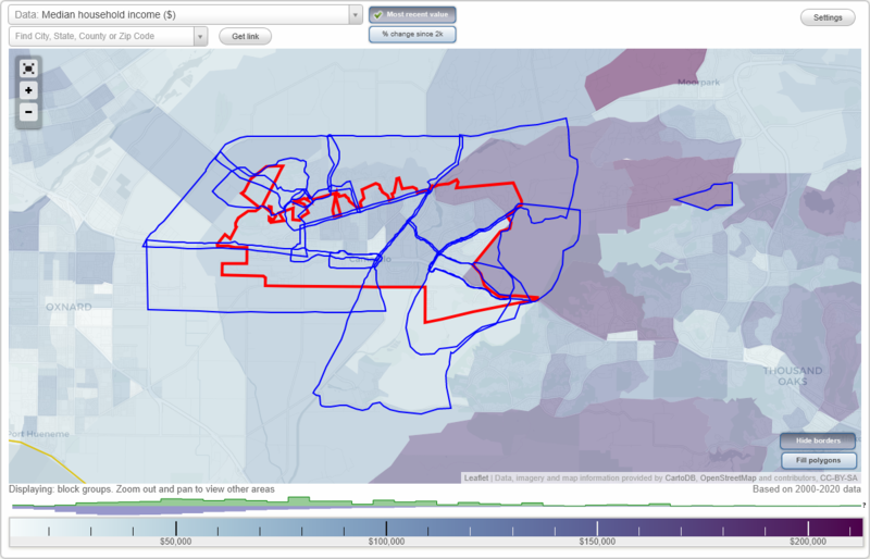
Camarillo, California Neighborhood Map - Income, House Prices, Occupations, Boundaries
Settings
X

- City boundary
- Neighborhood boundaries
Business Search - 14 Million verified businesses
Neighborhoods:
Camarillo Heights, Camarillo Springs, Central Camarillo, Factory Outlets, Hidden Meadows, Las Posas Estates, Las Posas North, Leisure Village, Mission Oaks, Old Town, Santa Rosa Valley, Spanish Hills, Sterling Hills, Village at the ParkCamarillo Heights neighborhood in Camarillo statistics: (Find on map)
Area: 5.542 square miles
Population: 7,436
Population density:
Median household income in 2021:
Median rent in in 2021:
Male vs Females
Median age
Housing prices:
Average estimated value of detached houses in 2021 (82.3% of all units):
Average estimated value of townhouses or other attached units in 2021 (16.8% of all units):
Average estimated '21 value of housing units in 5-or-more-unit structures (15.7% of all units):
Most popular occupations of males: sales and office occupations (18.2%); service occupations (16.4%); management occupations (except farmers) (15.6%); architecture and engineering occupations (8.0%); business and financial operations occupations (7.6%); healthcare practitioners and technical occupations (5.5%); construction, extraction, and maintenance occupations (3.9%)
Most popular occupations of females: sales and office occupations (25.6%); service occupations (23.5%); education, training, and library occupations (11.3%); management occupations (except farmers) (8.5%); healthcare practitioners and technical occupations (7.5%); community and social services occupations (6.3%); business and financial operations occupations (6.2%)
Highways in this neighborhood: E Los Angeles Ave (State Rte 118); Somis Rd (State Rte 34); N Lewis Rd (State Rte 34).
Roads and streets: Las Posas Rd; Ridgeline; W Highland Dr; Mesa Dr; E Highland Dr; North St; Groves Pl; W Loop Dr; E Landen St; N Loop Dr; Anacapa Dr; E Loop Dr; Ocean View Dr; E Ocean View Dr; Antonio Ave (Antonio Dr); Alosta Dr; Temple Ave; Mission Dr; N Ponderosa Dr; Mar Vista Dr; Loma Dr; Amber Dr; Charter Oak Dr; San Clemente Way; Altamont Way; Santa Cruz Way; Lemon Dr; West St; Aloha St; Highland Hills Dr (Plain View Dr); San Ysidro St; Valencia Dr; Brookhill Dr; Villamonte Ct; Beverly Dr; Alosta Pl; el Rancho Dr; Dodson St; Calaveras Dr; Parkway Dr; Klamath Dr; Catalina Dr; Camilar Dr; San Miguel Dr; Cll Cita; Via Corza; Danbrook Ave; Mansfield Ln; la Suen Dr; Cabrillo Way; Euclid Cir (Euclid Ave); Fieldgate Dr; Westwood Dr; Via Tomas; el Nido St; Bell Ranch Rd; Maria Ln; Rice St; Maybrook Ave; Corte Caballos; Gypsy Ln; Brentford Ct; Natalie Way; Norma Ct; Via Vela; Merced Dr; Moreno Dr; Buena Vista Dr; Viking Dr; Vanguard Dr; E Via del Nogal; Vincente Ave; Mission Ter; Highland Ter; Bell St; Wilden Dr; Reseda Ct; Leafwood Dr; Pepperwood St; Rio Hato Ct; Huerta Ct; Tanglewood St; Paradise Cir; Beverly Cir; Via Leal; Presilla Pl; Pso Yolo; Via del Suelo; Fairgrove Cir; Orange Ln; Maxine Dr; Tabor Cir; Lori Ln; Via Mantilla; Serape Pl; Chuckar Ln; Arch St; el Nido Ct; Alosta Ln; Cll Bellota; Chuckars St; Vanita Pl; Wayside Cir; Arneill Rd; Marco Dr; Corte Olmo; Corte Tela; Seminary Rd; Upland Rd; Amigos Ct.
Railroad features: Union Pacific RR.
Other features: Fox Barranca.
Camarillo Heights neighborhood detailed profile
Area: 5.542 square miles
Population: 7,436
Population density:
| Camarillo Heights: | 1,342 people per square mile |
| Camarillo: | 3,742 people per square mile |
Median household income in 2021:
| Camarillo Heights: | $126,066 |
| Camarillo: | $100,238 |
Median rent in in 2021:
| Camarillo Heights: | $1,953 |
| Camarillo: | $2,001 |
Male vs Females
| Males: | 3,813 |
| Females: | 3,623 |
Median age
| Males: | 40.8 years |
| Females: | 46.2 years |
Housing prices:
Average estimated value of detached houses in 2021 (82.3% of all units):
| Camarillo Heights: | $831,527 |
| Camarillo: | $749,676 |
Average estimated value of townhouses or other attached units in 2021 (16.8% of all units):
| This neighborhood: | $455,571 |
| city: | $487,292 |
Average estimated '21 value of housing units in 5-or-more-unit structures (15.7% of all units):
| Camarillo Heights: | $337,333 |
| Camarillo: | $658,155 |
Most popular occupations of males: sales and office occupations (18.2%); service occupations (16.4%); management occupations (except farmers) (15.6%); architecture and engineering occupations (8.0%); business and financial operations occupations (7.6%); healthcare practitioners and technical occupations (5.5%); construction, extraction, and maintenance occupations (3.9%)
Most popular occupations of females: sales and office occupations (25.6%); service occupations (23.5%); education, training, and library occupations (11.3%); management occupations (except farmers) (8.5%); healthcare practitioners and technical occupations (7.5%); community and social services occupations (6.3%); business and financial operations occupations (6.2%)
Highways in this neighborhood: E Los Angeles Ave (State Rte 118); Somis Rd (State Rte 34); N Lewis Rd (State Rte 34).
Roads and streets: Las Posas Rd; Ridgeline; W Highland Dr; Mesa Dr; E Highland Dr; North St; Groves Pl; W Loop Dr; E Landen St; N Loop Dr; Anacapa Dr; E Loop Dr; Ocean View Dr; E Ocean View Dr; Antonio Ave (Antonio Dr); Alosta Dr; Temple Ave; Mission Dr; N Ponderosa Dr; Mar Vista Dr; Loma Dr; Amber Dr; Charter Oak Dr; San Clemente Way; Altamont Way; Santa Cruz Way; Lemon Dr; West St; Aloha St; Highland Hills Dr (Plain View Dr); San Ysidro St; Valencia Dr; Brookhill Dr; Villamonte Ct; Beverly Dr; Alosta Pl; el Rancho Dr; Dodson St; Calaveras Dr; Parkway Dr; Klamath Dr; Catalina Dr; Camilar Dr; San Miguel Dr; Cll Cita; Via Corza; Danbrook Ave; Mansfield Ln; la Suen Dr; Cabrillo Way; Euclid Cir (Euclid Ave); Fieldgate Dr; Westwood Dr; Via Tomas; el Nido St; Bell Ranch Rd; Maria Ln; Rice St; Maybrook Ave; Corte Caballos; Gypsy Ln; Brentford Ct; Natalie Way; Norma Ct; Via Vela; Merced Dr; Moreno Dr; Buena Vista Dr; Viking Dr; Vanguard Dr; E Via del Nogal; Vincente Ave; Mission Ter; Highland Ter; Bell St; Wilden Dr; Reseda Ct; Leafwood Dr; Pepperwood St; Rio Hato Ct; Huerta Ct; Tanglewood St; Paradise Cir; Beverly Cir; Via Leal; Presilla Pl; Pso Yolo; Via del Suelo; Fairgrove Cir; Orange Ln; Maxine Dr; Tabor Cir; Lori Ln; Via Mantilla; Serape Pl; Chuckar Ln; Arch St; el Nido Ct; Alosta Ln; Cll Bellota; Chuckars St; Vanita Pl; Wayside Cir; Arneill Rd; Marco Dr; Corte Olmo; Corte Tela; Seminary Rd; Upland Rd; Amigos Ct.
Railroad features: Union Pacific RR.
Other features: Fox Barranca.
Camarillo Heights neighborhood detailed profile
Camarillo Springs neighborhood in Camarillo statistics: (Find on map)
Area: 5.596 square miles
Population: 3,639
Population density:
Median household income in 2021:
Median rent in in 2021:
Male vs Females
Median age
Average estimated value of detached houses in 2021 (43.1% of all units):
Most popular occupations of males: sales and office occupations (31.3%); management occupations (except farmers) (15.5%); production occupations (11.3%); service occupations (8.1%); computer and mathematical occupations (5.5%); community and social services occupations (4.3%); legal occupations (4.3%)
Most popular occupations of females: service occupations (22.4%); healthcare practitioners and technical occupations (15.4%); sales and office occupations (14.6%); management occupations (except farmers) (12.5%); business and financial operations occupations (10.3%); transportation occupations (9.5%); education, training, and library occupations (8.8%)
Highways in this neighborhood: el Camino Real (US Hwy 101, Ventura Fwy).
Roads and streets: Camarillo Springs Rd; Pancho Rd; Howard Rd; Irena Ave; Adolfo Rd; Adohr Ln; Ridge View St; Verdugo Way; Cam Ruiz; Pleasant Valley Rd; Via Montanez; Margarita; Gitana Ave; Hartman Dr; Sanitation Rd; Cll Plano; Cll Cuesta; Cam Carillo; Santa Rosa Rd; Cll Alto; Cll Quetzal; San Como Ln; Lada Ave; Pso Encantada; Isabel Ave; Vis Arriago; Cll Carga; Cll Bolero; Belleza St; Balboa Cir; N San Como Ln (Itamo St); Paquita St; Christina Ave; Pso Margarita; San Dimas Ave; Cortez Cir; Pso Tosamar; E Camarillo Springs Rd; Oak Grove Fire Rd; Inez St; Pso Serenata; Via Lorente; Corte Antigua; Corte Lucinda; Corte Barata; Cll Galuez; Fino Ave; Delgada St; San Como Ct; Cll Agrado; Corte Safiro; Corte Picado; Via Rota; Via Cozumel; Corte Campina; Corte Tunitas; Los Pueblos Dr.
Other features: Conejo Crk.
Camarillo Springs neighborhood detailed profile
Area: 5.596 square miles
Population: 3,639
Population density:
| Camarillo Springs: | 650 people per square mile |
| Camarillo: | 3,742 people per square mile |
Median household income in 2021:
| Camarillo Springs: | $169,528 |
| Camarillo: | $100,238 |
Median rent in in 2021:
| Camarillo Springs: | $2,069 |
| Camarillo: | $2,001 |
Male vs Females
| Males: | 1,868 |
| Females: | 1,771 |
Median age
| Males: | 47.0 years |
| Females: | 54.0 years |
Average estimated value of detached houses in 2021 (43.1% of all units):
| Camarillo Springs: | $1,347,613 |
| Camarillo: | $749,676 |
Most popular occupations of males: sales and office occupations (31.3%); management occupations (except farmers) (15.5%); production occupations (11.3%); service occupations (8.1%); computer and mathematical occupations (5.5%); community and social services occupations (4.3%); legal occupations (4.3%)
Most popular occupations of females: service occupations (22.4%); healthcare practitioners and technical occupations (15.4%); sales and office occupations (14.6%); management occupations (except farmers) (12.5%); business and financial operations occupations (10.3%); transportation occupations (9.5%); education, training, and library occupations (8.8%)
Highways in this neighborhood: el Camino Real (US Hwy 101, Ventura Fwy).
Roads and streets: Camarillo Springs Rd; Pancho Rd; Howard Rd; Irena Ave; Adolfo Rd; Adohr Ln; Ridge View St; Verdugo Way; Cam Ruiz; Pleasant Valley Rd; Via Montanez; Margarita; Gitana Ave; Hartman Dr; Sanitation Rd; Cll Plano; Cll Cuesta; Cam Carillo; Santa Rosa Rd; Cll Alto; Cll Quetzal; San Como Ln; Lada Ave; Pso Encantada; Isabel Ave; Vis Arriago; Cll Carga; Cll Bolero; Belleza St; Balboa Cir; N San Como Ln (Itamo St); Paquita St; Christina Ave; Pso Margarita; San Dimas Ave; Cortez Cir; Pso Tosamar; E Camarillo Springs Rd; Oak Grove Fire Rd; Inez St; Pso Serenata; Via Lorente; Corte Antigua; Corte Lucinda; Corte Barata; Cll Galuez; Fino Ave; Delgada St; San Como Ct; Cll Agrado; Corte Safiro; Corte Picado; Via Rota; Via Cozumel; Corte Campina; Corte Tunitas; Los Pueblos Dr.
Other features: Conejo Crk.
Camarillo Springs neighborhood detailed profile
Central Camarillo neighborhood in Camarillo statistics: (Find on map)
Area: 3.773 square miles
Population: 26,076
Population density:
Median household income in 2021:
Median rent in in 2021:
Male vs Females
Median age
Housing prices:
Average estimated value of detached houses in 2021 (60.4% of all units):
Average estimated value of townhouses or other attached units in 2021 (22.0% of all units):
Average estimated '21 value of housing units in 5-or-more-unit structures (13.5% of all units):
Most popular occupations of males: sales and office occupations (18.8%); service occupations (15.2%); management occupations (except farmers) (11.4%); computer and mathematical occupations (7.1%); construction, extraction, and maintenance occupations (7.0%); business and financial operations occupations (6.2%); architecture and engineering occupations (6.0%)
Most popular occupations of females: sales and office occupations (28.9%); service occupations (22.6%); healthcare practitioners and technical occupations (9.8%); management occupations (except farmers) (9.0%); education, training, and library occupations (8.9%); business and financial operations occupations (3.9%); architecture and engineering occupations (2.6%)
Highways in this neighborhood: US Hwy 101 (Ventura Fwy, el Camino Real); State Rte 34 (N Lewis Rd); S Lewis Rd (State Rte 34).
Roads and streets: Las Posas Rd; Ponderosa Dr; E Ponderosa Dr; E Daily Dr; Arneill Rd; Ventura Blvd; Temple Ave; Carmen Dr; Dunnigan St; Mobil Ave; Pso Camarillo; Rosewood Ave; Lantana St; Euclid Ave; E Landen St; Dwight Ave; Barry St; N Adolfo Rd; N Rowland Ave (Rowland Ave); Rocklyn St; Corby Ave; Walker Ave; Gracia St; Dara St; N Brently Ave; Palmer Ave; Marco Dr; Coe St; Edgemont Dr; Skeel Dr; Loma Dr; Hobart Dr; Wolverton Ave; Eston St; Dewayne Ave; Germain St; Kendall Ave; Regent St; Fulton St; Vincente Ave; Jose Ave; N Agusta Ave; Jay Ave; Durkin St; Munson St; N Bedford Dr; Hartnell St; Pickwick Dr; E Cll la Sombra; Stiles Ave; Via Montoya; Ave Magdalena; Fortuna Ave; Dumetz St; Murray Ave; Cll la Roda; Aileen St; Leonard St; E Rowland Ave; Ciprian Ave; Weston Cir; Fiesta Dr; Brookhaven Ave; W Daily Dr; Burnley St; Lakehurst Ave; Lomita St; Pso Lunar; Appian Way; W Ventura Blvd; Corona St; Nordman Dr; Cll la Cumbre; Almendro Way; E Cll la Guerra; Sharon Dr; Briarfield St; Baywood Ave; Beechwood St; Waverly Ave; Arroyo del Mar; Hayden St; Barton Ave; Chandler St; E Barca St; Elma St; Merritt Ave; Harris Ave; Raemere St; Lucero St; Saturn St; Cll el Avion; Bordeaux Ave; Bronson St; Senan St; Lake Side Dr; N Modesto Ave; Anacapa Dr; Castano Dr; Milligan Dr; Sweetwater Ave; McCulloch St; Lonsdale St; Farnworth St; Derby St; Sherborne St; Redoak Pl; Los Nogales Ave; Wendell St; Wilcox St; Gorman St; Cam la Madera; Shalimar St; Shepherd Dr; N Nellora St; E Croydon Ave; Shoreline St; N Cll Circulo; Centennial Ave; Canoga Pl; Cll el Volador; Monte Vista Dr; Belden Ave; Antonio Ave (Antonio Dr); Kelley Ave; Stone Meadow Dr; Parron St; Pso del Valle; Rivermore St; Seybolt Ave; Francis Ave; Chapala Dr; Cll la Palmera; N Lantana St; Fenmore Ave; S Las Posas Rd; Vis del Sol; Bolin Ave; Comanche Ct; Truman St; Ashbury Ct; Abbott Ave; Lexington Ct; Graham Ave; Faria St; Sun Grove Dr; Staunton St; E Modesto Ave; Benito Dr; Obrien Cir; Sanchez Dr; Roman Ave; Kimberly Ave; Berwick St; E Cll la Guerra (S Cll la Cumbre); Ave San Antero; del Prado Dr; Garces Ave; Valle Lindo Dr; Blue Oak St; Cll el Halcon; Viejo Dr; Gemini St; N Cll la Paz; N Croydon Ave; Ascot Pl; Cambon Ave; Deer Hunter Ln; Sierra Madre Dr; Cll la Fiesta; Dorman St; Cll la Granada; Sorrel St; Baja Ct; Cam Alvarez; Empress Ave; Duvall Ave; N Landen St; Cam Avellana; Bancroft St; Granger St; Curt Dr; Pso de Cortaga; N Glenn Dr; Sparkman Ave; Biscayne Ave; N Cll la Sombra; Sonora Dr; Onda Dr; E Cll Circulo; Cll Camellia; Acala St; Escondido Ct; Darnell Ct; Balmoral Ct; Deerfield Ct; Parkhill Ct; Olivo Ct; Bogart St; E Belair Ct; Leven Ave; Cll Mirasol; Cll la Rocha; Pheasant Hill Rd; Cll la Prada; Coronado Ct; Mission Dr; Chapala St; Algonquin Ct; Kino St; Christina Ct; Mardigras Ct; Helma Ct; Ridden St; Fairchild St; Getman St; Pleasant Hill Rd; Belmont St; Royce Ct; Gemini Ct; Yolanda St; Woodgate Ct; Forar Cir; Bandera Dr (Bandera St); Pinehurst Pl; Vista St; Tejon Ct; Prima Ct; Cipres Ct; Cambria Ct; Sequan Ct; Dexter St; Hedon Cir; Habra Ct; Edgewater Ln; Big Horn Ct; Yearling Ct; E Karena Ct; Suner Cir; Lido Ct; Dockside Ln; Capistrano Ct; Pierside Ln; N Barca St; Bettina Ct; Oakhurst Ct; Milburn St; Canter Ave; Dapple Ave; Poggi St; Julia Ct; N Belair Ct; Cameo Ct; Clayton Ct; Pla San Leandro; Mandalay Ct; Bridgeport Ln; Pla San Dimas; W Cll la Guerra; Peoples Ave; Lucero Ct; Exeter Ct; Fenmore Ct; Vista Cir; S Glenn Dr; Bedford Ct; Almendro Ct; Cherokee Ct; Pla San Rufino; Knight Rondo; Nellora; A; Sunrise Ct; Shepard Dr; Pso Arroyo; Loreta Ct; Selby Cir; Isla Ct; Graves Ct; Jalisco Ct; Fieldgate Dr; Taxco Ct; Adolfo Rd; Cll Miguel; Baywood Ct; Hidalgo Ct; Durango Ct; Crestview Ave; Geneive St; Delgada Ct; Upland Rd; Colonia Pl; Keyser Rondo; McLeod Rondo; Fir St; Iroquois Ct; Marsh Rondo; Sabet Ct; Apache Ct.
Railroad features: Union Pacific RR.
Central Camarillo neighborhood detailed profile
Area: 3.773 square miles
Population: 26,076
Population density:
| Central Camarillo: | 6,912 people per square mile |
| Camarillo: | 3,742 people per square mile |
Median household income in 2021:
| Central Camarillo: | $99,737 |
| Camarillo: | $100,238 |
Median rent in in 2021:
| Central Camarillo: | $2,076 |
| Camarillo: | $2,001 |
Male vs Females
| Males: | 12,657 |
| Females: | 13,418 |
Median age
| Males: | 37.9 years |
| Females: | 42.3 years |
Housing prices:
Average estimated value of detached houses in 2021 (60.4% of all units):
| Central Camarillo: | $612,831 |
| Camarillo: | $749,676 |
Average estimated value of townhouses or other attached units in 2021 (22.0% of all units):
| This neighborhood: | $517,198 |
| city: | $487,292 |
Average estimated '21 value of housing units in 5-or-more-unit structures (13.5% of all units):
| Central Camarillo: | $337,333 |
| Camarillo: | $658,155 |
Most popular occupations of males: sales and office occupations (18.8%); service occupations (15.2%); management occupations (except farmers) (11.4%); computer and mathematical occupations (7.1%); construction, extraction, and maintenance occupations (7.0%); business and financial operations occupations (6.2%); architecture and engineering occupations (6.0%)
Most popular occupations of females: sales and office occupations (28.9%); service occupations (22.6%); healthcare practitioners and technical occupations (9.8%); management occupations (except farmers) (9.0%); education, training, and library occupations (8.9%); business and financial operations occupations (3.9%); architecture and engineering occupations (2.6%)
Highways in this neighborhood: US Hwy 101 (Ventura Fwy, el Camino Real); State Rte 34 (N Lewis Rd); S Lewis Rd (State Rte 34).
Roads and streets: Las Posas Rd; Ponderosa Dr; E Ponderosa Dr; E Daily Dr; Arneill Rd; Ventura Blvd; Temple Ave; Carmen Dr; Dunnigan St; Mobil Ave; Pso Camarillo; Rosewood Ave; Lantana St; Euclid Ave; E Landen St; Dwight Ave; Barry St; N Adolfo Rd; N Rowland Ave (Rowland Ave); Rocklyn St; Corby Ave; Walker Ave; Gracia St; Dara St; N Brently Ave; Palmer Ave; Marco Dr; Coe St; Edgemont Dr; Skeel Dr; Loma Dr; Hobart Dr; Wolverton Ave; Eston St; Dewayne Ave; Germain St; Kendall Ave; Regent St; Fulton St; Vincente Ave; Jose Ave; N Agusta Ave; Jay Ave; Durkin St; Munson St; N Bedford Dr; Hartnell St; Pickwick Dr; E Cll la Sombra; Stiles Ave; Via Montoya; Ave Magdalena; Fortuna Ave; Dumetz St; Murray Ave; Cll la Roda; Aileen St; Leonard St; E Rowland Ave; Ciprian Ave; Weston Cir; Fiesta Dr; Brookhaven Ave; W Daily Dr; Burnley St; Lakehurst Ave; Lomita St; Pso Lunar; Appian Way; W Ventura Blvd; Corona St; Nordman Dr; Cll la Cumbre; Almendro Way; E Cll la Guerra; Sharon Dr; Briarfield St; Baywood Ave; Beechwood St; Waverly Ave; Arroyo del Mar; Hayden St; Barton Ave; Chandler St; E Barca St; Elma St; Merritt Ave; Harris Ave; Raemere St; Lucero St; Saturn St; Cll el Avion; Bordeaux Ave; Bronson St; Senan St; Lake Side Dr; N Modesto Ave; Anacapa Dr; Castano Dr; Milligan Dr; Sweetwater Ave; McCulloch St; Lonsdale St; Farnworth St; Derby St; Sherborne St; Redoak Pl; Los Nogales Ave; Wendell St; Wilcox St; Gorman St; Cam la Madera; Shalimar St; Shepherd Dr; N Nellora St; E Croydon Ave; Shoreline St; N Cll Circulo; Centennial Ave; Canoga Pl; Cll el Volador; Monte Vista Dr; Belden Ave; Antonio Ave (Antonio Dr); Kelley Ave; Stone Meadow Dr; Parron St; Pso del Valle; Rivermore St; Seybolt Ave; Francis Ave; Chapala Dr; Cll la Palmera; N Lantana St; Fenmore Ave; S Las Posas Rd; Vis del Sol; Bolin Ave; Comanche Ct; Truman St; Ashbury Ct; Abbott Ave; Lexington Ct; Graham Ave; Faria St; Sun Grove Dr; Staunton St; E Modesto Ave; Benito Dr; Obrien Cir; Sanchez Dr; Roman Ave; Kimberly Ave; Berwick St; E Cll la Guerra (S Cll la Cumbre); Ave San Antero; del Prado Dr; Garces Ave; Valle Lindo Dr; Blue Oak St; Cll el Halcon; Viejo Dr; Gemini St; N Cll la Paz; N Croydon Ave; Ascot Pl; Cambon Ave; Deer Hunter Ln; Sierra Madre Dr; Cll la Fiesta; Dorman St; Cll la Granada; Sorrel St; Baja Ct; Cam Alvarez; Empress Ave; Duvall Ave; N Landen St; Cam Avellana; Bancroft St; Granger St; Curt Dr; Pso de Cortaga; N Glenn Dr; Sparkman Ave; Biscayne Ave; N Cll la Sombra; Sonora Dr; Onda Dr; E Cll Circulo; Cll Camellia; Acala St; Escondido Ct; Darnell Ct; Balmoral Ct; Deerfield Ct; Parkhill Ct; Olivo Ct; Bogart St; E Belair Ct; Leven Ave; Cll Mirasol; Cll la Rocha; Pheasant Hill Rd; Cll la Prada; Coronado Ct; Mission Dr; Chapala St; Algonquin Ct; Kino St; Christina Ct; Mardigras Ct; Helma Ct; Ridden St; Fairchild St; Getman St; Pleasant Hill Rd; Belmont St; Royce Ct; Gemini Ct; Yolanda St; Woodgate Ct; Forar Cir; Bandera Dr (Bandera St); Pinehurst Pl; Vista St; Tejon Ct; Prima Ct; Cipres Ct; Cambria Ct; Sequan Ct; Dexter St; Hedon Cir; Habra Ct; Edgewater Ln; Big Horn Ct; Yearling Ct; E Karena Ct; Suner Cir; Lido Ct; Dockside Ln; Capistrano Ct; Pierside Ln; N Barca St; Bettina Ct; Oakhurst Ct; Milburn St; Canter Ave; Dapple Ave; Poggi St; Julia Ct; N Belair Ct; Cameo Ct; Clayton Ct; Pla San Leandro; Mandalay Ct; Bridgeport Ln; Pla San Dimas; W Cll la Guerra; Peoples Ave; Lucero Ct; Exeter Ct; Fenmore Ct; Vista Cir; S Glenn Dr; Bedford Ct; Almendro Ct; Cherokee Ct; Pla San Rufino; Knight Rondo; Nellora; A; Sunrise Ct; Shepard Dr; Pso Arroyo; Loreta Ct; Selby Cir; Isla Ct; Graves Ct; Jalisco Ct; Fieldgate Dr; Taxco Ct; Adolfo Rd; Cll Miguel; Baywood Ct; Hidalgo Ct; Durango Ct; Crestview Ave; Geneive St; Delgada Ct; Upland Rd; Colonia Pl; Keyser Rondo; McLeod Rondo; Fir St; Iroquois Ct; Marsh Rondo; Sabet Ct; Apache Ct.
Railroad features: Union Pacific RR.
Central Camarillo neighborhood detailed profile
Factory Outlets neighborhood in Camarillo statistics: (Find on map)
Area: 11.000 square miles
Population: 46,209
Population density:
Median household income in 2021:
Median rent in in 2021:
Male vs Females
Median age
Housing prices:
Average estimated value of detached houses in 2021 (19.4% of all units):
Average estimated value of mobile home in 2021 (2.5% of all units):
Most popular occupations of males: sales and office occupations (18.9%); service occupations (14.6%); computer and mathematical occupations (13.1%); management occupations (except farmers) (8.0%); construction, extraction, and maintenance occupations (7.8%); healthcare practitioners and technical occupations (7.4%); production occupations (7.0%)
Most popular occupations of females: sales and office occupations (29.1%); service occupations (23.1%); healthcare practitioners and technical occupations (10.0%); management occupations (except farmers) (8.7%); computer and mathematical occupations (4.4%); life, physical, and social science occupations (4.4%); farming, fishing, and forestry occupations (4.3%)
Highways in this neighborhood: US Hwy 101 (el Camino Real, Ventura Fwy); State Rte 34 (E 5th St); S Lewis Rd (State Rte 34); State Rte 34 (N Lewis Rd).
Roads and streets: Ventura Blvd; Sturgis Rd; Pleasant Valley Rd; W Ventura Blvd; S Las Posas Rd; E Daily Dr; del Norte Blvd; Aviation Dr; W Daily Dr; E Pleasant Valley Rd; Wood Rd; N Rice Ave; Cam del Sol; Camarillo Center Dr; W Pleasant Valley Rd; Willis Ave; Dawson Dr; Chapel Dr; Durley Ave; Skyway Dr; Horizon Cir; Grandview Dr; Carmen Dr; S Wolff Rd; Airport Way; N Elevar St; Kinetic Dr; Springville Rd; S Rice Ave; Grandview Cir; Sevilla St; Bajo Aqua Ave; Camino Ave; Hughes Dr; S Glenn Dr; Factory Stores Dr; Las Posas Rd; Challenger Pl; Granada St; Eubanks St; Geneive St; N Aviador St; Post St; Cll San Pablo; Spectrum Cir; Southfield Rd; Discovery Dr; Stearman St; Colonia Pl; W Verdulera St (Verdulera St); Fir St; Rice Ave; Palm Dr; Barcelona St; Elm Dr; Cartagena St; Oak St; Cedar Dr; Houck St; Marker Ave; Convair St; Elevar St; Kenneth St; Freedom Park Dr; W Chapel Dr; Rubio Ave; Central Ave; Miramar St; Pso Loma; N Nellora St; Lunar Ct; Trabajo Dr; Jupiter Ct; Stinson St; Cll Segunda; Arneill Rd; Galaxy Pl; Orchard View Cir (Orchard View St); Plaza la Vis; Dawson Pl; N Dawson Dr; Hebert Dr; Shirley St; Ida St; Geneive Cir; Holly Dr; Nellora; Fulton St; Santa Clara Ave; Los Santos Ct; la Verada Ct; Tierra Buena Cpirt; el Soneta Ct; Corte Lejos; Los Alisos Ct.
Railroad features: Union Pacific RR; Union Pacific.
Other features: Camarillo Arprt.
Other features: Revolon Slough; Beardsley Wash.
Factory Outlets neighborhood detailed profile
Area: 11.000 square miles
Population: 46,209
Population density:
| Factory Outlets: | 4,201 people per square mile |
| Camarillo: | 3,742 people per square mile |
Median household income in 2021:
| Factory Outlets: | $54,552 |
| Camarillo: | $100,238 |
Median rent in in 2021:
| Factory Outlets: | $1,592 |
| Camarillo: | $2,001 |
Male vs Females
| Males: | 20,393 |
| Females: | 25,816 |
Median age
| Males: | 32.4 years |
| Females: | 33.7 years |
Housing prices:
Average estimated value of detached houses in 2021 (19.4% of all units):
| Factory Outlets: | $738,921 |
| Camarillo: | $749,676 |
Average estimated value of mobile home in 2021 (2.5% of all units):
| Factory Outlets: | $123,129 |
| Camarillo: | $194,628 |
Most popular occupations of males: sales and office occupations (18.9%); service occupations (14.6%); computer and mathematical occupations (13.1%); management occupations (except farmers) (8.0%); construction, extraction, and maintenance occupations (7.8%); healthcare practitioners and technical occupations (7.4%); production occupations (7.0%)
Most popular occupations of females: sales and office occupations (29.1%); service occupations (23.1%); healthcare practitioners and technical occupations (10.0%); management occupations (except farmers) (8.7%); computer and mathematical occupations (4.4%); life, physical, and social science occupations (4.4%); farming, fishing, and forestry occupations (4.3%)
Highways in this neighborhood: US Hwy 101 (el Camino Real, Ventura Fwy); State Rte 34 (E 5th St); S Lewis Rd (State Rte 34); State Rte 34 (N Lewis Rd).
Roads and streets: Ventura Blvd; Sturgis Rd; Pleasant Valley Rd; W Ventura Blvd; S Las Posas Rd; E Daily Dr; del Norte Blvd; Aviation Dr; W Daily Dr; E Pleasant Valley Rd; Wood Rd; N Rice Ave; Cam del Sol; Camarillo Center Dr; W Pleasant Valley Rd; Willis Ave; Dawson Dr; Chapel Dr; Durley Ave; Skyway Dr; Horizon Cir; Grandview Dr; Carmen Dr; S Wolff Rd; Airport Way; N Elevar St; Kinetic Dr; Springville Rd; S Rice Ave; Grandview Cir; Sevilla St; Bajo Aqua Ave; Camino Ave; Hughes Dr; S Glenn Dr; Factory Stores Dr; Las Posas Rd; Challenger Pl; Granada St; Eubanks St; Geneive St; N Aviador St; Post St; Cll San Pablo; Spectrum Cir; Southfield Rd; Discovery Dr; Stearman St; Colonia Pl; W Verdulera St (Verdulera St); Fir St; Rice Ave; Palm Dr; Barcelona St; Elm Dr; Cartagena St; Oak St; Cedar Dr; Houck St; Marker Ave; Convair St; Elevar St; Kenneth St; Freedom Park Dr; W Chapel Dr; Rubio Ave; Central Ave; Miramar St; Pso Loma; N Nellora St; Lunar Ct; Trabajo Dr; Jupiter Ct; Stinson St; Cll Segunda; Arneill Rd; Galaxy Pl; Orchard View Cir (Orchard View St); Plaza la Vis; Dawson Pl; N Dawson Dr; Hebert Dr; Shirley St; Ida St; Geneive Cir; Holly Dr; Nellora; Fulton St; Santa Clara Ave; Los Santos Ct; la Verada Ct; Tierra Buena Cpirt; el Soneta Ct; Corte Lejos; Los Alisos Ct.
Railroad features: Union Pacific RR; Union Pacific.
Other features: Camarillo Arprt.
Other features: Revolon Slough; Beardsley Wash.
Factory Outlets neighborhood detailed profile
Hidden Meadows neighborhood in Camarillo statistics: (Find on map)
Area: 0.620 square miles
Population: 326
Population density:
Median household income in 2021:
Median rent in in 2021:
Male vs Females
Median age
Most popular occupations of males: management occupations (except farmers) (30.1%); sales and office occupations (16.2%); healthcare practitioners and technical occupations (8.7%); construction, extraction, and maintenance occupations (7.7%); service occupations (5.7%); material moving occupations (5.5%); arts, design, entertainment, sports, and media occupations (5.0%)
Most popular occupations of females: management occupations (except farmers) (30.2%); sales and office occupations (22.3%); healthcare practitioners and technical occupations (13.1%); education, training, and library occupations (11.5%); service occupations (7.2%); business and financial operations occupations (6.8%); arts, design, entertainment, sports, and media occupations (2.3%)
Roads and streets: Andalusia Dr; Old Butterfield Rd; San Sebastian Ct; Alhambra Ct; Alicante Ct; Marvella Ct.
Hidden Meadows neighborhood detailed profile
Area: 0.620 square miles
Population: 326
Population density:
| Hidden Meadows: | 526 people per square mile |
| Camarillo: | 3,742 people per square mile |
Median household income in 2021:
| Hidden Meadows: | $128,422 |
| Camarillo: | $100,238 |
Median rent in in 2021:
| Hidden Meadows: | $1,980 |
| Camarillo: | $2,001 |
Male vs Females
| Males: | 167 |
| Females: | 158 |
Median age
| Males: | 50.4 years |
| Females: | 60.2 years |
Most popular occupations of males: management occupations (except farmers) (30.1%); sales and office occupations (16.2%); healthcare practitioners and technical occupations (8.7%); construction, extraction, and maintenance occupations (7.7%); service occupations (5.7%); material moving occupations (5.5%); arts, design, entertainment, sports, and media occupations (5.0%)
Most popular occupations of females: management occupations (except farmers) (30.2%); sales and office occupations (22.3%); healthcare practitioners and technical occupations (13.1%); education, training, and library occupations (11.5%); service occupations (7.2%); business and financial operations occupations (6.8%); arts, design, entertainment, sports, and media occupations (2.3%)
Roads and streets: Andalusia Dr; Old Butterfield Rd; San Sebastian Ct; Alhambra Ct; Alicante Ct; Marvella Ct.
Hidden Meadows neighborhood detailed profile
Las Posas Estates neighborhood in Camarillo statistics: (Find on map)
Area: 4.500 square miles
Population: 1,071
Population density:
Median household income in 2021:
Median rent in in 2021:
Male vs Females
Median age
Housing prices:
Average estimated value of detached houses in 2021 (89.5% of all units):
Average estimated value of townhouses or other attached units in 2021 (49.4% of all units):
Average estimated '21 value of housing units in 5-or-more-unit structures (74.6% of all units):
Most popular occupations of males: management occupations (except farmers) (15.2%); architecture and engineering occupations (14.0%); sales and office occupations (12.5%); business and financial operations occupations (9.4%); transportation occupations (7.1%); service occupations (5.5%); healthcare practitioners and technical occupations (4.5%)
Most popular occupations of females: sales and office occupations (40.3%); management occupations (except farmers) (13.0%); service occupations (9.6%); architecture and engineering occupations (8.9%); healthcare practitioners and technical occupations (8.4%); education, training, and library occupations (6.3%); business and financial operations occupations (4.6%)
Highways in this neighborhood: W Los Angeles Ave (State Rte 118); State Rte 118 (E Los Angeles Ave).
Roads and streets: Valley Vista Dr; Fairway Dr; Center School Rd; Deseo Ave; Ramona Dr; Cam Concordia; Estaban Dr; Cll de Debesa; Cll Aurora; la Patera Dr; Cll del Norte; Alviso Dr; Trueno Ave; Cerro Crest Dr; Old Coach Dr; Dirt Rd; Vientos Rd; Garrido Dr; Callado St; Vista del Mar Ave; Cll de Marejada; Grada Ave; Via del Cerro; Avocado Pl; Goldenspur Dr; Marine View Dr; Via Veneto; Mesa School; Beardsley Rd; Piropo Ct; Vis del Cima; Cll Portada; Country View Pl; Cll Corva; Vis Montana; Las Tuero Ct; Corriente Ct; el Tuaca Ct; Riente St; Pso Verde; Vis del Campo; Sudario Ct; Lopaco Ct; Cll Orinda; Garrido Ct; Corte de Encinitas; Mariano St; Via Con Dios; Patera Ct; Guinda Ct; Tueross Ct; Otero Ct; Fairway Ct; N Avocado Pl; Cll Los Aceitunos; Cam la Posada; Klamath Dr; Corte Campanero; Rosada Ct; Cll Acopada; Cll Rocas; Sueno Ct; Patina Ct; Retiro Ct; Ave de Autlan; Corte de Quintero.
Other features: Beardsley Wash; Milligan Barranca.
Las Posas Estates neighborhood detailed profile
Area: 4.500 square miles
Population: 1,071
Population density:
| Las Posas Estates: | 238 people per square mile |
| Camarillo: | 3,742 people per square mile |
Median household income in 2021:
| Las Posas Estates: | $97,422 |
| Camarillo: | $100,238 |
Median rent in in 2021:
| Las Posas Estates: | $1,903 |
| Camarillo: | $2,001 |
Male vs Females
| Males: | 527 |
| Females: | 543 |
Median age
| Males: | 42.5 years |
| Females: | 50.3 years |
Housing prices:
Average estimated value of detached houses in 2021 (89.5% of all units):
| Las Posas Estates: | $1,085,106 |
| Camarillo: | $749,676 |
Average estimated value of townhouses or other attached units in 2021 (49.4% of all units):
| This neighborhood: | $448,523 |
| city: | $487,292 |
Average estimated '21 value of housing units in 5-or-more-unit structures (74.6% of all units):
| Las Posas Estates: | $337,333 |
| Camarillo: | $658,155 |
Most popular occupations of males: management occupations (except farmers) (15.2%); architecture and engineering occupations (14.0%); sales and office occupations (12.5%); business and financial operations occupations (9.4%); transportation occupations (7.1%); service occupations (5.5%); healthcare practitioners and technical occupations (4.5%)
Most popular occupations of females: sales and office occupations (40.3%); management occupations (except farmers) (13.0%); service occupations (9.6%); architecture and engineering occupations (8.9%); healthcare practitioners and technical occupations (8.4%); education, training, and library occupations (6.3%); business and financial operations occupations (4.6%)
Highways in this neighborhood: W Los Angeles Ave (State Rte 118); State Rte 118 (E Los Angeles Ave).
Roads and streets: Valley Vista Dr; Fairway Dr; Center School Rd; Deseo Ave; Ramona Dr; Cam Concordia; Estaban Dr; Cll de Debesa; Cll Aurora; la Patera Dr; Cll del Norte; Alviso Dr; Trueno Ave; Cerro Crest Dr; Old Coach Dr; Dirt Rd; Vientos Rd; Garrido Dr; Callado St; Vista del Mar Ave; Cll de Marejada; Grada Ave; Via del Cerro; Avocado Pl; Goldenspur Dr; Marine View Dr; Via Veneto; Mesa School; Beardsley Rd; Piropo Ct; Vis del Cima; Cll Portada; Country View Pl; Cll Corva; Vis Montana; Las Tuero Ct; Corriente Ct; el Tuaca Ct; Riente St; Pso Verde; Vis del Campo; Sudario Ct; Lopaco Ct; Cll Orinda; Garrido Ct; Corte de Encinitas; Mariano St; Via Con Dios; Patera Ct; Guinda Ct; Tueross Ct; Otero Ct; Fairway Ct; N Avocado Pl; Cll Los Aceitunos; Cam la Posada; Klamath Dr; Corte Campanero; Rosada Ct; Cll Acopada; Cll Rocas; Sueno Ct; Patina Ct; Retiro Ct; Ave de Autlan; Corte de Quintero.
Other features: Beardsley Wash; Milligan Barranca.
Las Posas Estates neighborhood detailed profile
Las Posas North neighborhood in Camarillo statistics: (Find on map)
Area: 1.629 square miles
Population: 9,187
Population density:
Median household income in 2021:
Median rent in in 2021:
Male vs Females
Median age
Housing prices:
Average estimated value of detached houses in 2021 (87.7% of all units):
Average estimated value of townhouses or other attached units in 2021 (5.3% of all units):
Average estimated '21 value of housing units in 5-or-more-unit structures (18.3% of all units):
Most popular occupations of males: architecture and engineering occupations (17.0%); management occupations (except farmers) (14.2%); service occupations (9.2%); sales and office occupations (9.2%); production occupations (7.7%); business and financial operations occupations (7.6%); construction, extraction, and maintenance occupations (6.6%)
Most popular occupations of females: sales and office occupations (48.9%); service occupations (17.0%); healthcare practitioners and technical occupations (10.2%); management occupations (except farmers) (6.7%); business and financial operations occupations (5.7%); education, training, and library occupations (4.5%); arts, design, entertainment, sports, and media occupations (3.1%)
Roads and streets: Las Posas Rd; Cll Higuera; Mission Dr; Valley Vista Dr; Anacapa Dr; Cll Portilla; Euclid Ave; Gardenia Ave; Lyndhurst Ave; Crestview Ave; Estaban Dr; Glenbrook Ave; Lantana St; Tamarix St; Encino Ave; Ave del Manzano; Vista del Mar Ave; Cll Converse; Cll la Cumbre; Vis Coto Verde; Camarillo Dr; Cerro Vista Way; Baja Vista Way; Sausalito Dr; Cam Esplendido; Pso Barona; Cam Vera Cruz; Cll Larios; Lathan Ave; Marine View Dr; Sierra Mesa Dr; Ave Soltura; Cam Castanada; Cranbrook St; Cll Navarro; Cll Escalon; Cam la Madera; Bradford Ave; Earl Joseph Ave (Earl Joeseph Ave); San Miguel Dr; Cabrillo Mesa Ct; Pso Castille; Alborada Dr; Via la Silva; Calle Bella Vis; Reddington Ct; Catalina Dr; Cll Alberca; Corriente Ct; Corte Rosalinda; Daphne St; Tiffany Ct; Valley Vista Ct; Alta Seguna Ct; Menta Ln; Herron Ct; Fayton Ct; Corte Aguacate; Corte Colina; Corte Golondrina; Corte Castano; Neish St; Calamar Ct; Nancy St; Getman St; Pino Ct; Via Acorde; Calabria Ct; Santa Anita St; Grace Ct; Via Alcazar; Cam Estrada; Tierra Linda Ct; Corte Vina; Cordova Ct; Plumbago St; N Cll la Cumbre; Melia St; Jody Ln; W Highland Dr; Hyacinth St; Pso Esplendido; Otero Ct; Winsdor Ct; Orena Ct; Chelsey Ct; Newquist Ct; Calle Vis; Brea Ct; Corte Cerrito; Azalea Ct; Corte Azal; Rosewood Ave.
Las Posas North neighborhood detailed profile
Area: 1.629 square miles
Population: 9,187
Population density:
| Las Posas North: | 5,640 people per square mile |
| Camarillo: | 3,742 people per square mile |
Median household income in 2021:
| Las Posas North: | $105,186 |
| Camarillo: | $100,238 |
Median rent in in 2021:
| Las Posas North: | $2,127 |
| Camarillo: | $2,001 |
Male vs Females
| Males: | 4,702 |
| Females: | 4,485 |
Median age
| Males: | 39.1 years |
| Females: | 44.1 years |
Housing prices:
Average estimated value of detached houses in 2021 (87.7% of all units):
| Las Posas North: | $668,326 |
| Camarillo: | $749,676 |
Average estimated value of townhouses or other attached units in 2021 (5.3% of all units):
| This neighborhood: | $448,523 |
| city: | $487,292 |
Average estimated '21 value of housing units in 5-or-more-unit structures (18.3% of all units):
| Las Posas North: | $337,333 |
| Camarillo: | $658,155 |
Most popular occupations of males: architecture and engineering occupations (17.0%); management occupations (except farmers) (14.2%); service occupations (9.2%); sales and office occupations (9.2%); production occupations (7.7%); business and financial operations occupations (7.6%); construction, extraction, and maintenance occupations (6.6%)
Most popular occupations of females: sales and office occupations (48.9%); service occupations (17.0%); healthcare practitioners and technical occupations (10.2%); management occupations (except farmers) (6.7%); business and financial operations occupations (5.7%); education, training, and library occupations (4.5%); arts, design, entertainment, sports, and media occupations (3.1%)
Roads and streets: Las Posas Rd; Cll Higuera; Mission Dr; Valley Vista Dr; Anacapa Dr; Cll Portilla; Euclid Ave; Gardenia Ave; Lyndhurst Ave; Crestview Ave; Estaban Dr; Glenbrook Ave; Lantana St; Tamarix St; Encino Ave; Ave del Manzano; Vista del Mar Ave; Cll Converse; Cll la Cumbre; Vis Coto Verde; Camarillo Dr; Cerro Vista Way; Baja Vista Way; Sausalito Dr; Cam Esplendido; Pso Barona; Cam Vera Cruz; Cll Larios; Lathan Ave; Marine View Dr; Sierra Mesa Dr; Ave Soltura; Cam Castanada; Cranbrook St; Cll Navarro; Cll Escalon; Cam la Madera; Bradford Ave; Earl Joseph Ave (Earl Joeseph Ave); San Miguel Dr; Cabrillo Mesa Ct; Pso Castille; Alborada Dr; Via la Silva; Calle Bella Vis; Reddington Ct; Catalina Dr; Cll Alberca; Corriente Ct; Corte Rosalinda; Daphne St; Tiffany Ct; Valley Vista Ct; Alta Seguna Ct; Menta Ln; Herron Ct; Fayton Ct; Corte Aguacate; Corte Colina; Corte Golondrina; Corte Castano; Neish St; Calamar Ct; Nancy St; Getman St; Pino Ct; Via Acorde; Calabria Ct; Santa Anita St; Grace Ct; Via Alcazar; Cam Estrada; Tierra Linda Ct; Corte Vina; Cordova Ct; Plumbago St; N Cll la Cumbre; Melia St; Jody Ln; W Highland Dr; Hyacinth St; Pso Esplendido; Otero Ct; Winsdor Ct; Orena Ct; Chelsey Ct; Newquist Ct; Calle Vis; Brea Ct; Corte Cerrito; Azalea Ct; Corte Azal; Rosewood Ave.
Las Posas North neighborhood detailed profile
Leisure Village neighborhood in Camarillo statistics: (Find on map)
Area: 2.633 square miles
Population: 3,511
Population density:
Median household income in 2021:
Median rent in in 2021:
Male vs Females
Median age
Housing prices:
Average estimated value of detached houses in 2021 (42.8% of all units):
Average estimated value of townhouses or other attached units in 2021 (46.9% of all units):
Average estimated '21 value of housing units in 5-or-more-unit structures (5.7% of all units):
Most popular occupations of males: sales and office occupations (27.8%); management occupations (except farmers) (16.8%); business and financial operations occupations (8.9%); service occupations (8.5%); production occupations (6.8%); architecture and engineering occupations (6.4%); transportation occupations (5.2%)
Most popular occupations of females: management occupations (except farmers) (19.6%); sales and office occupations (18.0%); education, training, and library occupations (12.7%); service occupations (11.5%); healthcare practitioners and technical occupations (9.2%); community and social services occupations (6.8%); business and financial operations occupations (4.9%)
Highways in this neighborhood: el Camino Real (US Hwy 101, Ventura Fwy).
Roads and streets: Santa Rosa Rd; E Leisure Village Dr; Mountain View Dr; Adolfo Rd; Camarillo Springs Rd; Leisure Village Dr; Cam Ruiz; Verdugo Way; Los Pueblos Dr; Village 42; Hartman Dr; Village 20; Village 17; Village 7; Village 44; Village 25; Cam Carillo; Village 16; Village 15; Cll Cuesta; Village 6; Village 41; Village 31; Village 4; Village 5; Via Calderon; Cll Bodega; Village 13; Village 28; Village 11; Village 23; Felicia St; Pleasant Valley Rd; Ave Encanto; Village 18; Village 9; Cam Deville; Village 37; Village 40; Cll Arena; Village 33; Village 38; Village 34; Village 1; Mariposa Dr; Balboa Cir; Village 39; Village 19; Hidalgo St; Village 22; Village 24; Village 32; Village 35; Village 3; Abrazo Dr; Village 26; Manzanita St; Village 30; Village 8; Cortez Cir; Heather St; Village 29; Baroda Dr; Mesquite St; Cam Leon; Cll Sencillo; Mariposa Pl; Village 14; Deloz Dr; Cll Canon; Otono Ct; Nueve Ct; Mira Flores Ct; Carissa Ct; Blanco Ct; Madreselva Ct; Village 16 (Village Dr); Cam el Rincon; Calvados Dr; Cll Tamega; Cll Pamaro; Andante Ct; Via Cristal; Adobe Way; Cam Compadre; Woodcreek Rd; Cll Amorosa.
Other features: Conejo Crk.
Leisure Village neighborhood detailed profile
Area: 2.633 square miles
Population: 3,511
Population density:
| Leisure Village: | 1,333 people per square mile |
| Camarillo: | 3,742 people per square mile |
Median household income in 2021:
| Leisure Village: | $150,549 |
| Camarillo: | $100,238 |
Median rent in in 2021:
| Leisure Village: | $2,174 |
| Camarillo: | $2,001 |
Male vs Females
| Males: | 1,734 |
| Females: | 1,776 |
Median age
| Males: | 45.0 years |
| Females: | 50.3 years |
Housing prices:
Average estimated value of detached houses in 2021 (42.8% of all units):
| Leisure Village: | $1,105,215 |
| Camarillo: | $749,676 |
Average estimated value of townhouses or other attached units in 2021 (46.9% of all units):
| This neighborhood: | $478,069 |
| city: | $487,292 |
Average estimated '21 value of housing units in 5-or-more-unit structures (5.7% of all units):
| Leisure Village: | $354,138 |
| Camarillo: | $658,155 |
Most popular occupations of males: sales and office occupations (27.8%); management occupations (except farmers) (16.8%); business and financial operations occupations (8.9%); service occupations (8.5%); production occupations (6.8%); architecture and engineering occupations (6.4%); transportation occupations (5.2%)
Most popular occupations of females: management occupations (except farmers) (19.6%); sales and office occupations (18.0%); education, training, and library occupations (12.7%); service occupations (11.5%); healthcare practitioners and technical occupations (9.2%); community and social services occupations (6.8%); business and financial operations occupations (4.9%)
Highways in this neighborhood: el Camino Real (US Hwy 101, Ventura Fwy).
Roads and streets: Santa Rosa Rd; E Leisure Village Dr; Mountain View Dr; Adolfo Rd; Camarillo Springs Rd; Leisure Village Dr; Cam Ruiz; Verdugo Way; Los Pueblos Dr; Village 42; Hartman Dr; Village 20; Village 17; Village 7; Village 44; Village 25; Cam Carillo; Village 16; Village 15; Cll Cuesta; Village 6; Village 41; Village 31; Village 4; Village 5; Via Calderon; Cll Bodega; Village 13; Village 28; Village 11; Village 23; Felicia St; Pleasant Valley Rd; Ave Encanto; Village 18; Village 9; Cam Deville; Village 37; Village 40; Cll Arena; Village 33; Village 38; Village 34; Village 1; Mariposa Dr; Balboa Cir; Village 39; Village 19; Hidalgo St; Village 22; Village 24; Village 32; Village 35; Village 3; Abrazo Dr; Village 26; Manzanita St; Village 30; Village 8; Cortez Cir; Heather St; Village 29; Baroda Dr; Mesquite St; Cam Leon; Cll Sencillo; Mariposa Pl; Village 14; Deloz Dr; Cll Canon; Otono Ct; Nueve Ct; Mira Flores Ct; Carissa Ct; Blanco Ct; Madreselva Ct; Village 16 (Village Dr); Cam el Rincon; Calvados Dr; Cll Tamega; Cll Pamaro; Andante Ct; Via Cristal; Adobe Way; Cam Compadre; Woodcreek Rd; Cll Amorosa.
Other features: Conejo Crk.
Leisure Village neighborhood detailed profile
Mission Oaks neighborhood in Camarillo statistics: (Find on map)
Area: 9.938 square miles
Population: 7,871
Population density:
Median household income in 2021:
Median rent in in 2021:
Male vs Females
Median age
Housing prices:
Average estimated value of detached houses in 2021 (86.0% of all units):
Average estimated value of townhouses or other attached units in 2021 (11.4% of all units):
Average estimated '21 value of housing units in 5-or-more-unit structures (39.9% of all units):
Most popular occupations of males: management occupations (except farmers) (16.7%); sales and office occupations (16.1%); architecture and engineering occupations (12.0%); service occupations (9.5%); business and financial operations occupations (9.4%); construction, extraction, and maintenance occupations (8.3%); arts, design, entertainment, sports, and media occupations (4.3%)
Most popular occupations of females: sales and office occupations (26.3%); management occupations (except farmers) (20.3%); education, training, and library occupations (12.8%); healthcare practitioners and technical occupations (10.2%); service occupations (9.3%); business and financial operations occupations (7.0%); community and social services occupations (3.8%)
Highways in this neighborhood: State Rte 118 (E Los Angeles Ave); State Rte 34 (N Lewis Rd); Somis Rd (State Rte 34); State Rte 118 (Los Angeles Ave).
Roads and streets: Santa Rosa Rd; Worth Way; Mission Oaks Blvd; Upland Rd; Adolfo Rd; Woodcreek Rd; Seminary Rd; Hilltop Ln; Ave Acaso; Cll Brisa; Flynn Rd; Old Ranch Rd; Gerry Rd; Terra Bella Ln; Fieldcrest Dr; Summerfield St; Oak Cannon Rd; Cervato Dr; Quito Ct; San Onofre Dr; Via Latina Dr; Sunkist Rd; Calarosa Ranch Rd; Colony Dr; Ave Cafe; Pso Noche; Cll Dia; Willow View Dr; Rancho Adolfo Dr; Via Cupertino; Santo Domingo; Stacy Ln; Laurel Park Dr; Fremont Cir; Hillridge Dr; Via Montecito; Los Coyotes Pl; Vis Alcedo; Palomar Cir; Creekside Rd; Aviano Dr; Butterfield St; Corte Estima; Caleta Dr; Cherry Ridge Dr; Galano Dr; Hollyridge Dr; Cam Las Ramblas; Alta Vista Pl; Morongo Dr; Quailridge Dr; Rosita Rd; Pso Montelena; Ridgewood Dr; Pso del Campo; Tahquitz Dr; Alta Colina Rd; Mulberry Ridge Dr; la Ramada Dr; Solano Dr; Pueblo Vis; la Culebra Cir; del Ciervo Pl; Cam Avellana; Cll Lozano; Cll Tesoro; Corte Olivas; Via Arandana; Pso Maravilla; Cll Suerte; Armitos Dr; Saddleback Way; Cll Tania; Lynnwood Dr; Buenos Tiempos Dr; Estancia Pl; Via Fresco; Joshua Trl; Via Secoya; Ladera Vista Dr; San Rafael Way; Cll Descanso; Los Pueblos Dr; Heritage Trl; Pso Girasol; Hacienda Dr; Hillcrest Dr; Rambling Rose Dr; la Puma Ct; Via Carranza; Mission Verde Dr; Corte Jubilo; Pso Ricoso; San Francesca Dr; Via Pacheco; Cielo Vista Ct; Cll Cancun; Aliento Way; N Creekside Rd; Tranquila Dr; Castillo de Rosas; Corte Bocina; Villa Mallorca Pl; Buena Mesa Ct; Cmt Luisa; Via Aciando; Harvest Ln; Jeffrey Rd; Seminary Rd (Old Somis Rd); Fernridge Ct; Coachman Dr; Cedarbrook Walk; Clearwater Dr; Birchview Ln; Goldenridge Ct; Hickory View Cir; Meadowridge Ct; Bell Ranch Rd; del Rayo Ct; Cll Fronte; San Vito Ln; Frazier St; el Reposo Dr; Saddleback Trl; Danbury Dr; Via Dulce; Via Alba; Rose Vista Ter; la Veta Dr; Meadowview Dr; Corte Vistora; Marsala Way; Arabian Pl; Tahoe Pl; la Sierra Ct; E Elm View Dr; Moonshadow Cir; Montessa Dr; Shasta Pl; Recodo Way; Laurel Ridge Ln; Corte Arbusto; Terra Bella Ct; Marrisa Way; Sobre Colinas Pl; Cmt Mirador; Via Loma; Corte Tiara; Maple View Cir; Winchester Way; Via Pajaro; Padre Ln; Talud Ter; Tahquitz Ct; Prairieview St; Rice St; Cmt Posada; Ashwood Ct; North St; Firebird Ct; Cll Serra; Chestnut Pl; la Tuna Pl; Cll Bonita; Hunt Cir; Joshua Pl; Cervato Ct; Ave de la Rosa; East St; Valerio Way; Cll Luminoso; Plata Rosa Ct; Brandywine Ct; San Ardo Ct; Meadowbluff Ct; Spindrift Ct; Corte Pinata; Ventoso Ave; Chula Vista Ct; Villa Adobe; el Lazo Ct; Las Estrellas Ct; Montsalas Ct; Yorba Linda Pl; Paso Robles Ct; E Ash View Ln; Creekside Cir; Novina Pl; Corte Monarca; la Porte St; la Cumbre Rd; Via de Canto; Rana Pl; Laurel Park Cir; Cam del Arbol; Rosetta Way; Heritage Pl; Rancho Adolfo Ct; la Senda Ct; el Cortijo Pl; Corte Pico Verde; Aqua Verde Ct; Los Damscos Pl; Cebolla Dr; Elder View Ln; Corte Espaldera; Pala Vis; Villa Mallorca; San Rafael Ave; Caleta Ct; Cll Mendota; Picado Dr; Riave Ct; Hacienda Cir; Alder View Ln; Via Silvestre; Birchspring Walk; Olivebrook Walk; Maplecreek Walk; Saddleback Cir; Cll Agramonte; Tranquila Cir; Spyglass Way; Las Veredas Pl; Bell St; Gabriela Ct; Beechview Cir; Leisure Village Dr; Romero Pl.
Railroad features: Union Pacific RR.
Other features: Calleguas Crk; Arroyo Las Posas; Fox Barranca.
Mission Oaks neighborhood detailed profile
Area: 9.938 square miles
Population: 7,871
Population density:
| Mission Oaks: | 792 people per square mile |
| Camarillo: | 3,742 people per square mile |
Median household income in 2021:
| Mission Oaks: | $120,107 |
| Camarillo: | $100,238 |
Median rent in in 2021:
| Mission Oaks: | $2,431 |
| Camarillo: | $2,001 |
Male vs Females
| Males: | 4,187 |
| Females: | 3,683 |
Median age
| Males: | 45.3 years |
| Females: | 52.8 years |
Housing prices:
Average estimated value of detached houses in 2021 (86.0% of all units):
| Mission Oaks: | $886,145 |
| Camarillo: | $749,676 |
Average estimated value of townhouses or other attached units in 2021 (11.4% of all units):
| This neighborhood: | $479,102 |
| city: | $487,292 |
Average estimated '21 value of housing units in 5-or-more-unit structures (39.9% of all units):
| Mission Oaks: | $224,439 |
| Camarillo: | $658,155 |
Most popular occupations of males: management occupations (except farmers) (16.7%); sales and office occupations (16.1%); architecture and engineering occupations (12.0%); service occupations (9.5%); business and financial operations occupations (9.4%); construction, extraction, and maintenance occupations (8.3%); arts, design, entertainment, sports, and media occupations (4.3%)
Most popular occupations of females: sales and office occupations (26.3%); management occupations (except farmers) (20.3%); education, training, and library occupations (12.8%); healthcare practitioners and technical occupations (10.2%); service occupations (9.3%); business and financial operations occupations (7.0%); community and social services occupations (3.8%)
Highways in this neighborhood: State Rte 118 (E Los Angeles Ave); State Rte 34 (N Lewis Rd); Somis Rd (State Rte 34); State Rte 118 (Los Angeles Ave).
Roads and streets: Santa Rosa Rd; Worth Way; Mission Oaks Blvd; Upland Rd; Adolfo Rd; Woodcreek Rd; Seminary Rd; Hilltop Ln; Ave Acaso; Cll Brisa; Flynn Rd; Old Ranch Rd; Gerry Rd; Terra Bella Ln; Fieldcrest Dr; Summerfield St; Oak Cannon Rd; Cervato Dr; Quito Ct; San Onofre Dr; Via Latina Dr; Sunkist Rd; Calarosa Ranch Rd; Colony Dr; Ave Cafe; Pso Noche; Cll Dia; Willow View Dr; Rancho Adolfo Dr; Via Cupertino; Santo Domingo; Stacy Ln; Laurel Park Dr; Fremont Cir; Hillridge Dr; Via Montecito; Los Coyotes Pl; Vis Alcedo; Palomar Cir; Creekside Rd; Aviano Dr; Butterfield St; Corte Estima; Caleta Dr; Cherry Ridge Dr; Galano Dr; Hollyridge Dr; Cam Las Ramblas; Alta Vista Pl; Morongo Dr; Quailridge Dr; Rosita Rd; Pso Montelena; Ridgewood Dr; Pso del Campo; Tahquitz Dr; Alta Colina Rd; Mulberry Ridge Dr; la Ramada Dr; Solano Dr; Pueblo Vis; la Culebra Cir; del Ciervo Pl; Cam Avellana; Cll Lozano; Cll Tesoro; Corte Olivas; Via Arandana; Pso Maravilla; Cll Suerte; Armitos Dr; Saddleback Way; Cll Tania; Lynnwood Dr; Buenos Tiempos Dr; Estancia Pl; Via Fresco; Joshua Trl; Via Secoya; Ladera Vista Dr; San Rafael Way; Cll Descanso; Los Pueblos Dr; Heritage Trl; Pso Girasol; Hacienda Dr; Hillcrest Dr; Rambling Rose Dr; la Puma Ct; Via Carranza; Mission Verde Dr; Corte Jubilo; Pso Ricoso; San Francesca Dr; Via Pacheco; Cielo Vista Ct; Cll Cancun; Aliento Way; N Creekside Rd; Tranquila Dr; Castillo de Rosas; Corte Bocina; Villa Mallorca Pl; Buena Mesa Ct; Cmt Luisa; Via Aciando; Harvest Ln; Jeffrey Rd; Seminary Rd (Old Somis Rd); Fernridge Ct; Coachman Dr; Cedarbrook Walk; Clearwater Dr; Birchview Ln; Goldenridge Ct; Hickory View Cir; Meadowridge Ct; Bell Ranch Rd; del Rayo Ct; Cll Fronte; San Vito Ln; Frazier St; el Reposo Dr; Saddleback Trl; Danbury Dr; Via Dulce; Via Alba; Rose Vista Ter; la Veta Dr; Meadowview Dr; Corte Vistora; Marsala Way; Arabian Pl; Tahoe Pl; la Sierra Ct; E Elm View Dr; Moonshadow Cir; Montessa Dr; Shasta Pl; Recodo Way; Laurel Ridge Ln; Corte Arbusto; Terra Bella Ct; Marrisa Way; Sobre Colinas Pl; Cmt Mirador; Via Loma; Corte Tiara; Maple View Cir; Winchester Way; Via Pajaro; Padre Ln; Talud Ter; Tahquitz Ct; Prairieview St; Rice St; Cmt Posada; Ashwood Ct; North St; Firebird Ct; Cll Serra; Chestnut Pl; la Tuna Pl; Cll Bonita; Hunt Cir; Joshua Pl; Cervato Ct; Ave de la Rosa; East St; Valerio Way; Cll Luminoso; Plata Rosa Ct; Brandywine Ct; San Ardo Ct; Meadowbluff Ct; Spindrift Ct; Corte Pinata; Ventoso Ave; Chula Vista Ct; Villa Adobe; el Lazo Ct; Las Estrellas Ct; Montsalas Ct; Yorba Linda Pl; Paso Robles Ct; E Ash View Ln; Creekside Cir; Novina Pl; Corte Monarca; la Porte St; la Cumbre Rd; Via de Canto; Rana Pl; Laurel Park Cir; Cam del Arbol; Rosetta Way; Heritage Pl; Rancho Adolfo Ct; la Senda Ct; el Cortijo Pl; Corte Pico Verde; Aqua Verde Ct; Los Damscos Pl; Cebolla Dr; Elder View Ln; Corte Espaldera; Pala Vis; Villa Mallorca; San Rafael Ave; Caleta Ct; Cll Mendota; Picado Dr; Riave Ct; Hacienda Cir; Alder View Ln; Via Silvestre; Birchspring Walk; Olivebrook Walk; Maplecreek Walk; Saddleback Cir; Cll Agramonte; Tranquila Cir; Spyglass Way; Las Veredas Pl; Bell St; Gabriela Ct; Beechview Cir; Leisure Village Dr; Romero Pl.
Railroad features: Union Pacific RR.
Other features: Calleguas Crk; Arroyo Las Posas; Fox Barranca.
Mission Oaks neighborhood detailed profile
Old Town neighborhood in Camarillo statistics: (Find on map)
Area: 0.503 square miles
Population: 3,325
Population density:
Median household income in 2021:
Median rent in in 2021:
Male vs Females
Median age
Most popular occupations of males: computer and mathematical occupations (16.6%); sales and office occupations (16.1%); service occupations (14.7%); management occupations (except farmers) (10.1%); construction, extraction, and maintenance occupations (7.7%); material moving occupations (7.4%); production occupations (6.4%)
Most popular occupations of females: sales and office occupations (25.9%); service occupations (23.3%); healthcare practitioners and technical occupations (9.8%); management occupations (except farmers) (9.1%); life, physical, and social science occupations (5.5%); computer and mathematical occupations (5.0%); business and financial operations occupations (3.6%)
Highways in this neighborhood: el Camino Real (US Hwy 101, Ventura Fwy); S Lewis Rd (State Rte 34); State Rte 34 (N Lewis Rd).
Roads and streets: E Daily Dr; Ventura Blvd; Chapel Dr; Grandview Dr; Carmen Dr; Grandview Cir; Sevilla St; S Glenn Dr; Granada St; Geneive St; Colonia Pl; Hughes Dr; Fir St; Palm Dr; Barcelona St; Elm Dr; Cartagena St; Oak St; Cedar Dr; Marker Ave; Kenneth St; W Chapel Dr; Rubio Ave; Miramar St; Pso Loma; N Nellora St; Cll Segunda; Arneill Rd; Orchard View Cir (Orchard View St); Hebert Dr; Shirley St; Ida St; Geneive Cir; Holly Dr; Nellora; Fulton St; Los Santos Ct; la Verada Ct; Tierra Buena Cpirt; el Soneta Ct; Corte Lejos; Los Alisos Ct.
Railroad features: Union Pacific RR.
Old Town neighborhood detailed profile
Area: 0.503 square miles
Population: 3,325
Population density:
| Old Town: | 6,606 people per square mile |
| Camarillo: | 3,742 people per square mile |
Median household income in 2021:
| Old Town: | $59,274 |
| Camarillo: | $100,238 |
Median rent in in 2021:
| Old Town: | $1,525 |
| Camarillo: | $2,001 |
Male vs Females
| Males: | 1,376 |
| Females: | 1,948 |
Median age
| Males: | 33.5 years |
| Females: | 36.1 years |
Most popular occupations of males: computer and mathematical occupations (16.6%); sales and office occupations (16.1%); service occupations (14.7%); management occupations (except farmers) (10.1%); construction, extraction, and maintenance occupations (7.7%); material moving occupations (7.4%); production occupations (6.4%)
Most popular occupations of females: sales and office occupations (25.9%); service occupations (23.3%); healthcare practitioners and technical occupations (9.8%); management occupations (except farmers) (9.1%); life, physical, and social science occupations (5.5%); computer and mathematical occupations (5.0%); business and financial operations occupations (3.6%)
Highways in this neighborhood: el Camino Real (US Hwy 101, Ventura Fwy); S Lewis Rd (State Rte 34); State Rte 34 (N Lewis Rd).
Roads and streets: E Daily Dr; Ventura Blvd; Chapel Dr; Grandview Dr; Carmen Dr; Grandview Cir; Sevilla St; S Glenn Dr; Granada St; Geneive St; Colonia Pl; Hughes Dr; Fir St; Palm Dr; Barcelona St; Elm Dr; Cartagena St; Oak St; Cedar Dr; Marker Ave; Kenneth St; W Chapel Dr; Rubio Ave; Miramar St; Pso Loma; N Nellora St; Cll Segunda; Arneill Rd; Orchard View Cir (Orchard View St); Hebert Dr; Shirley St; Ida St; Geneive Cir; Holly Dr; Nellora; Fulton St; Los Santos Ct; la Verada Ct; Tierra Buena Cpirt; el Soneta Ct; Corte Lejos; Los Alisos Ct.
Railroad features: Union Pacific RR.
Old Town neighborhood detailed profile
Santa Rosa Valley neighborhood in Camarillo statistics: (Find on map)
Area: 6.734 square miles
Population: 4,011
Population density:
Median household income in 2021:
Median rent in in 2021:
Male vs Females
Median age
Housing prices:
Average estimated value of detached houses in 2021 (49.1% of all units):
Average estimated value of townhouses or other attached units in 2021 (41.6% of all units):
Average estimated '21 value of housing units in 5-or-more-unit structures (13.0% of all units):
Most popular occupations of males: sales and office occupations (25.4%); management occupations (except farmers) (19.7%); business and financial operations occupations (8.9%); service occupations (8.1%); architecture and engineering occupations (6.2%); production occupations (5.6%); transportation occupations (4.6%)
Most popular occupations of females: sales and office occupations (19.6%); management occupations (except farmers) (18.5%); education, training, and library occupations (12.0%); service occupations (11.9%); healthcare practitioners and technical occupations (8.9%); community and social services occupations (6.3%); business and financial operations occupations (4.8%)
Highways in this neighborhood: el Camino Real (US Hwy 101, Ventura Fwy).
Roads and streets: Santa Rosa Rd; E Leisure Village Dr; Mountain View Dr; Adolfo Rd; Camarillo Springs Rd; Leisure Village Dr; Oak Grove Fire Rd; Cam Ruiz; Verdugo Way; Los Pueblos Dr; Village 42; Hartman Dr; Village 20; Village 17; Village 7; Village 44; Village 25; Cam Carillo; Village 16; Village 15; Cll Cuesta; Village 6; Village 41; Village 31; Village 4; Village 5; Via Calderon; Cll Bodega; Village 13; Village 28; Village 11; Village 23; Felicia St; Pleasant Valley Rd; Ave Encanto; Village 18; Village 9; Cam Deville; Village 37; Village 40; Cll Arena; Village 33; Village 38; Village 34; Village 1; Mariposa Dr; Balboa Cir; Village 39; Village 19; Hidalgo St; Village 22; Village 24; Village 32; Village 35; Village 3; Abrazo Dr; Village 26; Manzanita St; Village 30; Village 8; Cortez Cir; Heather St; Village 29; Baroda Dr; Mesquite St; Cam Leon; Cll Sencillo; Mariposa Pl; Village 14; Deloz Dr; Cll Canon; Otono Ct; Nueve Ct; Mira Flores Ct; E Camarillo Springs Rd; Carissa Ct; Blanco Ct; Madreselva Ct; Village 16 (Village Dr); Cam el Rincon; Calvados Dr; Cll Tamega; Cll Pamaro; Andante Ct; Via Cristal; Adobe Way; Cam Compadre; Via Montanez; Woodcreek Rd; Cll Amorosa; Census Tract Boundary.
Other features: Conejo Crk.
Santa Rosa Valley neighborhood detailed profile
Area: 6.734 square miles
Population: 4,011
Population density:
| Santa Rosa Valley: | 596 people per square mile |
| Camarillo: | 3,742 people per square mile |
Median household income in 2021:
| Santa Rosa Valley: | $150,549 |
| Camarillo: | $100,238 |
Median rent in in 2021:
| Santa Rosa Valley: | $2,175 |
| Camarillo: | $2,001 |
Male vs Females
| Males: | 1,993 |
| Females: | 2,018 |
Median age
| Males: | 45.0 years |
| Females: | 50.3 years |
Housing prices:
Average estimated value of detached houses in 2021 (49.1% of all units):
| Santa Rosa Valley: | $1,234,337 |
| Camarillo: | $749,676 |
Average estimated value of townhouses or other attached units in 2021 (41.6% of all units):
| This neighborhood: | $478,069 |
| city: | $487,292 |
Average estimated '21 value of housing units in 5-or-more-unit structures (13.0% of all units):
| Santa Rosa Valley: | $354,138 |
| Camarillo: | $658,155 |
Most popular occupations of males: sales and office occupations (25.4%); management occupations (except farmers) (19.7%); business and financial operations occupations (8.9%); service occupations (8.1%); architecture and engineering occupations (6.2%); production occupations (5.6%); transportation occupations (4.6%)
Most popular occupations of females: sales and office occupations (19.6%); management occupations (except farmers) (18.5%); education, training, and library occupations (12.0%); service occupations (11.9%); healthcare practitioners and technical occupations (8.9%); community and social services occupations (6.3%); business and financial operations occupations (4.8%)
Highways in this neighborhood: el Camino Real (US Hwy 101, Ventura Fwy).
Roads and streets: Santa Rosa Rd; E Leisure Village Dr; Mountain View Dr; Adolfo Rd; Camarillo Springs Rd; Leisure Village Dr; Oak Grove Fire Rd; Cam Ruiz; Verdugo Way; Los Pueblos Dr; Village 42; Hartman Dr; Village 20; Village 17; Village 7; Village 44; Village 25; Cam Carillo; Village 16; Village 15; Cll Cuesta; Village 6; Village 41; Village 31; Village 4; Village 5; Via Calderon; Cll Bodega; Village 13; Village 28; Village 11; Village 23; Felicia St; Pleasant Valley Rd; Ave Encanto; Village 18; Village 9; Cam Deville; Village 37; Village 40; Cll Arena; Village 33; Village 38; Village 34; Village 1; Mariposa Dr; Balboa Cir; Village 39; Village 19; Hidalgo St; Village 22; Village 24; Village 32; Village 35; Village 3; Abrazo Dr; Village 26; Manzanita St; Village 30; Village 8; Cortez Cir; Heather St; Village 29; Baroda Dr; Mesquite St; Cam Leon; Cll Sencillo; Mariposa Pl; Village 14; Deloz Dr; Cll Canon; Otono Ct; Nueve Ct; Mira Flores Ct; E Camarillo Springs Rd; Carissa Ct; Blanco Ct; Madreselva Ct; Village 16 (Village Dr); Cam el Rincon; Calvados Dr; Cll Tamega; Cll Pamaro; Andante Ct; Via Cristal; Adobe Way; Cam Compadre; Via Montanez; Woodcreek Rd; Cll Amorosa; Census Tract Boundary.
Other features: Conejo Crk.
Santa Rosa Valley neighborhood detailed profile
Spanish Hills neighborhood in Camarillo statistics: (Find on map)
Area: 7.397 square miles
Population: 9,505
Population density:
Median household income in 2021:
Median rent in in 2021:
Male vs Females
Median age
Average estimated value of detached houses in 2021 (39.5% of all units):
Most popular occupations of males: service occupations (19.8%); farming, fishing, and forestry occupations (15.5%); construction, extraction, and maintenance occupations (15.5%); production occupations (13.1%); sales and office occupations (11.0%); material moving occupations (7.8%); computer and mathematical occupations (4.0%)
Most popular occupations of females: sales and office occupations (36.7%); farming, fishing, and forestry occupations (18.8%); service occupations (15.0%); management occupations (except farmers) (9.0%); production occupations (6.8%); healthcare practitioners and technical occupations (5.2%); education, training, and library occupations (2.8%)
Highways in this neighborhood: US Hwy 101 (el Camino Real, Ventura Fwy).
Roads and streets: Santa Clara Ave; Beardsley Rd; Crestview Ave; W Daily Dr; Ventura Blvd; Central Ave; W Ventura Blvd; Las Posas Rd; Avocado Pl; Ave de Aprisa; Wright Rd; Earl Joseph Ave; Valley Vista Dr; Ave de Autlan; Ponderosa Dr; Cam Tierra Santa; Ramona Pl; Diamond Dr; Calle Tierra Vis; Sterling Hills Dr; la Patera Dr; Friedrich Rd; Nyland Ave; Bradford Ave; Alviso Dr; Via Aracena; Orange Dr; W Ponderosa Dr; Encino Ave; del Norte Rd; la Marina Dr; Corte la Cienega; Vista del Mar Ave; N Wood Rd; Springville Rd; la Crescenta Dr; Almond Dr; Corte Riviera; Cam Esplendido; Camino Ave; Eucalyptus Dr; Farm Svc Rd; Corte Sol; Marine View Dr; Golf Villa Way; Via Veneto; Green Vale Dr; Barton Ave; Corte Corrida; Corte Augusta; Cll Escalon; Via Terrado; Green Lawn Ave; Ramona Dr; Via Zamora; Cam Toluca; Ripley St; Cll Los Gatos; la Plata Dr; W Cll la Guerra; Cll la Palmera; Calle Bella Vis; Corte Tularosa; Corte Elegante; Corte Estrella; Las Tuero Ct; Corte Barroso; Patina Ct; Corte Viento; del Norte Blvd; Spanish Moss Pl; el Tuaca Ct; Valley Vista Ct; Wood Rd; Cam Cortina; Corte Pastoral; Jewel Ct; Menta Ln; Lopaco Ct; Carte Regalo; Green Glade Ct; Tower Ct; Auto Center Dr; W Bramble Ct; W Cll la Sombra; Pino Ct; Dominica Corte; Tree Fern Ct; Patera Ct; Tueross Ct; del Tio Ct; Corte Frondosa; Ashdale Ct; Pso Esplendido; N Avocado Pl; Klamath Dr; Calle Vis; Corte Cerrito; E Cll la Sombra; E Cll la Guerra (S Cll la Cumbre); Luna Dr; Club Ct.
Other features: Beardsley Wash; Revolon Slough.
Spanish Hills neighborhood detailed profile
Area: 7.397 square miles
Population: 9,505
Population density:
| Spanish Hills: | 1,285 people per square mile |
| Camarillo: | 3,742 people per square mile |
Median household income in 2021:
| Spanish Hills: | $61,589 |
| Camarillo: | $100,238 |
Median rent in in 2021:
| Spanish Hills: | $1,626 |
| Camarillo: | $2,001 |
Male vs Females
| Males: | 4,745 |
| Females: | 4,760 |
Median age
| Males: | 30.1 years |
| Females: | 29.2 years |
Average estimated value of detached houses in 2021 (39.5% of all units):
| Spanish Hills: | $589,772 |
| Camarillo: | $749,676 |
Most popular occupations of males: service occupations (19.8%); farming, fishing, and forestry occupations (15.5%); construction, extraction, and maintenance occupations (15.5%); production occupations (13.1%); sales and office occupations (11.0%); material moving occupations (7.8%); computer and mathematical occupations (4.0%)
Most popular occupations of females: sales and office occupations (36.7%); farming, fishing, and forestry occupations (18.8%); service occupations (15.0%); management occupations (except farmers) (9.0%); production occupations (6.8%); healthcare practitioners and technical occupations (5.2%); education, training, and library occupations (2.8%)
Highways in this neighborhood: US Hwy 101 (el Camino Real, Ventura Fwy).
Roads and streets: Santa Clara Ave; Beardsley Rd; Crestview Ave; W Daily Dr; Ventura Blvd; Central Ave; W Ventura Blvd; Las Posas Rd; Avocado Pl; Ave de Aprisa; Wright Rd; Earl Joseph Ave; Valley Vista Dr; Ave de Autlan; Ponderosa Dr; Cam Tierra Santa; Ramona Pl; Diamond Dr; Calle Tierra Vis; Sterling Hills Dr; la Patera Dr; Friedrich Rd; Nyland Ave; Bradford Ave; Alviso Dr; Via Aracena; Orange Dr; W Ponderosa Dr; Encino Ave; del Norte Rd; la Marina Dr; Corte la Cienega; Vista del Mar Ave; N Wood Rd; Springville Rd; la Crescenta Dr; Almond Dr; Corte Riviera; Cam Esplendido; Camino Ave; Eucalyptus Dr; Farm Svc Rd; Corte Sol; Marine View Dr; Golf Villa Way; Via Veneto; Green Vale Dr; Barton Ave; Corte Corrida; Corte Augusta; Cll Escalon; Via Terrado; Green Lawn Ave; Ramona Dr; Via Zamora; Cam Toluca; Ripley St; Cll Los Gatos; la Plata Dr; W Cll la Guerra; Cll la Palmera; Calle Bella Vis; Corte Tularosa; Corte Elegante; Corte Estrella; Las Tuero Ct; Corte Barroso; Patina Ct; Corte Viento; del Norte Blvd; Spanish Moss Pl; el Tuaca Ct; Valley Vista Ct; Wood Rd; Cam Cortina; Corte Pastoral; Jewel Ct; Menta Ln; Lopaco Ct; Carte Regalo; Green Glade Ct; Tower Ct; Auto Center Dr; W Bramble Ct; W Cll la Sombra; Pino Ct; Dominica Corte; Tree Fern Ct; Patera Ct; Tueross Ct; del Tio Ct; Corte Frondosa; Ashdale Ct; Pso Esplendido; N Avocado Pl; Klamath Dr; Calle Vis; Corte Cerrito; E Cll la Sombra; E Cll la Guerra (S Cll la Cumbre); Luna Dr; Club Ct.
Other features: Beardsley Wash; Revolon Slough.
Spanish Hills neighborhood detailed profile
Sterling Hills neighborhood in Camarillo statistics: (Find on map)
Area: 2.486 square miles
Roads and streets: Fairway Dr; Avocado Pl; Beardsley Rd; Ramona Dr; Ave de Autlan; Cam Concordia; Cll de Debesa; Ramona Pl; Cll Aurora; Diamond Dr; Sterling Hills Dr; la Patera Dr; Cll del Norte; Valley Vista Dr; Alviso Dr; Deseo Ave; Cll de Marejada; la Crescenta Dr; Via del Cerro; Golf Villa Way; Via Veneto; Vis del Cima; Cll Portada; Country View Pl; la Plata Dr; Cll Corva; Vis Montana; Las Tuero Ct; Patina Ct; el Tuaca Ct; Pso Verde; Vis del Campo; Jewel Ct; Lopaco Ct; Cll Orinda; Tower Ct; Corte de Encinitas; Mariano St; Via Con Dios; Patera Ct; Tueross Ct; del Tio Ct; Fairway Ct; N Avocado Pl; Cll Los Aceitunos; Cam la Posada; Klamath Dr; Corte Campanero; Cll Acopada; Cll Rocas; Wright Rd; Club Ct; Corte de Quintero.
Other features: Beardsley Wash.
Sterling Hills neighborhood detailed profile
Village at the Park neighborhood in Camarillo statistics: (Find on map)
Area: 15.136 square miles
Population: 33,563
Population density:
Median household income in 2021:
Median rent in in 2021:
Male vs Females
Median age
Housing prices:
Average estimated value of detached houses in 2021 (27.3% of all units):
Average estimated value of townhouses or other attached units in 2021 (32.0% of all units):
Most popular occupations of males: service occupations (21.8%); sales and office occupations (20.6%); management occupations (except farmers) (10.5%); education, training, and library occupations (9.3%); computer and mathematical occupations (6.7%); transportation occupations (4.2%); architecture and engineering occupations (3.9%)
Most popular occupations of females: sales and office occupations (28.7%); service occupations (27.3%); education, training, and library occupations (11.0%); management occupations (except farmers) (5.9%); business and financial operations occupations (5.8%); arts, design, entertainment, sports, and media occupations (4.5%); production occupations (3.7%)
Highways in this neighborhood: Ventura Fwy (el Camino Real, US Hwy 101); State Rte 34 (Pleasant Valley Rd); State Rte 34 (N Lewis Rd); E 5th St (State Rte 34).
Roads and streets: Adolfo Rd; W Potrero Rd; S Lewis Rd; Pancho Rd; Mission Oaks Blvd; Howard Rd; Camarillo Springs Rd; Irena Ave; University Dr; Adohr Ln; Ridge View St; Rincon Dr; Old Dairy Rd; Creek Rd; Flynn Rd; Cawelti Rd; Village at the Park Dr; Verdugo Way; Cam Ruiz; Dawson Dr; Santa Rosa Rd; Bridgehampton Way; Via Montanez; Camarillo Rd; Margarita; Farm Rd; Camarillo St; Gitana Ave; Via Rosal; Appletree Ave; Petit St; Rancho Calleguas Dr; Via Alondra; Sanitation Rd; Via Pescador; Cll Tecate; Village Common Blvd; Ventura St; Cll Plano; Cll de la Rosa; Cll Cuesta; Carob Dr; Conejo Dr; Cam Carillo; Moorpark Cir; Los Angeles Ave; Ave Valencia; Bent Twig Ave; Ave Acaso; Cll Alto; Camarillo Ranch Rd; Golden Pond Dr; Via Marquesa; Cll Quetzal; Spindlewood Ave; San Como Ln; Westpark Ct; Japonica Ave; Lada Ave; Pso Encantada; N Dawson Dr; Milpas St; Isabel Ave; Round Mountain Rd; Fountain St; Via Olivera; Fallen Leaf Ave; Calleguas; Cam Ranchero; Commons Park Dr; Deerhurst Ave; Cll Mapache; Chapel Dr; Davenport St; Vis Arriago; Cll Carga; Cll Bolero; Flora Vista Ave; Cll San Pablo; Constitution Ave; Priske Dr; E Park; Santa Paula Ave; Santa Barbara Ave; Cottage Grove Ave; Magnolia St; Adohr Rd; Castleton St; Bellafonte; Belleza St; Spring Park Rd; Somis St; Balboa Cir; N San Como Ln (Itamo St); Brister Park Ct; Picket Ave; Ave Gaviota; Paquita St; Hedge Ln; Cll Argolla; San Luis Ave; Via Cantilena; Acacia St; Fillmore St; Leatherwood St; Maya Linda; Christina Ave; el Capitan Pl; Twilight Ct; Town Forest Ct; Pso Margarita; Vis Mercado; San Dimas Ave; Cortez Cir; Edison Rd; Pso Tosamar; el Corazon Ct; Tiverton Dr; Stonetree Ave; White Rock Rd; Cll Arboles (Cll Escorial); Sycamore Cottage Ct; Corte Melpaso; Inez St; Pso Serenata; Via Lorente; Corte Antigua; Wickford Pl; Park Cottage Pl; Ojai St; Trellis Pl; Brigdeton Way; Vis Palacio; Corte Lucinda; Via Marisma; Landing Cove; Dawson Pl; Via Sintra; Via Gabilan; Cam Algarve; Leatherwood Ct; Cam Valverde; Cll Viejo; Commons Ct; Corte Fresca; Spindlewood Ct; Corte Barata; Cll Orovista; Via Lisboa; Cll Galuez; Cll Paradora; Via Paloma; Pso Sabanero; Fino Ave; Tahquitz Dr; Delgada St; Japonica Ct; Anguila Pl; San Como Ct; Cll Agrado; Via Jacara; Pla Buena Rosa; Corte Safiro; Apple Tree Ct; Corte Picado; Via Rota; Via Cozumel; Cll Aguila; Japonica Pl; Corte Campina; Corte Tunitas; Los Pueblos Dr; Via Medanos.
Railroad features: Union Pacific RR; Union Pacific.
Other features: Calleguas Crk; Conejo Crk.
Village at the Park neighborhood detailed profile
Area: 15.136 square miles
Population: 33,563
Population density:
| Village at the Park: | 2,217 people per square mile |
| Camarillo: | 3,742 people per square mile |
Median household income in 2021:
| Village at the Park: | $119,485 |
| Camarillo: | $100,238 |
Median rent in in 2021:
| Village at the Park: | $2,018 |
| Camarillo: | $2,001 |
Male vs Females
| Males: | 15,265 |
| Females: | 18,297 |
Median age
| Males: | 39.4 years |
| Females: | 45.5 years |
Housing prices:
Average estimated value of detached houses in 2021 (27.3% of all units):
| Village at the Park: | $708,241 |
| Camarillo: | $749,676 |
Average estimated value of townhouses or other attached units in 2021 (32.0% of all units):
| This neighborhood: | $356,694 |
| city: | $487,292 |
Most popular occupations of males: service occupations (21.8%); sales and office occupations (20.6%); management occupations (except farmers) (10.5%); education, training, and library occupations (9.3%); computer and mathematical occupations (6.7%); transportation occupations (4.2%); architecture and engineering occupations (3.9%)
Most popular occupations of females: sales and office occupations (28.7%); service occupations (27.3%); education, training, and library occupations (11.0%); management occupations (except farmers) (5.9%); business and financial operations occupations (5.8%); arts, design, entertainment, sports, and media occupations (4.5%); production occupations (3.7%)
Highways in this neighborhood: Ventura Fwy (el Camino Real, US Hwy 101); State Rte 34 (Pleasant Valley Rd); State Rte 34 (N Lewis Rd); E 5th St (State Rte 34).
Roads and streets: Adolfo Rd; W Potrero Rd; S Lewis Rd; Pancho Rd; Mission Oaks Blvd; Howard Rd; Camarillo Springs Rd; Irena Ave; University Dr; Adohr Ln; Ridge View St; Rincon Dr; Old Dairy Rd; Creek Rd; Flynn Rd; Cawelti Rd; Village at the Park Dr; Verdugo Way; Cam Ruiz; Dawson Dr; Santa Rosa Rd; Bridgehampton Way; Via Montanez; Camarillo Rd; Margarita; Farm Rd; Camarillo St; Gitana Ave; Via Rosal; Appletree Ave; Petit St; Rancho Calleguas Dr; Via Alondra; Sanitation Rd; Via Pescador; Cll Tecate; Village Common Blvd; Ventura St; Cll Plano; Cll de la Rosa; Cll Cuesta; Carob Dr; Conejo Dr; Cam Carillo; Moorpark Cir; Los Angeles Ave; Ave Valencia; Bent Twig Ave; Ave Acaso; Cll Alto; Camarillo Ranch Rd; Golden Pond Dr; Via Marquesa; Cll Quetzal; Spindlewood Ave; San Como Ln; Westpark Ct; Japonica Ave; Lada Ave; Pso Encantada; N Dawson Dr; Milpas St; Isabel Ave; Round Mountain Rd; Fountain St; Via Olivera; Fallen Leaf Ave; Calleguas; Cam Ranchero; Commons Park Dr; Deerhurst Ave; Cll Mapache; Chapel Dr; Davenport St; Vis Arriago; Cll Carga; Cll Bolero; Flora Vista Ave; Cll San Pablo; Constitution Ave; Priske Dr; E Park; Santa Paula Ave; Santa Barbara Ave; Cottage Grove Ave; Magnolia St; Adohr Rd; Castleton St; Bellafonte; Belleza St; Spring Park Rd; Somis St; Balboa Cir; N San Como Ln (Itamo St); Brister Park Ct; Picket Ave; Ave Gaviota; Paquita St; Hedge Ln; Cll Argolla; San Luis Ave; Via Cantilena; Acacia St; Fillmore St; Leatherwood St; Maya Linda; Christina Ave; el Capitan Pl; Twilight Ct; Town Forest Ct; Pso Margarita; Vis Mercado; San Dimas Ave; Cortez Cir; Edison Rd; Pso Tosamar; el Corazon Ct; Tiverton Dr; Stonetree Ave; White Rock Rd; Cll Arboles (Cll Escorial); Sycamore Cottage Ct; Corte Melpaso; Inez St; Pso Serenata; Via Lorente; Corte Antigua; Wickford Pl; Park Cottage Pl; Ojai St; Trellis Pl; Brigdeton Way; Vis Palacio; Corte Lucinda; Via Marisma; Landing Cove; Dawson Pl; Via Sintra; Via Gabilan; Cam Algarve; Leatherwood Ct; Cam Valverde; Cll Viejo; Commons Ct; Corte Fresca; Spindlewood Ct; Corte Barata; Cll Orovista; Via Lisboa; Cll Galuez; Cll Paradora; Via Paloma; Pso Sabanero; Fino Ave; Tahquitz Dr; Delgada St; Japonica Ct; Anguila Pl; San Como Ct; Cll Agrado; Via Jacara; Pla Buena Rosa; Corte Safiro; Apple Tree Ct; Corte Picado; Via Rota; Via Cozumel; Cll Aguila; Japonica Pl; Corte Campina; Corte Tunitas; Los Pueblos Dr; Via Medanos.
Railroad features: Union Pacific RR; Union Pacific.
Other features: Calleguas Crk; Conejo Crk.
Village at the Park neighborhood detailed profile