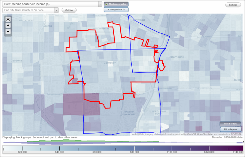
Compton, California Neighborhood Map - Income, House Prices, Occupations, Boundaries
Settings
X

- City boundary
- Neighborhood boundaries
Business Search - 14 Million verified businesses
Neighborhoods:
East Compton, Rancho DominguezEast Compton neighborhood in Compton statistics: (Find on map)
Area: 3.490 square miles
Population: 46,472
Population density:
Median household income in 2021:
Median rent in in 2021:
Male vs Females
Median age
Housing prices:
Average estimated value of detached houses in 2021 (67.3% of all units):
Average estimated value of townhouses or other attached units in 2021 (8.5% of all units):
Average estimated '21 value of housing units in 5-or-more-unit structures (5.2% of all units):
Average estimated value of mobile home in 2021 (13.2% of all units):
Most popular occupations of males: service occupations (17.6%); construction, extraction, and maintenance occupations (15.3%); production occupations (13.1%); material moving occupations (11.8%); sales and office occupations (11.5%); transportation occupations (9.0%); management occupations (except farmers) (3.3%)
Most popular occupations of females: sales and office occupations (31.6%); service occupations (31.1%); production occupations (7.7%); material moving occupations (7.1%); education, training, and library occupations (5.4%); healthcare practitioners and technical occupations (3.8%); business and financial operations occupations (3.4%)
Limited-access highways (interstate or state) in this neighborhood: Century Fwy (Century Freeway, Interstate Highway 105, I- 105, Glenn M Anderson Freeway and Transit, Glenn M Anderson Freeway and Transit); Long Beach Fwy (I- 710).
Roads and streets: Atlantic Ave (S Atlantic Ave); E McMillan St; Fernwood Ave; Josephine St; Carlin Ave; E Compton Blvd; S Lime Ave; E Rosecrans Ave; Agnes St; E Alondra Blvd; Virginia Ave (Virginia St); E Myrrh St; E San Vincente St; S Gibson Ave; S Williams Ave; N Bradfield Ave; N Bullis Rd; S Butler Ave; S Frailey Ave; S White Ave; Long Beach Blvd; N Long Beach Blvd; Olanda St; Harris Ave; E San Luis St; Lavinia Ave; Louise St; S Cookacre Ave (S Cookacre St); S Castlegate Ave; S Thorson Ave; Palm Ave; E Saunders St; Bullis Rd; S Harris Ave; N Locust Ave; Magnolia Ave; Clark St; E Linsley St; Thorson Ave; S Long Beach Blvd; Wright Rd; S Bradfield Ave; S Essey Ave; S Bullis Rd; Rosecrans Ave; S Pannes Ave; E Orchard St; E Laurel St; E Queensdale St; E San Marcus St; E Pine St; N Crane Ave; S Washington Ave; S Holly Ave; S Ward Ave; E Killen Pl; Lynwood Rd; Gertrude Dr; E Pixley St; Muriel Dr; E Rose St; Waldorf Dr; N Pannes Ave; E Cypress St; School St; E Stockton Ave (E Stockton St); E Ezmirlian St; E Cedar St (Cedar Ave); Niland St; Burton Ave; N Castlegate Ave; E Palmer St; Bradfield Ave; N Stoneacre Ave; Cookacre Ave; N Harris Ave (S Harris Ave); E Diane Dr; E Tucker St; S Manette Pl; Pelleur St; E Bales St; E Kay St; N Holly Ave; Rayborn St; 2nd Ave; Edgebrook Ave; Duncan Ave; Alvada St; E Elizabeth St; S Locust Ave; N Bowen Ave; S Locust Cir; 1st Ave; Fir St; Ernestine Ave; E San Mateo St; S Bowen Ave; 4th Ave; Arlington Ave; E Palmerstone St; Orchard Ave; 3rd Ave; N Ward Ave; Euclid Ave (Euclid St); Cardwell St; Wilson Ave; Fertile St; Cornish Ave; Halo Dr; Louise Ave; N Thorson Ave; E San Carlos St; E Wilbarn St; Alondra Blvd; Pope Ave; E San Rafael St; Blount Pl; E San Juan St; N Muriel Ave (Muriel Ave); E Elm St; Platt Ave; Antigua Ct; Phillips Ave; S Halo Dr; E San Miguel St; S Wright Rd; Millrace Ave; E Addington St; California Ave; Mulford Ave; Marguerita Dr; Belinda Ct; E Pattie Ct; S Stoneacre Ave; Manette Pl; Lewis St; N Essey Ave; Saratoga Dr; E Arlington Ave; Warren Ave; Olive St; Palm St; Cortland St; E Summerdale St; Hansa Ct; E Killen Ct; N Waldorf Dr; Elm Ave; Impala Dr; Pattie St.
East Compton neighborhood detailed profile
Area: 3.490 square miles
Population: 46,472
Population density:
| East Compton (East Rancho Dominguez): | 13,316 people per square mile |
| Compton: | 9,235 people per square mile |
Median household income in 2021:
| East Compton (East Rancho Dominguez): | $65,337 |
| Compton: | $62,050 |
Median rent in in 2021:
| East Compton (East Rancho Dominguez): | $1,351 |
| Compton: | $1,244 |
Male vs Females
| Males: | 23,161 |
| Females: | 23,310 |
Median age
| Males: | 30.4 years |
| Females: | 32.2 years |
Housing prices:
Average estimated value of detached houses in 2021 (67.3% of all units):
| East Compton (East Rancho Dominguez): | $432,241 |
| California: | $881,672 |
Average estimated value of townhouses or other attached units in 2021 (8.5% of all units):
| This neighborhood: | $456,667 |
| California: | $745,373 |
Average estimated '21 value of housing units in 5-or-more-unit structures (5.2% of all units):
| East Compton (East Rancho Dominguez): | $53,188 |
| California: | $701,962 |
Average estimated value of mobile home in 2021 (13.2% of all units):
| East Compton (East Rancho Dominguez): | $255,342 |
| California: | $174,181 |
Most popular occupations of males: service occupations (17.6%); construction, extraction, and maintenance occupations (15.3%); production occupations (13.1%); material moving occupations (11.8%); sales and office occupations (11.5%); transportation occupations (9.0%); management occupations (except farmers) (3.3%)
Most popular occupations of females: sales and office occupations (31.6%); service occupations (31.1%); production occupations (7.7%); material moving occupations (7.1%); education, training, and library occupations (5.4%); healthcare practitioners and technical occupations (3.8%); business and financial operations occupations (3.4%)
Limited-access highways (interstate or state) in this neighborhood: Century Fwy (Century Freeway, Interstate Highway 105, I- 105, Glenn M Anderson Freeway and Transit, Glenn M Anderson Freeway and Transit); Long Beach Fwy (I- 710).
Roads and streets: Atlantic Ave (S Atlantic Ave); E McMillan St; Fernwood Ave; Josephine St; Carlin Ave; E Compton Blvd; S Lime Ave; E Rosecrans Ave; Agnes St; E Alondra Blvd; Virginia Ave (Virginia St); E Myrrh St; E San Vincente St; S Gibson Ave; S Williams Ave; N Bradfield Ave; N Bullis Rd; S Butler Ave; S Frailey Ave; S White Ave; Long Beach Blvd; N Long Beach Blvd; Olanda St; Harris Ave; E San Luis St; Lavinia Ave; Louise St; S Cookacre Ave (S Cookacre St); S Castlegate Ave; S Thorson Ave; Palm Ave; E Saunders St; Bullis Rd; S Harris Ave; N Locust Ave; Magnolia Ave; Clark St; E Linsley St; Thorson Ave; S Long Beach Blvd; Wright Rd; S Bradfield Ave; S Essey Ave; S Bullis Rd; Rosecrans Ave; S Pannes Ave; E Orchard St; E Laurel St; E Queensdale St; E San Marcus St; E Pine St; N Crane Ave; S Washington Ave; S Holly Ave; S Ward Ave; E Killen Pl; Lynwood Rd; Gertrude Dr; E Pixley St; Muriel Dr; E Rose St; Waldorf Dr; N Pannes Ave; E Cypress St; School St; E Stockton Ave (E Stockton St); E Ezmirlian St; E Cedar St (Cedar Ave); Niland St; Burton Ave; N Castlegate Ave; E Palmer St; Bradfield Ave; N Stoneacre Ave; Cookacre Ave; N Harris Ave (S Harris Ave); E Diane Dr; E Tucker St; S Manette Pl; Pelleur St; E Bales St; E Kay St; N Holly Ave; Rayborn St; 2nd Ave; Edgebrook Ave; Duncan Ave; Alvada St; E Elizabeth St; S Locust Ave; N Bowen Ave; S Locust Cir; 1st Ave; Fir St; Ernestine Ave; E San Mateo St; S Bowen Ave; 4th Ave; Arlington Ave; E Palmerstone St; Orchard Ave; 3rd Ave; N Ward Ave; Euclid Ave (Euclid St); Cardwell St; Wilson Ave; Fertile St; Cornish Ave; Halo Dr; Louise Ave; N Thorson Ave; E San Carlos St; E Wilbarn St; Alondra Blvd; Pope Ave; E San Rafael St; Blount Pl; E San Juan St; N Muriel Ave (Muriel Ave); E Elm St; Platt Ave; Antigua Ct; Phillips Ave; S Halo Dr; E San Miguel St; S Wright Rd; Millrace Ave; E Addington St; California Ave; Mulford Ave; Marguerita Dr; Belinda Ct; E Pattie Ct; S Stoneacre Ave; Manette Pl; Lewis St; N Essey Ave; Saratoga Dr; E Arlington Ave; Warren Ave; Olive St; Palm St; Cortland St; E Summerdale St; Hansa Ct; E Killen Ct; N Waldorf Dr; Elm Ave; Impala Dr; Pattie St.
East Compton neighborhood detailed profile
Rancho Dominguez neighborhood in Compton statistics: (Find on map)
Area: 15.199 square miles
Population: 124,404
Population density:
Median household income in 2021:
Median rent in in 2021:
Male vs Females
Median age
Housing prices:
Average estimated value of detached houses in 2021 (62.7% of all units):
Average estimated value of townhouses or other attached units in 2021 (16.6% of all units):
Average estimated '21 value of housing units in 5-or-more-unit structures (19.7% of all units):
Average estimated value of mobile home in 2021 (13.2% of all units):
Most popular occupations of males: service occupations (17.3%); sales and office occupations (15.3%); construction, extraction, and maintenance occupations (12.7%); transportation occupations (10.5%); material moving occupations (10.5%); production occupations (10.0%); management occupations (except farmers) (5.4%)
Most popular occupations of females: sales and office occupations (33.1%); service occupations (27.8%); production occupations (4.9%); education, training, and library occupations (4.8%); business and financial operations occupations (4.6%); material moving occupations (4.6%); healthcare practitioners and technical occupations (4.5%)
Limited-access highways (interstate or state) in this neighborhood: I- 710 (Long Beach Fwy).
Highways in this neighborhood: State Rte 91 (Artesia Fwy); S Alameda St (State Rte 47).
Roads and streets: S Central Ave; Atlantic Ave (S Atlantic Ave); W Artesia Blvd; S Santa Fe Ave (Santa Fe Ave); E del Amo Blvd; S Wilmington Ave; N Long Beach Blvd; E Compton Blvd; E Rosecrans Ave; E Alondra Blvd; E Myrrh St; S Willowbrook Ave; E Artesia Blvd; E Greenleaf Blvd; S Susana Rd; W Rosecrans Ave; W Compton Blvd; E Gladwick St; W Poplar St; W Alondra Blvd; W Greenleaf Blvd; W Caldwell St; E Laurel St; W Walnut St; W School St; W Palmer St; E Victoria St; Linden Ave; W Arbutus St; E University Dr; S Acacia Ave; E Caldwell St; W Magnolia St; E Palmer St; S White Ave; N Elm Ave; W Spruce St; E Bennett St; S Lime Ave; W Raymond St; W Victoria St; S Butler Ave; E San Vincente St; E Elm St; E Cypress St; S Harris Ave; W Tichenor St; Locust Ave; S Castlegate Ave; Charles Willard St; W Bennett St; W Manville St; S Thorson Ave; S Williams Ave; S Long Beach Blvd; S Oleander Ave; N Alameda St; W Laurel St; E San Luis St; S Frailey Ave; S Pearl Ave; S Mayo Ave; White Ave; N Willowbrook Ave; S Washington Ave; S Pannes Ave; S Gibson Ave; S Gunlock Ave; E Turmont St; E 56th St; Glenn Curtiss St; W 156th St; W Elm St; W Carob St; E 55th St; S Poinsettia Ave; W del Amo Blvd; S Chester Ave; E Helmick St; Butler Ave; S Center Ave (S Center St); S Tamarind Ave; Market St; W Almond St; S Bradfield Ave; S Reyes Ave; W Cedar St; Muriel Ave; E Fernrock St; E 53rd St; S Dwight Ave; W 151st St; E Harcourt St; de Forest Ave; E Ellis St; W 152nd St; E Marcelle St; S Cookacre Ave (S Cookacre St); S Burris Ave; S Essey Ave; E Louise St; E 68th Way; E Saunders St; E 59th St; S Laurel Park Rd; Tajauta Ave; Cedar Ave; S Kemp Ave; S Rancho Way; E Plymouth St; E Ana St; E 52nd St; W Brazil St; E South St; E 67th Way; Gale Ave; E Mountain View St; E 57th St; E 67th St; E 60th St; S Northwood Ave; E Platt St; S Bullis Rd; S Sloan Ave; E Linsley St; E Hullett St; Coachella Ave; E Abbottson St; E Morningside St; E 68th St; E Adams St; E 69th Way; E Sunset St; Harlan Ave; E Cyrene Dr; N Jaymills Ave; E 51st St; S Tajauta Ave; W 154th St; E Elizabeth St; W Palm St; W Myrrh St; E Pleasant St; E Osgood St; E Pauline St; Pine Ave; E 61st St; W Reeve St; Rosecrans Ave; N Bradfield Ave; E Dimondale Dr; N Culver Ave; W Apra St; S Central Ave (N Central Ave); E Millmont St; S Dominguez Hills Dr; W Cypress St; N Acacia Ave; E San Marcus St; N Dwight Ave; E Tichenor St; N Bullis Rd; N Crane Ave; N Poinsettia Ave; N Matthisen Ave; N Aranbe Ave (S Aranbe Ave); N Tamarind Ave; N Sloan Ave; N Mayo Ave; N Burris Ave; N Pearl Ave; N Chester Ave; S Broadwick St; N Oleander Ave; N Santa Fe Ave; S Holly Ave; N Willow Ave; N Spring Ave (N Spring St); N Rose Ave; S Ward Ave; S Caress Ave; S Muriel Ave; S Stoneacre Ave; Bishop Ave; E 69th St; E Maria St; N Tajauta Ave; S Exmoor Ave; N Nestor Ave; N Wilmington Ave; E Las Hermanas St; Harbor Ave; Delta Ave; N Locust Ave; S Nestor Ave; E 142nd St; E Home St; E Johnson St; Harmon Ave; E Pixley St; E Neece St; E Cashdan St; W Maple St; Nestor Ave; E Smith St; Dairy Ave; E Harding St; E Rose St; E Forhan St; N Kemp Ave; W 51st St; Auto Dr N; E Norton St; Beachey Pl; S Whitemarsh Ave; E Adair St; E Bort St; E Janice St; E Marker St; Hillford Ave; W Mahalo Pl; W Cocoa St; Pricetown Ave; E Poppy St; S Atlantic Dr; S Temple Ave; W 52nd St; Kramer Dr; Grandee Ave; S Cliveden Ave; N Lime Ave; Auto Dr S; N Broadacres Ave; S Anderson Ave; E Scott St; E 63rd St; Northwood Ave; W Mountain View St; W Claude St; E Vista Bella Way; S Cuzco Ave; W 153rd St; Chestnut Ave; S Sportsman Dr; E Coolidge St; W 67th Way; W 53rd St; E Glencoe St (E Glencoe Ave); E Via Arado; W 155th St; Orcutt Ave; S Grandee Ave; Artesia Ln; N Paulsen Ave; Midtown Ave; E Via Mondo; Victoria St; W Zane St; W Bort St; S Hillford Ave; N Pacific Ave; Broadacres Ave; Cliveden Ave; Paradise Ln; Kona Dr; S Harlan Ave; E Reeve St; W Pleasant St; W Harcourt St; Polynesian Dr; E Raymond St; South St; W Home St; W Plymouth St; Orchid Ln; S Tartar Ln; Pacific Ave; E Stanley St; Dalfsen Ave; Radlett Ave; 1st St; E Bales St; Circle Dr; Kemp Ave; N Holly Ave; Rahn Ave; Greenleaf Dr; E Paulhan St (Paulhan St); Daisy Ave; W Barclay St; W Adams St; E Edom St; Sidney Ave; E Indigo St; E Plenty St; Elm Ave; W 163rd St; W Johnson St; S Sherer Pl; E Elsmere Dr; W Scott St; W Traffort St; W Glencoe St; Plaza Dr; E Palm St; Alvo Ave; Racquet Club Dr; E Silva St; W Forhan St; S Crane Ave; S Willow Ave; W 165th St; W 166th St; S Matthisen Ave; S Locust Ave; N Bowen Ave; S Petrolia Ave; E Barclay St; S Broadacres Ave; S Ferris Pl; Beechley Ave; E Manville St; Orleans Way; S Locust Cir; W Market St; Long Beach Blvd W; E 65th St; E 64th St; Pali Dr; Ginger Dr; N Via Veranada; E San Mateo St; S Bowen Ave; Kona Ln; W 68th St; W Corregidor St; S Maie Ave; E Magnolia St; E Palmerstone St; N Harris Ave (Harris Ave); E Cummings Ln; E Heath Ln; Camba Ave; W Indigo St; Aloha Cir; S California Ave; W 145th St; S Coral Ave; Leslie Ave; W Dameron St; E Cedar St; E Pacifica Pl; E Allington St; N Albertson Ave; Gary Ave; E Maple St; Hula Hula; S Barron Ave (S Barron St); E Denwall Dr; W Cummings St; W Heath St; E Spruce St; Gardner St; W Louise St; E Eleanor Ln; Andmark Ave; S Aranabe Ave; E Cocoa St; N Cliveden Ave; W Pacific Ave; N Northwood Ave; N Van Ness Ave; N Evers Ave; Taylor St; N Kalsman Ave; Norton St; N Maie Ave; E Wymore St; E Calstock St; N Hillford Ave; Cyrene Dr; W 70th St; Walnut Park Way (W Walnut Pkwy); Aloha Dr; Earlie Ave; N Atlantic Pl; Dimondale Dr; 4th St; E Cambridge St; N Thorson Ave; E Val Verde Ct; Bellhurst Ave; E San Carlos St; Craigjon Ave; E Iva St; E Marker Ln; Coral Ln; Kay St; Alondra Blvd; E del Mar Ct (del Mar Ct); E Clemmer Dr; E San Rafael St; E Josephine Ct; 3rd St; N Hickory Ave; Cooke Ave; Hilda St; W Coolidge St; E Bankers Dr; Atlantic Dr; Homestead Pl; Vis Industria; Virginia Ave; E San Juan St; N Magnolia Ct; S Rose Ave; Via Baron (S Via Barron); E Arbutus St; Tiki Walk; Lime Ave; S Willow St; N Harris Ave (S Harris Ave); Hula Dr; E Duma St; E Adana St; E Schinner St; 67th St; E Poplar St; Beth St; E San Miguel St; Carol St; E Pacific Commerce Dr; June St; Lei Dr; Greer St; Hula Ln; S Grape Ave; Walnut Park Dr; S Paulsen Ave; Donna St; Fern St; Ellen St; E Gordon St; Fuego St; N Pannes Ave; S Bentley Ave; Iva St; 2nd St; Marguerita Dr; Pali Walk; S Edison Way; E Pattie Ct; 5th St; Mahalo Pl; N Sherer Pl; E Kamm St; Sandra Ln; Sommerset Ln; Crane St; E Gladys St; Autocenter Dr (Auto Center Dr); N Galliard Dr; E Cedar Turn St; N Essey Ave; Alma St; S Reeves Ave; Acacia Ct; Greenleaf Blvd (E Greenleaf Blvd); S Flower Ave; Palm St; Artesia Blvd; W Myrrh Ln; Anderson Ave; Joplin Ave; Caldwell St; Paulsen Cir; Fenter Ave; S Amantha Ave; Cook Ave; S Sequoia Dr; S Sierra Dr; Barron Ave (Barron St); Atlantic Plz; E Carson Pl; Matthisen Cir; Cottonwood Ct; Anzac Cir; W 159th St; W Cypress Cir; S Parmelee Ave; W Gladys St; Palmer St; Maple Dr; Bell Lyn Ln; E 150th St; E 149th St; W Palm Cir; Hullett Turn; Grape Cir; S Baron Ave; Lester St; E 144th St; E 148th St; Myrrh St.
Railroad features: Pacific Electric Rlwy; Southern Pacific RR; Union Pacific RR.
Other features: Compton Crk; Los Angeles Riv; Storm Drainage Chnnl.
Rancho Dominguez neighborhood detailed profile
Area: 15.199 square miles
Population: 124,404
Population density:
| Rancho Dominguez: | 8,185 people per square mile |
| Compton: | 9,235 people per square mile |
Median household income in 2021:
| Rancho Dominguez: | $71,735 |
| Compton: | $62,050 |
Median rent in in 2021:
| Rancho Dominguez: | $1,284 |
| Compton: | $1,244 |
Male vs Females
| Males: | 60,400 |
| Females: | 64,004 |
Median age
| Males: | 32.9 years |
| Females: | 35.0 years |
Housing prices:
Average estimated value of detached houses in 2021 (62.7% of all units):
| Rancho Dominguez: | $478,111 |
| California: | $881,672 |
Average estimated value of townhouses or other attached units in 2021 (16.6% of all units):
| This neighborhood: | $416,255 |
| California: | $745,373 |
Average estimated '21 value of housing units in 5-or-more-unit structures (19.7% of all units):
| Rancho Dominguez: | $177,444 |
| California: | $701,962 |
Average estimated value of mobile home in 2021 (13.2% of all units):
| Rancho Dominguez: | $156,263 |
| California: | $174,181 |
Most popular occupations of males: service occupations (17.3%); sales and office occupations (15.3%); construction, extraction, and maintenance occupations (12.7%); transportation occupations (10.5%); material moving occupations (10.5%); production occupations (10.0%); management occupations (except farmers) (5.4%)
Most popular occupations of females: sales and office occupations (33.1%); service occupations (27.8%); production occupations (4.9%); education, training, and library occupations (4.8%); business and financial operations occupations (4.6%); material moving occupations (4.6%); healthcare practitioners and technical occupations (4.5%)
Limited-access highways (interstate or state) in this neighborhood: I- 710 (Long Beach Fwy).
Highways in this neighborhood: State Rte 91 (Artesia Fwy); S Alameda St (State Rte 47).
Roads and streets: S Central Ave; Atlantic Ave (S Atlantic Ave); W Artesia Blvd; S Santa Fe Ave (Santa Fe Ave); E del Amo Blvd; S Wilmington Ave; N Long Beach Blvd; E Compton Blvd; E Rosecrans Ave; E Alondra Blvd; E Myrrh St; S Willowbrook Ave; E Artesia Blvd; E Greenleaf Blvd; S Susana Rd; W Rosecrans Ave; W Compton Blvd; E Gladwick St; W Poplar St; W Alondra Blvd; W Greenleaf Blvd; W Caldwell St; E Laurel St; W Walnut St; W School St; W Palmer St; E Victoria St; Linden Ave; W Arbutus St; E University Dr; S Acacia Ave; E Caldwell St; W Magnolia St; E Palmer St; S White Ave; N Elm Ave; W Spruce St; E Bennett St; S Lime Ave; W Raymond St; W Victoria St; S Butler Ave; E San Vincente St; E Elm St; E Cypress St; S Harris Ave; W Tichenor St; Locust Ave; S Castlegate Ave; Charles Willard St; W Bennett St; W Manville St; S Thorson Ave; S Williams Ave; S Long Beach Blvd; S Oleander Ave; N Alameda St; W Laurel St; E San Luis St; S Frailey Ave; S Pearl Ave; S Mayo Ave; White Ave; N Willowbrook Ave; S Washington Ave; S Pannes Ave; S Gibson Ave; S Gunlock Ave; E Turmont St; E 56th St; Glenn Curtiss St; W 156th St; W Elm St; W Carob St; E 55th St; S Poinsettia Ave; W del Amo Blvd; S Chester Ave; E Helmick St; Butler Ave; S Center Ave (S Center St); S Tamarind Ave; Market St; W Almond St; S Bradfield Ave; S Reyes Ave; W Cedar St; Muriel Ave; E Fernrock St; E 53rd St; S Dwight Ave; W 151st St; E Harcourt St; de Forest Ave; E Ellis St; W 152nd St; E Marcelle St; S Cookacre Ave (S Cookacre St); S Burris Ave; S Essey Ave; E Louise St; E 68th Way; E Saunders St; E 59th St; S Laurel Park Rd; Tajauta Ave; Cedar Ave; S Kemp Ave; S Rancho Way; E Plymouth St; E Ana St; E 52nd St; W Brazil St; E South St; E 67th Way; Gale Ave; E Mountain View St; E 57th St; E 67th St; E 60th St; S Northwood Ave; E Platt St; S Bullis Rd; S Sloan Ave; E Linsley St; E Hullett St; Coachella Ave; E Abbottson St; E Morningside St; E 68th St; E Adams St; E 69th Way; E Sunset St; Harlan Ave; E Cyrene Dr; N Jaymills Ave; E 51st St; S Tajauta Ave; W 154th St; E Elizabeth St; W Palm St; W Myrrh St; E Pleasant St; E Osgood St; E Pauline St; Pine Ave; E 61st St; W Reeve St; Rosecrans Ave; N Bradfield Ave; E Dimondale Dr; N Culver Ave; W Apra St; S Central Ave (N Central Ave); E Millmont St; S Dominguez Hills Dr; W Cypress St; N Acacia Ave; E San Marcus St; N Dwight Ave; E Tichenor St; N Bullis Rd; N Crane Ave; N Poinsettia Ave; N Matthisen Ave; N Aranbe Ave (S Aranbe Ave); N Tamarind Ave; N Sloan Ave; N Mayo Ave; N Burris Ave; N Pearl Ave; N Chester Ave; S Broadwick St; N Oleander Ave; N Santa Fe Ave; S Holly Ave; N Willow Ave; N Spring Ave (N Spring St); N Rose Ave; S Ward Ave; S Caress Ave; S Muriel Ave; S Stoneacre Ave; Bishop Ave; E 69th St; E Maria St; N Tajauta Ave; S Exmoor Ave; N Nestor Ave; N Wilmington Ave; E Las Hermanas St; Harbor Ave; Delta Ave; N Locust Ave; S Nestor Ave; E 142nd St; E Home St; E Johnson St; Harmon Ave; E Pixley St; E Neece St; E Cashdan St; W Maple St; Nestor Ave; E Smith St; Dairy Ave; E Harding St; E Rose St; E Forhan St; N Kemp Ave; W 51st St; Auto Dr N; E Norton St; Beachey Pl; S Whitemarsh Ave; E Adair St; E Bort St; E Janice St; E Marker St; Hillford Ave; W Mahalo Pl; W Cocoa St; Pricetown Ave; E Poppy St; S Atlantic Dr; S Temple Ave; W 52nd St; Kramer Dr; Grandee Ave; S Cliveden Ave; N Lime Ave; Auto Dr S; N Broadacres Ave; S Anderson Ave; E Scott St; E 63rd St; Northwood Ave; W Mountain View St; W Claude St; E Vista Bella Way; S Cuzco Ave; W 153rd St; Chestnut Ave; S Sportsman Dr; E Coolidge St; W 67th Way; W 53rd St; E Glencoe St (E Glencoe Ave); E Via Arado; W 155th St; Orcutt Ave; S Grandee Ave; Artesia Ln; N Paulsen Ave; Midtown Ave; E Via Mondo; Victoria St; W Zane St; W Bort St; S Hillford Ave; N Pacific Ave; Broadacres Ave; Cliveden Ave; Paradise Ln; Kona Dr; S Harlan Ave; E Reeve St; W Pleasant St; W Harcourt St; Polynesian Dr; E Raymond St; South St; W Home St; W Plymouth St; Orchid Ln; S Tartar Ln; Pacific Ave; E Stanley St; Dalfsen Ave; Radlett Ave; 1st St; E Bales St; Circle Dr; Kemp Ave; N Holly Ave; Rahn Ave; Greenleaf Dr; E Paulhan St (Paulhan St); Daisy Ave; W Barclay St; W Adams St; E Edom St; Sidney Ave; E Indigo St; E Plenty St; Elm Ave; W 163rd St; W Johnson St; S Sherer Pl; E Elsmere Dr; W Scott St; W Traffort St; W Glencoe St; Plaza Dr; E Palm St; Alvo Ave; Racquet Club Dr; E Silva St; W Forhan St; S Crane Ave; S Willow Ave; W 165th St; W 166th St; S Matthisen Ave; S Locust Ave; N Bowen Ave; S Petrolia Ave; E Barclay St; S Broadacres Ave; S Ferris Pl; Beechley Ave; E Manville St; Orleans Way; S Locust Cir; W Market St; Long Beach Blvd W; E 65th St; E 64th St; Pali Dr; Ginger Dr; N Via Veranada; E San Mateo St; S Bowen Ave; Kona Ln; W 68th St; W Corregidor St; S Maie Ave; E Magnolia St; E Palmerstone St; N Harris Ave (Harris Ave); E Cummings Ln; E Heath Ln; Camba Ave; W Indigo St; Aloha Cir; S California Ave; W 145th St; S Coral Ave; Leslie Ave; W Dameron St; E Cedar St; E Pacifica Pl; E Allington St; N Albertson Ave; Gary Ave; E Maple St; Hula Hula; S Barron Ave (S Barron St); E Denwall Dr; W Cummings St; W Heath St; E Spruce St; Gardner St; W Louise St; E Eleanor Ln; Andmark Ave; S Aranabe Ave; E Cocoa St; N Cliveden Ave; W Pacific Ave; N Northwood Ave; N Van Ness Ave; N Evers Ave; Taylor St; N Kalsman Ave; Norton St; N Maie Ave; E Wymore St; E Calstock St; N Hillford Ave; Cyrene Dr; W 70th St; Walnut Park Way (W Walnut Pkwy); Aloha Dr; Earlie Ave; N Atlantic Pl; Dimondale Dr; 4th St; E Cambridge St; N Thorson Ave; E Val Verde Ct; Bellhurst Ave; E San Carlos St; Craigjon Ave; E Iva St; E Marker Ln; Coral Ln; Kay St; Alondra Blvd; E del Mar Ct (del Mar Ct); E Clemmer Dr; E San Rafael St; E Josephine Ct; 3rd St; N Hickory Ave; Cooke Ave; Hilda St; W Coolidge St; E Bankers Dr; Atlantic Dr; Homestead Pl; Vis Industria; Virginia Ave; E San Juan St; N Magnolia Ct; S Rose Ave; Via Baron (S Via Barron); E Arbutus St; Tiki Walk; Lime Ave; S Willow St; N Harris Ave (S Harris Ave); Hula Dr; E Duma St; E Adana St; E Schinner St; 67th St; E Poplar St; Beth St; E San Miguel St; Carol St; E Pacific Commerce Dr; June St; Lei Dr; Greer St; Hula Ln; S Grape Ave; Walnut Park Dr; S Paulsen Ave; Donna St; Fern St; Ellen St; E Gordon St; Fuego St; N Pannes Ave; S Bentley Ave; Iva St; 2nd St; Marguerita Dr; Pali Walk; S Edison Way; E Pattie Ct; 5th St; Mahalo Pl; N Sherer Pl; E Kamm St; Sandra Ln; Sommerset Ln; Crane St; E Gladys St; Autocenter Dr (Auto Center Dr); N Galliard Dr; E Cedar Turn St; N Essey Ave; Alma St; S Reeves Ave; Acacia Ct; Greenleaf Blvd (E Greenleaf Blvd); S Flower Ave; Palm St; Artesia Blvd; W Myrrh Ln; Anderson Ave; Joplin Ave; Caldwell St; Paulsen Cir; Fenter Ave; S Amantha Ave; Cook Ave; S Sequoia Dr; S Sierra Dr; Barron Ave (Barron St); Atlantic Plz; E Carson Pl; Matthisen Cir; Cottonwood Ct; Anzac Cir; W 159th St; W Cypress Cir; S Parmelee Ave; W Gladys St; Palmer St; Maple Dr; Bell Lyn Ln; E 150th St; E 149th St; W Palm Cir; Hullett Turn; Grape Cir; S Baron Ave; Lester St; E 144th St; E 148th St; Myrrh St.
Railroad features: Pacific Electric Rlwy; Southern Pacific RR; Union Pacific RR.
Other features: Compton Crk; Los Angeles Riv; Storm Drainage Chnnl.
Rancho Dominguez neighborhood detailed profile