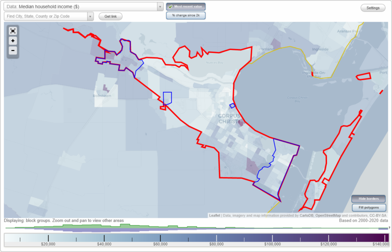
Corpus Christi, Texas Neighborhood Map - Income, House Prices, Occupations, Boundaries
Settings
X

- City boundary
- Neighborhood boundaries
Business Search - 14 Million verified businesses
Neighborhoods:
Calallen, Clarkwood, Del Mar, Flour BluffCalallen neighborhood in Corpus Christi statistics: (Find on map)
Area: 11.158 square miles
Population: 21,522
Population density:
Median household income in 2021:
Median rent in in 2021:
Male vs Females
Median age
Housing prices:
Average estimated value of detached houses in 2021 (71.3% of all units):
Average estimated value of townhouses or other attached units in 2021 (3.9% of all units):
Average estimated value of mobile home in 2021 (10.0% of all units):
Most popular occupations of males: service occupations (14.5%); construction, extraction, and maintenance occupations (12.9%); sales and office occupations (12.2%); management occupations (except farmers) (10.9%); production occupations (9.4%); transportation occupations (8.4%); business and financial operations occupations (3.8%)
Most popular occupations of females: sales and office occupations (35.7%); healthcare practitioners and technical occupations (15.9%); service occupations (13.8%); management occupations (except farmers) (13.6%); education, training, and library occupations (7.2%); business and financial operations occupations (2.8%); transportation occupations (2.4%)
Limited-access highways (interstate or state) in this neighborhood: I- 37.
Highways in this neighborhood: US Hwy 77.
Roads and streets: (Ih 37 N); Up River Rd; Leopard St; FM 624 (Northwest Blvd); Hearn Rd; Violet Rd; River Ln; Callicoatte Rd; Ss 407 W; Co Rd 69; Sharpsburg Rd; E Riverview St; Calallen Dr; Wood River Dr; US Hwy 77 N; Red River Dr; Figueroa St (1st St); Rehfeld Rd; Emory Dr; Santa Gertrudis Dr; Mc Burnett Dr; Magee Ln; Cliff Crenshaw St; Beal Dr; Clear Fork Dr; Cynthia St; Woodland Creek Dr; Wandering Creek Dr; River Rock Dr; Mountain View Dr; Riverway Dr; Western Dr; Guadalupe River Dr; Nolford Pl; Willowood Creek Dr; Ave C; Spring Creek Dr; Rapids Dr; River Park Dr; River Hill Dr; Lindgreen Rd (Lindgreen St); Loma Alta Rd; FM 624 (Northeast Blvd); Mountain Trl; Sierra St; Woodway Creek Dr; Chamizal St; Hart Rd; Railroad Ave; Lott Ave; Northwest Trl; Spaulding Dr; Shelton Blvd; Dunstain St; Smith Dr; Brookside Dr; Wildcat Dr; W Buckhorn Dr; Cornett Dr; Brookhaven Dr; Zamora St; Turkey Creek Dr; Mesa Ave (Mesa Dr); Perry Ln; Teague Ln; River Forest Dr; Brookhill Dr; FM 1889; W Redbird Ln; Pernitas Creek Dr; Big Cypress Bayou; Teal Dr; Middle Ln; Hillwood Trl; Sweetwater Creek Dr; High Ridge Dr; Iron River Dr; River East Dr; Chispa Creek Dr (Opossum Creek Dr); Riverside Blvd; River Run Rd; Crystal Ln; Reagan Dr; Pecos River Dr; Coleta Creek Dr; Powell Dr; Ave A; Fairway Dr; Blades St; Butler Rd; Petronila Creek Ct; Guess Dr; Trinity River Dr; Windsor Dr (Windsor St); Calaveras Dr; Prairie Creek Dr; Riverwood Dr; Bickham Rd; Ave B; Piedra Creek Dr; Paddlewheel Dr; Ravine Dr; Exchequer Dr; River Canyon Dr; Ramos St; River View Trl; Rolling Ridge Dr (Rolling Ridge Trl); River Ridge Dr; Country Estates Dr; Devils Creek Dr; Country Dawn Dr; Hondo Creek Dr; Cripple Creek Dr; E Redbird Ln; Oglethorpe Dr; Harney Rd; San Roque Creek Dr; Sandy Ridge Rd (Sandy Ridge St); Caliche Creek Dr; Rushing Blvd; River Valley Dr; Church St; Prairie Dog Fork Dr; Velda (Velda Dr); Rippling Creek Dr; Keegan (Keegan Dr); W River Dr; Silver Creek Dr; Cox Cir; Access Rd; Catfish Dr; Martine St; Burning Tree Ln; Margie Dr; Fontana Ave; Lori Dr; Moorhead Dr; Steamboat Ln; Sandy Hollow Rd (Sandy Hollow Creek Dr); Opossum Creek Dr; Nichols Dr; Brooklane Dr; Nuecestown Rd; Ripple Rd; Sandy Creek Ct; Wirt Ave; Sunnyville Dr; Rio Vista Dr; Honey Creek Dr; Vista Ridge Dr (Vista Ridge St); Hackberry St; Sandy Hollow Dr (Sandy Hollow Creek Dr); Round Rock Rd (Round Rock St); Scenic Cir; Sugar Magnolia Dr; Elmont Ave; Carencia Dr; Griffith St; Red Bluff Rd; Deep Water Cir; Attoyac Dr; Shoshone Dr (Shoshone Point Dr); Pinnacle Dr; Yellow Oak Ave; Cowhouse Creek Ct; Sue Cir; Wolf Creek Ct; Hillwood Trl N; Caplin Dr; Bee Mountain Dr (Bee Mountain St); Honey Trail St; Ballard Tree Dr; Shoal Creek Cir; N Creek Cir; Blueridge Mountains Dr; Wildhorse Valley Dr; Wardworth Creek Dr; Black Peak Dr; Yellowstone Dr; Geronimo Dr; Platte River Dr; Dry Creek Dr; Jacob St; Buttes Dr; Dew Creek Cir; Ave D; Pecan Bayou Ct; Clear Creek Dr; Moon River Trl; Flatrock Crossing Cir; Peach Creek Ct; Red Bird Ln; Nighthawk Ln; Lavaca River Dr; Country Side Cir; Canyon St; Agua Dulce Creek Dr; Mesa Cir; Black Bayou (Black Bayou Cir); Palisade St; Paint Rock Rd (Paint Rock St); Rustling Cove Dr (Rustling Cove Rd); Springs Creek Cir; Raintree Dr; Rustic Oak Dr (Rustic Oak St); Sea Dog Cir; Orrel Cir; Bluff Trl; Olmos River Ct; Astola Ave; Flagstone Creek Dr; Diana Cir; Saspamco Creek Dr; Olmos Creek Cir; Whitman Cir; Rorer Cir; N Creek Dr; Beth Creek Cir; Brookhollow Dr; Banily; Red Creek Cir; Lavaca River Ct; Vista Cir; Clear Fork Ct; Sierra Cir; Blue Creek Cir; Fonvilla Cir; S Creek Dr; Rebecca Dr; Flagstone Creek Cir; Matt Ave; E Eliff St (Elliff); Indio Creek Cir; Calamity Ct; Forest Cir; Thoreau Cir; Doris Creek Cir; Medina Spring (Medina Springs Ct); Pintas Creek Cir; Kimberly; Rippling Creek Cir; Post Oak Cir; Dockside Cir; el Gato Creek Cir; 1st St Exd; Cactus Cir; Kickapoo Dr; Melex Dr; River Ridge Cir; Quig Cir; Ripple.
Railroad features: Missouri Pacific RR.
Other features: Drainage Cnl.
Calallen neighborhood detailed profile
Area: 11.158 square miles
Population: 21,522
Population density:
| Calallen: | 1,929 people per square mile |
| Corpus Christi: | 2,055 people per square mile |
Median household income in 2021:
| Calallen: | $77,096 |
| Corpus Christi: | $59,812 |
Median rent in in 2021:
| Calallen: | $1,038 |
| Corpus Christi: | $930 |
Male vs Females
| Males: | 10,866 |
| Females: | 10,655 |
Median age
| Males: | 35.0 years |
| Females: | 38.5 years |
Housing prices:
Average estimated value of detached houses in 2021 (71.3% of all units):
| Calallen: | $253,642 |
| Corpus Christi: | $212,792 |
Average estimated value of townhouses or other attached units in 2021 (3.9% of all units):
| This neighborhood: | $139,283 |
| city: | $168,101 |
Average estimated value of mobile home in 2021 (10.0% of all units):
| Calallen: | $63,408 |
| Corpus Christi: | $33,205 |
Most popular occupations of males: service occupations (14.5%); construction, extraction, and maintenance occupations (12.9%); sales and office occupations (12.2%); management occupations (except farmers) (10.9%); production occupations (9.4%); transportation occupations (8.4%); business and financial operations occupations (3.8%)
Most popular occupations of females: sales and office occupations (35.7%); healthcare practitioners and technical occupations (15.9%); service occupations (13.8%); management occupations (except farmers) (13.6%); education, training, and library occupations (7.2%); business and financial operations occupations (2.8%); transportation occupations (2.4%)
Limited-access highways (interstate or state) in this neighborhood: I- 37.
Highways in this neighborhood: US Hwy 77.
Roads and streets: (Ih 37 N); Up River Rd; Leopard St; FM 624 (Northwest Blvd); Hearn Rd; Violet Rd; River Ln; Callicoatte Rd; Ss 407 W; Co Rd 69; Sharpsburg Rd; E Riverview St; Calallen Dr; Wood River Dr; US Hwy 77 N; Red River Dr; Figueroa St (1st St); Rehfeld Rd; Emory Dr; Santa Gertrudis Dr; Mc Burnett Dr; Magee Ln; Cliff Crenshaw St; Beal Dr; Clear Fork Dr; Cynthia St; Woodland Creek Dr; Wandering Creek Dr; River Rock Dr; Mountain View Dr; Riverway Dr; Western Dr; Guadalupe River Dr; Nolford Pl; Willowood Creek Dr; Ave C; Spring Creek Dr; Rapids Dr; River Park Dr; River Hill Dr; Lindgreen Rd (Lindgreen St); Loma Alta Rd; FM 624 (Northeast Blvd); Mountain Trl; Sierra St; Woodway Creek Dr; Chamizal St; Hart Rd; Railroad Ave; Lott Ave; Northwest Trl; Spaulding Dr; Shelton Blvd; Dunstain St; Smith Dr; Brookside Dr; Wildcat Dr; W Buckhorn Dr; Cornett Dr; Brookhaven Dr; Zamora St; Turkey Creek Dr; Mesa Ave (Mesa Dr); Perry Ln; Teague Ln; River Forest Dr; Brookhill Dr; FM 1889; W Redbird Ln; Pernitas Creek Dr; Big Cypress Bayou; Teal Dr; Middle Ln; Hillwood Trl; Sweetwater Creek Dr; High Ridge Dr; Iron River Dr; River East Dr; Chispa Creek Dr (Opossum Creek Dr); Riverside Blvd; River Run Rd; Crystal Ln; Reagan Dr; Pecos River Dr; Coleta Creek Dr; Powell Dr; Ave A; Fairway Dr; Blades St; Butler Rd; Petronila Creek Ct; Guess Dr; Trinity River Dr; Windsor Dr (Windsor St); Calaveras Dr; Prairie Creek Dr; Riverwood Dr; Bickham Rd; Ave B; Piedra Creek Dr; Paddlewheel Dr; Ravine Dr; Exchequer Dr; River Canyon Dr; Ramos St; River View Trl; Rolling Ridge Dr (Rolling Ridge Trl); River Ridge Dr; Country Estates Dr; Devils Creek Dr; Country Dawn Dr; Hondo Creek Dr; Cripple Creek Dr; E Redbird Ln; Oglethorpe Dr; Harney Rd; San Roque Creek Dr; Sandy Ridge Rd (Sandy Ridge St); Caliche Creek Dr; Rushing Blvd; River Valley Dr; Church St; Prairie Dog Fork Dr; Velda (Velda Dr); Rippling Creek Dr; Keegan (Keegan Dr); W River Dr; Silver Creek Dr; Cox Cir; Access Rd; Catfish Dr; Martine St; Burning Tree Ln; Margie Dr; Fontana Ave; Lori Dr; Moorhead Dr; Steamboat Ln; Sandy Hollow Rd (Sandy Hollow Creek Dr); Opossum Creek Dr; Nichols Dr; Brooklane Dr; Nuecestown Rd; Ripple Rd; Sandy Creek Ct; Wirt Ave; Sunnyville Dr; Rio Vista Dr; Honey Creek Dr; Vista Ridge Dr (Vista Ridge St); Hackberry St; Sandy Hollow Dr (Sandy Hollow Creek Dr); Round Rock Rd (Round Rock St); Scenic Cir; Sugar Magnolia Dr; Elmont Ave; Carencia Dr; Griffith St; Red Bluff Rd; Deep Water Cir; Attoyac Dr; Shoshone Dr (Shoshone Point Dr); Pinnacle Dr; Yellow Oak Ave; Cowhouse Creek Ct; Sue Cir; Wolf Creek Ct; Hillwood Trl N; Caplin Dr; Bee Mountain Dr (Bee Mountain St); Honey Trail St; Ballard Tree Dr; Shoal Creek Cir; N Creek Cir; Blueridge Mountains Dr; Wildhorse Valley Dr; Wardworth Creek Dr; Black Peak Dr; Yellowstone Dr; Geronimo Dr; Platte River Dr; Dry Creek Dr; Jacob St; Buttes Dr; Dew Creek Cir; Ave D; Pecan Bayou Ct; Clear Creek Dr; Moon River Trl; Flatrock Crossing Cir; Peach Creek Ct; Red Bird Ln; Nighthawk Ln; Lavaca River Dr; Country Side Cir; Canyon St; Agua Dulce Creek Dr; Mesa Cir; Black Bayou (Black Bayou Cir); Palisade St; Paint Rock Rd (Paint Rock St); Rustling Cove Dr (Rustling Cove Rd); Springs Creek Cir; Raintree Dr; Rustic Oak Dr (Rustic Oak St); Sea Dog Cir; Orrel Cir; Bluff Trl; Olmos River Ct; Astola Ave; Flagstone Creek Dr; Diana Cir; Saspamco Creek Dr; Olmos Creek Cir; Whitman Cir; Rorer Cir; N Creek Dr; Beth Creek Cir; Brookhollow Dr; Banily; Red Creek Cir; Lavaca River Ct; Vista Cir; Clear Fork Ct; Sierra Cir; Blue Creek Cir; Fonvilla Cir; S Creek Dr; Rebecca Dr; Flagstone Creek Cir; Matt Ave; E Eliff St (Elliff); Indio Creek Cir; Calamity Ct; Forest Cir; Thoreau Cir; Doris Creek Cir; Medina Spring (Medina Springs Ct); Pintas Creek Cir; Kimberly; Rippling Creek Cir; Post Oak Cir; Dockside Cir; el Gato Creek Cir; 1st St Exd; Cactus Cir; Kickapoo Dr; Melex Dr; River Ridge Cir; Quig Cir; Ripple.
Railroad features: Missouri Pacific RR.
Other features: Drainage Cnl.
Calallen neighborhood detailed profile
Clarkwood neighborhood in Corpus Christi statistics: (Find on map)
Area: 1.584 square miles
Population: 421
Population density:
Median household income in 2021:
Median rent in in 2021:
Male vs Females
Median age
Most popular occupations of males: construction, extraction, and maintenance occupations (30.8%); service occupations (19.4%); material moving occupations (12.8%); sales and office occupations (8.2%); production occupations (8.2%); life, physical, and social science occupations (3.8%); arts, design, entertainment, sports, and media occupations (2.9%)
Most popular occupations of females: service occupations (35.4%); sales and office occupations (32.4%); education, training, and library occupations (11.0%); transportation occupations (7.1%); management occupations (except farmers) (6.3%); business and financial operations occupations (3.9%); production occupations (2.2%)
Highways in this neighborhood: Agnes St (State Hwy 44).
Roads and streets: Alpine St; N Clarkwood Rd; Gilliam St; Bolkholt Rd; Manning Rd; Bark St; Barbra Ave; State Hwy 44 W; Donna Ave; Bockholt Rd; Commerce St; Needle St; Root St; Eklund Ave; Rusk St; Iris Ave; Sullivan St; Joyce Ave.
Railroad features: Texas Mexican Rlwy.
Other features: Clarkwood Drainagewy.
Clarkwood neighborhood detailed profile
Area: 1.584 square miles
Population: 421
Population density:
| Clarkwood: | 266 people per square mile |
| Corpus Christi: | 2,055 people per square mile |
Median household income in 2021:
| Clarkwood: | $47,405 |
| Corpus Christi: | $59,812 |
Median rent in in 2021:
| Clarkwood: | $812 |
| Corpus Christi: | $930 |
Male vs Females
| Males: | 227 |
| Females: | 193 |
Median age
| Males: | 41.0 years |
| Females: | 37.7 years |
Most popular occupations of males: construction, extraction, and maintenance occupations (30.8%); service occupations (19.4%); material moving occupations (12.8%); sales and office occupations (8.2%); production occupations (8.2%); life, physical, and social science occupations (3.8%); arts, design, entertainment, sports, and media occupations (2.9%)
Most popular occupations of females: service occupations (35.4%); sales and office occupations (32.4%); education, training, and library occupations (11.0%); transportation occupations (7.1%); management occupations (except farmers) (6.3%); business and financial operations occupations (3.9%); production occupations (2.2%)
Highways in this neighborhood: Agnes St (State Hwy 44).
Roads and streets: Alpine St; N Clarkwood Rd; Gilliam St; Bolkholt Rd; Manning Rd; Bark St; Barbra Ave; State Hwy 44 W; Donna Ave; Bockholt Rd; Commerce St; Needle St; Root St; Eklund Ave; Rusk St; Iris Ave; Sullivan St; Joyce Ave.
Railroad features: Texas Mexican Rlwy.
Other features: Clarkwood Drainagewy.
Clarkwood neighborhood detailed profile
Del Mar neighborhood in Corpus Christi statistics: (Find on map)
Area: 0.241 square miles
Population: 1,220
Population density:
Median household income in 2021:
Median rent in in 2021:
Male vs Females
Median age
Average estimated value of detached houses in 2021 (80.1% of all units):
Most popular occupations of males: management occupations (except farmers) (18.0%); production occupations (16.6%); material moving occupations (12.3%); architecture and engineering occupations (12.1%); construction, extraction, and maintenance occupations (11.7%); sales and office occupations (6.4%); healthcare practitioners and technical occupations (6.2%)
Most popular occupations of females: sales and office occupations (30.3%); education, training, and library occupations (24.5%); management occupations (except farmers) (12.2%); service occupations (9.5%); legal occupations (4.9%); healthcare practitioners and technical occupations (4.9%); community and social services occupations (2.6%)
Roads and streets: Louisiana Ave; Southern St; Atlantic St; Naples St; del Mar Blvd; Cole St; Santa Fe St; Lawnview St; S Alameda St; Ocean Dr; 3rd St; Clifford St; 2nd St.
Del Mar neighborhood detailed profile
Area: 0.241 square miles
Population: 1,220
Population density:
| Del Mar: | 5,064 people per square mile |
| Corpus Christi: | 2,055 people per square mile |
Median household income in 2021:
| Del Mar: | $82,923 |
| Corpus Christi: | $59,812 |
Median rent in in 2021:
| Del Mar: | $834 |
| Corpus Christi: | $930 |
Male vs Females
| Males: | 508 |
| Females: | 712 |
Median age
| Males: | 31.2 years |
| Females: | 39.4 years |
Average estimated value of detached houses in 2021 (80.1% of all units):
| Del Mar: | $462,436 |
| Corpus Christi: | $212,792 |
Most popular occupations of males: management occupations (except farmers) (18.0%); production occupations (16.6%); material moving occupations (12.3%); architecture and engineering occupations (12.1%); construction, extraction, and maintenance occupations (11.7%); sales and office occupations (6.4%); healthcare practitioners and technical occupations (6.2%)
Most popular occupations of females: sales and office occupations (30.3%); education, training, and library occupations (24.5%); management occupations (except farmers) (12.2%); service occupations (9.5%); legal occupations (4.9%); healthcare practitioners and technical occupations (4.9%); community and social services occupations (2.6%)
Roads and streets: Louisiana Ave; Southern St; Atlantic St; Naples St; del Mar Blvd; Cole St; Santa Fe St; Lawnview St; S Alameda St; Ocean Dr; 3rd St; Clifford St; 2nd St.
Del Mar neighborhood detailed profile
Flour Bluff neighborhood in Corpus Christi statistics: (Find on map)
Area: 20.001 square miles
Population: 2,805
Population density:
Median household income in 2021:
Median rent in in 2021:
Male vs Females
Median age
Housing prices:
Average estimated value of detached houses in 2021 (8.1% of all units):
Average estimated value of townhouses or other attached units in 2021 (61.5% of all units):
Average estimated value of mobile home in 2021 (1.1% of all units):
Most popular occupations of males: service occupations (28.7%); business and financial operations occupations (12.7%); transportation occupations (12.7%); sales and office occupations (9.9%); education, training, and library occupations (7.5%); material moving occupations (6.9%); management occupations (except farmers) (5.6%)
Most popular occupations of females: service occupations (27.1%); sales and office occupations (26.3%); management occupations (except farmers) (23.1%); healthcare practitioners and technical occupations (14.1%); material moving occupations (3.4%); education, training, and library occupations (3.2%); community and social services occupations (1.5%)
Highways in this neighborhood: S Padre Island Dr (State Hwy 358); S Padre Island Dr (Nas Dr, State Hwy 358); State Park Rd (S Padre Island Dr).
Roads and streets: Waldron Rd; Laguna Shores Rd; Flour Bluff Dr; Ocean Dr; Yorktown Blvd; Glenoak Dr; Sendero and Patrol Rd; Graham Rd; Pr 22 N; Caribbean Dr; D St; State Hwy 358 W; Dimmit Dr; E St; Lexington Blvd; Don Patricio Rd; 1st St; Jester St; Compton Rd; Purdue Rd; Ramfield Rd; Jamaica Dr; Roscher Rd; 9th St; Holly Rd; Mediterranean Dr; Skipper Ln; Military Dr; Matlock St; Hustlin Hornet Dr; Webb St; Debra Ln; Lakeside Dr; Quetzal St; Scarlet Oak Dr; Knickerbocker St; Division Rd; Joe Ed St; Clearview Dr; Iwo Jima St; King Dr; Retta Dr; Amber Dr; Sentinel Dr; Woodcrest Dr; Cartagena Dr; Aviation Dr; Anchor St; State Hwy 358 E; Meadow Ridge Dr; Scotland Dr; Claride St; St Peter St; Stone St; O Neill St; Cantera Trl; Sweet Bay Dr; Road N; Ave J; Midway St; Orion Dr; Ave L; Mc Donald St; Crecy St (3rd St); Redmond St; Ave F (Ave E-1); Oriole St; Wagner Lee Dr; Bimini Dr; Behman St; Vega Dr; Pelican Ave; Richland Dr (Richland St); 5th St; Wise Owl Ln; Seaside Dr; Herring Dr; Weaver St; Ave K; Orleans Dr; Marine Dr; Okinawa St; 4th St; Shore Dr; Fawn Dr; Trafalgar Dr; Heron Dr; Sandy Way; Mounts Dr; Oakdale Dr; Rex Ln; Lorine Dr; Sands Dr; Held Dr; Rd H; Whispering Oak Dr; Essex; Claudia Dr; Coral Reef Dr; Road S; Greenbay Dr; S Sea Dr; Juniper Dr; Love Bird St; Utica St; Alhambra Dr; Ave C; Aristocrat Dr; Golden Oak Dr; Bel Air Dr; Waxwing St; Riata Dr; Easy St; W Lakeside Dr; Kaipo Dr; Airdome Dr; Alazan Dr; Orange St; Santana Dr; Valerie St; Talmadge Dr (Talmadge St); Sunnycrest St; Crestmont St; Mulberry Ave; St Joseph (St Joseph St); Baybrook Dr; Ransom Island Dr; Vialoux Dr; Mill Brook Dr; Hialeah Dr; Dove Ln; Marlin Dr; Lynda Lee Dr; Whiteley Dr; Blue Jay St; Tuna St; Stardust Ln; Coveway Dr; Riverdale Dr; Mc Iver St; Buena Vista Dr; Hermine Dr; Matteson St; Cantera Bay Dr; Meeks Rd; Vicksburg St; Ester Dr; Lola Johnson Rd; Skyray Dr; St Francis; Stingray Cts; Charlotte Dr; Norfolk Dr; Recreation Dr; Seafoam Dr; Tulane St; Rd Q; Rose St; Manila Rd; Jane St; Riviera Dr; Admiral Dr; Guadalcanal St; Gadwell St; Annabelle; E Lakeside Dr; Nagle St; Las Palmas Dr; Catcay Dr; O Connell St; Cline St; Samoa Dr; Nassau Dr; Maui Dr; Tahiti Dr; Azores Dr; Summit Dr; Baffin Bay Dr; 2nd St; Courtland Dr; 1st National Dr (First National Blvd); Manitoba Dr; Bali Dr; Bataan Rd; Coffman Ln; Panay Dr; Truk Dr; Caprice Dr; Dema St; Dewitt St; Mariana Dr; 7th St; Casa Blanca Ct; Rd O; Tarawa St; Preston St; Central St; Baywood Ln; Barton St; Jonnell St; Montreal Dr; St Felicity Dr; Oak Ridge Dr; Oberste St; Roseanne St; Sandy Oaks Dr; Pearson Ave (Pearson St); Viking Dr; Gettysburg Ave; Ribbon Tail St; Versailles Dr; Belma Dr (Belma St); June Dr; Blossom St; Lombardy Dr; Burgundy Dr; Linnet Ct (Linnet Cts); Tulia Dr; Dorchester Dr; Saxony Dr; Crossbill St; Sussex Dr; Coralee Dr; Newport Dr; St Maria Dr; Polaris Pl; Antares Dr; Pleiades Pl; St Lucy Dr; Alisa Ann Dr; Brighton Dr; Newcastle Dr; Selkirk Dr; Ontario Dr; Flamingo Dr; Sunfish Ct (Sunfish St); Sailfish Cts; Rosedown Dr; Easy Cir; Redfish Bay Dr; Annette Dr; Armitage Dr; Corregidor St; Winnipeg Dr; Celon Dr; Bird Island Dr; Humble Rd; Spring Ln; Tonga Dr; Judie Ct (Judie Cts); Melody Ln; Gulf Stream Dr; Burgentine Dr; Dagger Island Dr; Belmont Dr; Trinidad Dr; Black Hawk Ct; Ruddock Dr; Franklin Ave; Red Oak Dr; Mirror Ct (Mirror Cts); St Bernadine Dr; Pimlico Ln; Kaneohe St; Tinian Dr; Bougainville St; Ollie Dr (Ollie St); Greer Dr; Meadowwood St; Terrace Bay Dr; Marzbacher Rd; St Martin St; Sunburst Dr; Wittner Pl; Albacore St; Boat Hole Dr; Paradise Dr; Security Dr; Bullfinch St; Noeumea St; Thelma Dr; Rayfish St; Mora Rd; Raven St; Flyingfish St; Stanton Dr; Ivy Dr; St Christopher St; Castle Park Dr; Lynn St; S Bayberry Pl; Otranto Dr; N Bayberry Pl; St Gregory St; Grandview St; Blue Oak Dr; St Agatha Dr; Fire Ln; Audubon Dr; Black Oak Dr; Princeton Dr; Matthew Dr; Navy Dr; Boomer St; Briston Dr (Briston St); Walker Dr; St Perpetua Dr; Wilson St; Beasley Rd; St Bernard St; Martha Dr; St Bartholomew St; St Timothy St; Sulu Dr; Mullet Ct (Mullet St); Berlet Ln; Perthshire Dr; Brompton Dr; Redfish Ct (Redfish St); Islander Dr; Portsmouth Dr; Stewart St; Clarice Dr (Clarice St); Lynhurst St; Goldfinch Cir; Rd P; St Anthony Pl; St Benedict Ct; St Dominic Ct; Short St; Bramling Cir; Dune Dr; Goldcrest Cir; Gertrude St; Leyte St; Gateway Dr; Mission Lake Dr; Ashlock Dr; Red Start Cir; Green Jays Ct; St Phillip Ct; St Columban Pl; Luzon Dr; Monmouth St; Saratoga Dr; Red Poll Cir; Starfish Cts; Savoy St; Porpoise; Duaine; E Bayberry Pl; Windmere Dr; Carleta St; Gulfton Dr; Crestline Ave (Crestline St); E Cartagena Cir; Rick Ln; St Paul Cir; Vannoy Dr; Summer Breeze Ct; Pr 22 S; Padre Island Dr; Eikel Pl; W Cartagena Cir; Latour Pl; Red Bishop Cir; Porpoise Ct (Porpoise St); Lyre Bird Dr; Furgale Dr; Sunbird St; Snowfinch Cir; Riata Cir; Virden Ct; Berer Dr (Berens Ct); Knot Cir; Siskin Cir; Dolphin; Swift Cir; Twite Cir; Penescal Dr; Fiji Cir (Fiji Dr); Ranger; Point of Rocks Dr; Wyndale St.
Other features: Van Galen Ditch; Drainage Ditch.
Flour Bluff neighborhood detailed profile
Area: 20.001 square miles
Population: 2,805
Population density:
| Flour Bluff: | 140 people per square mile |
| Corpus Christi: | 2,055 people per square mile |
Median household income in 2021:
| Flour Bluff: | $82,243 |
| Corpus Christi: | $59,812 |
Median rent in in 2021:
| Flour Bluff: | $1,403 |
| Corpus Christi: | $930 |
Male vs Females
| Males: | 1,510 |
| Females: | 1,294 |
Median age
| Males: | 33.5 years |
| Females: | 34.8 years |
Housing prices:
Average estimated value of detached houses in 2021 (8.1% of all units):
| Flour Bluff: | $414,142 |
| Corpus Christi: | $212,792 |
Average estimated value of townhouses or other attached units in 2021 (61.5% of all units):
| This neighborhood: | $533,333 |
| city: | $168,101 |
Average estimated value of mobile home in 2021 (1.1% of all units):
| Flour Bluff: | $42,187 |
| Corpus Christi: | $33,205 |
Most popular occupations of males: service occupations (28.7%); business and financial operations occupations (12.7%); transportation occupations (12.7%); sales and office occupations (9.9%); education, training, and library occupations (7.5%); material moving occupations (6.9%); management occupations (except farmers) (5.6%)
Most popular occupations of females: service occupations (27.1%); sales and office occupations (26.3%); management occupations (except farmers) (23.1%); healthcare practitioners and technical occupations (14.1%); material moving occupations (3.4%); education, training, and library occupations (3.2%); community and social services occupations (1.5%)
Highways in this neighborhood: S Padre Island Dr (State Hwy 358); S Padre Island Dr (Nas Dr, State Hwy 358); State Park Rd (S Padre Island Dr).
Roads and streets: Waldron Rd; Laguna Shores Rd; Flour Bluff Dr; Ocean Dr; Yorktown Blvd; Glenoak Dr; Sendero and Patrol Rd; Graham Rd; Pr 22 N; Caribbean Dr; D St; State Hwy 358 W; Dimmit Dr; E St; Lexington Blvd; Don Patricio Rd; 1st St; Jester St; Compton Rd; Purdue Rd; Ramfield Rd; Jamaica Dr; Roscher Rd; 9th St; Holly Rd; Mediterranean Dr; Skipper Ln; Military Dr; Matlock St; Hustlin Hornet Dr; Webb St; Debra Ln; Lakeside Dr; Quetzal St; Scarlet Oak Dr; Knickerbocker St; Division Rd; Joe Ed St; Clearview Dr; Iwo Jima St; King Dr; Retta Dr; Amber Dr; Sentinel Dr; Woodcrest Dr; Cartagena Dr; Aviation Dr; Anchor St; State Hwy 358 E; Meadow Ridge Dr; Scotland Dr; Claride St; St Peter St; Stone St; O Neill St; Cantera Trl; Sweet Bay Dr; Road N; Ave J; Midway St; Orion Dr; Ave L; Mc Donald St; Crecy St (3rd St); Redmond St; Ave F (Ave E-1); Oriole St; Wagner Lee Dr; Bimini Dr; Behman St; Vega Dr; Pelican Ave; Richland Dr (Richland St); 5th St; Wise Owl Ln; Seaside Dr; Herring Dr; Weaver St; Ave K; Orleans Dr; Marine Dr; Okinawa St; 4th St; Shore Dr; Fawn Dr; Trafalgar Dr; Heron Dr; Sandy Way; Mounts Dr; Oakdale Dr; Rex Ln; Lorine Dr; Sands Dr; Held Dr; Rd H; Whispering Oak Dr; Essex; Claudia Dr; Coral Reef Dr; Road S; Greenbay Dr; S Sea Dr; Juniper Dr; Love Bird St; Utica St; Alhambra Dr; Ave C; Aristocrat Dr; Golden Oak Dr; Bel Air Dr; Waxwing St; Riata Dr; Easy St; W Lakeside Dr; Kaipo Dr; Airdome Dr; Alazan Dr; Orange St; Santana Dr; Valerie St; Talmadge Dr (Talmadge St); Sunnycrest St; Crestmont St; Mulberry Ave; St Joseph (St Joseph St); Baybrook Dr; Ransom Island Dr; Vialoux Dr; Mill Brook Dr; Hialeah Dr; Dove Ln; Marlin Dr; Lynda Lee Dr; Whiteley Dr; Blue Jay St; Tuna St; Stardust Ln; Coveway Dr; Riverdale Dr; Mc Iver St; Buena Vista Dr; Hermine Dr; Matteson St; Cantera Bay Dr; Meeks Rd; Vicksburg St; Ester Dr; Lola Johnson Rd; Skyray Dr; St Francis; Stingray Cts; Charlotte Dr; Norfolk Dr; Recreation Dr; Seafoam Dr; Tulane St; Rd Q; Rose St; Manila Rd; Jane St; Riviera Dr; Admiral Dr; Guadalcanal St; Gadwell St; Annabelle; E Lakeside Dr; Nagle St; Las Palmas Dr; Catcay Dr; O Connell St; Cline St; Samoa Dr; Nassau Dr; Maui Dr; Tahiti Dr; Azores Dr; Summit Dr; Baffin Bay Dr; 2nd St; Courtland Dr; 1st National Dr (First National Blvd); Manitoba Dr; Bali Dr; Bataan Rd; Coffman Ln; Panay Dr; Truk Dr; Caprice Dr; Dema St; Dewitt St; Mariana Dr; 7th St; Casa Blanca Ct; Rd O; Tarawa St; Preston St; Central St; Baywood Ln; Barton St; Jonnell St; Montreal Dr; St Felicity Dr; Oak Ridge Dr; Oberste St; Roseanne St; Sandy Oaks Dr; Pearson Ave (Pearson St); Viking Dr; Gettysburg Ave; Ribbon Tail St; Versailles Dr; Belma Dr (Belma St); June Dr; Blossom St; Lombardy Dr; Burgundy Dr; Linnet Ct (Linnet Cts); Tulia Dr; Dorchester Dr; Saxony Dr; Crossbill St; Sussex Dr; Coralee Dr; Newport Dr; St Maria Dr; Polaris Pl; Antares Dr; Pleiades Pl; St Lucy Dr; Alisa Ann Dr; Brighton Dr; Newcastle Dr; Selkirk Dr; Ontario Dr; Flamingo Dr; Sunfish Ct (Sunfish St); Sailfish Cts; Rosedown Dr; Easy Cir; Redfish Bay Dr; Annette Dr; Armitage Dr; Corregidor St; Winnipeg Dr; Celon Dr; Bird Island Dr; Humble Rd; Spring Ln; Tonga Dr; Judie Ct (Judie Cts); Melody Ln; Gulf Stream Dr; Burgentine Dr; Dagger Island Dr; Belmont Dr; Trinidad Dr; Black Hawk Ct; Ruddock Dr; Franklin Ave; Red Oak Dr; Mirror Ct (Mirror Cts); St Bernadine Dr; Pimlico Ln; Kaneohe St; Tinian Dr; Bougainville St; Ollie Dr (Ollie St); Greer Dr; Meadowwood St; Terrace Bay Dr; Marzbacher Rd; St Martin St; Sunburst Dr; Wittner Pl; Albacore St; Boat Hole Dr; Paradise Dr; Security Dr; Bullfinch St; Noeumea St; Thelma Dr; Rayfish St; Mora Rd; Raven St; Flyingfish St; Stanton Dr; Ivy Dr; St Christopher St; Castle Park Dr; Lynn St; S Bayberry Pl; Otranto Dr; N Bayberry Pl; St Gregory St; Grandview St; Blue Oak Dr; St Agatha Dr; Fire Ln; Audubon Dr; Black Oak Dr; Princeton Dr; Matthew Dr; Navy Dr; Boomer St; Briston Dr (Briston St); Walker Dr; St Perpetua Dr; Wilson St; Beasley Rd; St Bernard St; Martha Dr; St Bartholomew St; St Timothy St; Sulu Dr; Mullet Ct (Mullet St); Berlet Ln; Perthshire Dr; Brompton Dr; Redfish Ct (Redfish St); Islander Dr; Portsmouth Dr; Stewart St; Clarice Dr (Clarice St); Lynhurst St; Goldfinch Cir; Rd P; St Anthony Pl; St Benedict Ct; St Dominic Ct; Short St; Bramling Cir; Dune Dr; Goldcrest Cir; Gertrude St; Leyte St; Gateway Dr; Mission Lake Dr; Ashlock Dr; Red Start Cir; Green Jays Ct; St Phillip Ct; St Columban Pl; Luzon Dr; Monmouth St; Saratoga Dr; Red Poll Cir; Starfish Cts; Savoy St; Porpoise; Duaine; E Bayberry Pl; Windmere Dr; Carleta St; Gulfton Dr; Crestline Ave (Crestline St); E Cartagena Cir; Rick Ln; St Paul Cir; Vannoy Dr; Summer Breeze Ct; Pr 22 S; Padre Island Dr; Eikel Pl; W Cartagena Cir; Latour Pl; Red Bishop Cir; Porpoise Ct (Porpoise St); Lyre Bird Dr; Furgale Dr; Sunbird St; Snowfinch Cir; Riata Cir; Virden Ct; Berer Dr (Berens Ct); Knot Cir; Siskin Cir; Dolphin; Swift Cir; Twite Cir; Penescal Dr; Fiji Cir (Fiji Dr); Ranger; Point of Rocks Dr; Wyndale St.
Other features: Van Galen Ditch; Drainage Ditch.
Flour Bluff neighborhood detailed profile