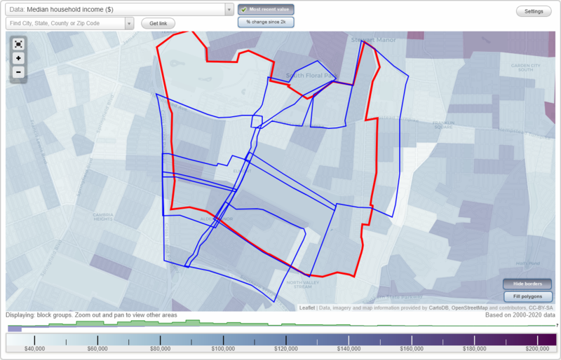
Elmont, New York Neighborhood Map - Income, House Prices, Occupations, Boundaries
Settings
X

- City boundary
- Neighborhood boundaries
Business Search - 14 Million verified businesses
Neighborhoods:
Alden Manor, Argo Village, East Elmont, Floral Park Crest, Jamaica Square, Locustwood Gotham, Parkhurst, Tudor ManorAlden Manor neighborhood in Elmont statistics: (Find on map)
Area: 0.417 square miles
Population: 5,274
Population density:
Median household income in 2021:
Median rent in in 2021:
Male vs Females
Median age
Average estimated value of detached houses in 2021 (96.7% of all units):
Most popular occupations of males: sales and office occupations (21.6%); service occupations (17.1%); construction, extraction, and maintenance occupations (12.2%); healthcare practitioners and technical occupations (8.9%); transportation occupations (8.3%); material moving occupations (8.0%); computer and mathematical occupations (5.0%)
Most popular occupations of females: healthcare practitioners and technical occupations (25.5%); sales and office occupations (25.5%); service occupations (15.7%); education, training, and library occupations (10.4%); management occupations (except farmers) (8.2%); production occupations (4.6%); community and social services occupations (3.6%)
Roads and streets: Elmont Rd; Baylis Ave; Renfrew Ave; Dutch Broadway; Parkway Dr; 238th St; 237th St; Leighton Rd; 240th St; 116th Ave; 116th Rd; Linden Blvd; Kirkby Rd; Goodwin Rd; Parkhurst Rd; Ridge Rd; 115th Ter; Bieling Rd; 117th Ave; 239th St; Croydon Rd; 117th Rd; Oakwood Pl; 115th Rd; 118th Ave; Conway Rd; Beiling Rd; Astor St; Keswick Rd; Froelich Pl; Rye St; Stanwich Pl; 1st St; Vista Pl.
Other features: Hook Crk.
Roads and streets: Cross Island Pkwy (Cross Island Pkwy Svc Rd); 115th Ave; Linden Blvd; X Isle Parkway Entrance Naval Base.
Alden Manor neighborhood detailed profile
Area: 0.417 square miles
Population: 5,274
Population density:
| Alden Manor: | 12,660 people per square mile |
| Elmont: | 10,789 people per square mile |
Median household income in 2021:
| Alden Manor: | $129,163 |
| Elmont: | $104,539 |
Median rent in in 2021:
| Alden Manor: | $1,448 |
| Elmont: | $1,897 |
Male vs Females
| Males: | 2,694 |
| Females: | 2,579 |
Median age
| Males: | 39.6 years |
| Females: | 45.9 years |
Average estimated value of detached houses in 2021 (96.7% of all units):
| Alden Manor: | $436,485 |
| New York: | $441,759 |
Most popular occupations of males: sales and office occupations (21.6%); service occupations (17.1%); construction, extraction, and maintenance occupations (12.2%); healthcare practitioners and technical occupations (8.9%); transportation occupations (8.3%); material moving occupations (8.0%); computer and mathematical occupations (5.0%)
Most popular occupations of females: healthcare practitioners and technical occupations (25.5%); sales and office occupations (25.5%); service occupations (15.7%); education, training, and library occupations (10.4%); management occupations (except farmers) (8.2%); production occupations (4.6%); community and social services occupations (3.6%)
Roads and streets: Elmont Rd; Baylis Ave; Renfrew Ave; Dutch Broadway; Parkway Dr; 238th St; 237th St; Leighton Rd; 240th St; 116th Ave; 116th Rd; Linden Blvd; Kirkby Rd; Goodwin Rd; Parkhurst Rd; Ridge Rd; 115th Ter; Bieling Rd; 117th Ave; 239th St; Croydon Rd; 117th Rd; Oakwood Pl; 115th Rd; 118th Ave; Conway Rd; Beiling Rd; Astor St; Keswick Rd; Froelich Pl; Rye St; Stanwich Pl; 1st St; Vista Pl.
Other features: Hook Crk.
Roads and streets: Cross Island Pkwy (Cross Island Pkwy Svc Rd); 115th Ave; Linden Blvd; X Isle Parkway Entrance Naval Base.
Alden Manor neighborhood detailed profile
Argo Village neighborhood in Elmont statistics: (Find on map)
Area: 0.746 square miles
Population: 6,927
Population density:
Median household income in 2021:
Median rent in in 2021:
Male vs Females
Median age
Housing prices:
Average estimated value of detached houses in 2021 (83.5% of all units):
Average estimated value of townhouses or other attached units in 2021 (5.4% of all units):
Average estimated value of housing units in 2-unit structures in 2021 (7.8% of all units):
Most popular occupations of males: sales and office occupations (17.9%); transportation occupations (16.3%); service occupations (14.3%); construction, extraction, and maintenance occupations (8.2%); healthcare practitioners and technical occupations (6.7%); production occupations (6.3%); management occupations (except farmers) (5.8%)
Most popular occupations of females: sales and office occupations (25.2%); service occupations (21.7%); healthcare practitioners and technical occupations (12.9%); education, training, and library occupations (9.8%); management occupations (except farmers) (9.6%); transportation occupations (4.7%); production occupations (4.1%)
Roads and streets: Dutch Broadway; Norfeld Blvd; Village Ave; Emily Ave; Fallon Ave; Miriam Pkwy; Elmont Rd; Russell Ave; Opal St; Barbara St; Silver St; Queens Ave; Nassau St; Dauntless Pkwy; Empire St; Miriam Ct; Diamond St; Ruby St; S King St; Lydia Ave; Woodstock St; Garnet Pl; Bauer St; Madison St; Demille Ave; Cerenzia Blvd; Lenox St; Diane St; Crystal St; Martha St; Stuyvesant St; Jackson Ave; Harriet St; Bauer Ct; Monoco Ave; Roy St; Amethyst St; N King St; Keegan St; Monaco Ave; Valmont Pl; Sylvan Ct; King St; Flint Pl; Gene Ln; Norma St; Lucille Ct; Fallon Ct; Cathy Ct; N King Ct.
Argo Village neighborhood detailed profile
Area: 0.746 square miles
Population: 6,927
Population density:
| Argo Village: | 9,281 people per square mile |
| Elmont: | 10,789 people per square mile |
Median household income in 2021:
| Argo Village: | $119,727 |
| Elmont: | $104,539 |
Median rent in in 2021:
| Argo Village: | $1,767 |
| Elmont: | $1,897 |
Male vs Females
| Males: | 3,252 |
| Females: | 3,675 |
Median age
| Males: | 36.9 years |
| Females: | 43.2 years |
Housing prices:
Average estimated value of detached houses in 2021 (83.5% of all units):
| Argo Village: | $436,683 |
| New York: | $441,759 |
Average estimated value of townhouses or other attached units in 2021 (5.4% of all units):
| This neighborhood: | $396,038 |
| New York: | $658,853 |
Average estimated value of housing units in 2-unit structures in 2021 (7.8% of all units):
| This neighborhood: | $670,833 |
| New York: | $655,904 |
Most popular occupations of males: sales and office occupations (17.9%); transportation occupations (16.3%); service occupations (14.3%); construction, extraction, and maintenance occupations (8.2%); healthcare practitioners and technical occupations (6.7%); production occupations (6.3%); management occupations (except farmers) (5.8%)
Most popular occupations of females: sales and office occupations (25.2%); service occupations (21.7%); healthcare practitioners and technical occupations (12.9%); education, training, and library occupations (9.8%); management occupations (except farmers) (9.6%); transportation occupations (4.7%); production occupations (4.1%)
Roads and streets: Dutch Broadway; Norfeld Blvd; Village Ave; Emily Ave; Fallon Ave; Miriam Pkwy; Elmont Rd; Russell Ave; Opal St; Barbara St; Silver St; Queens Ave; Nassau St; Dauntless Pkwy; Empire St; Miriam Ct; Diamond St; Ruby St; S King St; Lydia Ave; Woodstock St; Garnet Pl; Bauer St; Madison St; Demille Ave; Cerenzia Blvd; Lenox St; Diane St; Crystal St; Martha St; Stuyvesant St; Jackson Ave; Harriet St; Bauer Ct; Monoco Ave; Roy St; Amethyst St; N King St; Keegan St; Monaco Ave; Valmont Pl; Sylvan Ct; King St; Flint Pl; Gene Ln; Norma St; Lucille Ct; Fallon Ct; Cathy Ct; N King Ct.
Argo Village neighborhood detailed profile
East Elmont neighborhood in Elmont statistics: (Find on map)
Area: 1.528 square miles
Population: 21,242
Population density:
Median household income in 2021:
Median rent in in 2021:
Male vs Females
Median age
Housing prices:
Average estimated value of detached houses in 2021 (75.1% of all units):
Average estimated value of townhouses or other attached units in 2021 (5.0% of all units):
Average estimated value of housing units in 2-unit structures in 2021 (23.8% of all units):
Average estimated '21 value of housing units in 5-or-more-unit structures (3.2% of all units):
Most popular occupations of males: sales and office occupations (19.4%); service occupations (17.3%); construction, extraction, and maintenance occupations (13.6%); transportation occupations (10.3%); management occupations (except farmers) (8.5%); material moving occupations (4.6%); business and financial operations occupations (4.2%)
Most popular occupations of females: sales and office occupations (24.4%); service occupations (22.0%); healthcare practitioners and technical occupations (16.0%); education, training, and library occupations (9.0%); business and financial operations occupations (6.3%); management occupations (except farmers) (4.4%); transportation occupations (4.1%)
Highways in this neighborhood: State Hwy 24 (Hempstead Tpke).
Roads and streets: Lucille Ave; Clement Ave; Litchfield Ave; Evans Ave; Meacham Ave; Doris Ave; Oakley Ave; Atherton Ave; Hunnewell Ave; Covert Ave; Kiefer Ave; Madison St; Rosser Ave; Hill Ave; Doherty Ave; Tulip Ave; Lehrer Ave; Benson Ave; Marshall St; Sweetman Ave; Franklin St; Adams St; Jacob St; Stone St; Belmont Blvd; Clay St; Crest Ave; Stewart St; Crown Ave; Makofske Ave; Surprise St; Lincoln St; Johnson Ave; Estelle Ave; Randall Ave; Butler Blvd; Arthur Ave; Rosalind Ave; Travis Ave; Landau Ave; Farnum Blvd; Schenck Blvd; Hancock St; Kirkman Ave; Keller Ave; Langdon St; Theodora St; Drew Ave; Averill Blvd; Russell St; Emporia Ave; Bedford Ave; Sewanee Ave; Eweler Ave; E Terrace Ave (Terrace Ave); Hillsboro Ave; Rockmart Ave; New York Ave; Bruce St; Arlington Ave; Burton Ave; Barrymore Blvd; A St; Elmont Rd; James St; Star Ave; Scimitar Ave; News Ave; Standard Ave; Jefferson St; Webster St; Gilmore Blvd; Raff Ave; Harrison St; Virginia Dr; Monroe St; Lesoir Ave; Herald Ave; S Covert Ave; Argo Ave; School Rd; Sun Ave; Steele St; Francis Ct; Remsen St; Cross St; Gordon Blvd; Clinton St; Grand St; Tribune Ave; Depaul St; Appeal Ave; Times Ave; Reed Ave; School Pl; Mc Clure Ave; Whiteside Ave; Blossom St; Globe Ave; Citizen Ave; Crowell St; World Ave; Court St; Telegram Ave; Post Ave; Union Ave; Robert Ave; Eagle Ave; American Ave; Journal Ave; Collier Ave; Fairfax St; John Ave; Tarboro St; Chowan St; Werns Pl; Omega St; Alpha St; Woolworth St; Nelson St; Selma Pl; Healy St; Clarke St; Ludlam Pl; Martha Pl; Emma Pl; Marguerite Ave; Malta St; Melrose St; Praver Pl; Elliot St; Argyle Rd; Fox St; Brunswick Pl; Dover St; Charlotte Ct; Westgate; Chelsea St; Press St; Eureka Ave.
East Elmont neighborhood detailed profile
Area: 1.528 square miles
Population: 21,242
Population density:
| East Elmont (East End): | 13,901 people per square mile |
| Elmont: | 10,789 people per square mile |
Median household income in 2021:
| East Elmont (East End): | $111,172 |
| Elmont: | $104,539 |
Median rent in in 2021:
| East Elmont (East End): | $1,817 |
| Elmont: | $1,897 |
Male vs Females
| Males: | 10,540 |
| Females: | 10,702 |
Median age
| Males: | 40.1 years |
| Females: | 42.8 years |
Housing prices:
Average estimated value of detached houses in 2021 (75.1% of all units):
| East Elmont (East End): | $416,777 |
| New York: | $441,759 |
Average estimated value of townhouses or other attached units in 2021 (5.0% of all units):
| This neighborhood: | $48,157 |
| New York: | $658,853 |
Average estimated value of housing units in 2-unit structures in 2021 (23.8% of all units):
| This neighborhood: | $422,817 |
| New York: | $655,904 |
Average estimated '21 value of housing units in 5-or-more-unit structures (3.2% of all units):
| East Elmont (East End): | $233,071 |
| New York: | $784,206 |
Most popular occupations of males: sales and office occupations (19.4%); service occupations (17.3%); construction, extraction, and maintenance occupations (13.6%); transportation occupations (10.3%); management occupations (except farmers) (8.5%); material moving occupations (4.6%); business and financial operations occupations (4.2%)
Most popular occupations of females: sales and office occupations (24.4%); service occupations (22.0%); healthcare practitioners and technical occupations (16.0%); education, training, and library occupations (9.0%); business and financial operations occupations (6.3%); management occupations (except farmers) (4.4%); transportation occupations (4.1%)
Highways in this neighborhood: State Hwy 24 (Hempstead Tpke).
Roads and streets: Lucille Ave; Clement Ave; Litchfield Ave; Evans Ave; Meacham Ave; Doris Ave; Oakley Ave; Atherton Ave; Hunnewell Ave; Covert Ave; Kiefer Ave; Madison St; Rosser Ave; Hill Ave; Doherty Ave; Tulip Ave; Lehrer Ave; Benson Ave; Marshall St; Sweetman Ave; Franklin St; Adams St; Jacob St; Stone St; Belmont Blvd; Clay St; Crest Ave; Stewart St; Crown Ave; Makofske Ave; Surprise St; Lincoln St; Johnson Ave; Estelle Ave; Randall Ave; Butler Blvd; Arthur Ave; Rosalind Ave; Travis Ave; Landau Ave; Farnum Blvd; Schenck Blvd; Hancock St; Kirkman Ave; Keller Ave; Langdon St; Theodora St; Drew Ave; Averill Blvd; Russell St; Emporia Ave; Bedford Ave; Sewanee Ave; Eweler Ave; E Terrace Ave (Terrace Ave); Hillsboro Ave; Rockmart Ave; New York Ave; Bruce St; Arlington Ave; Burton Ave; Barrymore Blvd; A St; Elmont Rd; James St; Star Ave; Scimitar Ave; News Ave; Standard Ave; Jefferson St; Webster St; Gilmore Blvd; Raff Ave; Harrison St; Virginia Dr; Monroe St; Lesoir Ave; Herald Ave; S Covert Ave; Argo Ave; School Rd; Sun Ave; Steele St; Francis Ct; Remsen St; Cross St; Gordon Blvd; Clinton St; Grand St; Tribune Ave; Depaul St; Appeal Ave; Times Ave; Reed Ave; School Pl; Mc Clure Ave; Whiteside Ave; Blossom St; Globe Ave; Citizen Ave; Crowell St; World Ave; Court St; Telegram Ave; Post Ave; Union Ave; Robert Ave; Eagle Ave; American Ave; Journal Ave; Collier Ave; Fairfax St; John Ave; Tarboro St; Chowan St; Werns Pl; Omega St; Alpha St; Woolworth St; Nelson St; Selma Pl; Healy St; Clarke St; Ludlam Pl; Martha Pl; Emma Pl; Marguerite Ave; Malta St; Melrose St; Praver Pl; Elliot St; Argyle Rd; Fox St; Brunswick Pl; Dover St; Charlotte Ct; Westgate; Chelsea St; Press St; Eureka Ave.
East Elmont neighborhood detailed profile
Floral Park Crest neighborhood in Elmont statistics: (Find on map)
Area: 0.138 square miles
Population: 1,038
Population density:
Median household income in 2021:
Median rent in in 2021:
Male vs Females
Median age
Housing prices:
Average estimated value of detached houses in 2021 (93.6% of all units):
Average estimated value of housing units in 2-unit structures in 2021 (22.9% of all units):
Most popular occupations of males: sales and office occupations (39.5%); construction, extraction, and maintenance occupations (12.0%); transportation occupations (10.7%); management occupations (except farmers) (9.5%); education, training, and library occupations (5.5%); service occupations (5.0%); computer and mathematical occupations (3.5%)
Most popular occupations of females: sales and office occupations (37.1%); healthcare practitioners and technical occupations (19.1%); service occupations (10.9%); community and social services occupations (8.9%); business and financial operations occupations (7.8%); material moving occupations (6.3%); management occupations (except farmers) (4.0%)
Highways in this neighborhood: State Hwy 24 (Hempstead Tpke).
Roads and streets: Landau Ave; Marshall St; Adams St; Madison St; Virginia Dr; Argo Ave; Raff Ave; Francis Ct; Clay St; Cross St; Depaul St; Robert Ave; John Ave; Hancock St; Westgate.
Floral Park Crest neighborhood detailed profile
Area: 0.138 square miles
Population: 1,038
Population density:
| Floral Park Crest (Floral Park): | 7,496 people per square mile |
| Elmont: | 10,789 people per square mile |
Median household income in 2021:
| Floral Park Crest (Floral Park): | $121,842 |
| Elmont: | $104,539 |
Median rent in in 2021:
| Floral Park Crest (Floral Park): | $1,767 |
| Elmont: | $1,897 |
Male vs Females
| Males: | 527 |
| Females: | 511 |
Median age
| Males: | 42.4 years |
| Females: | 44.4 years |
Housing prices:
Average estimated value of detached houses in 2021 (93.6% of all units):
| Floral Park Crest (Floral Park): | $422,309 |
| New York: | $441,759 |
Average estimated value of housing units in 2-unit structures in 2021 (22.9% of all units):
| This neighborhood: | $467,857 |
| New York: | $655,904 |
Most popular occupations of males: sales and office occupations (39.5%); construction, extraction, and maintenance occupations (12.0%); transportation occupations (10.7%); management occupations (except farmers) (9.5%); education, training, and library occupations (5.5%); service occupations (5.0%); computer and mathematical occupations (3.5%)
Most popular occupations of females: sales and office occupations (37.1%); healthcare practitioners and technical occupations (19.1%); service occupations (10.9%); community and social services occupations (8.9%); business and financial operations occupations (7.8%); material moving occupations (6.3%); management occupations (except farmers) (4.0%)
Highways in this neighborhood: State Hwy 24 (Hempstead Tpke).
Roads and streets: Landau Ave; Marshall St; Adams St; Madison St; Virginia Dr; Argo Ave; Raff Ave; Francis Ct; Clay St; Cross St; Depaul St; Robert Ave; John Ave; Hancock St; Westgate.
Floral Park Crest neighborhood detailed profile
Jamaica Square neighborhood in Elmont statistics: (Find on map)
Area: 0.269 square miles
Population: 2,776
Population density:
Median household income in 2021:
Median rent in in 2021:
Male vs Females
Median age
Housing prices:
Average estimated value of detached houses in 2021 (86.0% of all units):
Average estimated value of townhouses or other attached units in 2021 (1.2% of all units):
Average estimated value of housing units in 2-unit structures in 2021 (10.6% of all units):
Most popular occupations of males: sales and office occupations (25.1%); transportation occupations (12.8%); construction, extraction, and maintenance occupations (11.3%); service occupations (10.6%); management occupations (except farmers) (7.6%); business and financial operations occupations (6.0%); material moving occupations (4.5%)
Most popular occupations of females: sales and office occupations (27.3%); service occupations (22.6%); healthcare practitioners and technical occupations (16.3%); management occupations (except farmers) (8.8%); business and financial operations occupations (6.3%); community and social services occupations (6.3%); education, training, and library occupations (4.8%)
Highways in this neighborhood: State Hwy 24 (Hempstead Tpke).
Roads and streets: Roquette Ave; Louis Ave; Marguerite Ave; Frederick Ave; Makofske Ave; Chelsea St; Kingston Ave; Arthur Ave; Hendrickson Ave; Pelham St; Carnegie Ave; Tennessee St; Emma St; Bertha St; Vanderwater Ave; Elmont Rd; Herbert Ave; School Rd; Hoeffner Ave; Memphis Ave; Arcade Pl; Star St; Burtis Pl; Press St; Webster St.
Jamaica Square neighborhood detailed profile
Area: 0.269 square miles
Population: 2,776
Population density:
| Jamaica Square: | 10,324 people per square mile |
| Elmont: | 10,789 people per square mile |
Median household income in 2021:
| Jamaica Square: | $110,287 |
| Elmont: | $104,539 |
Median rent in in 2021:
| Jamaica Square: | $1,668 |
| Elmont: | $1,897 |
Male vs Females
| Males: | 1,378 |
| Females: | 1,397 |
Median age
| Males: | 40.9 years |
| Females: | 42.4 years |
Housing prices:
Average estimated value of detached houses in 2021 (86.0% of all units):
| Jamaica Square: | $594,941 |
| New York: | $441,759 |
Average estimated value of townhouses or other attached units in 2021 (1.2% of all units):
| This neighborhood: | $416,667 |
| New York: | $658,853 |
Average estimated value of housing units in 2-unit structures in 2021 (10.6% of all units):
| This neighborhood: | $382,678 |
| New York: | $655,904 |
Most popular occupations of males: sales and office occupations (25.1%); transportation occupations (12.8%); construction, extraction, and maintenance occupations (11.3%); service occupations (10.6%); management occupations (except farmers) (7.6%); business and financial operations occupations (6.0%); material moving occupations (4.5%)
Most popular occupations of females: sales and office occupations (27.3%); service occupations (22.6%); healthcare practitioners and technical occupations (16.3%); management occupations (except farmers) (8.8%); business and financial operations occupations (6.3%); community and social services occupations (6.3%); education, training, and library occupations (4.8%)
Highways in this neighborhood: State Hwy 24 (Hempstead Tpke).
Roads and streets: Roquette Ave; Louis Ave; Marguerite Ave; Frederick Ave; Makofske Ave; Chelsea St; Kingston Ave; Arthur Ave; Hendrickson Ave; Pelham St; Carnegie Ave; Tennessee St; Emma St; Bertha St; Vanderwater Ave; Elmont Rd; Herbert Ave; School Rd; Hoeffner Ave; Memphis Ave; Arcade Pl; Star St; Burtis Pl; Press St; Webster St.
Jamaica Square neighborhood detailed profile
Locustwood Gotham neighborhood in Elmont statistics: (Find on map)
Area: 0.618 square miles
Population: 10,375
Population density:
Median household income in 2021:
Median rent in in 2021:
Male vs Females
Median age
Housing prices:
Average estimated value of detached houses in 2021 (84.4% of all units):
Average estimated value of townhouses or other attached units in 2021 (4.7% of all units):
Average estimated value of housing units in 2-unit structures in 2021 (7.3% of all units):
Most popular occupations of males: service occupations (22.5%); sales and office occupations (14.3%); transportation occupations (11.3%); construction, extraction, and maintenance occupations (9.6%); healthcare practitioners and technical occupations (7.3%); management occupations (except farmers) (6.5%); material moving occupations (5.8%)
Most popular occupations of females: sales and office occupations (26.4%); service occupations (26.3%); healthcare practitioners and technical occupations (20.7%); education, training, and library occupations (6.7%); management occupations (except farmers) (4.9%); community and social services occupations (2.9%); business and financial operations occupations (2.5%)
Highways in this neighborhood: State Hwy 24 (Hempstead Tpke).
Roads and streets: Belmont Ave; Hoffman Ave; Ludlam Ave; Baylis Ave; Elmont Rd; Gotham Ave; Heathcote Rd; Locustwood Blvd; Fieldmere St; Sussex Rd; Sterling Rd; Waldorf Ave; Warwick Rd; 106th Ave; Biltmore Ave; 109th Ave; Wellington Rd; Hathaway Ave; Murray Hill St; Holland Ave; Elzey Ave; Claridge Ave; Blackstone St; Savoy Ave; Joan Ct; Circle Dr E; Essex Rd; W Circle Dr; Peter St; Seville St; 1st St; 2nd St; 3rd St; 4th St; Pine St; Bonta St; N Circle Dr; Oak St; 5th St; Catherine Ct; Marie Ct; Cedar St; Belpark Ave; Huntley Rd; Parkway Dr; Lee Ct; Len Rd.
Other features: Hook Crk.
Limited-access highways (interstate or state) in this neighborhood: Cross Island Pkwy.
Roads and streets: Hempstead Ave; X Isle Parkway Entrance Naval Base; X Isle Parkway Exit Naval Base; 109th Ave.
Locustwood Gotham neighborhood detailed profile
Area: 0.618 square miles
Population: 10,375
Population density:
| Locustwood Gotham (Locustwood): | 16,791 people per square mile |
| Elmont: | 10,789 people per square mile |
Median household income in 2021:
| Locustwood Gotham (Locustwood): | $105,363 |
| Elmont: | $104,539 |
Median rent in in 2021:
| Locustwood Gotham (Locustwood): | $1,769 |
| Elmont: | $1,897 |
Male vs Females
| Males: | 5,178 |
| Females: | 5,197 |
Median age
| Males: | 38.2 years |
| Females: | 41.9 years |
Housing prices:
Average estimated value of detached houses in 2021 (84.4% of all units):
| Locustwood Gotham (Locustwood): | $456,647 |
| New York: | $441,759 |
Average estimated value of townhouses or other attached units in 2021 (4.7% of all units):
| This neighborhood: | $555,501 |
| New York: | $658,853 |
Average estimated value of housing units in 2-unit structures in 2021 (7.3% of all units):
| This neighborhood: | $491,146 |
| New York: | $655,904 |
Most popular occupations of males: service occupations (22.5%); sales and office occupations (14.3%); transportation occupations (11.3%); construction, extraction, and maintenance occupations (9.6%); healthcare practitioners and technical occupations (7.3%); management occupations (except farmers) (6.5%); material moving occupations (5.8%)
Most popular occupations of females: sales and office occupations (26.4%); service occupations (26.3%); healthcare practitioners and technical occupations (20.7%); education, training, and library occupations (6.7%); management occupations (except farmers) (4.9%); community and social services occupations (2.9%); business and financial operations occupations (2.5%)
Highways in this neighborhood: State Hwy 24 (Hempstead Tpke).
Roads and streets: Belmont Ave; Hoffman Ave; Ludlam Ave; Baylis Ave; Elmont Rd; Gotham Ave; Heathcote Rd; Locustwood Blvd; Fieldmere St; Sussex Rd; Sterling Rd; Waldorf Ave; Warwick Rd; 106th Ave; Biltmore Ave; 109th Ave; Wellington Rd; Hathaway Ave; Murray Hill St; Holland Ave; Elzey Ave; Claridge Ave; Blackstone St; Savoy Ave; Joan Ct; Circle Dr E; Essex Rd; W Circle Dr; Peter St; Seville St; 1st St; 2nd St; 3rd St; 4th St; Pine St; Bonta St; N Circle Dr; Oak St; 5th St; Catherine Ct; Marie Ct; Cedar St; Belpark Ave; Huntley Rd; Parkway Dr; Lee Ct; Len Rd.
Other features: Hook Crk.
Limited-access highways (interstate or state) in this neighborhood: Cross Island Pkwy.
Roads and streets: Hempstead Ave; X Isle Parkway Entrance Naval Base; X Isle Parkway Exit Naval Base; 109th Ave.
Locustwood Gotham neighborhood detailed profile
Parkhurst neighborhood in Elmont statistics: (Find on map)
Area: 0.412 square miles
Population: 6,711
Population density:
Median household income in 2021:
Median rent in in 2021:
Male vs Females
Median age
Housing prices:
Average estimated value of detached houses in 2021 (89.0% of all units):
Average estimated value of townhouses or other attached units in 2021 (4.7% of all units):
Average estimated value of housing units in 2-unit structures in 2021 (5.6% of all units):
Most popular occupations of males: service occupations (20.3%); sales and office occupations (17.4%); transportation occupations (11.6%); construction, extraction, and maintenance occupations (9.6%); material moving occupations (8.3%); healthcare practitioners and technical occupations (7.5%); management occupations (except farmers) (5.5%)
Most popular occupations of females: healthcare practitioners and technical occupations (24.9%); sales and office occupations (24.9%); service occupations (20.1%); management occupations (except farmers) (8.5%); education, training, and library occupations (7.7%); community and social services occupations (3.9%); business and financial operations occupations (3.1%)
Roads and streets: Belmont Ave; Hoffman Ave; Ludlam Ave; Baylis Ave; Renfrew Ave; Dutch Broadway; Elmont Rd; Hathaway Ave; Leighton Rd; Parkway Dr; Kirkby Rd; Goodwin Rd; Parkhurst Rd; Ridge Rd; Bieling Rd; 1st St; Circle Dr E; Croydon Rd; W Circle Dr; Peter St; 2nd St; 3rd St; 4th St; 115th Rd; Conway Rd; 237th St; Bonta St; N Circle Dr; 5th St; Catherine Ct; 238th St; Marie Ct; Beiling Rd; Astor St; Keswick Rd; Froelich Pl; Rye St; Stanwich Pl; Gotham Ave; Vista Pl; Fieldmere St; Len Rd.
Other features: Hook Crk.
Limited-access highways (interstate or state) in this neighborhood: Cross Island Pkwy.
Roads and streets: 115th Ave.
Parkhurst neighborhood detailed profile
Area: 0.412 square miles
Population: 6,711
Population density:
| Parkhurst: | 16,306 people per square mile |
| Elmont: | 10,789 people per square mile |
Median household income in 2021:
| Parkhurst: | $114,057 |
| Elmont: | $104,539 |
Median rent in in 2021:
| Parkhurst: | $1,767 |
| Elmont: | $1,897 |
Male vs Females
| Males: | 3,319 |
| Females: | 3,392 |
Median age
| Males: | 37.1 years |
| Females: | 45.4 years |
Housing prices:
Average estimated value of detached houses in 2021 (89.0% of all units):
| Parkhurst: | $441,337 |
| New York: | $441,759 |
Average estimated value of townhouses or other attached units in 2021 (4.7% of all units):
| This neighborhood: | $416,667 |
| New York: | $658,853 |
Average estimated value of housing units in 2-unit structures in 2021 (5.6% of all units):
| This neighborhood: | $670,833 |
| New York: | $655,904 |
Most popular occupations of males: service occupations (20.3%); sales and office occupations (17.4%); transportation occupations (11.6%); construction, extraction, and maintenance occupations (9.6%); material moving occupations (8.3%); healthcare practitioners and technical occupations (7.5%); management occupations (except farmers) (5.5%)
Most popular occupations of females: healthcare practitioners and technical occupations (24.9%); sales and office occupations (24.9%); service occupations (20.1%); management occupations (except farmers) (8.5%); education, training, and library occupations (7.7%); community and social services occupations (3.9%); business and financial operations occupations (3.1%)
Roads and streets: Belmont Ave; Hoffman Ave; Ludlam Ave; Baylis Ave; Renfrew Ave; Dutch Broadway; Elmont Rd; Hathaway Ave; Leighton Rd; Parkway Dr; Kirkby Rd; Goodwin Rd; Parkhurst Rd; Ridge Rd; Bieling Rd; 1st St; Circle Dr E; Croydon Rd; W Circle Dr; Peter St; 2nd St; 3rd St; 4th St; 115th Rd; Conway Rd; 237th St; Bonta St; N Circle Dr; 5th St; Catherine Ct; 238th St; Marie Ct; Beiling Rd; Astor St; Keswick Rd; Froelich Pl; Rye St; Stanwich Pl; Gotham Ave; Vista Pl; Fieldmere St; Len Rd.
Other features: Hook Crk.
Limited-access highways (interstate or state) in this neighborhood: Cross Island Pkwy.
Roads and streets: 115th Ave.
Parkhurst neighborhood detailed profile
Tudor Manor neighborhood in Elmont statistics: (Find on map)
Area: 0.619 square miles
Population: 6,955
Population density:
Median household income in 2021:
Median rent in in 2021:
Male vs Females
Median age
Average estimated value of detached houses in 2021 (92.2% of all units):
Most popular occupations of males: sales and office occupations (21.6%); service occupations (14.9%); transportation occupations (13.1%); construction, extraction, and maintenance occupations (10.3%); healthcare practitioners and technical occupations (8.1%); production occupations (5.8%); computer and mathematical occupations (4.4%)
Most popular occupations of females: sales and office occupations (24.3%); healthcare practitioners and technical occupations (21.2%); service occupations (18.0%); management occupations (except farmers) (12.3%); education, training, and library occupations (7.6%); business and financial operations occupations (2.9%); production occupations (2.6%)
Limited-access highways (interstate or state) in this neighborhood: Southern State Pkwy.
Roads and streets: Dutch Broadway; Elmont Rd; Freeman Ave; Village Ave; Greenway Blvd; Emily Ave; Linden Blvd; Virginia Ave; Miriam Pkwy; Byron Ave; Caroline Ave; Opal St; Silver St; Queens Ave; Nassau St; Diamond St; Norfolk Dr W; Cromer Rd W; Newburgh St; Ruby St; Kingston St; S King St; Albany St; Rifton St; Goshen St; Bauer St; Troy St; Stuart Ave; Niagara St; Buffalo St; Diane St; Landford Dr; Norfolk Dr E; Crystal St; Martha St; Parkview Pl; Jackson Ave; Peekskill St; Cromer Rd E; Harriet St; Bauer Ct; Doblin St; Crans St; Monoco Ave; Lorentz St; Keil St; Frick St; Roy St; Empire St; N King St; Keegan St; Monaco Ave; Donald Ct; Wagner St; Utica St; Ely Ct; Rome St; Lenox St; King St; Glafil St; Tudor Cres; Tuxedo Dr; Norma St; Greenway Blvd (Cromer Rd); Williams St; Finn St; Tudor Gate; Elizabeth St; Lucille Ct; Cathy Ct; Ann Ct; N King Ct.
Tudor Manor neighborhood detailed profile
Area: 0.619 square miles
Population: 6,955
Population density:
| Tudor Manor: | 11,238 people per square mile |
| Elmont: | 10,789 people per square mile |
Median household income in 2021:
| Tudor Manor: | $136,609 |
| Elmont: | $104,539 |
Median rent in in 2021:
| Tudor Manor: | $2,008 |
| Elmont: | $1,897 |
Male vs Females
| Males: | 3,407 |
| Females: | 3,547 |
Median age
| Males: | 39.0 years |
| Females: | 46.9 years |
Average estimated value of detached houses in 2021 (92.2% of all units):
| Tudor Manor: | $434,813 |
| New York: | $441,759 |
Most popular occupations of males: sales and office occupations (21.6%); service occupations (14.9%); transportation occupations (13.1%); construction, extraction, and maintenance occupations (10.3%); healthcare practitioners and technical occupations (8.1%); production occupations (5.8%); computer and mathematical occupations (4.4%)
Most popular occupations of females: sales and office occupations (24.3%); healthcare practitioners and technical occupations (21.2%); service occupations (18.0%); management occupations (except farmers) (12.3%); education, training, and library occupations (7.6%); business and financial operations occupations (2.9%); production occupations (2.6%)
Limited-access highways (interstate or state) in this neighborhood: Southern State Pkwy.
Roads and streets: Dutch Broadway; Elmont Rd; Freeman Ave; Village Ave; Greenway Blvd; Emily Ave; Linden Blvd; Virginia Ave; Miriam Pkwy; Byron Ave; Caroline Ave; Opal St; Silver St; Queens Ave; Nassau St; Diamond St; Norfolk Dr W; Cromer Rd W; Newburgh St; Ruby St; Kingston St; S King St; Albany St; Rifton St; Goshen St; Bauer St; Troy St; Stuart Ave; Niagara St; Buffalo St; Diane St; Landford Dr; Norfolk Dr E; Crystal St; Martha St; Parkview Pl; Jackson Ave; Peekskill St; Cromer Rd E; Harriet St; Bauer Ct; Doblin St; Crans St; Monoco Ave; Lorentz St; Keil St; Frick St; Roy St; Empire St; N King St; Keegan St; Monaco Ave; Donald Ct; Wagner St; Utica St; Ely Ct; Rome St; Lenox St; King St; Glafil St; Tudor Cres; Tuxedo Dr; Norma St; Greenway Blvd (Cromer Rd); Williams St; Finn St; Tudor Gate; Elizabeth St; Lucille Ct; Cathy Ct; Ann Ct; N King Ct.
Tudor Manor neighborhood detailed profile