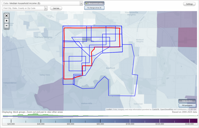
Maple Heights, Ohio Neighborhood Map - Income, House Prices, Occupations, Boundaries
Settings
X

- City boundary
- Neighborhood boundaries
Business Search - 14 Million verified businesses
Neighborhoods:
Bedford, Friend, Indian Village, Libby Road, Maple Heights, Mapleboro, Orchard Villas, Southgate, Walvern SteinBedford neighborhood in Maple Heights statistics: (Find on map)
Area: 7.601 square miles
Population: 19,779
Population density:
Median household income in 2021:
Median rent in in 2021:
Male vs Females
Median age
Housing prices:
Average estimated value of detached houses in 2021 (71.4% of all units):
Average estimated value of townhouses or other attached units in 2021 (2.8% of all units):
Most popular occupations of males: sales and office occupations (23.2%); service occupations (15.3%); production occupations (10.6%); management occupations (except farmers) (9.9%); material moving occupations (9.6%); transportation occupations (7.6%); construction, extraction, and maintenance occupations (4.4%)
Most popular occupations of females: sales and office occupations (35.7%); service occupations (22.5%); healthcare practitioners and technical occupations (7.4%); business and financial operations occupations (7.3%); production occupations (6.7%); education, training, and library occupations (5.9%); management occupations (except farmers) (5.4%)
Limited-access highways (interstate or state) in this neighborhood: Outerbelt East Fwy (I- 271, I- 480); Outerbelt South Fwy (I- 480).
Highways in this neighborhood: State Rte 8 (Northfield Rd); State Rte 14 (Broadway Ave); State Rte 17 (Libby Rd); Aurora Rd (State Rte 43).
Roads and streets: Rockside Rd; Button Rd (W Grace St); Columbus Rd (Columbus St); W Glendale St; Archer Rd; Solon Rd; Center Rd; Union St; Turney Rd; Forbes Rd; Warrensville Center Rd; Bedford Chagrin Pkwy; Raymond St; Grand Blvd; Clare Ave; Wellmon St; Talbot Dr; High St; Taft Ave; Southgate Park Blvd; Paul St; Wandle Ave; Gardenview Dr; Watson Rd; Franklin Rd; Hillgrove Ave; Applegate Rd; Donnybrook Rd; Willard Ave; Watercrest Ave; Egbert Rd; Waterbury Ave; Gould Ave; Mc Kinley Ave; Best St; Willis St; Bartlett Rd; John St; Eldred Ave; Greencroft Rd; Washington St; Hansen Rd; Kenyon Dr; Granite Rd; Palmetto Ave; Henry St; Woodrow Ave; Berwyn Dr; Lincoln Blvd; Ellenwood Ave; Button Rd; Oak Leaf Rd; William St; Prayner Rd; Olde Egbert Rd; Bowling Green Rd; Lori Dr; Santin Cir; Lee Rd; South Blvd; Hazelwood Ave; Kenyon Ave; 1st Pl; Flora Dr; Powers Rd; Avery Ave; Mapledale Ave; Sycamore Dr; Corkhill Rd; Nordham Dr; Avalon Dr; Ennis Ave; Sunnyslope Rd; Forest Dr; Clampher Rd; 1st Ave; Southwick Dr; Bexley Dr; Harriman Ave (Harriman St); Cleveland Metro Pkwy; Westview Rd; Tarbell Ave; Marion Dr; Adams St; Lamson Ave; Justin St; Logan St; Wheelock Dr; W Interstate St; Blaine Ave; Taylor Rd; Pinecrest Dr; Grandmere Dr; Maple Heights Blvd; Johnson Ave; Dalepark Dr; Centuryway Rd; Tudor Ave; Shawnee Ln; Greencliffe Dr; Maria Ave (Maria Dr); Cowles Ave; Natalie Rd; Caryl Dr; Leyton Rd; Charles St; Carlton Dr; Bonnieview Dr; Overlook Pl; Meadowgate Blvd; Broadmore Ave; Thames Ave; Ivanhoe Rd; Belle Ct; Jackson Blvd; Industry Dr; Terrace Dr; Krick Rd; Mountville Dr; E Grace St; Elm St; Salisbury Rd; Cannon Rd; W Monroe Ave; Norton Rd; Helper Dr; Magnolia Ave; East Ct; Flick Dr; Berkshire Ave; Cresswell Ave; Ledgewood Dr; Weber Park Dr; Southview Rd; Kenton Ave; E Taylor St; Noran Cir; Old Rockside; Thomas St; Sector Dr; Dewhurst Ave; Belle Ave; Harrison St; Carlyle Rd; Mortimer Dr; Garden St; Darlington Dr (Darlington Rd); Brune Dr; Deborah Ln; Mapleton Ave; Heather Ln; Holly Rd; Grand Park Cir; Bayberry Ln; Park Pl; Beverly Dr; E Interstate St; Oakwood Ave; Middle St; Edgewood Ave; Leonard Ave; Lee Ct; S Park St; Franklin Ave; Wenso Dr (Wenso Rd); Gilbert Dr; Edgecliff Dr; Lee Rd S; South Cir; E Monroe Ave; N Park Dr; Zingales Blvd (Zingales Dr); Dawson Ct; Whitacre Ct; Beechwood Ave; Bedford Glens Rd; E Glendale St; Mitchell Dr; Raynor Dr; Melba Dr; Washington Ct; Jefferson St; Briar Ln; Daisy Ave; Hawthorne Ave; Regina Dr; Brown Ln; Bluestone Lnae; Roy Ave; Sandalwood Rd; E Taylor Rd; Division St; Freda Ln; Free Ave; Juniper Ct; Vale Dr; Dogwood Dr.
Railroad features: Conrail RR (Norfolk Southern Rlwy); Norfolk and Western Rlwy; Wheeling and Lake RR; Penn Central RR.
Other features: Tinkers Crk.
Bedford neighborhood detailed profile
Area: 7.601 square miles
Population: 19,779
Population density:
| Bedford: | 2,602 people per square mile |
| Maple Heights: | 4,530 people per square mile |
Median household income in 2021:
| Bedford: | $62,213 |
| Maple Heights: | $44,773 |
Median rent in in 2021:
| Bedford: | $817 |
| Maple Heights: | $860 |
Male vs Females
| Males: | 9,808 |
| Females: | 9,971 |
Median age
| Males: | 40.0 years |
| Females: | 46.2 years |
Housing prices:
Average estimated value of detached houses in 2021 (71.4% of all units):
| Bedford: | $90,310 |
| Ohio: | $228,722 |
Average estimated value of townhouses or other attached units in 2021 (2.8% of all units):
| This neighborhood: | $90,286 |
| Ohio: | $203,882 |
Most popular occupations of males: sales and office occupations (23.2%); service occupations (15.3%); production occupations (10.6%); management occupations (except farmers) (9.9%); material moving occupations (9.6%); transportation occupations (7.6%); construction, extraction, and maintenance occupations (4.4%)
Most popular occupations of females: sales and office occupations (35.7%); service occupations (22.5%); healthcare practitioners and technical occupations (7.4%); business and financial operations occupations (7.3%); production occupations (6.7%); education, training, and library occupations (5.9%); management occupations (except farmers) (5.4%)
Limited-access highways (interstate or state) in this neighborhood: Outerbelt East Fwy (I- 271, I- 480); Outerbelt South Fwy (I- 480).
Highways in this neighborhood: State Rte 8 (Northfield Rd); State Rte 14 (Broadway Ave); State Rte 17 (Libby Rd); Aurora Rd (State Rte 43).
Roads and streets: Rockside Rd; Button Rd (W Grace St); Columbus Rd (Columbus St); W Glendale St; Archer Rd; Solon Rd; Center Rd; Union St; Turney Rd; Forbes Rd; Warrensville Center Rd; Bedford Chagrin Pkwy; Raymond St; Grand Blvd; Clare Ave; Wellmon St; Talbot Dr; High St; Taft Ave; Southgate Park Blvd; Paul St; Wandle Ave; Gardenview Dr; Watson Rd; Franklin Rd; Hillgrove Ave; Applegate Rd; Donnybrook Rd; Willard Ave; Watercrest Ave; Egbert Rd; Waterbury Ave; Gould Ave; Mc Kinley Ave; Best St; Willis St; Bartlett Rd; John St; Eldred Ave; Greencroft Rd; Washington St; Hansen Rd; Kenyon Dr; Granite Rd; Palmetto Ave; Henry St; Woodrow Ave; Berwyn Dr; Lincoln Blvd; Ellenwood Ave; Button Rd; Oak Leaf Rd; William St; Prayner Rd; Olde Egbert Rd; Bowling Green Rd; Lori Dr; Santin Cir; Lee Rd; South Blvd; Hazelwood Ave; Kenyon Ave; 1st Pl; Flora Dr; Powers Rd; Avery Ave; Mapledale Ave; Sycamore Dr; Corkhill Rd; Nordham Dr; Avalon Dr; Ennis Ave; Sunnyslope Rd; Forest Dr; Clampher Rd; 1st Ave; Southwick Dr; Bexley Dr; Harriman Ave (Harriman St); Cleveland Metro Pkwy; Westview Rd; Tarbell Ave; Marion Dr; Adams St; Lamson Ave; Justin St; Logan St; Wheelock Dr; W Interstate St; Blaine Ave; Taylor Rd; Pinecrest Dr; Grandmere Dr; Maple Heights Blvd; Johnson Ave; Dalepark Dr; Centuryway Rd; Tudor Ave; Shawnee Ln; Greencliffe Dr; Maria Ave (Maria Dr); Cowles Ave; Natalie Rd; Caryl Dr; Leyton Rd; Charles St; Carlton Dr; Bonnieview Dr; Overlook Pl; Meadowgate Blvd; Broadmore Ave; Thames Ave; Ivanhoe Rd; Belle Ct; Jackson Blvd; Industry Dr; Terrace Dr; Krick Rd; Mountville Dr; E Grace St; Elm St; Salisbury Rd; Cannon Rd; W Monroe Ave; Norton Rd; Helper Dr; Magnolia Ave; East Ct; Flick Dr; Berkshire Ave; Cresswell Ave; Ledgewood Dr; Weber Park Dr; Southview Rd; Kenton Ave; E Taylor St; Noran Cir; Old Rockside; Thomas St; Sector Dr; Dewhurst Ave; Belle Ave; Harrison St; Carlyle Rd; Mortimer Dr; Garden St; Darlington Dr (Darlington Rd); Brune Dr; Deborah Ln; Mapleton Ave; Heather Ln; Holly Rd; Grand Park Cir; Bayberry Ln; Park Pl; Beverly Dr; E Interstate St; Oakwood Ave; Middle St; Edgewood Ave; Leonard Ave; Lee Ct; S Park St; Franklin Ave; Wenso Dr (Wenso Rd); Gilbert Dr; Edgecliff Dr; Lee Rd S; South Cir; E Monroe Ave; N Park Dr; Zingales Blvd (Zingales Dr); Dawson Ct; Whitacre Ct; Beechwood Ave; Bedford Glens Rd; E Glendale St; Mitchell Dr; Raynor Dr; Melba Dr; Washington Ct; Jefferson St; Briar Ln; Daisy Ave; Hawthorne Ave; Regina Dr; Brown Ln; Bluestone Lnae; Roy Ave; Sandalwood Rd; E Taylor Rd; Division St; Freda Ln; Free Ave; Juniper Ct; Vale Dr; Dogwood Dr.
Railroad features: Conrail RR (Norfolk Southern Rlwy); Norfolk and Western Rlwy; Wheeling and Lake RR; Penn Central RR.
Other features: Tinkers Crk.
Bedford neighborhood detailed profile
Friend neighborhood in Maple Heights statistics: (Find on map)
Area: 1.037 square miles
Population: 2,723
Population density:
Median household income in 2021:
Median rent in in 2021:
Male vs Females
Median age
Average estimated value of detached houses in 2021 (85.8% of all units):
Most popular occupations of males: service occupations (24.5%); sales and office occupations (16.7%); production occupations (14.1%); material moving occupations (12.1%); transportation occupations (9.6%); business and financial operations occupations (6.4%); arts, design, entertainment, sports, and media occupations (4.2%)
Most popular occupations of females: sales and office occupations (31.2%); service occupations (18.8%); healthcare practitioners and technical occupations (10.3%); legal occupations (7.9%); business and financial operations occupations (7.3%); farming, fishing, and forestry occupations (5.2%); education, training, and library occupations (4.6%)
Limited-access highways (interstate or state) in this neighborhood: Outerbelt South Fwy (I- 480).
Highways in this neighborhood: State Rte 14 (Broadway Ave); State Rte 17 (Granger Rd); State Rte 17 (Libby Rd).
Roads and streets: McCracken Rd; Greenhurst Dr; Raymond St; Lee Rd; Maple Heights Blvd; Friend Ave; Anthony St; Maple Ave; Henry St; Pease Rd; Stanley Ave; Theodore St; Miller Ave; Dunham Rd; Grant Ave; Beech Ave; Forest Ave; Milo Ave; E 141st St; Paine Ave; Glenburn Ave; Meadow St; Kohout St; Charles St; Mapleboro Ave (Mapleboro Rd); West Blvd; Earl Ave; Marion St; E 139th St; Royal St; Vine St; Williams St; Elm Dr (Elm St); Rex St; Otis Pl; Osborn Rd; Evelyn Dr; Williams St (Granger Ct); Library Ln; Bangor Ave.
Railroad features: Norfolk and Western Rlwy; Penn Central RR (Norfolk Southern Rlwy).
Other features: Mill Crk.
Friend neighborhood detailed profile
Area: 1.037 square miles
Population: 2,723
Population density:
| Friend (Greenhurst): | 2,625 people per square mile |
| Maple Heights: | 4,530 people per square mile |
Median household income in 2021:
| Friend (Greenhurst): | $53,283 |
| Maple Heights: | $44,773 |
Median rent in in 2021:
| Friend (Greenhurst): | $851 |
| Maple Heights: | $860 |
Male vs Females
| Males: | 1,507 |
| Females: | 1,216 |
Median age
| Males: | 43.6 years |
| Females: | 49.8 years |
Average estimated value of detached houses in 2021 (85.8% of all units):
| Friend (Greenhurst): | $94,459 |
| Ohio: | $228,722 |
Most popular occupations of males: service occupations (24.5%); sales and office occupations (16.7%); production occupations (14.1%); material moving occupations (12.1%); transportation occupations (9.6%); business and financial operations occupations (6.4%); arts, design, entertainment, sports, and media occupations (4.2%)
Most popular occupations of females: sales and office occupations (31.2%); service occupations (18.8%); healthcare practitioners and technical occupations (10.3%); legal occupations (7.9%); business and financial operations occupations (7.3%); farming, fishing, and forestry occupations (5.2%); education, training, and library occupations (4.6%)
Limited-access highways (interstate or state) in this neighborhood: Outerbelt South Fwy (I- 480).
Highways in this neighborhood: State Rte 14 (Broadway Ave); State Rte 17 (Granger Rd); State Rte 17 (Libby Rd).
Roads and streets: McCracken Rd; Greenhurst Dr; Raymond St; Lee Rd; Maple Heights Blvd; Friend Ave; Anthony St; Maple Ave; Henry St; Pease Rd; Stanley Ave; Theodore St; Miller Ave; Dunham Rd; Grant Ave; Beech Ave; Forest Ave; Milo Ave; E 141st St; Paine Ave; Glenburn Ave; Meadow St; Kohout St; Charles St; Mapleboro Ave (Mapleboro Rd); West Blvd; Earl Ave; Marion St; E 139th St; Royal St; Vine St; Williams St; Elm Dr (Elm St); Rex St; Otis Pl; Osborn Rd; Evelyn Dr; Williams St (Granger Ct); Library Ln; Bangor Ave.
Railroad features: Norfolk and Western Rlwy; Penn Central RR (Norfolk Southern Rlwy).
Other features: Mill Crk.
Friend neighborhood detailed profile
Indian Village neighborhood in Maple Heights statistics: (Find on map)
Area: 1.063 square miles
Population: 9,749
Population density:
Median household income in 2021:
Median rent in in 2021:
Male vs Females
Median age
Average estimated value of detached houses in 2021 (89.0% of all units):
Most popular occupations of males: sales and office occupations (28.6%); service occupations (18.2%); material moving occupations (11.1%); production occupations (10.6%); business and financial operations occupations (7.9%); management occupations (except farmers) (6.0%); construction, extraction, and maintenance occupations (5.4%)
Most popular occupations of females: service occupations (39.4%); sales and office occupations (29.9%); education, training, and library occupations (8.1%); healthcare practitioners and technical occupations (5.9%); production occupations (4.9%); business and financial operations occupations (3.0%); arts, design, entertainment, sports, and media occupations (2.1%)
Limited-access highways (interstate or state) in this neighborhood: Outerbelt South Fwy (I- 480).
Highways in this neighborhood: State Rte 17 (Libby Rd).
Roads and streets: Raymond St; Maple Heights Blvd; McCracken Rd; Gardenview Dr; Preston Rd; Fairway Ave; Mountville Dr; Clare Ave; Longview Ave; Cato St; Warrensville Center Rd; Stockton Ave; Arch St; Camden Rd; Nitra Ave; Erwin St; Joseph St; Hansen Rd; Watson Rd; Franklin Rd; Hillgrove Ave; Mayville Ave; Clampher Rd; Stafford Ave; Beverly Ave; Kenyon Dr; Harlan Dr; Homewood Ave; Milan Dr; North Blvd; South Blvd; Lewis Dr; Highland Dr; Salisbury Rd; Beechwood Ave; Tatra Ave (Tatra St); Elmwood Ave; Knoll Dr (Knoll Ln); Hollywood Ave; Bellview St; Auburn Ave; Portland Ave.
Indian Village neighborhood detailed profile
Area: 1.063 square miles
Population: 9,749
Population density:
| Indian Village: | 9,172 people per square mile |
| Maple Heights: | 4,530 people per square mile |
Median household income in 2021:
| Indian Village: | $57,064 |
| Maple Heights: | $44,773 |
Median rent in in 2021:
| Indian Village: | $932 |
| Maple Heights: | $860 |
Male vs Females
| Males: | 4,499 |
| Females: | 5,249 |
Median age
| Males: | 38.5 years |
| Females: | 46.0 years |
Average estimated value of detached houses in 2021 (89.0% of all units):
| Indian Village: | $72,839 |
| Ohio: | $228,722 |
Most popular occupations of males: sales and office occupations (28.6%); service occupations (18.2%); material moving occupations (11.1%); production occupations (10.6%); business and financial operations occupations (7.9%); management occupations (except farmers) (6.0%); construction, extraction, and maintenance occupations (5.4%)
Most popular occupations of females: service occupations (39.4%); sales and office occupations (29.9%); education, training, and library occupations (8.1%); healthcare practitioners and technical occupations (5.9%); production occupations (4.9%); business and financial operations occupations (3.0%); arts, design, entertainment, sports, and media occupations (2.1%)
Limited-access highways (interstate or state) in this neighborhood: Outerbelt South Fwy (I- 480).
Highways in this neighborhood: State Rte 17 (Libby Rd).
Roads and streets: Raymond St; Maple Heights Blvd; McCracken Rd; Gardenview Dr; Preston Rd; Fairway Ave; Mountville Dr; Clare Ave; Longview Ave; Cato St; Warrensville Center Rd; Stockton Ave; Arch St; Camden Rd; Nitra Ave; Erwin St; Joseph St; Hansen Rd; Watson Rd; Franklin Rd; Hillgrove Ave; Mayville Ave; Clampher Rd; Stafford Ave; Beverly Ave; Kenyon Dr; Harlan Dr; Homewood Ave; Milan Dr; North Blvd; South Blvd; Lewis Dr; Highland Dr; Salisbury Rd; Beechwood Ave; Tatra Ave (Tatra St); Elmwood Ave; Knoll Dr (Knoll Ln); Hollywood Ave; Bellview St; Auburn Ave; Portland Ave.
Indian Village neighborhood detailed profile
Libby Road neighborhood in Maple Heights statistics: (Find on map)
Area: 3.588 square miles
Population: 21,724
Population density:
Median household income in 2021:
Median rent in in 2021:
Male vs Females
Median age
Average estimated value of detached houses in 2021 (86.4% of all units):
Most popular occupations of males: sales and office occupations (23.0%); service occupations (18.5%); material moving occupations (13.4%); production occupations (9.4%); management occupations (except farmers) (9.1%); business and financial operations occupations (6.5%); transportation occupations (5.9%)
Most popular occupations of females: sales and office occupations (33.1%); service occupations (28.7%); education, training, and library occupations (9.3%); healthcare practitioners and technical occupations (6.0%); production occupations (5.8%); business and financial operations occupations (4.7%); community and social services occupations (2.2%)
Limited-access highways (interstate or state) in this neighborhood: Outerbelt South Fwy (I- 480).
Highways in this neighborhood: State Rte 17 (Libby Rd); State Rte 14 (Broadway Ave); State Rte 17 (Granger Rd); State Rte 8 (Northfield Rd); Aurora Rd (State Rte 43).
Roads and streets: McCracken Rd; Raymond St; Maple Heights Blvd; Gardenview Dr; Greenhurst Dr; Mapleboro Ave (Mapleboro Rd); Warrensville Center Rd; Clement Ave (Clement St); Thomas St; Clare Ave; Lee Rd; Dalewood Ave; Preston Rd; Southgate Park Blvd; Watson Rd; Franklin Rd; Hillgrove Ave; Applegate Rd; Fairway Ave; Donnybrook Rd; Dunham Rd; Watercrest Ave; Mountville Dr; Waterbury Ave; Longview Ave; Cato St; Corridon Ave; Hazelwood Ave; Stockton Ave; Hansen Rd; Kenyon Dr; Arch St; E 141st St; Camden Rd; Nitra Ave; Friend Ave; Beechwood Ave; South Blvd; Anthony St; Elmwood Ave; Hollywood Ave; Edinboro Ave; Prayner Rd; Erwin St; Catherine St; Joseph St; Philip Ave (Philip St); Bowling Green Rd; Maple Ave; Mayville Ave; Henry St; Pease Rd; Grasmere Ave; Stanley Ave; Sunnyslope Rd; Clampher Rd; Oakwood Ave; Industrial Ave S; Theodore St; Miller Ave; Industrial Ave N; Stafford Ave; E 139th St; West Blvd; Jackson Blvd; Beverly Ave; Harlan Dr; Homewood Ave; Industrial Ave; Milan Dr; Centuryway Rd; Garden St; Grant Ave; Home Ave (Home St); North Blvd; Lewis Dr; Highland Dr; Beech Ave; Forest Ave; Milo Ave; Salisbury Rd; Tatra Ave (Tatra St); Paine Ave; Glenburn Ave; Morgan St; Meadow St; Kohout St; Knoll Dr (Knoll Ln); Charles St; Hill St; Holly Rd; Lafayette Ave; Orchard St; Bellview St; Earl Ave; Marion St; Auburn Ave; Royal St; Vine St; Williams St; Berkeley Ave; Elm Dr (Elm St); Rex St; Otis Pl; Osborn Rd; Portland Ave; Evelyn Dr; Williams St (Granger Ct); Roy Ave; Sandalwood Rd; Library Ln; Bangor Ave; Mapleboro Rd; E 146th St.
Railroad features: Norfolk and Western Rlwy; Penn Central RR (Norfolk Southern Rlwy).
Other features: Mill Crk.
Libby Road neighborhood detailed profile
Area: 3.588 square miles
Population: 21,724
Population density:
| Libby Road: | 6,054 people per square mile |
| Maple Heights: | 4,530 people per square mile |
Median household income in 2021:
| Libby Road: | $55,749 |
| Maple Heights: | $44,773 |
Median rent in in 2021:
| Libby Road: | $893 |
| Maple Heights: | $860 |
Male vs Females
| Males: | 10,465 |
| Females: | 11,258 |
Median age
| Males: | 41.2 years |
| Females: | 46.9 years |
Average estimated value of detached houses in 2021 (86.4% of all units):
| Libby Road: | $77,941 |
| Ohio: | $228,722 |
Most popular occupations of males: sales and office occupations (23.0%); service occupations (18.5%); material moving occupations (13.4%); production occupations (9.4%); management occupations (except farmers) (9.1%); business and financial operations occupations (6.5%); transportation occupations (5.9%)
Most popular occupations of females: sales and office occupations (33.1%); service occupations (28.7%); education, training, and library occupations (9.3%); healthcare practitioners and technical occupations (6.0%); production occupations (5.8%); business and financial operations occupations (4.7%); community and social services occupations (2.2%)
Limited-access highways (interstate or state) in this neighborhood: Outerbelt South Fwy (I- 480).
Highways in this neighborhood: State Rte 17 (Libby Rd); State Rte 14 (Broadway Ave); State Rte 17 (Granger Rd); State Rte 8 (Northfield Rd); Aurora Rd (State Rte 43).
Roads and streets: McCracken Rd; Raymond St; Maple Heights Blvd; Gardenview Dr; Greenhurst Dr; Mapleboro Ave (Mapleboro Rd); Warrensville Center Rd; Clement Ave (Clement St); Thomas St; Clare Ave; Lee Rd; Dalewood Ave; Preston Rd; Southgate Park Blvd; Watson Rd; Franklin Rd; Hillgrove Ave; Applegate Rd; Fairway Ave; Donnybrook Rd; Dunham Rd; Watercrest Ave; Mountville Dr; Waterbury Ave; Longview Ave; Cato St; Corridon Ave; Hazelwood Ave; Stockton Ave; Hansen Rd; Kenyon Dr; Arch St; E 141st St; Camden Rd; Nitra Ave; Friend Ave; Beechwood Ave; South Blvd; Anthony St; Elmwood Ave; Hollywood Ave; Edinboro Ave; Prayner Rd; Erwin St; Catherine St; Joseph St; Philip Ave (Philip St); Bowling Green Rd; Maple Ave; Mayville Ave; Henry St; Pease Rd; Grasmere Ave; Stanley Ave; Sunnyslope Rd; Clampher Rd; Oakwood Ave; Industrial Ave S; Theodore St; Miller Ave; Industrial Ave N; Stafford Ave; E 139th St; West Blvd; Jackson Blvd; Beverly Ave; Harlan Dr; Homewood Ave; Industrial Ave; Milan Dr; Centuryway Rd; Garden St; Grant Ave; Home Ave (Home St); North Blvd; Lewis Dr; Highland Dr; Beech Ave; Forest Ave; Milo Ave; Salisbury Rd; Tatra Ave (Tatra St); Paine Ave; Glenburn Ave; Morgan St; Meadow St; Kohout St; Knoll Dr (Knoll Ln); Charles St; Hill St; Holly Rd; Lafayette Ave; Orchard St; Bellview St; Earl Ave; Marion St; Auburn Ave; Royal St; Vine St; Williams St; Berkeley Ave; Elm Dr (Elm St); Rex St; Otis Pl; Osborn Rd; Portland Ave; Evelyn Dr; Williams St (Granger Ct); Roy Ave; Sandalwood Rd; Library Ln; Bangor Ave; Mapleboro Rd; E 146th St.
Railroad features: Norfolk and Western Rlwy; Penn Central RR (Norfolk Southern Rlwy).
Other features: Mill Crk.
Libby Road neighborhood detailed profile
Maple Heights neighborhood in Maple Heights statistics: (Find on map)
Area: 6.808 square miles
Population: 30,755
Population density:
Median household income in 2021:
Median rent in in 2021:
Male vs Females
Median age
Housing prices:
Average estimated value of detached houses in 2021 (82.1% of all units):
Average estimated value of townhouses or other attached units in 2021 (4.1% of all units):
Most popular occupations of males: sales and office occupations (20.6%); service occupations (17.2%); material moving occupations (11.7%); production occupations (11.4%); management occupations (except farmers) (8.6%); transportation occupations (6.8%); business and financial operations occupations (5.7%)
Most popular occupations of females: sales and office occupations (35.9%); service occupations (25.1%); education, training, and library occupations (9.2%); healthcare practitioners and technical occupations (6.4%); production occupations (5.4%); business and financial operations occupations (4.3%); community and social services occupations (3.4%)
Limited-access highways (interstate or state) in this neighborhood: Outerbelt South Fwy (I- 480).
Highways in this neighborhood: State Rte 17 (Libby Rd); State Rte 14 (Broadway Ave); State Rte 17 (Granger Rd); State Rte 8 (Northfield Rd); Aurora Rd (State Rte 43).
Roads and streets: Rockside Rd; McCracken Rd; Raymond St; Maple Heights Blvd; Dunham Rd; Turney Rd; Lee Rd; Gardenview Dr; Glenwood Ave; Greenhurst Dr; Mapleboro Ave (Mapleboro Rd); Thomas St; Warrensville Center Rd; Corkhill Rd; Clement Ave (Clement St); E 141st St; Preston Rd; Ramage Ave; Waterbury Ave; Clare Ave; South Blvd; Dalewood Ave; Lee Rd S; E 146th St; Southgate Park Blvd; Summit Ave; Watson Rd; Schreiber Rd; Franklin Rd; Hillgrove Ave; Applegate Rd; Fairway Ave; Donnybrook Rd; Rochelle Dr; Watercrest Ave; Mountville Dr; Lisa Dr; Maplewood Ave; Edgewood Ave; Janice Dr; Longvale Ave; Rowena Ave; Mendota Ave; Steinway Blvd; James Ave; Walvern Blvd; Shirley Ave; Wheeler Rd; Woodbrook Ave; Reddington Ave; Longview Ave; Brunswick Ave; Tabor Ave; Tokay Ave; Krems Ave; Cato St; Corridon Ave; Greencroft Rd; Pennsylvania Ave; Hazelwood Ave; Stockton Ave; Hansen Rd; Kenyon Dr; Arch St; Granite Rd; Camden Rd; Nitra Ave; Friend Ave; Northwood Ave; E 139th St; Beechwood Ave; Jackson Blvd; Maple Park Dr; Kennerdown Ave; Anthony St; Elmwood Ave; Hollywood Ave; Edinboro Ave; Prayner Rd; Erwin St; Catherine St; Joseph St; Philip Ave (Philip St); Bowling Green Rd; Maple Ave; Mayville Ave; Henry St; Pease Rd; Ryan Dr; E 140th St; Flora Dr; Grasmere Ave; Stanley Ave; Wingate Rd; Sunnyslope Rd; Clampher Rd; Oakwood Ave; Industrial Ave S; Gerard Ave; Fernway Dr; Theodore St; Valley Ranch Dr; Miller Ave; Westview Rd; Industrial Ave N; Florence Dr; Dunbury Dr; Morning Star Ave; Evening Star Ave; Greendale Ave (Greendale Rd); Stafford Ave; Center Rd; Grand Blvd; West Blvd; Beverly Ave; Carol Dr; Harlan Dr; Homewood Ave; Industrial Ave; Benhoff Dr; Milan Dr; Washington Ave; Centuryway Rd; Tudor Ave; Greencliffe Dr; Lafayette Ave; Garden St; Jefferson Ave; Natalie Rd; Grant Ave; Adams Ave; Monica Ln; Garfield Ave; Harrison Ave; Meadowgate Blvd; Thames Ave; Home Ave (Home St); North Blvd; Lewis Dr; Highland Dr; Beech Ave; Forest Ave; Longwood Ave; Milo Ave; Salisbury Rd; Norton Rd; Sterling Ave; Cresswell Ave; Tatra Ave (Tatra St); Southview Rd; Paine Ave; Kenton Ave; Old Rockside; Sector Dr; Dewhurst Ave; Glenburn Ave; Morgan St; Carlyle Rd; Eastwood Ave; Sunny Lane Rd; Brune Dr; Meadow St; Kohout St; Ledgeview Ct; Knoll Dr (Knoll Ln); Charles St; Terrace Dr; Hill St; Holly Rd; Oak Park Blvd; Bayberry Ln; Rockytop Ct; E Glenn Dr; Orchard St; Bellview St; Ridge Peak Ct; Earl Ave; Martin Dr; Marion St; Auburn Ave; Ceile Cir; Thunderbird Dr; Mustang Dr; Royal St; Vine St; Williams St; W Glenn Dr; S Glenn Dr; Berkeley Ave; Lawn Ave; Thraves Ave (Thraves Rd); Elm Dr (Elm St); Palmer Ave; Milo Rd; Ladd Ln; Rex St; Otis Pl; Osborn Rd; Portland Ave; Evelyn Dr; Williams St (Granger Ct); Roy Ave; Sandalwood Rd; Grove Dr; Library Ln; Kenyon Ave; Bangor Ave; Mapleboro Rd.
Railroad features: Norfolk and Western Rlwy; Conrail RR (Norfolk Southern Rlwy); Penn Central RR (Norfolk Southern Rlwy).
Other features: Mill Crk.
Maple Heights neighborhood detailed profile
Area: 6.808 square miles
Population: 30,755
Population density:
| Maple Heights: | 4,517 people per square mile |
| Maple Heights city: | 4,530 people per square mile |
Median household income in 2021:
| Maple Heights: | $65,027 |
| Maple Heights city: | $44,773 |
Median rent in in 2021:
| Maple Heights: | $866 |
| Maple Heights city: | $860 |
Male vs Females
| Males: | 14,662 |
| Females: | 16,092 |
Median age
| Males: | 42.9 years |
| Females: | 49.3 years |
Housing prices:
Average estimated value of detached houses in 2021 (82.1% of all units):
| Maple Heights: | $80,005 |
| Ohio: | $228,722 |
Average estimated value of townhouses or other attached units in 2021 (4.1% of all units):
| This neighborhood: | $53,912 |
| Ohio: | $203,882 |
Most popular occupations of males: sales and office occupations (20.6%); service occupations (17.2%); material moving occupations (11.7%); production occupations (11.4%); management occupations (except farmers) (8.6%); transportation occupations (6.8%); business and financial operations occupations (5.7%)
Most popular occupations of females: sales and office occupations (35.9%); service occupations (25.1%); education, training, and library occupations (9.2%); healthcare practitioners and technical occupations (6.4%); production occupations (5.4%); business and financial operations occupations (4.3%); community and social services occupations (3.4%)
Limited-access highways (interstate or state) in this neighborhood: Outerbelt South Fwy (I- 480).
Highways in this neighborhood: State Rte 17 (Libby Rd); State Rte 14 (Broadway Ave); State Rte 17 (Granger Rd); State Rte 8 (Northfield Rd); Aurora Rd (State Rte 43).
Roads and streets: Rockside Rd; McCracken Rd; Raymond St; Maple Heights Blvd; Dunham Rd; Turney Rd; Lee Rd; Gardenview Dr; Glenwood Ave; Greenhurst Dr; Mapleboro Ave (Mapleboro Rd); Thomas St; Warrensville Center Rd; Corkhill Rd; Clement Ave (Clement St); E 141st St; Preston Rd; Ramage Ave; Waterbury Ave; Clare Ave; South Blvd; Dalewood Ave; Lee Rd S; E 146th St; Southgate Park Blvd; Summit Ave; Watson Rd; Schreiber Rd; Franklin Rd; Hillgrove Ave; Applegate Rd; Fairway Ave; Donnybrook Rd; Rochelle Dr; Watercrest Ave; Mountville Dr; Lisa Dr; Maplewood Ave; Edgewood Ave; Janice Dr; Longvale Ave; Rowena Ave; Mendota Ave; Steinway Blvd; James Ave; Walvern Blvd; Shirley Ave; Wheeler Rd; Woodbrook Ave; Reddington Ave; Longview Ave; Brunswick Ave; Tabor Ave; Tokay Ave; Krems Ave; Cato St; Corridon Ave; Greencroft Rd; Pennsylvania Ave; Hazelwood Ave; Stockton Ave; Hansen Rd; Kenyon Dr; Arch St; Granite Rd; Camden Rd; Nitra Ave; Friend Ave; Northwood Ave; E 139th St; Beechwood Ave; Jackson Blvd; Maple Park Dr; Kennerdown Ave; Anthony St; Elmwood Ave; Hollywood Ave; Edinboro Ave; Prayner Rd; Erwin St; Catherine St; Joseph St; Philip Ave (Philip St); Bowling Green Rd; Maple Ave; Mayville Ave; Henry St; Pease Rd; Ryan Dr; E 140th St; Flora Dr; Grasmere Ave; Stanley Ave; Wingate Rd; Sunnyslope Rd; Clampher Rd; Oakwood Ave; Industrial Ave S; Gerard Ave; Fernway Dr; Theodore St; Valley Ranch Dr; Miller Ave; Westview Rd; Industrial Ave N; Florence Dr; Dunbury Dr; Morning Star Ave; Evening Star Ave; Greendale Ave (Greendale Rd); Stafford Ave; Center Rd; Grand Blvd; West Blvd; Beverly Ave; Carol Dr; Harlan Dr; Homewood Ave; Industrial Ave; Benhoff Dr; Milan Dr; Washington Ave; Centuryway Rd; Tudor Ave; Greencliffe Dr; Lafayette Ave; Garden St; Jefferson Ave; Natalie Rd; Grant Ave; Adams Ave; Monica Ln; Garfield Ave; Harrison Ave; Meadowgate Blvd; Thames Ave; Home Ave (Home St); North Blvd; Lewis Dr; Highland Dr; Beech Ave; Forest Ave; Longwood Ave; Milo Ave; Salisbury Rd; Norton Rd; Sterling Ave; Cresswell Ave; Tatra Ave (Tatra St); Southview Rd; Paine Ave; Kenton Ave; Old Rockside; Sector Dr; Dewhurst Ave; Glenburn Ave; Morgan St; Carlyle Rd; Eastwood Ave; Sunny Lane Rd; Brune Dr; Meadow St; Kohout St; Ledgeview Ct; Knoll Dr (Knoll Ln); Charles St; Terrace Dr; Hill St; Holly Rd; Oak Park Blvd; Bayberry Ln; Rockytop Ct; E Glenn Dr; Orchard St; Bellview St; Ridge Peak Ct; Earl Ave; Martin Dr; Marion St; Auburn Ave; Ceile Cir; Thunderbird Dr; Mustang Dr; Royal St; Vine St; Williams St; W Glenn Dr; S Glenn Dr; Berkeley Ave; Lawn Ave; Thraves Ave (Thraves Rd); Elm Dr (Elm St); Palmer Ave; Milo Rd; Ladd Ln; Rex St; Otis Pl; Osborn Rd; Portland Ave; Evelyn Dr; Williams St (Granger Ct); Roy Ave; Sandalwood Rd; Grove Dr; Library Ln; Kenyon Ave; Bangor Ave; Mapleboro Rd.
Railroad features: Norfolk and Western Rlwy; Conrail RR (Norfolk Southern Rlwy); Penn Central RR (Norfolk Southern Rlwy).
Other features: Mill Crk.
Maple Heights neighborhood detailed profile
Mapleboro neighborhood in Maple Heights statistics: (Find on map)
Area: 1.404 square miles
Population: 7,745
Population density:
Median household income in 2021:
Median rent in in 2021:
Male vs Females
Median age
Housing prices:
Average estimated value of detached houses in 2021 (85.9% of all units):
Average estimated value of townhouses or other attached units in 2021 (6.0% of all units):
Most popular occupations of males: sales and office occupations (17.9%); service occupations (13.5%); material moving occupations (13.4%); management occupations (except farmers) (12.7%); production occupations (11.0%); business and financial operations occupations (7.7%); transportation occupations (6.7%)
Most popular occupations of females: sales and office occupations (39.4%); service occupations (23.8%); education, training, and library occupations (14.3%); business and financial operations occupations (6.1%); community and social services occupations (4.5%); legal occupations (4.0%); production occupations (2.9%)
Highways in this neighborhood: State Rte 14 (Broadway Ave).
Roads and streets: Maple Heights Blvd; Mapleboro Ave (Mapleboro Rd); Rockside Rd; Waterbury Ave; Dalewood Ave; South Blvd; Watercrest Ave; Greencroft Rd; Hazelwood Ave; Stockton Ave; Jackson Blvd; Edinboro Ave; Thomas St; Beechwood Ave; Flora Dr; Clement Ave (Clement St); Grasmere Ave; Oakwood Ave; Hollywood Ave; Gerard Ave; Elmwood Ave; Stafford Ave; West Blvd; Beverly Ave; Warrensville Center Rd; Washington Ave; Tudor Ave; Lafayette Ave; Garden St; Jefferson Ave; Lee Rd; Adams Ave; Garfield Ave; Harrison Ave; Thames Ave; Home Ave (Home St); North Blvd; Lewis Dr; Mayville Ave; Highland Dr; Longwood Ave; Dunham Rd; Sterling Ave; Cresswell Ave; Kenton Ave; Dewhurst Ave; Morgan St; Knoll Dr (Knoll Ln); Hill St; Orchard St; Marion St; Auburn Ave; Berkeley Ave; Palmer Ave; Mapleboro Rd.
Railroad features: Norfolk and Western Rlwy.
Mapleboro neighborhood detailed profile
Area: 1.404 square miles
Population: 7,745
Population density:
| Mapleboro: | 5,518 people per square mile |
| Maple Heights: | 4,530 people per square mile |
Median household income in 2021:
| Mapleboro: | $50,506 |
| Maple Heights: | $44,773 |
Median rent in in 2021:
| Mapleboro: | $834 |
| Maple Heights: | $860 |
Male vs Females
| Males: | 3,483 |
| Females: | 4,262 |
Median age
| Males: | 39.6 years |
| Females: | 44.6 years |
Housing prices:
Average estimated value of detached houses in 2021 (85.9% of all units):
| Mapleboro: | $81,212 |
| Ohio: | $228,722 |
Average estimated value of townhouses or other attached units in 2021 (6.0% of all units):
| This neighborhood: | $697,481 |
| Ohio: | $203,882 |
Most popular occupations of males: sales and office occupations (17.9%); service occupations (13.5%); material moving occupations (13.4%); management occupations (except farmers) (12.7%); production occupations (11.0%); business and financial operations occupations (7.7%); transportation occupations (6.7%)
Most popular occupations of females: sales and office occupations (39.4%); service occupations (23.8%); education, training, and library occupations (14.3%); business and financial operations occupations (6.1%); community and social services occupations (4.5%); legal occupations (4.0%); production occupations (2.9%)
Highways in this neighborhood: State Rte 14 (Broadway Ave).
Roads and streets: Maple Heights Blvd; Mapleboro Ave (Mapleboro Rd); Rockside Rd; Waterbury Ave; Dalewood Ave; South Blvd; Watercrest Ave; Greencroft Rd; Hazelwood Ave; Stockton Ave; Jackson Blvd; Edinboro Ave; Thomas St; Beechwood Ave; Flora Dr; Clement Ave (Clement St); Grasmere Ave; Oakwood Ave; Hollywood Ave; Gerard Ave; Elmwood Ave; Stafford Ave; West Blvd; Beverly Ave; Warrensville Center Rd; Washington Ave; Tudor Ave; Lafayette Ave; Garden St; Jefferson Ave; Lee Rd; Adams Ave; Garfield Ave; Harrison Ave; Thames Ave; Home Ave (Home St); North Blvd; Lewis Dr; Mayville Ave; Highland Dr; Longwood Ave; Dunham Rd; Sterling Ave; Cresswell Ave; Kenton Ave; Dewhurst Ave; Morgan St; Knoll Dr (Knoll Ln); Hill St; Orchard St; Marion St; Auburn Ave; Berkeley Ave; Palmer Ave; Mapleboro Rd.
Railroad features: Norfolk and Western Rlwy.
Mapleboro neighborhood detailed profile
Orchard Villas neighborhood in Maple Heights statistics: (Find on map)
Area: 1.045 square miles
Population: 5,072
Population density:
Median household income in 2021:
Median rent in in 2021:
Male vs Females
Median age
Average estimated value of detached houses in 2021 (88.8% of all units):
Most popular occupations of males: production occupations (18.2%); service occupations (16.7%); transportation occupations (11.0%); material moving occupations (10.8%); sales and office occupations (9.8%); construction, extraction, and maintenance occupations (9.2%); arts, design, entertainment, sports, and media occupations (8.5%)
Most popular occupations of females: sales and office occupations (30.3%); transportation occupations (19.9%); construction, extraction, and maintenance occupations (16.0%); healthcare practitioners and technical occupations (14.5%); community and social services occupations (13.8%); education, training, and library occupations (12.1%); service occupations (9.7%)
Roads and streets: Rockside Rd; Dunham Rd; E 146th St; E 141st St; Janice Dr; James Ave; Wheeler Rd; Reddington Ave; Brunswick Ave; Tabor Ave; Tokay Ave; Krems Ave; Corridon Ave; Northwood Ave; Edgewood Ave; Maplewood Ave; Glenwood Ave; Maple Park Dr; Kennerdown Ave; E 139th St; Wingate Rd; Industrial Ave S; Lisa Dr; Ramage Ave; Fernway Dr; Industrial Ave N; Greendale Ave (Greendale Rd); Industrial Ave; Dunbury Dr; Benhoff Dr; E 140th St; Monica Ln; Eastwood Ave; Sunny Lane Rd; Oak Park Blvd; E Glenn Dr; W Glenn Dr; S Glenn Dr; Lawn Ave; Thraves Ave (Thraves Rd); Milo Rd; Home Ave (Home St).
Railroad features: Norfolk and Western Rlwy.
Orchard Villas neighborhood detailed profile
Area: 1.045 square miles
Population: 5,072
Population density:
| Orchard Villas: | 4,854 people per square mile |
| Maple Heights: | 4,530 people per square mile |
Median household income in 2021:
| Orchard Villas: | $55,904 |
| Maple Heights: | $44,773 |
Median rent in in 2021:
| Orchard Villas: | $922 |
| Maple Heights: | $860 |
Male vs Females
| Males: | 2,897 |
| Females: | 2,174 |
Median age
| Males: | 36.9 years |
| Females: | 48.7 years |
Average estimated value of detached houses in 2021 (88.8% of all units):
| Orchard Villas: | $76,871 |
| Ohio: | $228,722 |
Most popular occupations of males: production occupations (18.2%); service occupations (16.7%); transportation occupations (11.0%); material moving occupations (10.8%); sales and office occupations (9.8%); construction, extraction, and maintenance occupations (9.2%); arts, design, entertainment, sports, and media occupations (8.5%)
Most popular occupations of females: sales and office occupations (30.3%); transportation occupations (19.9%); construction, extraction, and maintenance occupations (16.0%); healthcare practitioners and technical occupations (14.5%); community and social services occupations (13.8%); education, training, and library occupations (12.1%); service occupations (9.7%)
Roads and streets: Rockside Rd; Dunham Rd; E 146th St; E 141st St; Janice Dr; James Ave; Wheeler Rd; Reddington Ave; Brunswick Ave; Tabor Ave; Tokay Ave; Krems Ave; Corridon Ave; Northwood Ave; Edgewood Ave; Maplewood Ave; Glenwood Ave; Maple Park Dr; Kennerdown Ave; E 139th St; Wingate Rd; Industrial Ave S; Lisa Dr; Ramage Ave; Fernway Dr; Industrial Ave N; Greendale Ave (Greendale Rd); Industrial Ave; Dunbury Dr; Benhoff Dr; E 140th St; Monica Ln; Eastwood Ave; Sunny Lane Rd; Oak Park Blvd; E Glenn Dr; W Glenn Dr; S Glenn Dr; Lawn Ave; Thraves Ave (Thraves Rd); Milo Rd; Home Ave (Home St).
Railroad features: Norfolk and Western Rlwy.
Orchard Villas neighborhood detailed profile
Southgate neighborhood in Maple Heights statistics: (Find on map)
Area: 1.036 square miles
Population: 3,715
Population density:
Median household income in 2021:
Median rent in in 2021:
Male vs Females
Median age
Average estimated value of detached houses in 2021 (76.0% of all units):
Most popular occupations of males: sales and office occupations (41.4%); service occupations (9.3%); production occupations (9.3%); business and financial operations occupations (8.4%); material moving occupations (8.3%); transportation occupations (4.5%); management occupations (except farmers) (4.3%)
Most popular occupations of females: sales and office occupations (41.5%); service occupations (29.2%); production occupations (9.5%); transportation occupations (5.2%); management occupations (except farmers) (3.8%); business and financial operations occupations (3.2%); education, training, and library occupations (3.1%)
Highways in this neighborhood: State Rte 17 (Libby Rd); State Rte 8 (Northfield Rd).
Roads and streets: Gardenview Dr; Southgate Park Blvd; Rockside Rd; Clare Ave; Applegate Rd; Donnybrook Rd; Warrensville Center Rd; Mountville Dr; Kenyon Dr; Watercrest Ave; Bowling Green Rd; Mayville Ave; Sunnyslope Rd; Westview Rd; Center Rd; Grand Blvd; Stockton Ave; Centuryway Rd; Natalie Rd; Meadowgate Blvd; Southview Rd; Prayner Rd; Carlyle Rd; Terrace Dr; Holly Rd; Maple Heights Blvd; Roy Ave; Sandalwood Rd; Clampher Rd; Kenyon Ave.
Southgate neighborhood detailed profile
Area: 1.036 square miles
Population: 3,715
Population density:
| Southgate: | 3,584 people per square mile |
| Maple Heights: | 4,530 people per square mile |
Median household income in 2021:
| Southgate: | $53,481 |
| Maple Heights: | $44,773 |
Median rent in in 2021:
| Southgate: | $853 |
| Maple Heights: | $860 |
Male vs Females
| Males: | 1,846 |
| Females: | 1,868 |
Median age
| Males: | 40.2 years |
| Females: | 47.9 years |
Average estimated value of detached houses in 2021 (76.0% of all units):
| Southgate: | $81,268 |
| Ohio: | $228,722 |
Most popular occupations of males: sales and office occupations (41.4%); service occupations (9.3%); production occupations (9.3%); business and financial operations occupations (8.4%); material moving occupations (8.3%); transportation occupations (4.5%); management occupations (except farmers) (4.3%)
Most popular occupations of females: sales and office occupations (41.5%); service occupations (29.2%); production occupations (9.5%); transportation occupations (5.2%); management occupations (except farmers) (3.8%); business and financial operations occupations (3.2%); education, training, and library occupations (3.1%)
Highways in this neighborhood: State Rte 17 (Libby Rd); State Rte 8 (Northfield Rd).
Roads and streets: Gardenview Dr; Southgate Park Blvd; Rockside Rd; Clare Ave; Applegate Rd; Donnybrook Rd; Warrensville Center Rd; Mountville Dr; Kenyon Dr; Watercrest Ave; Bowling Green Rd; Mayville Ave; Sunnyslope Rd; Westview Rd; Center Rd; Grand Blvd; Stockton Ave; Centuryway Rd; Natalie Rd; Meadowgate Blvd; Southview Rd; Prayner Rd; Carlyle Rd; Terrace Dr; Holly Rd; Maple Heights Blvd; Roy Ave; Sandalwood Rd; Clampher Rd; Kenyon Ave.
Southgate neighborhood detailed profile
Walvern Stein neighborhood in Maple Heights statistics: (Find on map)
Area: 0.695 square miles
Population: 706
Population density:
Median household income in 2021:
Median rent in in 2021:
Male vs Females
Median age
Housing prices:
Average estimated value of detached houses in 2021 (40.5% of all units):
Most popular occupations of males: business and financial operations occupations (247.7%); education, training, and library occupations (237.3%); community and social services occupations (81.8%); architecture and engineering occupations (59.2%); sales and office occupations (28.1%); transportation occupations (19.8%); management occupations (except farmers) (14.8%)
Most popular occupations of females: management occupations (except farmers) (610.3%); construction, extraction, and maintenance occupations (291.1%); business and financial operations occupations (267.2%); arts, design, entertainment, sports, and media occupations (74.4%); sales and office occupations (57.4%); transportation occupations (56.0%); healthcare practitioners and technical occupations (14.0%)
Roads and streets: Turney Rd; Dunham Rd; Ramage Ave; Rowena Ave; Mendota Ave; Steinway Blvd; Walvern Blvd; Shirley Ave; Glenwood Ave; Maple Park Dr; Dunbury Dr; Morning Star Ave; Evening Star Ave; Lee Rd S; Carol Dr; Lee Rd; S Glenn Dr.
Walvern Stein neighborhood detailed profile
Area: 0.695 square miles
Population: 706
Population density:
| Walvern Stein: | 1,016 people per square mile |
| Maple Heights: | 4,530 people per square mile |
Median household income in 2021:
| Walvern Stein: | $45,757 |
| Maple Heights: | $44,773 |
Median rent in in 2021:
| Walvern Stein: | $835 |
| Maple Heights: | $860 |
Male vs Females
| Males: | 329 |
| Females: | 377 |
Median age
| Males: | 46.7 years |
| Females: | 47.8 years |
Housing prices:
Average estimated value of detached houses in 2021 (40.5% of all units):
| Walvern Stein: | $82,515 |
| Ohio: | $228,722 |
Most popular occupations of males: business and financial operations occupations (247.7%); education, training, and library occupations (237.3%); community and social services occupations (81.8%); architecture and engineering occupations (59.2%); sales and office occupations (28.1%); transportation occupations (19.8%); management occupations (except farmers) (14.8%)
Most popular occupations of females: management occupations (except farmers) (610.3%); construction, extraction, and maintenance occupations (291.1%); business and financial operations occupations (267.2%); arts, design, entertainment, sports, and media occupations (74.4%); sales and office occupations (57.4%); transportation occupations (56.0%); healthcare practitioners and technical occupations (14.0%)
Roads and streets: Turney Rd; Dunham Rd; Ramage Ave; Rowena Ave; Mendota Ave; Steinway Blvd; Walvern Blvd; Shirley Ave; Glenwood Ave; Maple Park Dr; Dunbury Dr; Morning Star Ave; Evening Star Ave; Lee Rd S; Carol Dr; Lee Rd; S Glenn Dr.
Walvern Stein neighborhood detailed profile