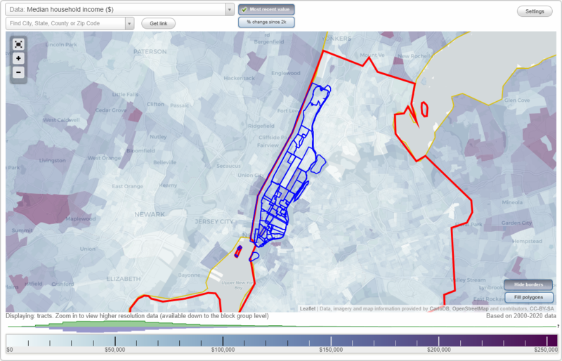
New York, New York Neighborhood Map - Income, House Prices, Occupations, Boundaries
Settings
X

- City boundary
- Neighborhood boundaries
Business Search - 14 Million verified businesses
Neighborhoods:
Battery Park City, Bellevue, Bowery, Central Park, Chelsea, Chinatown, City Hall, Civic Center, Downtown, East Harlem, East Side, East Village, Garment District, Gramercy Park, Gramercy-Flatiron, Greenwich Village, Hamilton Grange, Hamilton Heights, Harlem, Hell's Kitchen, Inwood, Kips Bay, Lenox Hill, Little Italy, LoDel, Lower East Side, Manhattan, Manhattan Valley, Manhattanville, Meat Packing District, Midtown, Midtown West, Morningside Heights, Murray Hill, NoHo, Nolita, Peter Cooper Village, Roosevelt Island, Seaport, Soho, St. Nicholas Terrace, Stuyvesant Town, Sutton Place, Theatre District, Tribeca, Tudor City, Turtle Bay, Two Bridges, Union Square, Upper East Side, Upper West Side, Uptown, Wall Street, Washington Heights, West Side, West Village, World Trade Center, YorkvilleBattery Park City neighborhood in New York statistics: (Find on map)
Area: 0.207 square miles
Population: 7,143
Population density:
Median household income in 2021:
Median rent in in 2021:
Male vs Females
Median age
Average estimated '21 value of housing units in 5-or-more-unit structures (96.0% of all units):
Most popular occupations of males: legal occupations (26.4%); business and financial operations occupations (15.8%); management occupations (except farmers) (14.8%); service occupations (10.7%); sales and office occupations (9.9%); computer and mathematical occupations (6.7%); arts, design, entertainment, sports, and media occupations (5.8%)
Most popular occupations of females: management occupations (except farmers) (34.4%); business and financial operations occupations (18.8%); sales and office occupations (10.8%); legal occupations (8.6%); education, training, and library occupations (6.6%); healthcare practitioners and technical occupations (3.8%); arts, design, entertainment, sports, and media occupations (3.6%)
Highways in this neighborhood: West St (State Hwy 9a).
Roads and streets: N End Ave; Murray St; Bowling Grn (Battery Pl); Rector Pl; S End Ave; Vesey St; River Ter; Albany St; Park Pl W; Warren St; W Thames St; F D R Dr (S St Viaduct); 1st Pl (1 Pl); Chambers St; 2 Pl (2nd Pl); Esplanade; 3 Pl (3rd Pl); Vesey St (Vesey Pl).
Battery Park City neighborhood detailed profile
Area: 0.207 square miles
Population: 7,143
Population density:
| Battery Park City: | 34,587 people per square mile |
| New York: | 27,917 people per square mile |
Median household income in 2021:
| Battery Park City: | $186,746 |
| New York: | $67,997 |
Median rent in in 2021:
| Battery Park City: | $3,268 |
| New York: | $1,490 |
Male vs Females
| Males: | 3,114 |
| Females: | 4,028 |
Median age
| Males: | 31.7 years |
| Females: | 35.0 years |
Average estimated '21 value of housing units in 5-or-more-unit structures (96.0% of all units):
| Battery Park City: | $880,210 |
| New York: | $987,733 |
Most popular occupations of males: legal occupations (26.4%); business and financial operations occupations (15.8%); management occupations (except farmers) (14.8%); service occupations (10.7%); sales and office occupations (9.9%); computer and mathematical occupations (6.7%); arts, design, entertainment, sports, and media occupations (5.8%)
Most popular occupations of females: management occupations (except farmers) (34.4%); business and financial operations occupations (18.8%); sales and office occupations (10.8%); legal occupations (8.6%); education, training, and library occupations (6.6%); healthcare practitioners and technical occupations (3.8%); arts, design, entertainment, sports, and media occupations (3.6%)
Highways in this neighborhood: West St (State Hwy 9a).
Roads and streets: N End Ave; Murray St; Bowling Grn (Battery Pl); Rector Pl; S End Ave; Vesey St; River Ter; Albany St; Park Pl W; Warren St; W Thames St; F D R Dr (S St Viaduct); 1st Pl (1 Pl); Chambers St; 2 Pl (2nd Pl); Esplanade; 3 Pl (3rd Pl); Vesey St (Vesey Pl).
Battery Park City neighborhood detailed profile
Bellevue neighborhood in New York statistics: (Find on map)
Area: 0.139 square miles
Population: 6,240
Population density:
Median household income in 2021:
Median rent in in 2021:
Male vs Females
Median age
Housing prices:
Average estimated value of detached houses in 2021 (15.8% of all units):
Average estimated '21 value of housing units in 5-or-more-unit structures (56.4% of all units):
Most popular occupations of males: management occupations (except farmers) (21.7%); business and financial operations occupations (20.5%); service occupations (16.9%); legal occupations (9.6%); sales and office occupations (8.4%); healthcare practitioners and technical occupations (8.2%); education, training, and library occupations (4.8%)
Most popular occupations of females: management occupations (except farmers) (23.4%); education, training, and library occupations (19.9%); sales and office occupations (15.7%); business and financial operations occupations (9.8%); service occupations (8.2%); arts, design, entertainment, sports, and media occupations (7.8%); healthcare practitioners and technical occupations (4.9%)
Roads and streets: F D R Dr; 1st Ave (1 Ave); E 25 St (E 25th St); E 27 St; E 28th St (E 28 St); Mount Carmel Pl; E 29th St (E 29 St); E 26th St; E 23 St (E 23rd St); E 25 St Branch; E 34 St (E 34th St).
Bellevue neighborhood detailed profile
Area: 0.139 square miles
Population: 6,240
Population density:
| Bellevue: | 44,972 people per square mile |
| New York: | 27,917 people per square mile |
Median household income in 2021:
| Bellevue: | $126,867 |
| New York: | $67,997 |
Median rent in in 2021:
| Bellevue: | $2,343 |
| New York: | $1,490 |
Male vs Females
| Males: | 2,834 |
| Females: | 3,405 |
Median age
| Males: | 36.9 years |
| Females: | 33.6 years |
Housing prices:
Average estimated value of detached houses in 2021 (15.8% of all units):
| Bellevue: | $174,276 |
| New York: | $712,559 |
Average estimated '21 value of housing units in 5-or-more-unit structures (56.4% of all units):
| Bellevue: | $872,415 |
| New York: | $987,733 |
Most popular occupations of males: management occupations (except farmers) (21.7%); business and financial operations occupations (20.5%); service occupations (16.9%); legal occupations (9.6%); sales and office occupations (8.4%); healthcare practitioners and technical occupations (8.2%); education, training, and library occupations (4.8%)
Most popular occupations of females: management occupations (except farmers) (23.4%); education, training, and library occupations (19.9%); sales and office occupations (15.7%); business and financial operations occupations (9.8%); service occupations (8.2%); arts, design, entertainment, sports, and media occupations (7.8%); healthcare practitioners and technical occupations (4.9%)
Roads and streets: F D R Dr; 1st Ave (1 Ave); E 25 St (E 25th St); E 27 St; E 28th St (E 28 St); Mount Carmel Pl; E 29th St (E 29 St); E 26th St; E 23 St (E 23rd St); E 25 St Branch; E 34 St (E 34th St).
Bellevue neighborhood detailed profile
Bowery neighborhood in New York statistics: (Find on map)
Area: 0.039 square miles
Population: 1,734
Population density:
Median household income in 2021:
Median rent in in 2021:
Male vs Females
Median age
Average estimated '21 value of housing units in 5-or-more-unit structures (43.4% of all units):
Most popular occupations of males: sales and office occupations (32.2%); service occupations (30.1%); business and financial operations occupations (12.0%); computer and mathematical occupations (10.6%); management occupations (except farmers) (8.8%); production occupations (4.0%); construction, extraction, and maintenance occupations (3.6%)
Most popular occupations of females: sales and office occupations (24.6%); business and financial operations occupations (15.9%); service occupations (14.5%); management occupations (except farmers) (12.2%); production occupations (10.8%); education, training, and library occupations (7.1%); material moving occupations (6.1%)
Roads and streets: Chrystie St; Freeman Aly; Rivington St.
Bowery neighborhood detailed profile
Area: 0.039 square miles
Population: 1,734
Population density:
| Bowery: | 44,467 people per square mile |
| New York: | 27,917 people per square mile |
Median household income in 2021:
| Bowery: | $116,987 |
| New York: | $67,997 |
Median rent in in 2021:
| Bowery: | $1,440 |
| New York: | $1,490 |
Male vs Females
| Males: | 875 |
| Females: | 858 |
Median age
| Males: | 34.1 years |
| Females: | 37.9 years |
Average estimated '21 value of housing units in 5-or-more-unit structures (43.4% of all units):
| Bowery: | $995,861 |
| New York: | $987,733 |
Most popular occupations of males: sales and office occupations (32.2%); service occupations (30.1%); business and financial operations occupations (12.0%); computer and mathematical occupations (10.6%); management occupations (except farmers) (8.8%); production occupations (4.0%); construction, extraction, and maintenance occupations (3.6%)
Most popular occupations of females: sales and office occupations (24.6%); business and financial operations occupations (15.9%); service occupations (14.5%); management occupations (except farmers) (12.2%); production occupations (10.8%); education, training, and library occupations (7.1%); material moving occupations (6.1%)
Roads and streets: Chrystie St; Freeman Aly; Rivington St.
Bowery neighborhood detailed profile
Central Park neighborhood in New York statistics: (Find on map)
Area: 1.372 square miles
Population: 95,410
Population density:
Median household income in 2021:
Median rent in in 2021:
Male vs Females
Median age
Housing prices:
Average estimated value of detached houses in 2021 (2.8% of all units):
Average estimated '21 value of housing units in 5-or-more-unit structures (58.2% of all units):
Most popular occupations of males: management occupations (except farmers) (17.4%); sales and office occupations (15.5%); business and financial operations occupations (13.1%); service occupations (11.3%); transportation occupations (9.8%); arts, design, entertainment, sports, and media occupations (6.6%); legal occupations (5.8%)
Most popular occupations of females: management occupations (except farmers) (17.9%); business and financial operations occupations (14.1%); service occupations (14.1%); sales and office occupations (12.9%); education, training, and library occupations (8.5%); arts, design, entertainment, sports, and media occupations (7.7%); computer and mathematical occupations (5.2%)
Roads and streets: East Dr; West Dr; 5th Ave; Central Park Driveway; 97th St Transverse; 65th St Transverse; 85th St Transverse; 72nd St Transverse; W 59 St (Central Park S); Central Park Gr Hill; 79th St Transverse Rd; The Mall; Central Park-Center Dr; W 110 St (W 110th St, Cathedral Pkwy, Central Park N); 79th St Transverse; 86th Transverse Rd; Central Pk-Ctr Dr (Central Park-Ctr Dr, Center Dr, Central Park Driveway, Central Pk-Center Dr, Central Park-Center Dr); Grand Army Plz; Transverse Rd Four (Transverse Rd Number 4, Transverse Number 4, Transverse Rd 4, 97 St Transverse, Transverse Number Four); Doris C Freedman Pl; Frawley Cir; Transverse Number Two (79 St Transverse, Transverse Rd Number 2, Transverse Rd 2, Transverse Rd Number Two, Transverse Number 2).
Central Park neighborhood detailed profile
Area: 1.372 square miles
Population: 95,410
Population density:
| Central Park: | 69,548 people per square mile |
| New York: | 27,917 people per square mile |
Median household income in 2021:
| Central Park: | $142,322 |
| New York: | $67,997 |
Median rent in in 2021:
| Central Park: | $2,442 |
| New York: | $1,490 |
Male vs Females
| Males: | 47,975 |
| Females: | 47,435 |
Median age
| Males: | 43.5 years |
| Females: | 43.3 years |
Housing prices:
Average estimated value of detached houses in 2021 (2.8% of all units):
| Central Park: | $728,862 |
| New York: | $712,559 |
Average estimated '21 value of housing units in 5-or-more-unit structures (58.2% of all units):
| Central Park: | $1,307,151 |
| New York: | $987,733 |
Most popular occupations of males: management occupations (except farmers) (17.4%); sales and office occupations (15.5%); business and financial operations occupations (13.1%); service occupations (11.3%); transportation occupations (9.8%); arts, design, entertainment, sports, and media occupations (6.6%); legal occupations (5.8%)
Most popular occupations of females: management occupations (except farmers) (17.9%); business and financial operations occupations (14.1%); service occupations (14.1%); sales and office occupations (12.9%); education, training, and library occupations (8.5%); arts, design, entertainment, sports, and media occupations (7.7%); computer and mathematical occupations (5.2%)
Roads and streets: East Dr; West Dr; 5th Ave; Central Park Driveway; 97th St Transverse; 65th St Transverse; 85th St Transverse; 72nd St Transverse; W 59 St (Central Park S); Central Park Gr Hill; 79th St Transverse Rd; The Mall; Central Park-Center Dr; W 110 St (W 110th St, Cathedral Pkwy, Central Park N); 79th St Transverse; 86th Transverse Rd; Central Pk-Ctr Dr (Central Park-Ctr Dr, Center Dr, Central Park Driveway, Central Pk-Center Dr, Central Park-Center Dr); Grand Army Plz; Transverse Rd Four (Transverse Rd Number 4, Transverse Number 4, Transverse Rd 4, 97 St Transverse, Transverse Number Four); Doris C Freedman Pl; Frawley Cir; Transverse Number Two (79 St Transverse, Transverse Rd Number 2, Transverse Rd 2, Transverse Rd Number Two, Transverse Number 2).
Central Park neighborhood detailed profile
Chelsea neighborhood in New York statistics: (Find on map)
Area: 0.774 square miles
Population: 47,867
Population density:
Median household income in 2021:
Median rent in in 2021:
Male vs Females
Median age
Average estimated '21 value of housing units in 5-or-more-unit structures (58.2% of all units):
Most popular occupations of males: management occupations (except farmers) (22.9%); business and financial operations occupations (16.5%); sales and office occupations (15.2%); arts, design, entertainment, sports, and media occupations (11.9%); service occupations (6.2%); computer and mathematical occupations (5.5%); legal occupations (5.4%)
Most popular occupations of females: sales and office occupations (23.0%); management occupations (except farmers) (18.9%); business and financial operations occupations (15.4%); education, training, and library occupations (10.3%); service occupations (8.5%); legal occupations (5.8%); arts, design, entertainment, sports, and media occupations (5.7%)
Roads and streets: W 24th St; W 23rd St; W 26th St; W 25th St; W 22 St (W 22nd St); 10th Ave (10 Ave); 8th Ave (8 Ave); 9th Ave (9 Ave); W 15th St (W 15 St); W 20th St; W 19th St (W 19 St); W 21st St (W 21 St); W 18th St (W 18 St); W 17th St (W 17 St); W 14th St (W 14 St); W 16 St (W 16th St); W 33rd St (W 33 St); W 28th St (W 28 St); W 30 St (W 30th St); W 29th St; 7th Ave (7 Ave); Ave of the Americas (6th Ave, 6 Ave); 11 Ave (11th Ave); W 31st St (W 31 St); W 27 St (W 27th St); Dyer Ave; W 27th St; 9th Ave.
Railroad features: Amtrak RR (Metro North Commuter RR).
Chelsea neighborhood detailed profile
Area: 0.774 square miles
Population: 47,867
Population density:
| Chelsea: | 61,847 people per square mile |
| New York: | 27,917 people per square mile |
Median household income in 2021:
| Chelsea: | $130,632 |
| New York: | $67,997 |
Median rent in in 2021:
| Chelsea: | $2,073 |
| New York: | $1,490 |
Male vs Females
| Males: | 24,732 |
| Females: | 23,134 |
Median age
| Males: | 44.3 years |
| Females: | 43.0 years |
Average estimated '21 value of housing units in 5-or-more-unit structures (58.2% of all units):
| Chelsea: | $1,056,820 |
| New York: | $987,733 |
Most popular occupations of males: management occupations (except farmers) (22.9%); business and financial operations occupations (16.5%); sales and office occupations (15.2%); arts, design, entertainment, sports, and media occupations (11.9%); service occupations (6.2%); computer and mathematical occupations (5.5%); legal occupations (5.4%)
Most popular occupations of females: sales and office occupations (23.0%); management occupations (except farmers) (18.9%); business and financial operations occupations (15.4%); education, training, and library occupations (10.3%); service occupations (8.5%); legal occupations (5.8%); arts, design, entertainment, sports, and media occupations (5.7%)
Roads and streets: W 24th St; W 23rd St; W 26th St; W 25th St; W 22 St (W 22nd St); 10th Ave (10 Ave); 8th Ave (8 Ave); 9th Ave (9 Ave); W 15th St (W 15 St); W 20th St; W 19th St (W 19 St); W 21st St (W 21 St); W 18th St (W 18 St); W 17th St (W 17 St); W 14th St (W 14 St); W 16 St (W 16th St); W 33rd St (W 33 St); W 28th St (W 28 St); W 30 St (W 30th St); W 29th St; 7th Ave (7 Ave); Ave of the Americas (6th Ave, 6 Ave); 11 Ave (11th Ave); W 31st St (W 31 St); W 27 St (W 27th St); Dyer Ave; W 27th St; 9th Ave.
Railroad features: Amtrak RR (Metro North Commuter RR).
Chelsea neighborhood detailed profile
Chinatown neighborhood in New York statistics: (Find on map)
Area: 0.082 square miles
Population: 5,123
Population density:
Median household income in 2021:
Median rent in in 2021:
Male vs Females
Median age
Average estimated '21 value of housing units in 5-or-more-unit structures (7.5% of all units):
Most popular occupations of males: service occupations (23.6%); business and financial operations occupations (15.3%); computer and mathematical occupations (13.1%); sales and office occupations (12.7%); management occupations (except farmers) (9.0%); arts, design, entertainment, sports, and media occupations (6.6%); material moving occupations (6.2%)
Most popular occupations of females: sales and office occupations (30.1%); service occupations (20.0%); business and financial operations occupations (13.7%); management occupations (except farmers) (9.9%); arts, design, entertainment, sports, and media occupations (9.1%); education, training, and library occupations (5.1%); production occupations (4.8%)
Roads and streets: Canal St; Bayard St; E Broadway; Mulberry St; Manhattan Brg; Division St; Mott St; Bowery; Pell St; Baxter St; Elizabeth St; Doyers St; Walker St; Mosco St; Chatham Sq; Market St; Catherine St.
Chinatown neighborhood detailed profile
Area: 0.082 square miles
Population: 5,123
Population density:
| Chinatown: | 62,181 people per square mile |
| New York: | 27,917 people per square mile |
Median household income in 2021:
| Chinatown: | $110,362 |
| New York: | $67,997 |
Median rent in in 2021:
| Chinatown: | $1,273 |
| New York: | $1,490 |
Male vs Females
| Males: | 2,580 |
| Females: | 2,543 |
Median age
| Males: | 38.9 years |
| Females: | 39.7 years |
Average estimated '21 value of housing units in 5-or-more-unit structures (7.5% of all units):
| Chinatown: | $948,536 |
| New York: | $987,733 |
Most popular occupations of males: service occupations (23.6%); business and financial operations occupations (15.3%); computer and mathematical occupations (13.1%); sales and office occupations (12.7%); management occupations (except farmers) (9.0%); arts, design, entertainment, sports, and media occupations (6.6%); material moving occupations (6.2%)
Most popular occupations of females: sales and office occupations (30.1%); service occupations (20.0%); business and financial operations occupations (13.7%); management occupations (except farmers) (9.9%); arts, design, entertainment, sports, and media occupations (9.1%); education, training, and library occupations (5.1%); production occupations (4.8%)
Roads and streets: Canal St; Bayard St; E Broadway; Mulberry St; Manhattan Brg; Division St; Mott St; Bowery; Pell St; Baxter St; Elizabeth St; Doyers St; Walker St; Mosco St; Chatham Sq; Market St; Catherine St.
Chinatown neighborhood detailed profile
City Hall neighborhood in New York statistics: (Find on map)
Area: 0.190 square miles
Population: 16,936
Population density:
Median household income in 2021:
Median rent in in 2021:
Male vs Females
Median age
Average estimated '21 value of housing units in 5-or-more-unit structures (86.0% of all units):
Most popular occupations of males: sales and office occupations (25.4%); management occupations (except farmers) (22.7%); business and financial operations occupations (14.4%); service occupations (13.7%); computer and mathematical occupations (4.6%); education, training, and library occupations (3.7%); arts, design, entertainment, sports, and media occupations (3.7%)
Most popular occupations of females: sales and office occupations (26.3%); management occupations (except farmers) (17.4%); service occupations (16.7%); business and financial operations occupations (12.4%); education, training, and library occupations (9.3%); healthcare practitioners and technical occupations (5.9%); arts, design, entertainment, sports, and media occupations (5.2%)
Roads and streets: Park Row; Centre St; Pearl St; Lafayette St; Frankfort St; Gold St; Rose St; Beekman St; Madison St; Worth St (Ave of the Strongest); Leonard St; Cardinal Hayes Pl; Spruce St; Cortlandt Aly; Foley Sq; White St; Walker St; Baxter St; Federal Plz (Lafayette St); William St; Elk St; Duane St; Nassau St; Ave of the Finest; Ann St; Hamill Pl; Franklin St; Canal St; Reade St; Chambers St; Kent Pl; Benson St; Cardinal Hayes Pl (Hayes Pl).
City Hall neighborhood detailed profile
Area: 0.190 square miles
Population: 16,936
Population density:
| City Hall: | 89,008 people per square mile |
| New York: | 27,917 people per square mile |
Median household income in 2021:
| City Hall: | $147,785 |
| New York: | $67,997 |
Median rent in in 2021:
| City Hall: | $2,030 |
| New York: | $1,490 |
Male vs Females
| Males: | 7,479 |
| Females: | 9,457 |
Median age
| Males: | 43.0 years |
| Females: | 39.9 years |
Average estimated '21 value of housing units in 5-or-more-unit structures (86.0% of all units):
| City Hall: | $959,648 |
| New York: | $987,733 |
Most popular occupations of males: sales and office occupations (25.4%); management occupations (except farmers) (22.7%); business and financial operations occupations (14.4%); service occupations (13.7%); computer and mathematical occupations (4.6%); education, training, and library occupations (3.7%); arts, design, entertainment, sports, and media occupations (3.7%)
Most popular occupations of females: sales and office occupations (26.3%); management occupations (except farmers) (17.4%); service occupations (16.7%); business and financial operations occupations (12.4%); education, training, and library occupations (9.3%); healthcare practitioners and technical occupations (5.9%); arts, design, entertainment, sports, and media occupations (5.2%)
Roads and streets: Park Row; Centre St; Pearl St; Lafayette St; Frankfort St; Gold St; Rose St; Beekman St; Madison St; Worth St (Ave of the Strongest); Leonard St; Cardinal Hayes Pl; Spruce St; Cortlandt Aly; Foley Sq; White St; Walker St; Baxter St; Federal Plz (Lafayette St); William St; Elk St; Duane St; Nassau St; Ave of the Finest; Ann St; Hamill Pl; Franklin St; Canal St; Reade St; Chambers St; Kent Pl; Benson St; Cardinal Hayes Pl (Hayes Pl).
City Hall neighborhood detailed profile
Civic Center neighborhood in New York statistics: (Find on map)
Area: 0.795 square miles
Population: 41,246
Population density:
Median household income in 2021:
Median rent in in 2021:
Male vs Females
Median age
Average estimated '21 value of housing units in 5-or-more-unit structures (63.4% of all units):
Most popular occupations of males: sales and office occupations (17.8%); business and financial operations occupations (16.6%); management occupations (except farmers) (15.8%); service occupations (12.0%); legal occupations (7.9%); computer and mathematical occupations (6.6%); arts, design, entertainment, sports, and media occupations (6.4%)
Most popular occupations of females: sales and office occupations (23.8%); management occupations (except farmers) (16.8%); service occupations (14.4%); business and financial operations occupations (12.9%); education, training, and library occupations (8.0%); arts, design, entertainment, sports, and media occupations (7.8%); healthcare practitioners and technical occupations (4.6%)
Roads and streets: Park Row; South St; F D R Dr (S St Viaduct); Broadway; Pearl St; Church St; Madison St; Canal St; Worth St; Centre St; Gold St; Fulton St; John St; Walker St; Water St; White St; Leonard St; Nassau St; Catherine Slip; Catherine St; Beekman St; Manhattan Brg; Duane St; Liberty St; Lafayette St; Reade St; Front St; Chambers St; William St; Henry St; St James Pl; Frankfort St; Ann St; Cherry St; Baxter St; E Broadway; Market St; Mott St; Monroe St; Maiden Ln; Franklin St; Bayard St; Mulberry St; Vesey St; Rose St; Peck Slip; Ave of the Finest; Cardinal Hayes Pl; Division St; Bowery; Spruce St; Fletcher St; Robert F Wagner Sr Pl; Cortlandt Aly; Dover St; Foley Sq; Murray St Exd; Platt St; Lispenard St; Chatham Sq; Thomas St; Pell St; Warren St; Murray St; Park Pl; Barclay St; Mosco St; Catherine Ln; Ave of the Americas (6 Ave); James St; Federal Plz (Lafayette St); Dey St; Oliver St; Elizabeth St; Elk St; Cortlandt St; Cliff St; Theatre Aly; Doyers St; Dutch St; Market Slip; Hamill Pl; Brooklyn Brg; Trinity Pl; Kent Pl; Liberty Pl; Franklin Pl; Ryders Aly; Trimble Pl; Mercer St; Benson St; Cardinal Hayes Pl (Hayes Pl).
Civic Center neighborhood detailed profile
Area: 0.795 square miles
Population: 41,246
Population density:
| Civic Center: | 51,894 people per square mile |
| New York: | 27,917 people per square mile |
Median household income in 2021:
| Civic Center: | $155,980 |
| New York: | $67,997 |
Median rent in in 2021:
| Civic Center: | $2,429 |
| New York: | $1,490 |
Male vs Females
| Males: | 19,964 |
| Females: | 21,282 |
Median age
| Males: | 35.9 years |
| Females: | 35.2 years |
Average estimated '21 value of housing units in 5-or-more-unit structures (63.4% of all units):
| Civic Center: | $970,165 |
| New York: | $987,733 |
Most popular occupations of males: sales and office occupations (17.8%); business and financial operations occupations (16.6%); management occupations (except farmers) (15.8%); service occupations (12.0%); legal occupations (7.9%); computer and mathematical occupations (6.6%); arts, design, entertainment, sports, and media occupations (6.4%)
Most popular occupations of females: sales and office occupations (23.8%); management occupations (except farmers) (16.8%); service occupations (14.4%); business and financial operations occupations (12.9%); education, training, and library occupations (8.0%); arts, design, entertainment, sports, and media occupations (7.8%); healthcare practitioners and technical occupations (4.6%)
Roads and streets: Park Row; South St; F D R Dr (S St Viaduct); Broadway; Pearl St; Church St; Madison St; Canal St; Worth St; Centre St; Gold St; Fulton St; John St; Walker St; Water St; White St; Leonard St; Nassau St; Catherine Slip; Catherine St; Beekman St; Manhattan Brg; Duane St; Liberty St; Lafayette St; Reade St; Front St; Chambers St; William St; Henry St; St James Pl; Frankfort St; Ann St; Cherry St; Baxter St; E Broadway; Market St; Mott St; Monroe St; Maiden Ln; Franklin St; Bayard St; Mulberry St; Vesey St; Rose St; Peck Slip; Ave of the Finest; Cardinal Hayes Pl; Division St; Bowery; Spruce St; Fletcher St; Robert F Wagner Sr Pl; Cortlandt Aly; Dover St; Foley Sq; Murray St Exd; Platt St; Lispenard St; Chatham Sq; Thomas St; Pell St; Warren St; Murray St; Park Pl; Barclay St; Mosco St; Catherine Ln; Ave of the Americas (6 Ave); James St; Federal Plz (Lafayette St); Dey St; Oliver St; Elizabeth St; Elk St; Cortlandt St; Cliff St; Theatre Aly; Doyers St; Dutch St; Market Slip; Hamill Pl; Brooklyn Brg; Trinity Pl; Kent Pl; Liberty Pl; Franklin Pl; Ryders Aly; Trimble Pl; Mercer St; Benson St; Cardinal Hayes Pl (Hayes Pl).
Civic Center neighborhood detailed profile
Downtown neighborhood in New York statistics: (Find on map)
Area: 4.309 square miles
Population: 284,898
Population density:
Median household income in 2021:
Median rent in in 2021:
Male vs Females
Median age
Housing prices:
Average estimated value of detached houses in 2021 (3.5% of all units):
Average estimated '21 value of housing units in 5-or-more-unit structures (47.0% of all units):
Most popular occupations of males: management occupations (except farmers) (19.4%); sales and office occupations (18.8%); business and financial operations occupations (13.6%); service occupations (10.7%); arts, design, entertainment, sports, and media occupations (8.8%); computer and mathematical occupations (8.1%); education, training, and library occupations (4.4%)
Most popular occupations of females: sales and office occupations (22.7%); management occupations (except farmers) (16.4%); business and financial operations occupations (12.4%); service occupations (12.3%); arts, design, entertainment, sports, and media occupations (10.2%); education, training, and library occupations (7.6%); healthcare practitioners and technical occupations (4.6%)
Highways in this neighborhood: West St (State Hwy 9a).
Roads and streets: F D R Dr (S St Viaduct); Broadway; South St; Greenwich St; Grand St; Broome St; Washington St; Canal St; Hudson St; Madison St; E 10th St (E 10 St); Pearl St; Ave of the Americas (6 Ave); E 9 St (E 9th St); E 12 St (E 12th St); E Houston St; E 13 St (E 13th St); Lafayette St; E 11 St (E 11th St); Water St; Allen St; Bleecker St; Fdr Dr; W Broadway; E 4 St (E 4th St); E 6 St (E 6th St); Henry St; Spring St; Delancey St; E Broadway; E 7th St (E 7 St); W 13th St (W 13 St); Cherry St; E 3rd St (E 3 St); W 10 St (W 10th St); W Houston St; E 2nd St (E 2 St); Mercer St; Bowery; W 12th St (W 12 St); Park Row; W 11 St (W 11th St); Rivington St; Mott St; Mulberry St; Church St; F D R Dr; Williamsburg Brg; Front St; Murray St; W 4 St (W 4th St); E 5 St (E 5th St); Chambers St; Greene St; Worth St; Clinton St; Forsyth St; Thompson St; Centre St; E 8th St (E 8 St); Varick St; Elizabeth St; Stanton St; Prince St; 2nd Ave (2 Ave); Sullivan St; Eldridge St; Warren St; Waverly Pl; Vesey St; Delancey St S; Duane St; 1 Ave (1st Ave); Chrystie St; Liberty St; Hester St; Franklin St; Orchard St; Christopher St; Ludlow St; E 2nd St (Ave A); Ave B; Leonard St; Loisada Ave (Ave C); Crosby St; Essex St; Ave D; 7th Ave S (7 Ave S); Charles St; Gold St; William St; Manhattan Brg; Fulton St; Reade St; Bowling Grn (Battery Pl); Perry St; Walker St; Pike St; Wooster St; W 3 St (W 3rd St); St Marks Pl; Division St; John St; Mac Dougal St; Barrow St; Nassau St; Maiden Ln; King St; Watts St; N End Ave; White St; Greenwich Ave; E 1 St (E 1st St); Charlton St; Wall St; Leroy St; Bank St; Baxter St; Pitt St; Norfolk St; Suffolk St; Ridge St; Beach St; Columbia St (Abraham Kazan St); Pine St; Jane St; Cedar St; Barclay St; University Pl; Brooklyn Battery Tunl; Morton St; Monroe St; Horatio St; 5th Ave; Broad St; State St; Grove St; Trinity Pl; Beaver St; Albany St; Vandam St; Laight St; Cooper Sq; Bedford St; N Moore St; Park Pl; Catherine Slip; Catherine St; Attorney St; Beekman St; 4th Ave (4 Ave, Lafayette St); Thomas St; Rector Pl; 8 Ave (Hudson St); Gansevoort St; Baruch Dr; Vestry St; St James Pl; S End Ave; Montgomery St; Frankfort St; Clarkson St; Ann St; Laguardia Pl; Kenmare St; Carmine St; E 14th St (E 14 St); Astor Pl; 3 Ave (3rd Ave); Market St; River Ter; Exchange Pl; Bond St; Bayard St; W 9th St (W 9 St); W 8 St (W 8th St); Rutgers St; Lispenard St; Dominick St; Washington Sq N; Rector St; Washington Sq S; Park Pl W; Howard St; Jackson St; Great Jones St; Holland Tunl (I- 78, Canal St); Downing St; New St; Rose St; Peck Slip; W Washington Pl; Ave of the Finest; W Thames St; Bridge St; Stone St; Cardinal Hayes Pl; Old Slip; 1st Pl (1 Pl); Baruch Pl; Whitehall St; Gouverneur St; Washington Pl; Spruce St; Fletcher St; Commerce St; Robert F Wagner Sr Pl; Willett St (Bialystoker St); Bethune St; Cortlandt Aly; Jefferson St; Sheriff St; Desbrosses St; Hubert St; Stuyvesant St; Battery Pl; Pike Slip; Rutgers Slip; Dover St; Lewis St; Foley Sq; Little W 12th St; Thames St; Murray St Exd; Platt St; 2 Pl (2nd Pl); Morris St; Stanton St Exn; Chatham Sq; Mangin St; Cornelia St; S William St; Pell St; Lillian Wald Dr; Jones St; Renwick St; New York Plz; Carlisle St; Mosco St; Samuel Dickstein Plz; Washington Mews; Esplanade; Washington St (W U I Plz); Catherine Ln; Jay St; Harrison St; 7 Ave (7th Ave); E Houston St (Peretz Sq); Cleveland Pl; Washington Sq E; Washington Sq W; James St; Szold Pl; Federal Plz (Lafayette St); Dey St; Gouverneur Ln; Oliver St; St Johns Ln; Collister St; Staple St; Elk St; Minetta St; Cortlandt St; Grove Ct; Cliff St; Centre Market Pl; Minetta Ln; Jones Aly; Shinbone Aly; Marketfield St; Hanover St; Bialystoker Pl; Stable Ct; Theatre Aly; Doyers St; Jersey St; Dutch St; Market Slip; Abraham Pl; Christopher St (Stonewall Pl); Hamill Pl; 9 Ave (9th Ave); Hanover Sq; Brooklyn Brg; de Peyster St; Exchange Plz (Exchange Aly); State Street Plz; Mac Dougal Aly; Sheridan Sq (W Washington Pl); Gay St; Joseph P Ward St; 3 Pl (3rd Pl); Merchant Marine Pl (Marine Pl, Battery Pl, Merchant Marine Veterans Pl); Wooster St Exd; Stuyvesant Aly; Kent Pl; Liberty Pl; Weehawken St; Franklin Pl; Taras Shevchenko Pl; Ryders Aly; Trimble Pl; Freeman Aly; York St; Cannon St; Gouverneur Slip W; Benson St; Gouverneur Slip E; Coenties Slip; Extra Pl; Moore St; Great Jones Aly; Edgar St; Village Sq (Christopher St); Greenwich Ct; Patchin Pl; Coenties Aly; Milligan Pl; Greenwich Mews; W 4th St; Mill Ln; Lafayette Ct; Bleecker St (Bleeker St).
Downtown neighborhood detailed profile
Area: 4.309 square miles
Population: 284,898
Population density:
| Downtown: | 66,111 people per square mile |
| New York: | 27,917 people per square mile |
Median household income in 2021:
| Downtown: | $124,025 |
| New York: | $67,997 |
Median rent in in 2021:
| Downtown: | $2,153 |
| New York: | $1,490 |
Male vs Females
| Males: | 140,670 |
| Females: | 144,228 |
Median age
| Males: | 37.7 years |
| Females: | 38.8 years |
Housing prices:
Average estimated value of detached houses in 2021 (3.5% of all units):
| Downtown: | $326,129 |
| New York: | $712,559 |
Average estimated '21 value of housing units in 5-or-more-unit structures (47.0% of all units):
| Downtown: | $982,295 |
| New York: | $987,733 |
Most popular occupations of males: management occupations (except farmers) (19.4%); sales and office occupations (18.8%); business and financial operations occupations (13.6%); service occupations (10.7%); arts, design, entertainment, sports, and media occupations (8.8%); computer and mathematical occupations (8.1%); education, training, and library occupations (4.4%)
Most popular occupations of females: sales and office occupations (22.7%); management occupations (except farmers) (16.4%); business and financial operations occupations (12.4%); service occupations (12.3%); arts, design, entertainment, sports, and media occupations (10.2%); education, training, and library occupations (7.6%); healthcare practitioners and technical occupations (4.6%)
Highways in this neighborhood: West St (State Hwy 9a).
Roads and streets: F D R Dr (S St Viaduct); Broadway; South St; Greenwich St; Grand St; Broome St; Washington St; Canal St; Hudson St; Madison St; E 10th St (E 10 St); Pearl St; Ave of the Americas (6 Ave); E 9 St (E 9th St); E 12 St (E 12th St); E Houston St; E 13 St (E 13th St); Lafayette St; E 11 St (E 11th St); Water St; Allen St; Bleecker St; Fdr Dr; W Broadway; E 4 St (E 4th St); E 6 St (E 6th St); Henry St; Spring St; Delancey St; E Broadway; E 7th St (E 7 St); W 13th St (W 13 St); Cherry St; E 3rd St (E 3 St); W 10 St (W 10th St); W Houston St; E 2nd St (E 2 St); Mercer St; Bowery; W 12th St (W 12 St); Park Row; W 11 St (W 11th St); Rivington St; Mott St; Mulberry St; Church St; F D R Dr; Williamsburg Brg; Front St; Murray St; W 4 St (W 4th St); E 5 St (E 5th St); Chambers St; Greene St; Worth St; Clinton St; Forsyth St; Thompson St; Centre St; E 8th St (E 8 St); Varick St; Elizabeth St; Stanton St; Prince St; 2nd Ave (2 Ave); Sullivan St; Eldridge St; Warren St; Waverly Pl; Vesey St; Delancey St S; Duane St; 1 Ave (1st Ave); Chrystie St; Liberty St; Hester St; Franklin St; Orchard St; Christopher St; Ludlow St; E 2nd St (Ave A); Ave B; Leonard St; Loisada Ave (Ave C); Crosby St; Essex St; Ave D; 7th Ave S (7 Ave S); Charles St; Gold St; William St; Manhattan Brg; Fulton St; Reade St; Bowling Grn (Battery Pl); Perry St; Walker St; Pike St; Wooster St; W 3 St (W 3rd St); St Marks Pl; Division St; John St; Mac Dougal St; Barrow St; Nassau St; Maiden Ln; King St; Watts St; N End Ave; White St; Greenwich Ave; E 1 St (E 1st St); Charlton St; Wall St; Leroy St; Bank St; Baxter St; Pitt St; Norfolk St; Suffolk St; Ridge St; Beach St; Columbia St (Abraham Kazan St); Pine St; Jane St; Cedar St; Barclay St; University Pl; Brooklyn Battery Tunl; Morton St; Monroe St; Horatio St; 5th Ave; Broad St; State St; Grove St; Trinity Pl; Beaver St; Albany St; Vandam St; Laight St; Cooper Sq; Bedford St; N Moore St; Park Pl; Catherine Slip; Catherine St; Attorney St; Beekman St; 4th Ave (4 Ave, Lafayette St); Thomas St; Rector Pl; 8 Ave (Hudson St); Gansevoort St; Baruch Dr; Vestry St; St James Pl; S End Ave; Montgomery St; Frankfort St; Clarkson St; Ann St; Laguardia Pl; Kenmare St; Carmine St; E 14th St (E 14 St); Astor Pl; 3 Ave (3rd Ave); Market St; River Ter; Exchange Pl; Bond St; Bayard St; W 9th St (W 9 St); W 8 St (W 8th St); Rutgers St; Lispenard St; Dominick St; Washington Sq N; Rector St; Washington Sq S; Park Pl W; Howard St; Jackson St; Great Jones St; Holland Tunl (I- 78, Canal St); Downing St; New St; Rose St; Peck Slip; W Washington Pl; Ave of the Finest; W Thames St; Bridge St; Stone St; Cardinal Hayes Pl; Old Slip; 1st Pl (1 Pl); Baruch Pl; Whitehall St; Gouverneur St; Washington Pl; Spruce St; Fletcher St; Commerce St; Robert F Wagner Sr Pl; Willett St (Bialystoker St); Bethune St; Cortlandt Aly; Jefferson St; Sheriff St; Desbrosses St; Hubert St; Stuyvesant St; Battery Pl; Pike Slip; Rutgers Slip; Dover St; Lewis St; Foley Sq; Little W 12th St; Thames St; Murray St Exd; Platt St; 2 Pl (2nd Pl); Morris St; Stanton St Exn; Chatham Sq; Mangin St; Cornelia St; S William St; Pell St; Lillian Wald Dr; Jones St; Renwick St; New York Plz; Carlisle St; Mosco St; Samuel Dickstein Plz; Washington Mews; Esplanade; Washington St (W U I Plz); Catherine Ln; Jay St; Harrison St; 7 Ave (7th Ave); E Houston St (Peretz Sq); Cleveland Pl; Washington Sq E; Washington Sq W; James St; Szold Pl; Federal Plz (Lafayette St); Dey St; Gouverneur Ln; Oliver St; St Johns Ln; Collister St; Staple St; Elk St; Minetta St; Cortlandt St; Grove Ct; Cliff St; Centre Market Pl; Minetta Ln; Jones Aly; Shinbone Aly; Marketfield St; Hanover St; Bialystoker Pl; Stable Ct; Theatre Aly; Doyers St; Jersey St; Dutch St; Market Slip; Abraham Pl; Christopher St (Stonewall Pl); Hamill Pl; 9 Ave (9th Ave); Hanover Sq; Brooklyn Brg; de Peyster St; Exchange Plz (Exchange Aly); State Street Plz; Mac Dougal Aly; Sheridan Sq (W Washington Pl); Gay St; Joseph P Ward St; 3 Pl (3rd Pl); Merchant Marine Pl (Marine Pl, Battery Pl, Merchant Marine Veterans Pl); Wooster St Exd; Stuyvesant Aly; Kent Pl; Liberty Pl; Weehawken St; Franklin Pl; Taras Shevchenko Pl; Ryders Aly; Trimble Pl; Freeman Aly; York St; Cannon St; Gouverneur Slip W; Benson St; Gouverneur Slip E; Coenties Slip; Extra Pl; Moore St; Great Jones Aly; Edgar St; Village Sq (Christopher St); Greenwich Ct; Patchin Pl; Coenties Aly; Milligan Pl; Greenwich Mews; W 4th St; Mill Ln; Lafayette Ct; Bleecker St (Bleeker St).
Downtown neighborhood detailed profile
East Harlem neighborhood in New York statistics: (Find on map)
Area: 1.467 square miles
Population: 119,292
Population density:
Median household income in 2021:
Median rent in in 2021:
Male vs Females
Median age
Housing prices:
Average estimated '21 value of housing units in 3-to-4-unit structures (13.6% of all units):
Average estimated '21 value of housing units in 5-or-more-unit structures (54.3% of all units):
Most popular occupations of males: service occupations (22.0%); sales and office occupations (14.1%); management occupations (except farmers) (13.9%); business and financial operations occupations (6.5%); transportation occupations (5.9%); construction, extraction, and maintenance occupations (5.4%); arts, design, entertainment, sports, and media occupations (4.8%)
Most popular occupations of females: service occupations (26.6%); sales and office occupations (26.1%); education, training, and library occupations (9.6%); management occupations (except farmers) (9.5%); business and financial operations occupations (7.1%); healthcare practitioners and technical occupations (6.0%); arts, design, entertainment, sports, and media occupations (4.1%)
Roads and streets: Park Ave; Madison Ave; 2nd Ave (2 Ave); E River Dr; Lexington Ave; 3 Ave (3rd Ave); 1 Ave (1st Ave); E 117 St (E 117th St); E 120th St (E 120 St); E 119th St (E 119 St); E 118th St (E 118 St); E 102 St (E 102nd St); E 111th St (E 111 St); E 115 St (E 115th St); E 106 St (E 106th St); E 99th St (E 99 St); E 125th St (Martin Luther King Blvd, Dr Martin Luther King Jr Blvd, E 125 St); E 105th St (E 105 St); E 97th St (E 97 St); E 96 St (E 96th St); E 124th St; E 109th St (E 109 St); E 126th St (E 126 St); E 112th St (E 112 St); E 104 St (E 104th St); E 116 St (E 116th St, Luis Munoz Marin Blvd); E 110 St (E 110th St); E 127th St (E 127 St); Harlem River Dr; E 100th St (E 100 St); E 108th St (E 108 St); E 123rd St (E 123 St); E 121st St (E 121 St); E 122nd St (E 122 St); F D R Dr; E 128th St (E 128 St); E 103 St (E 103rd St); E 101 St (E 101st St); Paladino Ave; E 98 St (E 98th St); Pleasant Ave; E 116th St; E 130 St (E 130th St); E 129th St (E 129 St); E 107th St (E 107 St); E 131 St (E 131st St); E 113th St (E 113 St); E 114th St (E 114 St); E 110th St; 1st Ave; E 125th St; E 127th St; Sylvan Pl; Lexington Ave (E 129th St); E 128th St (Lexington Ave); E 111th St; 3rd Ave; Willis Avenue Brg; Sylvan Ct; Triborough Brg.
East Harlem neighborhood detailed profile
Area: 1.467 square miles
Population: 119,292
Population density:
| East Harlem: | 81,321 people per square mile |
| New York: | 27,917 people per square mile |
Median household income in 2021:
| East Harlem: | $50,419 |
| New York: | $67,997 |
Median rent in in 2021:
| East Harlem: | $1,165 |
| New York: | $1,490 |
Male vs Females
| Males: | 55,503 |
| Females: | 63,789 |
Median age
| Males: | 35.7 years |
| Females: | 40.9 years |
Housing prices:
Average estimated '21 value of housing units in 3-to-4-unit structures (13.6% of all units):
| East Harlem: | $629,039 |
| city: | $1,076,612 |
Average estimated '21 value of housing units in 5-or-more-unit structures (54.3% of all units):
| East Harlem: | $613,770 |
| New York: | $987,733 |
Most popular occupations of males: service occupations (22.0%); sales and office occupations (14.1%); management occupations (except farmers) (13.9%); business and financial operations occupations (6.5%); transportation occupations (5.9%); construction, extraction, and maintenance occupations (5.4%); arts, design, entertainment, sports, and media occupations (4.8%)
Most popular occupations of females: service occupations (26.6%); sales and office occupations (26.1%); education, training, and library occupations (9.6%); management occupations (except farmers) (9.5%); business and financial operations occupations (7.1%); healthcare practitioners and technical occupations (6.0%); arts, design, entertainment, sports, and media occupations (4.1%)
Roads and streets: Park Ave; Madison Ave; 2nd Ave (2 Ave); E River Dr; Lexington Ave; 3 Ave (3rd Ave); 1 Ave (1st Ave); E 117 St (E 117th St); E 120th St (E 120 St); E 119th St (E 119 St); E 118th St (E 118 St); E 102 St (E 102nd St); E 111th St (E 111 St); E 115 St (E 115th St); E 106 St (E 106th St); E 99th St (E 99 St); E 125th St (Martin Luther King Blvd, Dr Martin Luther King Jr Blvd, E 125 St); E 105th St (E 105 St); E 97th St (E 97 St); E 96 St (E 96th St); E 124th St; E 109th St (E 109 St); E 126th St (E 126 St); E 112th St (E 112 St); E 104 St (E 104th St); E 116 St (E 116th St, Luis Munoz Marin Blvd); E 110 St (E 110th St); E 127th St (E 127 St); Harlem River Dr; E 100th St (E 100 St); E 108th St (E 108 St); E 123rd St (E 123 St); E 121st St (E 121 St); E 122nd St (E 122 St); F D R Dr; E 128th St (E 128 St); E 103 St (E 103rd St); E 101 St (E 101st St); Paladino Ave; E 98 St (E 98th St); Pleasant Ave; E 116th St; E 130 St (E 130th St); E 129th St (E 129 St); E 107th St (E 107 St); E 131 St (E 131st St); E 113th St (E 113 St); E 114th St (E 114 St); E 110th St; 1st Ave; E 125th St; E 127th St; Sylvan Pl; Lexington Ave (E 129th St); E 128th St (Lexington Ave); E 111th St; 3rd Ave; Willis Avenue Brg; Sylvan Ct; Triborough Brg.
East Harlem neighborhood detailed profile
East Side neighborhood in New York statistics: (Find on map)
Area: 1.156 square miles
Population: 67,089
Population density:
Median household income in 2021:
Median rent in in 2021:
Male vs Females
Median age
Housing prices:
Average estimated value of detached houses in 2021 (12.9% of all units):
Average estimated value of townhouses or other attached units in 2021 (3.0% of all units):
Average estimated '21 value of housing units in 5-or-more-unit structures (68.7% of all units):
Most popular occupations of males: management occupations (except farmers) (23.5%); business and financial operations occupations (17.1%); sales and office occupations (13.2%); computer and mathematical occupations (9.5%); legal occupations (7.0%); arts, design, entertainment, sports, and media occupations (6.9%); service occupations (6.9%)
Most popular occupations of females: management occupations (except farmers) (22.8%); business and financial operations occupations (20.3%); sales and office occupations (16.3%); arts, design, entertainment, sports, and media occupations (8.2%); service occupations (7.0%); healthcare practitioners and technical occupations (6.7%); education, training, and library occupations (6.6%)
Limited-access highways (interstate or state) in this neighborhood: Queens Midtown Tunl (I- 495).
Roads and streets: F D R Dr; 1st Ave (1 Ave); 2nd Ave (2 Ave); 3 Ave (3rd Ave); E 23 St (E 23rd St); E 34 St (E 34th St); E 35th St (E 35 St); E 38th St; E 36th St; E 37th St; E 48th St; Bernard Baruch Way (E 25th St, E 25 St); Gramercy Park S (E 20th St); Lexington Ave; E 39th St (E 39 St); E 40th St; E 56 St (E 56th St); E 55th St (E 55 St); E 54 St (E 54th St); E 52nd St (E 52 St); E 57th St; E 58th St; E 49th St; E 30th St (E 30 St); E 53rd St (E 53 St); E 42nd St; E 50th St (E 50 St); E 51st St (E 51 St); E 26th St; E 29th St; E 24th St; E 41st St; E 27th St (E 27 St); E 21st St; Tunnel Entrance St; Peter Cooper Rd; E 46th St; E 22nd St (E 22 St); E 19 St (E 19th St); E 45th St; E 43rd St; E 44th St; E 47th St; E 33rd St (E 33 St); Tunnel Exit St; Park Ave; E 28th St; Sutton Pl S; E 28 St (Lexington Ave); E 31st St (E 31 St); E 32nd St (E 32 St); Tudor City Pl; E 29th St (E 29 St); Asser Levy Pl; Beekman Pl; Mount Carmel Pl; Mitchell Pl; E 53rd St; Ave C (F D R Dr); Sutton Pl; Broadway Aly; Sutton Sq; Gramercy Park E; E 25 St Branch; Sniffen Ct.
East Side neighborhood detailed profile
Area: 1.156 square miles
Population: 67,089
Population density:
| East Side (Midtown East): | 58,020 people per square mile |
| New York: | 27,917 people per square mile |
Median household income in 2021:
| East Side (Midtown East): | $161,818 |
| New York: | $67,997 |
Median rent in in 2021:
| East Side (Midtown East): | $2,542 |
| New York: | $1,490 |
Male vs Females
| Males: | 31,447 |
| Females: | 35,642 |
Median age
| Males: | 39.4 years |
| Females: | 39.6 years |
Housing prices:
Average estimated value of detached houses in 2021 (12.9% of all units):
| East Side (Midtown East): | $139,369 |
| New York: | $712,559 |
Average estimated value of townhouses or other attached units in 2021 (3.0% of all units):
| This neighborhood: | $4,046,753 |
| city: | $818,447 |
Average estimated '21 value of housing units in 5-or-more-unit structures (68.7% of all units):
| East Side (Midtown East): | $1,015,366 |
| New York: | $987,733 |
Most popular occupations of males: management occupations (except farmers) (23.5%); business and financial operations occupations (17.1%); sales and office occupations (13.2%); computer and mathematical occupations (9.5%); legal occupations (7.0%); arts, design, entertainment, sports, and media occupations (6.9%); service occupations (6.9%)
Most popular occupations of females: management occupations (except farmers) (22.8%); business and financial operations occupations (20.3%); sales and office occupations (16.3%); arts, design, entertainment, sports, and media occupations (8.2%); service occupations (7.0%); healthcare practitioners and technical occupations (6.7%); education, training, and library occupations (6.6%)
Limited-access highways (interstate or state) in this neighborhood: Queens Midtown Tunl (I- 495).
Roads and streets: F D R Dr; 1st Ave (1 Ave); 2nd Ave (2 Ave); 3 Ave (3rd Ave); E 23 St (E 23rd St); E 34 St (E 34th St); E 35th St (E 35 St); E 38th St; E 36th St; E 37th St; E 48th St; Bernard Baruch Way (E 25th St, E 25 St); Gramercy Park S (E 20th St); Lexington Ave; E 39th St (E 39 St); E 40th St; E 56 St (E 56th St); E 55th St (E 55 St); E 54 St (E 54th St); E 52nd St (E 52 St); E 57th St; E 58th St; E 49th St; E 30th St (E 30 St); E 53rd St (E 53 St); E 42nd St; E 50th St (E 50 St); E 51st St (E 51 St); E 26th St; E 29th St; E 24th St; E 41st St; E 27th St (E 27 St); E 21st St; Tunnel Entrance St; Peter Cooper Rd; E 46th St; E 22nd St (E 22 St); E 19 St (E 19th St); E 45th St; E 43rd St; E 44th St; E 47th St; E 33rd St (E 33 St); Tunnel Exit St; Park Ave; E 28th St; Sutton Pl S; E 28 St (Lexington Ave); E 31st St (E 31 St); E 32nd St (E 32 St); Tudor City Pl; E 29th St (E 29 St); Asser Levy Pl; Beekman Pl; Mount Carmel Pl; Mitchell Pl; E 53rd St; Ave C (F D R Dr); Sutton Pl; Broadway Aly; Sutton Sq; Gramercy Park E; E 25 St Branch; Sniffen Ct.
East Side neighborhood detailed profile
East Village neighborhood in New York statistics: (Find on map)
Area: 0.768 square miles
Population: 60,150
Population density:
Median household income in 2021:
Median rent in in 2021:
Male vs Females
Median age
Housing prices:
Average estimated value of detached houses in 2021 (3.6% of all units):
Average estimated '21 value of housing units in 5-or-more-unit structures (37.9% of all units):
Most popular occupations of males: sales and office occupations (17.8%); management occupations (except farmers) (16.5%); business and financial operations occupations (15.3%); service occupations (10.9%); computer and mathematical occupations (9.6%); arts, design, entertainment, sports, and media occupations (8.3%); education, training, and library occupations (4.7%)
Most popular occupations of females: sales and office occupations (21.3%); management occupations (except farmers) (15.9%); arts, design, entertainment, sports, and media occupations (13.1%); service occupations (12.3%); business and financial operations occupations (11.8%); education, training, and library occupations (6.8%); computer and mathematical occupations (6.5%)
Roads and streets: E Houston St; E 10th St (E 10 St); E 6 St (E 6th St); E 4 St (E 4th St); E 12th St (E 12 St); E 13th St (E 13 St); Wanamaker Pl (E 9 St); E 7th St (E 7 St); E 11th St (E 11 St); E 3rd St (E 3 St); E 2nd St (E 2 St); E 5 St (E 5th St); 2nd Ave (2 Ave); 1 Ave (1st Ave); E 2nd St (Ave A); Ave B; Loisada Ave (Ave C); Ave D; Fdr Dr; Lafayette St; F D R Dr; St Marks Pl; E 1 St (E 1st St); E 8th St (E 8 St); Cooper Sq; 4th Ave (4 Ave, Lafayette St); 3 Ave (3rd Ave); Bowery; Bleecker St; Bond St; Great Jones St; Astor Pl; Stuyvesant St; Lillian Wald Dr; E Houston St (Peretz Sq); Szold Pl; Jones Aly; Shinbone Aly; E 14th St (E 14 St); Stable Ct; Crosby St; Elizabeth St; Mott St; Mulberry St; Stuyvesant Aly; Taras Shevchenko Pl; Extra Pl; Great Jones Aly; Lafayette Ct; A Ave (Ave A).
East Village neighborhood detailed profile
Area: 0.768 square miles
Population: 60,150
Population density:
| East Village (Alphabet City): | 78,338 people per square mile |
| New York: | 27,917 people per square mile |
Median household income in 2021:
| East Village (Alphabet City): | $94,042 |
| New York: | $67,997 |
Median rent in in 2021:
| East Village (Alphabet City): | $1,811 |
| New York: | $1,490 |
Male vs Females
| Males: | 30,197 |
| Females: | 29,952 |
Median age
| Males: | 36.6 years |
| Females: | 37.9 years |
Housing prices:
Average estimated value of detached houses in 2021 (3.6% of all units):
| East Village (Alphabet City): | $326,129 |
| New York: | $712,559 |
Average estimated '21 value of housing units in 5-or-more-unit structures (37.9% of all units):
| East Village (Alphabet City): | $472,830 |
| New York: | $987,733 |
Most popular occupations of males: sales and office occupations (17.8%); management occupations (except farmers) (16.5%); business and financial operations occupations (15.3%); service occupations (10.9%); computer and mathematical occupations (9.6%); arts, design, entertainment, sports, and media occupations (8.3%); education, training, and library occupations (4.7%)
Most popular occupations of females: sales and office occupations (21.3%); management occupations (except farmers) (15.9%); arts, design, entertainment, sports, and media occupations (13.1%); service occupations (12.3%); business and financial operations occupations (11.8%); education, training, and library occupations (6.8%); computer and mathematical occupations (6.5%)
Roads and streets: E Houston St; E 10th St (E 10 St); E 6 St (E 6th St); E 4 St (E 4th St); E 12th St (E 12 St); E 13th St (E 13 St); Wanamaker Pl (E 9 St); E 7th St (E 7 St); E 11th St (E 11 St); E 3rd St (E 3 St); E 2nd St (E 2 St); E 5 St (E 5th St); 2nd Ave (2 Ave); 1 Ave (1st Ave); E 2nd St (Ave A); Ave B; Loisada Ave (Ave C); Ave D; Fdr Dr; Lafayette St; F D R Dr; St Marks Pl; E 1 St (E 1st St); E 8th St (E 8 St); Cooper Sq; 4th Ave (4 Ave, Lafayette St); 3 Ave (3rd Ave); Bowery; Bleecker St; Bond St; Great Jones St; Astor Pl; Stuyvesant St; Lillian Wald Dr; E Houston St (Peretz Sq); Szold Pl; Jones Aly; Shinbone Aly; E 14th St (E 14 St); Stable Ct; Crosby St; Elizabeth St; Mott St; Mulberry St; Stuyvesant Aly; Taras Shevchenko Pl; Extra Pl; Great Jones Aly; Lafayette Ct; A Ave (Ave A).
East Village neighborhood detailed profile
Garment District neighborhood in New York statistics: (Find on map)
Area: 0.203 square miles
Population: 8,270
Population density:
Median household income in 2021:
Median rent in in 2021:
Male vs Females
Median age
Average estimated '21 value of housing units in 5-or-more-unit structures (65.8% of all units):
Most popular occupations of males: business and financial operations occupations (19.4%); management occupations (except farmers) (19.3%); computer and mathematical occupations (14.6%); arts, design, entertainment, sports, and media occupations (10.1%); sales and office occupations (9.6%); education, training, and library occupations (9.2%); healthcare practitioners and technical occupations (6.8%)
Most popular occupations of females: business and financial operations occupations (23.8%); management occupations (except farmers) (18.1%); service occupations (14.7%); sales and office occupations (9.9%); arts, design, entertainment, sports, and media occupations (8.7%); transportation occupations (6.0%); education, training, and library occupations (5.5%)
Roads and streets: 7 Ave (7th Ave); 6 Ave (6th Ave, Ave of the Americas); W 34th St; W 32 St (W 32nd St); W 27 St (W 27th St); W 35th St (W 35 St); W 36 St (W 36th St); W 30th St (W 30 St); W 31st St (W 31 St); W 29th St; W 28th St (W 28 St); W 33rd St (W 33 St); Broadway.
Garment District neighborhood detailed profile
Area: 0.203 square miles
Population: 8,270
Population density:
| Garment District: | 40,730 people per square mile |
| New York: | 27,917 people per square mile |
Median household income in 2021:
| Garment District: | $118,949 |
| New York: | $67,997 |
Median rent in in 2021:
| Garment District: | $2,939 |
| New York: | $1,490 |
Male vs Females
| Males: | 3,529 |
| Females: | 4,741 |
Median age
| Males: | 39.8 years |
| Females: | 37.2 years |
Average estimated '21 value of housing units in 5-or-more-unit structures (65.8% of all units):
| Garment District: | $1,733,307 |
| New York: | $987,733 |
Most popular occupations of males: business and financial operations occupations (19.4%); management occupations (except farmers) (19.3%); computer and mathematical occupations (14.6%); arts, design, entertainment, sports, and media occupations (10.1%); sales and office occupations (9.6%); education, training, and library occupations (9.2%); healthcare practitioners and technical occupations (6.8%)
Most popular occupations of females: business and financial operations occupations (23.8%); management occupations (except farmers) (18.1%); service occupations (14.7%); sales and office occupations (9.9%); arts, design, entertainment, sports, and media occupations (8.7%); transportation occupations (6.0%); education, training, and library occupations (5.5%)
Roads and streets: 7 Ave (7th Ave); 6 Ave (6th Ave, Ave of the Americas); W 34th St; W 32 St (W 32nd St); W 27 St (W 27th St); W 35th St (W 35 St); W 36 St (W 36th St); W 30th St (W 30 St); W 31st St (W 31 St); W 29th St; W 28th St (W 28 St); W 33rd St (W 33 St); Broadway.
Garment District neighborhood detailed profile
Gramercy Park neighborhood in New York statistics: (Find on map)
Area: 0.195 square miles
Population: 13,986
Population density:
Median household income in 2021:
Median rent in in 2021:
Male vs Females
Median age
Housing prices:
Average estimated value of detached houses in 2021 (13.2% of all units):
Average estimated '21 value of housing units in 5-or-more-unit structures (52.9% of all units):
Most popular occupations of males: management occupations (except farmers) (17.0%); business and financial operations occupations (15.1%); sales and office occupations (13.8%); arts, design, entertainment, sports, and media occupations (11.9%); computer and mathematical occupations (11.0%); legal occupations (6.1%); production occupations (5.9%)
Most popular occupations of females: management occupations (except farmers) (24.4%); business and financial operations occupations (22.8%); service occupations (12.5%); arts, design, entertainment, sports, and media occupations (11.4%); sales and office occupations (10.0%); computer and mathematical occupations (4.3%); healthcare practitioners and technical occupations (4.1%)
Roads and streets: 2nd Ave (2 Ave); 3 Ave (3rd Ave); Gramercy Park S (E 20th St); E 29th St; E 21st St; E 22nd St (E 22 St); E 19 St (E 19th St); Bernard Baruch Way (E 25th St, E 25 St); E 26th St; E 28th St; E 23 St (E 23rd St); E 24th St; E 27th St (E 27 St); Lexington Ave; 1st Ave (1 Ave); E 28 St (Lexington Ave); Broadway Aly; Gramercy Park E.
Gramercy Park neighborhood detailed profile
Area: 0.195 square miles
Population: 13,986
Population density:
| Gramercy Park: | 71,817 people per square mile |
| New York: | 27,917 people per square mile |
Median household income in 2021:
| Gramercy Park: | $172,798 |
| New York: | $67,997 |
Median rent in in 2021:
| Gramercy Park: | $2,629 |
| New York: | $1,490 |
Male vs Females
| Males: | 6,619 |
| Females: | 7,367 |
Median age
| Males: | 38.1 years |
| Females: | 37.2 years |
Housing prices:
Average estimated value of detached houses in 2021 (13.2% of all units):
| Gramercy Park: | $410,431 |
| New York: | $712,559 |
Average estimated '21 value of housing units in 5-or-more-unit structures (52.9% of all units):
| Gramercy Park: | $764,157 |
| New York: | $987,733 |
Most popular occupations of males: management occupations (except farmers) (17.0%); business and financial operations occupations (15.1%); sales and office occupations (13.8%); arts, design, entertainment, sports, and media occupations (11.9%); computer and mathematical occupations (11.0%); legal occupations (6.1%); production occupations (5.9%)
Most popular occupations of females: management occupations (except farmers) (24.4%); business and financial operations occupations (22.8%); service occupations (12.5%); arts, design, entertainment, sports, and media occupations (11.4%); sales and office occupations (10.0%); computer and mathematical occupations (4.3%); healthcare practitioners and technical occupations (4.1%)
Roads and streets: 2nd Ave (2 Ave); 3 Ave (3rd Ave); Gramercy Park S (E 20th St); E 29th St; E 21st St; E 22nd St (E 22 St); E 19 St (E 19th St); Bernard Baruch Way (E 25th St, E 25 St); E 26th St; E 28th St; E 23 St (E 23rd St); E 24th St; E 27th St (E 27 St); Lexington Ave; 1st Ave (1 Ave); E 28 St (Lexington Ave); Broadway Aly; Gramercy Park E.
Gramercy Park neighborhood detailed profile
Gramercy-Flatiron neighborhood in New York statistics: (Find on map)
Area: 1.427 square miles
Population: 80,685
Population density:
Median household income in 2021:
Median rent in in 2021:
Male vs Females
Median age
Housing prices:
Average estimated value of detached houses in 2021 (7.2% of all units):
Average estimated '21 value of housing units in 5-or-more-unit structures (57.4% of all units):
Most popular occupations of males: management occupations (except farmers) (19.6%); business and financial operations occupations (18.1%); sales and office occupations (16.9%); computer and mathematical occupations (9.6%); arts, design, entertainment, sports, and media occupations (8.0%); service occupations (6.1%); legal occupations (5.9%)
Most popular occupations of females: management occupations (except farmers) (20.2%); sales and office occupations (17.6%); business and financial operations occupations (16.1%); arts, design, entertainment, sports, and media occupations (11.8%); service occupations (9.1%); education, training, and library occupations (6.8%); legal occupations (6.1%)
Roads and streets: E 14th St (E 14 St); E 12 St (E 12th St); E 13 St (E 13th St); F D R Dr; E 20th St; E 23 St (E 23rd St); E 15th St (E 15 St); 5th Ave; 2 Ave (2nd Ave); 1 Ave (1st Ave); Ave of the Americas (6th Ave, 6 Ave); 3 Ave (3rd Ave); E 22 St (E 22nd St); E 19 St (E 19th St); E 17th St (E 17 St); E 18 St (E 18th St); E 21st St; E 29th St; E 30th St (E 30 St); E 26th St (Madison Sq N); E 27 St (E 27th St); Broadway; E 16th St (E 16 St); E 24th St; Bernard Baruch Way (E 25th St, E 25 St); E 28th St; Stuyvesant Walk; Park Ave S; Ave C (Loisada Ave); W 15 St (W 15th St); Lexington Ave; W 14 St (W 14th St); Madison Ave; Stuyvesant Oval; Peter Cooper Rd; Irving Pl; Stuyvesant Loop N; Stuyvesant Loop W; Stuyvesant Loop E; Stuyvesant Loop S; W 24th St; E 25th St; W 23rd St; W 25th St; W 30 St (W 30th St); W 26th St; W 13 St (W 13th St); W 29th St; W 12th St (W 12 St); W 27th St (W 27 St); W 20th St; W 22nd St (W 22 St); W 17th St (W 17 St); W 21st St (W 21 St); W 28 St (W 28th St); W 16th St (W 16 St); W 18 St (W 18th St); W 19 St (W 19th St); 4 Ave (4th Ave); E 28 St (Lexington Ave); Union Sq E; Union Sq W; E 29th St (E 29 St); University Pl; Ave A; Ave B; Ave D; Asser Levy Pl; Rutherford Pl; Nathan D Perlman Pl; Mount Carmel Pl; Union Sq S; Broadway Aly; Gramercy Park W; Gramercy Park E; Fdr Dr; E 25 St Branch; E 14th St Exn.
Gramercy-Flatiron neighborhood detailed profile
Area: 1.427 square miles
Population: 80,685
Population density:
| Gramercy-Flatiron (Gramercy/Flatiron): | 56,554 people per square mile |
| New York: | 27,917 people per square mile |
Median household income in 2021:
| Gramercy-Flatiron (Gramercy/Flatiron): | $156,168 |
| New York: | $67,997 |
Median rent in in 2021:
| Gramercy-Flatiron (Gramercy/Flatiron): | $2,443 |
| New York: | $1,490 |
Male vs Females
| Males: | 39,284 |
| Females: | 41,401 |
Median age
| Males: | 37.7 years |
| Females: | 35.9 years |
Housing prices:
Average estimated value of detached houses in 2021 (7.2% of all units):
| Gramercy-Flatiron (Gramercy/Flatiron): | $326,129 |
| New York: | $712,559 |
Average estimated '21 value of housing units in 5-or-more-unit structures (57.4% of all units):
| Gramercy-Flatiron (Gramercy/Flatiron): | $1,580,413 |
| New York: | $987,733 |
Most popular occupations of males: management occupations (except farmers) (19.6%); business and financial operations occupations (18.1%); sales and office occupations (16.9%); computer and mathematical occupations (9.6%); arts, design, entertainment, sports, and media occupations (8.0%); service occupations (6.1%); legal occupations (5.9%)
Most popular occupations of females: management occupations (except farmers) (20.2%); sales and office occupations (17.6%); business and financial operations occupations (16.1%); arts, design, entertainment, sports, and media occupations (11.8%); service occupations (9.1%); education, training, and library occupations (6.8%); legal occupations (6.1%)
Roads and streets: E 14th St (E 14 St); E 12 St (E 12th St); E 13 St (E 13th St); F D R Dr; E 20th St; E 23 St (E 23rd St); E 15th St (E 15 St); 5th Ave; 2 Ave (2nd Ave); 1 Ave (1st Ave); Ave of the Americas (6th Ave, 6 Ave); 3 Ave (3rd Ave); E 22 St (E 22nd St); E 19 St (E 19th St); E 17th St (E 17 St); E 18 St (E 18th St); E 21st St; E 29th St; E 30th St (E 30 St); E 26th St (Madison Sq N); E 27 St (E 27th St); Broadway; E 16th St (E 16 St); E 24th St; Bernard Baruch Way (E 25th St, E 25 St); E 28th St; Stuyvesant Walk; Park Ave S; Ave C (Loisada Ave); W 15 St (W 15th St); Lexington Ave; W 14 St (W 14th St); Madison Ave; Stuyvesant Oval; Peter Cooper Rd; Irving Pl; Stuyvesant Loop N; Stuyvesant Loop W; Stuyvesant Loop E; Stuyvesant Loop S; W 24th St; E 25th St; W 23rd St; W 25th St; W 30 St (W 30th St); W 26th St; W 13 St (W 13th St); W 29th St; W 12th St (W 12 St); W 27th St (W 27 St); W 20th St; W 22nd St (W 22 St); W 17th St (W 17 St); W 21st St (W 21 St); W 28 St (W 28th St); W 16th St (W 16 St); W 18 St (W 18th St); W 19 St (W 19th St); 4 Ave (4th Ave); E 28 St (Lexington Ave); Union Sq E; Union Sq W; E 29th St (E 29 St); University Pl; Ave A; Ave B; Ave D; Asser Levy Pl; Rutherford Pl; Nathan D Perlman Pl; Mount Carmel Pl; Union Sq S; Broadway Aly; Gramercy Park W; Gramercy Park E; Fdr Dr; E 25 St Branch; E 14th St Exn.
Gramercy-Flatiron neighborhood detailed profile
Greenwich Village neighborhood in New York statistics: (Find on map)
Area: 0.289 square miles
Population: 22,504
Population density:
Median household income in 2021:
Median rent in in 2021:
Male vs Females
Median age
Housing prices:
Average estimated value of detached houses in 2021 (2.8% of all units):
Average estimated '21 value of housing units in 5-or-more-unit structures (51.9% of all units):
Most popular occupations of males: management occupations (except farmers) (21.7%); sales and office occupations (16.4%); business and financial operations occupations (14.4%); education, training, and library occupations (10.7%); computer and mathematical occupations (9.4%); arts, design, entertainment, sports, and media occupations (8.7%); service occupations (6.8%)
Most popular occupations of females: sales and office occupations (19.5%); management occupations (except farmers) (17.9%); education, training, and library occupations (11.4%); arts, design, entertainment, sports, and media occupations (10.5%); business and financial operations occupations (10.2%); service occupations (9.1%); healthcare practitioners and technical occupations (7.2%)
Roads and streets: Broadway; W 3rd St (W 3 St); Bleecker St; University Pl; 5th Ave; Mercer St; Greene St; E 10th St (E 10 St); E 9 St (E 9th St); E 8th St (E 8 St); E 11 St (E 11th St); E 12 St (E 12th St); E 13 St (E 13th St); Mac Dougal St; Washington Sq N; Washington Sq S; E 14th St (E 14 St); W 4 St (W 4th St); Washington Pl; Waverly Pl; Thompson St; Laguardia Pl; Sullivan St; W 8 St (W 8th St); Washington Mews; Washington Sq E; Washington Sq W; Mac Dougal Aly; Wooster St Exd; Minetta Ln.
Greenwich Village neighborhood detailed profile
Area: 0.289 square miles
Population: 22,504
Population density:
| Greenwich Village: | 77,849 people per square mile |
| New York: | 27,917 people per square mile |
Median household income in 2021:
| Greenwich Village: | $178,123 |
| New York: | $67,997 |
Median rent in in 2021:
| Greenwich Village: | $2,593 |
| New York: | $1,490 |
Male vs Females
| Males: | 10,952 |
| Females: | 11,552 |
Median age
| Males: | 37.0 years |
| Females: | 36.0 years |
Housing prices:
Average estimated value of detached houses in 2021 (2.8% of all units):
| Greenwich Village: | $326,129 |
| New York: | $712,559 |
Average estimated '21 value of housing units in 5-or-more-unit structures (51.9% of all units):
| Greenwich Village: | $1,659,540 |
| New York: | $987,733 |
Most popular occupations of males: management occupations (except farmers) (21.7%); sales and office occupations (16.4%); business and financial operations occupations (14.4%); education, training, and library occupations (10.7%); computer and mathematical occupations (9.4%); arts, design, entertainment, sports, and media occupations (8.7%); service occupations (6.8%)
Most popular occupations of females: sales and office occupations (19.5%); management occupations (except farmers) (17.9%); education, training, and library occupations (11.4%); arts, design, entertainment, sports, and media occupations (10.5%); business and financial operations occupations (10.2%); service occupations (9.1%); healthcare practitioners and technical occupations (7.2%)
Roads and streets: Broadway; W 3rd St (W 3 St); Bleecker St; University Pl; 5th Ave; Mercer St; Greene St; E 10th St (E 10 St); E 9 St (E 9th St); E 8th St (E 8 St); E 11 St (E 11th St); E 12 St (E 12th St); E 13 St (E 13th St); Mac Dougal St; Washington Sq N; Washington Sq S; E 14th St (E 14 St); W 4 St (W 4th St); Washington Pl; Waverly Pl; Thompson St; Laguardia Pl; Sullivan St; W 8 St (W 8th St); Washington Mews; Washington Sq E; Washington Sq W; Mac Dougal Aly; Wooster St Exd; Minetta Ln.
Greenwich Village neighborhood detailed profile
Hamilton Grange neighborhood in New York statistics: (Find on map)
Area: 0.053 square miles
Roads and streets: W 141st St (W 141 St); Convent Ave; Hamilton Ter; Bradhurst Ave; Edgecombe Ave; W 144th St (W 144 St); W 142 St (W 142nd St).
Hamilton Grange neighborhood detailed profile
Area: 0.053 square miles
Roads and streets: W 141st St (W 141 St); Convent Ave; Hamilton Ter; Bradhurst Ave; Edgecombe Ave; W 144th St (W 144 St); W 142 St (W 142nd St).
Hamilton Grange neighborhood detailed profile
Hamilton Heights neighborhood in New York statistics: (Find on map)
Area: 0.416 square miles
Population: 44,937
Population density:
Median household income in 2021:
Median rent in in 2021:
Male vs Females
Median age
Average estimated '21 value of housing units in 5-or-more-unit structures (30.6% of all units):
Most popular occupations of males: service occupations (24.5%); sales and office occupations (14.2%); transportation occupations (9.0%); management occupations (except farmers) (8.2%); arts, design, entertainment, sports, and media occupations (7.8%); education, training, and library occupations (6.4%); construction, extraction, and maintenance occupations (5.7%)
Most popular occupations of females: service occupations (32.4%); sales and office occupations (19.8%); management occupations (except farmers) (11.1%); business and financial operations occupations (11.0%); arts, design, entertainment, sports, and media occupations (7.4%); education, training, and library occupations (6.1%); community and social services occupations (3.1%)
Roads and streets: Riverside Dr; Amsterdam Ave; W 145th St; Broadway; W 153rd St; W 150 St (W 150th St); W 152 St (W 152nd St); Edgecombe Ave; W 151st St (W 151 St); W 146 St (W 146th St); W 147th St (W 147 St); W 148th St (W 148 St); W 149th St (W 149 St); Bradhurst Ave; St Nicholas Ave; Convent Ave; W 141 St (W 141st St); W 142 St (W 142nd St); W 143 St (W 143rd St); W 144 St (W 144th St); St Nicholas Pl; Hamilton Pl; W 154th St (W 154 St); W 145th St (W 145 St); Donnellon Sq.
Hamilton Heights neighborhood detailed profile
Area: 0.416 square miles
Population: 44,937
Population density:
| Hamilton Heights: | 108,060 people per square mile |
| New York: | 27,917 people per square mile |
Median household income in 2021:
| Hamilton Heights: | $60,434 |
| New York: | $67,997 |
Median rent in in 2021:
| Hamilton Heights: | $1,502 |
| New York: | $1,490 |
Male vs Females
| Males: | 22,025 |
| Females: | 22,912 |
Median age
| Males: | 32.7 years |
| Females: | 39.1 years |
Average estimated '21 value of housing units in 5-or-more-unit structures (30.6% of all units):
| Hamilton Heights: | $168,225 |
| New York: | $987,733 |
Most popular occupations of males: service occupations (24.5%); sales and office occupations (14.2%); transportation occupations (9.0%); management occupations (except farmers) (8.2%); arts, design, entertainment, sports, and media occupations (7.8%); education, training, and library occupations (6.4%); construction, extraction, and maintenance occupations (5.7%)
Most popular occupations of females: service occupations (32.4%); sales and office occupations (19.8%); management occupations (except farmers) (11.1%); business and financial operations occupations (11.0%); arts, design, entertainment, sports, and media occupations (7.4%); education, training, and library occupations (6.1%); community and social services occupations (3.1%)
Roads and streets: Riverside Dr; Amsterdam Ave; W 145th St; Broadway; W 153rd St; W 150 St (W 150th St); W 152 St (W 152nd St); Edgecombe Ave; W 151st St (W 151 St); W 146 St (W 146th St); W 147th St (W 147 St); W 148th St (W 148 St); W 149th St (W 149 St); Bradhurst Ave; St Nicholas Ave; Convent Ave; W 141 St (W 141st St); W 142 St (W 142nd St); W 143 St (W 143rd St); W 144 St (W 144th St); St Nicholas Pl; Hamilton Pl; W 154th St (W 154 St); W 145th St (W 145 St); Donnellon Sq.
Hamilton Heights neighborhood detailed profile
Harlem neighborhood in New York statistics: (Find on map)
Area: 2.944 square miles
Population: 241,737
Population density:
Median household income in 2021:
Median rent in in 2021:
Male vs Females
Median age
Housing prices:
Average estimated '21 value of housing units in 3-to-4-unit structures (13.6% of all units):
Average estimated '21 value of housing units in 5-or-more-unit structures (45.6% of all units):
Most popular occupations of males: service occupations (21.4%); sales and office occupations (14.5%); management occupations (except farmers) (12.7%); transportation occupations (7.1%); arts, design, entertainment, sports, and media occupations (6.8%); business and financial operations occupations (5.7%); education, training, and library occupations (5.2%)
Most popular occupations of females: service occupations (24.9%); sales and office occupations (22.1%); management occupations (except farmers) (11.5%); education, training, and library occupations (9.9%); healthcare practitioners and technical occupations (6.9%); business and financial operations occupations (6.6%); arts, design, entertainment, sports, and media occupations (5.2%)
Roads and streets: 7th Ave (Adam Clayton Powell Jr Blvd); Frederick Douglass Blvd (8th Ave); Madison Ave; Harlem River Dr; Park Ave; Malcolm X Blvd (Lenox Ave); 2nd Ave (2 Ave); E River Dr; Lexington Ave; 3 Ave (3rd Ave); 1 Ave (1st Ave); E 117 St (E 117th St); E 120th St (E 120 St); E 119 St (E 119th St); E 118th St (E 118 St); E 111th St (E 111 St); E 115th St (E 115 St); 5 Ave (5th Ave); E 125th St (Martin Luther King Blvd, E 125 St, Dr Martin Luther King Jr Blvd); E 102 St (E 102nd St); W 118 St (W 118th St); W 117th St; W 119 St (W 119th St); W 120th St (W 120 St); W 116 St (W 116th St); E 106 St (E 106th St); W 115th St (W 115 St); E 124th St; E 126 St (E 126th St); E 116th St (Luis Munoz Marin Blvd, E 116 St); E 112th St (E 112 St); E 99th St (E 99 St); W 112th St (W 112 St); W 111th St (W 111 St); W 136 St (W 136th St); W 138th St (W 138 St); W 139 St (W 139th St); W 137th St (W 137 St); E 105th St (E 105 St); W 122 St (W 122nd St); W 121st St; E 127th St (E 127 St); E 97th St (E 97 St); E 96 St (E 96th St); E 110 St (E 110th St); E 109th St (E 109 St); E 104 St (E 104th St); St Nicholas Ave; W 132 St (W 132nd St); W 131 St (W 131st St); W 135th St (W 135 St); W 126th St (W 126 St); W 124th St; Martin Luther King Blvd (Dr Martin Luther King Jr Blvd, W 125 St, W 125th St); W 127 St (W 127th St, Lloyd E Dickens Pl); W 142 St (W 142nd St); E 128 St (E 128th St); W 143 St (W 143rd St); W 123rd St (W 123 St); Manhattan Ave; 5th Ave; W 145th St; W 114th St (W 114 St); W 129th St (W 129 St); E 100th St (E 100 St); E 108th St (E 108 St); W 141st St (W 141 St); E 123rd St (E 123 St); E 121st St (E 121 St); E 122nd St (E 122 St); F D R Dr; W 113th St (W 113 St); W 140 St (W 140th St); Morningside Ave; W 134th St (W 134 St); E 103 St (E 103rd St); W 130th St (W 130 St); W 128 St (W 128th St); W 144 St (W 144th St); W 133 St (W 133rd St); W 146th St (W 146 St); W 147 St (W 147th St); Macombs Pl; E 101 St (E 101st St); Paladino Ave; E 130th St (E 130 St); E 129th St (E 129 St); E 131 St (E 131st St); E 98 St (E 98th St); Pleasant Ave; E 116th St; W 151st St (W 151 St); W 152 St (W 152nd St); W 153 St (W 153rd St); E 107th St (E 107 St); E 132 St (E 132nd St); Central Park N (W 110th St, Cathedral Pkwy, W 110 St); Mount Morris Park W; Edgecombe Ave; E 135 St (E 135th St); W 148 St (W 148th St); W 150th St (W 150 St); W 149 St (W 149th St); E 113th St (E 113 St); E 114th St (E 114 St); E 110th St; W 154th St (W 154 St); 1st Ave; E 138th St (E 138 St); Esplanade Gardens Plz; E 139 St (E 139th St); Frederick Douglass Cir; E 125th St; E 127th St; 145th St Brg; Lenox Terrace Pl; Sylvan Pl; Lexington Ave (E 129th St); E 128th St (Lexington Ave); Chisum Pl; E 111th St; Madison Avenue Brg; Frawley Cir; 3rd Ave; Willis Avenue Brg; W 110 St (Cathedral Pkwy, W 110th St); Sylvan Ct.
Railroad features: Conrail RR (Amtrak RR).
Harlem neighborhood detailed profile
Area: 2.944 square miles
Population: 241,737
Population density:
| Harlem: | 82,116 people per square mile |
| New York: | 27,917 people per square mile |
Median household income in 2021:
| Harlem: | $56,453 |
| New York: | $67,997 |
Median rent in in 2021:
| Harlem: | $1,236 |
| New York: | $1,490 |
Male vs Females
| Males: | 113,867 |
| Females: | 127,870 |
Median age
| Males: | 35.1 years |
| Females: | 40.0 years |
Housing prices:
Average estimated '21 value of housing units in 3-to-4-unit structures (13.6% of all units):
| Harlem: | $2,262,026 |
| city: | $1,076,612 |
Average estimated '21 value of housing units in 5-or-more-unit structures (45.6% of all units):
| Harlem: | $593,315 |
| New York: | $987,733 |
Most popular occupations of males: service occupations (21.4%); sales and office occupations (14.5%); management occupations (except farmers) (12.7%); transportation occupations (7.1%); arts, design, entertainment, sports, and media occupations (6.8%); business and financial operations occupations (5.7%); education, training, and library occupations (5.2%)
Most popular occupations of females: service occupations (24.9%); sales and office occupations (22.1%); management occupations (except farmers) (11.5%); education, training, and library occupations (9.9%); healthcare practitioners and technical occupations (6.9%); business and financial operations occupations (6.6%); arts, design, entertainment, sports, and media occupations (5.2%)
Roads and streets: 7th Ave (Adam Clayton Powell Jr Blvd); Frederick Douglass Blvd (8th Ave); Madison Ave; Harlem River Dr; Park Ave; Malcolm X Blvd (Lenox Ave); 2nd Ave (2 Ave); E River Dr; Lexington Ave; 3 Ave (3rd Ave); 1 Ave (1st Ave); E 117 St (E 117th St); E 120th St (E 120 St); E 119 St (E 119th St); E 118th St (E 118 St); E 111th St (E 111 St); E 115th St (E 115 St); 5 Ave (5th Ave); E 125th St (Martin Luther King Blvd, E 125 St, Dr Martin Luther King Jr Blvd); E 102 St (E 102nd St); W 118 St (W 118th St); W 117th St; W 119 St (W 119th St); W 120th St (W 120 St); W 116 St (W 116th St); E 106 St (E 106th St); W 115th St (W 115 St); E 124th St; E 126 St (E 126th St); E 116th St (Luis Munoz Marin Blvd, E 116 St); E 112th St (E 112 St); E 99th St (E 99 St); W 112th St (W 112 St); W 111th St (W 111 St); W 136 St (W 136th St); W 138th St (W 138 St); W 139 St (W 139th St); W 137th St (W 137 St); E 105th St (E 105 St); W 122 St (W 122nd St); W 121st St; E 127th St (E 127 St); E 97th St (E 97 St); E 96 St (E 96th St); E 110 St (E 110th St); E 109th St (E 109 St); E 104 St (E 104th St); St Nicholas Ave; W 132 St (W 132nd St); W 131 St (W 131st St); W 135th St (W 135 St); W 126th St (W 126 St); W 124th St; Martin Luther King Blvd (Dr Martin Luther King Jr Blvd, W 125 St, W 125th St); W 127 St (W 127th St, Lloyd E Dickens Pl); W 142 St (W 142nd St); E 128 St (E 128th St); W 143 St (W 143rd St); W 123rd St (W 123 St); Manhattan Ave; 5th Ave; W 145th St; W 114th St (W 114 St); W 129th St (W 129 St); E 100th St (E 100 St); E 108th St (E 108 St); W 141st St (W 141 St); E 123rd St (E 123 St); E 121st St (E 121 St); E 122nd St (E 122 St); F D R Dr; W 113th St (W 113 St); W 140 St (W 140th St); Morningside Ave; W 134th St (W 134 St); E 103 St (E 103rd St); W 130th St (W 130 St); W 128 St (W 128th St); W 144 St (W 144th St); W 133 St (W 133rd St); W 146th St (W 146 St); W 147 St (W 147th St); Macombs Pl; E 101 St (E 101st St); Paladino Ave; E 130th St (E 130 St); E 129th St (E 129 St); E 131 St (E 131st St); E 98 St (E 98th St); Pleasant Ave; E 116th St; W 151st St (W 151 St); W 152 St (W 152nd St); W 153 St (W 153rd St); E 107th St (E 107 St); E 132 St (E 132nd St); Central Park N (W 110th St, Cathedral Pkwy, W 110 St); Mount Morris Park W; Edgecombe Ave; E 135 St (E 135th St); W 148 St (W 148th St); W 150th St (W 150 St); W 149 St (W 149th St); E 113th St (E 113 St); E 114th St (E 114 St); E 110th St; W 154th St (W 154 St); 1st Ave; E 138th St (E 138 St); Esplanade Gardens Plz; E 139 St (E 139th St); Frederick Douglass Cir; E 125th St; E 127th St; 145th St Brg; Lenox Terrace Pl; Sylvan Pl; Lexington Ave (E 129th St); E 128th St (Lexington Ave); Chisum Pl; E 111th St; Madison Avenue Brg; Frawley Cir; 3rd Ave; Willis Avenue Brg; W 110 St (Cathedral Pkwy, W 110th St); Sylvan Ct.
Railroad features: Conrail RR (Amtrak RR).
Harlem neighborhood detailed profile
Hell's Kitchen neighborhood in New York statistics: (Find on map)
Area: 0.841 square miles
Population: 62,413
Population density:
Median household income in 2021:
Median rent in in 2021:
Male vs Females
Median age
Average estimated '21 value of housing units in 5-or-more-unit structures (66.0% of all units):
Most popular occupations of males: management occupations (except farmers) (20.4%); business and financial operations occupations (19.8%); sales and office occupations (18.8%); arts, design, entertainment, sports, and media occupations (7.3%); service occupations (7.0%); computer and mathematical occupations (6.5%); legal occupations (5.4%)
Most popular occupations of females: sales and office occupations (17.7%); business and financial operations occupations (16.5%); management occupations (except farmers) (15.3%); arts, design, entertainment, sports, and media occupations (11.4%); service occupations (10.6%); education, training, and library occupations (6.8%); legal occupations (5.0%)
Limited-access highways (interstate or state) in this neighborhood: I- 495 (Lincoln Tunl).
Highways in this neighborhood: State Hwy 9a (12th Ave, West St).
Roads and streets: 8th Ave (8 Ave); 9th Ave (9 Ave); 10th Ave (10 Ave); 11th Ave (11 Ave); W 43rd St; W 44th St; W 48th St (W 48 St); W 47 St (W 47th St); W 45 St (W 45th St); W 46th St (W 46 St); W 50th St; W 51st St; W 49th St (W 49 St); Dyer Ave; W 40th St (W 40 St); W 34th St; W 58th St; W 53rd St (W 53 St); W 36th St (W 36 St); W 52nd St; W 57 St (W 57th St); W 56th St (W 56 St); W 55th St (W 55 St); W 35th St (W 35 St); W 42nd St; W 54th St (W 54 St); W 41st St; W 39th St (W 39 St); W 38th St; W 37th St; Columbus Cir; 11th Ave; Lincoln Tun Bus Exit.
Railroad features: Amtrak RR (Metro North Commuter RR).
Hell's Kitchen neighborhood detailed profile
Area: 0.841 square miles
Population: 62,413
Population density:
| Hell's Kitchen (Clinton): | 74,178 people per square mile |
| New York: | 27,917 people per square mile |
Median household income in 2021:
| Hell's Kitchen (Clinton): | $135,483 |
| New York: | $67,997 |
Median rent in in 2021:
| Hell's Kitchen (Clinton): | $2,513 |
| New York: | $1,490 |
Male vs Females
| Males: | 36,378 |
| Females: | 26,034 |
Median age
| Males: | 38.8 years |
| Females: | 37.4 years |
Average estimated '21 value of housing units in 5-or-more-unit structures (66.0% of all units):
| Hell's Kitchen (Clinton): | $739,848 |
| New York: | $987,733 |
Most popular occupations of males: management occupations (except farmers) (20.4%); business and financial operations occupations (19.8%); sales and office occupations (18.8%); arts, design, entertainment, sports, and media occupations (7.3%); service occupations (7.0%); computer and mathematical occupations (6.5%); legal occupations (5.4%)
Most popular occupations of females: sales and office occupations (17.7%); business and financial operations occupations (16.5%); management occupations (except farmers) (15.3%); arts, design, entertainment, sports, and media occupations (11.4%); service occupations (10.6%); education, training, and library occupations (6.8%); legal occupations (5.0%)
Limited-access highways (interstate or state) in this neighborhood: I- 495 (Lincoln Tunl).
Highways in this neighborhood: State Hwy 9a (12th Ave, West St).
Roads and streets: 8th Ave (8 Ave); 9th Ave (9 Ave); 10th Ave (10 Ave); 11th Ave (11 Ave); W 43rd St; W 44th St; W 48th St (W 48 St); W 47 St (W 47th St); W 45 St (W 45th St); W 46th St (W 46 St); W 50th St; W 51st St; W 49th St (W 49 St); Dyer Ave; W 40th St (W 40 St); W 34th St; W 58th St; W 53rd St (W 53 St); W 36th St (W 36 St); W 52nd St; W 57 St (W 57th St); W 56th St (W 56 St); W 55th St (W 55 St); W 35th St (W 35 St); W 42nd St; W 54th St (W 54 St); W 41st St; W 39th St (W 39 St); W 38th St; W 37th St; Columbus Cir; 11th Ave; Lincoln Tun Bus Exit.
Railroad features: Amtrak RR (Metro North Commuter RR).
Hell's Kitchen neighborhood detailed profile
Inwood neighborhood in New York statistics: (Find on map)
Area: 1.245 square miles
Population: 63,092
Population density:
Median household income in 2021:
Median rent in in 2021:
Male vs Females
Median age
Housing prices:
Average estimated value of detached houses in 2021 (3.8% of all units):
Average estimated '21 value of housing units in 5-or-more-unit structures (45.7% of all units):
Most popular occupations of males: service occupations (23.6%); sales and office occupations (16.9%); management occupations (except farmers) (10.4%); material moving occupations (6.1%); education, training, and library occupations (5.7%); construction, extraction, and maintenance occupations (5.7%); transportation occupations (5.4%)
Most popular occupations of females: service occupations (29.9%); sales and office occupations (19.8%); education, training, and library occupations (11.5%); management occupations (except farmers) (9.7%); healthcare practitioners and technical occupations (7.9%); business and financial operations occupations (4.6%); arts, design, entertainment, sports, and media occupations (4.5%)
Limited-access highways (interstate or state) in this neighborhood: Henry Hudson Pkwy (State Hwy 9a).
Highways in this neighborhood: US Hwy 9 (Broadway).
Roads and streets: 10 Ave (10th Ave); Sherman Ave; Seaman Ave; Margaret Corbin Dr; 9th Ave (9 Ave); Nagle Ave; Dyckman St; W 204th St; W 207th St; Vermilyea Ave; Hillside Ave; Payson Ave; Post Ave; Riverside Dr; Academy St; Cooper St; Fort George Hill; Isham St; Park Ter W; W 218th St; Thayer St; W 215 St (W 215th St); Arden St; W 214 St (W 214th St); W 215th St; Ellwood St; Park Ter E; W 216th St (W 216 St); Bennett Ave; Ft Tryon Pl; W 206th St (W 206 St); Sickles St; W 205 St (W 205th St); W 211 St (W 211th St); W 202nd St; W 218th St (W 218 St); Exterior St; W 203rd St (W 203 St); W 201 St (W 201st St); Bogardus Pl; W 212 St (W 212th St); W 196 St (W 196th St); Dongan Pl; W 208th St (W 208 St); W 219 St (W 219th St); Margaret Corbin Dr (Ft Washington Ave); W 213th St (W 213 St); W 220th St (W 220 St); Indian Rd; Cumming St; Staff St; Henshaw St; W 217 St (W 217th St); Fairview Ave; W 193rd St (W 193 St); W 214th St Exn; Beak St.
Inwood neighborhood detailed profile
Area: 1.245 square miles
Population: 63,092
Population density:
| Inwood: | 50,696 people per square mile |
| New York: | 27,917 people per square mile |
Median household income in 2021:
| Inwood: | $67,356 |
| New York: | $67,997 |
Median rent in in 2021:
| Inwood: | $1,435 |
| New York: | $1,490 |
Male vs Females
| Males: | 30,153 |
| Females: | 32,938 |
Median age
| Males: | 39.4 years |
| Females: | 42.2 years |
Housing prices:
Average estimated value of detached houses in 2021 (3.8% of all units):
| Inwood: | $3,694,828 |
| New York: | $712,559 |
Average estimated '21 value of housing units in 5-or-more-unit structures (45.7% of all units):
| Inwood: | $295,188 |
| New York: | $987,733 |
Most popular occupations of males: service occupations (23.6%); sales and office occupations (16.9%); management occupations (except farmers) (10.4%); material moving occupations (6.1%); education, training, and library occupations (5.7%); construction, extraction, and maintenance occupations (5.7%); transportation occupations (5.4%)
Most popular occupations of females: service occupations (29.9%); sales and office occupations (19.8%); education, training, and library occupations (11.5%); management occupations (except farmers) (9.7%); healthcare practitioners and technical occupations (7.9%); business and financial operations occupations (4.6%); arts, design, entertainment, sports, and media occupations (4.5%)
Limited-access highways (interstate or state) in this neighborhood: Henry Hudson Pkwy (State Hwy 9a).
Highways in this neighborhood: US Hwy 9 (Broadway).
Roads and streets: 10 Ave (10th Ave); Sherman Ave; Seaman Ave; Margaret Corbin Dr; 9th Ave (9 Ave); Nagle Ave; Dyckman St; W 204th St; W 207th St; Vermilyea Ave; Hillside Ave; Payson Ave; Post Ave; Riverside Dr; Academy St; Cooper St; Fort George Hill; Isham St; Park Ter W; W 218th St; Thayer St; W 215 St (W 215th St); Arden St; W 214 St (W 214th St); W 215th St; Ellwood St; Park Ter E; W 216th St (W 216 St); Bennett Ave; Ft Tryon Pl; W 206th St (W 206 St); Sickles St; W 205 St (W 205th St); W 211 St (W 211th St); W 202nd St; W 218th St (W 218 St); Exterior St; W 203rd St (W 203 St); W 201 St (W 201st St); Bogardus Pl; W 212 St (W 212th St); W 196 St (W 196th St); Dongan Pl; W 208th St (W 208 St); W 219 St (W 219th St); Margaret Corbin Dr (Ft Washington Ave); W 213th St (W 213 St); W 220th St (W 220 St); Indian Rd; Cumming St; Staff St; Henshaw St; W 217 St (W 217th St); Fairview Ave; W 193rd St (W 193 St); W 214th St Exn; Beak St.
Inwood neighborhood detailed profile
Kips Bay neighborhood in New York statistics: (Find on map)
Area: 0.074 square miles
Population: 4,736
Population density:
Median household income in 2021:
Median rent in in 2021:
Male vs Females
Median age
Average estimated '21 value of housing units in 5-or-more-unit structures (87.2% of all units):
Most popular occupations of males: management occupations (except farmers) (42.2%); business and financial operations occupations (15.9%); arts, design, entertainment, sports, and media occupations (14.3%); sales and office occupations (12.4%); construction, extraction, and maintenance occupations (9.2%); computer and mathematical occupations (6.0%); life, physical, and social science occupations (1.9%)
Most popular occupations of females: business and financial operations occupations (34.0%); management occupations (except farmers) (26.0%); sales and office occupations (11.1%); healthcare practitioners and technical occupations (10.6%); legal occupations (5.7%); arts, design, entertainment, sports, and media occupations (3.7%); computer and mathematical occupations (2.7%)
Roads and streets: E 30th St (E 30 St); E 33rd St (E 33 St); E 31st St (E 31 St); E 32nd St (E 32 St); 3rd Ave (3 Ave); 2nd Ave (2 Ave); 1 Ave (1st Ave).
Kips Bay neighborhood detailed profile
Area: 0.074 square miles
Population: 4,736
Population density:
| Kips Bay: | 64,137 people per square mile |
| New York: | 27,917 people per square mile |
Median household income in 2021:
| Kips Bay: | $161,153 |
| New York: | $67,997 |
Median rent in in 2021:
| Kips Bay: | $2,675 |
| New York: | $1,490 |
Male vs Females
| Males: | 1,759 |
| Females: | 2,976 |
Median age
| Males: | 35.5 years |
| Females: | 40.6 years |
Average estimated '21 value of housing units in 5-or-more-unit structures (87.2% of all units):
| Kips Bay: | $791,395 |
| New York: | $987,733 |
Most popular occupations of males: management occupations (except farmers) (42.2%); business and financial operations occupations (15.9%); arts, design, entertainment, sports, and media occupations (14.3%); sales and office occupations (12.4%); construction, extraction, and maintenance occupations (9.2%); computer and mathematical occupations (6.0%); life, physical, and social science occupations (1.9%)
Most popular occupations of females: business and financial operations occupations (34.0%); management occupations (except farmers) (26.0%); sales and office occupations (11.1%); healthcare practitioners and technical occupations (10.6%); legal occupations (5.7%); arts, design, entertainment, sports, and media occupations (3.7%); computer and mathematical occupations (2.7%)
Roads and streets: E 30th St (E 30 St); E 33rd St (E 33 St); E 31st St (E 31 St); E 32nd St (E 32 St); 3rd Ave (3 Ave); 2nd Ave (2 Ave); 1 Ave (1st Ave).
Kips Bay neighborhood detailed profile
Lenox Hill neighborhood in New York statistics: (Find on map)
Area: 0.548 square miles
Population: 31,099
Population density:
Median household income in 2021:
Median rent in in 2021:
Male vs Females
Median age
Average estimated '21 value of housing units in 5-or-more-unit structures (67.6% of all units):
Most popular occupations of males: management occupations (except farmers) (19.3%); sales and office occupations (16.3%); healthcare practitioners and technical occupations (16.2%); business and financial operations occupations (11.4%); computer and mathematical occupations (8.8%); arts, design, entertainment, sports, and media occupations (7.0%); legal occupations (6.7%)
Most popular occupations of females: management occupations (except farmers) (23.0%); sales and office occupations (20.8%); healthcare practitioners and technical occupations (13.4%); business and financial operations occupations (9.1%); life, physical, and social science occupations (8.2%); education, training, and library occupations (5.8%); arts, design, entertainment, sports, and media occupations (5.7%)
Roads and streets: F D R Dr; 2 Ave (2nd Ave); 1 Ave (1st Ave); York Ave; E 71st St (E 71 St); E 70 St (E 70th St); E 76 St (E 76th St); E 75th St (E 75 St); E 78 St (E 78th St); E 74th St (E 74 St); E 73 St (E 73rd St); E 68 St (E 68th St); E 72nd St (E 72 St); E 69th St (E 69 St); E 77 St (E 77th St); E 62nd St; E 63rd St (E 63 St); E 61st St (E 61 St); E 59th St (E 59 St); E 66 St (E 66th St); E 67 St (E 67th St); E 65 St (E 65th St); E 64 St (E 64th St); E 60 St (E 60th St); Marginal St; Cherokee Pl; Sutton Pl; E 73rd St; E 61 St Exd.
Lenox Hill neighborhood detailed profile
Area: 0.548 square miles
Population: 31,099
Population density:
| Lenox Hill: | 56,726 people per square mile |
| New York: | 27,917 people per square mile |
Median household income in 2021:
| Lenox Hill: | $174,699 |
| New York: | $67,997 |
Median rent in in 2021:
| Lenox Hill: | $2,529 |
| New York: | $1,490 |
Male vs Females
| Males: | 13,634 |
| Females: | 17,465 |
Median age
| Males: | 40.0 years |
| Females: | 42.3 years |
Average estimated '21 value of housing units in 5-or-more-unit structures (67.6% of all units):
| Lenox Hill: | $1,040,426 |
| New York: | $987,733 |
Most popular occupations of males: management occupations (except farmers) (19.3%); sales and office occupations (16.3%); healthcare practitioners and technical occupations (16.2%); business and financial operations occupations (11.4%); computer and mathematical occupations (8.8%); arts, design, entertainment, sports, and media occupations (7.0%); legal occupations (6.7%)
Most popular occupations of females: management occupations (except farmers) (23.0%); sales and office occupations (20.8%); healthcare practitioners and technical occupations (13.4%); business and financial operations occupations (9.1%); life, physical, and social science occupations (8.2%); education, training, and library occupations (5.8%); arts, design, entertainment, sports, and media occupations (5.7%)
Roads and streets: F D R Dr; 2 Ave (2nd Ave); 1 Ave (1st Ave); York Ave; E 71st St (E 71 St); E 70 St (E 70th St); E 76 St (E 76th St); E 75th St (E 75 St); E 78 St (E 78th St); E 74th St (E 74 St); E 73 St (E 73rd St); E 68 St (E 68th St); E 72nd St (E 72 St); E 69th St (E 69 St); E 77 St (E 77th St); E 62nd St; E 63rd St (E 63 St); E 61st St (E 61 St); E 59th St (E 59 St); E 66 St (E 66th St); E 67 St (E 67th St); E 65 St (E 65th St); E 64 St (E 64th St); E 60 St (E 60th St); Marginal St; Cherokee Pl; Sutton Pl; E 73rd St; E 61 St Exd.
Lenox Hill neighborhood detailed profile
Little Italy neighborhood in New York statistics: (Find on map)
Area: 0.052 square miles
Population: 5,183
Population density:
Median household income in 2021:
Median rent in in 2021:
Male vs Females
Median age
Average estimated '21 value of housing units in 5-or-more-unit structures (4.8% of all units):
Most popular occupations of males: sales and office occupations (20.5%); service occupations (15.9%); management occupations (except farmers) (15.0%); arts, design, entertainment, sports, and media occupations (11.7%); computer and mathematical occupations (11.3%); business and financial operations occupations (8.0%); material moving occupations (6.2%)
Most popular occupations of females: sales and office occupations (30.8%); business and financial operations occupations (12.9%); service occupations (12.8%); management occupations (except farmers) (11.5%); arts, design, entertainment, sports, and media occupations (10.7%); education, training, and library occupations (6.5%); production occupations (5.1%)
Roads and streets: Hester St; Grand St; Broome St; Mulberry St; Mott St; Elizabeth St; Bowery; Centre St; Baxter St; Centre Market Pl.
Little Italy neighborhood detailed profile
Area: 0.052 square miles
Population: 5,183
Population density:
| Little Italy: | 100,231 people per square mile |
| New York: | 27,917 people per square mile |
Median household income in 2021:
| Little Italy: | $125,032 |
| New York: | $67,997 |
Median rent in in 2021:
| Little Italy: | $1,230 |
| New York: | $1,490 |
Male vs Females
| Males: | 2,530 |
| Females: | 2,652 |
Median age
| Males: | 37.1 years |
| Females: | 38.0 years |
Average estimated '21 value of housing units in 5-or-more-unit structures (4.8% of all units):
| Little Italy: | $861,290 |
| New York: | $987,733 |
Most popular occupations of males: sales and office occupations (20.5%); service occupations (15.9%); management occupations (except farmers) (15.0%); arts, design, entertainment, sports, and media occupations (11.7%); computer and mathematical occupations (11.3%); business and financial operations occupations (8.0%); material moving occupations (6.2%)
Most popular occupations of females: sales and office occupations (30.8%); business and financial operations occupations (12.9%); service occupations (12.8%); management occupations (except farmers) (11.5%); arts, design, entertainment, sports, and media occupations (10.7%); education, training, and library occupations (6.5%); production occupations (5.1%)
Roads and streets: Hester St; Grand St; Broome St; Mulberry St; Mott St; Elizabeth St; Bowery; Centre St; Baxter St; Centre Market Pl.
Little Italy neighborhood detailed profile
LoDel neighborhood in New York statistics: (Find on map)
Area: 0.260 square miles
Population: 23,140
Population density:
Median household income in 2021:
Median rent in in 2021:
Male vs Females
Median age
Average estimated '21 value of housing units in 5-or-more-unit structures (55.0% of all units):
Most popular occupations of males: service occupations (20.3%); sales and office occupations (17.2%); arts, design, entertainment, sports, and media occupations (10.6%); management occupations (except farmers) (10.4%); business and financial operations occupations (10.1%); computer and mathematical occupations (7.0%); education, training, and library occupations (4.9%)
Most popular occupations of females: service occupations (24.4%); sales and office occupations (19.1%); management occupations (except farmers) (13.6%); business and financial operations occupations (12.0%); arts, design, entertainment, sports, and media occupations (9.7%); education, training, and library occupations (7.6%); healthcare practitioners and technical occupations (4.9%)
Roads and streets: Delancey St; Grand St; Broome St; Williamsburg Brg; Allen St; Delancey St S; E Broadway; Forsyth St; Eldridge St; Orchard St; Canal St; Ludlow St; Essex St; Hester St; Clinton St; Division St; Pitt St; Columbia St (Abraham Kazan St); Lewis St; Ridge St; Norfolk St; Suffolk St; Attorney St; Fdr Dr; Bialystoker Pl; Abraham Pl; F D R Dr (S St Viaduct); Samuel Dickstein Plz; Mangin St; Baruch Pl; Sheriff St; Cannon St; Jefferson St; F D R Dr; Alan St (Allen St).
LoDel neighborhood detailed profile
Area: 0.260 square miles
Population: 23,140
Population density:
| LoDel: | 88,839 people per square mile |
| New York: | 27,917 people per square mile |
Median household income in 2021:
| LoDel: | $64,445 |
| New York: | $67,997 |
Median rent in in 2021:
| LoDel: | $1,192 |
| New York: | $1,490 |
Male vs Females
| Males: | 11,965 |
| Females: | 11,174 |
Median age
| Males: | 42.1 years |
| Females: | 45.2 years |
Average estimated '21 value of housing units in 5-or-more-unit structures (55.0% of all units):
| LoDel: | $456,657 |
| New York: | $987,733 |
Most popular occupations of males: service occupations (20.3%); sales and office occupations (17.2%); arts, design, entertainment, sports, and media occupations (10.6%); management occupations (except farmers) (10.4%); business and financial operations occupations (10.1%); computer and mathematical occupations (7.0%); education, training, and library occupations (4.9%)
Most popular occupations of females: service occupations (24.4%); sales and office occupations (19.1%); management occupations (except farmers) (13.6%); business and financial operations occupations (12.0%); arts, design, entertainment, sports, and media occupations (9.7%); education, training, and library occupations (7.6%); healthcare practitioners and technical occupations (4.9%)
Roads and streets: Delancey St; Grand St; Broome St; Williamsburg Brg; Allen St; Delancey St S; E Broadway; Forsyth St; Eldridge St; Orchard St; Canal St; Ludlow St; Essex St; Hester St; Clinton St; Division St; Pitt St; Columbia St (Abraham Kazan St); Lewis St; Ridge St; Norfolk St; Suffolk St; Attorney St; Fdr Dr; Bialystoker Pl; Abraham Pl; F D R Dr (S St Viaduct); Samuel Dickstein Plz; Mangin St; Baruch Pl; Sheriff St; Cannon St; Jefferson St; F D R Dr; Alan St (Allen St).
LoDel neighborhood detailed profile
Lower East Side neighborhood in New York statistics: (Find on map)
Area: 0.498 square miles
Population: 40,145
Population density:
Median household income in 2021:
Median rent in in 2021:
Male vs Females
Median age
Average estimated '21 value of housing units in 5-or-more-unit structures (48.8% of all units):
Most popular occupations of males: sales and office occupations (22.6%); service occupations (17.4%); management occupations (except farmers) (11.9%); arts, design, entertainment, sports, and media occupations (9.7%); business and financial operations occupations (9.3%); computer and mathematical occupations (6.8%); transportation occupations (4.7%)
Most popular occupations of females: sales and office occupations (22.6%); service occupations (21.2%); management occupations (except farmers) (12.7%); business and financial operations occupations (12.2%); arts, design, entertainment, sports, and media occupations (8.7%); education, training, and library occupations (7.2%); healthcare practitioners and technical occupations (3.9%)
Roads and streets: Allen St; Delancey St; Broome St; Grand St; Williamsburg Brg; Rivington St; Delancey St S; Stanton St; Forsyth St; Eldridge St; Orchard St; Ludlow St; E Broadway; Essex St; Clinton St; Columbia St (Abraham Kazan St); Canal St; Pitt St; Norfolk St; Suffolk St; Ridge St; Fdr Dr; Hester St; Baruch Dr; Division St; Attorney St; Willett St (Bialystoker St); F D R Dr; Stanton St Exn; Bialystoker Pl; Lewis St; Abraham Pl; Sheriff St; F D R Dr (S St Viaduct); Samuel Dickstein Plz; Mangin St; Baruch Pl; Cannon St; Jefferson St; Alan St (Allen St).
Lower East Side neighborhood detailed profile
Area: 0.498 square miles
Population: 40,145
Population density:
| Lower East Side (LES): | 80,579 people per square mile |
| New York: | 27,917 people per square mile |
Median household income in 2021:
| Lower East Side (LES): | $64,073 |
| New York: | $67,997 |
Median rent in in 2021:
| Lower East Side (LES): | $1,314 |
| New York: | $1,490 |
Male vs Females
| Males: | 20,099 |
| Females: | 20,045 |
Median age
| Males: | 40.2 years |
| Females: | 43.6 years |
Average estimated '21 value of housing units in 5-or-more-unit structures (48.8% of all units):
| Lower East Side (LES): | $425,643 |
| New York: | $987,733 |
Most popular occupations of males: sales and office occupations (22.6%); service occupations (17.4%); management occupations (except farmers) (11.9%); arts, design, entertainment, sports, and media occupations (9.7%); business and financial operations occupations (9.3%); computer and mathematical occupations (6.8%); transportation occupations (4.7%)
Most popular occupations of females: sales and office occupations (22.6%); service occupations (21.2%); management occupations (except farmers) (12.7%); business and financial operations occupations (12.2%); arts, design, entertainment, sports, and media occupations (8.7%); education, training, and library occupations (7.2%); healthcare practitioners and technical occupations (3.9%)
Roads and streets: Allen St; Delancey St; Broome St; Grand St; Williamsburg Brg; Rivington St; Delancey St S; Stanton St; Forsyth St; Eldridge St; Orchard St; Ludlow St; E Broadway; Essex St; Clinton St; Columbia St (Abraham Kazan St); Canal St; Pitt St; Norfolk St; Suffolk St; Ridge St; Fdr Dr; Hester St; Baruch Dr; Division St; Attorney St; Willett St (Bialystoker St); F D R Dr; Stanton St Exn; Bialystoker Pl; Lewis St; Abraham Pl; Sheriff St; F D R Dr (S St Viaduct); Samuel Dickstein Plz; Mangin St; Baruch Pl; Cannon St; Jefferson St; Alan St (Allen St).
Lower East Side neighborhood detailed profile
Manhattan neighborhood in New York statistics: (Find on map)
Area: 28.543 square miles
Population: 1,625
Population density:
Median household income in 2021:
Median rent in in 2021:
Male vs Females
Median age
Housing prices:
Average estimated value of detached houses in 2021 (4.3% of all units):
Average estimated value of townhouses or other attached units in 2021 (4.2% of all units):
Average estimated '21 value of housing units in 3-to-4-unit structures (6.7% of all units):
Average estimated '21 value of housing units in 5-or-more-unit structures (52.9% of all units):
Most popular occupations of males: management occupations (except farmers) (17.3%); sales and office occupations (14.9%); service occupations (13.8%); business and financial operations occupations (10.6%); arts, design, entertainment, sports, and media occupations (7.2%); computer and mathematical occupations (6.3%); education, training, and library occupations (5.1%)
Most popular occupations of females: sales and office occupations (20.3%); service occupations (16.7%); management occupations (except farmers) (14.7%); business and financial operations occupations (10.6%); education, training, and library occupations (8.6%); arts, design, entertainment, sports, and media occupations (8.3%); healthcare practitioners and technical occupations (6.6%)
Limited-access highways (interstate or state) in this neighborhood: Lincoln Tunl (I- 495); I- 278 (Triborough Brg); US Hwy 9 (I- 95, US Hwy 1, George Washington Brg); Holland Tunl (I- 78).
Highways in this neighborhood: Henry Hudson Pkwy (State Hwy 9a); West St (State Hwy 9a); 12th Ave (West St, State Hwy 9a); State Hwy 9a (12 Ave, Henry Hudson Pkwy); State Hwy 9a (West St, 11th Ave); West St (State Hwy 9a, 10th Ave).
Roads and streets: Broadway; Riverside Dr; F D R Dr; Amsterdam Ave; 2nd Ave (2 Ave); 1 Ave (1st Ave); 3 Ave (3rd Ave); Madison Ave; 5th Ave; Park Ave; Lexington Ave; Harlem River Dr; St Nicholas Ave; Ave of the Americas (6 Ave); 10 Ave (10th Ave); 9 Ave (9th Ave); East Dr; West Dr; F D R Dr (S St Viaduct); Columbus Ave; Frederick Douglass Blvd (8th Ave); Central Park W; 8 Ave (Hudson St); W End Ave; 7 Ave (7th Ave); E River Dr; South St; 7th Ave (Adam Clayton Powell Jr Blvd); Greenwich St; Grand St; Edgecombe Ave; Canal St; Broome St; 11 Ave (11th Ave); Washington St; Malcolm X Blvd (Lenox Ave); Fort Washington Ave; Hudson St; York Ave; East Rd; Madison St; E 10th St (E 10 St); W 125th St (W 125 St); Central Park Driveway; E 14th St (E 14 St); Pearl St; Audubon Ave; W 30th St (W 30 St); W 33rd St (W 33 St); W 34th St; W 29th St; W 40 St (W 40th St); E 9 St (E 9th St); E 12 St (E 12th St); W 28th St (W 28 St); W 42nd St; W 57th St (W 57 St); W 58th St; E Houston St; W 44th St; W 56 St (W 56th St); W 26th St; W 43rd St; W 24th St; W 47 St (W 47th St); W 48th St (W 48 St); W 45 St (W 45th St); E 13 St (E 13th St); W 46th St (W 46 St); W 55th St (W 55 St); W 52nd St; W 54 St (W 54th St); W 50th St; W 51st St; W 49th St (W 49 St); Lafayette St; W 23rd St; Triborough Brg; Convent Ave; Main St (Governors Island); W 116th St (W 116 St); E 11 St (E 11th St); W 120 St (W 120th St); Water St; W 141 St (W 141st St); W 145th St; Allen St; Manhattan Ave; Fdr Dr; W 25th St; W 36th St (W 36 St); W 53rd St (W 53 St); W 126 St (W 126th St); W 35th St (W 35 St); W 39th St (W 39 St); W 38th St; W 37th St; W 22 St (W 22nd St); Bleecker St; W 21 St (W 21st St); W 41st St; W 20th St; W Broadway; W 135th St (W 135 St); Spring St; W 19th St (W 19 St); E 83rd St; E 84th St; E 4 St (E 4th St); E 117 St (E 117th St); W 142 St (W 142nd St); E 20th St; W 18th St (W 18 St); E 82nd St; E 6 St (E 6th St); E 80 St (E 80th St); E 81st St; W 17th St (W 17 St); E 79th St (E 79 St); W 139th St (W 139 St); E 76th St (E 76 St); E 78 St (E 78th St); E 75th St (E 75 St); W 16th St (W 16 St); E 74 St (E 74th St); Henry St; W 123rd St (W 123 St); W 138 St (W 138th St); E 73rd St (E 73 St); E 85th St; E 86 St (E 86th St); E 88 St (E 88th St); E 90th St (E 90 St); E 89th St (E 89 St); E 87 St (E 87th St); W 143 St (W 143rd St); E 72 St (E 72nd St); W 136th St (W 136 St); W 15 St (W 15th St); E 71 St (E 71st St); E 48th St; E 70th St (E 70 St); E 120th St (E 120 St); E 119 St (E 119th St); W 129th St (W 129 St); W 14 St (W 14th St); W 115 St (W 115th St); Wadsworth Ave; W 122nd St (W 122 St); W 112 St (W 112th St); W 131 St (W 131st St); E 77th St (E 77 St); W Houston St; Delancey St; E Broadway; E 118th St (E 118 St); W 31st St (W 31 St); W 12th St (W 12 St); W 121st St; W 114 St (W 114th St); E 7th St (E 7 St); E 23 St (E 23rd St); Loisada Ave (Ave C); West Rd; E 62nd St; W 119th St (W 119 St); W 27 St (W 27th St); W 11 St (W 11th St); E 63rd St (E 63 St); W 133rd St (W 133 St); W 113 St (W 113th St); W 155th St (W 155 St); E 56 St (E 56th St); E 55th St (E 55 St); W 140th St (W 140 St); E 68th St (E 68 St); E 54 St (E 54th St); E 59th St (E 59 St); E 61st St (E 61 St); W 13th St (W 13 St); W 127th St (W 127 St); W 10 St (W 10th St); E 52nd St (E 52 St); W 130th St (W 130 St); W 146 St (W 146th St); E 57th St; W 147th St (W 147 St); Grand Army Plz (5 Ave); Cherry St; E 58th St; E 3rd St (E 3 St); W 118 St (W 118th St); W 144 St (W 144th St); E 49th St; E 15th St (E 15 St); E 102 St (E 102nd St); E 2nd St (E 2 St); E 111th St (E 111 St); Mercer St; E 115th St (E 115 St); E 91st St (E 91 St); Bowery; E 92nd St (E 92 St); E 65th St (E 65 St); E 66th St (E 66 St); E 60th St (E 60 St); E 64 St (E 64th St); E 67 St (E 67th St); E 69 St (E 69th St); E 106th St (E 106 St); E 30th St (E 30 St); E 53 St (E 53rd St); Park Row; Dyer Ave; E 93rd St (E 93 St); Cabrini Blvd; E 42nd St; E 50th St (E 50 St); Rivington St; E 51 St (E 51st St); W 137 St (W 137th St); 65th St Transverse; E 41st St; W 132 St (W 132nd St); E 34th St (E 34 St); Sherman Ave; Mott St; E 35th St (E 35 St); W 152 St (W 152nd St); E 38th St; Seaman Ave; E 36th St; E 37th St; E 125th St (Martin Luther King Blvd, E 125 St, Dr Martin Luther King Jr Blvd); W 151st St (W 151 St); Mulberry St; Dyckman St; W 150 St (W 150th St); Margaret Corbin Dr; E 105 St (E 105th St); E 95th St (E 95 St); Church St; W 128th St (W 128 St); E 96 St (E 96th St); E 97 St (E 97th St); W 124th St; 97th St Transverse; W 117th St; E 39th St (E 39 St); Williamsburg Brg; Front St; W 187 St (W 187th St); Murray St; W 4 St (W 4th St); W 134th St (W 134 St); W 72nd St (W 72 St); Nagle Ave; W 71 St; E 46th St; W 70th St (W 70 St); E 22 St (E 22nd St); E 19 St (E 19th St); E 17th St (E 17 St); E 18 St (E 18th St); E 5 St (E 5th St); Chambers St; E 21st St; E 124th St; E 126 St (E 126th St); E 45th St; E 116th St (Luis Munoz Marin Blvd, E 116 St); E 112th St (E 112 St); E 104th St (E 104 St); E 109 St (E 109th St); E 94th St (E 94 St); E 29th St; E 26th St (Madison Sq N); E 40th St; E 33rd St (E 33 St); E 47th St; Greene St; W 86th St (W 86 St); W 85 St (W 85th St); W 87 St (W 87th St); W 88th St (W 88 St); Worth St; Clinton St; W 181st St (W 181 St, Plz Lafayette); W 148th St (W 148 St); 85th St Transverse; E 27 St (E 27th St); W 149th St (W 149 St); E 99th St (E 99 St); W 100 St; W 84th St (W 84 St, Edgar Allen Poe St); W 89th St (W 89 St); Forsyth St; St Nicholas Ter; W 95 St (W 95th St); W 94 St (W 94th St); Thompson St; W 66 St; W 76th St (W 76 St); W 83rd St (W 83 St); Centre St; E 8th St (E 8 St); Varick St; W 111th St (W 111 St); W 96 St (W 96th St); Morningside Ave; W 77 St (W 77th St); Elizabeth St; W 108th St (W 108 St); W 75 St (W 75th St); W 104 St (W 104th St); Bennett Ave; W 106th St (W 106 St, Duke Ellington Blvd); W 90 St (W 90th St); W 93rd St (W 93 St); W 207th St; W 74th St (W 74 St); E 127th St (E 127 St); W 91st St (W 91 St); Stanton St; W 109 St (W 109th St); W 107th St (W 107 St); W 105 St (W 105th St); W 92nd St (W 92 St); W 60th St; Prince St; W 82 St (W 82nd St); W 97th St; E 16th St (E 16 St); W 73rd St (W 73 St); Craig Rd S; Park Ave S; W 110th St (Cathedral Pkwy, W 110 St); E 110 St (E 110th St); Morningside Dr; W 81st St (W 81 St); W 165 St (W 165th St); E 24th St; Bradhurst Ave; Sullivan St; W 158th St Exn (W 158 St); E 2nd St (Ave A); Eldridge St; Warren St; W 204th St; Ave B; Waverly Pl; Charles St; W 177 St (W 177th St); W 180th St (W 180 St); Bernard Baruch Way (E 25th St, E 25 St); Vesey St; Central Park N (W 110th St, Cathedral Pkwy, W 110 St); Delancey St S; Christopher St; W 59th St; E 108 St (E 108th St); Duane St; E 31st St (E 31 St); E 32 St (E 32nd St); E 43rd St; E 44th St; Chrystie St; Liberty St; W 179 St (W 179th St); E 28th St; W 176th St (W 176 St); Hester St; Perry St; E 128 St (E 128th St); W 153rd St; Franklin St; Orchard St; W 178th St (W 178 St); Ave D; W 65th St (W 65 St); Stuyvesant Walk; Ludlow St; W 160th St (W 160 St); W 163rd St (W 163 St); Leonard St; Claremont Ave; E End Ave; W 172 St (W 172nd St); Vermilyea Ave; W 162nd St (W 162 St); Barrow St; W 186 St (W 186th St); 72nd St Transverse; Crosby St; E 103 St (E 103rd St); W 173 St (W 173rd St); Essex St; Esplanade; Central Park S (W 59 St); Craig Rd N; 7th Ave S (7 Ave S); W 168 St (Haven Ave, W 168th St); Gold St; W 170th St (W 170 St); William St; W 190th St (W 190 St); Watts St; Manhattan Brg; Fulton St; Bank St; W 78th St (W 78 St); Reade St; W 159th St (Harlem River Dr); E 100th St (E 100 St); Bowling Grn (Battery Pl); E 123rd St (E 123 St); E 121st St (E 121 St); E 122nd St (E 122 St); Pinehurst Ave; W 79th St (W 79 St); W 102nd St (W 102 St); Gresham Rd; Leroy St; Andes Rd; Walker St; Jane St; E 101 St (E 101st St); W 80th St (W 80 St); Pike St; Hillside Ave; Hamilton Pl; W 62 St (W 62nd St); W 171 St (W 171st St); Wooster St; W 161 St (W 161st St); Beach St; W 183rd St (W 183 St); W 3 St (W 3rd St); W 103rd St (W 103 St); St Marks Pl; Payson Ave; Division St; W 184 St (W 184th St); Post Ave; W 157th St (W 157 St); Horatio St; John St; Mac Dougal St; Morton St; Carder Rd; W 69 St; W 68 St; Nassau St; W 61st St (W 61 St); Maiden Ln; W 169th St (W 169 St); King St; W 164 St (W 164th St); E 98th St (E 98 St); Haven Ave; N End Ave; White St; Academy St; W 175 St (W 175th St); Comfort Rd; W 67 St; Clayton Rd; Greenwich Ave; W 185th St (W 185 St); E 1 St (E 1st St); Gansevoort St; W 32 St (W 32nd St); Kimmel Rd; Charlton St; W 174 St (W 174th St); Wall St; Laight St; W 101st St (W 101 St); Baxter St; W 182 St (W 182nd St); N Moore St; W 64th St (W 64 St); Pitt St; W 189 St (W 189th St); Norfolk St; Suffolk St; 4th Ave (4 Ave, Lafayette St); Ridge St; Columbia St (Abraham Kazan St); Macombs Pl; Pine St; Cedar St; Barclay St; University Pl; Chittenden Ave; Brooklyn Battery Tunl; Riverside Blvd; Monroe St; W 156th St (W 156 St); Tunnel Entrance St; Broad St; State St; Paladino Ave; W 63rd St (Thelonius Monk Cir, W 63 St); Grove St; Cooper St; Fort George Hill; Laurel Hill Ter; Clarkson St; Central Park Gr Hill; W 154th St (W 154 St); Trinity Pl; Stuyvesant Oval; Beaver St; Albany St; Vestry St; W 111th St; Peter Cooper Rd; Vandam St; E 130th St (E 130 St); E 129th St (E 129 St); E 131 St (E 131st St); W 188th St (W 188 St); E 107th St (E 107 St); W 159 St (W 159th St); Cooper Sq; Fort George Ave; Bedford St; Enright Rd; Isham St; Park Ter W; Park Pl; Catherine Slip; Catherine St; Attorney St; W 99 St (W 99th St); Beekman St; Pleasant Ave; W 153rd St (W 153 St); W 166th St (W 166 St); Overlook Ter; W 218th St; Tunnel Exit St; E 116th St; Hay Rd; 79th St Transverse Rd; W 98 St (W 98th St); Barry Rd; Irving Pl; Thayer St; Fairview Ave; W 215 St (W 215th St); Riverside Dr W; Thomas St; Arden St; Central Rd N; The Mall; W 165th St (Riverside Dr); Rector Pl; W 167th St (W 167 St); Baruch Dr; Terrace View Ave; W 214 St (W 214th St); la Salle St; Wadsworth Ter; W 215th St; St James Pl; S End Ave; Montgomery St; Frankfort St; Bethune St; Ann St; Stuyvesant Loop N; Laguardia Pl; Stuyvesant Loop W; Vanderbilt Ave; Kenmare St; Stuyvesant Loop E; St Nicholas Pl; Carmine St; Washington Brg (W 181st St); Astor Pl; Ellwood St; Market St; River Ter; Park Ter E; Exchange Pl; Stuyvesant Loop S; Harrison St; W 216th St (W 216 St); Hubert St; Bond St; Adrian Ave; Ft Tryon Pl; W 192nd St (W 192 St); Bayard St; W 9th St (W 9 St); Desbrosses St; E 25th St; Marble Hill Ave; W 8 St (W 8th St); E 132 St (E 132nd St); Rutgers St; Lispenard St; Dominick St; Washington Sq N; Rector St; Washington Sq S; Little W 12th St; Central Park-Center Dr; Park Pl W; Howard St; W 206th St (W 206 St); Jackson St; Great Jones St; Marginal St; Columbus Cir; Sickles St; Sutton Pl S; Downing St; New St; Rose St; W 39th St; de Pew Pl; Peck Slip; E 28 St (Lexington Ave); Mount Morris Park W; E 135 St (E 135th St); 79th St Transverse; W Washington Pl; Freedom Pl; Ave of the Finest; W 205 St (W 205th St); W 225th St (W 225 St); W 211 St (W 211th St); W Thames St; W 228 St (W 228th St); W 191st St (W 191 St); Old Broadway; W 202nd St; St Clair Pl; Bridge St; Half Moon Rd; Stone St; Cardinal Hayes Pl; Old Slip; 1st Pl (1 Pl); Evans Rd; Baruch Pl; Whitehall St; E 113th St (E 113 St); River Rd; Gouverneur St; W 218th St (W 218 St); 86th Transverse Rd; Washington Pl; Spruce St; Exterior St; Fletcher St; Commerce St; Robert F Wagner Sr Pl; Willett St (Bialystoker St); W 193rd St (W 193 St); Union Sq E; W 203rd St (W 203 St); Cortlandt Aly; Tudor City Pl; Jefferson St; Sheriff St; E 114th St (E 114 St); E 110th St; W 79st Transverse Rd; Union Sq W; Rockefeller Plz; Wards Is Rd; W 201 St (W 201st St); E 29th St (E 29 St); Hamilton Ter; Stuyvesant St; Bogardus Pl; Battery Pl; Pike Slip; Jumel Pl; Rutgers Slip; Dover St; Lewis St; Foley Sq; Frawley Cir; Wheeler Ave; W 212 St (W 212th St); Thames St; Fort Charles Pl; Sutton Pl; Murray St Exd; W 196 St (W 196th St); Platt St; 2 Pl (2nd Pl); Tiemann Pl; Morris St; 1st Ave; Stanton St Exn; Van Corlear Pl; Miller Hwy; Chatham Sq; Mangin St; Cornelia St; S William St; Dongan Pl; W 27th St; W 208th St (W 208 St); W 219 St (W 219th St); Pell St; Lillian Wald Dr; Margaret Corbin Dr (Ft Washington Ave); Edward M Morgan Pl; E 138th St (E 138 St); Jones St; Renwick St; New York Plz; Carlisle St; Mosco St; Samuel Dickstein Plz; Washington Mews; Asser Levy Pl; King Ave; Washington St (W U I Plz); Catherine Ln; Charles Ln; Jay St; Central Pk-Ctr Dr (Central Park-Ctr Dr, Center Dr, Central Park Driveway, Central Pk-Center Dr, Central Park-Center Dr); Esplanade Gardens Plz; W 213th St (W 213 St); W 220th St (W 220 St); High Brg; E Houston St (Peretz Sq); Cleveland Pl; Beekman Pl; Earlybird Rd; Washington Sq E; Indian Rd; Washington Sq W; W 225th St; James St; Rutherford Pl; Nathan D Perlman Pl; Hancock Pl; Mount Carmel Pl; Szold Pl; Federal Plz (Lafayette St); Rd 6; W 145th St (W 145 St); Dey St; Mitchell Pl; Grand Army Plz; Gouverneur Ln; Cumming St; Staff St; Oliver St; St Johns Ln; Henshaw St; Collister St; W 227 St (W 227th St); Staple St; E 139 St (E 139th St); Elk St; Rd 3; W 217 St (W 217th St); Minetta St; Cortlandt St; Colonel Robert Magaw Pl (Magaw Pl); E 53rd St; 3rd Ave; Grove Ct; Cliff St; Centre Market Pl; Minetta Ln; Escanaba Rd; Icarus Rd; Chincoteague Rd; Owasco Rd; Bear Rd; Jones Aly; Absecon Rd; Shinbone Aly; Cathedral Pkwy (W 110th St); Jumel Ter; Broadway Ter; Marketfield St; W 61 Dr (W 61st Dr, ); Hanover St; Bialystoker Pl; Stable Ct; Theatre Aly; Short Ave; Doyers St; Yeaton Rd; Jersey St; Teunissen Pl; Frederick Douglass Cir; Dutch St; Market Slip; Abraham Pl; Fred Douglass Cir; Christopher St (Stonewall Pl); Hamill Pl; E 125th St; Hanover Sq; Jacobus Pl; Cartigan Rd; Brooklyn Brg; Rd 10; Sylvan Ter; W 129th St; W 230 St; de Peyster St; W 79th St; Exchange Plz (Exchange Aly); E 127th St; State Street Plz; W 214th St Exn; 145th St Brg; Tampa Rd; Mac Dougal Aly; Marble Hill Ln; Sheridan Sq (W Washington Pl); Gay St; 9th Ave; Joseph P Ward St; Union Sq S; 3 Pl (3rd Pl); Merchant Marine Pl (Marine Pl, Battery Pl, Merchant Marine Veterans Pl); Wooster St Exd; Lenox Terrace Pl; Donnellon Sq; Beak St; Stuyvesant Aly; W 64th St; Kent Pl; Pomander Walk; Sylvan Pl; Cherokee Pl; Riverview Ter; Lexington Ave (E 129th St); E 128th St (Lexington Ave); W 135th St; Roosevelt Island Brg; Broadway Aly; Liberty Pl; Weehawken St; Sutton Sq; Franklin Pl; Triborough Plz; Chisum Pl; Gramercy Park W; Gramercy Park E; Taras Shevchenko Pl; Dimaggio Hwy (W Side Hwy, Joe Dimaggio Hwy); Gustave L Levy Pl; Transverse Rd Four (Transverse Rd Number 4, Transverse Number 4, Transverse Rd 4, 97 St Transverse, Transverse Number Four); Ryders Aly; E Tower Dr; Trimble Pl; Randalls Is Rd; Doris C Freedman Pl; Freeman Aly; Bloomfield St; York St; Madison Avenue Brg; Kimball Rd; Cannon St; Watts St Exn; Washington Ter; Henderson Pl; Gouverneur Slip W; Benson St; Gouverneur Slip E; W 63rd St; Coenties Slip; Extra Pl; E 25 St Branch; Moore St; Great Jones Aly; Edgar St; Lincoln Tun Bus Exit; Village Sq (Christopher St); Queensboro Brg (59th Street Brg); E 73rd St; Greenwich Ct; Macombs Dam Brg; E 92nd St; Patchin Pl; W 186th St; E 61 St Exd; Willis Avenue Brg; Coenties Aly; Milligan Pl; Sniffen Ct; Camp Powell Appr (Central Park Acp Blvd Appr, Ctrl Park Powell Blvd Appr); Greenwich Mews; W 4th St; Sylvan Ct; Mill Ln; W 70th St; Ferry Line Rd; Times Square Plz (Times Sq); Transverse Number Two (79 St Transverse, Transverse Rd Number 2, Transverse Rd 2, Transverse Rd Number Two, Transverse Number 2); Lafayette Ct; Mc Kenna Sq.
Railroad features: Amtrak RR.
Other features: Hudson River Phl.
Manhattan neighborhood detailed profile
Area: 28.543 square miles
Population: 1,625
Population density:
| Manhattan: | 57 people per square mile |
| New York: | 27,917 people per square mile |
Median household income in 2021:
| Manhattan: | $99 |
| New York: | $67,997 |
Median rent in in 2021:
| Manhattan: | $2 |
| New York: | $1,490 |
Male vs Females
| Males: | 781 |
| Females: | 844 |
Median age
| Males: | 0.0 years |
| Females: | 0.0 years |
Housing prices:
Average estimated value of detached houses in 2021 (4.3% of all units):
| Manhattan: | $844,759 |
| New York: | $712,559 |
Average estimated value of townhouses or other attached units in 2021 (4.2% of all units):
| This neighborhood: | $4,959,091 |
| city: | $818,447 |
Average estimated '21 value of housing units in 3-to-4-unit structures (6.7% of all units):
| Manhattan: | $1,639,752 |
| city: | $1,076,612 |
Average estimated '21 value of housing units in 5-or-more-unit structures (52.9% of all units):
| Manhattan: | $1,026,707 |
| New York: | $987,733 |
Most popular occupations of males: management occupations (except farmers) (17.3%); sales and office occupations (14.9%); service occupations (13.8%); business and financial operations occupations (10.6%); arts, design, entertainment, sports, and media occupations (7.2%); computer and mathematical occupations (6.3%); education, training, and library occupations (5.1%)
Most popular occupations of females: sales and office occupations (20.3%); service occupations (16.7%); management occupations (except farmers) (14.7%); business and financial operations occupations (10.6%); education, training, and library occupations (8.6%); arts, design, entertainment, sports, and media occupations (8.3%); healthcare practitioners and technical occupations (6.6%)
Limited-access highways (interstate or state) in this neighborhood: Lincoln Tunl (I- 495); I- 278 (Triborough Brg); US Hwy 9 (I- 95, US Hwy 1, George Washington Brg); Holland Tunl (I- 78).
Highways in this neighborhood: Henry Hudson Pkwy (State Hwy 9a); West St (State Hwy 9a); 12th Ave (West St, State Hwy 9a); State Hwy 9a (12 Ave, Henry Hudson Pkwy); State Hwy 9a (West St, 11th Ave); West St (State Hwy 9a, 10th Ave).
Roads and streets: Broadway; Riverside Dr; F D R Dr; Amsterdam Ave; 2nd Ave (2 Ave); 1 Ave (1st Ave); 3 Ave (3rd Ave); Madison Ave; 5th Ave; Park Ave; Lexington Ave; Harlem River Dr; St Nicholas Ave; Ave of the Americas (6 Ave); 10 Ave (10th Ave); 9 Ave (9th Ave); East Dr; West Dr; F D R Dr (S St Viaduct); Columbus Ave; Frederick Douglass Blvd (8th Ave); Central Park W; 8 Ave (Hudson St); W End Ave; 7 Ave (7th Ave); E River Dr; South St; 7th Ave (Adam Clayton Powell Jr Blvd); Greenwich St; Grand St; Edgecombe Ave; Canal St; Broome St; 11 Ave (11th Ave); Washington St; Malcolm X Blvd (Lenox Ave); Fort Washington Ave; Hudson St; York Ave; East Rd; Madison St; E 10th St (E 10 St); W 125th St (W 125 St); Central Park Driveway; E 14th St (E 14 St); Pearl St; Audubon Ave; W 30th St (W 30 St); W 33rd St (W 33 St); W 34th St; W 29th St; W 40 St (W 40th St); E 9 St (E 9th St); E 12 St (E 12th St); W 28th St (W 28 St); W 42nd St; W 57th St (W 57 St); W 58th St; E Houston St; W 44th St; W 56 St (W 56th St); W 26th St; W 43rd St; W 24th St; W 47 St (W 47th St); W 48th St (W 48 St); W 45 St (W 45th St); E 13 St (E 13th St); W 46th St (W 46 St); W 55th St (W 55 St); W 52nd St; W 54 St (W 54th St); W 50th St; W 51st St; W 49th St (W 49 St); Lafayette St; W 23rd St; Triborough Brg; Convent Ave; Main St (Governors Island); W 116th St (W 116 St); E 11 St (E 11th St); W 120 St (W 120th St); Water St; W 141 St (W 141st St); W 145th St; Allen St; Manhattan Ave; Fdr Dr; W 25th St; W 36th St (W 36 St); W 53rd St (W 53 St); W 126 St (W 126th St); W 35th St (W 35 St); W 39th St (W 39 St); W 38th St; W 37th St; W 22 St (W 22nd St); Bleecker St; W 21 St (W 21st St); W 41st St; W 20th St; W Broadway; W 135th St (W 135 St); Spring St; W 19th St (W 19 St); E 83rd St; E 84th St; E 4 St (E 4th St); E 117 St (E 117th St); W 142 St (W 142nd St); E 20th St; W 18th St (W 18 St); E 82nd St; E 6 St (E 6th St); E 80 St (E 80th St); E 81st St; W 17th St (W 17 St); E 79th St (E 79 St); W 139th St (W 139 St); E 76th St (E 76 St); E 78 St (E 78th St); E 75th St (E 75 St); W 16th St (W 16 St); E 74 St (E 74th St); Henry St; W 123rd St (W 123 St); W 138 St (W 138th St); E 73rd St (E 73 St); E 85th St; E 86 St (E 86th St); E 88 St (E 88th St); E 90th St (E 90 St); E 89th St (E 89 St); E 87 St (E 87th St); W 143 St (W 143rd St); E 72 St (E 72nd St); W 136th St (W 136 St); W 15 St (W 15th St); E 71 St (E 71st St); E 48th St; E 70th St (E 70 St); E 120th St (E 120 St); E 119 St (E 119th St); W 129th St (W 129 St); W 14 St (W 14th St); W 115 St (W 115th St); Wadsworth Ave; W 122nd St (W 122 St); W 112 St (W 112th St); W 131 St (W 131st St); E 77th St (E 77 St); W Houston St; Delancey St; E Broadway; E 118th St (E 118 St); W 31st St (W 31 St); W 12th St (W 12 St); W 121st St; W 114 St (W 114th St); E 7th St (E 7 St); E 23 St (E 23rd St); Loisada Ave (Ave C); West Rd; E 62nd St; W 119th St (W 119 St); W 27 St (W 27th St); W 11 St (W 11th St); E 63rd St (E 63 St); W 133rd St (W 133 St); W 113 St (W 113th St); W 155th St (W 155 St); E 56 St (E 56th St); E 55th St (E 55 St); W 140th St (W 140 St); E 68th St (E 68 St); E 54 St (E 54th St); E 59th St (E 59 St); E 61st St (E 61 St); W 13th St (W 13 St); W 127th St (W 127 St); W 10 St (W 10th St); E 52nd St (E 52 St); W 130th St (W 130 St); W 146 St (W 146th St); E 57th St; W 147th St (W 147 St); Grand Army Plz (5 Ave); Cherry St; E 58th St; E 3rd St (E 3 St); W 118 St (W 118th St); W 144 St (W 144th St); E 49th St; E 15th St (E 15 St); E 102 St (E 102nd St); E 2nd St (E 2 St); E 111th St (E 111 St); Mercer St; E 115th St (E 115 St); E 91st St (E 91 St); Bowery; E 92nd St (E 92 St); E 65th St (E 65 St); E 66th St (E 66 St); E 60th St (E 60 St); E 64 St (E 64th St); E 67 St (E 67th St); E 69 St (E 69th St); E 106th St (E 106 St); E 30th St (E 30 St); E 53 St (E 53rd St); Park Row; Dyer Ave; E 93rd St (E 93 St); Cabrini Blvd; E 42nd St; E 50th St (E 50 St); Rivington St; E 51 St (E 51st St); W 137 St (W 137th St); 65th St Transverse; E 41st St; W 132 St (W 132nd St); E 34th St (E 34 St); Sherman Ave; Mott St; E 35th St (E 35 St); W 152 St (W 152nd St); E 38th St; Seaman Ave; E 36th St; E 37th St; E 125th St (Martin Luther King Blvd, E 125 St, Dr Martin Luther King Jr Blvd); W 151st St (W 151 St); Mulberry St; Dyckman St; W 150 St (W 150th St); Margaret Corbin Dr; E 105 St (E 105th St); E 95th St (E 95 St); Church St; W 128th St (W 128 St); E 96 St (E 96th St); E 97 St (E 97th St); W 124th St; 97th St Transverse; W 117th St; E 39th St (E 39 St); Williamsburg Brg; Front St; W 187 St (W 187th St); Murray St; W 4 St (W 4th St); W 134th St (W 134 St); W 72nd St (W 72 St); Nagle Ave; W 71 St; E 46th St; W 70th St (W 70 St); E 22 St (E 22nd St); E 19 St (E 19th St); E 17th St (E 17 St); E 18 St (E 18th St); E 5 St (E 5th St); Chambers St; E 21st St; E 124th St; E 126 St (E 126th St); E 45th St; E 116th St (Luis Munoz Marin Blvd, E 116 St); E 112th St (E 112 St); E 104th St (E 104 St); E 109 St (E 109th St); E 94th St (E 94 St); E 29th St; E 26th St (Madison Sq N); E 40th St; E 33rd St (E 33 St); E 47th St; Greene St; W 86th St (W 86 St); W 85 St (W 85th St); W 87 St (W 87th St); W 88th St (W 88 St); Worth St; Clinton St; W 181st St (W 181 St, Plz Lafayette); W 148th St (W 148 St); 85th St Transverse; E 27 St (E 27th St); W 149th St (W 149 St); E 99th St (E 99 St); W 100 St; W 84th St (W 84 St, Edgar Allen Poe St); W 89th St (W 89 St); Forsyth St; St Nicholas Ter; W 95 St (W 95th St); W 94 St (W 94th St); Thompson St; W 66 St; W 76th St (W 76 St); W 83rd St (W 83 St); Centre St; E 8th St (E 8 St); Varick St; W 111th St (W 111 St); W 96 St (W 96th St); Morningside Ave; W 77 St (W 77th St); Elizabeth St; W 108th St (W 108 St); W 75 St (W 75th St); W 104 St (W 104th St); Bennett Ave; W 106th St (W 106 St, Duke Ellington Blvd); W 90 St (W 90th St); W 93rd St (W 93 St); W 207th St; W 74th St (W 74 St); E 127th St (E 127 St); W 91st St (W 91 St); Stanton St; W 109 St (W 109th St); W 107th St (W 107 St); W 105 St (W 105th St); W 92nd St (W 92 St); W 60th St; Prince St; W 82 St (W 82nd St); W 97th St; E 16th St (E 16 St); W 73rd St (W 73 St); Craig Rd S; Park Ave S; W 110th St (Cathedral Pkwy, W 110 St); E 110 St (E 110th St); Morningside Dr; W 81st St (W 81 St); W 165 St (W 165th St); E 24th St; Bradhurst Ave; Sullivan St; W 158th St Exn (W 158 St); E 2nd St (Ave A); Eldridge St; Warren St; W 204th St; Ave B; Waverly Pl; Charles St; W 177 St (W 177th St); W 180th St (W 180 St); Bernard Baruch Way (E 25th St, E 25 St); Vesey St; Central Park N (W 110th St, Cathedral Pkwy, W 110 St); Delancey St S; Christopher St; W 59th St; E 108 St (E 108th St); Duane St; E 31st St (E 31 St); E 32 St (E 32nd St); E 43rd St; E 44th St; Chrystie St; Liberty St; W 179 St (W 179th St); E 28th St; W 176th St (W 176 St); Hester St; Perry St; E 128 St (E 128th St); W 153rd St; Franklin St; Orchard St; W 178th St (W 178 St); Ave D; W 65th St (W 65 St); Stuyvesant Walk; Ludlow St; W 160th St (W 160 St); W 163rd St (W 163 St); Leonard St; Claremont Ave; E End Ave; W 172 St (W 172nd St); Vermilyea Ave; W 162nd St (W 162 St); Barrow St; W 186 St (W 186th St); 72nd St Transverse; Crosby St; E 103 St (E 103rd St); W 173 St (W 173rd St); Essex St; Esplanade; Central Park S (W 59 St); Craig Rd N; 7th Ave S (7 Ave S); W 168 St (Haven Ave, W 168th St); Gold St; W 170th St (W 170 St); William St; W 190th St (W 190 St); Watts St; Manhattan Brg; Fulton St; Bank St; W 78th St (W 78 St); Reade St; W 159th St (Harlem River Dr); E 100th St (E 100 St); Bowling Grn (Battery Pl); E 123rd St (E 123 St); E 121st St (E 121 St); E 122nd St (E 122 St); Pinehurst Ave; W 79th St (W 79 St); W 102nd St (W 102 St); Gresham Rd; Leroy St; Andes Rd; Walker St; Jane St; E 101 St (E 101st St); W 80th St (W 80 St); Pike St; Hillside Ave; Hamilton Pl; W 62 St (W 62nd St); W 171 St (W 171st St); Wooster St; W 161 St (W 161st St); Beach St; W 183rd St (W 183 St); W 3 St (W 3rd St); W 103rd St (W 103 St); St Marks Pl; Payson Ave; Division St; W 184 St (W 184th St); Post Ave; W 157th St (W 157 St); Horatio St; John St; Mac Dougal St; Morton St; Carder Rd; W 69 St; W 68 St; Nassau St; W 61st St (W 61 St); Maiden Ln; W 169th St (W 169 St); King St; W 164 St (W 164th St); E 98th St (E 98 St); Haven Ave; N End Ave; White St; Academy St; W 175 St (W 175th St); Comfort Rd; W 67 St; Clayton Rd; Greenwich Ave; W 185th St (W 185 St); E 1 St (E 1st St); Gansevoort St; W 32 St (W 32nd St); Kimmel Rd; Charlton St; W 174 St (W 174th St); Wall St; Laight St; W 101st St (W 101 St); Baxter St; W 182 St (W 182nd St); N Moore St; W 64th St (W 64 St); Pitt St; W 189 St (W 189th St); Norfolk St; Suffolk St; 4th Ave (4 Ave, Lafayette St); Ridge St; Columbia St (Abraham Kazan St); Macombs Pl; Pine St; Cedar St; Barclay St; University Pl; Chittenden Ave; Brooklyn Battery Tunl; Riverside Blvd; Monroe St; W 156th St (W 156 St); Tunnel Entrance St; Broad St; State St; Paladino Ave; W 63rd St (Thelonius Monk Cir, W 63 St); Grove St; Cooper St; Fort George Hill; Laurel Hill Ter; Clarkson St; Central Park Gr Hill; W 154th St (W 154 St); Trinity Pl; Stuyvesant Oval; Beaver St; Albany St; Vestry St; W 111th St; Peter Cooper Rd; Vandam St; E 130th St (E 130 St); E 129th St (E 129 St); E 131 St (E 131st St); W 188th St (W 188 St); E 107th St (E 107 St); W 159 St (W 159th St); Cooper Sq; Fort George Ave; Bedford St; Enright Rd; Isham St; Park Ter W; Park Pl; Catherine Slip; Catherine St; Attorney St; W 99 St (W 99th St); Beekman St; Pleasant Ave; W 153rd St (W 153 St); W 166th St (W 166 St); Overlook Ter; W 218th St; Tunnel Exit St; E 116th St; Hay Rd; 79th St Transverse Rd; W 98 St (W 98th St); Barry Rd; Irving Pl; Thayer St; Fairview Ave; W 215 St (W 215th St); Riverside Dr W; Thomas St; Arden St; Central Rd N; The Mall; W 165th St (Riverside Dr); Rector Pl; W 167th St (W 167 St); Baruch Dr; Terrace View Ave; W 214 St (W 214th St); la Salle St; Wadsworth Ter; W 215th St; St James Pl; S End Ave; Montgomery St; Frankfort St; Bethune St; Ann St; Stuyvesant Loop N; Laguardia Pl; Stuyvesant Loop W; Vanderbilt Ave; Kenmare St; Stuyvesant Loop E; St Nicholas Pl; Carmine St; Washington Brg (W 181st St); Astor Pl; Ellwood St; Market St; River Ter; Park Ter E; Exchange Pl; Stuyvesant Loop S; Harrison St; W 216th St (W 216 St); Hubert St; Bond St; Adrian Ave; Ft Tryon Pl; W 192nd St (W 192 St); Bayard St; W 9th St (W 9 St); Desbrosses St; E 25th St; Marble Hill Ave; W 8 St (W 8th St); E 132 St (E 132nd St); Rutgers St; Lispenard St; Dominick St; Washington Sq N; Rector St; Washington Sq S; Little W 12th St; Central Park-Center Dr; Park Pl W; Howard St; W 206th St (W 206 St); Jackson St; Great Jones St; Marginal St; Columbus Cir; Sickles St; Sutton Pl S; Downing St; New St; Rose St; W 39th St; de Pew Pl; Peck Slip; E 28 St (Lexington Ave); Mount Morris Park W; E 135 St (E 135th St); 79th St Transverse; W Washington Pl; Freedom Pl; Ave of the Finest; W 205 St (W 205th St); W 225th St (W 225 St); W 211 St (W 211th St); W Thames St; W 228 St (W 228th St); W 191st St (W 191 St); Old Broadway; W 202nd St; St Clair Pl; Bridge St; Half Moon Rd; Stone St; Cardinal Hayes Pl; Old Slip; 1st Pl (1 Pl); Evans Rd; Baruch Pl; Whitehall St; E 113th St (E 113 St); River Rd; Gouverneur St; W 218th St (W 218 St); 86th Transverse Rd; Washington Pl; Spruce St; Exterior St; Fletcher St; Commerce St; Robert F Wagner Sr Pl; Willett St (Bialystoker St); W 193rd St (W 193 St); Union Sq E; W 203rd St (W 203 St); Cortlandt Aly; Tudor City Pl; Jefferson St; Sheriff St; E 114th St (E 114 St); E 110th St; W 79st Transverse Rd; Union Sq W; Rockefeller Plz; Wards Is Rd; W 201 St (W 201st St); E 29th St (E 29 St); Hamilton Ter; Stuyvesant St; Bogardus Pl; Battery Pl; Pike Slip; Jumel Pl; Rutgers Slip; Dover St; Lewis St; Foley Sq; Frawley Cir; Wheeler Ave; W 212 St (W 212th St); Thames St; Fort Charles Pl; Sutton Pl; Murray St Exd; W 196 St (W 196th St); Platt St; 2 Pl (2nd Pl); Tiemann Pl; Morris St; 1st Ave; Stanton St Exn; Van Corlear Pl; Miller Hwy; Chatham Sq; Mangin St; Cornelia St; S William St; Dongan Pl; W 27th St; W 208th St (W 208 St); W 219 St (W 219th St); Pell St; Lillian Wald Dr; Margaret Corbin Dr (Ft Washington Ave); Edward M Morgan Pl; E 138th St (E 138 St); Jones St; Renwick St; New York Plz; Carlisle St; Mosco St; Samuel Dickstein Plz; Washington Mews; Asser Levy Pl; King Ave; Washington St (W U I Plz); Catherine Ln; Charles Ln; Jay St; Central Pk-Ctr Dr (Central Park-Ctr Dr, Center Dr, Central Park Driveway, Central Pk-Center Dr, Central Park-Center Dr); Esplanade Gardens Plz; W 213th St (W 213 St); W 220th St (W 220 St); High Brg; E Houston St (Peretz Sq); Cleveland Pl; Beekman Pl; Earlybird Rd; Washington Sq E; Indian Rd; Washington Sq W; W 225th St; James St; Rutherford Pl; Nathan D Perlman Pl; Hancock Pl; Mount Carmel Pl; Szold Pl; Federal Plz (Lafayette St); Rd 6; W 145th St (W 145 St); Dey St; Mitchell Pl; Grand Army Plz; Gouverneur Ln; Cumming St; Staff St; Oliver St; St Johns Ln; Henshaw St; Collister St; W 227 St (W 227th St); Staple St; E 139 St (E 139th St); Elk St; Rd 3; W 217 St (W 217th St); Minetta St; Cortlandt St; Colonel Robert Magaw Pl (Magaw Pl); E 53rd St; 3rd Ave; Grove Ct; Cliff St; Centre Market Pl; Minetta Ln; Escanaba Rd; Icarus Rd; Chincoteague Rd; Owasco Rd; Bear Rd; Jones Aly; Absecon Rd; Shinbone Aly; Cathedral Pkwy (W 110th St); Jumel Ter; Broadway Ter; Marketfield St; W 61 Dr (W 61st Dr, ); Hanover St; Bialystoker Pl; Stable Ct; Theatre Aly; Short Ave; Doyers St; Yeaton Rd; Jersey St; Teunissen Pl; Frederick Douglass Cir; Dutch St; Market Slip; Abraham Pl; Fred Douglass Cir; Christopher St (Stonewall Pl); Hamill Pl; E 125th St; Hanover Sq; Jacobus Pl; Cartigan Rd; Brooklyn Brg; Rd 10; Sylvan Ter; W 129th St; W 230 St; de Peyster St; W 79th St; Exchange Plz (Exchange Aly); E 127th St; State Street Plz; W 214th St Exn; 145th St Brg; Tampa Rd; Mac Dougal Aly; Marble Hill Ln; Sheridan Sq (W Washington Pl); Gay St; 9th Ave; Joseph P Ward St; Union Sq S; 3 Pl (3rd Pl); Merchant Marine Pl (Marine Pl, Battery Pl, Merchant Marine Veterans Pl); Wooster St Exd; Lenox Terrace Pl; Donnellon Sq; Beak St; Stuyvesant Aly; W 64th St; Kent Pl; Pomander Walk; Sylvan Pl; Cherokee Pl; Riverview Ter; Lexington Ave (E 129th St); E 128th St (Lexington Ave); W 135th St; Roosevelt Island Brg; Broadway Aly; Liberty Pl; Weehawken St; Sutton Sq; Franklin Pl; Triborough Plz; Chisum Pl; Gramercy Park W; Gramercy Park E; Taras Shevchenko Pl; Dimaggio Hwy (W Side Hwy, Joe Dimaggio Hwy); Gustave L Levy Pl; Transverse Rd Four (Transverse Rd Number 4, Transverse Number 4, Transverse Rd 4, 97 St Transverse, Transverse Number Four); Ryders Aly; E Tower Dr; Trimble Pl; Randalls Is Rd; Doris C Freedman Pl; Freeman Aly; Bloomfield St; York St; Madison Avenue Brg; Kimball Rd; Cannon St; Watts St Exn; Washington Ter; Henderson Pl; Gouverneur Slip W; Benson St; Gouverneur Slip E; W 63rd St; Coenties Slip; Extra Pl; E 25 St Branch; Moore St; Great Jones Aly; Edgar St; Lincoln Tun Bus Exit; Village Sq (Christopher St); Queensboro Brg (59th Street Brg); E 73rd St; Greenwich Ct; Macombs Dam Brg; E 92nd St; Patchin Pl; W 186th St; E 61 St Exd; Willis Avenue Brg; Coenties Aly; Milligan Pl; Sniffen Ct; Camp Powell Appr (Central Park Acp Blvd Appr, Ctrl Park Powell Blvd Appr); Greenwich Mews; W 4th St; Sylvan Ct; Mill Ln; W 70th St; Ferry Line Rd; Times Square Plz (Times Sq); Transverse Number Two (79 St Transverse, Transverse Rd Number 2, Transverse Rd 2, Transverse Rd Number Two, Transverse Number 2); Lafayette Ct; Mc Kenna Sq.
Railroad features: Amtrak RR.
Other features: Hudson River Phl.
Manhattan neighborhood detailed profile
Manhattan Valley neighborhood in New York statistics: (Find on map)
Area: 0.239 square miles
Population: 19,847
Population density:
Median household income in 2021:
Median rent in in 2021:
Male vs Females
Median age
Average estimated '21 value of housing units in 5-or-more-unit structures (44.3% of all units):
Most popular occupations of males: sales and office occupations (17.8%); service occupations (14.6%); management occupations (except farmers) (13.6%); education, training, and library occupations (10.2%); business and financial operations occupations (6.9%); computer and mathematical occupations (6.3%); transportation occupations (6.3%)
Most popular occupations of females: service occupations (20.4%); sales and office occupations (17.1%); education, training, and library occupations (13.2%); management occupations (except farmers) (11.6%); community and social services occupations (8.5%); business and financial operations occupations (8.4%); arts, design, entertainment, sports, and media occupations (7.9%)
Roads and streets: Central Park W; Columbus Ave; Manhattan Ave; W 96 St (W 96th St); W 104th St (W 104 St); W 100 St (W 100th St); W 107 St (W 107th St); W 109th St (W 109 St); W 108 St (W 108th St); W 105th St (W 105 St); W 97th St; Duke Ellington Blvd (W 106 St, W 106th St); W 103 St (W 103rd St); W 102nd St (W 102 St); W 101st St (W 101 St).
Manhattan Valley neighborhood detailed profile
Area: 0.239 square miles
Population: 19,847
Population density:
| Manhattan Valley: | 82,964 people per square mile |
| New York: | 27,917 people per square mile |
Median household income in 2021:
| Manhattan Valley: | $95,026 |
| New York: | $67,997 |
Median rent in in 2021:
| Manhattan Valley: | $1,628 |
| New York: | $1,490 |
Male vs Females
| Males: | 9,475 |
| Females: | 10,371 |
Median age
| Males: | 42.5 years |
| Females: | 46.5 years |
Average estimated '21 value of housing units in 5-or-more-unit structures (44.3% of all units):
| Manhattan Valley: | $902,453 |
| New York: | $987,733 |
Most popular occupations of males: sales and office occupations (17.8%); service occupations (14.6%); management occupations (except farmers) (13.6%); education, training, and library occupations (10.2%); business and financial operations occupations (6.9%); computer and mathematical occupations (6.3%); transportation occupations (6.3%)
Most popular occupations of females: service occupations (20.4%); sales and office occupations (17.1%); education, training, and library occupations (13.2%); management occupations (except farmers) (11.6%); community and social services occupations (8.5%); business and financial operations occupations (8.4%); arts, design, entertainment, sports, and media occupations (7.9%)
Roads and streets: Central Park W; Columbus Ave; Manhattan Ave; W 96 St (W 96th St); W 104th St (W 104 St); W 100 St (W 100th St); W 107 St (W 107th St); W 109th St (W 109 St); W 108 St (W 108th St); W 105th St (W 105 St); W 97th St; Duke Ellington Blvd (W 106 St, W 106th St); W 103 St (W 103rd St); W 102nd St (W 102 St); W 101st St (W 101 St).
Manhattan Valley neighborhood detailed profile
Manhattanville neighborhood in New York statistics: (Find on map)
Area: 0.356 square miles
Population: 37,419
Population density:
Median household income in 2021:
Median rent in in 2021:
Male vs Females
Median age
Housing prices:
Average estimated value of detached houses in 2021 (10.0% of all units):
Average estimated '21 value of housing units in 5-or-more-unit structures (54.6% of all units):
Most popular occupations of males: service occupations (30.9%); sales and office occupations (16.6%); transportation occupations (9.2%); arts, design, entertainment, sports, and media occupations (8.6%); education, training, and library occupations (5.8%); material moving occupations (4.6%); management occupations (except farmers) (3.8%)
Most popular occupations of females: service occupations (25.8%); sales and office occupations (25.1%); management occupations (except farmers) (11.2%); arts, design, entertainment, sports, and media occupations (8.2%); education, training, and library occupations (5.4%); healthcare practitioners and technical occupations (5.3%); community and social services occupations (3.6%)
Highways in this neighborhood: Henry Hudson Pkwy (State Hwy 9a).
Roads and streets: Convent Ave; Amsterdam Ave; Broadway; 12th Ave (12 Ave); W 133rd St (W 133 St); W 126 St (W 126th St); W 135th St (W 135 St); W 140th St (W 140 St); W 131 St (W 131st St); W 136th St (W 136 St); W 139th St (W 139 St); W 138 St (W 138th St); W 130th St (W 130 St); W 125 St (Martin Luther King Blvd, W 125th St, Dr Martin Luther King Jr Blvd); Riverside Dr; W 134th St (W 134 St); W 129th St (W 129 St); Hamilton Pl; W 132nd St (W 132 St); W 123 St (W 123rd St); Morningside Ave; W 128th St (W 128 St); W 127th St (W 127 St); W 137 St (W 137th St); Old Broadway; St Nicholas Ave; W 124th St; Hancock Pl; W 129th St; Manhattan Ave; W 135th St.
Railroad features: Amtrak RR (Metro North Commuter RR).
Manhattanville neighborhood detailed profile
Area: 0.356 square miles
Population: 37,419
Population density:
| Manhattanville: | 105,106 people per square mile |
| New York: | 27,917 people per square mile |
Median household income in 2021:
| Manhattanville: | $49,335 |
| New York: | $67,997 |
Median rent in in 2021:
| Manhattanville: | $1,090 |
| New York: | $1,490 |
Male vs Females
| Males: | 17,550 |
| Females: | 19,869 |
Median age
| Males: | 32.8 years |
| Females: | 41.9 years |
Housing prices:
Average estimated value of detached houses in 2021 (10.0% of all units):
| Manhattanville: | $1,028,038 |
| New York: | $712,559 |
Average estimated '21 value of housing units in 5-or-more-unit structures (54.6% of all units):
| Manhattanville: | $273,039 |
| New York: | $987,733 |
Most popular occupations of males: service occupations (30.9%); sales and office occupations (16.6%); transportation occupations (9.2%); arts, design, entertainment, sports, and media occupations (8.6%); education, training, and library occupations (5.8%); material moving occupations (4.6%); management occupations (except farmers) (3.8%)
Most popular occupations of females: service occupations (25.8%); sales and office occupations (25.1%); management occupations (except farmers) (11.2%); arts, design, entertainment, sports, and media occupations (8.2%); education, training, and library occupations (5.4%); healthcare practitioners and technical occupations (5.3%); community and social services occupations (3.6%)
Highways in this neighborhood: Henry Hudson Pkwy (State Hwy 9a).
Roads and streets: Convent Ave; Amsterdam Ave; Broadway; 12th Ave (12 Ave); W 133rd St (W 133 St); W 126 St (W 126th St); W 135th St (W 135 St); W 140th St (W 140 St); W 131 St (W 131st St); W 136th St (W 136 St); W 139th St (W 139 St); W 138 St (W 138th St); W 130th St (W 130 St); W 125 St (Martin Luther King Blvd, W 125th St, Dr Martin Luther King Jr Blvd); Riverside Dr; W 134th St (W 134 St); W 129th St (W 129 St); Hamilton Pl; W 132nd St (W 132 St); W 123 St (W 123rd St); Morningside Ave; W 128th St (W 128 St); W 127th St (W 127 St); W 137 St (W 137th St); Old Broadway; St Nicholas Ave; W 124th St; Hancock Pl; W 129th St; Manhattan Ave; W 135th St.
Railroad features: Amtrak RR (Metro North Commuter RR).
Manhattanville neighborhood detailed profile
Meat Packing District neighborhood in New York statistics: (Find on map)
Area: 0.039 square miles
Population: 1,383
Population density:
Median household income in 2021:
Median rent in in 2021:
Male vs Females
Median age
Most popular occupations of males: management occupations (except farmers) (33.2%); business and financial operations occupations (16.3%); sales and office occupations (12.7%); service occupations (10.3%); education, training, and library occupations (6.7%); architecture and engineering occupations (6.1%); arts, design, entertainment, sports, and media occupations (4.5%)
Most popular occupations of females: management occupations (except farmers) (32.9%); sales and office occupations (29.0%); business and financial operations occupations (19.3%); arts, design, entertainment, sports, and media occupations (7.7%); education, training, and library occupations (6.1%); legal occupations (5.0%); healthcare practitioners and technical occupations (2.5%)
Roads and streets: W 13th St (W 13 St); Gansevoort St; Little W 12th St; Washington St; 9 Ave (9th Ave); Hudson St.
Meat Packing District neighborhood detailed profile
Area: 0.039 square miles
Population: 1,383
Population density:
| Meat Packing District (Meatpacking District): | 35,624 people per square mile |
| New York: | 27,917 people per square mile |
Median household income in 2021:
| Meat Packing District (Meatpacking District): | $181,931 |
| New York: | $67,997 |
Median rent in in 2021:
| Meat Packing District (Meatpacking District): | $2,935 |
| New York: | $1,490 |
Male vs Females
| Males: | 699 |
| Females: | 684 |
Median age
| Males: | 35.0 years |
| Females: | 34.6 years |
Most popular occupations of males: management occupations (except farmers) (33.2%); business and financial operations occupations (16.3%); sales and office occupations (12.7%); service occupations (10.3%); education, training, and library occupations (6.7%); architecture and engineering occupations (6.1%); arts, design, entertainment, sports, and media occupations (4.5%)
Most popular occupations of females: management occupations (except farmers) (32.9%); sales and office occupations (29.0%); business and financial operations occupations (19.3%); arts, design, entertainment, sports, and media occupations (7.7%); education, training, and library occupations (6.1%); legal occupations (5.0%); healthcare practitioners and technical occupations (2.5%)
Roads and streets: W 13th St (W 13 St); Gansevoort St; Little W 12th St; Washington St; 9 Ave (9th Ave); Hudson St.
Meat Packing District neighborhood detailed profile
Midtown neighborhood in New York statistics: (Find on map)
Area: 2.254 square miles
Population: 93,587
Population density:
Median household income in 2021:
Median rent in in 2021:
Male vs Females
Median age
Housing prices:
Average estimated value of detached houses in 2021 (7.0% of all units):
Average estimated value of townhouses or other attached units in 2021 (2.4% of all units):
Average estimated '21 value of housing units in 5-or-more-unit structures (71.3% of all units):
Most popular occupations of males: management occupations (except farmers) (23.4%); business and financial operations occupations (18.3%); sales and office occupations (12.5%); computer and mathematical occupations (10.3%); arts, design, entertainment, sports, and media occupations (7.5%); legal occupations (6.9%); service occupations (6.9%)
Most popular occupations of females: management occupations (except farmers) (21.0%); business and financial operations occupations (20.7%); sales and office occupations (17.3%); arts, design, entertainment, sports, and media occupations (8.5%); service occupations (7.7%); healthcare practitioners and technical occupations (6.0%); education, training, and library occupations (5.4%)
Limited-access highways (interstate or state) in this neighborhood: Queens Midtown Tunl (I- 495).
Roads and streets: 2nd Ave (2 Ave); 3 Ave (3rd Ave); 5th Ave; Madison Ave; Broadway; Lexington Ave; Park Ave; 7 Ave (7th Ave); 6 Ave (6th Ave, Ave of the Americas); 1st Ave (1 Ave); E 48th St; F D R Dr; E 56 St (E 56th St); E 55th St (E 55 St); E 54 St (E 54th St); E 52nd St (E 52 St); E 57th St; E 58th St; E 49th St; E 53 St (E 53rd St); E 50th St (E 50 St); E 51 St (E 51st St); E 35th St (E 35 St); E 38th St; E 36th St; E 37th St; E 46th St; E 45th St; E 39th St (E 39 St); E 34th St (E 34 St); E 29th St; E 30th St (E 30 St); E 33rd St (E 33 St); E 47th St; E 31st St (E 31 St); E 32 St (E 32nd St); E 43rd St; E 44th St; E 42nd St; E 40th St; E 28th St; E 26th St (Madison Sq N); E 41st St; E 27 St (E 27th St); E 23 St (E 23rd St); W 58th St; W 57 St (W 57th St); W 56 St (W 56th St); W 55th St (W 55 St); W 45 St (W 45th St); W 44th St; E 24th St; W 54th St (W 54 St); W 53 St (W 53rd St); W 52nd St; W 51st St; W 50th St; W 49 St (W 49th St); W 48th St (W 48 St); W 47 St (W 47th St); W 46 St (W 46th St); Gramercy Park S (E 20th St); W 36 St (W 36th St); W 40th St (W 40 St); W 37th St; W 30th St (W 30 St); W 32 St (W 32nd St); W 27 St (W 27th St); W 38th St; W 29th St; W 34th St; W 33rd St (W 33 St); W 31st St (W 31 St); W 42nd St; W 28th St (W 28 St); W 39th St (W 39 St); W 35th St (W 35 St); W 43rd St; Park Ave S; E 21st St; E 22nd St (E 22 St); E 19 St (E 19th St); Tunnel Entrance St; Tunnel Exit St; Bernard Baruch Way (E 25th St, E 25 St); Vanderbilt Ave; E 25th St; Sutton Pl S; de Pew Pl; W 41st St; Rockefeller Plz; Beekman Pl; Mitchell Pl; E 53rd St; W 26th St; Sutton Pl; E 28 St (Lexington Ave); 4 Ave (Park Ave S); Broadway Aly; Sutton Sq; Gramercy Park E; W 25th St; Sniffen Ct; Times Square Plz (Times Sq); W 24th St.
Midtown neighborhood detailed profile
Area: 2.254 square miles
Population: 93,587
Population density:
| Midtown: | 41,519 people per square mile |
| New York: | 27,917 people per square mile |
Median household income in 2021:
| Midtown: | $164,012 |
| New York: | $67,997 |
Median rent in in 2021:
| Midtown: | $2,605 |
| New York: | $1,490 |
Male vs Females
| Males: | 44,150 |
| Females: | 49,437 |
Median age
| Males: | 40.9 years |
| Females: | 40.1 years |
Housing prices:
Average estimated value of detached houses in 2021 (7.0% of all units):
| Midtown: | $361,429 |
| New York: | $712,559 |
Average estimated value of townhouses or other attached units in 2021 (2.4% of all units):
| This neighborhood: | $4,046,753 |
| city: | $818,447 |
Average estimated '21 value of housing units in 5-or-more-unit structures (71.3% of all units):
| Midtown: | $1,104,338 |
| New York: | $987,733 |
Most popular occupations of males: management occupations (except farmers) (23.4%); business and financial operations occupations (18.3%); sales and office occupations (12.5%); computer and mathematical occupations (10.3%); arts, design, entertainment, sports, and media occupations (7.5%); legal occupations (6.9%); service occupations (6.9%)
Most popular occupations of females: management occupations (except farmers) (21.0%); business and financial operations occupations (20.7%); sales and office occupations (17.3%); arts, design, entertainment, sports, and media occupations (8.5%); service occupations (7.7%); healthcare practitioners and technical occupations (6.0%); education, training, and library occupations (5.4%)
Limited-access highways (interstate or state) in this neighborhood: Queens Midtown Tunl (I- 495).
Roads and streets: 2nd Ave (2 Ave); 3 Ave (3rd Ave); 5th Ave; Madison Ave; Broadway; Lexington Ave; Park Ave; 7 Ave (7th Ave); 6 Ave (6th Ave, Ave of the Americas); 1st Ave (1 Ave); E 48th St; F D R Dr; E 56 St (E 56th St); E 55th St (E 55 St); E 54 St (E 54th St); E 52nd St (E 52 St); E 57th St; E 58th St; E 49th St; E 53 St (E 53rd St); E 50th St (E 50 St); E 51 St (E 51st St); E 35th St (E 35 St); E 38th St; E 36th St; E 37th St; E 46th St; E 45th St; E 39th St (E 39 St); E 34th St (E 34 St); E 29th St; E 30th St (E 30 St); E 33rd St (E 33 St); E 47th St; E 31st St (E 31 St); E 32 St (E 32nd St); E 43rd St; E 44th St; E 42nd St; E 40th St; E 28th St; E 26th St (Madison Sq N); E 41st St; E 27 St (E 27th St); E 23 St (E 23rd St); W 58th St; W 57 St (W 57th St); W 56 St (W 56th St); W 55th St (W 55 St); W 45 St (W 45th St); W 44th St; E 24th St; W 54th St (W 54 St); W 53 St (W 53rd St); W 52nd St; W 51st St; W 50th St; W 49 St (W 49th St); W 48th St (W 48 St); W 47 St (W 47th St); W 46 St (W 46th St); Gramercy Park S (E 20th St); W 36 St (W 36th St); W 40th St (W 40 St); W 37th St; W 30th St (W 30 St); W 32 St (W 32nd St); W 27 St (W 27th St); W 38th St; W 29th St; W 34th St; W 33rd St (W 33 St); W 31st St (W 31 St); W 42nd St; W 28th St (W 28 St); W 39th St (W 39 St); W 35th St (W 35 St); W 43rd St; Park Ave S; E 21st St; E 22nd St (E 22 St); E 19 St (E 19th St); Tunnel Entrance St; Tunnel Exit St; Bernard Baruch Way (E 25th St, E 25 St); Vanderbilt Ave; E 25th St; Sutton Pl S; de Pew Pl; W 41st St; Rockefeller Plz; Beekman Pl; Mitchell Pl; E 53rd St; W 26th St; Sutton Pl; E 28 St (Lexington Ave); 4 Ave (Park Ave S); Broadway Aly; Sutton Sq; Gramercy Park E; W 25th St; Sniffen Ct; Times Square Plz (Times Sq); W 24th St.
Midtown neighborhood detailed profile
Midtown West neighborhood in New York statistics: (Find on map)
Area: 1.270 square miles
Population: 74,823
Population density:
Median household income in 2021:
Median rent in in 2021:
Male vs Females
Median age
Average estimated '21 value of housing units in 5-or-more-unit structures (69.2% of all units):
Most popular occupations of males: management occupations (except farmers) (21.4%); business and financial operations occupations (19.0%); sales and office occupations (17.7%); computer and mathematical occupations (8.2%); arts, design, entertainment, sports, and media occupations (7.3%); service occupations (7.0%); legal occupations (5.3%)
Most popular occupations of females: sales and office occupations (18.4%); business and financial operations occupations (16.4%); management occupations (except farmers) (15.4%); service occupations (10.9%); arts, design, entertainment, sports, and media occupations (10.5%); education, training, and library occupations (7.2%); healthcare practitioners and technical occupations (5.6%)
Limited-access highways (interstate or state) in this neighborhood: I- 495 (Lincoln Tunl).
Highways in this neighborhood: State Hwy 9a (12th Ave, West St).
Roads and streets: 8th Ave (8 Ave); Broadway; 9th Ave (9 Ave); 10 Ave (10th Ave); 11 Ave (11th Ave); W 33rd St (W 33 St); W 30 St (W 30th St); W 34th St; W 43rd St; W 44th St; W 35th St (W 35 St); W 45 St (W 45th St); W 36th St (W 36 St); W 46th St (W 46 St); W 47 St (W 47th St); W 37th St; W 40th St (W 40 St); W 48th St (W 48 St); Dyer Ave; W 38th St; W 39th St (W 39 St); W 49th St (W 49 St); W 50th St; W 52nd St; W 51st St; W 56 St (W 56th St); W 54 St (W 54th St); W 31st St (W 31 St); W 41st St; W 42nd St; 7 Ave (Penn Plz, 7th Ave); W 53rd St (W 53 St); W 55th St (W 55 St); W 57 St (W 57th St); W 58th St; W 32 St (W 32nd St); Columbus Cir; Ave of the Americas (6 Ave, 6th Ave); 11th Ave; Lincoln Tun Bus Exit; Times Square Plz (Times Sq).
Railroad features: Amtrak RR (Metro North Commuter RR).
Midtown West neighborhood detailed profile
Area: 1.270 square miles
Population: 74,823
Population density:
| Midtown West: | 58,923 people per square mile |
| New York: | 27,917 people per square mile |
Median household income in 2021:
| Midtown West: | $136,231 |
| New York: | $67,997 |
Median rent in in 2021:
| Midtown West: | $2,555 |
| New York: | $1,490 |
Male vs Females
| Males: | 42,511 |
| Females: | 32,312 |
Median age
| Males: | 40.1 years |
| Females: | 38.4 years |
Average estimated '21 value of housing units in 5-or-more-unit structures (69.2% of all units):
| Midtown West: | $718,984 |
| New York: | $987,733 |
Most popular occupations of males: management occupations (except farmers) (21.4%); business and financial operations occupations (19.0%); sales and office occupations (17.7%); computer and mathematical occupations (8.2%); arts, design, entertainment, sports, and media occupations (7.3%); service occupations (7.0%); legal occupations (5.3%)
Most popular occupations of females: sales and office occupations (18.4%); business and financial operations occupations (16.4%); management occupations (except farmers) (15.4%); service occupations (10.9%); arts, design, entertainment, sports, and media occupations (10.5%); education, training, and library occupations (7.2%); healthcare practitioners and technical occupations (5.6%)
Limited-access highways (interstate or state) in this neighborhood: I- 495 (Lincoln Tunl).
Highways in this neighborhood: State Hwy 9a (12th Ave, West St).
Roads and streets: 8th Ave (8 Ave); Broadway; 9th Ave (9 Ave); 10 Ave (10th Ave); 11 Ave (11th Ave); W 33rd St (W 33 St); W 30 St (W 30th St); W 34th St; W 43rd St; W 44th St; W 35th St (W 35 St); W 45 St (W 45th St); W 36th St (W 36 St); W 46th St (W 46 St); W 47 St (W 47th St); W 37th St; W 40th St (W 40 St); W 48th St (W 48 St); Dyer Ave; W 38th St; W 39th St (W 39 St); W 49th St (W 49 St); W 50th St; W 52nd St; W 51st St; W 56 St (W 56th St); W 54 St (W 54th St); W 31st St (W 31 St); W 41st St; W 42nd St; 7 Ave (Penn Plz, 7th Ave); W 53rd St (W 53 St); W 55th St (W 55 St); W 57 St (W 57th St); W 58th St; W 32 St (W 32nd St); Columbus Cir; Ave of the Americas (6 Ave, 6th Ave); 11th Ave; Lincoln Tun Bus Exit; Times Square Plz (Times Sq).
Railroad features: Amtrak RR (Metro North Commuter RR).
Midtown West neighborhood detailed profile
Morningside Heights neighborhood in New York statistics: (Find on map)
Area: 0.472 square miles
Population: 35,262
Population density:
Median household income in 2021:
Median rent in in 2021:
Male vs Females
Median age
Housing prices:
Average estimated value of detached houses in 2021 (5.7% of all units):
Average estimated '21 value of housing units in 5-or-more-unit structures (47.0% of all units):
Most popular occupations of males: education, training, and library occupations (27.2%); service occupations (16.9%); management occupations (except farmers) (13.5%); life, physical, and social science occupations (10.0%); sales and office occupations (8.0%); arts, design, entertainment, sports, and media occupations (5.5%); legal occupations (4.9%)
Most popular occupations of females: sales and office occupations (23.8%); education, training, and library occupations (23.1%); service occupations (20.1%); management occupations (except farmers) (8.7%); arts, design, entertainment, sports, and media occupations (7.1%); life, physical, and social science occupations (5.2%); business and financial operations occupations (3.4%)
Highways in this neighborhood: Henry Hudson Pkwy (State Hwy 9a).
Roads and streets: Riverside Dr; Broadway; Amsterdam Ave; Morningside Dr; Claremont Ave; W 113 St (W 113th St); W 110th St (Cathedral Pkwy, W 110 St); W 114 St (W 114th St); W 116th St (W 116 St); W 120 St (W 120th St); W 111th St; W 122nd St (W 122 St); W 112 St (W 112th St); W 121st St; W 125th St (W 125 St); la Salle St; W 115 St (W 115th St); W 123rd St (W 123 St); W 119th St (W 119 St); St Clair Pl; Tiemann Pl; W 118 St (W 118th St); Cathedral Pkwy (W 110th St); 12 Ave (12th Ave).
Railroad features: Amtrak RR (Metro North Commuter RR).
Morningside Heights neighborhood detailed profile
Area: 0.472 square miles
Population: 35,262
Population density:
| Morningside Heights: | 74,744 people per square mile |
| New York: | 27,917 people per square mile |
Median household income in 2021:
| Morningside Heights: | $103,654 |
| New York: | $67,997 |
Median rent in in 2021:
| Morningside Heights: | $2,116 |
| New York: | $1,490 |
Male vs Females
| Males: | 16,349 |
| Females: | 18,912 |
Median age
| Males: | 32.0 years |
| Females: | 30.4 years |
Housing prices:
Average estimated value of detached houses in 2021 (5.7% of all units):
| Morningside Heights: | $1,028,038 |
| New York: | $712,559 |
Average estimated '21 value of housing units in 5-or-more-unit structures (47.0% of all units):
| Morningside Heights: | $703,706 |
| New York: | $987,733 |
Most popular occupations of males: education, training, and library occupations (27.2%); service occupations (16.9%); management occupations (except farmers) (13.5%); life, physical, and social science occupations (10.0%); sales and office occupations (8.0%); arts, design, entertainment, sports, and media occupations (5.5%); legal occupations (4.9%)
Most popular occupations of females: sales and office occupations (23.8%); education, training, and library occupations (23.1%); service occupations (20.1%); management occupations (except farmers) (8.7%); arts, design, entertainment, sports, and media occupations (7.1%); life, physical, and social science occupations (5.2%); business and financial operations occupations (3.4%)
Highways in this neighborhood: Henry Hudson Pkwy (State Hwy 9a).
Roads and streets: Riverside Dr; Broadway; Amsterdam Ave; Morningside Dr; Claremont Ave; W 113 St (W 113th St); W 110th St (Cathedral Pkwy, W 110 St); W 114 St (W 114th St); W 116th St (W 116 St); W 120 St (W 120th St); W 111th St; W 122nd St (W 122 St); W 112 St (W 112th St); W 121st St; W 125th St (W 125 St); la Salle St; W 115 St (W 115th St); W 123rd St (W 123 St); W 119th St (W 119 St); St Clair Pl; Tiemann Pl; W 118 St (W 118th St); Cathedral Pkwy (W 110th St); 12 Ave (12th Ave).
Railroad features: Amtrak RR (Metro North Commuter RR).
Morningside Heights neighborhood detailed profile
Murray Hill neighborhood in New York statistics: (Find on map)
Area: 0.249 square miles
Population: 12,760
Population density:
Median household income in 2021:
Median rent in in 2021:
Male vs Females
Median age
Housing prices:
Average estimated value of detached houses in 2021 (3.0% of all units):
Average estimated value of townhouses or other attached units in 2021 (1.8% of all units):
Average estimated '21 value of housing units in 5-or-more-unit structures (74.3% of all units):
Most popular occupations of males: business and financial operations occupations (24.2%); management occupations (except farmers) (22.0%); sales and office occupations (16.2%); computer and mathematical occupations (9.3%); service occupations (6.7%); legal occupations (4.3%); healthcare practitioners and technical occupations (4.1%)
Most popular occupations of females: business and financial operations occupations (24.8%); management occupations (except farmers) (21.9%); sales and office occupations (14.0%); computer and mathematical occupations (7.7%); healthcare practitioners and technical occupations (7.4%); arts, design, entertainment, sports, and media occupations (6.8%); legal occupations (5.4%)
Limited-access highways (interstate or state) in this neighborhood: Queens Midtown Tunl (I- 495).
Roads and streets: E 35th St (E 35 St); E 38th St; E 36th St; E 37th St; E 34 St (E 34th St); E 39th St (E 39 St); 2nd Ave (2 Ave); 3rd Ave (3 Ave); E 40th St; Tunnel Entrance St; Tunnel Exit St; Lexington Ave; Park Ave; 1st Ave (1 Ave); F D R Dr; E 43rd St; E 42nd St; E 41st St; Sniffen Ct.
Murray Hill neighborhood detailed profile
Area: 0.249 square miles
Population: 12,760
Population density:
| Murray Hill (Curry Hill): | 51,260 people per square mile |
| New York: | 27,917 people per square mile |
Median household income in 2021:
| Murray Hill (Curry Hill): | $164,425 |
| New York: | $67,997 |
Median rent in in 2021:
| Murray Hill (Curry Hill): | $2,892 |
| New York: | $1,490 |
Male vs Females
| Males: | 5,848 |
| Females: | 6,912 |
Median age
| Males: | 36.4 years |
| Females: | 39.7 years |
Housing prices:
Average estimated value of detached houses in 2021 (3.0% of all units):
| Murray Hill (Curry Hill): | $83,535 |
| New York: | $712,559 |
Average estimated value of townhouses or other attached units in 2021 (1.8% of all units):
| This neighborhood: | $4,046,753 |
| city: | $818,447 |
Average estimated '21 value of housing units in 5-or-more-unit structures (74.3% of all units):
| Murray Hill (Curry Hill): | $923,861 |
| New York: | $987,733 |
Most popular occupations of males: business and financial operations occupations (24.2%); management occupations (except farmers) (22.0%); sales and office occupations (16.2%); computer and mathematical occupations (9.3%); service occupations (6.7%); legal occupations (4.3%); healthcare practitioners and technical occupations (4.1%)
Most popular occupations of females: business and financial operations occupations (24.8%); management occupations (except farmers) (21.9%); sales and office occupations (14.0%); computer and mathematical occupations (7.7%); healthcare practitioners and technical occupations (7.4%); arts, design, entertainment, sports, and media occupations (6.8%); legal occupations (5.4%)
Limited-access highways (interstate or state) in this neighborhood: Queens Midtown Tunl (I- 495).
Roads and streets: E 35th St (E 35 St); E 38th St; E 36th St; E 37th St; E 34 St (E 34th St); E 39th St (E 39 St); 2nd Ave (2 Ave); 3rd Ave (3 Ave); E 40th St; Tunnel Entrance St; Tunnel Exit St; Lexington Ave; Park Ave; 1st Ave (1 Ave); F D R Dr; E 43rd St; E 42nd St; E 41st St; Sniffen Ct.
Murray Hill neighborhood detailed profile
NoHo neighborhood in New York statistics: (Find on map)
Area: 0.322 square miles
Population: 24,217
Population density:
Median household income in 2021:
Median rent in in 2021:
Male vs Females
Median age
Housing prices:
Average estimated value of detached houses in 2021 (2.9% of all units):
Average estimated '21 value of housing units in 5-or-more-unit structures (50.6% of all units):
Most popular occupations of males: management occupations (except farmers) (22.7%); sales and office occupations (16.4%); business and financial operations occupations (14.4%); education, training, and library occupations (10.4%); computer and mathematical occupations (9.0%); arts, design, entertainment, sports, and media occupations (8.6%); service occupations (6.7%)
Most popular occupations of females: sales and office occupations (20.0%); management occupations (except farmers) (18.7%); education, training, and library occupations (11.6%); arts, design, entertainment, sports, and media occupations (10.8%); business and financial operations occupations (10.0%); service occupations (8.4%); legal occupations (6.6%)
Roads and streets: Broadway; Mercer St; Mac Dougal St; W Houston St; W 3rd St (W 3 St); Bleecker St; University Pl; 5th Ave; Thompson St; Sullivan St; Greene St; E 10th St (E 10 St); E 9 St (E 9th St); E 8th St (E 8 St); E 11 St (E 11th St); Laguardia Pl; E 12 St (E 12th St); E 13 St (E 13th St); Washington Sq N; Washington Sq S; E 14th St (E 14 St); W 4 St (W 4th St); Washington Pl; Waverly Pl; W 8 St (W 8th St); Prince St; Washington Mews; Washington Sq E; Washington Sq W; Mac Dougal Aly; Wooster St Exd; Minetta Ln.
NoHo neighborhood detailed profile
Area: 0.322 square miles
Population: 24,217
Population density:
| NoHo (North of Houston): | 75,159 people per square mile |
| New York: | 27,917 people per square mile |
Median household income in 2021:
| NoHo (North of Houston): | $172,761 |
| New York: | $67,997 |
Median rent in in 2021:
| NoHo (North of Houston): | $2,542 |
| New York: | $1,490 |
Male vs Females
| Males: | 11,685 |
| Females: | 12,532 |
Median age
| Males: | 37.5 years |
| Females: | 36.3 years |
Housing prices:
Average estimated value of detached houses in 2021 (2.9% of all units):
| NoHo (North of Houston): | $326,129 |
| New York: | $712,559 |
Average estimated '21 value of housing units in 5-or-more-unit structures (50.6% of all units):
| NoHo (North of Houston): | $1,397,762 |
| New York: | $987,733 |
Most popular occupations of males: management occupations (except farmers) (22.7%); sales and office occupations (16.4%); business and financial operations occupations (14.4%); education, training, and library occupations (10.4%); computer and mathematical occupations (9.0%); arts, design, entertainment, sports, and media occupations (8.6%); service occupations (6.7%)
Most popular occupations of females: sales and office occupations (20.0%); management occupations (except farmers) (18.7%); education, training, and library occupations (11.6%); arts, design, entertainment, sports, and media occupations (10.8%); business and financial operations occupations (10.0%); service occupations (8.4%); legal occupations (6.6%)
Roads and streets: Broadway; Mercer St; Mac Dougal St; W Houston St; W 3rd St (W 3 St); Bleecker St; University Pl; 5th Ave; Thompson St; Sullivan St; Greene St; E 10th St (E 10 St); E 9 St (E 9th St); E 8th St (E 8 St); E 11 St (E 11th St); Laguardia Pl; E 12 St (E 12th St); E 13 St (E 13th St); Washington Sq N; Washington Sq S; E 14th St (E 14 St); W 4 St (W 4th St); Washington Pl; Waverly Pl; W 8 St (W 8th St); Prince St; Washington Mews; Washington Sq E; Washington Sq W; Mac Dougal Aly; Wooster St Exd; Minetta Ln.
NoHo neighborhood detailed profile
Nolita neighborhood in New York statistics: (Find on map)
Area: 0.074 square miles
Population: 5,422
Population density:
Median household income in 2021:
Median rent in in 2021:
Male vs Females
Median age
Average estimated '21 value of housing units in 5-or-more-unit structures (18.1% of all units):
Most popular occupations of males: management occupations (except farmers) (23.5%); business and financial operations occupations (21.0%); sales and office occupations (14.5%); legal occupations (11.4%); service occupations (8.3%); computer and mathematical occupations (5.7%); arts, design, entertainment, sports, and media occupations (5.7%)
Most popular occupations of females: sales and office occupations (39.2%); arts, design, entertainment, sports, and media occupations (14.0%); business and financial operations occupations (10.3%); service occupations (9.1%); education, training, and library occupations (8.0%); management occupations (except farmers) (7.4%); life, physical, and social science occupations (5.1%)
Roads and streets: Spring St; Prince St; Bowery; Mulberry St; Kenmare St; Crosby St; Lafayette St; Mott St; Elizabeth St; Broadway; Jersey St.
Nolita neighborhood detailed profile
Area: 0.074 square miles
Population: 5,422
Population density:
| Nolita (North of Little Italy): | 73,193 people per square mile |
| New York: | 27,917 people per square mile |
Median household income in 2021:
| Nolita (North of Little Italy): | $136,661 |
| New York: | $67,997 |
Median rent in in 2021:
| Nolita (North of Little Italy): | $2,243 |
| New York: | $1,490 |
Male vs Females
| Males: | 2,650 |
| Females: | 2,772 |
Median age
| Males: | 36.5 years |
| Females: | 39.5 years |
Average estimated '21 value of housing units in 5-or-more-unit structures (18.1% of all units):
| Nolita (North of Little Italy): | $1,052,047 |
| New York: | $987,733 |
Most popular occupations of males: management occupations (except farmers) (23.5%); business and financial operations occupations (21.0%); sales and office occupations (14.5%); legal occupations (11.4%); service occupations (8.3%); computer and mathematical occupations (5.7%); arts, design, entertainment, sports, and media occupations (5.7%)
Most popular occupations of females: sales and office occupations (39.2%); arts, design, entertainment, sports, and media occupations (14.0%); business and financial operations occupations (10.3%); service occupations (9.1%); education, training, and library occupations (8.0%); management occupations (except farmers) (7.4%); life, physical, and social science occupations (5.1%)
Roads and streets: Spring St; Prince St; Bowery; Mulberry St; Kenmare St; Crosby St; Lafayette St; Mott St; Elizabeth St; Broadway; Jersey St.
Nolita neighborhood detailed profile
Peter Cooper Village neighborhood in New York statistics: (Find on map)
Area: 0.045 square miles
Population: 2,489
Population density:
Median household income in 2021:
Median rent in in 2021:
Male vs Females
Median age
Housing prices:
Average estimated value of detached houses in 2021 (7.8% of all units):
Average estimated '21 value of housing units in 5-or-more-unit structures (92.4% of all units):
Most popular occupations of males: sales and office occupations (32.8%); legal occupations (16.2%); computer and mathematical occupations (15.4%); business and financial operations occupations (12.5%); service occupations (7.9%); healthcare practitioners and technical occupations (6.7%); architecture and engineering occupations (3.8%)
Most popular occupations of females: sales and office occupations (29.5%); healthcare practitioners and technical occupations (20.8%); management occupations (except farmers) (18.8%); legal occupations (12.3%); business and financial operations occupations (9.6%); community and social services occupations (3.4%); service occupations (2.8%)
Roads and streets: Peter Cooper Rd; F D R Dr; E 20th St; F D R Dr (Ave C).
Peter Cooper Village neighborhood detailed profile
Area: 0.045 square miles
Population: 2,489
Population density:
| Peter Cooper Village (Peter Cooper): | 54,884 people per square mile |
| New York: | 27,917 people per square mile |
Median household income in 2021:
| Peter Cooper Village (Peter Cooper): | $127,635 |
| New York: | $67,997 |
Median rent in in 2021:
| Peter Cooper Village (Peter Cooper): | $2,193 |
| New York: | $1,490 |
Male vs Females
| Males: | 1,273 |
| Females: | 1,216 |
Median age
| Males: | 33.8 years |
| Females: | 30.0 years |
Housing prices:
Average estimated value of detached houses in 2021 (7.8% of all units):
| Peter Cooper Village (Peter Cooper): | $722,245 |
| New York: | $712,559 |
Average estimated '21 value of housing units in 5-or-more-unit structures (92.4% of all units):
| Peter Cooper Village (Peter Cooper): | $872,415 |
| New York: | $987,733 |
Most popular occupations of males: sales and office occupations (32.8%); legal occupations (16.2%); computer and mathematical occupations (15.4%); business and financial operations occupations (12.5%); service occupations (7.9%); healthcare practitioners and technical occupations (6.7%); architecture and engineering occupations (3.8%)
Most popular occupations of females: sales and office occupations (29.5%); healthcare practitioners and technical occupations (20.8%); management occupations (except farmers) (18.8%); legal occupations (12.3%); business and financial operations occupations (9.6%); community and social services occupations (3.4%); service occupations (2.8%)
Roads and streets: Peter Cooper Rd; F D R Dr; E 20th St; F D R Dr (Ave C).
Peter Cooper Village neighborhood detailed profile
Roosevelt Island neighborhood in New York statistics: (Find on map)
Area: 0.359 square miles
Roads and streets: West Rd; East Rd; Main St; Central Rd N; River Rd; 59th Street Brg (Queensboro Brg); Rd 5; Rd 6; Rd 3; Rd 10; Roosevelt Island Brg.
Roosevelt Island neighborhood detailed profile
Area: 0.359 square miles
Roads and streets: West Rd; East Rd; Main St; Central Rd N; River Rd; 59th Street Brg (Queensboro Brg); Rd 5; Rd 6; Rd 3; Rd 10; Roosevelt Island Brg.
Roosevelt Island neighborhood detailed profile
Seaport neighborhood in New York statistics: (Find on map)
Area: 0.090 square miles
Population: 7,216
Population density:
Median household income in 2021:
Median rent in in 2021:
Male vs Females
Median age
Average estimated '21 value of housing units in 5-or-more-unit structures (75.6% of all units):
Most popular occupations of males: sales and office occupations (30.4%); business and financial operations occupations (23.3%); management occupations (except farmers) (15.9%); arts, design, entertainment, sports, and media occupations (12.1%); service occupations (4.2%); computer and mathematical occupations (3.5%); legal occupations (3.4%)
Most popular occupations of females: sales and office occupations (31.2%); management occupations (except farmers) (23.2%); business and financial operations occupations (12.3%); legal occupations (6.4%); education, training, and library occupations (6.4%); community and social services occupations (5.6%); healthcare practitioners and technical occupations (3.3%)
Roads and streets: South St; F D R Dr (S St Viaduct); Peck Slip; Front St; Water St; Beekman St; Pearl St; Dover St; Brooklyn Brg.
Seaport neighborhood detailed profile
Area: 0.090 square miles
Population: 7,216
Population density:
| Seaport (South Street Seaport): | 80,017 people per square mile |
| New York: | 27,917 people per square mile |
Median household income in 2021:
| Seaport (South Street Seaport): | $204,918 |
| New York: | $67,997 |
Median rent in in 2021:
| Seaport (South Street Seaport): | $3,501 |
| New York: | $1,490 |
Male vs Females
| Males: | 3,182 |
| Females: | 4,033 |
Median age
| Males: | 38.4 years |
| Females: | 25.5 years |
Average estimated '21 value of housing units in 5-or-more-unit structures (75.6% of all units):
| Seaport (South Street Seaport): | $1,210,791 |
| New York: | $987,733 |
Most popular occupations of males: sales and office occupations (30.4%); business and financial operations occupations (23.3%); management occupations (except farmers) (15.9%); arts, design, entertainment, sports, and media occupations (12.1%); service occupations (4.2%); computer and mathematical occupations (3.5%); legal occupations (3.4%)
Most popular occupations of females: sales and office occupations (31.2%); management occupations (except farmers) (23.2%); business and financial operations occupations (12.3%); legal occupations (6.4%); education, training, and library occupations (6.4%); community and social services occupations (5.6%); healthcare practitioners and technical occupations (3.3%)
Roads and streets: South St; F D R Dr (S St Viaduct); Peck Slip; Front St; Water St; Beekman St; Pearl St; Dover St; Brooklyn Brg.
Seaport neighborhood detailed profile
Soho neighborhood in New York statistics: (Find on map)
Area: 0.336 square miles
Population: 19,372
Population density:
Median household income in 2021:
Median rent in in 2021:
Male vs Females
Median age
Average estimated '21 value of housing units in 5-or-more-unit structures (24.7% of all units):
Most popular occupations of males: management occupations (except farmers) (23.8%); arts, design, entertainment, sports, and media occupations (14.8%); sales and office occupations (14.3%); business and financial operations occupations (14.1%); education, training, and library occupations (12.0%); computer and mathematical occupations (6.1%); service occupations (4.7%)
Most popular occupations of females: sales and office occupations (23.5%); management occupations (except farmers) (18.8%); arts, design, entertainment, sports, and media occupations (14.7%); education, training, and library occupations (13.5%); business and financial operations occupations (8.0%); computer and mathematical occupations (5.0%); legal occupations (4.1%)
Roads and streets: Broome St; Spring St; Grand St; Thompson St; 6 Ave (6th Ave, Ave of the Americas); Mercer St; King St; Charlton St; W Houston St; W Broadway; Wooster St; Greene St; Sullivan St; Vandam St; Prince St; Varick St; Watts St; Hudson St; Greenwich St; Dominick St; Washington St; Lafayette St; Howard St; Crosby St; Holland Tunl (I- 78, Canal St); Broadway; Mac Dougal St; Cleveland Pl; Kenmare St; Renwick St.
Soho neighborhood detailed profile
Area: 0.336 square miles
Population: 19,372
Population density:
| Soho: | 57,643 people per square mile |
| New York: | 27,917 people per square mile |
Median household income in 2021:
| Soho: | $145,606 |
| New York: | $67,997 |
Median rent in in 2021:
| Soho: | $2,313 |
| New York: | $1,490 |
Male vs Females
| Males: | 9,584 |
| Females: | 9,788 |
Median age
| Males: | 38.8 years |
| Females: | 40.6 years |
Average estimated '21 value of housing units in 5-or-more-unit structures (24.7% of all units):
| Soho: | $2,472,356 |
| New York: | $987,733 |
Most popular occupations of males: management occupations (except farmers) (23.8%); arts, design, entertainment, sports, and media occupations (14.8%); sales and office occupations (14.3%); business and financial operations occupations (14.1%); education, training, and library occupations (12.0%); computer and mathematical occupations (6.1%); service occupations (4.7%)
Most popular occupations of females: sales and office occupations (23.5%); management occupations (except farmers) (18.8%); arts, design, entertainment, sports, and media occupations (14.7%); education, training, and library occupations (13.5%); business and financial operations occupations (8.0%); computer and mathematical occupations (5.0%); legal occupations (4.1%)
Roads and streets: Broome St; Spring St; Grand St; Thompson St; 6 Ave (6th Ave, Ave of the Americas); Mercer St; King St; Charlton St; W Houston St; W Broadway; Wooster St; Greene St; Sullivan St; Vandam St; Prince St; Varick St; Watts St; Hudson St; Greenwich St; Dominick St; Washington St; Lafayette St; Howard St; Crosby St; Holland Tunl (I- 78, Canal St); Broadway; Mac Dougal St; Cleveland Pl; Kenmare St; Renwick St.
Soho neighborhood detailed profile
St. Nicholas Terrace neighborhood in New York statistics: (Find on map)
Area: 0.115 square miles
Population: 10,021
Population density:
Median household income in 2021:
Median rent in in 2021:
Male vs Females
Median age
Most popular occupations of males: service occupations (22.0%); computer and mathematical occupations (13.1%); business and financial operations occupations (12.2%); arts, design, entertainment, sports, and media occupations (10.5%); legal occupations (8.6%); management occupations (except farmers) (8.1%); sales and office occupations (6.7%)
Most popular occupations of females: sales and office occupations (24.2%); education, training, and library occupations (19.1%); management occupations (except farmers) (15.9%); arts, design, entertainment, sports, and media occupations (12.2%); service occupations (11.7%); healthcare practitioners and technical occupations (5.9%); legal occupations (4.9%)
Roads and streets: St Nicholas Ter; St Nicholas Ave; W 128th St (W 128 St); W 127th St (W 127 St).
St. Nicholas Terrace neighborhood detailed profile
Area: 0.115 square miles
Population: 10,021
Population density:
| St. Nicholas Terrace (Sugar Hill): | 87,166 people per square mile |
| New York: | 27,917 people per square mile |
Median household income in 2021:
| St. Nicholas Terrace (Sugar Hill): | $99,931 |
| New York: | $67,997 |
Median rent in in 2021:
| St. Nicholas Terrace (Sugar Hill): | $1,460 |
| New York: | $1,490 |
Male vs Females
| Males: | 5,472 |
| Females: | 4,549 |
Median age
| Males: | 40.3 years |
| Females: | 39.6 years |
Most popular occupations of males: service occupations (22.0%); computer and mathematical occupations (13.1%); business and financial operations occupations (12.2%); arts, design, entertainment, sports, and media occupations (10.5%); legal occupations (8.6%); management occupations (except farmers) (8.1%); sales and office occupations (6.7%)
Most popular occupations of females: sales and office occupations (24.2%); education, training, and library occupations (19.1%); management occupations (except farmers) (15.9%); arts, design, entertainment, sports, and media occupations (12.2%); service occupations (11.7%); healthcare practitioners and technical occupations (5.9%); legal occupations (4.9%)
Roads and streets: St Nicholas Ter; St Nicholas Ave; W 128th St (W 128 St); W 127th St (W 127 St).
St. Nicholas Terrace neighborhood detailed profile
Stuyvesant Town neighborhood in New York statistics: (Find on map)
Area: 0.226 square miles
Population: 18,695
Population density:
Median household income in 2021:
Median rent in in 2021:
Male vs Females
Median age
Housing prices:
Average estimated value of detached houses in 2021 (7.4% of all units):
Average estimated '21 value of housing units in 5-or-more-unit structures (65.0% of all units):
Most popular occupations of males: management occupations (except farmers) (22.5%); sales and office occupations (17.2%); business and financial operations occupations (13.5%); arts, design, entertainment, sports, and media occupations (8.6%); education, training, and library occupations (8.4%); computer and mathematical occupations (7.3%); life, physical, and social science occupations (7.2%)
Most popular occupations of females: sales and office occupations (26.7%); arts, design, entertainment, sports, and media occupations (21.2%); business and financial operations occupations (14.5%); management occupations (except farmers) (11.7%); service occupations (9.4%); education, training, and library occupations (6.0%); healthcare practitioners and technical occupations (2.6%)
Roads and streets: E 14th St (E 14 St); Stuyvesant Walk; F D R Dr; E 15th St (E 15 St); Stuyvesant Oval; E 18 St (E 18th St); Stuyvesant Loop W; Stuyvesant Loop E; Stuyvesant Loop S; E 16th St (E 16 St); E 17 St (E 17th St); Stuyvesant Loop N; 2 Ave (2nd Ave); 1 Ave (1st Ave); Ave C (Loisada Ave); E 20th St; Rutherford Pl; Nathan D Perlman Pl; E 14th St Exn.
Stuyvesant Town neighborhood detailed profile
Area: 0.226 square miles
Population: 18,695
Population density:
| Stuyvesant Town (Stuyvesant Park): | 82,740 people per square mile |
| New York: | 27,917 people per square mile |
Median household income in 2021:
| Stuyvesant Town (Stuyvesant Park): | $122,082 |
| New York: | $67,997 |
Median rent in in 2021:
| Stuyvesant Town (Stuyvesant Park): | $2,638 |
| New York: | $1,490 |
Male vs Females
| Males: | 8,962 |
| Females: | 9,733 |
Median age
| Males: | 31.5 years |
| Females: | 35.9 years |
Housing prices:
Average estimated value of detached houses in 2021 (7.4% of all units):
| Stuyvesant Town (Stuyvesant Park): | $214,640 |
| New York: | $712,559 |
Average estimated '21 value of housing units in 5-or-more-unit structures (65.0% of all units):
| Stuyvesant Town (Stuyvesant Park): | $575,924 |
| New York: | $987,733 |
Most popular occupations of males: management occupations (except farmers) (22.5%); sales and office occupations (17.2%); business and financial operations occupations (13.5%); arts, design, entertainment, sports, and media occupations (8.6%); education, training, and library occupations (8.4%); computer and mathematical occupations (7.3%); life, physical, and social science occupations (7.2%)
Most popular occupations of females: sales and office occupations (26.7%); arts, design, entertainment, sports, and media occupations (21.2%); business and financial operations occupations (14.5%); management occupations (except farmers) (11.7%); service occupations (9.4%); education, training, and library occupations (6.0%); healthcare practitioners and technical occupations (2.6%)
Roads and streets: E 14th St (E 14 St); Stuyvesant Walk; F D R Dr; E 15th St (E 15 St); Stuyvesant Oval; E 18 St (E 18th St); Stuyvesant Loop W; Stuyvesant Loop E; Stuyvesant Loop S; E 16th St (E 16 St); E 17 St (E 17th St); Stuyvesant Loop N; 2 Ave (2nd Ave); 1 Ave (1st Ave); Ave C (Loisada Ave); E 20th St; Rutherford Pl; Nathan D Perlman Pl; E 14th St Exn.
Stuyvesant Town neighborhood detailed profile
Sutton Place neighborhood in New York statistics: (Find on map)
Area: 0.012 square miles
Population: 1,003
Population density:
Median household income in 2021:
Median rent in in 2021:
Male vs Females
Median age
Average estimated '21 value of housing units in 5-or-more-unit structures (82.4% of all units):
Most popular occupations of males: management occupations (except farmers) (47.0%); legal occupations (22.7%); arts, design, entertainment, sports, and media occupations (11.3%); architecture and engineering occupations (8.9%); healthcare practitioners and technical occupations (3.9%); computer and mathematical occupations (3.1%); sales and office occupations (3.1%)
Most popular occupations of females: sales and office occupations (37.1%); business and financial operations occupations (18.4%); management occupations (except farmers) (11.9%); legal occupations (10.9%); healthcare practitioners and technical occupations (10.2%); arts, design, entertainment, sports, and media occupations (6.8%); construction, extraction, and maintenance occupations (4.8%)
Roads and streets: F D R Dr; E 58th St.
Sutton Place neighborhood detailed profile
Area: 0.012 square miles
Population: 1,003
Population density:
| Sutton Place: | 85,011 people per square mile |
| New York: | 27,917 people per square mile |
Median household income in 2021:
| Sutton Place: | $232,879 |
| New York: | $67,997 |
Median rent in in 2021:
| Sutton Place: | $2,492 |
| New York: | $1,490 |
Male vs Females
| Males: | 451 |
| Females: | 552 |
Median age
| Males: | 60.5 years |
| Females: | 60.4 years |
Average estimated '21 value of housing units in 5-or-more-unit structures (82.4% of all units):
| Sutton Place: | $2,148,563 |
| New York: | $987,733 |
Most popular occupations of males: management occupations (except farmers) (47.0%); legal occupations (22.7%); arts, design, entertainment, sports, and media occupations (11.3%); architecture and engineering occupations (8.9%); healthcare practitioners and technical occupations (3.9%); computer and mathematical occupations (3.1%); sales and office occupations (3.1%)
Most popular occupations of females: sales and office occupations (37.1%); business and financial operations occupations (18.4%); management occupations (except farmers) (11.9%); legal occupations (10.9%); healthcare practitioners and technical occupations (10.2%); arts, design, entertainment, sports, and media occupations (6.8%); construction, extraction, and maintenance occupations (4.8%)
Roads and streets: F D R Dr; E 58th St.
Sutton Place neighborhood detailed profile
Theatre District neighborhood in New York statistics: (Find on map)
Area: 0.164 square miles
Population: 2,374
Population density:
Median household income in 2021:
Median rent in in 2021:
Male vs Females
Median age
Average estimated '21 value of housing units in 5-or-more-unit structures (82.5% of all units):
Most popular occupations of males: service occupations (18.2%); management occupations (except farmers) (17.1%); computer and mathematical occupations (14.6%); sales and office occupations (14.4%); legal occupations (14.3%); business and financial operations occupations (13.0%); arts, design, entertainment, sports, and media occupations (3.2%)
Most popular occupations of females: education, training, and library occupations (24.9%); healthcare practitioners and technical occupations (21.8%); sales and office occupations (14.4%); business and financial operations occupations (10.1%); management occupations (except farmers) (7.0%); arts, design, entertainment, sports, and media occupations (7.0%); production occupations (5.3%)
Roads and streets: 7th Ave (7 Ave); Broadway; 6 Ave (Ave of the Americas); W 45 St (W 45th St); W 44th St; W 49 St (W 49th St); W 48th St (W 48 St); W 47 St (W 47th St); W 46 St (W 46th St); W 43rd St; W 42nd St; Times Square Plz (Times Sq).
Theatre District neighborhood detailed profile
Area: 0.164 square miles
Population: 2,374
Population density:
| Theatre District: | 14,483 people per square mile |
| New York: | 27,917 people per square mile |
Median household income in 2021:
| Theatre District: | $113,573 |
| New York: | $67,997 |
Median rent in in 2021:
| Theatre District: | $2,144 |
| New York: | $1,490 |
Male vs Females
| Males: | 1,385 |
| Females: | 989 |
Median age
| Males: | 41.1 years |
| Females: | 38.3 years |
Average estimated '21 value of housing units in 5-or-more-unit structures (82.5% of all units):
| Theatre District: | $1,242,247 |
| New York: | $987,733 |
Most popular occupations of males: service occupations (18.2%); management occupations (except farmers) (17.1%); computer and mathematical occupations (14.6%); sales and office occupations (14.4%); legal occupations (14.3%); business and financial operations occupations (13.0%); arts, design, entertainment, sports, and media occupations (3.2%)
Most popular occupations of females: education, training, and library occupations (24.9%); healthcare practitioners and technical occupations (21.8%); sales and office occupations (14.4%); business and financial operations occupations (10.1%); management occupations (except farmers) (7.0%); arts, design, entertainment, sports, and media occupations (7.0%); production occupations (5.3%)
Roads and streets: 7th Ave (7 Ave); Broadway; 6 Ave (Ave of the Americas); W 45 St (W 45th St); W 44th St; W 49 St (W 49th St); W 48th St (W 48 St); W 47 St (W 47th St); W 46 St (W 46th St); W 43rd St; W 42nd St; Times Square Plz (Times Sq).
Theatre District neighborhood detailed profile
Tribeca neighborhood in New York statistics: (Find on map)
Area: 0.333 square miles
Population: 14,835
Population density:
Median household income in 2021:
Median rent in in 2021:
Male vs Females
Median age
Average estimated '21 value of housing units in 5-or-more-unit structures (56.0% of all units):
Most popular occupations of males: management occupations (except farmers) (27.8%); sales and office occupations (24.5%); business and financial operations occupations (16.6%); computer and mathematical occupations (7.3%); arts, design, entertainment, sports, and media occupations (6.6%); legal occupations (5.8%); healthcare practitioners and technical occupations (4.2%)
Most popular occupations of females: sales and office occupations (29.8%); management occupations (except farmers) (20.1%); business and financial operations occupations (12.4%); arts, design, entertainment, sports, and media occupations (10.5%); service occupations (7.2%); legal occupations (5.7%); healthcare practitioners and technical occupations (5.3%)
Roads and streets: Canal St; Greenwich St; W Broadway; Church St; Broadway; Hudson St; Franklin St; Chambers St; Duane St; Washington St; Beach St; Warren St; Reade St; Murray St; Laight St; Leonard St; N Moore St; Worth St; Barclay St; Thomas St; Varick St; Vesey St; Park Pl; Vestry St; Ave of the Americas (6 Ave); Lispenard St; Walker St; White St; Desbrosses St; Hubert St; Watts St; Jay St; Harrison St; St Johns Ln; Collister St; Staple St; Franklin Pl; Trimble Pl; York St; Thompson St.
Tribeca neighborhood detailed profile
Area: 0.333 square miles
Population: 14,835
Population density:
| Tribeca: | 44,568 people per square mile |
| New York: | 27,917 people per square mile |
Median household income in 2021:
| Tribeca: | $204,364 |
| New York: | $67,997 |
Median rent in in 2021:
| Tribeca: | $2,707 |
| New York: | $1,490 |
Male vs Females
| Males: | 7,069 |
| Females: | 7,765 |
Median age
| Males: | 36.8 years |
| Females: | 35.9 years |
Average estimated '21 value of housing units in 5-or-more-unit structures (56.0% of all units):
| Tribeca: | $3,392,961 |
| New York: | $987,733 |
Most popular occupations of males: management occupations (except farmers) (27.8%); sales and office occupations (24.5%); business and financial operations occupations (16.6%); computer and mathematical occupations (7.3%); arts, design, entertainment, sports, and media occupations (6.6%); legal occupations (5.8%); healthcare practitioners and technical occupations (4.2%)
Most popular occupations of females: sales and office occupations (29.8%); management occupations (except farmers) (20.1%); business and financial operations occupations (12.4%); arts, design, entertainment, sports, and media occupations (10.5%); service occupations (7.2%); legal occupations (5.7%); healthcare practitioners and technical occupations (5.3%)
Roads and streets: Canal St; Greenwich St; W Broadway; Church St; Broadway; Hudson St; Franklin St; Chambers St; Duane St; Washington St; Beach St; Warren St; Reade St; Murray St; Laight St; Leonard St; N Moore St; Worth St; Barclay St; Thomas St; Varick St; Vesey St; Park Pl; Vestry St; Ave of the Americas (6 Ave); Lispenard St; Walker St; White St; Desbrosses St; Hubert St; Watts St; Jay St; Harrison St; St Johns Ln; Collister St; Staple St; Franklin Pl; Trimble Pl; York St; Thompson St.
Tribeca neighborhood detailed profile
Tudor City neighborhood in New York statistics: (Find on map)
Area: 0.040 square miles
Population: 3,379
Population density:
Median household income in 2021:
Median rent in in 2021:
Male vs Females
Median age
Average estimated '21 value of housing units in 5-or-more-unit structures (88.2% of all units):
Most popular occupations of males: management occupations (except farmers) (31.5%); service occupations (18.2%); business and financial operations occupations (13.9%); sales and office occupations (8.2%); legal occupations (8.1%); computer and mathematical occupations (6.9%); arts, design, entertainment, sports, and media occupations (6.8%)
Most popular occupations of females: business and financial operations occupations (20.1%); healthcare practitioners and technical occupations (20.0%); sales and office occupations (15.1%); education, training, and library occupations (14.0%); construction, extraction, and maintenance occupations (11.9%); service occupations (10.7%); arts, design, entertainment, sports, and media occupations (10.4%)
Limited-access highways (interstate or state) in this neighborhood: I- 495 (Queens Midtown Tunl).
Roads and streets: E 42nd St; E 41st St; 1st Ave (United Nations Plz, 1 Ave); F D R Dr; Tudor City Pl.
Tudor City neighborhood detailed profile
Area: 0.040 square miles
Population: 3,379
Population density:
| Tudor City: | 84,625 people per square mile |
| New York: | 27,917 people per square mile |
Median household income in 2021:
| Tudor City: | $63,145 |
| New York: | $67,997 |
Median rent in in 2021:
| Tudor City: | $2,227 |
| New York: | $1,490 |
Male vs Females
| Males: | 1,812 |
| Females: | 1,566 |
Median age
| Males: | 32.5 years |
| Females: | 37.6 years |
Average estimated '21 value of housing units in 5-or-more-unit structures (88.2% of all units):
| Tudor City: | $1,561,579 |
| New York: | $987,733 |
Most popular occupations of males: management occupations (except farmers) (31.5%); service occupations (18.2%); business and financial operations occupations (13.9%); sales and office occupations (8.2%); legal occupations (8.1%); computer and mathematical occupations (6.9%); arts, design, entertainment, sports, and media occupations (6.8%)
Most popular occupations of females: business and financial operations occupations (20.1%); healthcare practitioners and technical occupations (20.0%); sales and office occupations (15.1%); education, training, and library occupations (14.0%); construction, extraction, and maintenance occupations (11.9%); service occupations (10.7%); arts, design, entertainment, sports, and media occupations (10.4%)
Limited-access highways (interstate or state) in this neighborhood: I- 495 (Queens Midtown Tunl).
Roads and streets: E 42nd St; E 41st St; 1st Ave (United Nations Plz, 1 Ave); F D R Dr; Tudor City Pl.
Tudor City neighborhood detailed profile
Turtle Bay neighborhood in New York statistics: (Find on map)
Area: 0.403 square miles
Population: 22,749
Population density:
Median household income in 2021:
Median rent in in 2021:
Male vs Females
Median age
Housing prices:
Average estimated value of detached houses in 2021 (10.0% of all units):
Average estimated value of townhouses or other attached units in 2021 (3.8% of all units):
Average estimated '21 value of housing units in 5-or-more-unit structures (75.2% of all units):
Most popular occupations of males: management occupations (except farmers) (28.9%); business and financial operations occupations (14.9%); sales and office occupations (11.1%); computer and mathematical occupations (10.8%); legal occupations (7.7%); service occupations (7.1%); arts, design, entertainment, sports, and media occupations (5.9%)
Most popular occupations of females: management occupations (except farmers) (24.8%); sales and office occupations (22.8%); business and financial operations occupations (17.9%); education, training, and library occupations (9.0%); arts, design, entertainment, sports, and media occupations (7.7%); service occupations (5.2%); healthcare practitioners and technical occupations (5.0%)
Roads and streets: 1 Ave (United Nations Plz, 1st Ave); 3rd Ave (3 Ave); 2 Ave (2nd Ave); E 48th St; F D R Dr; E 55th St (E 55 St); E 54 St (E 54th St); E 52nd St (E 52 St); E 49th St; E 56 St (E 56th St); E 57th St; E 58th St; E 53rd St (E 53 St); E 50th St (E 50 St); E 51st St (E 51 St); E 46th St; E 45th St; E 44th St; E 47th St; Sutton Pl S; Beekman Pl; Mitchell Pl; E 53rd St; Sutton Pl; E 43rd St.
Turtle Bay neighborhood detailed profile
Area: 0.403 square miles
Population: 22,749
Population density:
| Turtle Bay: | 56,455 people per square mile |
| New York: | 27,917 people per square mile |
Median household income in 2021:
| Turtle Bay: | $173,737 |
| New York: | $67,997 |
Median rent in in 2021:
| Turtle Bay: | $2,508 |
| New York: | $1,490 |
Male vs Females
| Males: | 10,742 |
| Females: | 12,006 |
Median age
| Males: | 44.2 years |
| Females: | 43.0 years |
Housing prices:
Average estimated value of detached houses in 2021 (10.0% of all units):
| Turtle Bay: | $221,667 |
| New York: | $712,559 |
Average estimated value of townhouses or other attached units in 2021 (3.8% of all units):
| This neighborhood: | $4,046,753 |
| city: | $818,447 |
Average estimated '21 value of housing units in 5-or-more-unit structures (75.2% of all units):
| Turtle Bay: | $1,155,724 |
| New York: | $987,733 |
Most popular occupations of males: management occupations (except farmers) (28.9%); business and financial operations occupations (14.9%); sales and office occupations (11.1%); computer and mathematical occupations (10.8%); legal occupations (7.7%); service occupations (7.1%); arts, design, entertainment, sports, and media occupations (5.9%)
Most popular occupations of females: management occupations (except farmers) (24.8%); sales and office occupations (22.8%); business and financial operations occupations (17.9%); education, training, and library occupations (9.0%); arts, design, entertainment, sports, and media occupations (7.7%); service occupations (5.2%); healthcare practitioners and technical occupations (5.0%)
Roads and streets: 1 Ave (United Nations Plz, 1st Ave); 3rd Ave (3 Ave); 2 Ave (2nd Ave); E 48th St; F D R Dr; E 55th St (E 55 St); E 54 St (E 54th St); E 52nd St (E 52 St); E 49th St; E 56 St (E 56th St); E 57th St; E 58th St; E 53rd St (E 53 St); E 50th St (E 50 St); E 51st St (E 51 St); E 46th St; E 45th St; E 44th St; E 47th St; Sutton Pl S; Beekman Pl; Mitchell Pl; E 53rd St; Sutton Pl; E 43rd St.
Turtle Bay neighborhood detailed profile
Two Bridges neighborhood in New York statistics: (Find on map)
Area: 0.455 square miles
Population: 24,979
Population density:
Median household income in 2021:
Median rent in in 2021:
Male vs Females
Median age
Average estimated '21 value of housing units in 5-or-more-unit structures (55.6% of all units):
Most popular occupations of males: service occupations (31.2%); sales and office occupations (14.4%); business and financial operations occupations (10.4%); computer and mathematical occupations (7.2%); arts, design, entertainment, sports, and media occupations (6.9%); material moving occupations (6.3%); community and social services occupations (6.1%)
Most popular occupations of females: service occupations (35.1%); sales and office occupations (24.5%); management occupations (except farmers) (8.2%); healthcare practitioners and technical occupations (6.7%); business and financial operations occupations (6.5%); arts, design, entertainment, sports, and media occupations (4.3%); education, training, and library occupations (3.6%)
Roads and streets: S St Viaduct (F D R Dr); Madison St; South St; Cherry St; Henry St; Water St; Pike St; Monroe St; Catherine Slip; Front St; Manhattan Brg; Fdr Dr; E Broadway; Catherine St; Montgomery St; Clinton St; Rutgers St; Grand St; Gouverneur St; Jackson St; Robert F Wagner Sr Pl; Market St; Pike Slip; Rutgers Slip; St James Pl; James St; Oliver St; Jefferson St; Market Slip; Forsyth St; Gouverneur Slip W; Gouverneur Slip E; Pearl St; Park Row; Worth St; St James Pl (Chatham Sq).
Two Bridges neighborhood detailed profile
Area: 0.455 square miles
Population: 24,979
Population density:
| Two Bridges: | 54,840 people per square mile |
| New York: | 27,917 people per square mile |
Median household income in 2021:
| Two Bridges: | $46,606 |
| New York: | $67,997 |
Median rent in in 2021:
| Two Bridges: | $811 |
| New York: | $1,490 |
Male vs Females
| Males: | 13,287 |
| Females: | 11,691 |
Median age
| Males: | 39.2 years |
| Females: | 44.6 years |
Average estimated '21 value of housing units in 5-or-more-unit structures (55.6% of all units):
| Two Bridges: | $650,684 |
| New York: | $987,733 |
Most popular occupations of males: service occupations (31.2%); sales and office occupations (14.4%); business and financial operations occupations (10.4%); computer and mathematical occupations (7.2%); arts, design, entertainment, sports, and media occupations (6.9%); material moving occupations (6.3%); community and social services occupations (6.1%)
Most popular occupations of females: service occupations (35.1%); sales and office occupations (24.5%); management occupations (except farmers) (8.2%); healthcare practitioners and technical occupations (6.7%); business and financial operations occupations (6.5%); arts, design, entertainment, sports, and media occupations (4.3%); education, training, and library occupations (3.6%)
Roads and streets: S St Viaduct (F D R Dr); Madison St; South St; Cherry St; Henry St; Water St; Pike St; Monroe St; Catherine Slip; Front St; Manhattan Brg; Fdr Dr; E Broadway; Catherine St; Montgomery St; Clinton St; Rutgers St; Grand St; Gouverneur St; Jackson St; Robert F Wagner Sr Pl; Market St; Pike Slip; Rutgers Slip; St James Pl; James St; Oliver St; Jefferson St; Market Slip; Forsyth St; Gouverneur Slip W; Gouverneur Slip E; Pearl St; Park Row; Worth St; St James Pl (Chatham Sq).
Two Bridges neighborhood detailed profile
Union Square neighborhood in New York statistics: (Find on map)
Area: 0.231 square miles
Population: 9,178
Population density:
Median household income in 2021:
Median rent in in 2021:
Male vs Females
Median age
Housing prices:
Average estimated value of detached houses in 2021 (2.6% of all units):
Average estimated '21 value of housing units in 5-or-more-unit structures (66.1% of all units):
Most popular occupations of males: management occupations (except farmers) (23.4%); sales and office occupations (21.0%); business and financial operations occupations (16.2%); computer and mathematical occupations (11.2%); legal occupations (6.4%); arts, design, entertainment, sports, and media occupations (4.7%); healthcare practitioners and technical occupations (4.4%)
Most popular occupations of females: management occupations (except farmers) (16.7%); business and financial operations occupations (15.4%); arts, design, entertainment, sports, and media occupations (14.4%); sales and office occupations (13.1%); life, physical, and social science occupations (9.8%); education, training, and library occupations (7.8%); legal occupations (7.5%)
Roads and streets: E 17th St (E 17 St); E 18 St (E 18th St); E 15th St (E 15 St); E 16th St (E 16 St); E 21st St; E 19 St (E 19th St); E 22 St (E 22nd St); 5th Ave; E 20th St; Park Ave S; Broadway; 3 Ave (3rd Ave); Irving Pl; Union Sq E; Union Sq W; Lexington Ave; Gramercy Park W.
Union Square neighborhood detailed profile
Area: 0.231 square miles
Population: 9,178
Population density:
| Union Square (Flatiron): | 39,739 people per square mile |
| New York: | 27,917 people per square mile |
Median household income in 2021:
| Union Square (Flatiron): | $177,820 |
| New York: | $67,997 |
Median rent in in 2021:
| Union Square (Flatiron): | $3,151 |
| New York: | $1,490 |
Male vs Females
| Males: | 4,696 |
| Females: | 4,482 |
Median age
| Males: | 38.0 years |
| Females: | 33.6 years |
Housing prices:
Average estimated value of detached houses in 2021 (2.6% of all units):
| Union Square (Flatiron): | $326,129 |
| New York: | $712,559 |
Average estimated '21 value of housing units in 5-or-more-unit structures (66.1% of all units):
| Union Square (Flatiron): | $2,675,949 |
| New York: | $987,733 |
Most popular occupations of males: management occupations (except farmers) (23.4%); sales and office occupations (21.0%); business and financial operations occupations (16.2%); computer and mathematical occupations (11.2%); legal occupations (6.4%); arts, design, entertainment, sports, and media occupations (4.7%); healthcare practitioners and technical occupations (4.4%)
Most popular occupations of females: management occupations (except farmers) (16.7%); business and financial operations occupations (15.4%); arts, design, entertainment, sports, and media occupations (14.4%); sales and office occupations (13.1%); life, physical, and social science occupations (9.8%); education, training, and library occupations (7.8%); legal occupations (7.5%)
Roads and streets: E 17th St (E 17 St); E 18 St (E 18th St); E 15th St (E 15 St); E 16th St (E 16 St); E 21st St; E 19 St (E 19th St); E 22 St (E 22nd St); 5th Ave; E 20th St; Park Ave S; Broadway; 3 Ave (3rd Ave); Irving Pl; Union Sq E; Union Sq W; Lexington Ave; Gramercy Park W.
Union Square neighborhood detailed profile
Upper East Side neighborhood in New York statistics: (Find on map)
Area: 1.760 square miles
Population: 109,878
Population density:
Median household income in 2021:
Median rent in in 2021:
Male vs Females
Median age
Housing prices:
Average estimated value of detached houses in 2021 (4.0% of all units):
Average estimated value of townhouses or other attached units in 2021 (4.0% of all units):
Average estimated '21 value of housing units in 5-or-more-unit structures (56.5% of all units):
Most popular occupations of males: management occupations (except farmers) (25.7%); sales and office occupations (14.1%); business and financial operations occupations (12.6%); healthcare practitioners and technical occupations (11.4%); legal occupations (8.7%); computer and mathematical occupations (5.6%); arts, design, entertainment, sports, and media occupations (5.2%)
Most popular occupations of females: management occupations (except farmers) (19.8%); sales and office occupations (17.2%); healthcare practitioners and technical occupations (13.0%); business and financial operations occupations (12.2%); education, training, and library occupations (7.6%); arts, design, entertainment, sports, and media occupations (7.6%); service occupations (5.9%)
Roads and streets: F D R Dr; Lexington Ave; 3 Ave (3rd Ave); Madison Ave; 2 Ave (2nd Ave); Park Ave; 1 Ave (1st Ave); York Ave; E 83rd St; E 84th St; E 82nd St; E 80th St (E 80 St); E 81st St; E 79th St (E 79 St); E 76 St (E 76th St); E 75 St (E 75th St); E 78 St (E 78th St); E 74 St (E 74th St); E 73 St (E 73rd St); E 86 St (E 86th St); E 89 St (E 89th St); E 88th St (E 88 St); E 87 St (E 87th St); E 85th St; E 90th St (E 90 St); E 72nd St (E 72 St); E 71 St (E 71st St); E 70th St (E 70 St); E 77 St (E 77th St); E 62nd St; E 63rd St (E 63 St); E 68 St (E 68th St); E 61 St (E 61st St); E 59 St (E 59th St); E 92 St (E 92nd St); E 91st St (E 91 St); E 60th St (E 60 St); E 66th St (E 66 St); E 65th St (E 65 St); E 64th St (E 64 St); E 69th St (E 69 St); E 67 St (E 67th St); E 93 St (E 93rd St); E 95th St (E 95 St); E 94th St (E 94 St); E End Ave; E River Dr; Marginal St; Cherokee Pl; Henderson Pl; Sutton Pl; E 73rd St; E 92nd St; E 61 St Exd; E 96th St.
Upper East Side neighborhood detailed profile
Area: 1.760 square miles
Population: 109,878
Population density:
| Upper East Side (UES): | 62,425 people per square mile |
| New York: | 27,917 people per square mile |
Median household income in 2021:
| Upper East Side (UES): | $180,613 |
| New York: | $67,997 |
Median rent in in 2021:
| Upper East Side (UES): | $2,461 |
| New York: | $1,490 |
Male vs Females
| Males: | 49,282 |
| Females: | 60,595 |
Median age
| Males: | 44.7 years |
| Females: | 45.3 years |
Housing prices:
Average estimated value of detached houses in 2021 (4.0% of all units):
| Upper East Side (UES): | $1,121,495 |
| New York: | $712,559 |
Average estimated value of townhouses or other attached units in 2021 (4.0% of all units):
| This neighborhood: | $4,959,091 |
| city: | $818,447 |
Average estimated '21 value of housing units in 5-or-more-unit structures (56.5% of all units):
| Upper East Side (UES): | $1,784,880 |
| New York: | $987,733 |
Most popular occupations of males: management occupations (except farmers) (25.7%); sales and office occupations (14.1%); business and financial operations occupations (12.6%); healthcare practitioners and technical occupations (11.4%); legal occupations (8.7%); computer and mathematical occupations (5.6%); arts, design, entertainment, sports, and media occupations (5.2%)
Most popular occupations of females: management occupations (except farmers) (19.8%); sales and office occupations (17.2%); healthcare practitioners and technical occupations (13.0%); business and financial operations occupations (12.2%); education, training, and library occupations (7.6%); arts, design, entertainment, sports, and media occupations (7.6%); service occupations (5.9%)
Roads and streets: F D R Dr; Lexington Ave; 3 Ave (3rd Ave); Madison Ave; 2 Ave (2nd Ave); Park Ave; 1 Ave (1st Ave); York Ave; E 83rd St; E 84th St; E 82nd St; E 80th St (E 80 St); E 81st St; E 79th St (E 79 St); E 76 St (E 76th St); E 75 St (E 75th St); E 78 St (E 78th St); E 74 St (E 74th St); E 73 St (E 73rd St); E 86 St (E 86th St); E 89 St (E 89th St); E 88th St (E 88 St); E 87 St (E 87th St); E 85th St; E 90th St (E 90 St); E 72nd St (E 72 St); E 71 St (E 71st St); E 70th St (E 70 St); E 77 St (E 77th St); E 62nd St; E 63rd St (E 63 St); E 68 St (E 68th St); E 61 St (E 61st St); E 59 St (E 59th St); E 92 St (E 92nd St); E 91st St (E 91 St); E 60th St (E 60 St); E 66th St (E 66 St); E 65th St (E 65 St); E 64th St (E 64 St); E 69th St (E 69 St); E 67 St (E 67th St); E 93 St (E 93rd St); E 95th St (E 95 St); E 94th St (E 94 St); E End Ave; E River Dr; Marginal St; Cherokee Pl; Henderson Pl; Sutton Pl; E 73rd St; E 92nd St; E 61 St Exd; E 96th St.
Upper East Side neighborhood detailed profile
Upper West Side neighborhood in New York statistics: (Find on map)
Area: 1.888 square miles
Population: 192,455
Population density:
Median household income in 2021:
Median rent in in 2021:
Male vs Females
Median age
Housing prices:
Average estimated value of detached houses in 2021 (4.8% of all units):
Average estimated '21 value of housing units in 5-or-more-unit structures (57.1% of all units):
Most popular occupations of males: management occupations (except farmers) (20.1%); sales and office occupations (11.7%); business and financial operations occupations (10.7%); service occupations (8.4%); legal occupations (8.3%); computer and mathematical occupations (7.9%); arts, design, entertainment, sports, and media occupations (7.5%)
Most popular occupations of females: management occupations (except farmers) (15.8%); sales and office occupations (15.7%); arts, design, entertainment, sports, and media occupations (12.6%); business and financial operations occupations (11.6%); education, training, and library occupations (9.2%); healthcare practitioners and technical occupations (9.2%); service occupations (8.3%)
Highways in this neighborhood: State Hwy 9a (Henry Hudson Pkwy).
Roads and streets: Riverside Dr; Columbus Ave; Amsterdam Ave; Central Park W; Broadway; W End Ave; W 72nd St (W 72 St); W 71 St; W 70th St (W 70 St); W 86th St (W 86 St); W 85 St (W 85th St); W 87 St (W 87th St); W 88th St (W 88 St); W 100 St; W 84th St (W 84 St, Edgar Allen Poe St); W 89th St (W 89 St); W 95 St (W 95th St); W 94 St (W 94th St); W 66 St; W 76th St (W 76 St); W 83rd St (W 83 St); W 96 St (W 96th St); W 77 St (W 77th St); W 108th St (W 108 St); W 75 St (W 75th St); W 104 St (W 104th St); W 106th St (W 106 St, Duke Ellington Blvd); W 90 St (W 90th St); W 93rd St (W 93 St); W 74th St (W 74 St); W 91st St (W 91 St); W 109 St (W 109th St); W 107th St (W 107 St); W 105 St (W 105th St); W 92nd St (W 92 St); W 60th St; W 82 St (W 82nd St); W 97th St; W 73rd St (W 73 St); W 81st St (W 81 St); W 65th St (W 65 St); W 78th St (W 78 St); Manhattan Ave; W 79th St (W 79 St); W 102nd St (W 102 St); W 80th St (W 80 St); W 62 St (W 62nd St); W 103rd St (W 103 St); W 69 St; W 68 St; W 61st St (W 61 St); W 67 St; W 101st St (W 101 St); W 64th St (W 64 St); W 59th St; Riverside Blvd; W 63rd St (Thelonius Monk Cir, W 63 St); W 99 St (W 99th St); W 98 St (W 98th St); Freedom Pl; W 61 Dr (W 61st Dr, ); W 79th St; W 64th St; Pomander Walk; E Tower Dr; W 63rd St; W 70th St.
Railroad features: Metro North Commuter RR (Amtrak RR).
Upper West Side neighborhood detailed profile
Area: 1.888 square miles
Population: 192,455
Population density:
| Upper West Side (UWS): | 101,943 people per square mile |
| New York: | 27,917 people per square mile |
Median household income in 2021:
| Upper West Side (UWS): | $149,164 |
| New York: | $67,997 |
Median rent in in 2021:
| Upper West Side (UWS): | $2,238 |
| New York: | $1,490 |
Male vs Females
| Males: | 87,584 |
| Females: | 104,871 |
Median age
| Males: | 43.9 years |
| Females: | 44.6 years |
Housing prices:
Average estimated value of detached houses in 2021 (4.8% of all units):
| Upper West Side (UWS): | $839,253 |
| New York: | $712,559 |
Average estimated '21 value of housing units in 5-or-more-unit structures (57.1% of all units):
| Upper West Side (UWS): | $1,163,020 |
| New York: | $987,733 |
Most popular occupations of males: management occupations (except farmers) (20.1%); sales and office occupations (11.7%); business and financial operations occupations (10.7%); service occupations (8.4%); legal occupations (8.3%); computer and mathematical occupations (7.9%); arts, design, entertainment, sports, and media occupations (7.5%)
Most popular occupations of females: management occupations (except farmers) (15.8%); sales and office occupations (15.7%); arts, design, entertainment, sports, and media occupations (12.6%); business and financial operations occupations (11.6%); education, training, and library occupations (9.2%); healthcare practitioners and technical occupations (9.2%); service occupations (8.3%)
Highways in this neighborhood: State Hwy 9a (Henry Hudson Pkwy).
Roads and streets: Riverside Dr; Columbus Ave; Amsterdam Ave; Central Park W; Broadway; W End Ave; W 72nd St (W 72 St); W 71 St; W 70th St (W 70 St); W 86th St (W 86 St); W 85 St (W 85th St); W 87 St (W 87th St); W 88th St (W 88 St); W 100 St; W 84th St (W 84 St, Edgar Allen Poe St); W 89th St (W 89 St); W 95 St (W 95th St); W 94 St (W 94th St); W 66 St; W 76th St (W 76 St); W 83rd St (W 83 St); W 96 St (W 96th St); W 77 St (W 77th St); W 108th St (W 108 St); W 75 St (W 75th St); W 104 St (W 104th St); W 106th St (W 106 St, Duke Ellington Blvd); W 90 St (W 90th St); W 93rd St (W 93 St); W 74th St (W 74 St); W 91st St (W 91 St); W 109 St (W 109th St); W 107th St (W 107 St); W 105 St (W 105th St); W 92nd St (W 92 St); W 60th St; W 82 St (W 82nd St); W 97th St; W 73rd St (W 73 St); W 81st St (W 81 St); W 65th St (W 65 St); W 78th St (W 78 St); Manhattan Ave; W 79th St (W 79 St); W 102nd St (W 102 St); W 80th St (W 80 St); W 62 St (W 62nd St); W 103rd St (W 103 St); W 69 St; W 68 St; W 61st St (W 61 St); W 67 St; W 101st St (W 101 St); W 64th St (W 64 St); W 59th St; Riverside Blvd; W 63rd St (Thelonius Monk Cir, W 63 St); W 99 St (W 99th St); W 98 St (W 98th St); Freedom Pl; W 61 Dr (W 61st Dr, ); W 79th St; W 64th St; Pomander Walk; E Tower Dr; W 63rd St; W 70th St.
Railroad features: Metro North Commuter RR (Amtrak RR).
Upper West Side neighborhood detailed profile
Uptown neighborhood in New York statistics: (Find on map)
Area: 12.353 square miles
Population: 1,041,085
Population density:
Median household income in 2021:
Median rent in in 2021:
Male vs Females
Median age
Housing prices:
Average estimated value of detached houses in 2021 (4.6% of all units):
Average estimated value of townhouses or other attached units in 2021 (4.7% of all units):
Average estimated '21 value of housing units in 3-to-4-unit structures (8.5% of all units):
Average estimated '21 value of housing units in 5-or-more-unit structures (49.6% of all units):
Most popular occupations of males: service occupations (17.1%); management occupations (except farmers) (14.9%); sales and office occupations (13.3%); business and financial operations occupations (7.0%); arts, design, entertainment, sports, and media occupations (6.4%); education, training, and library occupations (6.0%); transportation occupations (5.4%)
Most popular occupations of females: service occupations (20.2%); sales and office occupations (19.8%); management occupations (except farmers) (13.1%); education, training, and library occupations (9.4%); business and financial operations occupations (8.0%); healthcare practitioners and technical occupations (7.7%); arts, design, entertainment, sports, and media occupations (7.5%)
Limited-access highways (interstate or state) in this neighborhood: I- 95 (US Hwy 9, US Hwy 1, George Washington Brg).
Highways in this neighborhood: State Hwy 9a (Henry Hudson Pkwy).
Roads and streets: Riverside Dr; Broadway; Amsterdam Ave; Harlem River Dr; St Nicholas Ave; Madison Ave; Park Ave; 2 Ave (2nd Ave); Lexington Ave; 3 Ave (3rd Ave); 1 Ave (1st Ave); 5th Ave; East Dr; West Dr; F D R Dr; Columbus Ave; Frederick Douglass Blvd (8th Ave); Central Park W; W End Ave; E River Dr; 7th Ave (Adam Clayton Powell Jr Blvd); Edgecombe Ave; Malcolm X Blvd (Lenox Ave); Fort Washington Ave; York Ave; Central Park Driveway; W 125th St (W 125 St); Audubon Ave; Convent Ave; W 116th St (W 116 St); W 120 St (W 120th St); W 141 St (W 141st St); W 145th St; Manhattan Ave; W 126 St (W 126th St); W 135th St (W 135 St); E 83rd St; E 84th St; E 117 St (E 117th St); W 142 St (W 142nd St); E 82nd St; E 80 St (E 80th St); E 81st St; E 79th St (E 79 St); W 139th St (W 139 St); E 76th St (E 76 St); E 78 St (E 78th St); E 75th St (E 75 St); E 74 St (E 74th St); W 123rd St (W 123 St); W 138 St (W 138th St); E 73rd St (E 73 St); E 85th St; E 86 St (E 86th St); E 88 St (E 88th St); E 90th St (E 90 St); E 89th St (E 89 St); E 87 St (E 87th St); W 143 St (W 143rd St); E 72 St (E 72nd St); W 136th St (W 136 St); E 71 St (E 71st St); E 70th St (E 70 St); E 120th St (E 120 St); E 119 St (E 119th St); W 129th St (W 129 St); W 115 St (W 115th St); Wadsworth Ave; W 122nd St (W 122 St); W 112 St (W 112th St); W 131 St (W 131st St); E 77th St (E 77 St); E 118th St (E 118 St); W 121st St; W 114 St (W 114th St); E 62nd St; 10th Ave (10 Ave); W 119th St (W 119 St); E 63rd St (E 63 St); W 113 St (W 113th St); W 155th St (W 155 St); W 140th St (W 140 St); W 133rd St (W 133 St); E 68th St (E 68 St); E 59th St (E 59 St); E 61st St (E 61 St); W 127th St (W 127 St); W 130th St (W 130 St); W 146 St (W 146th St); W 147th St (W 147 St); W 118 St (W 118th St); W 144 St (W 144th St); E 102 St (E 102nd St); E 111th St (E 111 St); E 115th St (E 115 St); E 91st St (E 91 St); E 92nd St (E 92 St); E 65th St (E 65 St); E 66th St (E 66 St); E 60th St (E 60 St); E 64 St (E 64th St); E 67 St (E 67th St); E 69 St (E 69th St); E 106th St (E 106 St); 5 Ave (5th Ave); E 93rd St (E 93 St); Cabrini Blvd; W 137 St (W 137th St); 65th St Transverse; Sherman Ave; W 132nd St (W 132 St); W 152 St (W 152nd St); Seaman Ave; E 125th St (Martin Luther King Blvd, E 125 St, Dr Martin Luther King Jr Blvd); W 151st St (W 151 St); Dyckman St; W 150 St (W 150th St); Margaret Corbin Dr; E 105 St (E 105th St); E 95th St (E 95 St); W 128th St (W 128 St); E 96 St (E 96th St); E 97 St (E 97th St); W 124th St; 97th St Transverse; W 117th St; W 187 St (W 187th St); W 72nd St (W 72 St); 9th Ave (9 Ave); Nagle Ave; W 134th St (W 134 St); W 71 St; W 70th St (W 70 St); E 124th St; E 126 St (E 126th St); E 116th St (Luis Munoz Marin Blvd, E 116 St); E 112th St (E 112 St); E 104th St (E 104 St); E 109 St (E 109th St); E 94th St (E 94 St); W 86th St (W 86 St); W 85 St (W 85th St); W 87 St (W 87th St); W 88th St (W 88 St); W 181st St (W 181 St, Plz Lafayette); W 148th St (W 148 St); 85th St Transverse; W 149th St (W 149 St); E 99th St (E 99 St); W 100 St; W 84th St (W 84 St, Edgar Allen Poe St); W 89th St (W 89 St); St Nicholas Ter; W 95 St (W 95th St); W 94 St (W 94th St); W 66 St; W 76th St (W 76 St); W 83rd St (W 83 St); W 111th St (W 111 St); W 96 St (W 96th St); Morningside Ave; W 77 St (W 77th St); W 108th St (W 108 St); W 75 St (W 75th St); W 104 St (W 104th St); Bennett Ave; W 106th St (W 106 St, Duke Ellington Blvd); W 90 St (W 90th St); W 93rd St (W 93 St); W 74th St (W 74 St); E 127th St (E 127 St); W 91st St (W 91 St); W 109 St (W 109th St); W 107th St (W 107 St); W 105 St (W 105th St); W 92nd St (W 92 St); W 60th St; W 82 St (W 82nd St); W 97th St; W 73rd St (W 73 St); W 110th St (Cathedral Pkwy, W 110 St); E 110 St (E 110th St); Morningside Dr; W 81st St (W 81 St); W 165 St (W 165th St); Bradhurst Ave; W 158th St Exn (W 158 St); W 204th St; W 207th St; W 177 St (W 177th St); W 180th St (W 180 St); Central Park N (W 110th St, Cathedral Pkwy, W 110 St); E 108 St (E 108th St); 12th Ave (12 Ave); W 179 St (W 179th St); W 176th St (W 176 St); E 128 St (E 128th St); W 153rd St; W 178th St (W 178 St); W 65th St (W 65 St); W 160th St (W 160 St); W 163rd St (W 163 St); Claremont Ave; E End Ave; W 172 St (W 172nd St); Vermilyea Ave; W 162nd St (W 162 St); W 186 St (W 186th St); 72nd St Transverse; E 103 St (E 103rd St); W 173 St (W 173rd St); W 168 St (Haven Ave, W 168th St); W 170th St (W 170 St); W 190th St (W 190 St); W 78th St (W 78 St); W 159th St (Harlem River Dr); E 100th St (E 100 St); E 123rd St (E 123 St); E 121st St (E 121 St); E 122nd St (E 122 St); Pinehurst Ave; W 79th St (W 79 St); W 102nd St (W 102 St); E 101 St (E 101st St); W 80th St (W 80 St); Hillside Ave; Hamilton Pl; W 62 St (W 62nd St); W 171 St (W 171st St); W 161 St (W 161st St); W 183rd St (W 183 St); W 103rd St (W 103 St); Payson Ave; W 184 St (W 184th St); Post Ave; W 157th St (W 157 St); W 69 St; W 68 St; W 61st St (W 61 St); W 169th St (W 169 St); W 164 St (W 164th St); E 98th St (E 98 St); Haven Ave; Academy St; W 175 St (W 175th St); W 67 St; W 185th St (W 185 St); W 174 St (W 174th St); W 101st St (W 101 St); W 182 St (W 182nd St); W 64th St (W 64 St); W 189 St (W 189th St); Macombs Pl; W 59th St; Chittenden Ave; W 59 St (Central Park S); Riverside Blvd; W 156th St (W 156 St); Paladino Ave; W 63rd St (Thelonius Monk Cir, W 63 St); Cooper St; Fort George Hill; Laurel Hill Ter; Central Park Gr Hill; W 154th St (W 154 St); W 111th St; E 130th St (E 130 St); E 129th St (E 129 St); E 131 St (E 131st St); W 188th St (W 188 St); E 107th St (E 107 St); W 159 St (W 159th St); Fort George Ave; Isham St; Park Ter W; W 99 St (W 99th St); Pleasant Ave; W 153rd St (W 153 St); W 166th St (W 166 St); Overlook Ter; W 218th St; E 116th St; 79th St Transverse Rd; W 98 St (W 98th St); Thayer St; Fairview Ave; W 215 St (W 215th St); Riverside Dr W; Arden St; The Mall; W 165th St (Riverside Dr); W 167th St (W 167 St); W 214 St (W 214th St); la Salle St; Wadsworth Ter; W 215th St; St Nicholas Pl; Ellwood St; Park Ter E; W 216th St (W 216 St); Ft Tryon Pl; W 192nd St (W 192 St); E 132 St (E 132nd St); Central Park-Center Dr; W 206th St (W 206 St); Marginal St; Sickles St; Mount Morris Park W; E 135 St (E 135th St); 79th St Transverse; Freedom Pl; W 205 St (W 205th St); W 211 St (W 211th St); W 191st St (W 191 St); Old Broadway; W 202nd St; Washington Brg (W 181st St); E 113th St (E 113 St); W 218th St (W 218 St); 86th Transverse Rd; Exterior St; W 193rd St (W 193 St); W 203rd St (W 203 St); E 114th St (E 114 St); E 110th St; W 79st Transverse Rd; W 201 St (W 201st St); Hamilton Ter; Bogardus Pl; St Clair Pl; Jumel Pl; Frawley Cir; W 212 St (W 212th St); W 196 St (W 196th St); Tiemann Pl; 1st Ave; Dongan Pl; W 208th St (W 208 St); W 219 St (W 219th St); Margaret Corbin Dr (Ft Washington Ave); Edward M Morgan Pl; E 138th St (E 138 St); Central Pk-Ctr Dr (Central Park-Ctr Dr, Center Dr, Central Park Driveway, Central Pk-Center Dr, Central Park-Center Dr); Esplanade Gardens Plz; W 213th St (W 213 St); W 220th St (W 220 St); Indian Rd; Hancock Pl; W 145th St (W 145 St); Grand Army Plz; Cumming St; Staff St; Henshaw St; E 139 St (E 139th St); W 217 St (W 217th St); Colonel Robert Magaw Pl (Magaw Pl); Cathedral Pkwy (W 110th St); Jumel Ter; Broadway Ter; W 61 Dr (W 61st Dr, ); Frederick Douglass Cir; Fred Douglass Cir; E 125th St; Sylvan Ter; W 129th St; W 79th St; E 127th St; W 214th St Exn; 145th St Brg; Lenox Terrace Pl; Donnellon Sq; Beak St; W 64th St; Pomander Walk; Sylvan Pl; Cherokee Pl; Lexington Ave (E 129th St); E 128th St (Lexington Ave); Chisum Pl; Gustave L Levy Pl; Transverse Rd Four (Transverse Rd Number 4, Transverse Number 4, Transverse Rd 4, 97 St Transverse, Transverse Number Four); E Tower Dr; Doris C Freedman Pl; E 111th St; Madison Avenue Brg; Washington Ter; Henderson Pl; W 63rd St; W 135th St; Sutton Pl; E 73rd St; Macombs Dam Brg; E 92nd St; 3rd Ave; W 186th St; E 61 St Exd; Willis Avenue Brg; High Brg; Camp Powell Appr (Central Park Acp Blvd Appr, Ctrl Park Powell Blvd Appr); Sylvan Ct; Columbus Cir; W 70th St; Transverse Number Two (79 St Transverse, Transverse Rd Number 2, Transverse Rd 2, Transverse Rd Number Two, Transverse Number 2); Mc Kenna Sq.
Railroad features: Metro North Commuter RR (Amtrak RR).
Uptown neighborhood detailed profile
Area: 12.353 square miles
Population: 1,041,085
Population density:
| Uptown: | 84,276 people per square mile |
| New York: | 27,917 people per square mile |
Median household income in 2021:
| Uptown: | $99,843 |
| New York: | $67,997 |
Median rent in in 2021:
| Uptown: | $1,764 |
| New York: | $1,490 |
Male vs Females
| Males: | 490,245 |
| Females: | 550,840 |
Median age
| Males: | 38.8 years |
| Females: | 41.5 years |
Housing prices:
Average estimated value of detached houses in 2021 (4.6% of all units):
| Uptown: | $1,121,495 |
| New York: | $712,559 |
Average estimated value of townhouses or other attached units in 2021 (4.7% of all units):
| This neighborhood: | $4,959,091 |
| city: | $818,447 |
Average estimated '21 value of housing units in 3-to-4-unit structures (8.5% of all units):
| Uptown: | $1,640,385 |
| city: | $1,076,612 |
Average estimated '21 value of housing units in 5-or-more-unit structures (49.6% of all units):
| Uptown: | $1,042,555 |
| New York: | $987,733 |
Most popular occupations of males: service occupations (17.1%); management occupations (except farmers) (14.9%); sales and office occupations (13.3%); business and financial operations occupations (7.0%); arts, design, entertainment, sports, and media occupations (6.4%); education, training, and library occupations (6.0%); transportation occupations (5.4%)
Most popular occupations of females: service occupations (20.2%); sales and office occupations (19.8%); management occupations (except farmers) (13.1%); education, training, and library occupations (9.4%); business and financial operations occupations (8.0%); healthcare practitioners and technical occupations (7.7%); arts, design, entertainment, sports, and media occupations (7.5%)
Limited-access highways (interstate or state) in this neighborhood: I- 95 (US Hwy 9, US Hwy 1, George Washington Brg).
Highways in this neighborhood: State Hwy 9a (Henry Hudson Pkwy).
Roads and streets: Riverside Dr; Broadway; Amsterdam Ave; Harlem River Dr; St Nicholas Ave; Madison Ave; Park Ave; 2 Ave (2nd Ave); Lexington Ave; 3 Ave (3rd Ave); 1 Ave (1st Ave); 5th Ave; East Dr; West Dr; F D R Dr; Columbus Ave; Frederick Douglass Blvd (8th Ave); Central Park W; W End Ave; E River Dr; 7th Ave (Adam Clayton Powell Jr Blvd); Edgecombe Ave; Malcolm X Blvd (Lenox Ave); Fort Washington Ave; York Ave; Central Park Driveway; W 125th St (W 125 St); Audubon Ave; Convent Ave; W 116th St (W 116 St); W 120 St (W 120th St); W 141 St (W 141st St); W 145th St; Manhattan Ave; W 126 St (W 126th St); W 135th St (W 135 St); E 83rd St; E 84th St; E 117 St (E 117th St); W 142 St (W 142nd St); E 82nd St; E 80 St (E 80th St); E 81st St; E 79th St (E 79 St); W 139th St (W 139 St); E 76th St (E 76 St); E 78 St (E 78th St); E 75th St (E 75 St); E 74 St (E 74th St); W 123rd St (W 123 St); W 138 St (W 138th St); E 73rd St (E 73 St); E 85th St; E 86 St (E 86th St); E 88 St (E 88th St); E 90th St (E 90 St); E 89th St (E 89 St); E 87 St (E 87th St); W 143 St (W 143rd St); E 72 St (E 72nd St); W 136th St (W 136 St); E 71 St (E 71st St); E 70th St (E 70 St); E 120th St (E 120 St); E 119 St (E 119th St); W 129th St (W 129 St); W 115 St (W 115th St); Wadsworth Ave; W 122nd St (W 122 St); W 112 St (W 112th St); W 131 St (W 131st St); E 77th St (E 77 St); E 118th St (E 118 St); W 121st St; W 114 St (W 114th St); E 62nd St; 10th Ave (10 Ave); W 119th St (W 119 St); E 63rd St (E 63 St); W 113 St (W 113th St); W 155th St (W 155 St); W 140th St (W 140 St); W 133rd St (W 133 St); E 68th St (E 68 St); E 59th St (E 59 St); E 61st St (E 61 St); W 127th St (W 127 St); W 130th St (W 130 St); W 146 St (W 146th St); W 147th St (W 147 St); W 118 St (W 118th St); W 144 St (W 144th St); E 102 St (E 102nd St); E 111th St (E 111 St); E 115th St (E 115 St); E 91st St (E 91 St); E 92nd St (E 92 St); E 65th St (E 65 St); E 66th St (E 66 St); E 60th St (E 60 St); E 64 St (E 64th St); E 67 St (E 67th St); E 69 St (E 69th St); E 106th St (E 106 St); 5 Ave (5th Ave); E 93rd St (E 93 St); Cabrini Blvd; W 137 St (W 137th St); 65th St Transverse; Sherman Ave; W 132nd St (W 132 St); W 152 St (W 152nd St); Seaman Ave; E 125th St (Martin Luther King Blvd, E 125 St, Dr Martin Luther King Jr Blvd); W 151st St (W 151 St); Dyckman St; W 150 St (W 150th St); Margaret Corbin Dr; E 105 St (E 105th St); E 95th St (E 95 St); W 128th St (W 128 St); E 96 St (E 96th St); E 97 St (E 97th St); W 124th St; 97th St Transverse; W 117th St; W 187 St (W 187th St); W 72nd St (W 72 St); 9th Ave (9 Ave); Nagle Ave; W 134th St (W 134 St); W 71 St; W 70th St (W 70 St); E 124th St; E 126 St (E 126th St); E 116th St (Luis Munoz Marin Blvd, E 116 St); E 112th St (E 112 St); E 104th St (E 104 St); E 109 St (E 109th St); E 94th St (E 94 St); W 86th St (W 86 St); W 85 St (W 85th St); W 87 St (W 87th St); W 88th St (W 88 St); W 181st St (W 181 St, Plz Lafayette); W 148th St (W 148 St); 85th St Transverse; W 149th St (W 149 St); E 99th St (E 99 St); W 100 St; W 84th St (W 84 St, Edgar Allen Poe St); W 89th St (W 89 St); St Nicholas Ter; W 95 St (W 95th St); W 94 St (W 94th St); W 66 St; W 76th St (W 76 St); W 83rd St (W 83 St); W 111th St (W 111 St); W 96 St (W 96th St); Morningside Ave; W 77 St (W 77th St); W 108th St (W 108 St); W 75 St (W 75th St); W 104 St (W 104th St); Bennett Ave; W 106th St (W 106 St, Duke Ellington Blvd); W 90 St (W 90th St); W 93rd St (W 93 St); W 74th St (W 74 St); E 127th St (E 127 St); W 91st St (W 91 St); W 109 St (W 109th St); W 107th St (W 107 St); W 105 St (W 105th St); W 92nd St (W 92 St); W 60th St; W 82 St (W 82nd St); W 97th St; W 73rd St (W 73 St); W 110th St (Cathedral Pkwy, W 110 St); E 110 St (E 110th St); Morningside Dr; W 81st St (W 81 St); W 165 St (W 165th St); Bradhurst Ave; W 158th St Exn (W 158 St); W 204th St; W 207th St; W 177 St (W 177th St); W 180th St (W 180 St); Central Park N (W 110th St, Cathedral Pkwy, W 110 St); E 108 St (E 108th St); 12th Ave (12 Ave); W 179 St (W 179th St); W 176th St (W 176 St); E 128 St (E 128th St); W 153rd St; W 178th St (W 178 St); W 65th St (W 65 St); W 160th St (W 160 St); W 163rd St (W 163 St); Claremont Ave; E End Ave; W 172 St (W 172nd St); Vermilyea Ave; W 162nd St (W 162 St); W 186 St (W 186th St); 72nd St Transverse; E 103 St (E 103rd St); W 173 St (W 173rd St); W 168 St (Haven Ave, W 168th St); W 170th St (W 170 St); W 190th St (W 190 St); W 78th St (W 78 St); W 159th St (Harlem River Dr); E 100th St (E 100 St); E 123rd St (E 123 St); E 121st St (E 121 St); E 122nd St (E 122 St); Pinehurst Ave; W 79th St (W 79 St); W 102nd St (W 102 St); E 101 St (E 101st St); W 80th St (W 80 St); Hillside Ave; Hamilton Pl; W 62 St (W 62nd St); W 171 St (W 171st St); W 161 St (W 161st St); W 183rd St (W 183 St); W 103rd St (W 103 St); Payson Ave; W 184 St (W 184th St); Post Ave; W 157th St (W 157 St); W 69 St; W 68 St; W 61st St (W 61 St); W 169th St (W 169 St); W 164 St (W 164th St); E 98th St (E 98 St); Haven Ave; Academy St; W 175 St (W 175th St); W 67 St; W 185th St (W 185 St); W 174 St (W 174th St); W 101st St (W 101 St); W 182 St (W 182nd St); W 64th St (W 64 St); W 189 St (W 189th St); Macombs Pl; W 59th St; Chittenden Ave; W 59 St (Central Park S); Riverside Blvd; W 156th St (W 156 St); Paladino Ave; W 63rd St (Thelonius Monk Cir, W 63 St); Cooper St; Fort George Hill; Laurel Hill Ter; Central Park Gr Hill; W 154th St (W 154 St); W 111th St; E 130th St (E 130 St); E 129th St (E 129 St); E 131 St (E 131st St); W 188th St (W 188 St); E 107th St (E 107 St); W 159 St (W 159th St); Fort George Ave; Isham St; Park Ter W; W 99 St (W 99th St); Pleasant Ave; W 153rd St (W 153 St); W 166th St (W 166 St); Overlook Ter; W 218th St; E 116th St; 79th St Transverse Rd; W 98 St (W 98th St); Thayer St; Fairview Ave; W 215 St (W 215th St); Riverside Dr W; Arden St; The Mall; W 165th St (Riverside Dr); W 167th St (W 167 St); W 214 St (W 214th St); la Salle St; Wadsworth Ter; W 215th St; St Nicholas Pl; Ellwood St; Park Ter E; W 216th St (W 216 St); Ft Tryon Pl; W 192nd St (W 192 St); E 132 St (E 132nd St); Central Park-Center Dr; W 206th St (W 206 St); Marginal St; Sickles St; Mount Morris Park W; E 135 St (E 135th St); 79th St Transverse; Freedom Pl; W 205 St (W 205th St); W 211 St (W 211th St); W 191st St (W 191 St); Old Broadway; W 202nd St; Washington Brg (W 181st St); E 113th St (E 113 St); W 218th St (W 218 St); 86th Transverse Rd; Exterior St; W 193rd St (W 193 St); W 203rd St (W 203 St); E 114th St (E 114 St); E 110th St; W 79st Transverse Rd; W 201 St (W 201st St); Hamilton Ter; Bogardus Pl; St Clair Pl; Jumel Pl; Frawley Cir; W 212 St (W 212th St); W 196 St (W 196th St); Tiemann Pl; 1st Ave; Dongan Pl; W 208th St (W 208 St); W 219 St (W 219th St); Margaret Corbin Dr (Ft Washington Ave); Edward M Morgan Pl; E 138th St (E 138 St); Central Pk-Ctr Dr (Central Park-Ctr Dr, Center Dr, Central Park Driveway, Central Pk-Center Dr, Central Park-Center Dr); Esplanade Gardens Plz; W 213th St (W 213 St); W 220th St (W 220 St); Indian Rd; Hancock Pl; W 145th St (W 145 St); Grand Army Plz; Cumming St; Staff St; Henshaw St; E 139 St (E 139th St); W 217 St (W 217th St); Colonel Robert Magaw Pl (Magaw Pl); Cathedral Pkwy (W 110th St); Jumel Ter; Broadway Ter; W 61 Dr (W 61st Dr, ); Frederick Douglass Cir; Fred Douglass Cir; E 125th St; Sylvan Ter; W 129th St; W 79th St; E 127th St; W 214th St Exn; 145th St Brg; Lenox Terrace Pl; Donnellon Sq; Beak St; W 64th St; Pomander Walk; Sylvan Pl; Cherokee Pl; Lexington Ave (E 129th St); E 128th St (Lexington Ave); Chisum Pl; Gustave L Levy Pl; Transverse Rd Four (Transverse Rd Number 4, Transverse Number 4, Transverse Rd 4, 97 St Transverse, Transverse Number Four); E Tower Dr; Doris C Freedman Pl; E 111th St; Madison Avenue Brg; Washington Ter; Henderson Pl; W 63rd St; W 135th St; Sutton Pl; E 73rd St; Macombs Dam Brg; E 92nd St; 3rd Ave; W 186th St; E 61 St Exd; Willis Avenue Brg; High Brg; Camp Powell Appr (Central Park Acp Blvd Appr, Ctrl Park Powell Blvd Appr); Sylvan Ct; Columbus Cir; W 70th St; Transverse Number Two (79 St Transverse, Transverse Rd Number 2, Transverse Rd 2, Transverse Rd Number Two, Transverse Number 2); Mc Kenna Sq.
Railroad features: Metro North Commuter RR (Amtrak RR).
Uptown neighborhood detailed profile
Wall Street neighborhood in New York statistics: (Find on map)
Area: 0.453 square miles
Population: 20,263
Population density:
Median household income in 2021:
Median rent in in 2021:
Male vs Females
Median age
Average estimated '21 value of housing units in 5-or-more-unit structures (85.2% of all units):
Most popular occupations of males: management occupations (except farmers) (20.9%); sales and office occupations (18.2%); business and financial operations occupations (12.7%); computer and mathematical occupations (11.4%); legal occupations (11.2%); service occupations (7.1%); arts, design, entertainment, sports, and media occupations (6.0%)
Most popular occupations of females: management occupations (except farmers) (17.9%); sales and office occupations (17.8%); education, training, and library occupations (12.2%); business and financial operations occupations (12.0%); computer and mathematical occupations (8.2%); arts, design, entertainment, sports, and media occupations (8.1%); legal occupations (6.6%)
Roads and streets: F D R Dr (S St Viaduct); Pearl St; South St; Water St; Broadway; Maiden Ln; Wall St; John St; William St; Fulton St; Pine St; Broad St; State St; Beaver St; Cedar St; Greenwich St; Front St; Nassau St; Brooklyn Battery Tunl; Trinity Pl; Exchange Pl; Liberty St; New St; Washington St; Bridge St; Stone St; Gold St; Old Slip; Whitehall St; Rector St; Fletcher St; Thames St; Bowling Grn (Battery Pl); Platt St; S William St; New York Plz; Washington St (W U I Plz); Battery Pl (Battery Park Plz); Gouverneur Ln; Cliff St; Marketfield St; Hanover St; Morris St; Dutch St; Hanover Sq; de Peyster St; Exchange Plz (Exchange Aly); State Street Plz; Albany St; Carlisle St; Merchant Marine Pl (Marine Pl, Battery Pl, Merchant Marine Veterans Pl); Liberty Pl; Ryders Aly; Coenties Slip; Moore St; Edgar St; Ann St; Coenties Aly; Mill Ln; Edens Aly.
Wall Street neighborhood detailed profile
Area: 0.453 square miles
Population: 20,263
Population density:
| Wall Street (Financial District): | 44,690 people per square mile |
| New York: | 27,917 people per square mile |
Median household income in 2021:
| Wall Street (Financial District): | $182,051 |
| New York: | $67,997 |
Median rent in in 2021:
| Wall Street (Financial District): | $2,913 |
| New York: | $1,490 |
Male vs Females
| Males: | 9,652 |
| Females: | 10,611 |
Median age
| Males: | 34.6 years |
| Females: | 32.4 years |
Average estimated '21 value of housing units in 5-or-more-unit structures (85.2% of all units):
| Wall Street (Financial District): | $821,132 |
| New York: | $987,733 |
Most popular occupations of males: management occupations (except farmers) (20.9%); sales and office occupations (18.2%); business and financial operations occupations (12.7%); computer and mathematical occupations (11.4%); legal occupations (11.2%); service occupations (7.1%); arts, design, entertainment, sports, and media occupations (6.0%)
Most popular occupations of females: management occupations (except farmers) (17.9%); sales and office occupations (17.8%); education, training, and library occupations (12.2%); business and financial operations occupations (12.0%); computer and mathematical occupations (8.2%); arts, design, entertainment, sports, and media occupations (8.1%); legal occupations (6.6%)
Roads and streets: F D R Dr (S St Viaduct); Pearl St; South St; Water St; Broadway; Maiden Ln; Wall St; John St; William St; Fulton St; Pine St; Broad St; State St; Beaver St; Cedar St; Greenwich St; Front St; Nassau St; Brooklyn Battery Tunl; Trinity Pl; Exchange Pl; Liberty St; New St; Washington St; Bridge St; Stone St; Gold St; Old Slip; Whitehall St; Rector St; Fletcher St; Thames St; Bowling Grn (Battery Pl); Platt St; S William St; New York Plz; Washington St (W U I Plz); Battery Pl (Battery Park Plz); Gouverneur Ln; Cliff St; Marketfield St; Hanover St; Morris St; Dutch St; Hanover Sq; de Peyster St; Exchange Plz (Exchange Aly); State Street Plz; Albany St; Carlisle St; Merchant Marine Pl (Marine Pl, Battery Pl, Merchant Marine Veterans Pl); Liberty Pl; Ryders Aly; Coenties Slip; Moore St; Edgar St; Ann St; Coenties Aly; Mill Ln; Edens Aly.
Wall Street neighborhood detailed profile
Washington Heights neighborhood in New York statistics: (Find on map)
Area: 1.732 square miles
Population: 202,109
Population density:
Median household income in 2021:
Median rent in in 2021:
Male vs Females
Median age
Average estimated '21 value of housing units in 5-or-more-unit structures (39.2% of all units):
Most popular occupations of males: service occupations (24.2%); sales and office occupations (11.7%); transportation occupations (9.2%); management occupations (except farmers) (9.0%); construction, extraction, and maintenance occupations (7.0%); arts, design, entertainment, sports, and media occupations (5.7%); education, training, and library occupations (5.5%)
Most popular occupations of females: service occupations (31.8%); sales and office occupations (21.8%); management occupations (except farmers) (10.0%); education, training, and library occupations (8.5%); healthcare practitioners and technical occupations (5.4%); arts, design, entertainment, sports, and media occupations (5.3%); business and financial operations occupations (4.8%)
Limited-access highways (interstate or state) in this neighborhood: I- 95 (US Hwy 9, US Hwy 1, George Washington Brg).
Highways in this neighborhood: Henry Hudson Pkwy (State Hwy 9a).
Roads and streets: Harlem River Dr; Riverside Dr; Amsterdam Ave; St Nicholas Ave; Broadway; Fort Washington Ave; Audubon Ave; Wadsworth Ave; W 155th St (W 155 St); Edgecombe Ave; W 187 St (W 187th St); W 181st St (W 181 St, Plz Lafayette); Cabrini Blvd; W 165 St (W 165th St); W 158th St Exn (W 158 St); W 177 St (W 177th St); W 180th St (W 180 St); W 179 St (W 179th St); W 176th St (W 176 St); W 178th St (W 178 St); W 160th St (W 160 St); W 163rd St (W 163 St); W 172 St (W 172nd St); W 162nd St (W 162 St); W 186 St (W 186th St); W 173 St (W 173rd St); W 168 St (Haven Ave, W 168th St); W 170th St (W 170 St); W 190th St (W 190 St); W 159th St (Harlem River Dr); Pinehurst Ave; W 171 St (W 171st St); W 161 St (W 161st St); W 183rd St (W 183 St); W 184 St (W 184th St); W 157th St (W 157 St); W 169th St (W 169 St); Bennett Ave; W 164 St (W 164th St); Haven Ave; W 175 St (W 175th St); W 185th St (W 185 St); W 174 St (W 174th St); W 182 St (W 182nd St); W 189 St (W 189th St); Chittenden Ave; W 156th St (W 156 St); Laurel Hill Ter; W 188th St (W 188 St); W 159 St (W 159th St); Fort George Ave; W 166th St (W 166 St); Overlook Ter; Frederick Douglass Blvd (8th Ave); Riverside Dr W; W 165th St (Riverside Dr); W 167th St (W 167 St); W 191st St (W 191 St); Washington Brg (W 181st St); W 192 St (W 192nd St); Jumel Pl; Edward M Morgan Pl; W 193 St (W 193rd St); Wadsworth Ter; Colonel Robert Magaw Pl (Magaw Pl); Jumel Ter; Fairview Ave; Dyckman St; Sylvan Ter; Washington Ter; W 186th St; High Brg; Mc Kenna Sq.
Railroad features: Metro North Commuter RR (Amtrak RR).
Washington Heights neighborhood detailed profile
Area: 1.732 square miles
Population: 202,109
Population density:
| Washington Heights: | 116,673 people per square mile |
| New York: | 27,917 people per square mile |
Median household income in 2021:
| Washington Heights: | $64,980 |
| New York: | $67,997 |
Median rent in in 2021:
| Washington Heights: | $1,388 |
| New York: | $1,490 |
Male vs Females
| Males: | 100,790 |
| Females: | 101,319 |
Median age
| Males: | 36.5 years |
| Females: | 39.8 years |
Average estimated '21 value of housing units in 5-or-more-unit structures (39.2% of all units):
| Washington Heights: | $393,357 |
| New York: | $987,733 |
Most popular occupations of males: service occupations (24.2%); sales and office occupations (11.7%); transportation occupations (9.2%); management occupations (except farmers) (9.0%); construction, extraction, and maintenance occupations (7.0%); arts, design, entertainment, sports, and media occupations (5.7%); education, training, and library occupations (5.5%)
Most popular occupations of females: service occupations (31.8%); sales and office occupations (21.8%); management occupations (except farmers) (10.0%); education, training, and library occupations (8.5%); healthcare practitioners and technical occupations (5.4%); arts, design, entertainment, sports, and media occupations (5.3%); business and financial operations occupations (4.8%)
Limited-access highways (interstate or state) in this neighborhood: I- 95 (US Hwy 9, US Hwy 1, George Washington Brg).
Highways in this neighborhood: Henry Hudson Pkwy (State Hwy 9a).
Roads and streets: Harlem River Dr; Riverside Dr; Amsterdam Ave; St Nicholas Ave; Broadway; Fort Washington Ave; Audubon Ave; Wadsworth Ave; W 155th St (W 155 St); Edgecombe Ave; W 187 St (W 187th St); W 181st St (W 181 St, Plz Lafayette); Cabrini Blvd; W 165 St (W 165th St); W 158th St Exn (W 158 St); W 177 St (W 177th St); W 180th St (W 180 St); W 179 St (W 179th St); W 176th St (W 176 St); W 178th St (W 178 St); W 160th St (W 160 St); W 163rd St (W 163 St); W 172 St (W 172nd St); W 162nd St (W 162 St); W 186 St (W 186th St); W 173 St (W 173rd St); W 168 St (Haven Ave, W 168th St); W 170th St (W 170 St); W 190th St (W 190 St); W 159th St (Harlem River Dr); Pinehurst Ave; W 171 St (W 171st St); W 161 St (W 161st St); W 183rd St (W 183 St); W 184 St (W 184th St); W 157th St (W 157 St); W 169th St (W 169 St); Bennett Ave; W 164 St (W 164th St); Haven Ave; W 175 St (W 175th St); W 185th St (W 185 St); W 174 St (W 174th St); W 182 St (W 182nd St); W 189 St (W 189th St); Chittenden Ave; W 156th St (W 156 St); Laurel Hill Ter; W 188th St (W 188 St); W 159 St (W 159th St); Fort George Ave; W 166th St (W 166 St); Overlook Ter; Frederick Douglass Blvd (8th Ave); Riverside Dr W; W 165th St (Riverside Dr); W 167th St (W 167 St); W 191st St (W 191 St); Washington Brg (W 181st St); W 192 St (W 192nd St); Jumel Pl; Edward M Morgan Pl; W 193 St (W 193rd St); Wadsworth Ter; Colonel Robert Magaw Pl (Magaw Pl); Jumel Ter; Fairview Ave; Dyckman St; Sylvan Ter; Washington Ter; W 186th St; High Brg; Mc Kenna Sq.
Railroad features: Metro North Commuter RR (Amtrak RR).
Washington Heights neighborhood detailed profile
West Side neighborhood in New York statistics: (Find on map)
Area: 3.503 square miles
Population: 306,476
Population density:
Median household income in 2021:
Median rent in in 2021:
Male vs Females
Median age
Housing prices:
Average estimated value of detached houses in 2021 (4.1% of all units):
Average estimated '21 value of housing units in 5-or-more-unit structures (59.0% of all units):
Most popular occupations of males: management occupations (except farmers) (20.7%); sales and office occupations (13.9%); business and financial operations occupations (13.8%); arts, design, entertainment, sports, and media occupations (8.2%); service occupations (7.7%); computer and mathematical occupations (7.2%); legal occupations (7.1%)
Most popular occupations of females: sales and office occupations (17.2%); management occupations (except farmers) (16.2%); business and financial operations occupations (13.0%); arts, design, entertainment, sports, and media occupations (11.3%); education, training, and library occupations (9.0%); service occupations (8.7%); healthcare practitioners and technical occupations (7.8%)
Limited-access highways (interstate or state) in this neighborhood: I- 495 (Lincoln Tunl).
Highways in this neighborhood: State Hwy 9a (Henry Hudson Pkwy); State Hwy 9a (12th Ave, West St).
Roads and streets: Riverside Dr; Broadway; Columbus Ave; Amsterdam Ave; Central Park W; W End Ave; 10th Ave (10 Ave); 9th Ave (9 Ave); 8th Ave (8 Ave); 11 Ave (11th Ave); W 24th St; W 23rd St; W 26th St; W 25th St; W 22 St (W 22nd St); Dyer Ave; W 15th St (W 15 St); W 20th St; W 19th St (W 19 St); W 21st St (W 21 St); W 18th St (W 18 St); W 17th St (W 17 St); W 14th St (W 14 St); W 16 St (W 16th St); W 72nd St (W 72 St); W 71 St; W 70th St (W 70 St); W 43rd St; W 86th St (W 86 St); W 85 St (W 85th St); W 87 St (W 87th St); W 88th St (W 88 St); W 33rd St (W 33 St); W 44th St; W 100 St; W 84th St (W 84 St, Edgar Allen Poe St); W 89th St (W 89 St); W 48th St (W 48 St); W 47 St (W 47th St); W 45 St (W 45th St); W 46th St (W 46 St); W 95 St (W 95th St); W 94 St (W 94th St); W 66 St; W 50th St; W 51st St; W 76th St (W 76 St); W 49th St (W 49 St); W 83rd St (W 83 St); W 96 St (W 96th St); W 77 St (W 77th St); W 108th St (W 108 St); W 75 St (W 75th St); W 104 St (W 104th St); W 106th St (W 106 St, Duke Ellington Blvd); W 90 St (W 90th St); W 93rd St (W 93 St); W 74th St (W 74 St); W 91st St (W 91 St); W 109 St (W 109th St); W 107th St (W 107 St); W 105 St (W 105th St); W 92nd St (W 92 St); W 60th St; W 82 St (W 82nd St); W 97th St; W 73rd St (W 73 St); W 81st St (W 81 St); W 40th St (W 40 St); W 34th St; W 28th St (W 28 St); W 58th St; W 53rd St (W 53 St); W 36th St (W 36 St); W 52nd St; W 57 St (W 57th St); W 56th St (W 56 St); W 30 St (W 30th St); W 29th St; W 55th St (W 55 St); W 35th St (W 35 St); W 42nd St; W 54th St (W 54 St); W 65th St (W 65 St); W 41st St; W 39th St (W 39 St); W 38th St; W 37th St; 7th Ave (7 Ave); Ave of the Americas (6th Ave, 6 Ave); W 78th St (W 78 St); Manhattan Ave; W 79th St (W 79 St); W 102nd St (W 102 St); W 80th St (W 80 St); W 62 St (W 62nd St); W 103rd St (W 103 St); W 69 St; W 68 St; W 61st St (W 61 St); W 67 St; W 101st St (W 101 St); W 64th St (W 64 St); W 59th St; W 31st St (W 31 St); Riverside Blvd; W 63rd St (Thelonius Monk Cir, W 63 St); W 99 St (W 99th St); W 98 St (W 98th St); W 27 St (W 27th St); Freedom Pl; Columbus Cir; W 27th St; W 61 Dr (W 61st Dr, ); W 79th St; 9th Ave; W 64th St; Pomander Walk; 11th Ave; E Tower Dr; W 63rd St; Lincoln Tun Bus Exit; W 70th St.
Railroad features: Amtrak RR (Metro North Commuter RR).
West Side neighborhood detailed profile
Area: 3.503 square miles
Population: 306,476
Population density:
| West Side: | 87,484 people per square mile |
| New York: | 27,917 people per square mile |
Median household income in 2021:
| West Side: | $141,629 |
| New York: | $67,997 |
Median rent in in 2021:
| West Side: | $2,248 |
| New York: | $1,490 |
Male vs Females
| Males: | 148,923 |
| Females: | 157,553 |
Median age
| Males: | 43.4 years |
| Females: | 43.3 years |
Housing prices:
Average estimated value of detached houses in 2021 (4.1% of all units):
| West Side: | $984,877 |
| New York: | $712,559 |
Average estimated '21 value of housing units in 5-or-more-unit structures (59.0% of all units):
| West Side: | $1,097,519 |
| New York: | $987,733 |
Most popular occupations of males: management occupations (except farmers) (20.7%); sales and office occupations (13.9%); business and financial operations occupations (13.8%); arts, design, entertainment, sports, and media occupations (8.2%); service occupations (7.7%); computer and mathematical occupations (7.2%); legal occupations (7.1%)
Most popular occupations of females: sales and office occupations (17.2%); management occupations (except farmers) (16.2%); business and financial operations occupations (13.0%); arts, design, entertainment, sports, and media occupations (11.3%); education, training, and library occupations (9.0%); service occupations (8.7%); healthcare practitioners and technical occupations (7.8%)
Limited-access highways (interstate or state) in this neighborhood: I- 495 (Lincoln Tunl).
Highways in this neighborhood: State Hwy 9a (Henry Hudson Pkwy); State Hwy 9a (12th Ave, West St).
Roads and streets: Riverside Dr; Broadway; Columbus Ave; Amsterdam Ave; Central Park W; W End Ave; 10th Ave (10 Ave); 9th Ave (9 Ave); 8th Ave (8 Ave); 11 Ave (11th Ave); W 24th St; W 23rd St; W 26th St; W 25th St; W 22 St (W 22nd St); Dyer Ave; W 15th St (W 15 St); W 20th St; W 19th St (W 19 St); W 21st St (W 21 St); W 18th St (W 18 St); W 17th St (W 17 St); W 14th St (W 14 St); W 16 St (W 16th St); W 72nd St (W 72 St); W 71 St; W 70th St (W 70 St); W 43rd St; W 86th St (W 86 St); W 85 St (W 85th St); W 87 St (W 87th St); W 88th St (W 88 St); W 33rd St (W 33 St); W 44th St; W 100 St; W 84th St (W 84 St, Edgar Allen Poe St); W 89th St (W 89 St); W 48th St (W 48 St); W 47 St (W 47th St); W 45 St (W 45th St); W 46th St (W 46 St); W 95 St (W 95th St); W 94 St (W 94th St); W 66 St; W 50th St; W 51st St; W 76th St (W 76 St); W 49th St (W 49 St); W 83rd St (W 83 St); W 96 St (W 96th St); W 77 St (W 77th St); W 108th St (W 108 St); W 75 St (W 75th St); W 104 St (W 104th St); W 106th St (W 106 St, Duke Ellington Blvd); W 90 St (W 90th St); W 93rd St (W 93 St); W 74th St (W 74 St); W 91st St (W 91 St); W 109 St (W 109th St); W 107th St (W 107 St); W 105 St (W 105th St); W 92nd St (W 92 St); W 60th St; W 82 St (W 82nd St); W 97th St; W 73rd St (W 73 St); W 81st St (W 81 St); W 40th St (W 40 St); W 34th St; W 28th St (W 28 St); W 58th St; W 53rd St (W 53 St); W 36th St (W 36 St); W 52nd St; W 57 St (W 57th St); W 56th St (W 56 St); W 30 St (W 30th St); W 29th St; W 55th St (W 55 St); W 35th St (W 35 St); W 42nd St; W 54th St (W 54 St); W 65th St (W 65 St); W 41st St; W 39th St (W 39 St); W 38th St; W 37th St; 7th Ave (7 Ave); Ave of the Americas (6th Ave, 6 Ave); W 78th St (W 78 St); Manhattan Ave; W 79th St (W 79 St); W 102nd St (W 102 St); W 80th St (W 80 St); W 62 St (W 62nd St); W 103rd St (W 103 St); W 69 St; W 68 St; W 61st St (W 61 St); W 67 St; W 101st St (W 101 St); W 64th St (W 64 St); W 59th St; W 31st St (W 31 St); Riverside Blvd; W 63rd St (Thelonius Monk Cir, W 63 St); W 99 St (W 99th St); W 98 St (W 98th St); W 27 St (W 27th St); Freedom Pl; Columbus Cir; W 27th St; W 61 Dr (W 61st Dr, ); W 79th St; 9th Ave; W 64th St; Pomander Walk; 11th Ave; E Tower Dr; W 63rd St; Lincoln Tun Bus Exit; W 70th St.
Railroad features: Amtrak RR (Metro North Commuter RR).
West Side neighborhood detailed profile
West Village neighborhood in New York statistics: (Find on map)
Area: 0.401 square miles
Population: 26,713
Population density:
Median household income in 2021:
Median rent in in 2021:
Male vs Females
Median age
Average estimated '21 value of housing units in 5-or-more-unit structures (39.6% of all units):
Most popular occupations of males: management occupations (except farmers) (30.3%); sales and office occupations (18.4%); arts, design, entertainment, sports, and media occupations (12.4%); business and financial operations occupations (11.7%); computer and mathematical occupations (6.6%); legal occupations (4.4%); service occupations (4.4%)
Most popular occupations of females: management occupations (except farmers) (20.9%); sales and office occupations (19.3%); business and financial operations occupations (18.2%); arts, design, entertainment, sports, and media occupations (9.3%); service occupations (7.1%); education, training, and library occupations (6.8%); computer and mathematical occupations (6.0%)
Roads and streets: W 10 St (W 10th St); W 12th St (W 12 St); W 11 St (W 11th St); Hudson St; 6 Ave (Bedford St); Greenwich St; Washington St; Christopher St; 7th Ave S (7 Ave S); Charles St; Bleecker St; Perry St; W 4 St (W 4th St); Barrow St; W Houston St; Greenwich Ave; Leroy St; Bank St; Jane St; Morton St; Horatio St; Waverly Pl; Grove St; W 13th St (W 13 St); Bedford St; 8 Ave (Hudson St); Clarkson St; Carmine St; Downing St; Commerce St; Bethune St; Cornelia St; Jones St; 7 Ave (7th Ave); W Washington Pl; Grove Ct; Christopher St (Stonewall Pl); Sheridan Sq (W Washington Pl); Gay St; Weehawken St; Varick St; Village Sq (Christopher St); Greenwich Ct; Patchin Pl; Milligan Pl; Greenwich Mews; W 4th St; Bleecker St (Bleeker St).
West Village neighborhood detailed profile
Area: 0.401 square miles
Population: 26,713
Population density:
| West Village: | 66,571 people per square mile |
| New York: | 27,917 people per square mile |
Median household income in 2021:
| West Village: | $162,281 |
| New York: | $67,997 |
Median rent in in 2021:
| West Village: | $2,601 |
| New York: | $1,490 |
Male vs Females
| Males: | 12,848 |
| Females: | 13,864 |
Median age
| Males: | 40.7 years |
| Females: | 38.6 years |
Average estimated '21 value of housing units in 5-or-more-unit structures (39.6% of all units):
| West Village: | $479,528 |
| New York: | $987,733 |
Most popular occupations of males: management occupations (except farmers) (30.3%); sales and office occupations (18.4%); arts, design, entertainment, sports, and media occupations (12.4%); business and financial operations occupations (11.7%); computer and mathematical occupations (6.6%); legal occupations (4.4%); service occupations (4.4%)
Most popular occupations of females: management occupations (except farmers) (20.9%); sales and office occupations (19.3%); business and financial operations occupations (18.2%); arts, design, entertainment, sports, and media occupations (9.3%); service occupations (7.1%); education, training, and library occupations (6.8%); computer and mathematical occupations (6.0%)
Roads and streets: W 10 St (W 10th St); W 12th St (W 12 St); W 11 St (W 11th St); Hudson St; 6 Ave (Bedford St); Greenwich St; Washington St; Christopher St; 7th Ave S (7 Ave S); Charles St; Bleecker St; Perry St; W 4 St (W 4th St); Barrow St; W Houston St; Greenwich Ave; Leroy St; Bank St; Jane St; Morton St; Horatio St; Waverly Pl; Grove St; W 13th St (W 13 St); Bedford St; 8 Ave (Hudson St); Clarkson St; Carmine St; Downing St; Commerce St; Bethune St; Cornelia St; Jones St; 7 Ave (7th Ave); W Washington Pl; Grove Ct; Christopher St (Stonewall Pl); Sheridan Sq (W Washington Pl); Gay St; Weehawken St; Varick St; Village Sq (Christopher St); Greenwich Ct; Patchin Pl; Milligan Pl; Greenwich Mews; W 4th St; Bleecker St (Bleeker St).
West Village neighborhood detailed profile
World Trade Center neighborhood in New York statistics: (Find on map)
Area: 0.035 square miles
Population: 1,512
Population density:
Median household income in 2021:
Median rent in in 2021:
Male vs Females
Median age
Average estimated '21 value of housing units in 5-or-more-unit structures (94.5% of all units):
Most popular occupations of males: legal occupations (47.2%); business and financial operations occupations (16.0%); management occupations (except farmers) (13.8%); computer and mathematical occupations (12.0%); sales and office occupations (9.7%)
Most popular occupations of females: management occupations (except farmers) (32.9%); healthcare practitioners and technical occupations (19.1%); legal occupations (18.9%); sales and office occupations (12.3%); business and financial operations occupations (9.6%); computer and mathematical occupations (5.2%); education, training, and library occupations (1.0%)
Roads and streets: Liberty St; Church St; Trinity Pl.
World Trade Center neighborhood detailed profile
Area: 0.035 square miles
Population: 1,512
Population density:
| World Trade Center (WTC): | 43,095 people per square mile |
| New York: | 27,917 people per square mile |
Median household income in 2021:
| World Trade Center (WTC): | $190,004 |
| New York: | $67,997 |
Median rent in in 2021:
| World Trade Center (WTC): | $3,163 |
| New York: | $1,490 |
Male vs Females
| Males: | 640 |
| Females: | 872 |
Median age
| Males: | 31.7 years |
| Females: | 30.2 years |
Average estimated '21 value of housing units in 5-or-more-unit structures (94.5% of all units):
| World Trade Center (WTC): | $820,931 |
| New York: | $987,733 |
Most popular occupations of males: legal occupations (47.2%); business and financial operations occupations (16.0%); management occupations (except farmers) (13.8%); computer and mathematical occupations (12.0%); sales and office occupations (9.7%)
Most popular occupations of females: management occupations (except farmers) (32.9%); healthcare practitioners and technical occupations (19.1%); legal occupations (18.9%); sales and office occupations (12.3%); business and financial operations occupations (9.6%); computer and mathematical occupations (5.2%); education, training, and library occupations (1.0%)
Roads and streets: Liberty St; Church St; Trinity Pl.
World Trade Center neighborhood detailed profile
Yorkville neighborhood in New York statistics: (Find on map)
Area: 0.492 square miles
Population: 26,334
Population density:
Median household income in 2021:
Median rent in in 2021:
Male vs Females
Median age
Average estimated '21 value of housing units in 5-or-more-unit structures (58.3% of all units):
Most popular occupations of males: management occupations (except farmers) (24.0%); healthcare practitioners and technical occupations (12.9%); sales and office occupations (11.1%); business and financial operations occupations (11.0%); computer and mathematical occupations (9.0%); legal occupations (7.6%); service occupations (5.3%)
Most popular occupations of females: management occupations (except farmers) (17.2%); sales and office occupations (16.5%); healthcare practitioners and technical occupations (12.9%); service occupations (11.3%); business and financial operations occupations (9.7%); education, training, and library occupations (7.9%); arts, design, entertainment, sports, and media occupations (6.9%)
Roads and streets: F D R Dr; 2nd Ave (2 Ave); 1st Ave (1 Ave); York Ave; E 88th St (E 88 St); E 87th St (E 87 St); E End Ave; E 83rd St; E 84th St; E 82nd St; E 80 St (E 80th St); E 81st St; E 79th St (E 79 St); E River Dr; E 89th St (E 89 St); E 86 St (E 86th St); E 85th St; E 90th St (E 90 St); E 92nd St (E 92 St); E 91 St (E 91st St); E 95 St (E 95th St); E 93rd St (E 93 St); E 94 St (E 94th St); Henderson Pl; E 92nd St; E 96th St.
Yorkville neighborhood detailed profile
Area: 0.492 square miles
Population: 26,334
Population density:
| Yorkville: | 53,532 people per square mile |
| New York: | 27,917 people per square mile |
Median household income in 2021:
| Yorkville: | $137,327 |
| New York: | $67,997 |
Median rent in in 2021:
| Yorkville: | $2,339 |
| New York: | $1,490 |
Male vs Females
| Males: | 11,879 |
| Females: | 14,455 |
Median age
| Males: | 38.5 years |
| Females: | 41.4 years |
Average estimated '21 value of housing units in 5-or-more-unit structures (58.3% of all units):
| Yorkville: | $1,480,856 |
| New York: | $987,733 |
Most popular occupations of males: management occupations (except farmers) (24.0%); healthcare practitioners and technical occupations (12.9%); sales and office occupations (11.1%); business and financial operations occupations (11.0%); computer and mathematical occupations (9.0%); legal occupations (7.6%); service occupations (5.3%)
Most popular occupations of females: management occupations (except farmers) (17.2%); sales and office occupations (16.5%); healthcare practitioners and technical occupations (12.9%); service occupations (11.3%); business and financial operations occupations (9.7%); education, training, and library occupations (7.9%); arts, design, entertainment, sports, and media occupations (6.9%)
Roads and streets: F D R Dr; 2nd Ave (2 Ave); 1st Ave (1 Ave); York Ave; E 88th St (E 88 St); E 87th St (E 87 St); E End Ave; E 83rd St; E 84th St; E 82nd St; E 80 St (E 80th St); E 81st St; E 79th St (E 79 St); E River Dr; E 89th St (E 89 St); E 86 St (E 86th St); E 85th St; E 90th St (E 90 St); E 92nd St (E 92 St); E 91 St (E 91st St); E 95 St (E 95th St); E 93rd St (E 93 St); E 94 St (E 94th St); Henderson Pl; E 92nd St; E 96th St.
Yorkville neighborhood detailed profile