Peabody, Massachusetts Neighborhood Map - Income, House Prices, Occupations, Boundaries
Settings
X

- City boundary
- Neighborhood boundaries
Business Search - 14 Million verified businesses
Neighborhoods:
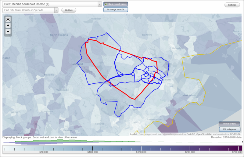
Central Peabody, Downtown, Needham Corner, North Salem, Peabody Civic Center Historic District, South Peabody, Washington Street Historic District, West PeabodyCentral Peabody neighborhood in Peabody statistics: (Find on map)
Area: 5.693 square miles
Population: 59,601
Population density:
Median household income in 2021:
Median rent in in 2021:
Male vs Females
Median age
Housing prices:
Average estimated value of detached houses in 2021 (36.1% of all units):
Average estimated value of townhouses or other attached units in 2021 (6.2% of all units):
Average estimated value of housing units in 2-unit structures in 2021 (17.2% of all units):
Average estimated '21 value of housing units in 3-to-4-unit structures (20.0% of all units):
Average estimated '21 value of housing units in 5-or-more-unit structures (11.6% of all units):
Most popular occupations of males: service occupations (17.9%); sales and office occupations (16.5%); management occupations (except farmers) (12.7%); production occupations (9.7%); construction, extraction, and maintenance occupations (8.9%); transportation occupations (6.6%); material moving occupations (5.2%)
Most popular occupations of females: sales and office occupations (33.9%); service occupations (26.3%); business and financial operations occupations (8.3%); management occupations (except farmers) (7.9%); healthcare practitioners and technical occupations (7.8%); education, training, and library occupations (5.0%); production occupations (4.5%)
Limited-access highways (interstate or state) in this neighborhood: I- 95.
Highways in this neighborhood: Yankee Division Hwy (State Hwy 128, State Hwy 128, Yankee Division Hwy); Andover St (State Hwy 114); Essex St (State Hwy 107).
Roads and streets: Lowell St; Forest St; Summit St; Washington St; Park Ave; Boston St; Nancy Ave; Felton St; Prospect St; Northshore Rd; Aborn St; Trask Rd; Ellsworth Rd; Bourbon St; Downing Rd; Reed Rd; Walnut St; Paul Ave; Cross St; Proctor Cir; Main St; Tumelty Rd; Mason St; Baldwin St; Endicott St; Essex Center Dr; King St; Harmony Grove Rd; Franklin St; Foster St; Warren St Exn; Grove St; Central St; Mount Pleasant Dr; Princeton St; Irving St; Raylen Ave; Edythe Ln; Shore Dr; Warren St; Castle Cir; Beaver St; Pierpont St; James St; Butler St; Putnam St; Sutton St; Judith Rd; Essex Green Ln; Chestnut St; Clark Rd; Wheatland St; Raymond Cir; Olsen Rd; Proctor St; Oak St; Lynnfield St; Hawthorne Cir; Holten St; Longstreet Rd; Allens Ln; Wallis St; Arboretum Way; Calumet St; Buttonwood Ln; Albert Rd; Page St; South St; Clement Ave; Blaney Ave; Apple Hill Rd; Dudley St; Kingdom Ter; Crescent Dr; Arnold Ave; Federal St; Eileen Rd; Ord St; Summit Ter; Edgehill Rd; Phillips St; Hanson St; Coleman St; Essex Ln; Nichols St; Hog Hill Rd; Ruth Ave; Kosciusko St; Beckett St; Anthony Rd; Ledgewood Way; Dartmouth St; Violet Rd; Dahlia Ave; Richartson Rd; Paleologos St; Railroad Ave; Elm St; Tomah Dr; Country Club Rd; Centennial Dr; Grandview Ave; Dustin St; Hardy St; Bowditch St; Belleview Ave; George Ave; Douglas St; Crowninshield St; Cortland St; Albion St; Swampscott Ave; Harvard St; Southwick Rd; Sherry Lee Ln; Peabody Rd; Newton Dr; Goodhue St; Hingston St; Ord St Exd; Augustus St; Charles St; Caller St; Eagan Pl; Joseph Ave; N377; Jacobs St; Emerson St; Jill's Way; Pope St; Crestwood Ln; Cottage St; Adelaide Ave; Emery St; Winter St; Wahtera Rd; Water St; Farnham Ave; Osborne St; Philip Ave; Center St; Upton St; Berry St; Bragg St; Howley St; Price Rd; Sherman St; Pleasant St; Dane St; Tamarack Ln; Varney St; Bow St; Church St; Stuart Rd; Witch Way; Seamount Rd; Wheeler St; Hunt St; Sewall St; Harris St; Shillaber St; Stevens St; Garden Dr; Hillside Ave; Tremont St; Fowler St; Hilltop Dr; Silver St; Puritan Rd; Fay Ave; Home St; Hancock St; Palmer Ave; Ferry Ln; Ethel Ave; Charlotte St; Kingdom Ct; Mill St; Dundee St; Essex Pl; Burke St; Bartlett St; Rawlins St; Cider Mill Rd; State St; Thorndike St; Ray St; Parsons St; Felton Ter; Ayer St; Colby Rd; Spring St; Columbus Rd; Jennifer Ln; Summer St; May St; Littles Ln; Wallis Ann Rd; Berkley St; Orchard St; Wall St; Park St; Goldthwaite Pl; Perkins St; Carrollton St; Hemlock Rd; Purchase St; Maple St; Essex Green Dr; Ober St; Dudley Cir; School St; Meadowview Rd; Breshnahan St; Willowdale Ave; Lowe St; Emerson St Exn; Bedford St; Witchcraft Rd; Jeffrey St; Tracey St; Coolidge Rd; Abbott St (E Aborn St); Yale St; Fulton St; Cunha Rd; Rawding Rd; Grafton St; Howard Ave; Cosmos Dr; 1st Ave; Fitz Rd; Buxton St; Baker St; Mansell Pkwy; Walker Rd; Looney Ave; Birney St; Fountain St; Christina Dr; Walcott St; Beacon St; Arbor Ct; Aborn Pl; Sanborn St; Scotia St; Almeda St W; Norwich Rd; Spruce Way; Flint St; Shaws Ln; Barrett Rd; Noble Ln; Dalton Ct; Sawyer St; Aberdeen St; Frederick St; Priscilla Ln; Pioneer Rd; Munroe Ct; Prospect Ave; Keyes Dr; Karelitz Rd; Henry Ter; Smidt Ave; Ord Street Ct; Washington Pl; Witch Hill Rd; Abbott St; Gallows Hill Rd; Linden Ave; Kings Hill Rd; Ridgefield Ave (Ridgefield St); Parkview Ln; Aspen Ln; Stratis Way; Pioneer Cir; Sutton Ter; N Pine St; Perkins Way; State St Exn; Milk St Exn; Hawthorne Rd; Elliott Pl; Monroe St; Avalon Dr; Basford Ct; Corinne St; Fairmount Rd; Friend St; Langdon St; Border St; Belaire St; Dennis St; Gallows Cir; Berry Pl; McIntire Ct; Milk St; Martha Ter; Park Sq; Avalon Village Way; Logan St; Juniper Rd; Wagner St; Henry St; Audette St; Berube Rd; Kendall Rd; Blaney Ln; Harrod St; Ellis St; Bradley Ave; Elm Pl; Peabody Sq; Zielinski Way; Regal Ter; Eastman Park; Summit Industrial Park; Hilton St; Ash St; Safford St; Franklin Street Ct; Fenton St; Watson St; Anthony Way; Lark St; Lincoln Pl; Fairmount Ct; Burns Way; Wall Street Ct; Colonial Ter; Gilmore Ter; Tanners Ct; Spring Street Ct; Aborn Street Ct; Andover Ter; Griffin Pl; Richard Rd.
Railroad features: Boston and Maine RR.
Other features: Proctor Brk.
Other features: Goldthwait Brk.
Other features: Strongwater Brk; North Riv; Tapley Brk.
Central Peabody neighborhood detailed profile
Area: 5.693 square miles
Population: 59,601
Population density:
| Central Peabody: | 10,470 people per square mile |
| Peabody: | 3,306 people per square mile |
Median household income in 2021:
| Central Peabody: | $74,518 |
| Peabody: | $83,570 |
Median rent in in 2021:
| Central Peabody: | $1,263 |
| Peabody: | $1,491 |
Male vs Females
| Males: | 27,289 |
| Females: | 32,312 |
Median age
| Males: | 38.7 years |
| Females: | 39.8 years |
Housing prices:
Average estimated value of detached houses in 2021 (36.1% of all units):
| Central Peabody: | $450,759 |
| Massachusetts: | $512,170 |
Average estimated value of townhouses or other attached units in 2021 (6.2% of all units):
| This neighborhood: | $1,247,312 |
| Massachusetts: | $446,467 |
Average estimated value of housing units in 2-unit structures in 2021 (17.2% of all units):
| This neighborhood: | $376,728 |
| Massachusetts: | $492,911 |
Average estimated '21 value of housing units in 3-to-4-unit structures (20.0% of all units):
| Central Peabody: | $6,073,024 |
| Massachusetts: | $520,726 |
Average estimated '21 value of housing units in 5-or-more-unit structures (11.6% of all units):
| Central Peabody: | $352,258 |
| Massachusetts: | $484,981 |
Most popular occupations of males: service occupations (17.9%); sales and office occupations (16.5%); management occupations (except farmers) (12.7%); production occupations (9.7%); construction, extraction, and maintenance occupations (8.9%); transportation occupations (6.6%); material moving occupations (5.2%)
Most popular occupations of females: sales and office occupations (33.9%); service occupations (26.3%); business and financial operations occupations (8.3%); management occupations (except farmers) (7.9%); healthcare practitioners and technical occupations (7.8%); education, training, and library occupations (5.0%); production occupations (4.5%)
Limited-access highways (interstate or state) in this neighborhood: I- 95.
Highways in this neighborhood: Yankee Division Hwy (State Hwy 128, State Hwy 128, Yankee Division Hwy); Andover St (State Hwy 114); Essex St (State Hwy 107).
Roads and streets: Lowell St; Forest St; Summit St; Washington St; Park Ave; Boston St; Nancy Ave; Felton St; Prospect St; Northshore Rd; Aborn St; Trask Rd; Ellsworth Rd; Bourbon St; Downing Rd; Reed Rd; Walnut St; Paul Ave; Cross St; Proctor Cir; Main St; Tumelty Rd; Mason St; Baldwin St; Endicott St; Essex Center Dr; King St; Harmony Grove Rd; Franklin St; Foster St; Warren St Exn; Grove St; Central St; Mount Pleasant Dr; Princeton St; Irving St; Raylen Ave; Edythe Ln; Shore Dr; Warren St; Castle Cir; Beaver St; Pierpont St; James St; Butler St; Putnam St; Sutton St; Judith Rd; Essex Green Ln; Chestnut St; Clark Rd; Wheatland St; Raymond Cir; Olsen Rd; Proctor St; Oak St; Lynnfield St; Hawthorne Cir; Holten St; Longstreet Rd; Allens Ln; Wallis St; Arboretum Way; Calumet St; Buttonwood Ln; Albert Rd; Page St; South St; Clement Ave; Blaney Ave; Apple Hill Rd; Dudley St; Kingdom Ter; Crescent Dr; Arnold Ave; Federal St; Eileen Rd; Ord St; Summit Ter; Edgehill Rd; Phillips St; Hanson St; Coleman St; Essex Ln; Nichols St; Hog Hill Rd; Ruth Ave; Kosciusko St; Beckett St; Anthony Rd; Ledgewood Way; Dartmouth St; Violet Rd; Dahlia Ave; Richartson Rd; Paleologos St; Railroad Ave; Elm St; Tomah Dr; Country Club Rd; Centennial Dr; Grandview Ave; Dustin St; Hardy St; Bowditch St; Belleview Ave; George Ave; Douglas St; Crowninshield St; Cortland St; Albion St; Swampscott Ave; Harvard St; Southwick Rd; Sherry Lee Ln; Peabody Rd; Newton Dr; Goodhue St; Hingston St; Ord St Exd; Augustus St; Charles St; Caller St; Eagan Pl; Joseph Ave; N377; Jacobs St; Emerson St; Jill's Way; Pope St; Crestwood Ln; Cottage St; Adelaide Ave; Emery St; Winter St; Wahtera Rd; Water St; Farnham Ave; Osborne St; Philip Ave; Center St; Upton St; Berry St; Bragg St; Howley St; Price Rd; Sherman St; Pleasant St; Dane St; Tamarack Ln; Varney St; Bow St; Church St; Stuart Rd; Witch Way; Seamount Rd; Wheeler St; Hunt St; Sewall St; Harris St; Shillaber St; Stevens St; Garden Dr; Hillside Ave; Tremont St; Fowler St; Hilltop Dr; Silver St; Puritan Rd; Fay Ave; Home St; Hancock St; Palmer Ave; Ferry Ln; Ethel Ave; Charlotte St; Kingdom Ct; Mill St; Dundee St; Essex Pl; Burke St; Bartlett St; Rawlins St; Cider Mill Rd; State St; Thorndike St; Ray St; Parsons St; Felton Ter; Ayer St; Colby Rd; Spring St; Columbus Rd; Jennifer Ln; Summer St; May St; Littles Ln; Wallis Ann Rd; Berkley St; Orchard St; Wall St; Park St; Goldthwaite Pl; Perkins St; Carrollton St; Hemlock Rd; Purchase St; Maple St; Essex Green Dr; Ober St; Dudley Cir; School St; Meadowview Rd; Breshnahan St; Willowdale Ave; Lowe St; Emerson St Exn; Bedford St; Witchcraft Rd; Jeffrey St; Tracey St; Coolidge Rd; Abbott St (E Aborn St); Yale St; Fulton St; Cunha Rd; Rawding Rd; Grafton St; Howard Ave; Cosmos Dr; 1st Ave; Fitz Rd; Buxton St; Baker St; Mansell Pkwy; Walker Rd; Looney Ave; Birney St; Fountain St; Christina Dr; Walcott St; Beacon St; Arbor Ct; Aborn Pl; Sanborn St; Scotia St; Almeda St W; Norwich Rd; Spruce Way; Flint St; Shaws Ln; Barrett Rd; Noble Ln; Dalton Ct; Sawyer St; Aberdeen St; Frederick St; Priscilla Ln; Pioneer Rd; Munroe Ct; Prospect Ave; Keyes Dr; Karelitz Rd; Henry Ter; Smidt Ave; Ord Street Ct; Washington Pl; Witch Hill Rd; Abbott St; Gallows Hill Rd; Linden Ave; Kings Hill Rd; Ridgefield Ave (Ridgefield St); Parkview Ln; Aspen Ln; Stratis Way; Pioneer Cir; Sutton Ter; N Pine St; Perkins Way; State St Exn; Milk St Exn; Hawthorne Rd; Elliott Pl; Monroe St; Avalon Dr; Basford Ct; Corinne St; Fairmount Rd; Friend St; Langdon St; Border St; Belaire St; Dennis St; Gallows Cir; Berry Pl; McIntire Ct; Milk St; Martha Ter; Park Sq; Avalon Village Way; Logan St; Juniper Rd; Wagner St; Henry St; Audette St; Berube Rd; Kendall Rd; Blaney Ln; Harrod St; Ellis St; Bradley Ave; Elm Pl; Peabody Sq; Zielinski Way; Regal Ter; Eastman Park; Summit Industrial Park; Hilton St; Ash St; Safford St; Franklin Street Ct; Fenton St; Watson St; Anthony Way; Lark St; Lincoln Pl; Fairmount Ct; Burns Way; Wall Street Ct; Colonial Ter; Gilmore Ter; Tanners Ct; Spring Street Ct; Aborn Street Ct; Andover Ter; Griffin Pl; Richard Rd.
Railroad features: Boston and Maine RR.
Other features: Proctor Brk.
Other features: Goldthwait Brk.
Other features: Strongwater Brk; North Riv; Tapley Brk.
Central Peabody neighborhood detailed profile
Downtown neighborhood in Peabody statistics: (Find on map)
Area: 2.082 square miles
Population: 22,015
Population density:
Median household income in 2021:
Median rent in in 2021:
Male vs Females
Median age
Housing prices:
Average estimated value of detached houses in 2021 (37.4% of all units):
Average estimated value of housing units in 2-unit structures in 2021 (19.4% of all units):
Average estimated '21 value of housing units in 5-or-more-unit structures (9.9% of all units):
Most popular occupations of males: service occupations (18.4%); sales and office occupations (15.8%); management occupations (except farmers) (13.9%); production occupations (9.2%); construction, extraction, and maintenance occupations (8.7%); transportation occupations (6.1%); computer and mathematical occupations (4.9%)
Most popular occupations of females: sales and office occupations (31.8%); service occupations (24.7%); management occupations (except farmers) (10.2%); business and financial operations occupations (8.1%); healthcare practitioners and technical occupations (6.6%); education, training, and library occupations (5.3%); production occupations (3.9%)
Highways in this neighborhood: Bridge St (State Hwy 107); State Hwy 114 (North St); State Hwy 114 (Margin St); Gardner St (State Hwy 114); Andover St (State Hwy 114).
Roads and streets: Tremont St; Washington St; Mason St; Aborn St; Boston St; Walnut St; Main St; Central St; Endicott St; Northend St; Newcastle Rd; Harmony Grove Rd; Foster St; Grove St; School St; Oakland St; Oak St; Warren St; Beaver St; Buffum St; Pierpont St; Walsh Ave; Proctor St; Lowell St; Butler St; Wallis St; Putnam St; Sutton St; Paleologos St; Chestnut St; Summit St; Driscoll St; Franklin St; Mount Vernon St; Holten St; Dunlap St; Collins St; Fulton St; Barr St; Highland St; Tracey St; Calumet St; Harris St; Barstow St; Clement Ave; Blaney Ave; Balcomb St; Crescent Dr; Commercial St; Lincoln Rd; Ord St; Phillips St; Hanson St; Kenwood Rd; Nichols St; Irving St; Bradford St; Beckett St; Railroad Ave; Elm St; Symonds St; Dustin St; Webster St; Hardy St; Sparrow Ln; Bowditch St; Belleview Ave; Osborne Ter; Albion St; Swampscott Ave; Cushing St; Highland Park; Goodhue St; Hingston St; Lovett St; Ord St Exd; Northend Ave; Caller St; Eagan Pl; N377; Jacobs St; Cottage St; Goodell St; Roycroft Rd; Adelaide Ave; Allens Ln; South St; Winter St; Water St; Davis Ter; Osborne St; Center St; Upton St; Berry St; Howley St; Japonica St; Sherman St; Pleasant St; Dane St; Varney St; Nelson Rd; Bow St; Church St; Carol Ann Rd; Witch Way; Seamount Rd; Wheeler St; Sewall St; Shamrock St; Shillaber St; Goldberg Rd; Flint St; Stevens St; Dark Ln; Sparrow Ln Exd; Silver St; Puritan Rd; Hancock St; Charlotte St; Wilson Ter; Mill St; Dundee St; Burke St; Rawlins St; Englewood Rd; Jefferson Rd; State St; Bates Ter; Parsons St; Ayer St; Spring St; Summer St; Littles Ln; Union St; Wallis Ann Rd; Kirkland Rd; Berkley St; Wall St; Park St; Goldthwaite Pl; Crowninshield St; Carrollton St; Purchase St; Harrod St; Foster Ct; Maple St; Sprague St; Ober St; Tremont Pl; Breshnahan St; Lowe St; Sheldon Rd; Bedford St; Witchcraft Rd; Cressey Ave; Connolly Ter; Coolidge Rd; Abbott St (E Aborn St); Melody Rd; Sylvan St; Grafton St; Highland Ter; Howard Ave; S Mason St; Buxton St; Mansell Pkwy; Walker Rd; Haskell Pl; Birney St; Fountain St; Beacon St; Aborn Pl; Sanborn St; Granite St; Scotia St; Almeda St W; Laurine Rd; Shaws Ln; Bryant St; Chandler St; Noble Ln; Dalton Ct; Sawyer St; Winthrop St; Aberdeen St; Frederick St; Pioneer Rd; Munroe Ct; Barry St; Prospect Ave; Smidt Ave; Ord Street Ct; Washington Pl; Abbott St; Linden Ave; Mooney Ave; Parkview Ln; Pioneer Cir; Sutton Ter; State St Exn; Milk St Exn; Elliott Pl; Monroe St; Basford Ct; Harmony St; Devereaux Ave; Burnham Rd; Friend St; Langdon St; Churchill St; Border St; Belaire St; Devereaux St; Emmett St; Dennis St; Gallows Cir; Berry Pl; McIntire Ct; Milk St; Ridgeway St; Arielle Ln; Park Sq; Logan St; Wagner St; Henry St; Berube Rd; Waters St; Blaney Ln; Elm Pl; Peabody Sq; Zielinski Way; Eastman Park; Japonica Ave; Hilton St; Ash St; Safford St; Watson St; Lark St; Gallows Hill Rd; Lincoln Pl; Santa Ovaia Cir; Burns Way; Wall Street Ct; Colonial Ter; Spring Street Ct; Aborn Street Ct; Norton Ter; Andover Ter; School Street Ct; Richard Rd.
Railroad features: Boston and Maine RR.
Other features: North Riv; Strongwater Brk; Proctor Brk; Goldthwait Brk.
Downtown neighborhood detailed profile
Area: 2.082 square miles
Population: 22,015
Population density:
| Downtown: | 10,572 people per square mile |
| Peabody: | 3,306 people per square mile |
Median household income in 2021:
| Downtown: | $73,284 |
| Peabody: | $83,570 |
Median rent in in 2021:
| Downtown: | $1,207 |
| Peabody: | $1,491 |
Male vs Females
| Males: | 9,962 |
| Females: | 12,053 |
Median age
| Males: | 38.8 years |
| Females: | 39.3 years |
Housing prices:
Average estimated value of detached houses in 2021 (37.4% of all units):
| Downtown: | $435,950 |
| Massachusetts: | $512,170 |
Average estimated value of housing units in 2-unit structures in 2021 (19.4% of all units):
| This neighborhood: | $374,942 |
| Massachusetts: | $492,911 |
Average estimated '21 value of housing units in 5-or-more-unit structures (9.9% of all units):
| Downtown: | $352,258 |
| Massachusetts: | $484,981 |
Most popular occupations of males: service occupations (18.4%); sales and office occupations (15.8%); management occupations (except farmers) (13.9%); production occupations (9.2%); construction, extraction, and maintenance occupations (8.7%); transportation occupations (6.1%); computer and mathematical occupations (4.9%)
Most popular occupations of females: sales and office occupations (31.8%); service occupations (24.7%); management occupations (except farmers) (10.2%); business and financial operations occupations (8.1%); healthcare practitioners and technical occupations (6.6%); education, training, and library occupations (5.3%); production occupations (3.9%)
Highways in this neighborhood: Bridge St (State Hwy 107); State Hwy 114 (North St); State Hwy 114 (Margin St); Gardner St (State Hwy 114); Andover St (State Hwy 114).
Roads and streets: Tremont St; Washington St; Mason St; Aborn St; Boston St; Walnut St; Main St; Central St; Endicott St; Northend St; Newcastle Rd; Harmony Grove Rd; Foster St; Grove St; School St; Oakland St; Oak St; Warren St; Beaver St; Buffum St; Pierpont St; Walsh Ave; Proctor St; Lowell St; Butler St; Wallis St; Putnam St; Sutton St; Paleologos St; Chestnut St; Summit St; Driscoll St; Franklin St; Mount Vernon St; Holten St; Dunlap St; Collins St; Fulton St; Barr St; Highland St; Tracey St; Calumet St; Harris St; Barstow St; Clement Ave; Blaney Ave; Balcomb St; Crescent Dr; Commercial St; Lincoln Rd; Ord St; Phillips St; Hanson St; Kenwood Rd; Nichols St; Irving St; Bradford St; Beckett St; Railroad Ave; Elm St; Symonds St; Dustin St; Webster St; Hardy St; Sparrow Ln; Bowditch St; Belleview Ave; Osborne Ter; Albion St; Swampscott Ave; Cushing St; Highland Park; Goodhue St; Hingston St; Lovett St; Ord St Exd; Northend Ave; Caller St; Eagan Pl; N377; Jacobs St; Cottage St; Goodell St; Roycroft Rd; Adelaide Ave; Allens Ln; South St; Winter St; Water St; Davis Ter; Osborne St; Center St; Upton St; Berry St; Howley St; Japonica St; Sherman St; Pleasant St; Dane St; Varney St; Nelson Rd; Bow St; Church St; Carol Ann Rd; Witch Way; Seamount Rd; Wheeler St; Sewall St; Shamrock St; Shillaber St; Goldberg Rd; Flint St; Stevens St; Dark Ln; Sparrow Ln Exd; Silver St; Puritan Rd; Hancock St; Charlotte St; Wilson Ter; Mill St; Dundee St; Burke St; Rawlins St; Englewood Rd; Jefferson Rd; State St; Bates Ter; Parsons St; Ayer St; Spring St; Summer St; Littles Ln; Union St; Wallis Ann Rd; Kirkland Rd; Berkley St; Wall St; Park St; Goldthwaite Pl; Crowninshield St; Carrollton St; Purchase St; Harrod St; Foster Ct; Maple St; Sprague St; Ober St; Tremont Pl; Breshnahan St; Lowe St; Sheldon Rd; Bedford St; Witchcraft Rd; Cressey Ave; Connolly Ter; Coolidge Rd; Abbott St (E Aborn St); Melody Rd; Sylvan St; Grafton St; Highland Ter; Howard Ave; S Mason St; Buxton St; Mansell Pkwy; Walker Rd; Haskell Pl; Birney St; Fountain St; Beacon St; Aborn Pl; Sanborn St; Granite St; Scotia St; Almeda St W; Laurine Rd; Shaws Ln; Bryant St; Chandler St; Noble Ln; Dalton Ct; Sawyer St; Winthrop St; Aberdeen St; Frederick St; Pioneer Rd; Munroe Ct; Barry St; Prospect Ave; Smidt Ave; Ord Street Ct; Washington Pl; Abbott St; Linden Ave; Mooney Ave; Parkview Ln; Pioneer Cir; Sutton Ter; State St Exn; Milk St Exn; Elliott Pl; Monroe St; Basford Ct; Harmony St; Devereaux Ave; Burnham Rd; Friend St; Langdon St; Churchill St; Border St; Belaire St; Devereaux St; Emmett St; Dennis St; Gallows Cir; Berry Pl; McIntire Ct; Milk St; Ridgeway St; Arielle Ln; Park Sq; Logan St; Wagner St; Henry St; Berube Rd; Waters St; Blaney Ln; Elm Pl; Peabody Sq; Zielinski Way; Eastman Park; Japonica Ave; Hilton St; Ash St; Safford St; Watson St; Lark St; Gallows Hill Rd; Lincoln Pl; Santa Ovaia Cir; Burns Way; Wall Street Ct; Colonial Ter; Spring Street Ct; Aborn Street Ct; Norton Ter; Andover Ter; School Street Ct; Richard Rd.
Railroad features: Boston and Maine RR.
Other features: North Riv; Strongwater Brk; Proctor Brk; Goldthwait Brk.
Downtown neighborhood detailed profile
Needham Corner neighborhood in Peabody statistics: (Find on map)
Area: 2.560 square miles
Population: 15,237
Population density:
Median household income in 2021:
Median rent in in 2021:
Male vs Females
Median age
Housing prices:
Average estimated value of detached houses in 2021 (53.2% of all units):
Average estimated value of housing units in 2-unit structures in 2021 (27.1% of all units):
Average estimated '21 value of housing units in 5-or-more-unit structures (4.9% of all units):
Most popular occupations of males: service occupations (26.8%); construction, extraction, and maintenance occupations (14.4%); sales and office occupations (11.8%); management occupations (except farmers) (10.5%); transportation occupations (7.7%); business and financial operations occupations (4.0%); material moving occupations (3.0%)
Most popular occupations of females: sales and office occupations (37.3%); service occupations (25.2%); healthcare practitioners and technical occupations (14.4%); business and financial operations occupations (8.5%); education, training, and library occupations (7.0%); management occupations (except farmers) (3.9%); arts, design, entertainment, sports, and media occupations (1.1%)
Limited-access highways (interstate or state) in this neighborhood: State Hwy 128 (I- 95, Yankee Division Hwy).
Highways in this neighborhood: State Hwy 128 (Yankee Division Hwy, State Hwy 128, Yankee Division Hwy); State Hwy 129 (Lynnfield St); Salem St (State Hwy 129).
Roads and streets: Centennial Dr; Washington St; Jubilee Dr; Summit St; Park Ave; Lowell St; 1st Ave; Ellsworth Rd; Forest St; King St; Franklin St; Foster St; N378; Quail Rd; James St; Raymond Cir; 5th St; Allens Ln; Oak St; Joyce Rd; Chestnut St; Dudley St; Kingdom Ter; Arnold Ave; N377; Summit Ter; 2nd St; Whitney Dr (Whitney Rd); Coleman St; Holden St; Lynch St; Kosciusko St; Anthony Rd; Leonard Rd; Douglas St; Mason St; Irving St; Southwick Rd; Will Sawyer St; Technology Dr; Augustus St; Main St; Charles St; Emerson St; Winter St; Mansfield St; Farnham Ave; Seamount Rd; Hunt St; 4th St; Fay Ave; Palmer Ave; Ethel Ave; Kingdom Ct; Bartlett St; Ray St; Spring St; Summer St; Littles Ln; Wright St; Park St; Perkins St; Dudley Cir; School St; Lowe St; Corwin St; Emerson St Exn; Church St; Jeffrey St; Coolidge Rd; Robin Rd; Baker St; Walker Rd; Birney St; Christina Dr; Walcott St; Sanborn St; Curtis St; Demoree Ter; Washington Pl; Kings Hill Rd; Perkins Way; Elliott Pl; Basford Ct; Corporation Way; Martha Ter; Park Sq; Audette St; Kendall Rd; Bradley Ave; Summit Industrial Park; Travis Way; Franklin Street Ct; Fenton St; Anthony Way; Lincoln Pl; Alexander St; Tanners Ct; Spring Street Ct.
Railroad features: Boston and Maine RR.
Other features: Goldthwait Brk; Tapley Brk.
Needham Corner neighborhood detailed profile
Area: 2.560 square miles
Population: 15,237
Population density:
| Needham Corner (Needham Corners): | 5,953 people per square mile |
| Peabody: | 3,306 people per square mile |
Median household income in 2021:
| Needham Corner (Needham Corners): | $82,590 |
| Peabody: | $83,570 |
Median rent in in 2021:
| Needham Corner (Needham Corners): | $1,601 |
| Peabody: | $1,491 |
Male vs Females
| Males: | 7,626 |
| Females: | 7,610 |
Median age
| Males: | 40.7 years |
| Females: | 40.7 years |
Housing prices:
Average estimated value of detached houses in 2021 (53.2% of all units):
| Needham Corner (Needham Corners): | $509,303 |
| Massachusetts: | $512,170 |
Average estimated value of housing units in 2-unit structures in 2021 (27.1% of all units):
| This neighborhood: | $430,949 |
| Massachusetts: | $492,911 |
Average estimated '21 value of housing units in 5-or-more-unit structures (4.9% of all units):
| Needham Corner (Needham Corners): | $352,258 |
| Massachusetts: | $484,981 |
Most popular occupations of males: service occupations (26.8%); construction, extraction, and maintenance occupations (14.4%); sales and office occupations (11.8%); management occupations (except farmers) (10.5%); transportation occupations (7.7%); business and financial operations occupations (4.0%); material moving occupations (3.0%)
Most popular occupations of females: sales and office occupations (37.3%); service occupations (25.2%); healthcare practitioners and technical occupations (14.4%); business and financial operations occupations (8.5%); education, training, and library occupations (7.0%); management occupations (except farmers) (3.9%); arts, design, entertainment, sports, and media occupations (1.1%)
Limited-access highways (interstate or state) in this neighborhood: State Hwy 128 (I- 95, Yankee Division Hwy).
Highways in this neighborhood: State Hwy 128 (Yankee Division Hwy, State Hwy 128, Yankee Division Hwy); State Hwy 129 (Lynnfield St); Salem St (State Hwy 129).
Roads and streets: Centennial Dr; Washington St; Jubilee Dr; Summit St; Park Ave; Lowell St; 1st Ave; Ellsworth Rd; Forest St; King St; Franklin St; Foster St; N378; Quail Rd; James St; Raymond Cir; 5th St; Allens Ln; Oak St; Joyce Rd; Chestnut St; Dudley St; Kingdom Ter; Arnold Ave; N377; Summit Ter; 2nd St; Whitney Dr (Whitney Rd); Coleman St; Holden St; Lynch St; Kosciusko St; Anthony Rd; Leonard Rd; Douglas St; Mason St; Irving St; Southwick Rd; Will Sawyer St; Technology Dr; Augustus St; Main St; Charles St; Emerson St; Winter St; Mansfield St; Farnham Ave; Seamount Rd; Hunt St; 4th St; Fay Ave; Palmer Ave; Ethel Ave; Kingdom Ct; Bartlett St; Ray St; Spring St; Summer St; Littles Ln; Wright St; Park St; Perkins St; Dudley Cir; School St; Lowe St; Corwin St; Emerson St Exn; Church St; Jeffrey St; Coolidge Rd; Robin Rd; Baker St; Walker Rd; Birney St; Christina Dr; Walcott St; Sanborn St; Curtis St; Demoree Ter; Washington Pl; Kings Hill Rd; Perkins Way; Elliott Pl; Basford Ct; Corporation Way; Martha Ter; Park Sq; Audette St; Kendall Rd; Bradley Ave; Summit Industrial Park; Travis Way; Franklin Street Ct; Fenton St; Anthony Way; Lincoln Pl; Alexander St; Tanners Ct; Spring Street Ct.
Railroad features: Boston and Maine RR.
Other features: Goldthwait Brk; Tapley Brk.
Needham Corner neighborhood detailed profile
North Salem neighborhood in Peabody statistics: (Find on map)
Area: 4.568 square miles
Population: 27,823
Population density:
Median household income in 2021:
Median rent in in 2021:
Male vs Females
Median age
Housing prices:
Average estimated value of detached houses in 2021 (37.6% of all units):
Average estimated value of housing units in 2-unit structures in 2021 (23.0% of all units):
Average estimated '21 value of housing units in 5-or-more-unit structures (21.0% of all units):
Most popular occupations of males: service occupations (19.7%); sales and office occupations (14.8%); construction, extraction, and maintenance occupations (11.2%); management occupations (except farmers) (10.6%); computer and mathematical occupations (8.4%); transportation occupations (8.3%); production occupations (7.5%)
Most popular occupations of females: sales and office occupations (28.6%); service occupations (21.7%); management occupations (except farmers) (11.6%); healthcare practitioners and technical occupations (8.9%); business and financial operations occupations (8.7%); education, training, and library occupations (5.9%); life, physical, and social science occupations (3.4%)
Highways in this neighborhood: Yankee Division Hwy (State Hwy 128); State Hwy 114 (North St); State Hwy 114 (Andover St); Bridge St (State Hwy 107); Margin St (State Hwy 35); State Hwy 114 (Pulaski St); Gardner St (State Hwy 114).
Roads and streets: Lowell St; Tremont St; Washington St; Park Ave; Mason St; Franklin St; Northshore Rd; Foster St; Ellsworth Rd; Central St; Walnut St; Forest St; Endicott St; King St; N Shore Ave; Dearborn St; Northend St; School St; Lynnfield St; Newcastle Rd; Harmony Grove Rd; Liberty Hill Ave; Boston St; Warren St Exn; Kernwood St; Oakland St; Irving St; Orchard St; Oak St; Main St; Grove St; Shore Dr; Warren St; Water St; Castle Cir; Beaver St; Summit St; Buffum St; Orne St; Walsh Ave; James St; Buttonwood Ln; Harris St; N Central St; Wallis St; Paleologos St; Appleton St; Chestnut St; Jacobs Ave; Raymond Cir; Driscoll St; Commercial St; Sargent St; Mount Vernon St; Dunlap St; Collins St; Fulton St; Allens Ln; Barr St; Walter St; Highland St; Mount Carmel Rd; Tracey St; Cabot Farm St; Sabino Farm Rd; Evans Rd; Barstow St; Lenox Rd; Balcomb St; Dudley St; Kingdom Ter; Nickerson Rd; Abington Ave; Arnold Ave; Colonial Rd; Osborne St; Lincoln Rd; Esquire Dr; Summit Ter; Phillips St; Felt St; Coleman St; Kenwood Rd; Nursery St; Wiseman Dr; Bradford St; Kosciusko St; Canterbury Dr; Upham St; Anthony Rd; Violet Rd; Dahlia Ave; Larchmont Rd; Buxton Ln; Railroad Ave; Elm St; Symonds St; Sheffield Dr; Westview Cir; Grandview Ave; Webster St; Margin Ter; Hardy St; Sparrow Ln; Bowditch St; Lee St; Osborne Ter; Douglas St; Dobbs Rd; Crowninshield St; Cushing St; Southwick Rd; Highland Park; Proctor St; S Shore Ave; Goodhue St; Lovett St; Northend Ave; Augustus St; Fairmount St; Charles St; N377; Jacobs St; Emerson St; Jill's Way; S Liberty St; Woodside St; Bay View Cir; Goodell St; Roycroft Rd; Winter St; Wahtera Rd; Davis Ter; Roland Rd; Farnham Ave; Spinale Rd; Upton St; Berry St; Howley St; Japonica St; Nelson Rd; Church St; Carol Ann Rd; Seamount Rd; Hunt St; Shamrock St; Goldberg Rd; Flint St; Stevens St; Garden Dr; Dark Ln; Sparrow Ln Exd; Hilltop Dr; Silver St; Fay Ave; Palmer Ave; Ethel Ave; Wilson Ter; Kingdom Ct; Mill St; Salt Wall Ln; Bartlett St; Roosevelt Rd; Englewood Rd; Jefferson Rd; Bates Ter; Thorndike St; Rand Rd; Ray St; Gallant Rd; Southwick St; Spring St; Columbus Rd; Jennifer Ln; Summer St; Littles Ln; Union St; Kirkland Rd; Park St; Perkins St; Harrod St; Foster Ct; Sprague St; Esquire Cir; Manning St; Tremont Pl; Dudley Cir; Lowe St; Sheldon Rd; Emerson St Exn; Kernwood Ave; Jeffrey St; Center St; Larch Ave; Cressey Ave; Connolly Ter; Coolidge Rd; Cunha Rd; Melody Rd; Rawding Rd; Sylvan St; Highland Ter; Locust St; Fitz Rd; S Mason St; Buxton St; Baker St; Walker Rd; Haskell Pl; Birney St; Beachmont Rd; Walcott St; Moulton Ave; Adams Ave; Sanborn St; Granite St; Margin Street Ct; Pound Ln; Laurine Rd; Barrett Rd; Bryant St; Everett Rd; Claremont Rd; Chandler St; Noble Ln; Jacobs Lndg; Caller St; Sawyer St; Winthrop St; Franklin Ct; Randall St; Felt Street Way; Munroe Ct; Barry St; Karelitz Rd; Smidt Ave; Washington Pl; Mooney Ave; Kings Hill Rd; Andover Dr; Parkview Ln; Perkins Way; Franklin Pierce Dr; Elliott Pl; Monroe St; N Central Ct; Basford Ct; Hayward St; Harmony St; Devereaux Ave; Orchard Ter; Burnham Rd; Fairmount Rd; Friend St; Churchill St; Devereaux St; Emmett St; Dennis St; Berry Pl; McIntire Ct; Ridgeway St; Martha Ter; Arielle Ln; Garden Ter; Park Sq; Seneca Rd; Audette St; Waters St; Dearborn Ln; Kendall Rd; Bradley Ave; Elm Pl; Peabody Sq; Stodder Pl; Regal Ter; Japonica Ave; Ash St; Safford St; Franklin Street Ct; Fenton St; Watson St; Anthony Way; Lincoln Pl; Leavitt Ct; Fairmount Ct; Santa Ovaia Cir; Mead Ct; Horton Ct; Gardner Rd; Gilmore Ter; Tanners Ct; Spring Street Ct; Norton Ter; Andover Ter; School Street Ct.
Railroad features: Boston and Maine RR.
Other features: Proctor Brk.
Other features: North Riv.
Other features: Goldthwait Brk.
Other features: Tapley Brk; Strongwater Brk.
North Salem neighborhood detailed profile
Area: 4.568 square miles
Population: 27,823
Population density:
| North Salem (N Salem): | 6,090 people per square mile |
| Peabody: | 3,306 people per square mile |
Median household income in 2021:
| North Salem (N Salem): | $79,803 |
| Peabody: | $83,570 |
Median rent in in 2021:
| North Salem (N Salem): | $1,199 |
| Peabody: | $1,491 |
Male vs Females
| Males: | 12,733 |
| Females: | 15,090 |
Median age
| Males: | 39.3 years |
| Females: | 39.9 years |
Housing prices:
Average estimated value of detached houses in 2021 (37.6% of all units):
| North Salem (N Salem): | $531,345 |
| Massachusetts: | $512,170 |
Average estimated value of housing units in 2-unit structures in 2021 (23.0% of all units):
| This neighborhood: | $371,999 |
| Massachusetts: | $492,911 |
Average estimated '21 value of housing units in 5-or-more-unit structures (21.0% of all units):
| North Salem (N Salem): | $352,258 |
| Massachusetts: | $484,981 |
Most popular occupations of males: service occupations (19.7%); sales and office occupations (14.8%); construction, extraction, and maintenance occupations (11.2%); management occupations (except farmers) (10.6%); computer and mathematical occupations (8.4%); transportation occupations (8.3%); production occupations (7.5%)
Most popular occupations of females: sales and office occupations (28.6%); service occupations (21.7%); management occupations (except farmers) (11.6%); healthcare practitioners and technical occupations (8.9%); business and financial operations occupations (8.7%); education, training, and library occupations (5.9%); life, physical, and social science occupations (3.4%)
Highways in this neighborhood: Yankee Division Hwy (State Hwy 128); State Hwy 114 (North St); State Hwy 114 (Andover St); Bridge St (State Hwy 107); Margin St (State Hwy 35); State Hwy 114 (Pulaski St); Gardner St (State Hwy 114).
Roads and streets: Lowell St; Tremont St; Washington St; Park Ave; Mason St; Franklin St; Northshore Rd; Foster St; Ellsworth Rd; Central St; Walnut St; Forest St; Endicott St; King St; N Shore Ave; Dearborn St; Northend St; School St; Lynnfield St; Newcastle Rd; Harmony Grove Rd; Liberty Hill Ave; Boston St; Warren St Exn; Kernwood St; Oakland St; Irving St; Orchard St; Oak St; Main St; Grove St; Shore Dr; Warren St; Water St; Castle Cir; Beaver St; Summit St; Buffum St; Orne St; Walsh Ave; James St; Buttonwood Ln; Harris St; N Central St; Wallis St; Paleologos St; Appleton St; Chestnut St; Jacobs Ave; Raymond Cir; Driscoll St; Commercial St; Sargent St; Mount Vernon St; Dunlap St; Collins St; Fulton St; Allens Ln; Barr St; Walter St; Highland St; Mount Carmel Rd; Tracey St; Cabot Farm St; Sabino Farm Rd; Evans Rd; Barstow St; Lenox Rd; Balcomb St; Dudley St; Kingdom Ter; Nickerson Rd; Abington Ave; Arnold Ave; Colonial Rd; Osborne St; Lincoln Rd; Esquire Dr; Summit Ter; Phillips St; Felt St; Coleman St; Kenwood Rd; Nursery St; Wiseman Dr; Bradford St; Kosciusko St; Canterbury Dr; Upham St; Anthony Rd; Violet Rd; Dahlia Ave; Larchmont Rd; Buxton Ln; Railroad Ave; Elm St; Symonds St; Sheffield Dr; Westview Cir; Grandview Ave; Webster St; Margin Ter; Hardy St; Sparrow Ln; Bowditch St; Lee St; Osborne Ter; Douglas St; Dobbs Rd; Crowninshield St; Cushing St; Southwick Rd; Highland Park; Proctor St; S Shore Ave; Goodhue St; Lovett St; Northend Ave; Augustus St; Fairmount St; Charles St; N377; Jacobs St; Emerson St; Jill's Way; S Liberty St; Woodside St; Bay View Cir; Goodell St; Roycroft Rd; Winter St; Wahtera Rd; Davis Ter; Roland Rd; Farnham Ave; Spinale Rd; Upton St; Berry St; Howley St; Japonica St; Nelson Rd; Church St; Carol Ann Rd; Seamount Rd; Hunt St; Shamrock St; Goldberg Rd; Flint St; Stevens St; Garden Dr; Dark Ln; Sparrow Ln Exd; Hilltop Dr; Silver St; Fay Ave; Palmer Ave; Ethel Ave; Wilson Ter; Kingdom Ct; Mill St; Salt Wall Ln; Bartlett St; Roosevelt Rd; Englewood Rd; Jefferson Rd; Bates Ter; Thorndike St; Rand Rd; Ray St; Gallant Rd; Southwick St; Spring St; Columbus Rd; Jennifer Ln; Summer St; Littles Ln; Union St; Kirkland Rd; Park St; Perkins St; Harrod St; Foster Ct; Sprague St; Esquire Cir; Manning St; Tremont Pl; Dudley Cir; Lowe St; Sheldon Rd; Emerson St Exn; Kernwood Ave; Jeffrey St; Center St; Larch Ave; Cressey Ave; Connolly Ter; Coolidge Rd; Cunha Rd; Melody Rd; Rawding Rd; Sylvan St; Highland Ter; Locust St; Fitz Rd; S Mason St; Buxton St; Baker St; Walker Rd; Haskell Pl; Birney St; Beachmont Rd; Walcott St; Moulton Ave; Adams Ave; Sanborn St; Granite St; Margin Street Ct; Pound Ln; Laurine Rd; Barrett Rd; Bryant St; Everett Rd; Claremont Rd; Chandler St; Noble Ln; Jacobs Lndg; Caller St; Sawyer St; Winthrop St; Franklin Ct; Randall St; Felt Street Way; Munroe Ct; Barry St; Karelitz Rd; Smidt Ave; Washington Pl; Mooney Ave; Kings Hill Rd; Andover Dr; Parkview Ln; Perkins Way; Franklin Pierce Dr; Elliott Pl; Monroe St; N Central Ct; Basford Ct; Hayward St; Harmony St; Devereaux Ave; Orchard Ter; Burnham Rd; Fairmount Rd; Friend St; Churchill St; Devereaux St; Emmett St; Dennis St; Berry Pl; McIntire Ct; Ridgeway St; Martha Ter; Arielle Ln; Garden Ter; Park Sq; Seneca Rd; Audette St; Waters St; Dearborn Ln; Kendall Rd; Bradley Ave; Elm Pl; Peabody Sq; Stodder Pl; Regal Ter; Japonica Ave; Ash St; Safford St; Franklin Street Ct; Fenton St; Watson St; Anthony Way; Lincoln Pl; Leavitt Ct; Fairmount Ct; Santa Ovaia Cir; Mead Ct; Horton Ct; Gardner Rd; Gilmore Ter; Tanners Ct; Spring Street Ct; Norton Ter; Andover Ter; School Street Ct.
Railroad features: Boston and Maine RR.
Other features: Proctor Brk.
Other features: North Riv.
Other features: Goldthwait Brk.
Other features: Tapley Brk; Strongwater Brk.
North Salem neighborhood detailed profile
Peabody Civic Center Historic District neighborhood in Peabody statistics: (Find on map)
Area: 0.096 square miles
Population: 1,078
Population density:
Median household income in 2021:
Median rent in in 2021:
Male vs Females
Median age
Housing prices:
Average estimated value of detached houses in 2021 (27.9% of all units):
Average estimated value of housing units in 2-unit structures in 2021 (33.9% of all units):
Most popular occupations of males: service occupations (28.3%); transportation occupations (18.2%); construction, extraction, and maintenance occupations (16.3%); sales and office occupations (12.5%); production occupations (6.4%); management occupations (except farmers) (4.5%); architecture and engineering occupations (3.7%)
Most popular occupations of females: service occupations (36.5%); sales and office occupations (30.7%); healthcare practitioners and technical occupations (19.9%); business and financial operations occupations (6.5%); arts, design, entertainment, sports, and media occupations (4.0%); management occupations (except farmers) (1.8%); transportation occupations (1.7%)
Roads and streets: Lowell St; Chestnut St; Franklin St; Railroad Ave; Church St; Seamount Rd; Foster St; Perkins St; School St; N377; Coolidge Rd; Walker Rd; Sawyer St; Central St; Perkins Way; Basford Ct; Peabody Sq.
Railroad features: Boston and Maine RR.
Other features: Proctor Brk.
Peabody Civic Center Historic District neighborhood detailed profile
Area: 0.096 square miles
Population: 1,078
Population density:
| Peabody Civic Center Historic District (Peabody Civic Center): | 11,198 people per square mile |
| Peabody: | 3,306 people per square mile |
Median household income in 2021:
| Peabody Civic Center Historic District (Peabody Civic Center): | $76,110 |
| Peabody: | $83,570 |
Median rent in in 2021:
| Peabody Civic Center Historic District (Peabody Civic Center): | $1,005 |
| Peabody: | $1,491 |
Male vs Females
| Males: | 490 |
| Females: | 587 |
Median age
| Males: | 39.1 years |
| Females: | 33.4 years |
Housing prices:
Average estimated value of detached houses in 2021 (27.9% of all units):
| Peabody Civic Center Historic District (Peabody Civic Center): | $442,202 |
| Massachusetts: | $512,170 |
Average estimated value of housing units in 2-unit structures in 2021 (33.9% of all units):
| This neighborhood: | $394,601 |
| Massachusetts: | $492,911 |
Most popular occupations of males: service occupations (28.3%); transportation occupations (18.2%); construction, extraction, and maintenance occupations (16.3%); sales and office occupations (12.5%); production occupations (6.4%); management occupations (except farmers) (4.5%); architecture and engineering occupations (3.7%)
Most popular occupations of females: service occupations (36.5%); sales and office occupations (30.7%); healthcare practitioners and technical occupations (19.9%); business and financial operations occupations (6.5%); arts, design, entertainment, sports, and media occupations (4.0%); management occupations (except farmers) (1.8%); transportation occupations (1.7%)
Roads and streets: Lowell St; Chestnut St; Franklin St; Railroad Ave; Church St; Seamount Rd; Foster St; Perkins St; School St; N377; Coolidge Rd; Walker Rd; Sawyer St; Central St; Perkins Way; Basford Ct; Peabody Sq.
Railroad features: Boston and Maine RR.
Other features: Proctor Brk.
Peabody Civic Center Historic District neighborhood detailed profile
South Peabody neighborhood in Peabody statistics: (Find on map)
Area: 12.326 square miles
Population: 48,975
Population density:
Median household income in 2021:
Median rent in in 2021:
Male vs Females
Median age
Housing prices:
Average estimated value of detached houses in 2021 (69.2% of all units):
Average estimated value of townhouses or other attached units in 2021 (10.8% of all units):
Average estimated value of housing units in 2-unit structures in 2021 (21.6% of all units):
Average estimated '21 value of housing units in 3-to-4-unit structures (10.7% of all units):
Average estimated '21 value of housing units in 5-or-more-unit structures (5.8% of all units):
Most popular occupations of males: service occupations (17.0%); sales and office occupations (15.3%); management occupations (except farmers) (14.5%); construction, extraction, and maintenance occupations (8.6%); production occupations (5.8%); healthcare practitioners and technical occupations (4.8%); transportation occupations (4.8%)
Most popular occupations of females: sales and office occupations (30.0%); service occupations (18.5%); healthcare practitioners and technical occupations (12.6%); education, training, and library occupations (10.9%); management occupations (except farmers) (8.4%); business and financial operations occupations (6.6%); community and social services occupations (2.5%)
Limited-access highways (interstate or state) in this neighborhood: Yankee Division Hwy (I- 95, State Hwy 128).
Highways in this neighborhood: State Hwy 129 (Lynnfield St); State Hwy 107 (Highland Ave); State Hwy 128 (Yankee Division Hwy, State Hwy 128, Yankee Division Hwy); State Hwy 129 (Salem St); State Hwy 107 (Western Ave); Newburyport Tpke (US Hwy 1, Broadway, State Hwy 129); Essex St (State Hwy 107).
Roads and streets: Bartholomew St; Lynn St; Centennial Dr; Summit St; Washington St; Cedar Brook Rd; Jubilee Dr; Park Ave; Den Quarry Rd; Fairview Ave; Marlborough Rd; Jenness St; Rockdale Ave; Spring Pond Rd; Lowell St; Broadway; Great Woods Rd; Fays Ave; 1st Ave; Forest St; Aborn St; Ellsworth Rd; Hillside Ave; Valley St; Verona St; Euclid Ave; Dartmouth St; King St; Franklin St; Edgemere Rd; County St; Quinn Rd; Foster St; Sandra Rd; Standish Rd; Emerald Dr; Greenwood Rd; Oak Ave; Spring View Dr; Gallows Hill Rd; Aberdeen Ave; Commonwealth Rd; N378; Kernwood Dr; Quail Rd; Crowdis St; Olde Village Dr; Bickford St; Grant Rd; Proctor St; Vista Ave; Cedar Grove Ave; Woodland Ave S; James St; Saunders Rd; Veterans Memorial Dr; Butler St; Sable Rd; Dexter St; May St; Ravenna Ave; Linden Rd; Millard Ave; Putnam St; Tara Rd; Circle Hill Rd; Nichols St; Sutton St; Range Ave; Sheilas Way; Outlook Ave; Fellsmere St; Home St; Glendale Ave; Murdock Dr; Nells Pond Rd; Granite Rd; Parkland Ave; Harris Rd; Raymond Cir; Woodland Ave N; Sunset Dr; Bacheller St; Longview Way; Elmwood Cir; York Rd; Macarthur Cir; Rainbow Rd; Fairview Rd; St Ann's Ave; 5th St; Copeland Rd; Diane Rd; Bay State Rd; Glenway Ave; Cherry Hill Ave; Allens Ln; Belleview Ave; Hourihan St; Columbia Blvd; Pierpont St; Sutcliffe Rd; Park Rd; Emerson Ave; Coolidge Ave; Calumet St; Louis Rd; Granite St; Fair Oaks Ave; Oak St; Fernwood Ave; Range Heights Rd; Glendale St; Joyce Rd; South St; Clement Ave; Chestnut St; Blaney Ave; Regina Rd; Maple St; Rainbow Cir; Dudley St; Kingdom Ter; Goodridge St; Crescent Dr; Sylvan Cir; Arnold Ave; Rose Cir; B St; Lookout Ter; Martinack Ave; John Rd; N377; Holten St; Ord St; Cannon Rock Rd; Mary Ellen Dr; Summit Ter; Stonewood Ln; Atkins Ave; Bay State Blvd; Griffin Rd; Colonial Ave; 2nd St; Ledge Rd; Gemma Dr; Mooney Rd; Whitney Dr (Whitney Rd); Coleman St; Lakeshore Rd; Amanda Way; Parlee St; Holden St; Bartholomew Ter; Judge Rd; Heritage Dr; Edge Hill Rd; Belleaire Ave; Lynch St; Batchelder Ave; W Diane Rd; Blair Ter; Beckett St; Anthony Rd; Lockwood Rd; Lynnbrook Rd; Kevill Rd; Clark Rd; Gables Cir; Lake Shore Rd; Ravenwood Rd; Bow Ridge Rd; Longwood Ave; Linton Rd; Beacon Blvd; Waselchuk Dr; Boston St; Anchor Rd; Barcelona Ave; Buena Vista Ave; Carlton St; Boulderbrook Dr; Joy Rd; Dustin St; Bowen Rd; Janet Ln; Maple Valley Rd; Lansing Rd; Hanson St; Clairmont St; Scenic Rd; Mayfair St; Sylvia Rd; Sarah's Way; Moon Rd; Urban St; Verdmont Ave; Leonard Rd; Elaine Ave; Pendexter St; Clearview Ave; Crooker Dr; Oak Ave Exd; Douglas St; Dooling Cir; Macarthur Rd; Maplewood Rd; Albion St; Canterbury Rd; Swampscott Ave; Mason St; Scenic Ave; Madeline Ave; Irving St; Holly Ave; Southwick Rd; Greenlawn Ave; Brentwood Dr; Will Sawyer St; Felton Ave; Glenwood Rd; Shirley Rd; Pulsifer Ave; Hingston St; Puritan Rd; Kosciusko St; Ord St Exd; Technology Dr; Augustus St; Casco Rd; Charles St; Thistle St; Nathan's Way; Johnson Ave; Donnelly Dr; Emerson St; Linwood St; B Street Pl; Park St; Phaeton Rock Rd; Cottage St; Brown St; Valley Cir; Myles St (Myles Rd); Munroe St; Kittridge Rd; Adelaide Ave; Arnold Rd; Hathaway Ave; Margaret Rd; Tuscan Rd; Thomas Cir; Winter St; Mansfield St; Dibble Rd; Stocker Ave; Norfolk Ave; Farnham Ave; Cloverdale Ave; Pope St; Locust St; Osborne St; Sherwood Ave; Alden Rd; Goldthaite Ave; Oak Ridge Cir; Cowdrey Ave; Laurel Rd; Cumberland Cir; Trevett Ave; Pumping Station Rd; Cobb Ln; Sherman St; Pleasant St; Dane St; Varney St; Longhill Rd; Bow St; Daniel Ter; Michelle Rd; Hollis Rd; Bailey St; Witch Way; Seamount Rd; Winnegance Ave; Wheeler St; Cashman Rd; Hunt St; 4th St; Ralph Rd; Sewall St; Savoy St; Stracia Rd; Christopher Ter; Shillaber St; Mayfair Rd; Witham St; Abby Ellen Ln; Verdon St; Rossmore Rd; Lawrence Rd; Kyleigh Ln; Lynnmere Ave; Ladd Hill Rd; Fay Ave; Hancock St; Cavour St; Allston St; Alison Way; Palmer Ave; Lexington Ave; Ethel Ave; Pyburn Ave; Charlotte St; Kingdom Ct; Parker Hill Ave; Dundee St; Burke St; Dona Rd; Stanwood St; Bartlett St; Sheehan Rd; Averill St; Cedardale Rd; Florence Rd; State St; Honey Ln; Tuckers Ct; Lions Ln; Krochmal Rd; Ray St; Hartford St; Willis Rd; Parsons St; Ayer St; Troy St; Antonio Dr; Basse Rd; Ritchie Rd; Litchfield Rd; Spring St; Martin Rd; Summer St; Taylor Rd; Appleby Rd; Daytona Rd; Wallis Ann Rd; Douglas Rd; Berkley St; Woodlawn Ave; Moray St; Rockway St (Rockway Rd); Otter Pond Rd; Bryant Ave; Glen Rd; Wright St; Piedmont St; Wall St; Goldthwaite Pl; Perkins St; Orleans Ave; Carrollton St; Broadway Cir; Great Woods Ter; Joel Cir; Freeman Rd; Purchase St; Daigle Rd; Pulver Dr; Longwood Rd; Appleton St; Lincoln St; Laurel St; Eagan Pl; Ober St; Druid Ave; Pearl Rd; Dudley Cir; School St; Warwick St; Elena's Way; Crest Ave; Hilda Rd; Breshnahan St; Floyd Ave; Dibiase St; Intervale St; Lebel Rd; Hillcrest St (Hillcrest Ave); Lowe St; Cumberland Rd; Corwin St; Emerson St Exn; Arvidson Rd; Tarfside Rd; Fairview Ave E; Douglass St; Woodale Rd; Bedford St; Dimitrios Cir; Pond St; Church St; Witchcraft Rd; Beliveau Dr; Jeffrey St; Treetop Ln; Coolidge Rd; Abbott St (E Aborn St); Kelly Ln; York Ter; Monte Rd; Tanglewood Ln; Robin Rd; Orchard Ter; Murphy Rd; Granite Rd Exn; Grafton St; Howard Ave; Brentwood Ave; Baker St; Ugo Rd; Mansell Pkwy; Sylvia St; Walker Rd; Oak Ridge Rd; Quarry Ter; Dambrosio Rd; Looney Ave; Birney St; Split Rock Rd; Fountain St; S View Rd; Christina Dr; Walcott St; Conant Rd; Beacon St; Roanoke St; Ronny Ter; Scranton Way; Aborn Pl; Sanborn St; Burdett Rd; Wyoma St; Michael Rd; Durgin Rd; Allen Rd Exd; Scotia St; Lynn End Rd; Almeda St W; Ashwood Rd; Francesca Dr; Bradford Rd; Ellen Rd; Curtis St; Gordon Rd; Savory St; Sterling Ave; Shaws Ln; Clairmont Ter; Sophia Rd; Sherbrook Pl; Ingalls Ter; Trofin Ln; Welcome St; Shoemaker Rd; Basse Cir; Dalton Ct; Courtney Ter; Janice Rd; Severance St; Indian Hill Ln; Betty Ter; Allen Rd; Alexander St; Ledgemont Ln; Aberdeen St; Frederick St; Demoree Ter; Oak Leaf Way; Ann Ln; Pioneer Rd; Oakcrest Rd; Rosemont St; Prospect Ave; Ladd Rd; Fall Way; Crosby St; Clayton St; Ord Street Ct; Washington Pl; Cherwick Rd; Katina Ln; Witch Hill Rd; Abbott St; Maple St Exd; Priscilla Way; Winslow Way; Kings Hill Rd; Vincent Rd; Raddin Rd; Range Heights Cir; Gracie Rd; Patterson St; Pioneer Cir; Sutton Ter; Sanger Ave; Bagley Ter; Serena Ter; Woodside Ter; Perkins Way; Paper St (Seldom Good Pasture Rd); Blueberry Way; Starboard Ter; State St Exn; Almeda St; Milk St Exn; Cameron Rd; Mazza Rd; Seemore St; Elliott Pl; Hill St; Gail Rd; Nancy Rd; Durkin Rd; Outlook Hill Rd; Miller Pl; Kent Rd; Ridgefield Ave; Grandview Ave; Otis St; Hacker Rd; Lake Ave; Basford Ct; Center St; Newhall Pl; Paul Ave; Colmer Rd; Hobson St; Cauldron Ct; Piedmont Rd; Sunnybrook Ln; Range Heights Ter; Langdon St; Border St; Belaire St; Log Cabin Rd; Gallo Rd; Corporation Way; Colfax St; Carriage Hill Ln; Clifton St; Springside Ave; Gallows Cir; Milk St; Sunset Rd; Rawlins St; Hollis Ave; Malm Ave; Green St; Elsie Rd; Martha Ter; Lauren Ln; Townsend Ter; Spring Path; Park Sq; Logan St; Euclid Rd; Granite Ct; Wagner St; Henry St; Audette St; Severance Ter; Berube Rd; Kendall Rd; Lynn Street Ct; Lee St; Oakdale Rd; Auburn St; Reed St; Wilton St; Blaney Ln; Scenic Pl; Henrietta Rd; Crestwood Cir; Bradley Ave; Overlea Ave; Marilyn Ct; Morgan Rd; Hycliff Ter; Colby St; Avon St; Lake Ct; Bowditch Ave; Red Twig Ln; Hiram Rd; Alma Ter; Karen Rd; Zielinski Way; Kingston St; Pond View Rd; Eastman Park; Arch St; Summit Industrial Park; Cannon View Cir; Flynn St; Calas Cir; Sylvan Ter; Travis Way; Alan Rd; Hilton St; Gasse Rd; Kerrins Ln; Den Quarry Way; Angel Way; Franklin Street Ct; Fenton St; Greg Rd; Malone Dr; Viewpoint Rd; Pelrean Ave; Anthony Way; Britton Rd; Lark St; Ashlee Glen; Larchmont St; Brassie Way; Tree Top Way; Lincoln Pl; Savona St; Alba Ave; Parker Hill Ter; Sluice Rd; Norwood Ave; Pickering Ter; Young Ter; Uphill Ln; Macarthur Ter; Mountain Ter; Ledgeview Rd; Woodrow Ter; Indian Hill Rd; Bowditch Ave Exd; Northshore Rd; Ridge Ln; Burns Way; Mosher Rd; Spring View Ter; Countryside Ln; Evergreen Way; Luise Ln; Cain Rd; Marianne Rd; Frederick Cir; Clarner Rd; Longfellow Ln; Wall Street Ct; Glenn Ave; Scenic Ter; Boulder Way; Tanners Ct; Julie Cir; Maple Ter; Spring Street Ct; Scenic Way; Short Rd; Aborn Street Ct; Dell St; Orlando Ave; Kernwood Pl; Way Cross Rd; Newbern St; Calvin Rd; Cropley Ter; Corporate Pl; Wendy Way; Ferris Rd; Lakeview Ave; Richard Rd; Sluice Rd Exd.
Railroad features: Boston and Maine RR.
Other features: Strongwater Brk; Goldthwait Brk; Cedar Brk; Tapley Brk; Forest Riv; Hawkes Brk; Walden Pond; Spring Water Brk.
South Peabody neighborhood detailed profile
Area: 12.326 square miles
Population: 48,975
Population density:
| South Peabody (S Peabody): | 3,973 people per square mile |
| Peabody: | 3,306 people per square mile |
Median household income in 2021:
| South Peabody (S Peabody): | $89,599 |
| Peabody: | $83,570 |
Median rent in in 2021:
| South Peabody (S Peabody): | $1,468 |
| Peabody: | $1,491 |
Male vs Females
| Males: | 24,111 |
| Females: | 24,863 |
Median age
| Males: | 38.1 years |
| Females: | 40.4 years |
Housing prices:
Average estimated value of detached houses in 2021 (69.2% of all units):
| South Peabody (S Peabody): | $464,073 |
| Massachusetts: | $512,170 |
Average estimated value of townhouses or other attached units in 2021 (10.8% of all units):
| This neighborhood: | $1,247,312 |
| Massachusetts: | $446,467 |
Average estimated value of housing units in 2-unit structures in 2021 (21.6% of all units):
| This neighborhood: | $415,170 |
| Massachusetts: | $492,911 |
Average estimated '21 value of housing units in 3-to-4-unit structures (10.7% of all units):
| South Peabody (S Peabody): | $480,988 |
| Massachusetts: | $520,726 |
Average estimated '21 value of housing units in 5-or-more-unit structures (5.8% of all units):
| South Peabody (S Peabody): | $234,863 |
| Massachusetts: | $484,981 |
Most popular occupations of males: service occupations (17.0%); sales and office occupations (15.3%); management occupations (except farmers) (14.5%); construction, extraction, and maintenance occupations (8.6%); production occupations (5.8%); healthcare practitioners and technical occupations (4.8%); transportation occupations (4.8%)
Most popular occupations of females: sales and office occupations (30.0%); service occupations (18.5%); healthcare practitioners and technical occupations (12.6%); education, training, and library occupations (10.9%); management occupations (except farmers) (8.4%); business and financial operations occupations (6.6%); community and social services occupations (2.5%)
Limited-access highways (interstate or state) in this neighborhood: Yankee Division Hwy (I- 95, State Hwy 128).
Highways in this neighborhood: State Hwy 129 (Lynnfield St); State Hwy 107 (Highland Ave); State Hwy 128 (Yankee Division Hwy, State Hwy 128, Yankee Division Hwy); State Hwy 129 (Salem St); State Hwy 107 (Western Ave); Newburyport Tpke (US Hwy 1, Broadway, State Hwy 129); Essex St (State Hwy 107).
Roads and streets: Bartholomew St; Lynn St; Centennial Dr; Summit St; Washington St; Cedar Brook Rd; Jubilee Dr; Park Ave; Den Quarry Rd; Fairview Ave; Marlborough Rd; Jenness St; Rockdale Ave; Spring Pond Rd; Lowell St; Broadway; Great Woods Rd; Fays Ave; 1st Ave; Forest St; Aborn St; Ellsworth Rd; Hillside Ave; Valley St; Verona St; Euclid Ave; Dartmouth St; King St; Franklin St; Edgemere Rd; County St; Quinn Rd; Foster St; Sandra Rd; Standish Rd; Emerald Dr; Greenwood Rd; Oak Ave; Spring View Dr; Gallows Hill Rd; Aberdeen Ave; Commonwealth Rd; N378; Kernwood Dr; Quail Rd; Crowdis St; Olde Village Dr; Bickford St; Grant Rd; Proctor St; Vista Ave; Cedar Grove Ave; Woodland Ave S; James St; Saunders Rd; Veterans Memorial Dr; Butler St; Sable Rd; Dexter St; May St; Ravenna Ave; Linden Rd; Millard Ave; Putnam St; Tara Rd; Circle Hill Rd; Nichols St; Sutton St; Range Ave; Sheilas Way; Outlook Ave; Fellsmere St; Home St; Glendale Ave; Murdock Dr; Nells Pond Rd; Granite Rd; Parkland Ave; Harris Rd; Raymond Cir; Woodland Ave N; Sunset Dr; Bacheller St; Longview Way; Elmwood Cir; York Rd; Macarthur Cir; Rainbow Rd; Fairview Rd; St Ann's Ave; 5th St; Copeland Rd; Diane Rd; Bay State Rd; Glenway Ave; Cherry Hill Ave; Allens Ln; Belleview Ave; Hourihan St; Columbia Blvd; Pierpont St; Sutcliffe Rd; Park Rd; Emerson Ave; Coolidge Ave; Calumet St; Louis Rd; Granite St; Fair Oaks Ave; Oak St; Fernwood Ave; Range Heights Rd; Glendale St; Joyce Rd; South St; Clement Ave; Chestnut St; Blaney Ave; Regina Rd; Maple St; Rainbow Cir; Dudley St; Kingdom Ter; Goodridge St; Crescent Dr; Sylvan Cir; Arnold Ave; Rose Cir; B St; Lookout Ter; Martinack Ave; John Rd; N377; Holten St; Ord St; Cannon Rock Rd; Mary Ellen Dr; Summit Ter; Stonewood Ln; Atkins Ave; Bay State Blvd; Griffin Rd; Colonial Ave; 2nd St; Ledge Rd; Gemma Dr; Mooney Rd; Whitney Dr (Whitney Rd); Coleman St; Lakeshore Rd; Amanda Way; Parlee St; Holden St; Bartholomew Ter; Judge Rd; Heritage Dr; Edge Hill Rd; Belleaire Ave; Lynch St; Batchelder Ave; W Diane Rd; Blair Ter; Beckett St; Anthony Rd; Lockwood Rd; Lynnbrook Rd; Kevill Rd; Clark Rd; Gables Cir; Lake Shore Rd; Ravenwood Rd; Bow Ridge Rd; Longwood Ave; Linton Rd; Beacon Blvd; Waselchuk Dr; Boston St; Anchor Rd; Barcelona Ave; Buena Vista Ave; Carlton St; Boulderbrook Dr; Joy Rd; Dustin St; Bowen Rd; Janet Ln; Maple Valley Rd; Lansing Rd; Hanson St; Clairmont St; Scenic Rd; Mayfair St; Sylvia Rd; Sarah's Way; Moon Rd; Urban St; Verdmont Ave; Leonard Rd; Elaine Ave; Pendexter St; Clearview Ave; Crooker Dr; Oak Ave Exd; Douglas St; Dooling Cir; Macarthur Rd; Maplewood Rd; Albion St; Canterbury Rd; Swampscott Ave; Mason St; Scenic Ave; Madeline Ave; Irving St; Holly Ave; Southwick Rd; Greenlawn Ave; Brentwood Dr; Will Sawyer St; Felton Ave; Glenwood Rd; Shirley Rd; Pulsifer Ave; Hingston St; Puritan Rd; Kosciusko St; Ord St Exd; Technology Dr; Augustus St; Casco Rd; Charles St; Thistle St; Nathan's Way; Johnson Ave; Donnelly Dr; Emerson St; Linwood St; B Street Pl; Park St; Phaeton Rock Rd; Cottage St; Brown St; Valley Cir; Myles St (Myles Rd); Munroe St; Kittridge Rd; Adelaide Ave; Arnold Rd; Hathaway Ave; Margaret Rd; Tuscan Rd; Thomas Cir; Winter St; Mansfield St; Dibble Rd; Stocker Ave; Norfolk Ave; Farnham Ave; Cloverdale Ave; Pope St; Locust St; Osborne St; Sherwood Ave; Alden Rd; Goldthaite Ave; Oak Ridge Cir; Cowdrey Ave; Laurel Rd; Cumberland Cir; Trevett Ave; Pumping Station Rd; Cobb Ln; Sherman St; Pleasant St; Dane St; Varney St; Longhill Rd; Bow St; Daniel Ter; Michelle Rd; Hollis Rd; Bailey St; Witch Way; Seamount Rd; Winnegance Ave; Wheeler St; Cashman Rd; Hunt St; 4th St; Ralph Rd; Sewall St; Savoy St; Stracia Rd; Christopher Ter; Shillaber St; Mayfair Rd; Witham St; Abby Ellen Ln; Verdon St; Rossmore Rd; Lawrence Rd; Kyleigh Ln; Lynnmere Ave; Ladd Hill Rd; Fay Ave; Hancock St; Cavour St; Allston St; Alison Way; Palmer Ave; Lexington Ave; Ethel Ave; Pyburn Ave; Charlotte St; Kingdom Ct; Parker Hill Ave; Dundee St; Burke St; Dona Rd; Stanwood St; Bartlett St; Sheehan Rd; Averill St; Cedardale Rd; Florence Rd; State St; Honey Ln; Tuckers Ct; Lions Ln; Krochmal Rd; Ray St; Hartford St; Willis Rd; Parsons St; Ayer St; Troy St; Antonio Dr; Basse Rd; Ritchie Rd; Litchfield Rd; Spring St; Martin Rd; Summer St; Taylor Rd; Appleby Rd; Daytona Rd; Wallis Ann Rd; Douglas Rd; Berkley St; Woodlawn Ave; Moray St; Rockway St (Rockway Rd); Otter Pond Rd; Bryant Ave; Glen Rd; Wright St; Piedmont St; Wall St; Goldthwaite Pl; Perkins St; Orleans Ave; Carrollton St; Broadway Cir; Great Woods Ter; Joel Cir; Freeman Rd; Purchase St; Daigle Rd; Pulver Dr; Longwood Rd; Appleton St; Lincoln St; Laurel St; Eagan Pl; Ober St; Druid Ave; Pearl Rd; Dudley Cir; School St; Warwick St; Elena's Way; Crest Ave; Hilda Rd; Breshnahan St; Floyd Ave; Dibiase St; Intervale St; Lebel Rd; Hillcrest St (Hillcrest Ave); Lowe St; Cumberland Rd; Corwin St; Emerson St Exn; Arvidson Rd; Tarfside Rd; Fairview Ave E; Douglass St; Woodale Rd; Bedford St; Dimitrios Cir; Pond St; Church St; Witchcraft Rd; Beliveau Dr; Jeffrey St; Treetop Ln; Coolidge Rd; Abbott St (E Aborn St); Kelly Ln; York Ter; Monte Rd; Tanglewood Ln; Robin Rd; Orchard Ter; Murphy Rd; Granite Rd Exn; Grafton St; Howard Ave; Brentwood Ave; Baker St; Ugo Rd; Mansell Pkwy; Sylvia St; Walker Rd; Oak Ridge Rd; Quarry Ter; Dambrosio Rd; Looney Ave; Birney St; Split Rock Rd; Fountain St; S View Rd; Christina Dr; Walcott St; Conant Rd; Beacon St; Roanoke St; Ronny Ter; Scranton Way; Aborn Pl; Sanborn St; Burdett Rd; Wyoma St; Michael Rd; Durgin Rd; Allen Rd Exd; Scotia St; Lynn End Rd; Almeda St W; Ashwood Rd; Francesca Dr; Bradford Rd; Ellen Rd; Curtis St; Gordon Rd; Savory St; Sterling Ave; Shaws Ln; Clairmont Ter; Sophia Rd; Sherbrook Pl; Ingalls Ter; Trofin Ln; Welcome St; Shoemaker Rd; Basse Cir; Dalton Ct; Courtney Ter; Janice Rd; Severance St; Indian Hill Ln; Betty Ter; Allen Rd; Alexander St; Ledgemont Ln; Aberdeen St; Frederick St; Demoree Ter; Oak Leaf Way; Ann Ln; Pioneer Rd; Oakcrest Rd; Rosemont St; Prospect Ave; Ladd Rd; Fall Way; Crosby St; Clayton St; Ord Street Ct; Washington Pl; Cherwick Rd; Katina Ln; Witch Hill Rd; Abbott St; Maple St Exd; Priscilla Way; Winslow Way; Kings Hill Rd; Vincent Rd; Raddin Rd; Range Heights Cir; Gracie Rd; Patterson St; Pioneer Cir; Sutton Ter; Sanger Ave; Bagley Ter; Serena Ter; Woodside Ter; Perkins Way; Paper St (Seldom Good Pasture Rd); Blueberry Way; Starboard Ter; State St Exn; Almeda St; Milk St Exn; Cameron Rd; Mazza Rd; Seemore St; Elliott Pl; Hill St; Gail Rd; Nancy Rd; Durkin Rd; Outlook Hill Rd; Miller Pl; Kent Rd; Ridgefield Ave; Grandview Ave; Otis St; Hacker Rd; Lake Ave; Basford Ct; Center St; Newhall Pl; Paul Ave; Colmer Rd; Hobson St; Cauldron Ct; Piedmont Rd; Sunnybrook Ln; Range Heights Ter; Langdon St; Border St; Belaire St; Log Cabin Rd; Gallo Rd; Corporation Way; Colfax St; Carriage Hill Ln; Clifton St; Springside Ave; Gallows Cir; Milk St; Sunset Rd; Rawlins St; Hollis Ave; Malm Ave; Green St; Elsie Rd; Martha Ter; Lauren Ln; Townsend Ter; Spring Path; Park Sq; Logan St; Euclid Rd; Granite Ct; Wagner St; Henry St; Audette St; Severance Ter; Berube Rd; Kendall Rd; Lynn Street Ct; Lee St; Oakdale Rd; Auburn St; Reed St; Wilton St; Blaney Ln; Scenic Pl; Henrietta Rd; Crestwood Cir; Bradley Ave; Overlea Ave; Marilyn Ct; Morgan Rd; Hycliff Ter; Colby St; Avon St; Lake Ct; Bowditch Ave; Red Twig Ln; Hiram Rd; Alma Ter; Karen Rd; Zielinski Way; Kingston St; Pond View Rd; Eastman Park; Arch St; Summit Industrial Park; Cannon View Cir; Flynn St; Calas Cir; Sylvan Ter; Travis Way; Alan Rd; Hilton St; Gasse Rd; Kerrins Ln; Den Quarry Way; Angel Way; Franklin Street Ct; Fenton St; Greg Rd; Malone Dr; Viewpoint Rd; Pelrean Ave; Anthony Way; Britton Rd; Lark St; Ashlee Glen; Larchmont St; Brassie Way; Tree Top Way; Lincoln Pl; Savona St; Alba Ave; Parker Hill Ter; Sluice Rd; Norwood Ave; Pickering Ter; Young Ter; Uphill Ln; Macarthur Ter; Mountain Ter; Ledgeview Rd; Woodrow Ter; Indian Hill Rd; Bowditch Ave Exd; Northshore Rd; Ridge Ln; Burns Way; Mosher Rd; Spring View Ter; Countryside Ln; Evergreen Way; Luise Ln; Cain Rd; Marianne Rd; Frederick Cir; Clarner Rd; Longfellow Ln; Wall Street Ct; Glenn Ave; Scenic Ter; Boulder Way; Tanners Ct; Julie Cir; Maple Ter; Spring Street Ct; Scenic Way; Short Rd; Aborn Street Ct; Dell St; Orlando Ave; Kernwood Pl; Way Cross Rd; Newbern St; Calvin Rd; Cropley Ter; Corporate Pl; Wendy Way; Ferris Rd; Lakeview Ave; Richard Rd; Sluice Rd Exd.
Railroad features: Boston and Maine RR.
Other features: Strongwater Brk; Goldthwait Brk; Cedar Brk; Tapley Brk; Forest Riv; Hawkes Brk; Walden Pond; Spring Water Brk.
South Peabody neighborhood detailed profile
Washington Street Historic District neighborhood in Peabody statistics: (Find on map)
Area: 0.236 square miles
Population: 4,774
Population density:
Median household income in 2021:
Median rent in in 2021:
Male vs Females
Median age
Housing prices:
Average estimated value of detached houses in 2021 (33.8% of all units):
Average estimated value of housing units in 2-unit structures in 2021 (13.7% of all units):
Average estimated '21 value of housing units in 5-or-more-unit structures (10.7% of all units):
Most popular occupations of males: sales and office occupations (23.2%); management occupations (except farmers) (16.8%); service occupations (12.9%); production occupations (11.0%); computer and mathematical occupations (5.7%); life, physical, and social science occupations (5.1%); material moving occupations (4.2%)
Most popular occupations of females: sales and office occupations (41.3%); service occupations (22.0%); management occupations (except farmers) (7.6%); business and financial operations occupations (6.2%); healthcare practitioners and technical occupations (5.6%); production occupations (5.5%); education, training, and library occupations (4.8%)
Roads and streets: Aborn St; Pierpont St; Main St; Holten St; Ord St; Sutton St; Beckett St; Clement Ave; Ord St Exd; Eagan Pl; Cottage St; Osborne St; Howley St; Putnam St; Bow St; Calumet St; Sewall St; Shillaber St; Charlotte St; Burke St; State St; Wallis Ann Rd; Berkley St; Maple St; Caller St; Abbott St (E Aborn St); Pleasant St; Fountain St; Beacon St; Aborn Pl; Washington St; Walnut St; Shaws Ln; Abbott St; Linden Ave; Paleologos St; Boston St; Center St; Border St; Milk St; Logan St; Wagner St; Frederick St; Bedford St; Lark St; Ayer St; Goldthwaite Pl; Aborn Street Ct.
Railroad features: Boston and Maine RR.
Other features: Strongwater Brk.
Other features: Proctor Brk; North Riv.
Washington Street Historic District neighborhood detailed profile
Area: 0.236 square miles
Population: 4,774
Population density:
| Washington Street Historic District (Washington Street): | 20,251 people per square mile |
| Peabody: | 3,306 people per square mile |
Median household income in 2021:
| Washington Street Historic District (Washington Street): | $67,492 |
| Peabody: | $83,570 |
Median rent in in 2021:
| Washington Street Historic District (Washington Street): | $1,285 |
| Peabody: | $1,491 |
Male vs Females
| Males: | 2,135 |
| Females: | 2,639 |
Median age
| Males: | 32.7 years |
| Females: | 35.1 years |
Housing prices:
Average estimated value of detached houses in 2021 (33.8% of all units):
| Washington Street Historic District (Washington Street): | $443,233 |
| Massachusetts: | $512,170 |
Average estimated value of housing units in 2-unit structures in 2021 (13.7% of all units):
| This neighborhood: | $355,614 |
| Massachusetts: | $492,911 |
Average estimated '21 value of housing units in 5-or-more-unit structures (10.7% of all units):
| Washington Street Historic District (Washington Street): | $352,258 |
| Massachusetts: | $484,981 |
Most popular occupations of males: sales and office occupations (23.2%); management occupations (except farmers) (16.8%); service occupations (12.9%); production occupations (11.0%); computer and mathematical occupations (5.7%); life, physical, and social science occupations (5.1%); material moving occupations (4.2%)
Most popular occupations of females: sales and office occupations (41.3%); service occupations (22.0%); management occupations (except farmers) (7.6%); business and financial operations occupations (6.2%); healthcare practitioners and technical occupations (5.6%); production occupations (5.5%); education, training, and library occupations (4.8%)
Roads and streets: Aborn St; Pierpont St; Main St; Holten St; Ord St; Sutton St; Beckett St; Clement Ave; Ord St Exd; Eagan Pl; Cottage St; Osborne St; Howley St; Putnam St; Bow St; Calumet St; Sewall St; Shillaber St; Charlotte St; Burke St; State St; Wallis Ann Rd; Berkley St; Maple St; Caller St; Abbott St (E Aborn St); Pleasant St; Fountain St; Beacon St; Aborn Pl; Washington St; Walnut St; Shaws Ln; Abbott St; Linden Ave; Paleologos St; Boston St; Center St; Border St; Milk St; Logan St; Wagner St; Frederick St; Bedford St; Lark St; Ayer St; Goldthwaite Pl; Aborn Street Ct.
Railroad features: Boston and Maine RR.
Other features: Strongwater Brk.
Other features: Proctor Brk; North Riv.
Washington Street Historic District neighborhood detailed profile
West Peabody neighborhood in Peabody statistics: (Find on map)
Area: 11.485 square miles
Population: 25,107
Population density:
Median household income in 2021:
Median rent in in 2021:
Male vs Females
Median age
Housing prices:
Average estimated value of detached houses in 2021 (88.4% of all units):
Average estimated value of mobile home in 2021 (27.6% of all units):
Most popular occupations of males: sales and office occupations (21.2%); management occupations (except farmers) (18.6%); service occupations (10.4%); construction, extraction, and maintenance occupations (7.4%); computer and mathematical occupations (6.0%); business and financial operations occupations (5.7%); transportation occupations (5.5%)
Most popular occupations of females: sales and office occupations (29.2%); healthcare practitioners and technical occupations (15.0%); management occupations (except farmers) (12.4%); business and financial operations occupations (12.2%); service occupations (11.5%); education, training, and library occupations (6.9%); life, physical, and social science occupations (3.3%)
Limited-access highways (interstate or state) in this neighborhood: Yankee Division Hwy (State Hwy 128, I- 95).
Highways in this neighborhood: Newburyport Tpke (US Hwy 1, Newbury St); State Hwy 114 (Andover St); State Hwy 128 (Yankee Division Hwy, State Hwy 128, Yankee Division Hwy); State Hwy 114 (Rundlett Way, S Main St); Broadway (Newburyport Tpke, US Hwy 1).
Roads and streets: Lowell St; Russell St; Winona St; Summer St; Lake St; Goodale St; Essex St; Lonergan Rd; Harrison Ave; Pine St; Locksley Rd; Birch St; Wildwood Dr; Catherine Dr; Glen Dr; Edgemere Rd; Grey Ln; Pillings Pond Rd; Chatham Way; Herrick Rd; Perley Ave; Dearborn Rd; Huntington Dr; Samoset Rd; Moulton Dr; Jordan Rd; River St; Bradford Rd; Bow St; Hampshire Rd; Walnut St; Durham Dr; Donna St; Daventry Ct; Jackson Ave; Surrey Ln; Buxton Ln; Donegal Rd; Worcester Rd; Farm Ave; Murray St; Elizabeth Ln; Patricia Rd; Forest St; Alexandra Rd; Curwen Rd; Bishops Ln; Symphony Rd; Johnson St; Benevento Cir; Emily Ln; Hamilton Rd; Livingston Dr; Eisenhower Rd; Fletcher Rd; Dale St; Rosewood Dr; Jennings Cir; Intervale Ave; Bourque Rd; Bristol Rd; Homestead Rd; Thomas Rd; Melch Rd; Doncaster Cir; Roosevelt Ave; Forest Hill Ave; Styles Dr; Blackstone St; Truman Rd; Kimberly Ln; Pinecrest Ave; Lindauer St; Huntingdon Rd; Cleveland Rd; Willowbrae Dr; Crane Ave; Pinewood Rd; America Dr; Broad St; Foxwood Cir; Bancroft St; Fernway; Leblanc Dr; Trickett Rd; Dublin Rd; Midland Rd; Magnolia Ter; E Huckleberry Rd; Wing Rd; Robin Rd; Woodbridge Rd; Longbow Cir; Heath Rd; Upham St; Pond View Rd; Hilldale Ave; Yorkshire Dr; Lisburn St; Taylor St; Lisa Rd; Manomet Rd; Antrim Rd; Lovell Rd; Monson Dr; Clearwater Rd; Pocahontas Dr; Madison Rd; Anne Dr; Stockton Rd; Oak Ridge Ter; Martin Cir; Pine Grove; Cobb Ave; Rutledge Rd; Nottingham Rd; Temple Rd; Hamerick Rd; Lone Pine Ln; Wentworth Rd; Squanto Rd; Reo Rd; Pine Brook Dr; Butternut Ave; Moulton Rd; Dana Rd; Brookbridge Rd; Herbert Ave; Herold Rd; Green St; Birchwood Ave; Crescent Ave; Gwinnett Rd; Mandalay Dr; Naumkeag Rd; Riverview Dr; Walden Hill Dr; Berkshire Rd; Sycamore Cir; Mulberry Dr; Buford Rd; Belfast Rd; Plymouth Rd; Atherton Cir; Wymon Way; Forenza Rd; Earley Rd; Cemetery Rd; Crest Rd; Maryvale Ln; Highland Ave; Wayne Rd; George Rd; Moran Rd; Clinton Rd; Robert Rd; Sachem Rd; Underhill Rd; Dunstan Rd; Old Pillings Pond Rd; Lantern Ln; Nichols Rd; Villa Ln; Peterson Rd; Popes Ln; Westover Dr; Magnolia Dr; Stafford Rd; Bellevue Ave; Scott Dr; Keniston Rd; E Coast Rd; Grant St; Rita Rd; Larrabee Ter; Briarwood Ave; Flynn Rd; Meade St; Mohawk Ln; Pontiac Rd; Willowby Way; Hoover Ave; Elginwood Rd; Penn Rd; Essex Village; Timberhill Ln; Saint Lo Dr (St Lo Dr); Randall Rd; Manor Dr; Greenway Rd; Landsdowne Ct; Williams Rd; Westway; Barnsley Rd; Longbow Rd; Carell Rd; Jones Rd; Mirabeau Ln; Intercontinental Way; Howard Ave; Scribner Rd; Beeman Rd; Hopkins Rd; Lakeview Dr; Lincoln Ave; Oran Cir; Stillman Rd; Barr Rd; Ivanhoe Dr; Crystal Dr; Doncaster Rd; Pequot Rd; Market St; Helen Dr; Drury Ln; Putney Ln; Packard Rd; Corporate Pl; Shady Nook Ln; Penny Ln; Timothy Rd; Meredith Rd; Corey Dr; Rodney Rd; N Dale St; Roundy Rd; Driftwood Ln; Stone Dr; Giugliano Ter; Moore St; Gerry Rd; Samos Cir; Archer Ln; Barnstable Rd; Pyburn Rd; Anderson St; Gates Rd; Arlington St; Hampton Ct; Bailey Ter; Normandy Dr; Knoll Rd; Sophie Rd; W Livingston Dr; Carpenter St; Aderene Rd; Connors Rd; Amy Rd; Pocahontas Way; Lowman Cir; Chase Cir; Hunting Ln; Newhall Rd; Theresa Rd; Deerfield Cir; Country Club Dr; Newington Rd; Meservey Ln; Reedy Rd; Kings Rd; Temi Rd; 1st Ave; Lakeland Park Dr; Greene Rd; McKinley Rd; Videtta St; Smoke Rise Cir; Selwyn Rd; Pleasant Ave; Melody Ln; Azalea Ln; Oxbow Rd; Mary Rose Way; Lander Rd; Maddison Ln; Jason Ln; Lockwood Rd; Hugh Ter; Main St; Celia Rd; Birchwood Rd; Debston Ln; Braxton Rd; Oak St; Lakeview Ave; Cedarwood Rd; Cardigan Rd; Doulton Pl; Anita Rd; Maplewoods Rd; Anzio Cir; Danforth St; Southwick Ave; Waldingfield Ln; Smith Farm Trl; Beechwood Rd; Gaywood Cir; Moretto Dr (Moretto Rd); Evans Rd; Suntaug St; Clooney Ter; Vokes Ter; Balgreen Dr; Maplewood Rd; Linwood Ave; Deanna Cir; Lakewood Rd; Skinner Ln; Whipple Rd; Strout Ave; Glenwood Rd; Pheasant Creek Ln; Postgate Ln; Nichols Ln; Island Rd; Crossrip Ave; Marion Rd; Currie Cir; Rogers Rd; Ryan Rd; Elliot Rd; Ashwood Rd; Hazel St; Sasha Cir (Cyrus Way); Forbes Way; Bellevue Island; Shannon Dr; Lantern Way; Birch Rd; Herrick Ln; Elmwood Rd; Quinn Ln; Northway; Clifton Cir; Brookside Rd; Rockwood Rd; Patricia Ter; Terri Rd; Greenwood Rd; Fern Ln; Maddabon Pl; Grove Ct; Jayne Cir; Stoneway; October Ln; Pierce Rd; Maywood Rd; Hopi Cir; Michaels Rd; Huckleberry Ct; Blanche Rd; Timberhill Ter; Hollow Tree Ct; Tonika Ct; Bishop Rd; Antiqua Cir; Abbey Ln; Longmeadow Rd; Ostis Way; Lils Way; Colonial Rd; Harley Ln; Littledale Rd; Linda Jean Ln; Caruso Ct; Jersey Ln; Yoland Rd; Selwyn St; Hewes Cir; Goodale Ter; Walsh Rd; Hoover Ter; Friars Ln; Ross Cir; Summer Ave; Lewis Cir; Janice Ln; Barbara Ln; Parkwood Rd; Stark Cir; Bald Hill Ln; Heatherwood Ln; Norris Brook Ln; Sandpiper Rd; Stone Ln; Veronica Dr; Ward Ter; Rear Dearborn Rd; Willow Rd; Squire Ln; Sawmill Rd; Spiros Way; Jubilee Dr; Redwood Rd; Central Rd; Lisburn Rd; Antonelli Way; Haven Cir; Grove St; Raymond Rd.
Railroad features: Boston and Maine RR.
Other features: Ipswich Riv; Norris Brk; Hawkes Brk; Crane Brk; Proctor Brk; Wills Brk.
West Peabody neighborhood detailed profile
Area: 11.485 square miles
Population: 25,107
Population density:
| West Peabody (W. Peabody): | 2,186 people per square mile |
| Peabody: | 3,306 people per square mile |
Median household income in 2021:
| West Peabody (W. Peabody): | $143,157 |
| Peabody: | $83,570 |
Median rent in in 2021:
| West Peabody (W. Peabody): | $1,739 |
| Peabody: | $1,491 |
Male vs Females
| Males: | 12,383 |
| Females: | 12,723 |
Median age
| Males: | 42.7 years |
| Females: | 45.0 years |
Housing prices:
Average estimated value of detached houses in 2021 (88.4% of all units):
| West Peabody (W. Peabody): | $657,125 |
| Massachusetts: | $512,170 |
Average estimated value of mobile home in 2021 (27.6% of all units):
| West Peabody (W. Peabody): | $75,113 |
| Massachusetts: | $138,960 |
Most popular occupations of males: sales and office occupations (21.2%); management occupations (except farmers) (18.6%); service occupations (10.4%); construction, extraction, and maintenance occupations (7.4%); computer and mathematical occupations (6.0%); business and financial operations occupations (5.7%); transportation occupations (5.5%)
Most popular occupations of females: sales and office occupations (29.2%); healthcare practitioners and technical occupations (15.0%); management occupations (except farmers) (12.4%); business and financial operations occupations (12.2%); service occupations (11.5%); education, training, and library occupations (6.9%); life, physical, and social science occupations (3.3%)
Limited-access highways (interstate or state) in this neighborhood: Yankee Division Hwy (State Hwy 128, I- 95).
Highways in this neighborhood: Newburyport Tpke (US Hwy 1, Newbury St); State Hwy 114 (Andover St); State Hwy 128 (Yankee Division Hwy, State Hwy 128, Yankee Division Hwy); State Hwy 114 (Rundlett Way, S Main St); Broadway (Newburyport Tpke, US Hwy 1).
Roads and streets: Lowell St; Russell St; Winona St; Summer St; Lake St; Goodale St; Essex St; Lonergan Rd; Harrison Ave; Pine St; Locksley Rd; Birch St; Wildwood Dr; Catherine Dr; Glen Dr; Edgemere Rd; Grey Ln; Pillings Pond Rd; Chatham Way; Herrick Rd; Perley Ave; Dearborn Rd; Huntington Dr; Samoset Rd; Moulton Dr; Jordan Rd; River St; Bradford Rd; Bow St; Hampshire Rd; Walnut St; Durham Dr; Donna St; Daventry Ct; Jackson Ave; Surrey Ln; Buxton Ln; Donegal Rd; Worcester Rd; Farm Ave; Murray St; Elizabeth Ln; Patricia Rd; Forest St; Alexandra Rd; Curwen Rd; Bishops Ln; Symphony Rd; Johnson St; Benevento Cir; Emily Ln; Hamilton Rd; Livingston Dr; Eisenhower Rd; Fletcher Rd; Dale St; Rosewood Dr; Jennings Cir; Intervale Ave; Bourque Rd; Bristol Rd; Homestead Rd; Thomas Rd; Melch Rd; Doncaster Cir; Roosevelt Ave; Forest Hill Ave; Styles Dr; Blackstone St; Truman Rd; Kimberly Ln; Pinecrest Ave; Lindauer St; Huntingdon Rd; Cleveland Rd; Willowbrae Dr; Crane Ave; Pinewood Rd; America Dr; Broad St; Foxwood Cir; Bancroft St; Fernway; Leblanc Dr; Trickett Rd; Dublin Rd; Midland Rd; Magnolia Ter; E Huckleberry Rd; Wing Rd; Robin Rd; Woodbridge Rd; Longbow Cir; Heath Rd; Upham St; Pond View Rd; Hilldale Ave; Yorkshire Dr; Lisburn St; Taylor St; Lisa Rd; Manomet Rd; Antrim Rd; Lovell Rd; Monson Dr; Clearwater Rd; Pocahontas Dr; Madison Rd; Anne Dr; Stockton Rd; Oak Ridge Ter; Martin Cir; Pine Grove; Cobb Ave; Rutledge Rd; Nottingham Rd; Temple Rd; Hamerick Rd; Lone Pine Ln; Wentworth Rd; Squanto Rd; Reo Rd; Pine Brook Dr; Butternut Ave; Moulton Rd; Dana Rd; Brookbridge Rd; Herbert Ave; Herold Rd; Green St; Birchwood Ave; Crescent Ave; Gwinnett Rd; Mandalay Dr; Naumkeag Rd; Riverview Dr; Walden Hill Dr; Berkshire Rd; Sycamore Cir; Mulberry Dr; Buford Rd; Belfast Rd; Plymouth Rd; Atherton Cir; Wymon Way; Forenza Rd; Earley Rd; Cemetery Rd; Crest Rd; Maryvale Ln; Highland Ave; Wayne Rd; George Rd; Moran Rd; Clinton Rd; Robert Rd; Sachem Rd; Underhill Rd; Dunstan Rd; Old Pillings Pond Rd; Lantern Ln; Nichols Rd; Villa Ln; Peterson Rd; Popes Ln; Westover Dr; Magnolia Dr; Stafford Rd; Bellevue Ave; Scott Dr; Keniston Rd; E Coast Rd; Grant St; Rita Rd; Larrabee Ter; Briarwood Ave; Flynn Rd; Meade St; Mohawk Ln; Pontiac Rd; Willowby Way; Hoover Ave; Elginwood Rd; Penn Rd; Essex Village; Timberhill Ln; Saint Lo Dr (St Lo Dr); Randall Rd; Manor Dr; Greenway Rd; Landsdowne Ct; Williams Rd; Westway; Barnsley Rd; Longbow Rd; Carell Rd; Jones Rd; Mirabeau Ln; Intercontinental Way; Howard Ave; Scribner Rd; Beeman Rd; Hopkins Rd; Lakeview Dr; Lincoln Ave; Oran Cir; Stillman Rd; Barr Rd; Ivanhoe Dr; Crystal Dr; Doncaster Rd; Pequot Rd; Market St; Helen Dr; Drury Ln; Putney Ln; Packard Rd; Corporate Pl; Shady Nook Ln; Penny Ln; Timothy Rd; Meredith Rd; Corey Dr; Rodney Rd; N Dale St; Roundy Rd; Driftwood Ln; Stone Dr; Giugliano Ter; Moore St; Gerry Rd; Samos Cir; Archer Ln; Barnstable Rd; Pyburn Rd; Anderson St; Gates Rd; Arlington St; Hampton Ct; Bailey Ter; Normandy Dr; Knoll Rd; Sophie Rd; W Livingston Dr; Carpenter St; Aderene Rd; Connors Rd; Amy Rd; Pocahontas Way; Lowman Cir; Chase Cir; Hunting Ln; Newhall Rd; Theresa Rd; Deerfield Cir; Country Club Dr; Newington Rd; Meservey Ln; Reedy Rd; Kings Rd; Temi Rd; 1st Ave; Lakeland Park Dr; Greene Rd; McKinley Rd; Videtta St; Smoke Rise Cir; Selwyn Rd; Pleasant Ave; Melody Ln; Azalea Ln; Oxbow Rd; Mary Rose Way; Lander Rd; Maddison Ln; Jason Ln; Lockwood Rd; Hugh Ter; Main St; Celia Rd; Birchwood Rd; Debston Ln; Braxton Rd; Oak St; Lakeview Ave; Cedarwood Rd; Cardigan Rd; Doulton Pl; Anita Rd; Maplewoods Rd; Anzio Cir; Danforth St; Southwick Ave; Waldingfield Ln; Smith Farm Trl; Beechwood Rd; Gaywood Cir; Moretto Dr (Moretto Rd); Evans Rd; Suntaug St; Clooney Ter; Vokes Ter; Balgreen Dr; Maplewood Rd; Linwood Ave; Deanna Cir; Lakewood Rd; Skinner Ln; Whipple Rd; Strout Ave; Glenwood Rd; Pheasant Creek Ln; Postgate Ln; Nichols Ln; Island Rd; Crossrip Ave; Marion Rd; Currie Cir; Rogers Rd; Ryan Rd; Elliot Rd; Ashwood Rd; Hazel St; Sasha Cir (Cyrus Way); Forbes Way; Bellevue Island; Shannon Dr; Lantern Way; Birch Rd; Herrick Ln; Elmwood Rd; Quinn Ln; Northway; Clifton Cir; Brookside Rd; Rockwood Rd; Patricia Ter; Terri Rd; Greenwood Rd; Fern Ln; Maddabon Pl; Grove Ct; Jayne Cir; Stoneway; October Ln; Pierce Rd; Maywood Rd; Hopi Cir; Michaels Rd; Huckleberry Ct; Blanche Rd; Timberhill Ter; Hollow Tree Ct; Tonika Ct; Bishop Rd; Antiqua Cir; Abbey Ln; Longmeadow Rd; Ostis Way; Lils Way; Colonial Rd; Harley Ln; Littledale Rd; Linda Jean Ln; Caruso Ct; Jersey Ln; Yoland Rd; Selwyn St; Hewes Cir; Goodale Ter; Walsh Rd; Hoover Ter; Friars Ln; Ross Cir; Summer Ave; Lewis Cir; Janice Ln; Barbara Ln; Parkwood Rd; Stark Cir; Bald Hill Ln; Heatherwood Ln; Norris Brook Ln; Sandpiper Rd; Stone Ln; Veronica Dr; Ward Ter; Rear Dearborn Rd; Willow Rd; Squire Ln; Sawmill Rd; Spiros Way; Jubilee Dr; Redwood Rd; Central Rd; Lisburn Rd; Antonelli Way; Haven Cir; Grove St; Raymond Rd.
Railroad features: Boston and Maine RR.
Other features: Ipswich Riv; Norris Brk; Hawkes Brk; Crane Brk; Proctor Brk; Wills Brk.
West Peabody neighborhood detailed profile