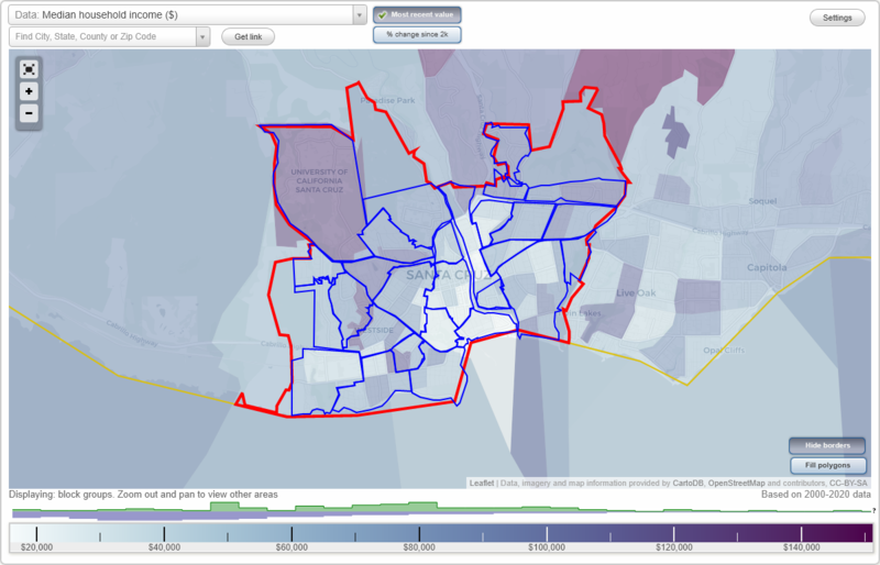
Santa Cruz, California Neighborhood Map - Income, House Prices, Occupations, Boundaries
Settings
X

- City boundary
- Neighborhood boundaries
Business Search - 14 Million verified businesses
Neighborhoods:
Arana Gulch, Bananna Belt, Beach Flats, Carbonera, Circles, Downtown, East Park, Eastside, Escolona, Harvey West, King Street, Lee, Lighthouse, Lower Ocean, Market Street, Meder, Natural Bridges, Neary Lagoon, Nobel, Ocean Street, Prospect Heights, River Street, Seabright, Spring Street, UCSC, West King Street, Western, WestsideArana Gulch neighborhood in Santa Cruz statistics: (Find on map)
Area: 0.169 square miles
Population: 1,063
Population density:
Median household income in 2021:
Median rent in in 2021:
Male vs Females
Median age
Most popular occupations of males: architecture and engineering occupations (19.8%); construction, extraction, and maintenance occupations (13.7%); service occupations (12.2%); sales and office occupations (10.6%); computer and mathematical occupations (7.2%); life, physical, and social science occupations (6.3%); arts, design, entertainment, sports, and media occupations (5.2%)
Most popular occupations of females: management occupations (except farmers) (17.2%); sales and office occupations (14.7%); service occupations (14.4%); community and social services occupations (13.9%); education, training, and library occupations (13.4%); healthcare practitioners and technical occupations (9.6%); business and financial operations occupations (7.6%)
Roads and streets: Mentel Ave; S Park Way; Agnes St; Capitola Rd; Hagemann Ct.
Other features: Arana Gulch.
Arana Gulch neighborhood detailed profile
Area: 0.169 square miles
Population: 1,063
Population density:
| Arana Gulch: | 6,274 people per square mile |
| Santa Cruz: | 5,004 people per square mile |
Median household income in 2021:
| Arana Gulch: | $124,255 |
| Santa Cruz: | $96,217 |
Median rent in in 2021:
| Arana Gulch: | $1,766 |
| Santa Cruz: | $1,924 |
Male vs Females
| Males: | 565 |
| Females: | 497 |
Median age
| Males: | 37.1 years |
| Females: | 44.0 years |
Most popular occupations of males: architecture and engineering occupations (19.8%); construction, extraction, and maintenance occupations (13.7%); service occupations (12.2%); sales and office occupations (10.6%); computer and mathematical occupations (7.2%); life, physical, and social science occupations (6.3%); arts, design, entertainment, sports, and media occupations (5.2%)
Most popular occupations of females: management occupations (except farmers) (17.2%); sales and office occupations (14.7%); service occupations (14.4%); community and social services occupations (13.9%); education, training, and library occupations (13.4%); healthcare practitioners and technical occupations (9.6%); business and financial operations occupations (7.6%)
Roads and streets: Mentel Ave; S Park Way; Agnes St; Capitola Rd; Hagemann Ct.
Other features: Arana Gulch.
Arana Gulch neighborhood detailed profile
Bananna Belt neighborhood in Santa Cruz statistics: (Find on map)
Area: 0.274 square miles
Population: 2,796
Population density:
Median household income in 2021:
Median rent in in 2021:
Male vs Females
Median age
Most popular occupations of males: service occupations (23.0%); management occupations (except farmers) (22.4%); education, training, and library occupations (14.9%); architecture and engineering occupations (8.0%); life, physical, and social science occupations (5.5%); production occupations (5.4%); construction, extraction, and maintenance occupations (4.3%)
Most popular occupations of females: sales and office occupations (45.2%); education, training, and library occupations (14.7%); service occupations (10.7%); healthcare practitioners and technical occupations (10.1%); business and financial operations occupations (5.6%); computer and mathematical occupations (5.1%); management occupations (except farmers) (4.5%)
Roads and streets: Fairmount Ave; Chilverton St; N Branciforte Ave; Melrose Ave; Stanford Ave; Berkeley Way; Linden St; Poplar Ave; Morrissey Blvd; Harrison Ave; Parnell St; Keystone Ave; Hammond Ave; Belvedere Ter; Reed Way; Berkeley Ct; Dake Ave; Arbor Ave; Dellview Ave; Rose St; Dahlia St; Concepcion Way; Amber Ln; Harrison Ct; Josefa Way.
Bananna Belt neighborhood detailed profile
Area: 0.274 square miles
Population: 2,796
Population density:
| Bananna Belt: | 10,220 people per square mile |
| Santa Cruz: | 5,004 people per square mile |
Median household income in 2021:
| Bananna Belt: | $99,211 |
| Santa Cruz: | $96,217 |
Median rent in in 2021:
| Bananna Belt: | $1,523 |
| Santa Cruz: | $1,924 |
Male vs Females
| Males: | 1,329 |
| Females: | 1,466 |
Median age
| Males: | 41.3 years |
| Females: | 45.0 years |
Most popular occupations of males: service occupations (23.0%); management occupations (except farmers) (22.4%); education, training, and library occupations (14.9%); architecture and engineering occupations (8.0%); life, physical, and social science occupations (5.5%); production occupations (5.4%); construction, extraction, and maintenance occupations (4.3%)
Most popular occupations of females: sales and office occupations (45.2%); education, training, and library occupations (14.7%); service occupations (10.7%); healthcare practitioners and technical occupations (10.1%); business and financial operations occupations (5.6%); computer and mathematical occupations (5.1%); management occupations (except farmers) (4.5%)
Roads and streets: Fairmount Ave; Chilverton St; N Branciforte Ave; Melrose Ave; Stanford Ave; Berkeley Way; Linden St; Poplar Ave; Morrissey Blvd; Harrison Ave; Parnell St; Keystone Ave; Hammond Ave; Belvedere Ter; Reed Way; Berkeley Ct; Dake Ave; Arbor Ave; Dellview Ave; Rose St; Dahlia St; Concepcion Way; Amber Ln; Harrison Ct; Josefa Way.
Bananna Belt neighborhood detailed profile
Beach Flats neighborhood in Santa Cruz statistics: (Find on map)
Area: 0.210 square miles
Roads and streets: 3rd St; Beach St; 2nd St; Leibrandt Ave; Cliff St; Main St; Park Pl; Raymond St; 1st St; Front St; Wave Ln; Washington St Exd (Pacific Ave); Younger Way; Riverside Ave; Trinity St; Kaye St; Uhden St; Villa Mar Vis; Westbrook St; Drift Way.
Railroad features: Union Pacific RR.
Beach Flats neighborhood detailed profile
Carbonera neighborhood in Santa Cruz statistics: (Find on map)
Area: 0.248 square miles
Population: 68
Population density:
Median household income in 2021:
Median rent in in 2021:
Male vs Females
Median age
Housing prices:
Average estimated value of detached houses in 2021 (96.6% of all units):
Average estimated value of townhouses or other attached units in 2021 (3.4% of all units):
Most popular occupations of males: management occupations (except farmers) (31.9%); material moving occupations (16.1%); architecture and engineering occupations (16.0%); computer and mathematical occupations (13.7%); arts, design, entertainment, sports, and media occupations (11.7%); healthcare practitioners and technical occupations (7.6%); community and social services occupations (5.5%)
Most popular occupations of females: sales and office occupations (27.0%); healthcare practitioners and technical occupations (25.9%); arts, design, entertainment, sports, and media occupations (8.5%); management occupations (except farmers) (7.8%); service occupations (7.8%); life, physical, and social science occupations (7.4%); education, training, and library occupations (7.4%)
Roads and streets: Isbel Dr; Carbonera Dr; Vista Bella Dr; Esmeralda Dr; Calcita Dr; Nanna Ct; Monte St; Via Hermosa; Bartlett Way; Esmeralda Ct; Jocelyn Ct; Misty Ct; Carbonera Ct; Isbel Ct.
Other features: Carbonera Crk; Branciforte Crk.
Carbonera neighborhood detailed profile
Area: 0.248 square miles
Population: 68
Population density:
| Carbonera: | 275 people per square mile |
| Santa Cruz: | 5,004 people per square mile |
Median household income in 2021:
| Carbonera: | $167,563 |
| Santa Cruz: | $96,217 |
Median rent in in 2021:
| Carbonera: | $2,069 |
| Santa Cruz: | $1,924 |
Male vs Females
| Males: | 35 |
| Females: | 33 |
Median age
| Males: | 42.7 years |
| Females: | 51.0 years |
Housing prices:
Average estimated value of detached houses in 2021 (96.6% of all units):
| Carbonera: | $1,211,207 |
| Santa Cruz: | $1,122,442 |
Average estimated value of townhouses or other attached units in 2021 (3.4% of all units):
| This neighborhood: | $1,107,143 |
| city: | $1,076,321 |
Most popular occupations of males: management occupations (except farmers) (31.9%); material moving occupations (16.1%); architecture and engineering occupations (16.0%); computer and mathematical occupations (13.7%); arts, design, entertainment, sports, and media occupations (11.7%); healthcare practitioners and technical occupations (7.6%); community and social services occupations (5.5%)
Most popular occupations of females: sales and office occupations (27.0%); healthcare practitioners and technical occupations (25.9%); arts, design, entertainment, sports, and media occupations (8.5%); management occupations (except farmers) (7.8%); service occupations (7.8%); life, physical, and social science occupations (7.4%); education, training, and library occupations (7.4%)
Roads and streets: Isbel Dr; Carbonera Dr; Vista Bella Dr; Esmeralda Dr; Calcita Dr; Nanna Ct; Monte St; Via Hermosa; Bartlett Way; Esmeralda Ct; Jocelyn Ct; Misty Ct; Carbonera Ct; Isbel Ct.
Other features: Carbonera Crk; Branciforte Crk.
Carbonera neighborhood detailed profile
Circles neighborhood in Santa Cruz statistics: (Find on map)
Area: 0.145 square miles
Population: 3,291
Population density:
Median household income in 2021:
Median rent in in 2021:
Male vs Females
Median age
Housing prices:
Average estimated value of detached houses in 2021 (85.5% of all units):
Average estimated value of townhouses or other attached units in 2021 (4.0% of all units):
Most popular occupations of males: service occupations (16.3%); management occupations (except farmers) (13.7%); sales and office occupations (10.4%); arts, design, entertainment, sports, and media occupations (9.3%); construction, extraction, and maintenance occupations (9.2%); production occupations (8.8%); healthcare practitioners and technical occupations (8.5%)
Most popular occupations of females: sales and office occupations (17.7%); management occupations (except farmers) (14.6%); life, physical, and social science occupations (13.1%); service occupations (12.8%); community and social services occupations (12.3%); production occupations (8.4%); arts, design, entertainment, sports, and media occupations (6.9%)
Roads and streets: Walk Cir; Wilkes Cir; Dufour St; Errett Cir; California Ave; Younglove Ave; Palm St; Naglee Ave; Bethany Curve; Pendegast Ave; Bellevue St; Rankin St; Redwood St; Graham Ave; Lennox St; Woodrow Ave.
Railroad features: Union Pacific RR.
Circles neighborhood detailed profile
Area: 0.145 square miles
Population: 3,291
Population density:
| Circles: | 22,656 people per square mile |
| Santa Cruz: | 5,004 people per square mile |
Median household income in 2021:
| Circles: | $116,692 |
| Santa Cruz: | $96,217 |
Median rent in in 2021:
| Circles: | $2,676 |
| Santa Cruz: | $1,924 |
Male vs Females
| Males: | 1,616 |
| Females: | 1,675 |
Median age
| Males: | 39.8 years |
| Females: | 44.3 years |
Housing prices:
Average estimated value of detached houses in 2021 (85.5% of all units):
| Circles: | $1,267,311 |
| Santa Cruz: | $1,122,442 |
Average estimated value of townhouses or other attached units in 2021 (4.0% of all units):
| This neighborhood: | $4,094,667 |
| city: | $1,076,321 |
Most popular occupations of males: service occupations (16.3%); management occupations (except farmers) (13.7%); sales and office occupations (10.4%); arts, design, entertainment, sports, and media occupations (9.3%); construction, extraction, and maintenance occupations (9.2%); production occupations (8.8%); healthcare practitioners and technical occupations (8.5%)
Most popular occupations of females: sales and office occupations (17.7%); management occupations (except farmers) (14.6%); life, physical, and social science occupations (13.1%); service occupations (12.8%); community and social services occupations (12.3%); production occupations (8.4%); arts, design, entertainment, sports, and media occupations (6.9%)
Roads and streets: Walk Cir; Wilkes Cir; Dufour St; Errett Cir; California Ave; Younglove Ave; Palm St; Naglee Ave; Bethany Curve; Pendegast Ave; Bellevue St; Rankin St; Redwood St; Graham Ave; Lennox St; Woodrow Ave.
Railroad features: Union Pacific RR.
Circles neighborhood detailed profile
Downtown neighborhood in Santa Cruz statistics: (Find on map)
Area: 0.346 square miles
Population: 1,992
Population density:
Median household income in 2021:
Median rent in in 2021:
Male vs Females
Median age
Housing prices:
Average estimated value of detached houses in 2021 (34.4% of all units):
Average estimated '21 value of housing units in 5-or-more-unit structures (40.7% of all units):
Average estimated value of mobile home in 2021 (14.9% of all units):
Most popular occupations of males: management occupations (except farmers) (43.3%); service occupations (13.7%); sales and office occupations (11.3%); computer and mathematical occupations (7.4%); business and financial operations occupations (5.4%); architecture and engineering occupations (5.4%); arts, design, entertainment, sports, and media occupations (4.7%)
Most popular occupations of females: management occupations (except farmers) (25.7%); sales and office occupations (18.8%); arts, design, entertainment, sports, and media occupations (12.1%); computer and mathematical occupations (11.0%); business and financial operations occupations (10.6%); education, training, and library occupations (10.1%); service occupations (9.3%)
Roads and streets: Center St; Chestnut St; Cedar St; Pacific Ave; Laurel St; Front St; Lincoln St; Walnut Ave; Maple St; Church St; Locust St; S River St; Elm St; Washington St; Union St; Cathcart St; Myrtle St; Spruce St; Soquel Ave; Rincon St; River St; Spruce St (Laurel St Exd); Sycamore St; Birch Ln; New St; Commerce Ln; Taylor St; Green St; Cooper St; Pearl Aly; Plaza Ln; Squid Row; Cross St.
Railroad features: Union Pacific RR.
Downtown neighborhood detailed profile
Area: 0.346 square miles
Population: 1,992
Population density:
| Downtown: | 5,755 people per square mile |
| Santa Cruz: | 5,004 people per square mile |
Median household income in 2021:
| Downtown: | $58,364 |
| Santa Cruz: | $96,217 |
Median rent in in 2021:
| Downtown: | $1,310 |
| Santa Cruz: | $1,924 |
Male vs Females
| Males: | 966 |
| Females: | 1,025 |
Median age
| Males: | 44.5 years |
| Females: | 39.7 years |
Housing prices:
Average estimated value of detached houses in 2021 (34.4% of all units):
| Downtown: | $2,014,286 |
| Santa Cruz: | $1,122,442 |
Average estimated '21 value of housing units in 5-or-more-unit structures (40.7% of all units):
| Downtown: | $582,840 |
| Santa Cruz: | $577,870 |
Average estimated value of mobile home in 2021 (14.9% of all units):
| Downtown: | $178,667 |
| Santa Cruz: | $134,836 |
Most popular occupations of males: management occupations (except farmers) (43.3%); service occupations (13.7%); sales and office occupations (11.3%); computer and mathematical occupations (7.4%); business and financial operations occupations (5.4%); architecture and engineering occupations (5.4%); arts, design, entertainment, sports, and media occupations (4.7%)
Most popular occupations of females: management occupations (except farmers) (25.7%); sales and office occupations (18.8%); arts, design, entertainment, sports, and media occupations (12.1%); computer and mathematical occupations (11.0%); business and financial operations occupations (10.6%); education, training, and library occupations (10.1%); service occupations (9.3%)
Roads and streets: Center St; Chestnut St; Cedar St; Pacific Ave; Laurel St; Front St; Lincoln St; Walnut Ave; Maple St; Church St; Locust St; S River St; Elm St; Washington St; Union St; Cathcart St; Myrtle St; Spruce St; Soquel Ave; Rincon St; River St; Spruce St (Laurel St Exd); Sycamore St; Birch Ln; New St; Commerce Ln; Taylor St; Green St; Cooper St; Pearl Aly; Plaza Ln; Squid Row; Cross St.
Railroad features: Union Pacific RR.
Downtown neighborhood detailed profile
East Park neighborhood in Santa Cruz statistics: (Find on map)
Area: 0.301 square miles
Population: 4,918
Population density:
Median household income in 2021:
Median rent in in 2021:
Male vs Females
Median age
Most popular occupations of males: service occupations (14.8%); sales and office occupations (14.8%); management occupations (except farmers) (13.8%); arts, design, entertainment, sports, and media occupations (13.4%); computer and mathematical occupations (7.8%); education, training, and library occupations (7.8%); production occupations (6.7%)
Most popular occupations of females: management occupations (except farmers) (26.0%); service occupations (18.1%); community and social services occupations (12.7%); healthcare practitioners and technical occupations (12.0%); sales and office occupations (6.2%); computer and mathematical occupations (5.8%); business and financial operations occupations (5.7%)
Roads and streets: Pacheco Ave; San Juan Ave; Roxas St; Trevethan Ave (Trevethan St); Soquel Ave; Marnell Ave; Park Way; Suburbia Ave; Melrose Ave; Parnell St; Fairmount Ave; Almena St; Carl Ave; Eastgate Ave; Acacia Way; la Fonda Ave; Abby Ct; Suburbia Ct; Park Way Ct.
Other features: Arana Gulch.
East Park neighborhood detailed profile
Area: 0.301 square miles
Population: 4,918
Population density:
| East Park: | 16,366 people per square mile |
| Santa Cruz: | 5,004 people per square mile |
Median household income in 2021:
| East Park: | $93,288 |
| Santa Cruz: | $96,217 |
Median rent in in 2021:
| East Park: | $1,866 |
| Santa Cruz: | $1,924 |
Male vs Females
| Males: | 2,654 |
| Females: | 2,263 |
Median age
| Males: | 39.3 years |
| Females: | 42.4 years |
Most popular occupations of males: service occupations (14.8%); sales and office occupations (14.8%); management occupations (except farmers) (13.8%); arts, design, entertainment, sports, and media occupations (13.4%); computer and mathematical occupations (7.8%); education, training, and library occupations (7.8%); production occupations (6.7%)
Most popular occupations of females: management occupations (except farmers) (26.0%); service occupations (18.1%); community and social services occupations (12.7%); healthcare practitioners and technical occupations (12.0%); sales and office occupations (6.2%); computer and mathematical occupations (5.8%); business and financial operations occupations (5.7%)
Roads and streets: Pacheco Ave; San Juan Ave; Roxas St; Trevethan Ave (Trevethan St); Soquel Ave; Marnell Ave; Park Way; Suburbia Ave; Melrose Ave; Parnell St; Fairmount Ave; Almena St; Carl Ave; Eastgate Ave; Acacia Way; la Fonda Ave; Abby Ct; Suburbia Ct; Park Way Ct.
Other features: Arana Gulch.
East Park neighborhood detailed profile
Eastside neighborhood in Santa Cruz statistics: (Find on map)
Area: 0.152 square miles
Population: 945
Population density:
Median household income in 2021:
Median rent in in 2021:
Male vs Females
Median age
Most popular occupations of males: construction, extraction, and maintenance occupations (22.8%); healthcare practitioners and technical occupations (17.0%); sales and office occupations (15.7%); arts, design, entertainment, sports, and media occupations (15.1%); service occupations (9.6%); computer and mathematical occupations (9.3%); management occupations (except farmers) (6.1%)
Most popular occupations of females: service occupations (36.4%); healthcare practitioners and technical occupations (18.1%); computer and mathematical occupations (15.3%); management occupations (except farmers) (14.0%); education, training, and library occupations (8.2%); community and social services occupations (4.7%); life, physical, and social science occupations (3.3%)
Roads and streets: Soquel Ave; Dakota Ave; Benito Ave; May Ave; N Branciforte Ave; Doyle St; Sunnyside Ave; Leonard St; Rathburn Way; Hugus Ave; McCornick St; Minnie St.
Other features: Branciforte Crk.
Eastside neighborhood detailed profile
Area: 0.152 square miles
Population: 945
Population density:
| Eastside: | 6,230 people per square mile |
| Santa Cruz: | 5,004 people per square mile |
Median household income in 2021:
| Eastside: | $69,118 |
| Santa Cruz: | $96,217 |
Median rent in in 2021:
| Eastside: | $2,223 |
| Santa Cruz: | $1,924 |
Male vs Females
| Males: | 483 |
| Females: | 461 |
Median age
| Males: | 34.7 years |
| Females: | 44.9 years |
Most popular occupations of males: construction, extraction, and maintenance occupations (22.8%); healthcare practitioners and technical occupations (17.0%); sales and office occupations (15.7%); arts, design, entertainment, sports, and media occupations (15.1%); service occupations (9.6%); computer and mathematical occupations (9.3%); management occupations (except farmers) (6.1%)
Most popular occupations of females: service occupations (36.4%); healthcare practitioners and technical occupations (18.1%); computer and mathematical occupations (15.3%); management occupations (except farmers) (14.0%); education, training, and library occupations (8.2%); community and social services occupations (4.7%); life, physical, and social science occupations (3.3%)
Roads and streets: Soquel Ave; Dakota Ave; Benito Ave; May Ave; N Branciforte Ave; Doyle St; Sunnyside Ave; Leonard St; Rathburn Way; Hugus Ave; McCornick St; Minnie St.
Other features: Branciforte Crk.
Eastside neighborhood detailed profile
Escolona neighborhood in Santa Cruz statistics: (Find on map)
Area: 0.230 square miles
Population: 1,012
Population density:
Median household income in 2021:
Median rent in in 2021:
Male vs Females
Median age
Housing prices:
Average estimated value of detached houses in 2021 (85.8% of all units):
Average estimated value of townhouses or other attached units in 2021 (13.2% of all units):
Most popular occupations of males: management occupations (except farmers) (30.1%); education, training, and library occupations (18.5%); healthcare practitioners and technical occupations (11.7%); computer and mathematical occupations (11.6%); arts, design, entertainment, sports, and media occupations (5.8%); sales and office occupations (5.7%); business and financial operations occupations (5.4%)
Most popular occupations of females: service occupations (22.3%); management occupations (except farmers) (14.7%); production occupations (11.7%); education, training, and library occupations (10.5%); community and social services occupations (10.2%); business and financial operations occupations (9.6%); sales and office occupations (9.0%)
Roads and streets: Moore St; Laurent St; Majors St; Spring St; Bradley Dr; High St; Archer Dr; Fridley Dr; Cardiff Pl; Iowa Dr; Westmoor Dr; Village Cir; Cardiff Ct; Allegro Dr; Westmoor Ct; Rulofson St; Westmoor Pl.
Escolona neighborhood detailed profile
Area: 0.230 square miles
Population: 1,012
Population density:
| Escolona: | 4,402 people per square mile |
| Santa Cruz: | 5,004 people per square mile |
Median household income in 2021:
| Escolona: | $126,501 |
| Santa Cruz: | $96,217 |
Median rent in in 2021:
| Escolona: | $1,899 |
| Santa Cruz: | $1,924 |
Male vs Females
| Males: | 457 |
| Females: | 555 |
Median age
| Males: | 32.8 years |
| Females: | 34.3 years |
Housing prices:
Average estimated value of detached houses in 2021 (85.8% of all units):
| Escolona: | $1,162,645 |
| Santa Cruz: | $1,122,442 |
Average estimated value of townhouses or other attached units in 2021 (13.2% of all units):
| This neighborhood: | $677,778 |
| city: | $1,076,321 |
Most popular occupations of males: management occupations (except farmers) (30.1%); education, training, and library occupations (18.5%); healthcare practitioners and technical occupations (11.7%); computer and mathematical occupations (11.6%); arts, design, entertainment, sports, and media occupations (5.8%); sales and office occupations (5.7%); business and financial operations occupations (5.4%)
Most popular occupations of females: service occupations (22.3%); management occupations (except farmers) (14.7%); production occupations (11.7%); education, training, and library occupations (10.5%); community and social services occupations (10.2%); business and financial operations occupations (9.6%); sales and office occupations (9.0%)
Roads and streets: Moore St; Laurent St; Majors St; Spring St; Bradley Dr; High St; Archer Dr; Fridley Dr; Cardiff Pl; Iowa Dr; Westmoor Dr; Village Cir; Cardiff Ct; Allegro Dr; Westmoor Ct; Rulofson St; Westmoor Pl.
Escolona neighborhood detailed profile
Harvey West neighborhood in Santa Cruz statistics: (Find on map)
Area: 0.540 square miles
Population: 612
Population density:
Median household income in 2021:
Median rent in in 2021:
Male vs Females
Median age
Housing prices:
Average estimated value of detached houses in 2021 (60.5% of all units):
Average estimated value of townhouses or other attached units in 2021 (12.9% of all units):
Average estimated '21 value of housing units in 5-or-more-unit structures (4.6% of all units):
Average estimated value of mobile home in 2021 (16.0% of all units):
Most popular occupations of males: computer and mathematical occupations (22.4%); management occupations (except farmers) (18.1%); education, training, and library occupations (14.4%); sales and office occupations (13.8%); transportation occupations (10.2%); material moving occupations (6.6%); service occupations (5.3%)
Most popular occupations of females: sales and office occupations (26.5%); service occupations (19.8%); education, training, and library occupations (17.7%); management occupations (except farmers) (10.7%); healthcare practitioners and technical occupations (5.9%); business and financial operations occupations (5.0%); farming, fishing, and forestry occupations (4.7%)
Highways in this neighborhood: River St (State Hwy 9, State Rte 9).
Roads and streets: Encinal St; Harvey West Blvd; Golf Club Dr; Coral St; Evergreen St; Fern St; Sylvania Ave; Dubois St; Pioneer St; Vernon St; Limekiln St; Post St.
Railroad features: Union Pacific RR.
Harvey West neighborhood detailed profile
Area: 0.540 square miles
Population: 612
Population density:
| Harvey West: | 1,134 people per square mile |
| Santa Cruz: | 5,004 people per square mile |
Median household income in 2021:
| Harvey West: | $95,766 |
| Santa Cruz: | $96,217 |
Median rent in in 2021:
| Harvey West: | $1,489 |
| Santa Cruz: | $1,924 |
Male vs Females
| Males: | 275 |
| Females: | 337 |
Median age
| Males: | 33.0 years |
| Females: | 40.1 years |
Housing prices:
Average estimated value of detached houses in 2021 (60.5% of all units):
| Harvey West: | $1,467,203 |
| Santa Cruz: | $1,122,442 |
Average estimated value of townhouses or other attached units in 2021 (12.9% of all units):
| This neighborhood: | $1,166,667 |
| city: | $1,076,321 |
Average estimated '21 value of housing units in 5-or-more-unit structures (4.6% of all units):
| Harvey West: | $567,585 |
| Santa Cruz: | $577,870 |
Average estimated value of mobile home in 2021 (16.0% of all units):
| Harvey West: | $178,667 |
| Santa Cruz: | $134,836 |
Most popular occupations of males: computer and mathematical occupations (22.4%); management occupations (except farmers) (18.1%); education, training, and library occupations (14.4%); sales and office occupations (13.8%); transportation occupations (10.2%); material moving occupations (6.6%); service occupations (5.3%)
Most popular occupations of females: sales and office occupations (26.5%); service occupations (19.8%); education, training, and library occupations (17.7%); management occupations (except farmers) (10.7%); healthcare practitioners and technical occupations (5.9%); business and financial operations occupations (5.0%); farming, fishing, and forestry occupations (4.7%)
Highways in this neighborhood: River St (State Hwy 9, State Rte 9).
Roads and streets: Encinal St; Harvey West Blvd; Golf Club Dr; Coral St; Evergreen St; Fern St; Sylvania Ave; Dubois St; Pioneer St; Vernon St; Limekiln St; Post St.
Railroad features: Union Pacific RR.
Harvey West neighborhood detailed profile
King Street neighborhood in Santa Cruz statistics: (Find on map)
Area: 0.453 square miles
Population: 2,781
Population density:
Median household income in 2021:
Median rent in in 2021:
Male vs Females
Median age
Housing prices:
Average estimated value of detached houses in 2021 (71.7% of all units):
Average estimated value of townhouses or other attached units in 2021 (5.3% of all units):
Average estimated '21 value of housing units in 5-or-more-unit structures (42.4% of all units):
Average estimated value of mobile home in 2021 (5.1% of all units):
Most popular occupations of males: service occupations (25.3%); healthcare practitioners and technical occupations (20.9%); management occupations (except farmers) (9.2%); material moving occupations (7.6%); computer and mathematical occupations (7.1%); sales and office occupations (5.3%); business and financial operations occupations (5.1%)
Most popular occupations of females: management occupations (except farmers) (24.2%); education, training, and library occupations (19.1%); service occupations (15.6%); community and social services occupations (11.3%); healthcare practitioners and technical occupations (7.6%); computer and mathematical occupations (7.3%); arts, design, entertainment, sports, and media occupations (5.8%)
Highways in this neighborhood: Mission St (State Hwy 1, State Rte 1).
Roads and streets: Escalona Dr; King St; Laurent St; Laurel St; Van Ness Ave; California St; Walnut Ave; Trescony St; Rigg St; Otis St; Hollywood Ave; Cleveland Ave; Peyton St; Sherman St; Locust St; Acadia Ave; Anthony St; Bay St; Miles St; Towne Ter; Dimond St; Seaside St; Dodero St; Chrystal Ter; Easterby Ave; Union St; Pine Pl; Woodside Ave; Kirby St; Storey St; Jordan St; Sadi St; Highland Ave; Weeks Ave; Sunnyslope Ct.
Other features: Nearys Lagoon Crk.
King Street neighborhood detailed profile
Area: 0.453 square miles
Population: 2,781
Population density:
| King Street: | 6,133 people per square mile |
| Santa Cruz: | 5,004 people per square mile |
Median household income in 2021:
| King Street: | $116,792 |
| Santa Cruz: | $96,217 |
Median rent in in 2021:
| King Street: | $2,245 |
| Santa Cruz: | $1,924 |
Male vs Females
| Males: | 1,562 |
| Females: | 1,219 |
Median age
| Males: | 38.6 years |
| Females: | 42.6 years |
Housing prices:
Average estimated value of detached houses in 2021 (71.7% of all units):
| King Street: | $1,318,629 |
| Santa Cruz: | $1,122,442 |
Average estimated value of townhouses or other attached units in 2021 (5.3% of all units):
| This neighborhood: | $677,778 |
| city: | $1,076,321 |
Average estimated '21 value of housing units in 5-or-more-unit structures (42.4% of all units):
| King Street: | $582,840 |
| Santa Cruz: | $577,870 |
Average estimated value of mobile home in 2021 (5.1% of all units):
| King Street: | $178,667 |
| Santa Cruz: | $134,836 |
Most popular occupations of males: service occupations (25.3%); healthcare practitioners and technical occupations (20.9%); management occupations (except farmers) (9.2%); material moving occupations (7.6%); computer and mathematical occupations (7.1%); sales and office occupations (5.3%); business and financial operations occupations (5.1%)
Most popular occupations of females: management occupations (except farmers) (24.2%); education, training, and library occupations (19.1%); service occupations (15.6%); community and social services occupations (11.3%); healthcare practitioners and technical occupations (7.6%); computer and mathematical occupations (7.3%); arts, design, entertainment, sports, and media occupations (5.8%)
Highways in this neighborhood: Mission St (State Hwy 1, State Rte 1).
Roads and streets: Escalona Dr; King St; Laurent St; Laurel St; Van Ness Ave; California St; Walnut Ave; Trescony St; Rigg St; Otis St; Hollywood Ave; Cleveland Ave; Peyton St; Sherman St; Locust St; Acadia Ave; Anthony St; Bay St; Miles St; Towne Ter; Dimond St; Seaside St; Dodero St; Chrystal Ter; Easterby Ave; Union St; Pine Pl; Woodside Ave; Kirby St; Storey St; Jordan St; Sadi St; Highland Ave; Weeks Ave; Sunnyslope Ct.
Other features: Nearys Lagoon Crk.
King Street neighborhood detailed profile
Lee neighborhood in Santa Cruz statistics: (Find on map)
Area: 0.114 square miles
Population: 72
Population density:
Median household income in 2021:
Median rent in in 2021:
Male vs Females
Median age
Housing prices:
Average estimated value of detached houses in 2021 (92.6% of all units):
Average estimated value of townhouses or other attached units in 2021 (3.7% of all units):
Most popular occupations of males: management occupations (except farmers) (21.0%); service occupations (20.6%); education, training, and library occupations (11.2%); sales and office occupations (8.2%); architecture and engineering occupations (8.0%); computer and mathematical occupations (6.9%); material moving occupations (4.2%)
Most popular occupations of females: sales and office occupations (31.8%); healthcare practitioners and technical occupations (19.9%); management occupations (except farmers) (11.6%); service occupations (9.7%); education, training, and library occupations (9.5%); life, physical, and social science occupations (4.0%); business and financial operations occupations (3.7%)
Roads and streets: Lee St; Emeline Ave; Grunewald Ct; Sutphen St; Branciforte Dr (Market St); Emeline St; Brookside Ave.
Other features: Carbonera Crk.
Lee neighborhood detailed profile
Area: 0.114 square miles
Population: 72
Population density:
| Lee: | 633 people per square mile |
| Santa Cruz: | 5,004 people per square mile |
Median household income in 2021:
| Lee: | $158,525 |
| Santa Cruz: | $96,217 |
Median rent in in 2021:
| Lee: | $2,116 |
| Santa Cruz: | $1,924 |
Male vs Females
| Males: | 35 |
| Females: | 37 |
Median age
| Males: | 43.0 years |
| Females: | 49.3 years |
Housing prices:
Average estimated value of detached houses in 2021 (92.6% of all units):
| Lee: | $1,211,207 |
| Santa Cruz: | $1,122,442 |
Average estimated value of townhouses or other attached units in 2021 (3.7% of all units):
| This neighborhood: | $1,107,143 |
| city: | $1,076,321 |
Most popular occupations of males: management occupations (except farmers) (21.0%); service occupations (20.6%); education, training, and library occupations (11.2%); sales and office occupations (8.2%); architecture and engineering occupations (8.0%); computer and mathematical occupations (6.9%); material moving occupations (4.2%)
Most popular occupations of females: sales and office occupations (31.8%); healthcare practitioners and technical occupations (19.9%); management occupations (except farmers) (11.6%); service occupations (9.7%); education, training, and library occupations (9.5%); life, physical, and social science occupations (4.0%); business and financial operations occupations (3.7%)
Roads and streets: Lee St; Emeline Ave; Grunewald Ct; Sutphen St; Branciforte Dr (Market St); Emeline St; Brookside Ave.
Other features: Carbonera Crk.
Lee neighborhood detailed profile
Lighthouse neighborhood in Santa Cruz statistics: (Find on map)
Area: 0.416 square miles
Population: 15,202
Population density:
Median household income in 2021:
Median rent in in 2021:
Male vs Females
Median age
Housing prices:
Average estimated value of detached houses in 2021 (75.5% of all units):
Average estimated value of townhouses or other attached units in 2021 (13.6% of all units):
Most popular occupations of males: sales and office occupations (16.0%); life, physical, and social science occupations (15.9%); management occupations (except farmers) (13.3%); service occupations (12.5%); computer and mathematical occupations (7.2%); healthcare practitioners and technical occupations (6.4%); business and financial operations occupations (5.6%)
Most popular occupations of females: service occupations (27.6%); sales and office occupations (20.1%); life, physical, and social science occupations (13.3%); management occupations (except farmers) (10.5%); education, training, and library occupations (7.0%); arts, design, entertainment, sports, and media occupations (6.2%); community and social services occupations (5.1%)
Roads and streets: W Cliff Dr; Pelton Ave; Columbia St; Gharkey St; Santa Cruz St; National St; Centennial St; Liberty St; Monterey St; Lighthouse Ave; Oregon St; Laguna St; Delaware Ave; Nevada St; Oxford Way; Bay St; Clark Ave; Eucalyptus Ave; Cowell St; Continental St; Phelan Ct; State St; Manor Ave W; Princeton St; Harvard St; Ave A; Manor Ave; Manor Pl; Manor Ave S.
Lighthouse neighborhood detailed profile
Area: 0.416 square miles
Population: 15,202
Population density:
| Lighthouse: | 36,534 people per square mile |
| Santa Cruz: | 5,004 people per square mile |
Median household income in 2021:
| Lighthouse: | $118,065 |
| Santa Cruz: | $96,217 |
Median rent in in 2021:
| Lighthouse: | $2,706 |
| Santa Cruz: | $1,924 |
Male vs Females
| Males: | 7,022 |
| Females: | 8,179 |
Median age
| Males: | 44.3 years |
| Females: | 48.3 years |
Housing prices:
Average estimated value of detached houses in 2021 (75.5% of all units):
| Lighthouse: | $1,267,311 |
| Santa Cruz: | $1,122,442 |
Average estimated value of townhouses or other attached units in 2021 (13.6% of all units):
| This neighborhood: | $4,094,667 |
| city: | $1,076,321 |
Most popular occupations of males: sales and office occupations (16.0%); life, physical, and social science occupations (15.9%); management occupations (except farmers) (13.3%); service occupations (12.5%); computer and mathematical occupations (7.2%); healthcare practitioners and technical occupations (6.4%); business and financial operations occupations (5.6%)
Most popular occupations of females: service occupations (27.6%); sales and office occupations (20.1%); life, physical, and social science occupations (13.3%); management occupations (except farmers) (10.5%); education, training, and library occupations (7.0%); arts, design, entertainment, sports, and media occupations (6.2%); community and social services occupations (5.1%)
Roads and streets: W Cliff Dr; Pelton Ave; Columbia St; Gharkey St; Santa Cruz St; National St; Centennial St; Liberty St; Monterey St; Lighthouse Ave; Oregon St; Laguna St; Delaware Ave; Nevada St; Oxford Way; Bay St; Clark Ave; Eucalyptus Ave; Cowell St; Continental St; Phelan Ct; State St; Manor Ave W; Princeton St; Harvard St; Ave A; Manor Ave; Manor Pl; Manor Ave S.
Lighthouse neighborhood detailed profile
Lower Ocean neighborhood in Santa Cruz statistics: (Find on map)
Area: 0.107 square miles
Roads and streets: Barson St; Riverside Ave; Pearl St; Jessie St; Bixby St; San Lorenzo Blvd; Canfield Ave; Lemos Ave; Ocean St; E Cliff Dr; Campbell St; Roosevelt Ter.
Lower Ocean neighborhood detailed profile
Area: 0.107 square miles
Roads and streets: Barson St; Riverside Ave; Pearl St; Jessie St; Bixby St; San Lorenzo Blvd; Canfield Ave; Lemos Ave; Ocean St; E Cliff Dr; Campbell St; Roosevelt Ter.
Lower Ocean neighborhood detailed profile
Market Street neighborhood in Santa Cruz statistics: (Find on map)
Area: 0.196 square miles
Population: 1,869
Population density:
Median household income in 2021:
Median rent in in 2021:
Male vs Females
Median age
Most popular occupations of males: service occupations (16.7%); management occupations (except farmers) (15.9%); sales and office occupations (12.1%); arts, design, entertainment, sports, and media occupations (10.9%); education, training, and library occupations (9.5%); computer and mathematical occupations (7.0%); production occupations (6.3%)
Most popular occupations of females: management occupations (except farmers) (20.9%); service occupations (16.4%); sales and office occupations (15.5%); healthcare practitioners and technical occupations (11.6%); community and social services occupations (10.3%); education, training, and library occupations (7.4%); business and financial operations occupations (5.8%)
Roads and streets: Market St; Button St; Grant St; Emeline Ave; Avalon St; Stoney Creek Rd; Brookside Ave; Jackson St; May Ave; Berry St; Washburn Ave; Glenwood Ave; Coulson Ave; Routier St; Belmont St; Hubbard St; Fernside St; Plymouth St; Curtis St; Victorian Ct.
Other features: Branciforte Crk.
Market Street neighborhood detailed profile
Area: 0.196 square miles
Population: 1,869
Population density:
| Market Street: | 9,525 people per square mile |
| Santa Cruz: | 5,004 people per square mile |
Median household income in 2021:
| Market Street: | $108,304 |
| Santa Cruz: | $96,217 |
Median rent in in 2021:
| Market Street: | $1,825 |
| Santa Cruz: | $1,924 |
Male vs Females
| Males: | 975 |
| Females: | 894 |
Median age
| Males: | 39.4 years |
| Females: | 38.5 years |
Most popular occupations of males: service occupations (16.7%); management occupations (except farmers) (15.9%); sales and office occupations (12.1%); arts, design, entertainment, sports, and media occupations (10.9%); education, training, and library occupations (9.5%); computer and mathematical occupations (7.0%); production occupations (6.3%)
Most popular occupations of females: management occupations (except farmers) (20.9%); service occupations (16.4%); sales and office occupations (15.5%); healthcare practitioners and technical occupations (11.6%); community and social services occupations (10.3%); education, training, and library occupations (7.4%); business and financial operations occupations (5.8%)
Roads and streets: Market St; Button St; Grant St; Emeline Ave; Avalon St; Stoney Creek Rd; Brookside Ave; Jackson St; May Ave; Berry St; Washburn Ave; Glenwood Ave; Coulson Ave; Routier St; Belmont St; Hubbard St; Fernside St; Plymouth St; Curtis St; Victorian Ct.
Other features: Branciforte Crk.
Market Street neighborhood detailed profile
Meder neighborhood in Santa Cruz statistics: (Find on map)
Area: 0.210 square miles
Population: 2,255
Population density:
Median household income in 2021:
Median rent in in 2021:
Male vs Females
Median age
Housing prices:
Average estimated value of detached houses in 2021 (47.8% of all units):
Average estimated value of townhouses or other attached units in 2021 (1.6% of all units):
Most popular occupations of males: education, training, and library occupations (16.0%); business and financial operations occupations (15.4%); computer and mathematical occupations (12.8%); construction, extraction, and maintenance occupations (11.3%); transportation occupations (9.6%); sales and office occupations (8.4%); management occupations (except farmers) (7.2%)
Most popular occupations of females: sales and office occupations (30.5%); service occupations (26.2%); education, training, and library occupations (21.5%); life, physical, and social science occupations (5.7%); arts, design, entertainment, sports, and media occupations (4.5%); management occupations (except farmers) (4.1%); construction, extraction, and maintenance occupations (3.5%)
Roads and streets: Meder St; Refugio Rd; Nobel Dr; Moore Creek Rd; Western Dr; High St; Bay St; Lisa Ct; Reese Ln; Robinson Ln; Penguin Ct; Stoneybrook Way; Ravenswood Ct.
Other features: Moore Crk; Arroyo Seco Cyn Drng.
Meder neighborhood detailed profile
Area: 0.210 square miles
Population: 2,255
Population density:
| Meder: | 10,762 people per square mile |
| Santa Cruz: | 5,004 people per square mile |
Median household income in 2021:
| Meder: | $116,353 |
| Santa Cruz: | $96,217 |
Median rent in in 2021:
| Meder: | $2,251 |
| Santa Cruz: | $1,924 |
Male vs Females
| Males: | 1,213 |
| Females: | 1,042 |
Median age
| Males: | 27.4 years |
| Females: | 27.6 years |
Housing prices:
Average estimated value of detached houses in 2021 (47.8% of all units):
| Meder: | $1,157,115 |
| Santa Cruz: | $1,122,442 |
Average estimated value of townhouses or other attached units in 2021 (1.6% of all units):
| This neighborhood: | $677,778 |
| city: | $1,076,321 |
Most popular occupations of males: education, training, and library occupations (16.0%); business and financial operations occupations (15.4%); computer and mathematical occupations (12.8%); construction, extraction, and maintenance occupations (11.3%); transportation occupations (9.6%); sales and office occupations (8.4%); management occupations (except farmers) (7.2%)
Most popular occupations of females: sales and office occupations (30.5%); service occupations (26.2%); education, training, and library occupations (21.5%); life, physical, and social science occupations (5.7%); arts, design, entertainment, sports, and media occupations (4.5%); management occupations (except farmers) (4.1%); construction, extraction, and maintenance occupations (3.5%)
Roads and streets: Meder St; Refugio Rd; Nobel Dr; Moore Creek Rd; Western Dr; High St; Bay St; Lisa Ct; Reese Ln; Robinson Ln; Penguin Ct; Stoneybrook Way; Ravenswood Ct.
Other features: Moore Crk; Arroyo Seco Cyn Drng.
Meder neighborhood detailed profile
Natural Bridges neighborhood in Santa Cruz statistics: (Find on map)
Area: 0.438 square miles
Population: 2,954
Population density:
Median household income in 2021:
Median rent in in 2021:
Male vs Females
Median age
Housing prices:
Average estimated value of detached houses in 2021 (51.8% of all units):
Average estimated value of townhouses or other attached units in 2021 (18.8% of all units):
Average estimated value of mobile home in 2021 (9.9% of all units):
Most popular occupations of males: service occupations (13.2%); construction, extraction, and maintenance occupations (12.1%); production occupations (11.9%); sales and office occupations (10.7%); architecture and engineering occupations (10.4%); computer and mathematical occupations (10.3%); management occupations (except farmers) (8.7%)
Most popular occupations of females: sales and office occupations (28.0%); service occupations (25.5%); management occupations (except farmers) (10.4%); life, physical, and social science occupations (6.6%); healthcare practitioners and technical occupations (6.6%); arts, design, entertainment, sports, and media occupations (6.1%); community and social services occupations (4.8%)
Roads and streets: W Cliff Dr; Fair Ave; Almar Ave; Modesto Ave; Delaware Ave; Oxford Way; John St; Getchell St; Alta Ave; Plateau Ave; Seaside St; Bethany Curve; Swift St; Swanton Blvd; Surfside Ave; Auburn Ave; Chace St (Chase St); Sacramento Ave; San Jose Ave; Wanzer St; Sunset Ave; Stockton Ave; Chico Ave; Merced Ave; Ingalls St; Anderson St; Hebard St; Handley St; Woodland Way; de la Costa Ave; Pendegast Ave; Reno Way; Coalinga Way; David Way; Rankin St; Quintana Ct.
Railroad features: Union Pacific RR.
Natural Bridges neighborhood detailed profile
Area: 0.438 square miles
Population: 2,954
Population density:
| Natural Bridges: | 6,743 people per square mile |
| Santa Cruz: | 5,004 people per square mile |
Median household income in 2021:
| Natural Bridges: | $104,952 |
| Santa Cruz: | $96,217 |
Median rent in in 2021:
| Natural Bridges: | $2,514 |
| Santa Cruz: | $1,924 |
Male vs Females
| Males: | 1,279 |
| Females: | 1,675 |
Median age
| Males: | 33.8 years |
| Females: | 40.2 years |
Housing prices:
Average estimated value of detached houses in 2021 (51.8% of all units):
| Natural Bridges: | $1,213,433 |
| Santa Cruz: | $1,122,442 |
Average estimated value of townhouses or other attached units in 2021 (18.8% of all units):
| This neighborhood: | $4,094,667 |
| city: | $1,076,321 |
Average estimated value of mobile home in 2021 (9.9% of all units):
| Natural Bridges: | $72,203 |
| Santa Cruz: | $134,836 |
Most popular occupations of males: service occupations (13.2%); construction, extraction, and maintenance occupations (12.1%); production occupations (11.9%); sales and office occupations (10.7%); architecture and engineering occupations (10.4%); computer and mathematical occupations (10.3%); management occupations (except farmers) (8.7%)
Most popular occupations of females: sales and office occupations (28.0%); service occupations (25.5%); management occupations (except farmers) (10.4%); life, physical, and social science occupations (6.6%); healthcare practitioners and technical occupations (6.6%); arts, design, entertainment, sports, and media occupations (6.1%); community and social services occupations (4.8%)
Roads and streets: W Cliff Dr; Fair Ave; Almar Ave; Modesto Ave; Delaware Ave; Oxford Way; John St; Getchell St; Alta Ave; Plateau Ave; Seaside St; Bethany Curve; Swift St; Swanton Blvd; Surfside Ave; Auburn Ave; Chace St (Chase St); Sacramento Ave; San Jose Ave; Wanzer St; Sunset Ave; Stockton Ave; Chico Ave; Merced Ave; Ingalls St; Anderson St; Hebard St; Handley St; Woodland Way; de la Costa Ave; Pendegast Ave; Reno Way; Coalinga Way; David Way; Rankin St; Quintana Ct.
Railroad features: Union Pacific RR.
Natural Bridges neighborhood detailed profile
Neary Lagoon neighborhood in Santa Cruz statistics: (Find on map)
Area: 0.198 square miles
Population: 7,614
Population density:
Median household income in 2021:
Median rent in in 2021:
Male vs Females
Median age
Average estimated value of detached houses in 2021 (73.8% of all units):
Most popular occupations of males: life, physical, and social science occupations (17.7%); sales and office occupations (16.4%); management occupations (except farmers) (12.6%); service occupations (11.2%); computer and mathematical occupations (8.2%); business and financial operations occupations (6.0%); healthcare practitioners and technical occupations (5.7%)
Most popular occupations of females: service occupations (30.2%); sales and office occupations (20.5%); life, physical, and social science occupations (13.4%); management occupations (except farmers) (10.0%); education, training, and library occupations (7.8%); arts, design, entertainment, sports, and media occupations (6.4%); healthcare practitioners and technical occupations (4.4%)
Roads and streets: Chestnut St; Shelter Lagoon Dr; Felix St; Jenne St; Bay St; Tree Frog Ln; Shelter Lagoon Ln; Neary St; Walti St; Blackburn St; Mary Case Ln; Laurel St.
Railroad features: Union Pacific RR.
Neary Lagoon neighborhood detailed profile
Area: 0.198 square miles
Population: 7,614
Population density:
| Neary Lagoon: | 38,444 people per square mile |
| Santa Cruz: | 5,004 people per square mile |
Median household income in 2021:
| Neary Lagoon: | $118,074 |
| Santa Cruz: | $96,217 |
Median rent in in 2021:
| Neary Lagoon: | $2,710 |
| Santa Cruz: | $1,924 |
Male vs Females
| Males: | 3,496 |
| Females: | 4,118 |
Median age
| Males: | 44.3 years |
| Females: | 48.3 years |
Average estimated value of detached houses in 2021 (73.8% of all units):
| Neary Lagoon: | $1,267,311 |
| Santa Cruz: | $1,122,442 |
Most popular occupations of males: life, physical, and social science occupations (17.7%); sales and office occupations (16.4%); management occupations (except farmers) (12.6%); service occupations (11.2%); computer and mathematical occupations (8.2%); business and financial operations occupations (6.0%); healthcare practitioners and technical occupations (5.7%)
Most popular occupations of females: service occupations (30.2%); sales and office occupations (20.5%); life, physical, and social science occupations (13.4%); management occupations (except farmers) (10.0%); education, training, and library occupations (7.8%); arts, design, entertainment, sports, and media occupations (6.4%); healthcare practitioners and technical occupations (4.4%)
Roads and streets: Chestnut St; Shelter Lagoon Dr; Felix St; Jenne St; Bay St; Tree Frog Ln; Shelter Lagoon Ln; Neary St; Walti St; Blackburn St; Mary Case Ln; Laurel St.
Railroad features: Union Pacific RR.
Neary Lagoon neighborhood detailed profile
Nobel neighborhood in Santa Cruz statistics: (Find on map)
Area: 0.330 square miles
Population: 4,693
Population density:
Median household income in 2021:
Median rent in in 2021:
Male vs Females
Median age
Housing prices:
Average estimated value of detached houses in 2021 (53.4% of all units):
Average estimated value of townhouses or other attached units in 2021 (9.9% of all units):
Average estimated '21 value of housing units in 3-to-4-unit structures (12.5% of all units):
Average estimated '21 value of housing units in 5-or-more-unit structures (11.3% of all units):
Most popular occupations of males: education, training, and library occupations (19.4%); management occupations (except farmers) (13.2%); sales and office occupations (12.5%); computer and mathematical occupations (11.9%); business and financial operations occupations (9.1%); service occupations (6.9%); construction, extraction, and maintenance occupations (6.7%)
Most popular occupations of females: sales and office occupations (32.2%); service occupations (20.2%); education, training, and library occupations (18.2%); business and financial operations occupations (5.0%); computer and mathematical occupations (4.9%); healthcare practitioners and technical occupations (3.7%); management occupations (except farmers) (3.6%)
Roads and streets: Nobel Dr; Alta Vista Dr; Arroyo Seco; Bayona Dr; Bay St; Calvin Pl; Segri Pl; Miramar Dr; McMillan Dr; Seaborg Pl; Northrop Pl; Seton Way; Mira Vista Dr; Peach Ter; Crestview Ter; Donna Ct; Scenic St; Palo Verde Ter; Overlook Dr; Los Altos Ct; Hope Ln; McMillan Ct; Grandview St; Arroyo Pl; Torrey Pine Ter; Arroyo Ct; Castillion Ter; Gina Ct.
Other features: Arroyo Seco Cyn Drng.
Nobel neighborhood detailed profile
Area: 0.330 square miles
Population: 4,693
Population density:
| Nobel: | 14,237 people per square mile |
| Santa Cruz: | 5,004 people per square mile |
Median household income in 2021:
| Nobel: | $113,293 |
| Santa Cruz: | $96,217 |
Median rent in in 2021:
| Nobel: | $2,247 |
| Santa Cruz: | $1,924 |
Male vs Females
| Males: | 2,301 |
| Females: | 2,392 |
Median age
| Males: | 30.8 years |
| Females: | 30.7 years |
Housing prices:
Average estimated value of detached houses in 2021 (53.4% of all units):
| Nobel: | $1,124,726 |
| Santa Cruz: | $1,122,442 |
Average estimated value of townhouses or other attached units in 2021 (9.9% of all units):
| This neighborhood: | $463,212 |
| city: | $1,076,321 |
Average estimated '21 value of housing units in 3-to-4-unit structures (12.5% of all units):
| Nobel: | $712,197 |
| city: | $655,625 |
Average estimated '21 value of housing units in 5-or-more-unit structures (11.3% of all units):
| Nobel: | $476,127 |
| Santa Cruz: | $577,870 |
Most popular occupations of males: education, training, and library occupations (19.4%); management occupations (except farmers) (13.2%); sales and office occupations (12.5%); computer and mathematical occupations (11.9%); business and financial operations occupations (9.1%); service occupations (6.9%); construction, extraction, and maintenance occupations (6.7%)
Most popular occupations of females: sales and office occupations (32.2%); service occupations (20.2%); education, training, and library occupations (18.2%); business and financial operations occupations (5.0%); computer and mathematical occupations (4.9%); healthcare practitioners and technical occupations (3.7%); management occupations (except farmers) (3.6%)
Roads and streets: Nobel Dr; Alta Vista Dr; Arroyo Seco; Bayona Dr; Bay St; Calvin Pl; Segri Pl; Miramar Dr; McMillan Dr; Seaborg Pl; Northrop Pl; Seton Way; Mira Vista Dr; Peach Ter; Crestview Ter; Donna Ct; Scenic St; Palo Verde Ter; Overlook Dr; Los Altos Ct; Hope Ln; McMillan Ct; Grandview St; Arroyo Pl; Torrey Pine Ter; Arroyo Ct; Castillion Ter; Gina Ct.
Other features: Arroyo Seco Cyn Drng.
Nobel neighborhood detailed profile
Ocean Street neighborhood in Santa Cruz statistics: (Find on map)
Area: 0.458 square miles
Population: 500
Population density:
Median household income in 2021:
Median rent in in 2021:
Male vs Females
Median age
Housing prices:
Average estimated value of detached houses in 2021 (77.4% of all units):
Average estimated value of townhouses or other attached units in 2021 (6.7% of all units):
Average estimated value of mobile home in 2021 (37.9% of all units):
Most popular occupations of males: farming, fishing, and forestry occupations (20.1%); management occupations (except farmers) (19.6%); service occupations (19.4%); life, physical, and social science occupations (19.2%); computer and mathematical occupations (13.2%); sales and office occupations (10.6%); education, training, and library occupations (8.1%)
Most popular occupations of females: sales and office occupations (22.4%); healthcare practitioners and technical occupations (15.6%); service occupations (14.7%); management occupations (except farmers) (9.5%); education, training, and library occupations (9.3%); computer and mathematical occupations (6.2%); business and financial operations occupations (6.1%)
Highways in this neighborhood: State Hwy 1.
Roads and streets: Ocean St; Riverside Ave; Tanner Heights Dr; Broadway; Barson St; Graham Hill Rd; Dakota Ave; Jewell St (Claremont Ter); Pearl St; Pryce St; Felker St; Soquel Ave; E Cliff Dr; Campbell St; Blaine St; Kennan St; Franklin St; Jessie St; Clay St; Bixby St; San Lorenzo Blvd; Hunolt St; Canfield Ave; Moon Aly; Villamar Way; Coloma St; Lemos Ave; Roosevelt Ter; Roberts St; Hillside Ave; Edgewood Way.
Other features: Branciforte Crk.
Ocean Street neighborhood detailed profile
Area: 0.458 square miles
Population: 500
Population density:
| Ocean Street: | 1,093 people per square mile |
| Santa Cruz: | 5,004 people per square mile |
Median household income in 2021:
| Ocean Street: | $133,217 |
| Santa Cruz: | $96,217 |
Median rent in in 2021:
| Ocean Street: | $1,639 |
| Santa Cruz: | $1,924 |
Male vs Females
| Males: | 270 |
| Females: | 229 |
Median age
| Males: | 41.1 years |
| Females: | 56.0 years |
Housing prices:
Average estimated value of detached houses in 2021 (77.4% of all units):
| Ocean Street: | $698,211 |
| Santa Cruz: | $1,122,442 |
Average estimated value of townhouses or other attached units in 2021 (6.7% of all units):
| This neighborhood: | $1,166,667 |
| city: | $1,076,321 |
Average estimated value of mobile home in 2021 (37.9% of all units):
| Ocean Street: | $365,374 |
| Santa Cruz: | $134,836 |
Most popular occupations of males: farming, fishing, and forestry occupations (20.1%); management occupations (except farmers) (19.6%); service occupations (19.4%); life, physical, and social science occupations (19.2%); computer and mathematical occupations (13.2%); sales and office occupations (10.6%); education, training, and library occupations (8.1%)
Most popular occupations of females: sales and office occupations (22.4%); healthcare practitioners and technical occupations (15.6%); service occupations (14.7%); management occupations (except farmers) (9.5%); education, training, and library occupations (9.3%); computer and mathematical occupations (6.2%); business and financial operations occupations (6.1%)
Highways in this neighborhood: State Hwy 1.
Roads and streets: Ocean St; Riverside Ave; Tanner Heights Dr; Broadway; Barson St; Graham Hill Rd; Dakota Ave; Jewell St (Claremont Ter); Pearl St; Pryce St; Felker St; Soquel Ave; E Cliff Dr; Campbell St; Blaine St; Kennan St; Franklin St; Jessie St; Clay St; Bixby St; San Lorenzo Blvd; Hunolt St; Canfield Ave; Moon Aly; Villamar Way; Coloma St; Lemos Ave; Roosevelt Ter; Roberts St; Hillside Ave; Edgewood Way.
Other features: Branciforte Crk.
Ocean Street neighborhood detailed profile
Prospect Heights neighborhood in Santa Cruz statistics: (Find on map)
Area: 0.322 square miles
Population: 680
Population density:
Median household income in 2021:
Median rent in in 2021:
Male vs Females
Median age
Most popular occupations of males: service occupations (30.3%); education, training, and library occupations (15.9%); management occupations (except farmers) (15.3%); sales and office occupations (10.5%); business and financial operations occupations (4.1%); architecture and engineering occupations (3.8%); computer and mathematical occupations (3.4%)
Most popular occupations of females: sales and office occupations (33.7%); healthcare practitioners and technical occupations (17.3%); management occupations (except farmers) (13.2%); service occupations (10.7%); education, training, and library occupations (10.4%); business and financial operations occupations (3.2%); life, physical, and social science occupations (2.6%)
Roads and streets: Prospect Hts; Morrissey Blvd; Goss Ave; Allerton St; Brookwood Dr; Park Way; la Fonda Ave; Oak Way; Trevethan Ave; Marnell Ave; San Juan Ave; Woodcrest Pl; Fairland Way; Pacheco Ave; Lance Ct; Holway Dr; Wanda Ct; Pso del Mar; Prospect Ct; Elk St; English Dr; Burton Dr; Rooney St; Molly Way; Cam del Sol; Miramonte Dr; Vis de Laveaga; Heather Ct; Gilbert Ln; Tyler Ct; Miller Ct; Gilbert Ct; Goss Ct; Bella Rose Te.
Prospect Heights neighborhood detailed profile
Area: 0.322 square miles
Population: 680
Population density:
| Prospect Heights: | 2,109 people per square mile |
| Santa Cruz: | 5,004 people per square mile |
Median household income in 2021:
| Prospect Heights: | $90,197 |
| Santa Cruz: | $96,217 |
Median rent in in 2021:
| Prospect Heights: | $2,238 |
| Santa Cruz: | $1,924 |
Male vs Females
| Males: | 322 |
| Females: | 358 |
Median age
| Males: | 32.2 years |
| Females: | 40.5 years |
Most popular occupations of males: service occupations (30.3%); education, training, and library occupations (15.9%); management occupations (except farmers) (15.3%); sales and office occupations (10.5%); business and financial operations occupations (4.1%); architecture and engineering occupations (3.8%); computer and mathematical occupations (3.4%)
Most popular occupations of females: sales and office occupations (33.7%); healthcare practitioners and technical occupations (17.3%); management occupations (except farmers) (13.2%); service occupations (10.7%); education, training, and library occupations (10.4%); business and financial operations occupations (3.2%); life, physical, and social science occupations (2.6%)
Roads and streets: Prospect Hts; Morrissey Blvd; Goss Ave; Allerton St; Brookwood Dr; Park Way; la Fonda Ave; Oak Way; Trevethan Ave; Marnell Ave; San Juan Ave; Woodcrest Pl; Fairland Way; Pacheco Ave; Lance Ct; Holway Dr; Wanda Ct; Pso del Mar; Prospect Ct; Elk St; English Dr; Burton Dr; Rooney St; Molly Way; Cam del Sol; Miramonte Dr; Vis de Laveaga; Heather Ct; Gilbert Ln; Tyler Ct; Miller Ct; Gilbert Ct; Goss Ct; Bella Rose Te.
Prospect Heights neighborhood detailed profile
River Street neighborhood in Santa Cruz statistics: (Find on map)
Area: 0.140 square miles
Population: 684
Population density:
Median household income in 2021:
Median rent in in 2021:
Male vs Females
Median age
Housing prices:
Average estimated value of detached houses in 2021 (17.8% of all units):
Average estimated '21 value of housing units in 5-or-more-unit structures (40.4% of all units):
Average estimated value of mobile home in 2021 (16.8% of all units):
Most popular occupations of males: computer and mathematical occupations (23.3%); management occupations (except farmers) (18.6%); service occupations (16.5%); sales and office occupations (15.0%); healthcare practitioners and technical occupations (5.3%); life, physical, and social science occupations (3.9%); arts, design, entertainment, sports, and media occupations (3.4%)
Most popular occupations of females: management occupations (except farmers) (41.8%); sales and office occupations (17.4%); arts, design, entertainment, sports, and media occupations (10.5%); service occupations (8.0%); education, training, and library occupations (6.8%); business and financial operations occupations (6.1%); computer and mathematical occupations (4.7%)
Roads and streets: River St; Potrero St; Amat St; High St; Mora St; N Pacific Ave; Josephine St; School St; Bulkhead St; Madrona St (Madrone St); School Ln (School Street Ln); Adobe St; Emmett St; Lindbergh St.
Railroad features: Union Pacific RR.
River Street neighborhood detailed profile
Area: 0.140 square miles
Population: 684
Population density:
| River Street: | 4,876 people per square mile |
| Santa Cruz: | 5,004 people per square mile |
Median household income in 2021:
| River Street: | $58,364 |
| Santa Cruz: | $96,217 |
Median rent in in 2021:
| River Street: | $1,492 |
| Santa Cruz: | $1,924 |
Male vs Females
| Males: | 395 |
| Females: | 288 |
Median age
| Males: | 44.5 years |
| Females: | 39.7 years |
Housing prices:
Average estimated value of detached houses in 2021 (17.8% of all units):
| River Street: | $2,014,286 |
| Santa Cruz: | $1,122,442 |
Average estimated '21 value of housing units in 5-or-more-unit structures (40.4% of all units):
| River Street: | $582,840 |
| Santa Cruz: | $577,870 |
Average estimated value of mobile home in 2021 (16.8% of all units):
| River Street: | $178,667 |
| Santa Cruz: | $134,836 |
Most popular occupations of males: computer and mathematical occupations (23.3%); management occupations (except farmers) (18.6%); service occupations (16.5%); sales and office occupations (15.0%); healthcare practitioners and technical occupations (5.3%); life, physical, and social science occupations (3.9%); arts, design, entertainment, sports, and media occupations (3.4%)
Most popular occupations of females: management occupations (except farmers) (41.8%); sales and office occupations (17.4%); arts, design, entertainment, sports, and media occupations (10.5%); service occupations (8.0%); education, training, and library occupations (6.8%); business and financial operations occupations (6.1%); computer and mathematical occupations (4.7%)
Roads and streets: River St; Potrero St; Amat St; High St; Mora St; N Pacific Ave; Josephine St; School St; Bulkhead St; Madrona St (Madrone St); School Ln (School Street Ln); Adobe St; Emmett St; Lindbergh St.
Railroad features: Union Pacific RR.
River Street neighborhood detailed profile
Seabright neighborhood in Santa Cruz statistics: (Find on map)
Area: 0.810 square miles
Population: 5,860
Population density:
Median household income in 2021:
Median rent in in 2021:
Male vs Females
Median age
Most popular occupations of males: service occupations (23.1%); management occupations (except farmers) (12.0%); construction, extraction, and maintenance occupations (11.0%); healthcare practitioners and technical occupations (10.8%); sales and office occupations (9.3%); computer and mathematical occupations (6.5%); arts, design, entertainment, sports, and media occupations (6.3%)
Most popular occupations of females: management occupations (except farmers) (25.4%); service occupations (18.1%); healthcare practitioners and technical occupations (11.0%); education, training, and library occupations (8.0%); life, physical, and social science occupations (7.8%); community and social services occupations (7.0%); computer and mathematical occupations (5.9%)
Roads and streets: Seabright Ave; Frederick St; Windsor St; Windham St; Broadway; Cayuga St; E Cliff Dr; Hanover St; Pine St; Murray St; Sumner St; Darwin St; S Branciforte Ave; Ocean View Ave; Clinton St; Effey St; Gault St; Caledonia St; Atlantic Ave; Buena Vista Ave; Mott Ave; Logan St; Mountain View Ave; 4th Ave; 3rd Ave; Harbor Dr; Marine Parade; Brook Ave; Owen St; Forbes St; 2nd Ave; Seaview Ave; 1st Ave; Woods St; Hall St; Southampton Ln; Hiawatha Ave; Pilkington Ave; Cypress Ave; Alhambra Ave; Hanover St (Hanover Ct); Pennsylvania Ave; James St; Bronson St; Park Ave; Glenview St; Idaho Ave; Doane St; Plum St; Francis Ct; Fairview Pl; Mountain View Ct; Watson St; Ocean View Way; Park Harbor; Annie Ln; Pleasant St; Riverview Ave (Riverview St); Baymount St; Peck Ter; Montesano Ct (Montesano St); Mariner Park Way; Library Ln; Hiawatha St.
Railroad features: Union Pacific RR.
Seabright neighborhood detailed profile
Area: 0.810 square miles
Population: 5,860
Population density:
| Seabright: | 7,235 people per square mile |
| Santa Cruz: | 5,004 people per square mile |
Median household income in 2021:
| Seabright: | $111,950 |
| Santa Cruz: | $96,217 |
Median rent in in 2021:
| Seabright: | $2,183 |
| Santa Cruz: | $1,924 |
Male vs Females
| Males: | 3,085 |
| Females: | 2,775 |
Median age
| Males: | 35.8 years |
| Females: | 44.4 years |
Most popular occupations of males: service occupations (23.1%); management occupations (except farmers) (12.0%); construction, extraction, and maintenance occupations (11.0%); healthcare practitioners and technical occupations (10.8%); sales and office occupations (9.3%); computer and mathematical occupations (6.5%); arts, design, entertainment, sports, and media occupations (6.3%)
Most popular occupations of females: management occupations (except farmers) (25.4%); service occupations (18.1%); healthcare practitioners and technical occupations (11.0%); education, training, and library occupations (8.0%); life, physical, and social science occupations (7.8%); community and social services occupations (7.0%); computer and mathematical occupations (5.9%)
Roads and streets: Seabright Ave; Frederick St; Windsor St; Windham St; Broadway; Cayuga St; E Cliff Dr; Hanover St; Pine St; Murray St; Sumner St; Darwin St; S Branciforte Ave; Ocean View Ave; Clinton St; Effey St; Gault St; Caledonia St; Atlantic Ave; Buena Vista Ave; Mott Ave; Logan St; Mountain View Ave; 4th Ave; 3rd Ave; Harbor Dr; Marine Parade; Brook Ave; Owen St; Forbes St; 2nd Ave; Seaview Ave; 1st Ave; Woods St; Hall St; Southampton Ln; Hiawatha Ave; Pilkington Ave; Cypress Ave; Alhambra Ave; Hanover St (Hanover Ct); Pennsylvania Ave; James St; Bronson St; Park Ave; Glenview St; Idaho Ave; Doane St; Plum St; Francis Ct; Fairview Pl; Mountain View Ct; Watson St; Ocean View Way; Park Harbor; Annie Ln; Pleasant St; Riverview Ave (Riverview St); Baymount St; Peck Ter; Montesano Ct (Montesano St); Mariner Park Way; Library Ln; Hiawatha St.
Railroad features: Union Pacific RR.
Seabright neighborhood detailed profile
Spring Street neighborhood in Santa Cruz statistics: (Find on map)
Area: 0.328 square miles
Population: 671
Population density:
Median household income in 2021:
Median rent in in 2021:
Male vs Females
Median age
Housing prices:
Average estimated value of detached houses in 2021 (75.5% of all units):
Average estimated value of townhouses or other attached units in 2021 (13.4% of all units):
Most popular occupations of males: management occupations (except farmers) (25.7%); education, training, and library occupations (17.3%); computer and mathematical occupations (16.6%); sales and office occupations (9.2%); healthcare practitioners and technical occupations (6.3%); transportation occupations (4.5%); arts, design, entertainment, sports, and media occupations (4.1%)
Most popular occupations of females: service occupations (21.4%); sales and office occupations (16.5%); education, training, and library occupations (13.3%); management occupations (except farmers) (12.8%); business and financial operations occupations (7.9%); production occupations (7.0%); healthcare practitioners and technical occupations (6.8%)
Roads and streets: Highland Ave; Spring St; Meadow Rd; Limestone Ln; Quarry Ln; Ortalon Ave; Ross St; Sheldon Ave; Laurent St; Estates Dr; Rockridge Ln; Roger Dr; Spring Ct; Hillcrest Ter; Highland Ct; Pasture Rd; Kalkar Dr; Kalkar Ln; High St; Longview Dr; Edgecliff Way; Ortalon Cir; Meadow Ct; Quarry Ct; Rockridge Ct.
Spring Street neighborhood detailed profile
Area: 0.328 square miles
Population: 671
Population density:
| Spring Street: | 2,045 people per square mile |
| Santa Cruz: | 5,004 people per square mile |
Median household income in 2021:
| Spring Street: | $118,921 |
| Santa Cruz: | $96,217 |
Median rent in in 2021:
| Spring Street: | $1,743 |
| Santa Cruz: | $1,924 |
Male vs Females
| Males: | 301 |
| Females: | 370 |
Median age
| Males: | 30.7 years |
| Females: | 32.5 years |
Housing prices:
Average estimated value of detached houses in 2021 (75.5% of all units):
| Spring Street: | $1,162,598 |
| Santa Cruz: | $1,122,442 |
Average estimated value of townhouses or other attached units in 2021 (13.4% of all units):
| This neighborhood: | $677,778 |
| city: | $1,076,321 |
Most popular occupations of males: management occupations (except farmers) (25.7%); education, training, and library occupations (17.3%); computer and mathematical occupations (16.6%); sales and office occupations (9.2%); healthcare practitioners and technical occupations (6.3%); transportation occupations (4.5%); arts, design, entertainment, sports, and media occupations (4.1%)
Most popular occupations of females: service occupations (21.4%); sales and office occupations (16.5%); education, training, and library occupations (13.3%); management occupations (except farmers) (12.8%); business and financial operations occupations (7.9%); production occupations (7.0%); healthcare practitioners and technical occupations (6.8%)
Roads and streets: Highland Ave; Spring St; Meadow Rd; Limestone Ln; Quarry Ln; Ortalon Ave; Ross St; Sheldon Ave; Laurent St; Estates Dr; Rockridge Ln; Roger Dr; Spring Ct; Hillcrest Ter; Highland Ct; Pasture Rd; Kalkar Dr; Kalkar Ln; High St; Longview Dr; Edgecliff Way; Ortalon Cir; Meadow Ct; Quarry Ct; Rockridge Ct.
Spring Street neighborhood detailed profile
UCSC neighborhood in Santa Cruz statistics: (Find on map)
Area: 1.649 square miles
Population: 4,361
Population density:
Median household income in 2021:
Median rent in in 2021:
Male vs Females
Median age
Average estimated value of detached houses in 2021 (16.3% of all units):
Most popular occupations of males: sales and office occupations (40.2%); education, training, and library occupations (18.7%); service occupations (16.6%); management occupations (except farmers) (3.8%); community and social services occupations (3.7%); arts, design, entertainment, sports, and media occupations (3.6%); computer and mathematical occupations (2.0%)
Most popular occupations of females: sales and office occupations (31.5%); service occupations (26.3%); business and financial operations occupations (11.5%); education, training, and library occupations (9.6%); computer and mathematical occupations (4.8%); arts, design, entertainment, sports, and media occupations (4.4%); management occupations (except farmers) (4.2%)
Roads and streets: Hagar Dr; Heller Dr; McLaughlin Dr; Leonardo Ln; Steinhart Way; Glenn Coolidge Dr; Meyer Dr; S Oakes Rd; Quarry Rd; Red Hill Rd; Koshland Way; Crown Loop; Engineering Loop; Merrill Way; Fitness Way; Camfac Loop; Dickens Way; Kresge Loop; Hagar Ct; College 10 Rd; Crown Ln; Stevenson Way; Arboretum Rd; Hahn Ct; Farm Rd; Kresge Ct; Cowell Loop; Chinquapin Rd; Upper Quarry; Stevenson Ct; College 8 Ct; Cowell Aly; College 9 Ci; Garden Ct; Chancellor Dr; N Oakes Rd; West Ct; College 9 Way; Lick Ln; Foundry Ct; Graduate Ct; Cardiff House Dr.
UCSC neighborhood detailed profile
Area: 1.649 square miles
Population: 4,361
Population density:
| UCSC: | 2,644 people per square mile |
| Santa Cruz: | 5,004 people per square mile |
Median household income in 2021:
| UCSC: | $94,107 |
| Santa Cruz: | $96,217 |
Median rent in in 2021:
| UCSC: | $1,345 |
| Santa Cruz: | $1,924 |
Male vs Females
| Males: | 1,969 |
| Females: | 2,391 |
Median age
| Males: | 29.2 years |
| Females: | 30.2 years |
Average estimated value of detached houses in 2021 (16.3% of all units):
| UCSC: | $729,605 |
| Santa Cruz: | $1,122,442 |
Most popular occupations of males: sales and office occupations (40.2%); education, training, and library occupations (18.7%); service occupations (16.6%); management occupations (except farmers) (3.8%); community and social services occupations (3.7%); arts, design, entertainment, sports, and media occupations (3.6%); computer and mathematical occupations (2.0%)
Most popular occupations of females: sales and office occupations (31.5%); service occupations (26.3%); business and financial operations occupations (11.5%); education, training, and library occupations (9.6%); computer and mathematical occupations (4.8%); arts, design, entertainment, sports, and media occupations (4.4%); management occupations (except farmers) (4.2%)
Roads and streets: Hagar Dr; Heller Dr; McLaughlin Dr; Leonardo Ln; Steinhart Way; Glenn Coolidge Dr; Meyer Dr; S Oakes Rd; Quarry Rd; Red Hill Rd; Koshland Way; Crown Loop; Engineering Loop; Merrill Way; Fitness Way; Camfac Loop; Dickens Way; Kresge Loop; Hagar Ct; College 10 Rd; Crown Ln; Stevenson Way; Arboretum Rd; Hahn Ct; Farm Rd; Kresge Ct; Cowell Loop; Chinquapin Rd; Upper Quarry; Stevenson Ct; College 8 Ct; Cowell Aly; College 9 Ci; Garden Ct; Chancellor Dr; N Oakes Rd; West Ct; College 9 Way; Lick Ln; Foundry Ct; Graduate Ct; Cardiff House Dr.
UCSC neighborhood detailed profile
West King Street neighborhood in Santa Cruz statistics: (Find on map)
Area: 0.311 square miles
Population: 4,422
Population density:
Median household income in 2021:
Median rent in in 2021:
Male vs Females
Median age
Housing prices:
Average estimated value of detached houses in 2021 (80.3% of all units):
Average estimated value of townhouses or other attached units in 2021 (7.2% of all units):
Average estimated '21 value of housing units in 3-to-4-unit structures (5.1% of all units):
Average estimated '21 value of housing units in 5-or-more-unit structures (4.9% of all units):
Average estimated value of mobile home in 2021 (5.7% of all units):
Most popular occupations of males: management occupations (except farmers) (16.7%); service occupations (14.1%); sales and office occupations (11.3%); education, training, and library occupations (9.4%); production occupations (8.3%); computer and mathematical occupations (6.9%); architecture and engineering occupations (5.9%)
Most popular occupations of females: sales and office occupations (26.9%); service occupations (13.0%); education, training, and library occupations (12.7%); life, physical, and social science occupations (9.5%); management occupations (except farmers) (9.1%); computer and mathematical occupations (8.2%); business and financial operations occupations (7.8%)
Highways in this neighborhood: State Hwy 1 (Mission St, State Rte 1).
Roads and streets: Escalona Dr; King St; Olive St; Baldwin St; Berkshire Ave; Miramar Dr; Palm St; Grandview St; Seaside St; Ladera Dr; Younglove Ave; Bellevue St; Dufour St; Anthony St; Toledo St; Averitt St; West Ave; Arroyo Seco; Glover St; Escalona Ct; Almar Ave; Colorado St; Fair Ave; Mesa Ln; Crespi Ct; Serra Ct; Las Ondas Ct; Anita St; Ladera Ct.
Railroad features: Union Pacific RR.
West King Street neighborhood detailed profile
Area: 0.311 square miles
Population: 4,422
Population density:
| West King Street: | 14,241 people per square mile |
| Santa Cruz: | 5,004 people per square mile |
Median household income in 2021:
| West King Street: | $110,813 |
| Santa Cruz: | $96,217 |
Median rent in in 2021:
| West King Street: | $2,300 |
| Santa Cruz: | $1,924 |
Male vs Females
| Males: | 2,267 |
| Females: | 2,154 |
Median age
| Males: | 33.9 years |
| Females: | 37.0 years |
Housing prices:
Average estimated value of detached houses in 2021 (80.3% of all units):
| West King Street: | $1,148,501 |
| Santa Cruz: | $1,122,442 |
Average estimated value of townhouses or other attached units in 2021 (7.2% of all units):
| This neighborhood: | $461,212 |
| city: | $1,076,321 |
Average estimated '21 value of housing units in 3-to-4-unit structures (5.1% of all units):
| West King Street: | $712,197 |
| city: | $655,625 |
Average estimated '21 value of housing units in 5-or-more-unit structures (4.9% of all units):
| West King Street: | $476,127 |
| Santa Cruz: | $577,870 |
Average estimated value of mobile home in 2021 (5.7% of all units):
| West King Street: | $72,203 |
| Santa Cruz: | $134,836 |
Most popular occupations of males: management occupations (except farmers) (16.7%); service occupations (14.1%); sales and office occupations (11.3%); education, training, and library occupations (9.4%); production occupations (8.3%); computer and mathematical occupations (6.9%); architecture and engineering occupations (5.9%)
Most popular occupations of females: sales and office occupations (26.9%); service occupations (13.0%); education, training, and library occupations (12.7%); life, physical, and social science occupations (9.5%); management occupations (except farmers) (9.1%); computer and mathematical occupations (8.2%); business and financial operations occupations (7.8%)
Highways in this neighborhood: State Hwy 1 (Mission St, State Rte 1).
Roads and streets: Escalona Dr; King St; Olive St; Baldwin St; Berkshire Ave; Miramar Dr; Palm St; Grandview St; Seaside St; Ladera Dr; Younglove Ave; Bellevue St; Dufour St; Anthony St; Toledo St; Averitt St; West Ave; Arroyo Seco; Glover St; Escalona Ct; Almar Ave; Colorado St; Fair Ave; Mesa Ln; Crespi Ct; Serra Ct; Las Ondas Ct; Anita St; Ladera Ct.
Railroad features: Union Pacific RR.
West King Street neighborhood detailed profile
Western neighborhood in Santa Cruz statistics: (Find on map)
Area: 0.265 square miles
Population: 3,027
Population density:
Median household income in 2021:
Median rent in in 2021:
Male vs Females
Median age
Most popular occupations of males: education, training, and library occupations (15.9%); business and financial operations occupations (15.6%); computer and mathematical occupations (12.8%); construction, extraction, and maintenance occupations (11.5%); transportation occupations (9.7%); sales and office occupations (8.3%); management occupations (except farmers) (6.9%)
Most popular occupations of females: business and financial operations occupations (50.6%); computer and mathematical occupations (50.6%); sales and office occupations (31.0%); service occupations (26.3%); life, physical, and social science occupations (25.0%); education, training, and library occupations (21.9%); legal occupations (8.3%)
Roads and streets: Western Dr; Alamo Ave; Beachview Ave; Grandview St; Cypress Park; Yosemite St (Yosemite Ave); Wavecrest Ave; Echo St; Mountain Way; Flower St; Western Ct; Westview Ct; Monarch Way.
Other features: Arroyo Seco Cyn Drng.
Western neighborhood detailed profile
Area: 0.265 square miles
Population: 3,027
Population density:
| Western: | 11,434 people per square mile |
| Santa Cruz: | 5,004 people per square mile |
Median household income in 2021:
| Western: | $96,971 |
| Santa Cruz: | $96,217 |
Median rent in in 2021:
| Western: | $2,261 |
| Santa Cruz: | $1,924 |
Male vs Females
| Males: | 1,636 |
| Females: | 1,391 |
Median age
| Males: | 31.3 years |
| Females: | 29.1 years |
Most popular occupations of males: education, training, and library occupations (15.9%); business and financial operations occupations (15.6%); computer and mathematical occupations (12.8%); construction, extraction, and maintenance occupations (11.5%); transportation occupations (9.7%); sales and office occupations (8.3%); management occupations (except farmers) (6.9%)
Most popular occupations of females: business and financial operations occupations (50.6%); computer and mathematical occupations (50.6%); sales and office occupations (31.0%); service occupations (26.3%); life, physical, and social science occupations (25.0%); education, training, and library occupations (21.9%); legal occupations (8.3%)
Roads and streets: Western Dr; Alamo Ave; Beachview Ave; Grandview St; Cypress Park; Yosemite St (Yosemite Ave); Wavecrest Ave; Echo St; Mountain Way; Flower St; Western Ct; Westview Ct; Monarch Way.
Other features: Arroyo Seco Cyn Drng.
Western neighborhood detailed profile
Westside neighborhood in Santa Cruz statistics: (Find on map)
Area: 0.595 square miles
Population: 3,385
Population density:
Median household income in 2021:
Median rent in in 2021:
Male vs Females
Median age
Housing prices:
Average estimated value of detached houses in 2021 (85.2% of all units):
Average estimated value of mobile home in 2021 (13.5% of all units):
Most popular occupations of males: architecture and engineering occupations (18.0%); sales and office occupations (17.2%); education, training, and library occupations (11.7%); service occupations (10.4%); management occupations (except farmers) (10.1%); computer and mathematical occupations (10.1%); construction, extraction, and maintenance occupations (7.9%)
Most popular occupations of females: sales and office occupations (16.1%); healthcare practitioners and technical occupations (15.1%); service occupations (12.4%); education, training, and library occupations (9.9%); business and financial operations occupations (9.6%); arts, design, entertainment, sports, and media occupations (9.2%); management occupations (except farmers) (8.5%)
Roads and streets: Delaware Ave; Mission St Exd; Horizon; Shaffer Rd; Cascade; Crespi Ct; Natural Bridges Dr; Lakeside; Swanton Blvd; Sierra Vis; Rockypoint; de Anza Pl; Burkett St; Ingalls St; Bridgewater; Vista Dr; Western Dr; Kristen Pl; Swift St.
Railroad features: Union Pacific RR.
Other features: Moore Crk.
Westside neighborhood detailed profile
Area: 0.595 square miles
Population: 3,385
Population density:
| Westside (WestSide Industry): | 5,687 people per square mile |
| Santa Cruz: | 5,004 people per square mile |
Median household income in 2021:
| Westside (WestSide Industry): | $102,788 |
| Santa Cruz: | $96,217 |
Median rent in in 2021:
| Westside (WestSide Industry): | $2,337 |
| Santa Cruz: | $1,924 |
Male vs Females
| Males: | 1,822 |
| Females: | 1,562 |
Median age
| Males: | 44.5 years |
| Females: | 58.2 years |
Housing prices:
Average estimated value of detached houses in 2021 (85.2% of all units):
| Westside (WestSide Industry): | $1,213,433 |
| Santa Cruz: | $1,122,442 |
Average estimated value of mobile home in 2021 (13.5% of all units):
| Westside (WestSide Industry): | $72,203 |
| Santa Cruz: | $134,836 |
Most popular occupations of males: architecture and engineering occupations (18.0%); sales and office occupations (17.2%); education, training, and library occupations (11.7%); service occupations (10.4%); management occupations (except farmers) (10.1%); computer and mathematical occupations (10.1%); construction, extraction, and maintenance occupations (7.9%)
Most popular occupations of females: sales and office occupations (16.1%); healthcare practitioners and technical occupations (15.1%); service occupations (12.4%); education, training, and library occupations (9.9%); business and financial operations occupations (9.6%); arts, design, entertainment, sports, and media occupations (9.2%); management occupations (except farmers) (8.5%)
Roads and streets: Delaware Ave; Mission St Exd; Horizon; Shaffer Rd; Cascade; Crespi Ct; Natural Bridges Dr; Lakeside; Swanton Blvd; Sierra Vis; Rockypoint; de Anza Pl; Burkett St; Ingalls St; Bridgewater; Vista Dr; Western Dr; Kristen Pl; Swift St.
Railroad features: Union Pacific RR.
Other features: Moore Crk.
Westside neighborhood detailed profile