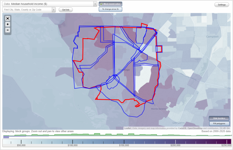
Saratoga, California Neighborhood Map - Income, House Prices, Occupations, Boundaries
Settings
X

- City boundary
- Neighborhood boundaries
Business Search - 14 Million verified businesses
Neighborhoods:
Blue Hills, Brookview, Champagne Fountain, Congress Springs, Downtown Saratoga, Fruitvale, Glen Una, Hillside, Mount Eden, Quito, Saratoga Woods, Sunland Park, Triangle North, Triangle South, West FruitvaleBlue Hills neighborhood in Saratoga statistics: (Find on map)
Area: 1.093 square miles
Population: 4,614
Population density:
Median household income in 2021:
Median rent in in 2021:
Male vs Females
Median age
Housing prices:
Average estimated value of detached houses in 2021 (81.3% of all units):
Average estimated value of townhouses or other attached units in 2021 (33.4% of all units):
Most popular occupations of males: management occupations (except farmers) (30.8%); architecture and engineering occupations (20.4%); computer and mathematical occupations (11.5%); business and financial operations occupations (7.6%); healthcare practitioners and technical occupations (7.2%); sales and office occupations (6.6%); service occupations (5.2%)
Most popular occupations of females: management occupations (except farmers) (31.0%); business and financial operations occupations (16.0%); sales and office occupations (12.9%); healthcare practitioners and technical occupations (6.9%); service occupations (6.8%); education, training, and library occupations (6.5%); computer and mathematical occupations (6.2%)
Limited-access highways (interstate or state) in this neighborhood: W Valley Fwy (State Hwy 85).
Roads and streets: Prospect Rd; Cox Ave; Sea Gull Way; Wardell Rd; Farr Ranch Rd; Fredericksburg Dr; Arroyo de Arguello; Beauchamp Ln; Knollwood Dr; Glen Brae Dr; Atrium Dr; Marilla Dr; S Saratoga Sunnyvale Rd; Kirkmont Dr; Carniel Ave; Goleta Ave; Saratoga Sunnyvale Rd; Karn Cir; Crayside Ln; Williamsburg Ln; de Sanka Ave; Via Roncole; Carol Ln; Sumner Dr; Oak Creek Ln; Merida Dr; Kirkbrook Dr; Maureen Way; Parker Ranch Rd; Meadow Oak Rd; Ted Ave; Julie Ln; Yuba Ct; Cherry Ln; Hillmoor Dr; Burnett Dr; Zorka Ave; Wardell Ct; Beauchamp Ct; McCartysville Pl; Manor Dr; Kreisler Ct; Arroyo Ln; Lido Way; Veronica Dr; Kane Dr; Guava Ct; Atrium Cir; Blue Meadows Ct; St Joan Ct; Farr Ranch Ct; Norada Ct; Greenmeadow Ln; Puente Ct; Covina Ct; Lowena Ct; Kirkdale Dr; Leutar Ct; Ritanna Ct; Verde Moor Ct; Marilla Ct; Natoma Ct; Indio Ct; Bowhill Ct; Orella Ct; Sea Gull Ct; Claridge Ct; Granada Ct; Kinman Ct; Saratoga Villa Pl; Gordon Ct; Spring Blossom Ct; Cheverly Ct; Mill Ct; Aberdeen Ct; Kane Ct; Woodmont Dr; Fredericksburg Ct; Kenyon Ct; Sheridan Cir; James Town Ct; Goleta Ct; Glen Arbor Ct; Manor Ct.
Railroad features: Union Pacific RR.
Other features: Prospect Crk; Calabazas Crk; Saratoga Crk.
Blue Hills neighborhood detailed profile
Area: 1.093 square miles
Population: 4,614
Population density:
| Blue Hills: | 4,222 people per square mile |
| Saratoga: | 2,577 people per square mile |
Median household income in 2021:
| Blue Hills: | $207,016 |
| Saratoga: | $224,179 |
Median rent in in 2021:
| Blue Hills: | $3,354 |
| Saratoga: | $2,001 |
Male vs Females
| Males: | 2,319 |
| Females: | 2,295 |
Median age
| Males: | 48.1 years |
| Females: | 47.6 years |
Housing prices:
Average estimated value of detached houses in 2021 (81.3% of all units):
| Blue Hills: | $2,360,045 |
| California: | $881,672 |
Average estimated value of townhouses or other attached units in 2021 (33.4% of all units):
| This neighborhood: | $1,514,583 |
| California: | $745,373 |
Most popular occupations of males: management occupations (except farmers) (30.8%); architecture and engineering occupations (20.4%); computer and mathematical occupations (11.5%); business and financial operations occupations (7.6%); healthcare practitioners and technical occupations (7.2%); sales and office occupations (6.6%); service occupations (5.2%)
Most popular occupations of females: management occupations (except farmers) (31.0%); business and financial operations occupations (16.0%); sales and office occupations (12.9%); healthcare practitioners and technical occupations (6.9%); service occupations (6.8%); education, training, and library occupations (6.5%); computer and mathematical occupations (6.2%)
Limited-access highways (interstate or state) in this neighborhood: W Valley Fwy (State Hwy 85).
Roads and streets: Prospect Rd; Cox Ave; Sea Gull Way; Wardell Rd; Farr Ranch Rd; Fredericksburg Dr; Arroyo de Arguello; Beauchamp Ln; Knollwood Dr; Glen Brae Dr; Atrium Dr; Marilla Dr; S Saratoga Sunnyvale Rd; Kirkmont Dr; Carniel Ave; Goleta Ave; Saratoga Sunnyvale Rd; Karn Cir; Crayside Ln; Williamsburg Ln; de Sanka Ave; Via Roncole; Carol Ln; Sumner Dr; Oak Creek Ln; Merida Dr; Kirkbrook Dr; Maureen Way; Parker Ranch Rd; Meadow Oak Rd; Ted Ave; Julie Ln; Yuba Ct; Cherry Ln; Hillmoor Dr; Burnett Dr; Zorka Ave; Wardell Ct; Beauchamp Ct; McCartysville Pl; Manor Dr; Kreisler Ct; Arroyo Ln; Lido Way; Veronica Dr; Kane Dr; Guava Ct; Atrium Cir; Blue Meadows Ct; St Joan Ct; Farr Ranch Ct; Norada Ct; Greenmeadow Ln; Puente Ct; Covina Ct; Lowena Ct; Kirkdale Dr; Leutar Ct; Ritanna Ct; Verde Moor Ct; Marilla Ct; Natoma Ct; Indio Ct; Bowhill Ct; Orella Ct; Sea Gull Ct; Claridge Ct; Granada Ct; Kinman Ct; Saratoga Villa Pl; Gordon Ct; Spring Blossom Ct; Cheverly Ct; Mill Ct; Aberdeen Ct; Kane Ct; Woodmont Dr; Fredericksburg Ct; Kenyon Ct; Sheridan Cir; James Town Ct; Goleta Ct; Glen Arbor Ct; Manor Ct.
Railroad features: Union Pacific RR.
Other features: Prospect Crk; Calabazas Crk; Saratoga Crk.
Blue Hills neighborhood detailed profile
Brookview neighborhood in Saratoga statistics: (Find on map)
Area: 0.325 square miles
Population: 1,401
Population density:
Median household income in 2021:
Median rent in in 2021:
Male vs Females
Median age
Housing prices:
Average estimated value of detached houses in 2021 (98.5% of all units):
Average estimated value of townhouses or other attached units in 2021 (2.3% of all units):
Most popular occupations of males: management occupations (except farmers) (31.5%); computer and mathematical occupations (18.4%); business and financial operations occupations (13.4%); architecture and engineering occupations (11.7%); service occupations (6.4%); sales and office occupations (6.1%); healthcare practitioners and technical occupations (5.5%)
Most popular occupations of females: computer and mathematical occupations (16.1%); service occupations (16.1%); business and financial operations occupations (14.7%); education, training, and library occupations (13.7%); sales and office occupations (10.2%); management occupations (except farmers) (10.0%); healthcare practitioners and technical occupations (9.5%)
Roads and streets: Brookglen Dr; Titus Ave; Woodside Dr; Prospect Rd; Miller Ave; Brookview Dr; Country Squire Ln; Brockton Ln; Cox Ave; Mellowood Dr; Palmtag Dr; Bellwood Dr; Melinda Cir; Kristy Ln; Northampton Dr; Brookglen Ct; Homes Dr; Gunther Ct; Vendura Ct; Fernbrook Ct; Titus Ct; Northampton Ct; Lynbrook Ct; Falmouth Ct; Woodside Ct; Rodoni Ct; Greenbrook Ct; Bach Ct; Country Squire Way; Country Squire Ct.
Other features: Saratoga Crk.
Brookview neighborhood detailed profile
Area: 0.325 square miles
Population: 1,401
Population density:
| Brookview: | 4,306 people per square mile |
| Saratoga: | 2,577 people per square mile |
Median household income in 2021:
| Brookview: | $168,127 |
| Saratoga: | $224,179 |
Median rent in in 2021:
| Brookview: | $3,498 |
| Saratoga: | $2,001 |
Male vs Females
| Males: | 606 |
| Females: | 795 |
Median age
| Males: | 53.9 years |
| Females: | 52.5 years |
Housing prices:
Average estimated value of detached houses in 2021 (98.5% of all units):
| Brookview: | $2,462,463 |
| California: | $881,672 |
Average estimated value of townhouses or other attached units in 2021 (2.3% of all units):
| This neighborhood: | $1,500,000 |
| California: | $745,373 |
Most popular occupations of males: management occupations (except farmers) (31.5%); computer and mathematical occupations (18.4%); business and financial operations occupations (13.4%); architecture and engineering occupations (11.7%); service occupations (6.4%); sales and office occupations (6.1%); healthcare practitioners and technical occupations (5.5%)
Most popular occupations of females: computer and mathematical occupations (16.1%); service occupations (16.1%); business and financial operations occupations (14.7%); education, training, and library occupations (13.7%); sales and office occupations (10.2%); management occupations (except farmers) (10.0%); healthcare practitioners and technical occupations (9.5%)
Roads and streets: Brookglen Dr; Titus Ave; Woodside Dr; Prospect Rd; Miller Ave; Brookview Dr; Country Squire Ln; Brockton Ln; Cox Ave; Mellowood Dr; Palmtag Dr; Bellwood Dr; Melinda Cir; Kristy Ln; Northampton Dr; Brookglen Ct; Homes Dr; Gunther Ct; Vendura Ct; Fernbrook Ct; Titus Ct; Northampton Ct; Lynbrook Ct; Falmouth Ct; Woodside Ct; Rodoni Ct; Greenbrook Ct; Bach Ct; Country Squire Way; Country Squire Ct.
Other features: Saratoga Crk.
Brookview neighborhood detailed profile
Champagne Fountain neighborhood in Saratoga statistics: (Find on map)
Area: 0.308 square miles
Population: 1,270
Population density:
Median household income in 2021:
Median rent in in 2021:
Male vs Females
Median age
Average estimated value of detached houses in 2021 (99.8% of all units):
Most popular occupations of males: sales and office occupations (22.3%); management occupations (except farmers) (21.7%); computer and mathematical occupations (14.3%); production occupations (9.7%); architecture and engineering occupations (7.6%); life, physical, and social science occupations (6.8%); business and financial operations occupations (5.8%)
Most popular occupations of females: management occupations (except farmers) (25.4%); sales and office occupations (17.6%); education, training, and library occupations (14.7%); computer and mathematical occupations (9.9%); service occupations (9.3%); healthcare practitioners and technical occupations (8.9%); business and financial operations occupations (5.0%)
Roads and streets: Saratoga Ave; Ronnie Way; Dagmar Dr; Portos Dr; Via Arriba Dr; Myren Dr; Bonnet Way; Via Ranchero Dr; Wendy Ln; Fruitvale Ave; Kerwin Ranch Ct; Holiday Dr; Ward Way; Harper Dr; Scotland Dr; Christie Dr; Ranfre Ln; Fontaine Dr; Portos Ct; Westover Dr; Oahu Ln; Sage Ct; Kodiac Pl; Via Real Dr; Tweed Ct; Casa Blanca Ln; Via Monte Dr; Via Crecente Ct; Holiday Ct; Myren Ct; Via Arriba Ct; Portos Pl; Buckingham Ct; Via Ranchero Ct.
Railroad features: Union Pacific RR.
Other features: Wildcat Crk.
Champagne Fountain neighborhood detailed profile
Area: 0.308 square miles
Population: 1,270
Population density:
| Champagne Fountain: | 4,120 people per square mile |
| Saratoga: | 2,577 people per square mile |
Median household income in 2021:
| Champagne Fountain: | $197,623 |
| Saratoga: | $224,179 |
Median rent in in 2021:
| Champagne Fountain: | $3,501 |
| Saratoga: | $2,001 |
Male vs Females
| Males: | 638 |
| Females: | 631 |
Median age
| Males: | 47.2 years |
| Females: | 48.8 years |
Average estimated value of detached houses in 2021 (99.8% of all units):
| Champagne Fountain: | $2,141,516 |
| California: | $881,672 |
Most popular occupations of males: sales and office occupations (22.3%); management occupations (except farmers) (21.7%); computer and mathematical occupations (14.3%); production occupations (9.7%); architecture and engineering occupations (7.6%); life, physical, and social science occupations (6.8%); business and financial operations occupations (5.8%)
Most popular occupations of females: management occupations (except farmers) (25.4%); sales and office occupations (17.6%); education, training, and library occupations (14.7%); computer and mathematical occupations (9.9%); service occupations (9.3%); healthcare practitioners and technical occupations (8.9%); business and financial operations occupations (5.0%)
Roads and streets: Saratoga Ave; Ronnie Way; Dagmar Dr; Portos Dr; Via Arriba Dr; Myren Dr; Bonnet Way; Via Ranchero Dr; Wendy Ln; Fruitvale Ave; Kerwin Ranch Ct; Holiday Dr; Ward Way; Harper Dr; Scotland Dr; Christie Dr; Ranfre Ln; Fontaine Dr; Portos Ct; Westover Dr; Oahu Ln; Sage Ct; Kodiac Pl; Via Real Dr; Tweed Ct; Casa Blanca Ln; Via Monte Dr; Via Crecente Ct; Holiday Ct; Myren Ct; Via Arriba Ct; Portos Pl; Buckingham Ct; Via Ranchero Ct.
Railroad features: Union Pacific RR.
Other features: Wildcat Crk.
Champagne Fountain neighborhood detailed profile
Congress Springs neighborhood in Saratoga statistics: (Find on map)
Area: 2.200 square miles
Population: 4,566
Population density:
Median household income in 2021:
Median rent in in 2021:
Male vs Females
Median age
Average estimated value of detached houses in 2021 (78.6% of all units):
Most popular occupations of males: management occupations (except farmers) (31.5%); computer and mathematical occupations (11.8%); sales and office occupations (11.4%); architecture and engineering occupations (10.4%); education, training, and library occupations (7.3%); business and financial operations occupations (5.9%); healthcare practitioners and technical occupations (5.6%)
Most popular occupations of females: management occupations (except farmers) (22.6%); architecture and engineering occupations (16.0%); business and financial operations occupations (15.4%); sales and office occupations (14.2%); healthcare practitioners and technical occupations (10.1%); computer and mathematical occupations (6.9%); service occupations (5.2%)
Highways in this neighborhood: State Hwy 9 (Big Basin Way); State Hwy 9 (Saratoga Los Gatos Rd, Los Gatos Saratoga Rd).
Roads and streets: Pierce Rd; S Saratoga Sunnyvale Rd; Canyon View Dr; Saratoga Hills Rd; Toll Gate Rd; Sarahills Dr; Pike Rd; Bank Mill Rd; Verde Vista Ln; Saratoga Heights Dr; Reid Ln; 4th St; Russell Ln; Springer Ave; Trinity Ave; Dorsey Way; Rocky Creek Way; Paramount Dr; Surrey Ln; Marion Rd; Teerlink Way; Deer Canyon Ln; Oak St; Paramount Ct; Sevilla Ln; Brandywine Dr; Leonard Rd; Seaton Ave; Stoneridge Dr; Michaels Dr; Fieldstone Dr; Sullivan Way; Malcom Ave; Debbie Ln; Albar Ct; Mount Eden Rd; Elva Ave; Brookwood Ln; Lynde Ave; Ambric Knolls Rd; Heber Way; Lumbertown Ln; Palomino Way; Saraview Dr; Paul Ave; Boyce Ln; Upper Hill Dr; Saratoga Ave; Haymeadow Dr; Upper Hills Ct; Bougainvillea Ct; Congress Hall Ln; 6th St; Saint Charles St; Rice Ct; Vintage Ln; Damon Ln; Pontiac Ave; Woodward Ct; Congress Springs Ln; Elvira St; Mount Eden Ct; Tamworth Ave; Dorene Ct; Toni Ann Pl; Mina Way; Glenmont Dr; Masson Ct; Verde Vista Ct; Mandarin Way; Saraview Ct; Wildberry Ln; 3rd St; Pamela Way; Houston Ct; Bank Mill Ln; Sarahills Ct; Turkey Track Ln; Neals Hollow Ln; Vis Regina; Lacey Ave; Perata Ct; Burns Way; 5th St; Lynde Ct; Stewart Ct; Vintner Ct; Springer Ct; Placida Ct; Thelma Ave; Wildwood Way; Deer Spring Ct; Esterlee Ave; Padero Ave; Deerpark Ct (Deep Park Ct); Saratoga Heights Ct; Prune Blossom Dr; Chalet Clothilde Dr (Chalet Clotilde Dr); Deepwell Ct; el Dorado Ct; Canyon View Ct; Gerald Zappelli Ct; Trinity Ct; Magnolia Ct; Fieldstone Ct; Petunia Ct; Apollo Way; Park Pl; Russell Ct; Reed Ct; Sycamore Grove; Brandywine Ct; Quarry Rd (Villa Oaks Ln).
Other features: Saratoga Crk; Calabazas Crk.
Congress Springs neighborhood detailed profile
Area: 2.200 square miles
Population: 4,566
Population density:
| Congress Springs: | 2,075 people per square mile |
| Saratoga: | 2,577 people per square mile |
Median household income in 2021:
| Congress Springs: | $238,354 |
| Saratoga: | $224,179 |
Median rent in in 2021:
| Congress Springs: | $3,478 |
| Saratoga: | $2,001 |
Male vs Females
| Males: | 2,344 |
| Females: | 2,221 |
Median age
| Males: | 47.5 years |
| Females: | 48.9 years |
Average estimated value of detached houses in 2021 (78.6% of all units):
| Congress Springs: | $2,883,577 |
| California: | $881,672 |
Most popular occupations of males: management occupations (except farmers) (31.5%); computer and mathematical occupations (11.8%); sales and office occupations (11.4%); architecture and engineering occupations (10.4%); education, training, and library occupations (7.3%); business and financial operations occupations (5.9%); healthcare practitioners and technical occupations (5.6%)
Most popular occupations of females: management occupations (except farmers) (22.6%); architecture and engineering occupations (16.0%); business and financial operations occupations (15.4%); sales and office occupations (14.2%); healthcare practitioners and technical occupations (10.1%); computer and mathematical occupations (6.9%); service occupations (5.2%)
Highways in this neighborhood: State Hwy 9 (Big Basin Way); State Hwy 9 (Saratoga Los Gatos Rd, Los Gatos Saratoga Rd).
Roads and streets: Pierce Rd; S Saratoga Sunnyvale Rd; Canyon View Dr; Saratoga Hills Rd; Toll Gate Rd; Sarahills Dr; Pike Rd; Bank Mill Rd; Verde Vista Ln; Saratoga Heights Dr; Reid Ln; 4th St; Russell Ln; Springer Ave; Trinity Ave; Dorsey Way; Rocky Creek Way; Paramount Dr; Surrey Ln; Marion Rd; Teerlink Way; Deer Canyon Ln; Oak St; Paramount Ct; Sevilla Ln; Brandywine Dr; Leonard Rd; Seaton Ave; Stoneridge Dr; Michaels Dr; Fieldstone Dr; Sullivan Way; Malcom Ave; Debbie Ln; Albar Ct; Mount Eden Rd; Elva Ave; Brookwood Ln; Lynde Ave; Ambric Knolls Rd; Heber Way; Lumbertown Ln; Palomino Way; Saraview Dr; Paul Ave; Boyce Ln; Upper Hill Dr; Saratoga Ave; Haymeadow Dr; Upper Hills Ct; Bougainvillea Ct; Congress Hall Ln; 6th St; Saint Charles St; Rice Ct; Vintage Ln; Damon Ln; Pontiac Ave; Woodward Ct; Congress Springs Ln; Elvira St; Mount Eden Ct; Tamworth Ave; Dorene Ct; Toni Ann Pl; Mina Way; Glenmont Dr; Masson Ct; Verde Vista Ct; Mandarin Way; Saraview Ct; Wildberry Ln; 3rd St; Pamela Way; Houston Ct; Bank Mill Ln; Sarahills Ct; Turkey Track Ln; Neals Hollow Ln; Vis Regina; Lacey Ave; Perata Ct; Burns Way; 5th St; Lynde Ct; Stewart Ct; Vintner Ct; Springer Ct; Placida Ct; Thelma Ave; Wildwood Way; Deer Spring Ct; Esterlee Ave; Padero Ave; Deerpark Ct (Deep Park Ct); Saratoga Heights Ct; Prune Blossom Dr; Chalet Clothilde Dr (Chalet Clotilde Dr); Deepwell Ct; el Dorado Ct; Canyon View Ct; Gerald Zappelli Ct; Trinity Ct; Magnolia Ct; Fieldstone Ct; Petunia Ct; Apollo Way; Park Pl; Russell Ct; Reed Ct; Sycamore Grove; Brandywine Ct; Quarry Rd (Villa Oaks Ln).
Other features: Saratoga Crk; Calabazas Crk.
Congress Springs neighborhood detailed profile
Downtown Saratoga neighborhood in Saratoga statistics: (Find on map)
Area: 0.303 square miles
Population: 291
Population density:
Median household income in 2021:
Median rent in in 2021:
Male vs Females
Median age
Average estimated value of detached houses in 2021 (85.5% of all units):
Most popular occupations of males: management occupations (except farmers) (22.9%); computer and mathematical occupations (20.2%); arts, design, entertainment, sports, and media occupations (12.3%); sales and office occupations (11.4%); architecture and engineering occupations (11.0%); business and financial operations occupations (8.4%); service occupations (4.8%)
Most popular occupations of females: management occupations (except farmers) (31.7%); computer and mathematical occupations (15.5%); healthcare practitioners and technical occupations (14.0%); sales and office occupations (7.8%); education, training, and library occupations (7.4%); business and financial operations occupations (6.6%); service occupations (4.9%)
Highways in this neighborhood: Big Basin Way (State Hwy 9); State Hwy 9 (Saratoga Los Gatos Rd, Los Gatos Saratoga Rd).
Roads and streets: Lomita Dr; Oak St; Aloha Ave; Vickery Ave; Oak Pl; Bohlman Rd; Wescott Dr; 6th St; Komina Ave; Orchard Rd; Park Pl; Saratoga Ave; Saint Charles St; Marden Ave; Forest Hills Dr; 3rd St; 4th St; Pamela Way; Vickery Pl; Cody Ln; Turkey Track Ln; 5th St; Butano Ter; S Saratoga Sunnyvale Rd.
Other features: Saratoga Crk.
Downtown Saratoga neighborhood detailed profile
Area: 0.303 square miles
Population: 291
Population density:
| Downtown Saratoga (Downtown): | 961 people per square mile |
| Saratoga: | 2,577 people per square mile |
Median household income in 2021:
| Downtown Saratoga (Downtown): | $239,339 |
| Saratoga: | $224,179 |
Median rent in in 2021:
| Downtown Saratoga (Downtown): | $3,497 |
| Saratoga: | $2,001 |
Male vs Females
| Males: | 163 |
| Females: | 127 |
Median age
| Males: | 42.1 years |
| Females: | 49.3 years |
Average estimated value of detached houses in 2021 (85.5% of all units):
| Downtown Saratoga (Downtown): | $2,599,318 |
| California: | $881,672 |
Most popular occupations of males: management occupations (except farmers) (22.9%); computer and mathematical occupations (20.2%); arts, design, entertainment, sports, and media occupations (12.3%); sales and office occupations (11.4%); architecture and engineering occupations (11.0%); business and financial operations occupations (8.4%); service occupations (4.8%)
Most popular occupations of females: management occupations (except farmers) (31.7%); computer and mathematical occupations (15.5%); healthcare practitioners and technical occupations (14.0%); sales and office occupations (7.8%); education, training, and library occupations (7.4%); business and financial operations occupations (6.6%); service occupations (4.9%)
Highways in this neighborhood: Big Basin Way (State Hwy 9); State Hwy 9 (Saratoga Los Gatos Rd, Los Gatos Saratoga Rd).
Roads and streets: Lomita Dr; Oak St; Aloha Ave; Vickery Ave; Oak Pl; Bohlman Rd; Wescott Dr; 6th St; Komina Ave; Orchard Rd; Park Pl; Saratoga Ave; Saint Charles St; Marden Ave; Forest Hills Dr; 3rd St; 4th St; Pamela Way; Vickery Pl; Cody Ln; Turkey Track Ln; 5th St; Butano Ter; S Saratoga Sunnyvale Rd.
Other features: Saratoga Crk.
Downtown Saratoga neighborhood detailed profile
Fruitvale neighborhood in Saratoga statistics: (Find on map)
Area: 1.999 square miles
Population: 3,592
Population density:
Median household income in 2021:
Median rent in in 2021:
Male vs Females
Median age
Average estimated value of detached houses in 2021 (66.6% of all units):
Most popular occupations of males: management occupations (except farmers) (24.7%); computer and mathematical occupations (21.8%); sales and office occupations (16.1%); architecture and engineering occupations (9.6%); life, physical, and social science occupations (9.1%); business and financial operations occupations (6.9%); healthcare practitioners and technical occupations (4.5%)
Most popular occupations of females: management occupations (except farmers) (33.7%); sales and office occupations (23.5%); service occupations (10.5%); computer and mathematical occupations (8.1%); healthcare practitioners and technical occupations (6.1%); legal occupations (5.6%); business and financial operations occupations (5.3%)
Highways in this neighborhood: Los Gatos Saratoga Rd (Saratoga Los Gatos Rd, State Hwy 9).
Roads and streets: Quito Rd; Sobey Rd; Chester Ave; Fruitvale Ave; Allendale Ave; Monte Vista Dr; San Marcos Rd; Gypsy Hill Rd; el Camino Grande; Valle Vista Dr; Crisp Ave; Woodbank Way; Ten Acres Rd; Montewood Dr; Granite Way; Via Colina; Cam de Los Barcos; Old Wood Rd; Sperry Ln; Austin Way; Ravenwood Dr; Marshall Ln; Via de Marcos; Rancho Las Cimas Way; Arcadia Palms Dr; Vessing Rd; el Camino Senda; Burgundy Way; Short Hill Ct; Panorama Dr; Blue Gum Ct; Evans Ln; Sobey Meadows Ct; Maude Ave; Marilyn Ln; Via Tesoro Ct; Sunnyside Dr; Hilltop Way; Oriole Rd; Spring Brook Ln; Singing Hill Ln; Encina Ct; Gardner Ln; Pinnacle Ct; Ten Acres Ct; Granite Ct; Andrew Ct; Riesling Ct; Sobey Oaks Ct; Arbolado Way; el Quito Way; Haun Ct; Apricot Hill; Omega Ln; Aquino Way; Valle Vista Ct; Leland Cir; Campo Calle Way; Zinfandel Ct; Cordwood Ct; Eucalyptus Dr; 10 Acres Rd; Chablis Ct; Maclay Ct; Emerald Hills Ct; Vessing Ct; Ambleside Ln; Loquat Ct; Oriole Way.
Other features: Vasona Crk; San Tomas Aquino Crk.
Fruitvale neighborhood detailed profile
Area: 1.999 square miles
Population: 3,592
Population density:
| Fruitvale (Sobey Road): | 1,797 people per square mile |
| Saratoga: | 2,577 people per square mile |
Median household income in 2021:
| Fruitvale (Sobey Road): | $210,900 |
| Saratoga: | $224,179 |
Median rent in in 2021:
| Fruitvale (Sobey Road): | $3,501 |
| Saratoga: | $2,001 |
Male vs Females
| Males: | 1,608 |
| Females: | 1,983 |
Median age
| Males: | 52.3 years |
| Females: | 54.4 years |
Average estimated value of detached houses in 2021 (66.6% of all units):
| Fruitvale (Sobey Road): | $2,491,959 |
| California: | $881,672 |
Most popular occupations of males: management occupations (except farmers) (24.7%); computer and mathematical occupations (21.8%); sales and office occupations (16.1%); architecture and engineering occupations (9.6%); life, physical, and social science occupations (9.1%); business and financial operations occupations (6.9%); healthcare practitioners and technical occupations (4.5%)
Most popular occupations of females: management occupations (except farmers) (33.7%); sales and office occupations (23.5%); service occupations (10.5%); computer and mathematical occupations (8.1%); healthcare practitioners and technical occupations (6.1%); legal occupations (5.6%); business and financial operations occupations (5.3%)
Highways in this neighborhood: Los Gatos Saratoga Rd (Saratoga Los Gatos Rd, State Hwy 9).
Roads and streets: Quito Rd; Sobey Rd; Chester Ave; Fruitvale Ave; Allendale Ave; Monte Vista Dr; San Marcos Rd; Gypsy Hill Rd; el Camino Grande; Valle Vista Dr; Crisp Ave; Woodbank Way; Ten Acres Rd; Montewood Dr; Granite Way; Via Colina; Cam de Los Barcos; Old Wood Rd; Sperry Ln; Austin Way; Ravenwood Dr; Marshall Ln; Via de Marcos; Rancho Las Cimas Way; Arcadia Palms Dr; Vessing Rd; el Camino Senda; Burgundy Way; Short Hill Ct; Panorama Dr; Blue Gum Ct; Evans Ln; Sobey Meadows Ct; Maude Ave; Marilyn Ln; Via Tesoro Ct; Sunnyside Dr; Hilltop Way; Oriole Rd; Spring Brook Ln; Singing Hill Ln; Encina Ct; Gardner Ln; Pinnacle Ct; Ten Acres Ct; Granite Ct; Andrew Ct; Riesling Ct; Sobey Oaks Ct; Arbolado Way; el Quito Way; Haun Ct; Apricot Hill; Omega Ln; Aquino Way; Valle Vista Ct; Leland Cir; Campo Calle Way; Zinfandel Ct; Cordwood Ct; Eucalyptus Dr; 10 Acres Rd; Chablis Ct; Maclay Ct; Emerald Hills Ct; Vessing Ct; Ambleside Ln; Loquat Ct; Oriole Way.
Other features: Vasona Crk; San Tomas Aquino Crk.
Fruitvale neighborhood detailed profile
Glen Una neighborhood in Saratoga statistics: (Find on map)
Area: 2.184 square miles
Population: 1,334
Population density:
Median household income in 2021:
Median rent in in 2021:
Male vs Females
Median age
Average estimated value of detached houses in 2021 (83.7% of all units):
Most popular occupations of males: management occupations (except farmers) (31.3%); computer and mathematical occupations (18.4%); sales and office occupations (12.6%); architecture and engineering occupations (10.0%); business and financial operations occupations (4.4%); education, training, and library occupations (4.3%); service occupations (4.2%)
Most popular occupations of females: management occupations (except farmers) (32.2%); sales and office occupations (16.0%); healthcare practitioners and technical occupations (13.3%); service occupations (8.6%); architecture and engineering occupations (6.0%); education, training, and library occupations (4.9%); business and financial operations occupations (4.3%)
Highways in this neighborhood: State Hwy 9 (Saratoga Los Gatos Rd, Los Gatos Saratoga Rd); Big Basin Way (State Hwy 9).
Roads and streets: Canon Dr; Glen Una Dr; Peach Hill Rd; Bainter Ave (Bainter Way); Vickery Ave; Wood Acres Rd; Piedmont Rd; Montalvo Rd; Mendelsohn Ln; Bohlman Rd; Redberry Dr; Littlebrook Dr; Lomita Dr; Pepper Ln; Oak St; Park Dr; Overlook Dr; Mountain Way; Ravine Rd; Hill Ave; Hidden View Ln; Hume Dr; Norton Rd; Aloha Ave; Montalvo Heights Dr (Lira Dr); Woodacres Rd; Wildcat Rd; Bellecourt; Madrone Hill Rd; Austin Way; W Canon Dr (Glen Una Dr, Red Hill Rd); Sky Oaks Way; Bonnie Brae Way; Hidden Hill Rd; 6th St; Komina Ave; Montalvo Ln; Jacks Rd; Citrus Ln; Sunset Dr; Bonnie Brae Ln; Bountiful Acres Way; Rancho Bella Vis; Robin Way; Audrey Smith Ln; Winn Rd; Saint Charles St; Lark Way; Vine St; Marden Ave; Lancaster Rd; West Rd (West Dr); Forest Hills Dr; Wieuca Rd; Lomas Ln; Juna Ln; 3rd St; S Saratoga Sunnyvale Rd; 4th St; Pamela Way; Vickery Pl; Cody Ln; Cll Montalvo; Turkey Track Ln; Pleasant Ave; Wood Acers Rd; Hidden Dr (Hidden Creek Dr); 5th St; Montalvo Oaks Pl; Butano Ter; Woodwardia Ln; Montalvo Heights Ct; Sigal Dr; Hidden Hill Pl; Rocky Creek Way.
Other features: San Tomas Aquino Crk; Wildcat Crk; Saratoga Crk.
Glen Una neighborhood detailed profile
Area: 2.184 square miles
Population: 1,334
Population density:
| Glen Una: | 611 people per square mile |
| Saratoga: | 2,577 people per square mile |
Median household income in 2021:
| Glen Una: | $226,981 |
| Saratoga: | $224,179 |
Median rent in in 2021:
| Glen Una: | $3,499 |
| Saratoga: | $2,001 |
Male vs Females
| Males: | 695 |
| Females: | 639 |
Median age
| Males: | 47.2 years |
| Females: | 50.8 years |
Average estimated value of detached houses in 2021 (83.7% of all units):
| Glen Una: | $2,851,130 |
| California: | $881,672 |
Most popular occupations of males: management occupations (except farmers) (31.3%); computer and mathematical occupations (18.4%); sales and office occupations (12.6%); architecture and engineering occupations (10.0%); business and financial operations occupations (4.4%); education, training, and library occupations (4.3%); service occupations (4.2%)
Most popular occupations of females: management occupations (except farmers) (32.2%); sales and office occupations (16.0%); healthcare practitioners and technical occupations (13.3%); service occupations (8.6%); architecture and engineering occupations (6.0%); education, training, and library occupations (4.9%); business and financial operations occupations (4.3%)
Highways in this neighborhood: State Hwy 9 (Saratoga Los Gatos Rd, Los Gatos Saratoga Rd); Big Basin Way (State Hwy 9).
Roads and streets: Canon Dr; Glen Una Dr; Peach Hill Rd; Bainter Ave (Bainter Way); Vickery Ave; Wood Acres Rd; Piedmont Rd; Montalvo Rd; Mendelsohn Ln; Bohlman Rd; Redberry Dr; Littlebrook Dr; Lomita Dr; Pepper Ln; Oak St; Park Dr; Overlook Dr; Mountain Way; Ravine Rd; Hill Ave; Hidden View Ln; Hume Dr; Norton Rd; Aloha Ave; Montalvo Heights Dr (Lira Dr); Woodacres Rd; Wildcat Rd; Bellecourt; Madrone Hill Rd; Austin Way; W Canon Dr (Glen Una Dr, Red Hill Rd); Sky Oaks Way; Bonnie Brae Way; Hidden Hill Rd; 6th St; Komina Ave; Montalvo Ln; Jacks Rd; Citrus Ln; Sunset Dr; Bonnie Brae Ln; Bountiful Acres Way; Rancho Bella Vis; Robin Way; Audrey Smith Ln; Winn Rd; Saint Charles St; Lark Way; Vine St; Marden Ave; Lancaster Rd; West Rd (West Dr); Forest Hills Dr; Wieuca Rd; Lomas Ln; Juna Ln; 3rd St; S Saratoga Sunnyvale Rd; 4th St; Pamela Way; Vickery Pl; Cody Ln; Cll Montalvo; Turkey Track Ln; Pleasant Ave; Wood Acers Rd; Hidden Dr (Hidden Creek Dr); 5th St; Montalvo Oaks Pl; Butano Ter; Woodwardia Ln; Montalvo Heights Ct; Sigal Dr; Hidden Hill Pl; Rocky Creek Way.
Other features: San Tomas Aquino Crk; Wildcat Crk; Saratoga Crk.
Glen Una neighborhood detailed profile
Hillside neighborhood in Saratoga statistics: (Find on map)
Area: 5.674 square miles
Population: 8,175
Population density:
Median household income in 2021:
Median rent in in 2021:
Male vs Females
Median age
Housing prices:
Average estimated value of detached houses in 2021 (80.4% of all units):
Average estimated value of townhouses or other attached units in 2021 (13.5% of all units):
Most popular occupations of males: management occupations (except farmers) (35.1%); architecture and engineering occupations (12.6%); computer and mathematical occupations (10.9%); sales and office occupations (9.0%); healthcare practitioners and technical occupations (6.3%); service occupations (5.9%); business and financial operations occupations (5.8%)
Most popular occupations of females: management occupations (except farmers) (22.3%); business and financial operations occupations (15.8%); sales and office occupations (13.4%); architecture and engineering occupations (11.1%); healthcare practitioners and technical occupations (8.2%); computer and mathematical occupations (8.0%); service occupations (6.0%)
Highways in this neighborhood: State Hwy 9 (Big Basin Way); State Hwy 9 (Saratoga Los Gatos Rd, Los Gatos Saratoga Rd).
Roads and streets: Pierce Rd; Prospect Rd; S Saratoga Sunnyvale Rd; Mount Eden Rd; Old Oak Way; Canyon View Dr; Saratoga Hills Rd; Toll Gate Rd; Quarry Rd (Villa Oaks Ln); Arroyo de Arguello; Wardell Rd; Sarahills Dr; Pike Rd; Edencrest Ln; Comer Dr; Parker Ranch Rd; Garrod Rd; Bank Mill Rd; Via Regina; Verde Vista Ln; Saratoga Heights Dr; Farr Ranch Rd; Beauchamp Ln; Rolling Hills Rd; Chiquita Way; Star Ridge Ct; Orchard Meadow Dr; Reid Ln; Arrowhead Ln; Russell Ln; Carniel Ave; Springer Ave; Trinity Ave; 4th St; Vis Regina; Dorsey Way; Saratoga Sunnyvale Rd; Rocky Creek Way; Maria Ln; Paramount Dr; Surrey Ln; Marion Rd; Teerlink Way; Deer Canyon Ln; Crayside Ln; Paramount Ct; Continental Cir; Sevilla Ln; Ashley Way; Blue Hills Dr (Blue Hills Ln); Parker Ranch Ct; Brandywine Dr; Damon Ln; Via Roncole; Leonard Rd; Seaton Ave; Stoneridge Dr; Michaels Dr; Fieldstone Dr; Sullivan Way; Malcom Ave; Debbie Ln; Oak Creek Ln; Deer Trail Ct (Cocciardi Ct); Albar Ct; Maureen Way; Atrium Dr; Elva Ave; Brookwood Ln; Meadow Oak Rd; Lynde Ave; Ambric Knolls Rd; Julie Ln; Heber Way; Lumbertown Ln; Vista Arroyo Ct; Palomino Way; Hillmoor Dr; Scenic Heights Way; Saraview Dr; Paul Ave; Burnett Dr; Boyce Ln; Picea Ct; Upper Hill Dr; Wardell Ct; Beauchamp Ct; Diamond Oaks Ct; Haymeadow Dr; Manor Dr; Kreisler Ct; Upper Hills Ct; Arroyo Ln; Bougainvillea Ct; Congress Hall Ln; Padero Ct; Bella Vina; Rice Ct; Vintage Ln; Pontiac Ave; Woodward Ct; Congress Springs Ln; Blue Meadows Ct; Elvira St; Mount Eden Ct; Tamworth Ave; St Joan Ct; Dorene Ct; Farr Ranch Ct; Norada Ct; Toni Ann Pl; Greenmeadow Ln; Vaquero Ct; Mina Way; Glenmont Dr; Masson Ct; Verde Vista Ct; Lowena Ct; Mandarin Way; Saraview Ct; Ritanna Ct; Verde Moor Ct; Wildberry Ln; Foothill Ln; Bowhill Ct; Houston Ct; Bank Mill Ln; Cox Ave; Padero Ave; Sarahills Ct; Turkey Track Ln; Neals Hollow Ln; Sea Gull Way; Chadwick Ct; Lacey Ave; Perata Ct; Granada Ct; Burns Way; Saratoga Villa Pl; Gordon Ct; Spring Blossom Ct; Lynde Ct; Glasgow Ct; Stewart Ct; Vintner Ct; Chiquita Ct; Miljevich Dr; Springer Ct; Placida Ct; Thelma Ave; Wildwood Way; Kirkmont Dr; Deer Spring Ct; Yolo Dr; Esterlee Ave; Mill Ct; Deerpark Ct (Deep Park Ct); Saratoga Heights Ct; Prune Blossom Dr; Chalet Clothilde Dr (Chalet Clotilde Dr); Deepwell Ct; Ashley Ct; el Dorado Ct; Canyon View Ct; Gerald Zappelli Ct; Atrium Cir; Trinity Ct; Magnolia Ct; Fieldstone Ct; Kenyon Ct; Jepsen Ct; Petunia Ct; Apollo Way; James Town Ct; Carniel Ct; Russell Ct; Calabazas Creek; Reed Ct; Sycamore Grove; Brandywine Ct; Manor Ct.
Railroad features: Union Pacific RR.
Other features: Calabazas Crk; Saratoga Crk; Prospect Crk.
Hillside neighborhood detailed profile
Area: 5.674 square miles
Population: 8,175
Population density:
| Hillside (Saratoga Hills): | 1,441 people per square mile |
| Saratoga: | 2,577 people per square mile |
Median household income in 2021:
| Hillside (Saratoga Hills): | $226,441 |
| Saratoga: | $224,179 |
Median rent in in 2021:
| Hillside (Saratoga Hills): | $3,451 |
| Saratoga: | $2,001 |
Male vs Females
| Males: | 4,123 |
| Females: | 4,052 |
Median age
| Males: | 46.5 years |
| Females: | 47.5 years |
Housing prices:
Average estimated value of detached houses in 2021 (80.4% of all units):
| Hillside (Saratoga Hills): | $2,767,961 |
| California: | $881,672 |
Average estimated value of townhouses or other attached units in 2021 (13.5% of all units):
| This neighborhood: | $1,514,583 |
| California: | $745,373 |
Most popular occupations of males: management occupations (except farmers) (35.1%); architecture and engineering occupations (12.6%); computer and mathematical occupations (10.9%); sales and office occupations (9.0%); healthcare practitioners and technical occupations (6.3%); service occupations (5.9%); business and financial operations occupations (5.8%)
Most popular occupations of females: management occupations (except farmers) (22.3%); business and financial operations occupations (15.8%); sales and office occupations (13.4%); architecture and engineering occupations (11.1%); healthcare practitioners and technical occupations (8.2%); computer and mathematical occupations (8.0%); service occupations (6.0%)
Highways in this neighborhood: State Hwy 9 (Big Basin Way); State Hwy 9 (Saratoga Los Gatos Rd, Los Gatos Saratoga Rd).
Roads and streets: Pierce Rd; Prospect Rd; S Saratoga Sunnyvale Rd; Mount Eden Rd; Old Oak Way; Canyon View Dr; Saratoga Hills Rd; Toll Gate Rd; Quarry Rd (Villa Oaks Ln); Arroyo de Arguello; Wardell Rd; Sarahills Dr; Pike Rd; Edencrest Ln; Comer Dr; Parker Ranch Rd; Garrod Rd; Bank Mill Rd; Via Regina; Verde Vista Ln; Saratoga Heights Dr; Farr Ranch Rd; Beauchamp Ln; Rolling Hills Rd; Chiquita Way; Star Ridge Ct; Orchard Meadow Dr; Reid Ln; Arrowhead Ln; Russell Ln; Carniel Ave; Springer Ave; Trinity Ave; 4th St; Vis Regina; Dorsey Way; Saratoga Sunnyvale Rd; Rocky Creek Way; Maria Ln; Paramount Dr; Surrey Ln; Marion Rd; Teerlink Way; Deer Canyon Ln; Crayside Ln; Paramount Ct; Continental Cir; Sevilla Ln; Ashley Way; Blue Hills Dr (Blue Hills Ln); Parker Ranch Ct; Brandywine Dr; Damon Ln; Via Roncole; Leonard Rd; Seaton Ave; Stoneridge Dr; Michaels Dr; Fieldstone Dr; Sullivan Way; Malcom Ave; Debbie Ln; Oak Creek Ln; Deer Trail Ct (Cocciardi Ct); Albar Ct; Maureen Way; Atrium Dr; Elva Ave; Brookwood Ln; Meadow Oak Rd; Lynde Ave; Ambric Knolls Rd; Julie Ln; Heber Way; Lumbertown Ln; Vista Arroyo Ct; Palomino Way; Hillmoor Dr; Scenic Heights Way; Saraview Dr; Paul Ave; Burnett Dr; Boyce Ln; Picea Ct; Upper Hill Dr; Wardell Ct; Beauchamp Ct; Diamond Oaks Ct; Haymeadow Dr; Manor Dr; Kreisler Ct; Upper Hills Ct; Arroyo Ln; Bougainvillea Ct; Congress Hall Ln; Padero Ct; Bella Vina; Rice Ct; Vintage Ln; Pontiac Ave; Woodward Ct; Congress Springs Ln; Blue Meadows Ct; Elvira St; Mount Eden Ct; Tamworth Ave; St Joan Ct; Dorene Ct; Farr Ranch Ct; Norada Ct; Toni Ann Pl; Greenmeadow Ln; Vaquero Ct; Mina Way; Glenmont Dr; Masson Ct; Verde Vista Ct; Lowena Ct; Mandarin Way; Saraview Ct; Ritanna Ct; Verde Moor Ct; Wildberry Ln; Foothill Ln; Bowhill Ct; Houston Ct; Bank Mill Ln; Cox Ave; Padero Ave; Sarahills Ct; Turkey Track Ln; Neals Hollow Ln; Sea Gull Way; Chadwick Ct; Lacey Ave; Perata Ct; Granada Ct; Burns Way; Saratoga Villa Pl; Gordon Ct; Spring Blossom Ct; Lynde Ct; Glasgow Ct; Stewart Ct; Vintner Ct; Chiquita Ct; Miljevich Dr; Springer Ct; Placida Ct; Thelma Ave; Wildwood Way; Kirkmont Dr; Deer Spring Ct; Yolo Dr; Esterlee Ave; Mill Ct; Deerpark Ct (Deep Park Ct); Saratoga Heights Ct; Prune Blossom Dr; Chalet Clothilde Dr (Chalet Clotilde Dr); Deepwell Ct; Ashley Ct; el Dorado Ct; Canyon View Ct; Gerald Zappelli Ct; Atrium Cir; Trinity Ct; Magnolia Ct; Fieldstone Ct; Kenyon Ct; Jepsen Ct; Petunia Ct; Apollo Way; James Town Ct; Carniel Ct; Russell Ct; Calabazas Creek; Reed Ct; Sycamore Grove; Brandywine Ct; Manor Ct.
Railroad features: Union Pacific RR.
Other features: Calabazas Crk; Saratoga Crk; Prospect Crk.
Hillside neighborhood detailed profile
Mount Eden neighborhood in Saratoga statistics: (Find on map)
Area: 2.738 square miles
Population: 1,910
Population density:
Median household income in 2021:
Median rent in in 2021:
Male vs Females
Median age
Housing prices:
Average estimated value of detached houses in 2021 (94.7% of all units):
Average estimated value of townhouses or other attached units in 2021 (3.1% of all units):
Most popular occupations of males: management occupations (except farmers) (43.9%); computer and mathematical occupations (9.6%); architecture and engineering occupations (9.3%); sales and office occupations (7.4%); business and financial operations occupations (7.3%); service occupations (6.8%); healthcare practitioners and technical occupations (5.8%)
Most popular occupations of females: business and financial operations occupations (19.5%); management occupations (except farmers) (16.5%); sales and office occupations (12.6%); life, physical, and social science occupations (10.5%); computer and mathematical occupations (9.3%); service occupations (8.3%); arts, design, entertainment, sports, and media occupations (6.8%)
Roads and streets: Pierce Rd; Prospect Rd; Old Oak Way; Mount Eden Rd; Quarry Rd (Villa Oaks Ln); Wardell Rd; Comer Dr; Parker Ranch Rd; Garrod Rd; Via Regina; Farr Ranch Rd; Rolling Hills Rd; Chiquita Way; Star Ridge Ct; Orchard Meadow Dr; Arroyo de Arguello; Arrowhead Ln; Vis Regina; Maria Ln; Continental Cir; Ashley Way; Blue Hills Dr (Blue Hills Ln); Parker Ranch Ct; Edencrest Ln; Deer Trail Ct (Cocciardi Ct); Vista Arroyo Ct; Scenic Heights Way; Picea Ct; Damon Ln; Diamond Oaks Ct; S Saratoga Sunnyvale Rd; Padero Ct; Bella Vina; Farr Ranch Ct; Vaquero Ct; Foothill Ln; Padero Ave; Chadwick Ct; Carniel Ave; Burnett Dr; Chiquita Ct; Yolo Dr; Cox Ave; Chalet Clothilde Dr (Chalet Clotilde Dr); Ashley Ct; Jepsen Ct; Carniel Ct; Calabazas Creek.
Other features: Calabazas Crk; Prospect Crk.
Mount Eden neighborhood detailed profile
Area: 2.738 square miles
Population: 1,910
Population density:
| Mount Eden (Mt. Eden): | 697 people per square mile |
| Saratoga: | 2,577 people per square mile |
Median household income in 2021:
| Mount Eden (Mt. Eden): | $238,010 |
| Saratoga: | $224,179 |
Median rent in in 2021:
| Mount Eden (Mt. Eden): | $3,499 |
| Saratoga: | $2,001 |
Male vs Females
| Males: | 946 |
| Females: | 964 |
Median age
| Males: | 49.2 years |
| Females: | 47.3 years |
Housing prices:
Average estimated value of detached houses in 2021 (94.7% of all units):
| Mount Eden (Mt. Eden): | $2,806,579 |
| California: | $881,672 |
Average estimated value of townhouses or other attached units in 2021 (3.1% of all units):
| This neighborhood: | $2,141,567 |
| California: | $745,373 |
Most popular occupations of males: management occupations (except farmers) (43.9%); computer and mathematical occupations (9.6%); architecture and engineering occupations (9.3%); sales and office occupations (7.4%); business and financial operations occupations (7.3%); service occupations (6.8%); healthcare practitioners and technical occupations (5.8%)
Most popular occupations of females: business and financial operations occupations (19.5%); management occupations (except farmers) (16.5%); sales and office occupations (12.6%); life, physical, and social science occupations (10.5%); computer and mathematical occupations (9.3%); service occupations (8.3%); arts, design, entertainment, sports, and media occupations (6.8%)
Roads and streets: Pierce Rd; Prospect Rd; Old Oak Way; Mount Eden Rd; Quarry Rd (Villa Oaks Ln); Wardell Rd; Comer Dr; Parker Ranch Rd; Garrod Rd; Via Regina; Farr Ranch Rd; Rolling Hills Rd; Chiquita Way; Star Ridge Ct; Orchard Meadow Dr; Arroyo de Arguello; Arrowhead Ln; Vis Regina; Maria Ln; Continental Cir; Ashley Way; Blue Hills Dr (Blue Hills Ln); Parker Ranch Ct; Edencrest Ln; Deer Trail Ct (Cocciardi Ct); Vista Arroyo Ct; Scenic Heights Way; Picea Ct; Damon Ln; Diamond Oaks Ct; S Saratoga Sunnyvale Rd; Padero Ct; Bella Vina; Farr Ranch Ct; Vaquero Ct; Foothill Ln; Padero Ave; Chadwick Ct; Carniel Ave; Burnett Dr; Chiquita Ct; Yolo Dr; Cox Ave; Chalet Clothilde Dr (Chalet Clotilde Dr); Ashley Ct; Jepsen Ct; Carniel Ct; Calabazas Creek.
Other features: Calabazas Crk; Prospect Crk.
Mount Eden neighborhood detailed profile
Quito neighborhood in Saratoga statistics: (Find on map)
Area: 1.145 square miles
Population: 4,860
Population density:
Median household income in 2021:
Median rent in in 2021:
Male vs Females
Median age
Average estimated value of detached houses in 2021 (86.0% of all units):
Most popular occupations of males: management occupations (except farmers) (22.4%); sales and office occupations (20.6%); computer and mathematical occupations (13.3%); architecture and engineering occupations (10.4%); business and financial operations occupations (7.7%); life, physical, and social science occupations (5.2%); production occupations (5.2%)
Most popular occupations of females: sales and office occupations (20.9%); management occupations (except farmers) (16.8%); computer and mathematical occupations (13.4%); education, training, and library occupations (12.6%); service occupations (12.2%); healthcare practitioners and technical occupations (6.4%); business and financial operations occupations (6.2%)
Limited-access highways (interstate or state) in this neighborhood: W Valley Fwy (State Hwy 85).
Roads and streets: Saratoga Ave; Quito Rd; Allendale Ave; Harleigh Dr; Bellgrove Cir; McFarland Ave; Ronnie Way; Aspesi Dr; Cox Ave; Pso Presada; Devon Ave; Portos Dr; Bonnet Way; Dagmar Dr; Afton Ave; Martha Ave; Casa Blanca Ln; Bucknall Rd; Pso Cerro; Pso Flores; Myren Dr; Dundee Ave; Pso Lado; McCoy Ave; Wendy Ln; Montpere Way; Montrose St; Pso Pueblo; Berwick St; Pso Tierra; Kerwin Ranch Ct; Kevin St; Carrick St; Mc Culloch Ave; Sousa Ln; Via Alto Ct; Dolphin Dr; Mc Dole St; Heath St; Holiday Dr; Pso Olivos; Ward Way; Harper Dr; Athos Pl; Christie Dr; Ranfre Ln; Perego Way; Biarritz Ln; Fontaine Dr; Abdulla Way; Alcott Way; Manteca Way; Sara Park Cir; Fruitvale Ave; Serra Oaks Ct; Portos Ct; Riverdale Dr; Westover Dr; Fortuna Ct; Oahu Ln; Lyons Ct; Sage Ct; Kodiac Pl; Yerba Santa Ct; Emanuel Ct; Pso Pico; Vineyard Ln; Congress Junction Ct; Twain Ct; Richelieu Ct; la Paz Way; Orleans Ct; Biarritz Ct; Metler Ct; Harleigh Ct; Masson Terrace Ct; Westmont Ave; Sterling Oak Ct; Clemson Ave; Baylor Ave; Holiday Ct; Alvarado Pl (Alvarado Ct); Springhill Ct; Yorkton Way; Myren Ct; Ferncrest Ct; Aspesi Ct; Portos Pl; Buckingham Ct; Woodleigh Ct.
Railroad features: Union Pacific RR.
Other features: Wildcat Crk; Vasona Crk.
Quito neighborhood detailed profile
Area: 1.145 square miles
Population: 4,860
Population density:
| Quito: | 4,243 people per square mile |
| Saratoga: | 2,577 people per square mile |
Median household income in 2021:
| Quito: | $208,264 |
| Saratoga: | $224,179 |
Median rent in in 2021:
| Quito: | $2,398 |
| Saratoga: | $2,001 |
Male vs Females
| Males: | 2,282 |
| Females: | 2,578 |
Median age
| Males: | 48.2 years |
| Females: | 46.5 years |
Average estimated value of detached houses in 2021 (86.0% of all units):
| Quito: | $2,048,289 |
| California: | $881,672 |
Most popular occupations of males: management occupations (except farmers) (22.4%); sales and office occupations (20.6%); computer and mathematical occupations (13.3%); architecture and engineering occupations (10.4%); business and financial operations occupations (7.7%); life, physical, and social science occupations (5.2%); production occupations (5.2%)
Most popular occupations of females: sales and office occupations (20.9%); management occupations (except farmers) (16.8%); computer and mathematical occupations (13.4%); education, training, and library occupations (12.6%); service occupations (12.2%); healthcare practitioners and technical occupations (6.4%); business and financial operations occupations (6.2%)
Limited-access highways (interstate or state) in this neighborhood: W Valley Fwy (State Hwy 85).
Roads and streets: Saratoga Ave; Quito Rd; Allendale Ave; Harleigh Dr; Bellgrove Cir; McFarland Ave; Ronnie Way; Aspesi Dr; Cox Ave; Pso Presada; Devon Ave; Portos Dr; Bonnet Way; Dagmar Dr; Afton Ave; Martha Ave; Casa Blanca Ln; Bucknall Rd; Pso Cerro; Pso Flores; Myren Dr; Dundee Ave; Pso Lado; McCoy Ave; Wendy Ln; Montpere Way; Montrose St; Pso Pueblo; Berwick St; Pso Tierra; Kerwin Ranch Ct; Kevin St; Carrick St; Mc Culloch Ave; Sousa Ln; Via Alto Ct; Dolphin Dr; Mc Dole St; Heath St; Holiday Dr; Pso Olivos; Ward Way; Harper Dr; Athos Pl; Christie Dr; Ranfre Ln; Perego Way; Biarritz Ln; Fontaine Dr; Abdulla Way; Alcott Way; Manteca Way; Sara Park Cir; Fruitvale Ave; Serra Oaks Ct; Portos Ct; Riverdale Dr; Westover Dr; Fortuna Ct; Oahu Ln; Lyons Ct; Sage Ct; Kodiac Pl; Yerba Santa Ct; Emanuel Ct; Pso Pico; Vineyard Ln; Congress Junction Ct; Twain Ct; Richelieu Ct; la Paz Way; Orleans Ct; Biarritz Ct; Metler Ct; Harleigh Ct; Masson Terrace Ct; Westmont Ave; Sterling Oak Ct; Clemson Ave; Baylor Ave; Holiday Ct; Alvarado Pl (Alvarado Ct); Springhill Ct; Yorkton Way; Myren Ct; Ferncrest Ct; Aspesi Ct; Portos Pl; Buckingham Ct; Woodleigh Ct.
Railroad features: Union Pacific RR.
Other features: Wildcat Crk; Vasona Crk.
Quito neighborhood detailed profile
Saratoga Woods neighborhood in Saratoga statistics: (Find on map)
Area: 0.395 square miles
Population: 1,619
Population density:
Median household income in 2021:
Median rent in in 2021:
Male vs Females
Median age
Housing prices:
Average estimated value of detached houses in 2021 (93.3% of all units):
Average estimated value of townhouses or other attached units in 2021 (16.6% of all units):
Most popular occupations of males: management occupations (except farmers) (24.1%); sales and office occupations (20.8%); architecture and engineering occupations (10.3%); business and financial operations occupations (9.8%); computer and mathematical occupations (9.5%); transportation occupations (5.0%); production occupations (4.7%)
Most popular occupations of females: sales and office occupations (38.9%); healthcare practitioners and technical occupations (14.9%); education, training, and library occupations (13.6%); management occupations (except farmers) (12.2%); business and financial operations occupations (6.2%); service occupations (4.1%); computer and mathematical occupations (2.4%)
Limited-access highways (interstate or state) in this neighborhood: Lawrence Expy.
Roads and streets: Saratoga Ave; Radoyka Dr; Saratoga Creek Dr; Vineyard Ln; Kosich Dr; Cabernet Dr; Westview Dr; Prospect Rd; Obrad Dr; Saratoga Glen Pl; Cox Ave; Mellon Dr; Easton Dr; Ansley Pl; Raleigh Pl; Hargrave Way; Palo Oaks Ct; Cyril Pl; San Palo Ct; Lolly Ct; Wood Dell Ct; Easton Pl; Village Dr; Saratoga Glen Ct; Kosich Ct; Kosich Pl; Curry Ct; Jolene Ct; Lolly Dr; Sun Valley Ct.
Other features: Saratoga Crk.
Saratoga Woods neighborhood detailed profile
Area: 0.395 square miles
Population: 1,619
Population density:
| Saratoga Woods: | 4,094 people per square mile |
| Saratoga: | 2,577 people per square mile |
Median household income in 2021:
| Saratoga Woods: | $162,929 |
| Saratoga: | $224,179 |
Median rent in in 2021:
| Saratoga Woods: | $2,995 |
| Saratoga: | $2,001 |
Male vs Females
| Males: | 849 |
| Females: | 769 |
Median age
| Males: | 50.0 years |
| Females: | 49.7 years |
Housing prices:
Average estimated value of detached houses in 2021 (93.3% of all units):
| Saratoga Woods: | $2,257,426 |
| California: | $881,672 |
Average estimated value of townhouses or other attached units in 2021 (16.6% of all units):
| This neighborhood: | $1,069,387 |
| California: | $745,373 |
Most popular occupations of males: management occupations (except farmers) (24.1%); sales and office occupations (20.8%); architecture and engineering occupations (10.3%); business and financial operations occupations (9.8%); computer and mathematical occupations (9.5%); transportation occupations (5.0%); production occupations (4.7%)
Most popular occupations of females: sales and office occupations (38.9%); healthcare practitioners and technical occupations (14.9%); education, training, and library occupations (13.6%); management occupations (except farmers) (12.2%); business and financial operations occupations (6.2%); service occupations (4.1%); computer and mathematical occupations (2.4%)
Limited-access highways (interstate or state) in this neighborhood: Lawrence Expy.
Roads and streets: Saratoga Ave; Radoyka Dr; Saratoga Creek Dr; Vineyard Ln; Kosich Dr; Cabernet Dr; Westview Dr; Prospect Rd; Obrad Dr; Saratoga Glen Pl; Cox Ave; Mellon Dr; Easton Dr; Ansley Pl; Raleigh Pl; Hargrave Way; Palo Oaks Ct; Cyril Pl; San Palo Ct; Lolly Ct; Wood Dell Ct; Easton Pl; Village Dr; Saratoga Glen Ct; Kosich Ct; Kosich Pl; Curry Ct; Jolene Ct; Lolly Dr; Sun Valley Ct.
Other features: Saratoga Crk.
Saratoga Woods neighborhood detailed profile
Sunland Park neighborhood in Saratoga statistics: (Find on map)
Area: 0.100 square miles
Population: 594
Population density:
Median household income in 2021:
Median rent in in 2021:
Male vs Females
Median age
Average estimated value of detached houses in 2021 (81.9% of all units):
Most popular occupations of males: computer and mathematical occupations (22.6%); management occupations (except farmers) (18.5%); sales and office occupations (12.3%); architecture and engineering occupations (11.3%); construction, extraction, and maintenance occupations (9.0%); business and financial operations occupations (7.6%); service occupations (4.9%)
Most popular occupations of females: service occupations (18.6%); sales and office occupations (17.1%); computer and mathematical occupations (16.2%); management occupations (except farmers) (11.6%); business and financial operations occupations (11.1%); healthcare practitioners and technical occupations (8.3%); education, training, and library occupations (8.2%)
Roads and streets: Swarthmore Dr; McCoy Ave; Vanderbilt Dr; Clemson Ave; Baylor Ave; Purdue Dr; Villanova Rd; Quito Rd.
Sunland Park neighborhood detailed profile
Area: 0.100 square miles
Population: 594
Population density:
| Sunland Park: | 5,962 people per square mile |
| Saratoga: | 2,577 people per square mile |
Median household income in 2021:
| Sunland Park: | $214,984 |
| Saratoga: | $224,179 |
Median rent in in 2021:
| Sunland Park: | $3,024 |
| Saratoga: | $2,001 |
Male vs Females
| Males: | 293 |
| Females: | 301 |
Median age
| Males: | 45.0 years |
| Females: | 39.3 years |
Average estimated value of detached houses in 2021 (81.9% of all units):
| Sunland Park: | $1,335,273 |
| California: | $881,672 |
Most popular occupations of males: computer and mathematical occupations (22.6%); management occupations (except farmers) (18.5%); sales and office occupations (12.3%); architecture and engineering occupations (11.3%); construction, extraction, and maintenance occupations (9.0%); business and financial operations occupations (7.6%); service occupations (4.9%)
Most popular occupations of females: service occupations (18.6%); sales and office occupations (17.1%); computer and mathematical occupations (16.2%); management occupations (except farmers) (11.6%); business and financial operations occupations (11.1%); healthcare practitioners and technical occupations (8.3%); education, training, and library occupations (8.2%)
Roads and streets: Swarthmore Dr; McCoy Ave; Vanderbilt Dr; Clemson Ave; Baylor Ave; Purdue Dr; Villanova Rd; Quito Rd.
Sunland Park neighborhood detailed profile
Triangle North neighborhood in Saratoga statistics: (Find on map)
Area: 1.324 square miles
Population: 5,545
Population density:
Median household income in 2021:
Median rent in in 2021:
Male vs Females
Median age
Housing prices:
Average estimated value of detached houses in 2021 (95.5% of all units):
Average estimated value of townhouses or other attached units in 2021 (4.4% of all units):
Most popular occupations of males: management occupations (except farmers) (25.7%); computer and mathematical occupations (17.0%); sales and office occupations (13.9%); architecture and engineering occupations (11.8%); business and financial operations occupations (10.9%); service occupations (4.5%); healthcare practitioners and technical occupations (3.0%)
Most popular occupations of females: sales and office occupations (19.5%); education, training, and library occupations (14.8%); management occupations (except farmers) (13.6%); computer and mathematical occupations (11.1%); business and financial operations occupations (10.5%); healthcare practitioners and technical occupations (10.4%); service occupations (9.0%)
Limited-access highways (interstate or state) in this neighborhood: W Valley Fwy (State Hwy 85); Lawrence Expy.
Roads and streets: Prospect Rd; Saratoga Ave; Miller Ave; Cox Ave; Brookglen Dr; Scully Ave; Titus Ave; Northampton Dr; Radoyka Dr; Saratoga Creek Dr; Woodside Dr; Vineyard Ln; Brockton Ln; de Havilland Dr; Saraglen Dr; Brookview Dr; Kosich Dr; Larchmont Ave; Cabernet Dr; Country Squire Ln; Westview Dr; Obrad Dr; Melinda Cir; Shubert Dr; Viewridge Dr; Mellowood Dr; Viewoak Dr; Bellgrove Cir; Palmtag Dr; Saratoga Glen Pl; Plymouth Dr; Cambridge Dr; Eric Dr; Terrence Ave; Bellwood Dr; Oakhaven Dr; Solana Dr; Candy Ln; Somerville Dr; Kristy Ln; Dorchester Dr; Mellon Dr; Ascension Dr; Easton Dr; Ansley Pl; Miller Ct; Edina Ln; Elisa Ave; Brookglen Ct; Homes Dr; Sara Park Cir; Gunther Ct; Raleigh Pl; Hargrave Way; Plumas Dr; Colby Ct; Vendura Ct; de Havilland Ct; Palo Oaks Ct; Cyril Pl; San Palo Ct; Lolly Ct; Wood Dell Ct; Easton Pl; Village Dr; Needham Ln; Fernbrook Ct; Titus Ct; Ladera Ct; Ashton Ct; Northampton Ct; Saratoga Glen Ct; Lynbrook Ct; Falmouth Ct; Ingrid Ct; Kosich Ct; Woodside Ct; Anza Dr; Kosich Pl; Rodoni Ct; Mabel Ct; Curry Ct; Biarritz Ln; Candy Ct; Greenbrook Ct; Saraglen Ct; Jolene Ct; Walden Ct; Bach Ct; Lolly Dr; Dover Ct; Newport Ct; Somerville Ct; Country Squire Way; Sun Valley Ct; Country Squire Ct; Shubert Ct; Newhouse Ct; Arden Ct; Ardmore Ct; Columbine Ct; Holyoke Ct; Nantucket Ct; Pampas Ct.
Railroad features: Union Pacific RR.
Other features: Saratoga Crk.
Triangle North neighborhood detailed profile
Area: 1.324 square miles
Population: 5,545
Population density:
| Triangle North: | 4,187 people per square mile |
| Saratoga: | 2,577 people per square mile |
Median household income in 2021:
| Triangle North: | $186,049 |
| Saratoga: | $224,179 |
Median rent in in 2021:
| Triangle North: | $3,187 |
| Saratoga: | $2,001 |
Male vs Females
| Males: | 2,702 |
| Females: | 2,843 |
Median age
| Males: | 49.4 years |
| Females: | 48.1 years |
Housing prices:
Average estimated value of detached houses in 2021 (95.5% of all units):
| Triangle North: | $2,349,478 |
| California: | $881,672 |
Average estimated value of townhouses or other attached units in 2021 (4.4% of all units):
| This neighborhood: | $1,500,000 |
| California: | $745,373 |
Most popular occupations of males: management occupations (except farmers) (25.7%); computer and mathematical occupations (17.0%); sales and office occupations (13.9%); architecture and engineering occupations (11.8%); business and financial operations occupations (10.9%); service occupations (4.5%); healthcare practitioners and technical occupations (3.0%)
Most popular occupations of females: sales and office occupations (19.5%); education, training, and library occupations (14.8%); management occupations (except farmers) (13.6%); computer and mathematical occupations (11.1%); business and financial operations occupations (10.5%); healthcare practitioners and technical occupations (10.4%); service occupations (9.0%)
Limited-access highways (interstate or state) in this neighborhood: W Valley Fwy (State Hwy 85); Lawrence Expy.
Roads and streets: Prospect Rd; Saratoga Ave; Miller Ave; Cox Ave; Brookglen Dr; Scully Ave; Titus Ave; Northampton Dr; Radoyka Dr; Saratoga Creek Dr; Woodside Dr; Vineyard Ln; Brockton Ln; de Havilland Dr; Saraglen Dr; Brookview Dr; Kosich Dr; Larchmont Ave; Cabernet Dr; Country Squire Ln; Westview Dr; Obrad Dr; Melinda Cir; Shubert Dr; Viewridge Dr; Mellowood Dr; Viewoak Dr; Bellgrove Cir; Palmtag Dr; Saratoga Glen Pl; Plymouth Dr; Cambridge Dr; Eric Dr; Terrence Ave; Bellwood Dr; Oakhaven Dr; Solana Dr; Candy Ln; Somerville Dr; Kristy Ln; Dorchester Dr; Mellon Dr; Ascension Dr; Easton Dr; Ansley Pl; Miller Ct; Edina Ln; Elisa Ave; Brookglen Ct; Homes Dr; Sara Park Cir; Gunther Ct; Raleigh Pl; Hargrave Way; Plumas Dr; Colby Ct; Vendura Ct; de Havilland Ct; Palo Oaks Ct; Cyril Pl; San Palo Ct; Lolly Ct; Wood Dell Ct; Easton Pl; Village Dr; Needham Ln; Fernbrook Ct; Titus Ct; Ladera Ct; Ashton Ct; Northampton Ct; Saratoga Glen Ct; Lynbrook Ct; Falmouth Ct; Ingrid Ct; Kosich Ct; Woodside Ct; Anza Dr; Kosich Pl; Rodoni Ct; Mabel Ct; Curry Ct; Biarritz Ln; Candy Ct; Greenbrook Ct; Saraglen Ct; Jolene Ct; Walden Ct; Bach Ct; Lolly Dr; Dover Ct; Newport Ct; Somerville Ct; Country Squire Way; Sun Valley Ct; Country Squire Ct; Shubert Ct; Newhouse Ct; Arden Ct; Ardmore Ct; Columbine Ct; Holyoke Ct; Nantucket Ct; Pampas Ct.
Railroad features: Union Pacific RR.
Other features: Saratoga Crk.
Triangle North neighborhood detailed profile
Triangle South neighborhood in Saratoga statistics: (Find on map)
Area: 1.548 square miles
Population: 6,333
Population density:
Median household income in 2021:
Median rent in in 2021:
Male vs Females
Median age
Housing prices:
Average estimated value of detached houses in 2021 (93.8% of all units):
Average estimated value of townhouses or other attached units in 2021 (5.9% of all units):
Most popular occupations of males: management occupations (except farmers) (25.2%); computer and mathematical occupations (25.0%); architecture and engineering occupations (13.9%); business and financial operations occupations (8.9%); sales and office occupations (7.4%); healthcare practitioners and technical occupations (5.8%); service occupations (3.6%)
Most popular occupations of females: management occupations (except farmers) (19.1%); sales and office occupations (15.6%); education, training, and library occupations (13.4%); computer and mathematical occupations (11.9%); business and financial operations occupations (10.2%); architecture and engineering occupations (7.8%); healthcare practitioners and technical occupations (5.8%)
Roads and streets: Saratoga Ave; S Saratoga Sunnyvale Rd; Glen Brae Dr; Scotland Dr; Cox Ave; Chateau Dr; Herriman Ave; Glasgow Dr; Braemar Dr; Beaumont Ave; Via Escuela Dr; Regan Ln; Cumberland Dr; Thelma Ave; Fredericksburg Dr; Pierce Rd; Miljevich Dr; Blauer Dr; Charters Ave; Ten Oak Way; Merribrook Dr; Kilbride Dr; Argonaut Dr; Saratoga Vista Ct; Via Grande Dr; Bonnie Ridge Way; Lanark Ln; Via Real Dr; Franklin Ave; Edinburgh Dr; Via Arriba Dr; Williamsburg Ln; Via Monte Dr; Via Madronas Dr; Saratoga Vista Ave; Alta Vista Ave; Chalet Ln; Via Ranchero Dr; Winter Ln; Woodmont Dr; Ljepava Dr; Old Tree Way; Howen Dr; Cll Tacuba; Sumner Dr; Hammons Ave; Jerries Dr; Craigen Cir; Buckhaven Ln; Junipero Way; Tricia Way; Lexington Ct; Cam Rico; Williams Ave; Loma Rio Dr; Crestbrook Dr; la Vista Dr; Shadow Mountain Dr; Oak Hollow Ln; McCartysville Pl; Merrick Dr; Squirrel Hollow Ln; Guava Ct; Blue Meadows Ct; Cunningham Pl; River Ranch Cir; Argonne Dr; Walnut Ave; Hickory Hill Way (Hickory Hill Dr); June Way; Angus Ct; Leutar Ct; Mallory Ct; Blythe Ct; Seagraves Way; Sage Ct; Charters Ct; Via Escuela Ct; Moran Ln; Wellington Ct; Jaccaranda Ct; Kilbride Ct; Arbeleche Ln; Tweed Ct; Victor Pl; Via Blanc Ct; Chardonnay Ct; Neals Hollow Ln; Worden Way; Rossmere Ct; Via Madronas Ct; Claridge Ct; Idlewood Ln; Briar Ct; Via Crecente Ct; Alder Ct; Cheverly Ct; Lannoy Ct; Glen Arbor Ct; Jims Way; Glasgow Ct; Roble Ct; Pierce Ct; Braemar Ct; Moray Ct; Garnett Ct; Palermo Ct; Kahala Ct; Manoa Ct; la Vista Ct; Via Grande Ct; Lomond Ct; St Ann Ct; Heritage Creek Ct; Ten Oak Ct; Gerald Zappelli Ct; Merribrook Ct; Fredericksburg Ct; Wolcot Way (Woolcot Way); Lika Ct; Ione Ct; Sheridan Cir; Gerneil Ct; Dagmar Dr; Saratoga Woods Cir; Via Arriba Ct; Chateau Ct; Kilt Ct; Glen Brae Ct; Via Ranchero Ct.
Railroad features: Union Pacific RR.
Other features: Saratoga Crk.
Triangle South neighborhood detailed profile
Area: 1.548 square miles
Population: 6,333
Population density:
| Triangle South (Golden Triangle): | 4,090 people per square mile |
| Saratoga: | 2,577 people per square mile |
Median household income in 2021:
| Triangle South (Golden Triangle): | $226,935 |
| Saratoga: | $224,179 |
Median rent in in 2021:
| Triangle South (Golden Triangle): | $3,494 |
| Saratoga: | $2,001 |
Male vs Females
| Males: | 3,260 |
| Females: | 3,073 |
Median age
| Males: | 47.9 years |
| Females: | 49.1 years |
Housing prices:
Average estimated value of detached houses in 2021 (93.8% of all units):
| Triangle South (Golden Triangle): | $2,288,687 |
| California: | $881,672 |
Average estimated value of townhouses or other attached units in 2021 (5.9% of all units):
| This neighborhood: | $1,514,583 |
| California: | $745,373 |
Most popular occupations of males: management occupations (except farmers) (25.2%); computer and mathematical occupations (25.0%); architecture and engineering occupations (13.9%); business and financial operations occupations (8.9%); sales and office occupations (7.4%); healthcare practitioners and technical occupations (5.8%); service occupations (3.6%)
Most popular occupations of females: management occupations (except farmers) (19.1%); sales and office occupations (15.6%); education, training, and library occupations (13.4%); computer and mathematical occupations (11.9%); business and financial operations occupations (10.2%); architecture and engineering occupations (7.8%); healthcare practitioners and technical occupations (5.8%)
Roads and streets: Saratoga Ave; S Saratoga Sunnyvale Rd; Glen Brae Dr; Scotland Dr; Cox Ave; Chateau Dr; Herriman Ave; Glasgow Dr; Braemar Dr; Beaumont Ave; Via Escuela Dr; Regan Ln; Cumberland Dr; Thelma Ave; Fredericksburg Dr; Pierce Rd; Miljevich Dr; Blauer Dr; Charters Ave; Ten Oak Way; Merribrook Dr; Kilbride Dr; Argonaut Dr; Saratoga Vista Ct; Via Grande Dr; Bonnie Ridge Way; Lanark Ln; Via Real Dr; Franklin Ave; Edinburgh Dr; Via Arriba Dr; Williamsburg Ln; Via Monte Dr; Via Madronas Dr; Saratoga Vista Ave; Alta Vista Ave; Chalet Ln; Via Ranchero Dr; Winter Ln; Woodmont Dr; Ljepava Dr; Old Tree Way; Howen Dr; Cll Tacuba; Sumner Dr; Hammons Ave; Jerries Dr; Craigen Cir; Buckhaven Ln; Junipero Way; Tricia Way; Lexington Ct; Cam Rico; Williams Ave; Loma Rio Dr; Crestbrook Dr; la Vista Dr; Shadow Mountain Dr; Oak Hollow Ln; McCartysville Pl; Merrick Dr; Squirrel Hollow Ln; Guava Ct; Blue Meadows Ct; Cunningham Pl; River Ranch Cir; Argonne Dr; Walnut Ave; Hickory Hill Way (Hickory Hill Dr); June Way; Angus Ct; Leutar Ct; Mallory Ct; Blythe Ct; Seagraves Way; Sage Ct; Charters Ct; Via Escuela Ct; Moran Ln; Wellington Ct; Jaccaranda Ct; Kilbride Ct; Arbeleche Ln; Tweed Ct; Victor Pl; Via Blanc Ct; Chardonnay Ct; Neals Hollow Ln; Worden Way; Rossmere Ct; Via Madronas Ct; Claridge Ct; Idlewood Ln; Briar Ct; Via Crecente Ct; Alder Ct; Cheverly Ct; Lannoy Ct; Glen Arbor Ct; Jims Way; Glasgow Ct; Roble Ct; Pierce Ct; Braemar Ct; Moray Ct; Garnett Ct; Palermo Ct; Kahala Ct; Manoa Ct; la Vista Ct; Via Grande Ct; Lomond Ct; St Ann Ct; Heritage Creek Ct; Ten Oak Ct; Gerald Zappelli Ct; Merribrook Ct; Fredericksburg Ct; Wolcot Way (Woolcot Way); Lika Ct; Ione Ct; Sheridan Cir; Gerneil Ct; Dagmar Dr; Saratoga Woods Cir; Via Arriba Ct; Chateau Ct; Kilt Ct; Glen Brae Ct; Via Ranchero Ct.
Railroad features: Union Pacific RR.
Other features: Saratoga Crk.
Triangle South neighborhood detailed profile
West Fruitvale neighborhood in Saratoga statistics: (Find on map)
Area: 0.997 square miles
Population: 1,839
Population density:
Median household income in 2021:
Median rent in in 2021:
Male vs Females
Median age
Average estimated value of detached houses in 2021 (94.4% of all units):
Most popular occupations of males: management occupations (except farmers) (30.8%); computer and mathematical occupations (17.7%); arts, design, entertainment, sports, and media occupations (12.9%); architecture and engineering occupations (10.6%); business and financial operations occupations (8.6%); life, physical, and social science occupations (6.4%); sales and office occupations (5.7%)
Most popular occupations of females: management occupations (except farmers) (36.9%); computer and mathematical occupations (16.7%); sales and office occupations (11.9%); education, training, and library occupations (9.1%); healthcare practitioners and technical occupations (7.2%); business and financial operations occupations (6.0%); service occupations (5.1%)
Highways in this neighborhood: State Hwy 9 (Saratoga Los Gatos Rd, Los Gatos Saratoga Rd).
Roads and streets: Fruitvale Ave; Saratoga Ave; Douglass Ln; Farwell Ave; Horseshoe Dr; Montauk Dr; Three Oaks Way; Shadow Oaks Way; Okanogan Dr; Oak Pl; Hayfield Ct; la Paloma Ave; Bella Vista Ave; Lutheria Way; Carnelian Glen Ct; Three Oaks Ct; Allendale Ave; Spaich Ct; Versailles Way; Baranga Ln; Kenosha Ct; Wescott Dr; Orchard Rd; Taos Dr; Park Pl; Live Oak Ln; Black Walnut Ct; Juniper Ln; Horseshoe Ct; Woodview Ln; Alondra Ln; Wild Oak Way; el Puente Way; Farwell Ct; Quail Acres; Shady Oak Ct (Taos Ct); Durham Ct; Donna Ln; Bestview Ct; Loveland Ct; Nutwood Ln; Montauk Ct; Minocqua Ct; Carnelian Cir; Heritage Oak; Barksdale Ct; Okanogan Ct; Big Basin Way; S Saratoga Sunnyvale Rd.
Other features: Wildcat Crk.
West Fruitvale neighborhood detailed profile
Area: 0.997 square miles
Population: 1,839
Population density:
| West Fruitvale (Fruitvale West): | 1,844 people per square mile |
| Saratoga: | 2,577 people per square mile |
Median household income in 2021:
| West Fruitvale (Fruitvale West): | $223,580 |
| Saratoga: | $224,179 |
Median rent in in 2021:
| West Fruitvale (Fruitvale West): | $3,501 |
| Saratoga: | $2,001 |
Male vs Females
| Males: | 974 |
| Females: | 864 |
Median age
| Males: | 49.5 years |
| Females: | 52.6 years |
Average estimated value of detached houses in 2021 (94.4% of all units):
| West Fruitvale (Fruitvale West): | $3,093,565 |
| California: | $881,672 |
Most popular occupations of males: management occupations (except farmers) (30.8%); computer and mathematical occupations (17.7%); arts, design, entertainment, sports, and media occupations (12.9%); architecture and engineering occupations (10.6%); business and financial operations occupations (8.6%); life, physical, and social science occupations (6.4%); sales and office occupations (5.7%)
Most popular occupations of females: management occupations (except farmers) (36.9%); computer and mathematical occupations (16.7%); sales and office occupations (11.9%); education, training, and library occupations (9.1%); healthcare practitioners and technical occupations (7.2%); business and financial operations occupations (6.0%); service occupations (5.1%)
Highways in this neighborhood: State Hwy 9 (Saratoga Los Gatos Rd, Los Gatos Saratoga Rd).
Roads and streets: Fruitvale Ave; Saratoga Ave; Douglass Ln; Farwell Ave; Horseshoe Dr; Montauk Dr; Three Oaks Way; Shadow Oaks Way; Okanogan Dr; Oak Pl; Hayfield Ct; la Paloma Ave; Bella Vista Ave; Lutheria Way; Carnelian Glen Ct; Three Oaks Ct; Allendale Ave; Spaich Ct; Versailles Way; Baranga Ln; Kenosha Ct; Wescott Dr; Orchard Rd; Taos Dr; Park Pl; Live Oak Ln; Black Walnut Ct; Juniper Ln; Horseshoe Ct; Woodview Ln; Alondra Ln; Wild Oak Way; el Puente Way; Farwell Ct; Quail Acres; Shady Oak Ct (Taos Ct); Durham Ct; Donna Ln; Bestview Ct; Loveland Ct; Nutwood Ln; Montauk Ct; Minocqua Ct; Carnelian Cir; Heritage Oak; Barksdale Ct; Okanogan Ct; Big Basin Way; S Saratoga Sunnyvale Rd.
Other features: Wildcat Crk.
West Fruitvale neighborhood detailed profile