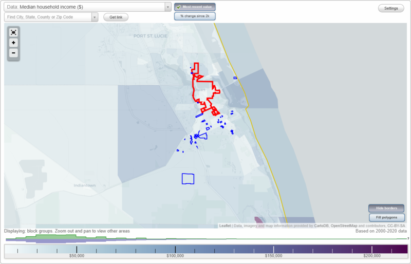
Stuart, Florida Neighborhood Map - Income, House Prices, Occupations, Boundaries
Settings
X

- City boundary
- Neighborhood boundaries
Business Search - 14 Million verified businesses
Neighborhoods:
95 Riverside, Air Ref Building, Ault Acres, Brone Stuart Trade Center, Chalets of Salerno, Commerce Bank, Cove Lakes, Cove Road Commercial Center, Crystal Lake Estates South, Egret Pond, Ellipse, Everglades Plantation, Galleon on the River, Gran Park West, Hammock Ridge, Harmony Ranch, Hunter Lake, Hurricane Harbour, Inlet Isle, Kanner Commercial Center, Kanner Professional Center, Kanner Square, Leach Estates, Lost River Coach Homes, Lost River Manors, Mariner Sands, Mariner Village Town Homes, River Marina Townhomes, River Run Industrial Park, Salerno Village Shopping Center, Sandy Cove Plaza, Summerfield, Sunshine Mobile Home Park, Tres Belle, Tropical Business Park, Tuckers Cove, Venetian Villages, Waterside Commons, Whitemarsh Reserve, Woodmill Pond95 Riverside neighborhood in Stuart statistics: (Find on map)
Area: 0.047 square miles
Roads and streets: SW Lost River Rd.
95 Riverside neighborhood detailed profile
Area: 0.047 square miles
Roads and streets: SW Lost River Rd.
95 Riverside neighborhood detailed profile
Air Ref Building neighborhood in Stuart statistics: (Find on map)
Area: 0.002 square miles
Population: 1
Population density:
Median household income in 2021:
Median rent in in 2021:
Most popular occupations of males: service occupations (46.9%); material moving occupations (8.6%); computer and mathematical occupations (7.7%); production occupations (6.0%); sales and office occupations (5.9%); transportation occupations (4.3%); arts, design, entertainment, sports, and media occupations (4.0%)
Most popular occupations of females: sales and office occupations (40.5%); service occupations (25.9%); healthcare practitioners and technical occupations (15.7%); business and financial operations occupations (8.4%); education, training, and library occupations (7.3%); production occupations (4.4%); legal occupations (2.2%)
Air Ref Building neighborhood detailed profile
Area: 0.002 square miles
Population: 1
Population density:
| Air Ref Building: | 511 people per square mile |
| Stuart: | 2,739 people per square mile |
Median household income in 2021:
| Air Ref Building: | $37,875 |
| Stuart: | $55,157 |
Median rent in in 2021:
| Air Ref Building: | $1,061 |
| Stuart: | $1,116 |
Most popular occupations of males: service occupations (46.9%); material moving occupations (8.6%); computer and mathematical occupations (7.7%); production occupations (6.0%); sales and office occupations (5.9%); transportation occupations (4.3%); arts, design, entertainment, sports, and media occupations (4.0%)
Most popular occupations of females: sales and office occupations (40.5%); service occupations (25.9%); healthcare practitioners and technical occupations (15.7%); business and financial operations occupations (8.4%); education, training, and library occupations (7.3%); production occupations (4.4%); legal occupations (2.2%)
Air Ref Building neighborhood detailed profile
Ault Acres neighborhood in Stuart statistics: (Find on map)
Area: 0.014 square miles
Ault Acres neighborhood detailed profile
Area: 0.014 square miles
Ault Acres neighborhood detailed profile
Brone Stuart Trade Center neighborhood in Stuart statistics: (Find on map)
Area: 0.003 square miles
Brone Stuart Trade Center neighborhood detailed profile
Area: 0.003 square miles
Brone Stuart Trade Center neighborhood detailed profile
Chalets of Salerno neighborhood in Stuart statistics: (Find on map)
Area: 0.008 square miles
Population: 6
Population density:
Median household income in 2021:
Median rent in in 2021:
Male vs Females
Median age
Most popular occupations of males: service occupations (26.4%); sales and office occupations (19.0%); construction, extraction, and maintenance occupations (11.6%); production occupations (10.7%); arts, design, entertainment, sports, and media occupations (7.2%); community and social services occupations (5.8%); material moving occupations (4.1%)
Most popular occupations of females: sales and office occupations (65.5%); service occupations (26.5%); production occupations (5.5%); healthcare practitioners and technical occupations (4.9%); business and financial operations occupations (2.6%); education, training, and library occupations (2.3%); material moving occupations (1.4%)
Chalets of Salerno neighborhood detailed profile
Area: 0.008 square miles
Population: 6
Population density:
| Chalets of Salerno: | 732 people per square mile |
| Stuart: | 2,739 people per square mile |
Median household income in 2021:
| Chalets of Salerno: | $31,247 |
| Stuart: | $55,157 |
Median rent in in 2021:
| Chalets of Salerno: | $975 |
| Stuart: | $1,116 |
Male vs Females
| Males: | 3 |
| Females: | 2 |
Median age
| Males: | 33.9 years |
| Females: | 22.8 years |
Most popular occupations of males: service occupations (26.4%); sales and office occupations (19.0%); construction, extraction, and maintenance occupations (11.6%); production occupations (10.7%); arts, design, entertainment, sports, and media occupations (7.2%); community and social services occupations (5.8%); material moving occupations (4.1%)
Most popular occupations of females: sales and office occupations (65.5%); service occupations (26.5%); production occupations (5.5%); healthcare practitioners and technical occupations (4.9%); business and financial operations occupations (2.6%); education, training, and library occupations (2.3%); material moving occupations (1.4%)
Chalets of Salerno neighborhood detailed profile
Commerce Bank neighborhood in Stuart statistics: (Find on map)
Area: 0.002 square miles
Population: 1
Population density:
Median household income in 2021:
Median rent in in 2021:
Most popular occupations of males: service occupations (54.6%); construction, extraction, and maintenance occupations (28.0%); production occupations (24.0%); management occupations (except farmers) (20.8%); arts, design, entertainment, sports, and media occupations (13.2%); business and financial operations occupations (9.6%); transportation occupations (9.6%)
Most popular occupations of females: healthcare practitioners and technical occupations (39.0%); service occupations (24.3%); computer and mathematical occupations (11.1%); sales and office occupations (10.2%); education, training, and library occupations (9.6%); material moving occupations (8.0%); management occupations (except farmers) (5.7%)
Commerce Bank neighborhood detailed profile
Area: 0.002 square miles
Population: 1
Population density:
| Commerce Bank: | 661 people per square mile |
| Stuart: | 2,739 people per square mile |
Median household income in 2021:
| Commerce Bank: | $103,598 |
| Stuart: | $55,157 |
Median rent in in 2021:
| Commerce Bank: | $1,071 |
| Stuart: | $1,116 |
Most popular occupations of males: service occupations (54.6%); construction, extraction, and maintenance occupations (28.0%); production occupations (24.0%); management occupations (except farmers) (20.8%); arts, design, entertainment, sports, and media occupations (13.2%); business and financial operations occupations (9.6%); transportation occupations (9.6%)
Most popular occupations of females: healthcare practitioners and technical occupations (39.0%); service occupations (24.3%); computer and mathematical occupations (11.1%); sales and office occupations (10.2%); education, training, and library occupations (9.6%); material moving occupations (8.0%); management occupations (except farmers) (5.7%)
Commerce Bank neighborhood detailed profile
Cove Lakes neighborhood in Stuart statistics: (Find on map)
Area: 0.084 square miles
Cove Lakes neighborhood detailed profile
Area: 0.084 square miles
Cove Lakes neighborhood detailed profile
Cove Road Commercial Center neighborhood in Stuart statistics: (Find on map)
Area: 0.028 square miles
Cove Road Commercial Center neighborhood detailed profile
Area: 0.028 square miles
Cove Road Commercial Center neighborhood detailed profile
Crystal Lake Estates South neighborhood in Stuart statistics: (Find on map)
Area: 0.007 square miles
Crystal Lake Estates South neighborhood detailed profile
Area: 0.007 square miles
Crystal Lake Estates South neighborhood detailed profile
Egret Pond neighborhood in Stuart statistics: (Find on map)
Area: 0.003 square miles
Egret Pond neighborhood detailed profile
Area: 0.003 square miles
Egret Pond neighborhood detailed profile
Ellipse neighborhood in Stuart statistics: (Find on map)
Area: 0.037 square miles
Ellipse neighborhood detailed profile
Area: 0.037 square miles
Ellipse neighborhood detailed profile
Everglades Plantation neighborhood in Stuart statistics: (Find on map)
Area: 0.022 square miles
Everglades Plantation neighborhood detailed profile
Area: 0.022 square miles
Everglades Plantation neighborhood detailed profile
Galleon on the River neighborhood in Stuart statistics: (Find on map)
Area: 0.070 square miles
Population: 4
Population density:
Median household income in 2021:
Median rent in in 2021:
Male vs Females
Median age
Most popular occupations of males: business and financial operations occupations (29.7%); management occupations (except farmers) (25.7%); sales and office occupations (17.6%); healthcare practitioners and technical occupations (14.9%); computer and mathematical occupations (12.2%); service occupations (11.0%); community and social services occupations (2.9%)
Most popular occupations of females: management occupations (except farmers) (37.1%); business and financial operations occupations (27.3%); healthcare practitioners and technical occupations (14.7%); service occupations (11.9%); education, training, and library occupations (7.0%); sales and office occupations (2.1%)
Galleon on the River neighborhood detailed profile
Area: 0.070 square miles
Population: 4
Population density:
| Galleon on the River: | 57 people per square mile |
| Stuart: | 2,739 people per square mile |
Median household income in 2021:
| Galleon on the River: | $96,875 |
| Stuart: | $55,157 |
Median rent in in 2021:
| Galleon on the River: | $2,114 |
| Stuart: | $1,116 |
Male vs Females
| Males: | 2 |
| Females: | 2 |
Median age
| Males: | 71.0 years |
| Females: | 69.3 years |
Most popular occupations of males: business and financial operations occupations (29.7%); management occupations (except farmers) (25.7%); sales and office occupations (17.6%); healthcare practitioners and technical occupations (14.9%); computer and mathematical occupations (12.2%); service occupations (11.0%); community and social services occupations (2.9%)
Most popular occupations of females: management occupations (except farmers) (37.1%); business and financial operations occupations (27.3%); healthcare practitioners and technical occupations (14.7%); service occupations (11.9%); education, training, and library occupations (7.0%); sales and office occupations (2.1%)
Galleon on the River neighborhood detailed profile
Gran Park West neighborhood in Stuart statistics: (Find on map)
Area: 0.002 square miles
Population: 1
Population density:
Median household income in 2021:
Median rent in in 2021:
Most popular occupations of males: service occupations (46.9%); material moving occupations (8.6%); computer and mathematical occupations (7.7%); production occupations (6.2%); sales and office occupations (5.9%); transportation occupations (4.3%); arts, design, entertainment, sports, and media occupations (4.1%)
Most popular occupations of females: sales and office occupations (40.5%); service occupations (25.9%); healthcare practitioners and technical occupations (15.7%); business and financial operations occupations (8.4%); education, training, and library occupations (7.3%); production occupations (4.5%); legal occupations (2.2%)
Gran Park West neighborhood detailed profile
Area: 0.002 square miles
Population: 1
Population density:
| Gran Park West: | 491 people per square mile |
| Stuart: | 2,739 people per square mile |
Median household income in 2021:
| Gran Park West: | $37,875 |
| Stuart: | $55,157 |
Median rent in in 2021:
| Gran Park West: | $1,061 |
| Stuart: | $1,116 |
Most popular occupations of males: service occupations (46.9%); material moving occupations (8.6%); computer and mathematical occupations (7.7%); production occupations (6.2%); sales and office occupations (5.9%); transportation occupations (4.3%); arts, design, entertainment, sports, and media occupations (4.1%)
Most popular occupations of females: sales and office occupations (40.5%); service occupations (25.9%); healthcare practitioners and technical occupations (15.7%); business and financial operations occupations (8.4%); education, training, and library occupations (7.3%); production occupations (4.5%); legal occupations (2.2%)
Gran Park West neighborhood detailed profile
Hammock Ridge neighborhood in Stuart statistics: (Find on map)
Area: 0.008 square miles
Population: 23
Population density:
Median household income in 2021:
Median rent in in 2021:
Male vs Females
Median age
Most popular occupations of males: management occupations (except farmers) (30.7%); service occupations (14.1%); transportation occupations (10.6%); sales and office occupations (10.0%); architecture and engineering occupations (8.9%); business and financial operations occupations (6.9%); construction, extraction, and maintenance occupations (3.4%)
Most popular occupations of females: sales and office occupations (28.1%); education, training, and library occupations (25.3%); service occupations (14.1%); management occupations (except farmers) (9.5%); healthcare practitioners and technical occupations (7.3%); arts, design, entertainment, sports, and media occupations (5.1%); business and financial operations occupations (3.9%)
Hammock Ridge neighborhood detailed profile
Area: 0.008 square miles
Population: 23
Population density:
| Hammock Ridge: | 2,762 people per square mile |
| Stuart: | 2,739 people per square mile |
Median household income in 2021:
| Hammock Ridge: | $76,367 |
| Stuart: | $55,157 |
Median rent in in 2021:
| Hammock Ridge: | $1,388 |
| Stuart: | $1,116 |
Male vs Females
| Males: | 10 |
| Females: | 12 |
Median age
| Males: | 58.1 years |
| Females: | 63.2 years |
Most popular occupations of males: management occupations (except farmers) (30.7%); service occupations (14.1%); transportation occupations (10.6%); sales and office occupations (10.0%); architecture and engineering occupations (8.9%); business and financial operations occupations (6.9%); construction, extraction, and maintenance occupations (3.4%)
Most popular occupations of females: sales and office occupations (28.1%); education, training, and library occupations (25.3%); service occupations (14.1%); management occupations (except farmers) (9.5%); healthcare practitioners and technical occupations (7.3%); arts, design, entertainment, sports, and media occupations (5.1%); business and financial operations occupations (3.9%)
Hammock Ridge neighborhood detailed profile
Harmony Ranch neighborhood in Stuart statistics: (Find on map)
Area: 1.763 square miles
Harmony Ranch neighborhood detailed profile
Area: 1.763 square miles
Harmony Ranch neighborhood detailed profile
Hunter Lake neighborhood in Stuart statistics: (Find on map)
Area: 0.015 square miles
Hunter Lake neighborhood detailed profile
Area: 0.015 square miles
Hunter Lake neighborhood detailed profile
Hurricane Harbour neighborhood in Stuart statistics: (Find on map)
Area: 0.009 square miles
Hurricane Harbour neighborhood detailed profile
Area: 0.009 square miles
Hurricane Harbour neighborhood detailed profile
Inlet Isle neighborhood in Stuart statistics: (Find on map)
Area: 0.014 square miles
Population: 38
Population density:
Median household income in 2021:
Median rent in in 2021:
Male vs Females
Median age
Most popular occupations of males: management occupations (except farmers) (30.7%); service occupations (14.1%); transportation occupations (10.6%); sales and office occupations (10.0%); architecture and engineering occupations (8.9%); business and financial operations occupations (6.9%); construction, extraction, and maintenance occupations (3.4%)
Most popular occupations of females: sales and office occupations (28.1%); education, training, and library occupations (25.3%); service occupations (14.1%); management occupations (except farmers) (9.5%); healthcare practitioners and technical occupations (7.3%); arts, design, entertainment, sports, and media occupations (5.1%); business and financial operations occupations (3.9%)
Inlet Isle neighborhood detailed profile
Area: 0.014 square miles
Population: 38
Population density:
| Inlet Isle: | 2,764 people per square mile |
| Stuart: | 2,739 people per square mile |
Median household income in 2021:
| Inlet Isle: | $76,367 |
| Stuart: | $55,157 |
Median rent in in 2021:
| Inlet Isle: | $1,388 |
| Stuart: | $1,116 |
Male vs Females
| Males: | 17 |
| Females: | 20 |
Median age
| Males: | 58.1 years |
| Females: | 63.2 years |
Most popular occupations of males: management occupations (except farmers) (30.7%); service occupations (14.1%); transportation occupations (10.6%); sales and office occupations (10.0%); architecture and engineering occupations (8.9%); business and financial operations occupations (6.9%); construction, extraction, and maintenance occupations (3.4%)
Most popular occupations of females: sales and office occupations (28.1%); education, training, and library occupations (25.3%); service occupations (14.1%); management occupations (except farmers) (9.5%); healthcare practitioners and technical occupations (7.3%); arts, design, entertainment, sports, and media occupations (5.1%); business and financial operations occupations (3.9%)
Inlet Isle neighborhood detailed profile
Kanner Commercial Center neighborhood in Stuart statistics: (Find on map)
Area: 0.004 square miles
Kanner Commercial Center neighborhood detailed profile
Area: 0.004 square miles
Kanner Commercial Center neighborhood detailed profile
Kanner Professional Center neighborhood in Stuart statistics: (Find on map)
Area: 0.019 square miles
Kanner Professional Center neighborhood detailed profile
Area: 0.019 square miles
Kanner Professional Center neighborhood detailed profile
Kanner Square neighborhood in Stuart statistics: (Find on map)
Area: 0.005 square miles
Kanner Square neighborhood detailed profile
Area: 0.005 square miles
Kanner Square neighborhood detailed profile
Leach Estates neighborhood in Stuart statistics: (Find on map)
Area: 0.004 square miles
Population: 8
Population density:
Median household income in 2021:
Median rent in in 2021:
Male vs Females
Median age
Most popular occupations of males: sales and office occupations (37.6%); service occupations (29.1%); management occupations (except farmers) (14.6%); construction, extraction, and maintenance occupations (5.6%); production occupations (5.6%); arts, design, entertainment, sports, and media occupations (4.9%); computer and mathematical occupations (4.2%)
Most popular occupations of females: service occupations (24.5%); sales and office occupations (23.6%); management occupations (except farmers) (12.5%); healthcare practitioners and technical occupations (11.7%); computer and mathematical occupations (10.1%); community and social services occupations (9.1%); material moving occupations (8.2%)
Leach Estates neighborhood detailed profile
Area: 0.004 square miles
Population: 8
Population density:
| Leach Estates: | 2,273 people per square mile |
| Stuart: | 2,739 people per square mile |
Median household income in 2021:
| Leach Estates: | $99,380 |
| Stuart: | $55,157 |
Median rent in in 2021:
| Leach Estates: | $1,609 |
| Stuart: | $1,116 |
Male vs Females
| Males: | 4 |
| Females: | 4 |
Median age
| Males: | 58.9 years |
| Females: | 59.0 years |
Most popular occupations of males: sales and office occupations (37.6%); service occupations (29.1%); management occupations (except farmers) (14.6%); construction, extraction, and maintenance occupations (5.6%); production occupations (5.6%); arts, design, entertainment, sports, and media occupations (4.9%); computer and mathematical occupations (4.2%)
Most popular occupations of females: service occupations (24.5%); sales and office occupations (23.6%); management occupations (except farmers) (12.5%); healthcare practitioners and technical occupations (11.7%); computer and mathematical occupations (10.1%); community and social services occupations (9.1%); material moving occupations (8.2%)
Leach Estates neighborhood detailed profile
Lost River Coach Homes neighborhood in Stuart statistics: (Find on map)
Area: 0.030 square miles
Lost River Coach Homes neighborhood detailed profile
Area: 0.030 square miles
Lost River Coach Homes neighborhood detailed profile
Lost River Manors neighborhood in Stuart statistics: (Find on map)
Area: 0.047 square miles
Lost River Manors neighborhood detailed profile
Area: 0.047 square miles
Lost River Manors neighborhood detailed profile
Mariner Sands neighborhood in Stuart statistics: (Find on map)
Area: 0.021 square miles
Mariner Sands neighborhood detailed profile
Area: 0.021 square miles
Mariner Sands neighborhood detailed profile
Mariner Village Town Homes neighborhood in Stuart statistics: (Find on map)
Area: 0.016 square miles
Mariner Village Town Homes neighborhood detailed profile
Area: 0.016 square miles
Mariner Village Town Homes neighborhood detailed profile
River Marina Townhomes neighborhood in Stuart statistics: (Find on map)
Area: 0.028 square miles
River Marina Townhomes neighborhood detailed profile
Area: 0.028 square miles
River Marina Townhomes neighborhood detailed profile
River Run Industrial Park neighborhood in Stuart statistics: (Find on map)
Area: 0.001 square miles
Population: 1
Population density:
Median household income in 2021:
Median rent in in 2021:
Most popular occupations of males: service occupations (46.9%); material moving occupations (8.6%); computer and mathematical occupations (7.7%); production occupations (6.1%); sales and office occupations (5.9%); transportation occupations (4.3%); arts, design, entertainment, sports, and media occupations (4.0%)
Most popular occupations of females: sales and office occupations (40.5%); service occupations (25.9%); healthcare practitioners and technical occupations (15.7%); business and financial operations occupations (8.4%); education, training, and library occupations (7.3%); production occupations (4.4%); legal occupations (2.2%)
River Run Industrial Park neighborhood detailed profile
Area: 0.001 square miles
Population: 1
Population density:
| River Run Industrial Park: | 667 people per square mile |
| Stuart: | 2,739 people per square mile |
Median household income in 2021:
| River Run Industrial Park: | $37,875 |
| Stuart: | $55,157 |
Median rent in in 2021:
| River Run Industrial Park: | $1,061 |
| Stuart: | $1,116 |
Most popular occupations of males: service occupations (46.9%); material moving occupations (8.6%); computer and mathematical occupations (7.7%); production occupations (6.1%); sales and office occupations (5.9%); transportation occupations (4.3%); arts, design, entertainment, sports, and media occupations (4.0%)
Most popular occupations of females: sales and office occupations (40.5%); service occupations (25.9%); healthcare practitioners and technical occupations (15.7%); business and financial operations occupations (8.4%); education, training, and library occupations (7.3%); production occupations (4.4%); legal occupations (2.2%)
River Run Industrial Park neighborhood detailed profile
Salerno Village Shopping Center neighborhood in Stuart statistics: (Find on map)
Area: 0.029 square miles
Population: 84
Population density:
Median household income in 2021:
Median rent in in 2021:
Male vs Females
Median age
Most popular occupations of males: service occupations (26.4%); sales and office occupations (19.0%); construction, extraction, and maintenance occupations (11.6%); production occupations (10.7%); arts, design, entertainment, sports, and media occupations (7.2%); community and social services occupations (5.8%); material moving occupations (4.1%)
Most popular occupations of females: sales and office occupations (65.5%); service occupations (26.5%); production occupations (5.5%); healthcare practitioners and technical occupations (4.9%); business and financial operations occupations (2.6%); education, training, and library occupations (2.3%); material moving occupations (1.4%)
Salerno Village Shopping Center neighborhood detailed profile
Area: 0.029 square miles
Population: 84
Population density:
| Salerno Village Shopping Center: | 2,875 people per square mile |
| Stuart: | 2,739 people per square mile |
Median household income in 2021:
| Salerno Village Shopping Center: | $31,250 |
| Stuart: | $55,157 |
Median rent in in 2021:
| Salerno Village Shopping Center: | $975 |
| Stuart: | $1,116 |
Male vs Females
| Males: | 43 |
| Females: | 40 |
Median age
| Males: | 33.9 years |
| Females: | 22.8 years |
Most popular occupations of males: service occupations (26.4%); sales and office occupations (19.0%); construction, extraction, and maintenance occupations (11.6%); production occupations (10.7%); arts, design, entertainment, sports, and media occupations (7.2%); community and social services occupations (5.8%); material moving occupations (4.1%)
Most popular occupations of females: sales and office occupations (65.5%); service occupations (26.5%); production occupations (5.5%); healthcare practitioners and technical occupations (4.9%); business and financial operations occupations (2.6%); education, training, and library occupations (2.3%); material moving occupations (1.4%)
Salerno Village Shopping Center neighborhood detailed profile
Sandy Cove Plaza neighborhood in Stuart statistics: (Find on map)
Area: 0.004 square miles
Sandy Cove Plaza neighborhood detailed profile
Area: 0.004 square miles
Sandy Cove Plaza neighborhood detailed profile
Summerfield neighborhood in Stuart statistics: (Find on map)
Area: 0.010 square miles
Summerfield neighborhood detailed profile
Area: 0.010 square miles
Summerfield neighborhood detailed profile
Sunshine Mobile Home Park neighborhood in Stuart statistics: (Find on map)
Area: 0.004 square miles
Sunshine Mobile Home Park neighborhood detailed profile
Area: 0.004 square miles
Sunshine Mobile Home Park neighborhood detailed profile
Tres Belle neighborhood in Stuart statistics: (Find on map)
Area: 0.482 square miles
Tres Belle neighborhood detailed profile
Area: 0.482 square miles
Tres Belle neighborhood detailed profile
Tropical Business Park neighborhood in Stuart statistics: (Find on map)
Area: 0.021 square miles
Tropical Business Park neighborhood detailed profile
Area: 0.021 square miles
Tropical Business Park neighborhood detailed profile
Tuckers Cove neighborhood in Stuart statistics: (Find on map)
Area: 0.015 square miles
Population: 12
Population density:
Median household income in 2021:
Median rent in in 2021:
Male vs Females
Median age
Most popular occupations of males: service occupations (57.9%); construction, extraction, and maintenance occupations (28.0%); production occupations (25.4%); management occupations (except farmers) (20.8%); arts, design, entertainment, sports, and media occupations (13.2%); transportation occupations (10.2%); business and financial operations occupations (9.6%)
Most popular occupations of females: healthcare practitioners and technical occupations (39.0%); service occupations (24.3%); computer and mathematical occupations (11.1%); sales and office occupations (10.2%); education, training, and library occupations (9.6%); material moving occupations (8.4%); management occupations (except farmers) (5.7%)
Tuckers Cove neighborhood detailed profile
Area: 0.015 square miles
Population: 12
Population density:
| Tuckers Cove: | 794 people per square mile |
| Stuart: | 2,739 people per square mile |
Median household income in 2021:
| Tuckers Cove: | $103,598 |
| Stuart: | $55,157 |
Median rent in in 2021:
| Tuckers Cove: | $1,071 |
| Stuart: | $1,116 |
Male vs Females
| Males: | 6 |
| Females: | 5 |
Median age
| Males: | 15.3 years |
| Females: | 51.3 years |
Most popular occupations of males: service occupations (57.9%); construction, extraction, and maintenance occupations (28.0%); production occupations (25.4%); management occupations (except farmers) (20.8%); arts, design, entertainment, sports, and media occupations (13.2%); transportation occupations (10.2%); business and financial operations occupations (9.6%)
Most popular occupations of females: healthcare practitioners and technical occupations (39.0%); service occupations (24.3%); computer and mathematical occupations (11.1%); sales and office occupations (10.2%); education, training, and library occupations (9.6%); material moving occupations (8.4%); management occupations (except farmers) (5.7%)
Tuckers Cove neighborhood detailed profile
Venetian Villages neighborhood in Stuart statistics: (Find on map)
Area: 0.048 square miles
Venetian Villages neighborhood detailed profile
Area: 0.048 square miles
Venetian Villages neighborhood detailed profile
Waterside Commons neighborhood in Stuart statistics: (Find on map)
Area: 0.003 square miles
Waterside Commons neighborhood detailed profile
Area: 0.003 square miles
Waterside Commons neighborhood detailed profile
Whitemarsh Reserve neighborhood in Stuart statistics: (Find on map)
Area: 0.125 square miles
Whitemarsh Reserve neighborhood detailed profile
Area: 0.125 square miles
Whitemarsh Reserve neighborhood detailed profile
Woodmill Pond neighborhood in Stuart statistics: (Find on map)
Area: 0.013 square miles
Woodmill Pond neighborhood detailed profile
Area: 0.013 square miles
Woodmill Pond neighborhood detailed profile