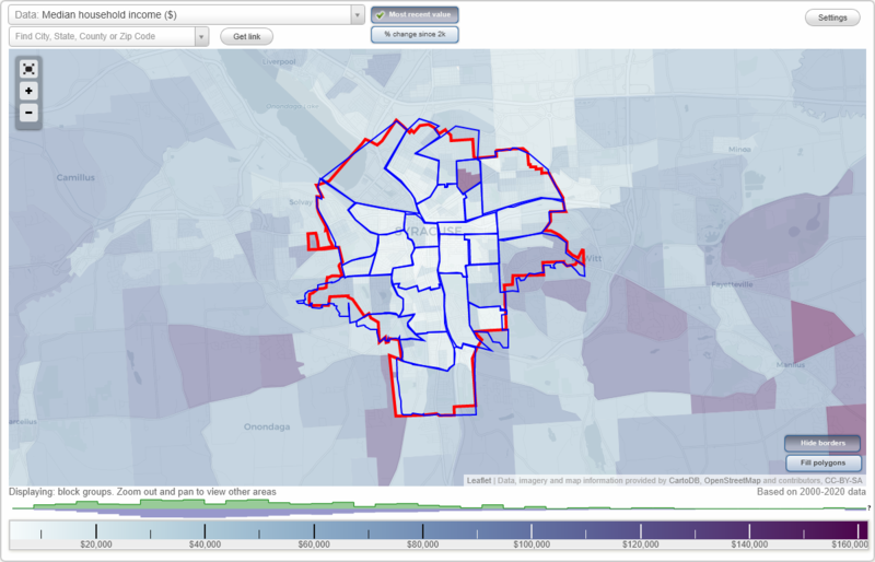
Syracuse, New York Neighborhood Map - Income, House Prices, Occupations, Boundaries
Settings
X

- City boundary
- Neighborhood boundaries
Business Search - 14 Million verified businesses
Neighborhoods:
Brighton, Downtown, Eastwood, Elmwood, Far Westside, Lakefront, Lincoln Park, Meadowbrook, Near Eastside, Near Northeast, Near Westside, North Valley, Northside, Outer Comstock, Salt Springs, Sedgwick, Skunk City, Skytop, South Valley, Southwest, Strathmore, University Hill, University Neighborhood, Washington Square, Westcott, WestsideBrighton neighborhood in Syracuse statistics: (Find on map)
Area: 1.010 square miles
Population: 9,126
Population density:
Median household income in 2021:
Median rent in in 2021:
Male vs Females
Median age
Housing prices:
Average estimated value of detached houses in 2021 (48.5% of all units):
Average estimated value of housing units in 2-unit structures in 2021 (30.2% of all units):
Most popular occupations of males: service occupations (30.2%); construction, extraction, and maintenance occupations (13.7%); sales and office occupations (12.3%); transportation occupations (11.3%); material moving occupations (7.5%); production occupations (5.0%); management occupations (except farmers) (4.3%)
Most popular occupations of females: service occupations (36.7%); sales and office occupations (18.2%); management occupations (except farmers) (17.5%); community and social services occupations (7.0%); education, training, and library occupations (5.1%); material moving occupations (3.5%); business and financial operations occupations (3.1%)
Limited-access highways (interstate or state) in this neighborhood: I- 81.
Highways in this neighborhood: S Salina St (US Hwy 11); South Ave (State Hwy 175).
Roads and streets: Midland Ave; W Brighton Ave; W Newell St; W Colvin St; W Ostrander Ave; W Matson Ave; W Lafayette Ave; Cannon St; Onondaga Creek Pkwy; Kirk Park Dr; W Calthrop Ave; W Pleasant Ave; W Beard Ave; Warner Ave; S State St; W Borden Ave; W Corning Ave; Kirk Ave; E Colvin St; Hunt Ave; Webster Ave; Forest Ave; Elmhurst Ave; Elk St; Primrose Ave; Hope Ave; Wood Ave; Hatch St; Mc Kinley Ave; Amherst Ave; Fernwood Ave; Fage Ave; W Lynhurst Ave; Garfield Ave; E Brighton Ave; Bishop Ave; Kenmore Ave; Wiman Ave; Berger Ave; E Bissell St; Elizabeth St; Mc Allister Ave; Baldwin Ave; Marguerite Ave; E Matson Ave; Randall Ave; Mc Clure Ave; E Beard Ave; Argyle Ter; Richardson Ave; Mark Ave; Vale St; Crehange St; Beard Pl; E Ostrander Ave; E Lafayette Ave; Glahn Ave; Kirkwood Pl; Dougall Ave; Raymond Ave; Centennial Dr; Rockland Ave; Mc Lennan Ave; Garfield Pl; Landon Ave; E Corning Ave; Edmund Ave; E Newell St; E Pleasant Ave; Elmhurst Av Brg.
Other features: Onondaga Crk.
Brighton neighborhood detailed profile
Area: 1.010 square miles
Population: 9,126
Population density:
| Brighton: | 9,033 people per square mile |
| Syracuse: | 5,824 people per square mile |
Median household income in 2021:
| Brighton: | $36,063 |
| Syracuse: | $40,076 |
Median rent in in 2021:
| Brighton: | $745 |
| Syracuse: | $764 |
Male vs Females
| Males: | 4,358 |
| Females: | 4,767 |
Median age
| Males: | 33.9 years |
| Females: | 36.0 years |
Housing prices:
Average estimated value of detached houses in 2021 (48.5% of all units):
| Brighton: | $62,528 |
| Syracuse: | $106,145 |
Average estimated value of housing units in 2-unit structures in 2021 (30.2% of all units):
| This neighborhood: | $153,602 |
| Syracuse: | $93,550 |
Most popular occupations of males: service occupations (30.2%); construction, extraction, and maintenance occupations (13.7%); sales and office occupations (12.3%); transportation occupations (11.3%); material moving occupations (7.5%); production occupations (5.0%); management occupations (except farmers) (4.3%)
Most popular occupations of females: service occupations (36.7%); sales and office occupations (18.2%); management occupations (except farmers) (17.5%); community and social services occupations (7.0%); education, training, and library occupations (5.1%); material moving occupations (3.5%); business and financial operations occupations (3.1%)
Limited-access highways (interstate or state) in this neighborhood: I- 81.
Highways in this neighborhood: S Salina St (US Hwy 11); South Ave (State Hwy 175).
Roads and streets: Midland Ave; W Brighton Ave; W Newell St; W Colvin St; W Ostrander Ave; W Matson Ave; W Lafayette Ave; Cannon St; Onondaga Creek Pkwy; Kirk Park Dr; W Calthrop Ave; W Pleasant Ave; W Beard Ave; Warner Ave; S State St; W Borden Ave; W Corning Ave; Kirk Ave; E Colvin St; Hunt Ave; Webster Ave; Forest Ave; Elmhurst Ave; Elk St; Primrose Ave; Hope Ave; Wood Ave; Hatch St; Mc Kinley Ave; Amherst Ave; Fernwood Ave; Fage Ave; W Lynhurst Ave; Garfield Ave; E Brighton Ave; Bishop Ave; Kenmore Ave; Wiman Ave; Berger Ave; E Bissell St; Elizabeth St; Mc Allister Ave; Baldwin Ave; Marguerite Ave; E Matson Ave; Randall Ave; Mc Clure Ave; E Beard Ave; Argyle Ter; Richardson Ave; Mark Ave; Vale St; Crehange St; Beard Pl; E Ostrander Ave; E Lafayette Ave; Glahn Ave; Kirkwood Pl; Dougall Ave; Raymond Ave; Centennial Dr; Rockland Ave; Mc Lennan Ave; Garfield Pl; Landon Ave; E Corning Ave; Edmund Ave; E Newell St; E Pleasant Ave; Elmhurst Av Brg.
Other features: Onondaga Crk.
Brighton neighborhood detailed profile
Downtown neighborhood in Syracuse statistics: (Find on map)
Area: 0.476 square miles
Population: 3,137
Population density:
Median household income in 2021:
Median rent in in 2021:
Male vs Females
Median age
Housing prices:
Average estimated value of detached houses in 2021 (12.3% of all units):
Average estimated value of housing units in 2-unit structures in 2021 (4.1% of all units):
Average estimated '21 value of housing units in 5-or-more-unit structures (56.2% of all units):
Most popular occupations of males: management occupations (except farmers) (16.4%); sales and office occupations (13.7%); education, training, and library occupations (12.1%); healthcare practitioners and technical occupations (9.3%); legal occupations (7.7%); computer and mathematical occupations (7.3%); business and financial operations occupations (7.0%)
Most popular occupations of females: service occupations (19.7%); healthcare practitioners and technical occupations (19.6%); education, training, and library occupations (14.4%); legal occupations (11.6%); business and financial operations occupations (11.3%); sales and office occupations (9.8%); management occupations (except farmers) (7.7%)
Limited-access highways (interstate or state) in this neighborhood: I- 81.
Highways in this neighborhood: S State St (US Hwy 11); State Hwy 5 (W Genesee St); State Hwy 5 (Erie Blvd E); State Hwy 290 (James St).
Roads and streets: S Townsend St; E Washington St; E Water St; Montgomery St; Harrison St; S Clinton St; E Fayette St; S Salina St; S Warren St; W Jefferson St; E Adams St; W Washington St; E Genesee St; Erie Blvd W; W Fayette St; E Onondaga St; W Water St; Walton St; E Jefferson St; S Franklin St; Madison St; S Mc Bride St; Herald Pl; W Willow St; N Franklin St; N Clinton St; W Adams St; Wallace St; W Onondaga St; S West St; Mc Carthy Ave; Bank St; N Warren St; Harrison Pl; N Salina St; Presidential Cts; E Willow St; Oswego Blvd; Market St; Bank Aly; Dickerson St; Gifford St; Presidential Plz; Landmark Pl.
Railroad features: Conrail RR.
Other features: Onondaga Crk.
Downtown neighborhood detailed profile
Area: 0.476 square miles
Population: 3,137
Population density:
| Downtown: | 6,588 people per square mile |
| Syracuse: | 5,824 people per square mile |
Median household income in 2021:
| Downtown: | $22,990 |
| Syracuse: | $40,076 |
Median rent in in 2021:
| Downtown: | $1,071 |
| Syracuse: | $764 |
Male vs Females
| Males: | 1,857 |
| Females: | 1,280 |
Median age
| Males: | 27.5 years |
| Females: | 29.2 years |
Housing prices:
Average estimated value of detached houses in 2021 (12.3% of all units):
| Downtown: | $64,108 |
| Syracuse: | $106,145 |
Average estimated value of housing units in 2-unit structures in 2021 (4.1% of all units):
| This neighborhood: | $64,844 |
| Syracuse: | $93,550 |
Average estimated '21 value of housing units in 5-or-more-unit structures (56.2% of all units):
| Downtown: | $237,390 |
| Syracuse: | $97,868 |
Most popular occupations of males: management occupations (except farmers) (16.4%); sales and office occupations (13.7%); education, training, and library occupations (12.1%); healthcare practitioners and technical occupations (9.3%); legal occupations (7.7%); computer and mathematical occupations (7.3%); business and financial operations occupations (7.0%)
Most popular occupations of females: service occupations (19.7%); healthcare practitioners and technical occupations (19.6%); education, training, and library occupations (14.4%); legal occupations (11.6%); business and financial operations occupations (11.3%); sales and office occupations (9.8%); management occupations (except farmers) (7.7%)
Limited-access highways (interstate or state) in this neighborhood: I- 81.
Highways in this neighborhood: S State St (US Hwy 11); State Hwy 5 (W Genesee St); State Hwy 5 (Erie Blvd E); State Hwy 290 (James St).
Roads and streets: S Townsend St; E Washington St; E Water St; Montgomery St; Harrison St; S Clinton St; E Fayette St; S Salina St; S Warren St; W Jefferson St; E Adams St; W Washington St; E Genesee St; Erie Blvd W; W Fayette St; E Onondaga St; W Water St; Walton St; E Jefferson St; S Franklin St; Madison St; S Mc Bride St; Herald Pl; W Willow St; N Franklin St; N Clinton St; W Adams St; Wallace St; W Onondaga St; S West St; Mc Carthy Ave; Bank St; N Warren St; Harrison Pl; N Salina St; Presidential Cts; E Willow St; Oswego Blvd; Market St; Bank Aly; Dickerson St; Gifford St; Presidential Plz; Landmark Pl.
Railroad features: Conrail RR.
Other features: Onondaga Crk.
Downtown neighborhood detailed profile
Eastwood neighborhood in Syracuse statistics: (Find on map)
Area: 1.990 square miles
Population: 18,014
Population density:
Median household income in 2021:
Median rent in in 2021:
Male vs Females
Median age
Housing prices:
Average estimated value of detached houses in 2021 (57.3% of all units):
Average estimated value of housing units in 2-unit structures in 2021 (14.4% of all units):
Most popular occupations of males: service occupations (22.5%); sales and office occupations (17.2%); material moving occupations (8.0%); management occupations (except farmers) (7.8%); healthcare practitioners and technical occupations (7.4%); production occupations (7.0%); construction, extraction, and maintenance occupations (5.5%)
Most popular occupations of females: sales and office occupations (39.4%); service occupations (16.9%); education, training, and library occupations (11.2%); healthcare practitioners and technical occupations (8.3%); management occupations (except farmers) (7.3%); community and social services occupations (4.1%); material moving occupations (3.2%)
Limited-access highways (interstate or state) in this neighborhood: I- 690.
Highways in this neighborhood: State Hwy 290 (James St); State Hwy 635 (Thompson Rd).
Roads and streets: Burnet Ave; Caleb Ave; Northcliffe Rd; Glen Cove Rd; Sunnycrest Rd; Forest Hill Dr; Shotwell Park; Hickok Ave; Stafford Ave; Woodbine Ave; Tyson Pl; S Midler Ave; Hillsdale Ave; S Collingwood Ave; Nichols Ave; S Edwards Ave; Mosley Dr; Plymouth Dr; Coughlin Ave; Melrose Ave; Clover Ridge Dr; Grant Blvd; Burns Ave; N Edwards Ave; Norwood Ave; Hixson Ave; N Collingwood Ave; N Midler Ave; Lillian Ave; Ridgewood Dr; Boston St; Village Dr; Fobes Ave; Vann St; Winthrop Rd; Roxbury Rd; N Glencove Rd; North Ave; Marlborough Rd; Lamson St; Ashdale Ave; Rigi Ave; Homecroft Rd; Clifton Pl; S Glencove Rd; Champlin Dr; Mildred Ave; Hazelhurst Ave; Luddington St; Lepage Pl; Hastings Pl; Erickson St; Aberdeen Ter; W Milford Dr; Paul Ave; Boyden St; Taft Ave; Beacon Rd; Dillaye Ave; E Milford Dr; Colby Ave; Sunstruck Dr; Walter Dr; Robinson St; Edtim Rd; Avon Rd; Arch St; Kinne St; Cook Ave; St Anns Dr; Culver Dr; Greenway Ave; Eastwood Rd; Cresline Dr; Conklin Ave; Mariposa St; Swansea Dr; George St; Lynwood Ave; Arnett St; Cowie St; Mooney Ave; Leo Ave; Grant Ter; Hasbrouck St; Lea Ln; E James St; Linwill Ter; Norton Ave; Eldorado St; Sheridan Pl; Gale St; Milford Ct; Village Dr Exn; Laurie Ave; Dale St; E Dale St.
Railroad features: Peat St Ld.
Eastwood neighborhood detailed profile
Area: 1.990 square miles
Population: 18,014
Population density:
| Eastwood: | 9,050 people per square mile |
| Syracuse: | 5,824 people per square mile |
Median household income in 2021:
| Eastwood: | $49,904 |
| Syracuse: | $40,076 |
Median rent in in 2021:
| Eastwood: | $796 |
| Syracuse: | $764 |
Male vs Females
| Males: | 9,285 |
| Females: | 8,728 |
Median age
| Males: | 37.5 years |
| Females: | 41.4 years |
Housing prices:
Average estimated value of detached houses in 2021 (57.3% of all units):
| Eastwood: | $119,567 |
| Syracuse: | $106,145 |
Average estimated value of housing units in 2-unit structures in 2021 (14.4% of all units):
| This neighborhood: | $65,000 |
| Syracuse: | $93,550 |
Most popular occupations of males: service occupations (22.5%); sales and office occupations (17.2%); material moving occupations (8.0%); management occupations (except farmers) (7.8%); healthcare practitioners and technical occupations (7.4%); production occupations (7.0%); construction, extraction, and maintenance occupations (5.5%)
Most popular occupations of females: sales and office occupations (39.4%); service occupations (16.9%); education, training, and library occupations (11.2%); healthcare practitioners and technical occupations (8.3%); management occupations (except farmers) (7.3%); community and social services occupations (4.1%); material moving occupations (3.2%)
Limited-access highways (interstate or state) in this neighborhood: I- 690.
Highways in this neighborhood: State Hwy 290 (James St); State Hwy 635 (Thompson Rd).
Roads and streets: Burnet Ave; Caleb Ave; Northcliffe Rd; Glen Cove Rd; Sunnycrest Rd; Forest Hill Dr; Shotwell Park; Hickok Ave; Stafford Ave; Woodbine Ave; Tyson Pl; S Midler Ave; Hillsdale Ave; S Collingwood Ave; Nichols Ave; S Edwards Ave; Mosley Dr; Plymouth Dr; Coughlin Ave; Melrose Ave; Clover Ridge Dr; Grant Blvd; Burns Ave; N Edwards Ave; Norwood Ave; Hixson Ave; N Collingwood Ave; N Midler Ave; Lillian Ave; Ridgewood Dr; Boston St; Village Dr; Fobes Ave; Vann St; Winthrop Rd; Roxbury Rd; N Glencove Rd; North Ave; Marlborough Rd; Lamson St; Ashdale Ave; Rigi Ave; Homecroft Rd; Clifton Pl; S Glencove Rd; Champlin Dr; Mildred Ave; Hazelhurst Ave; Luddington St; Lepage Pl; Hastings Pl; Erickson St; Aberdeen Ter; W Milford Dr; Paul Ave; Boyden St; Taft Ave; Beacon Rd; Dillaye Ave; E Milford Dr; Colby Ave; Sunstruck Dr; Walter Dr; Robinson St; Edtim Rd; Avon Rd; Arch St; Kinne St; Cook Ave; St Anns Dr; Culver Dr; Greenway Ave; Eastwood Rd; Cresline Dr; Conklin Ave; Mariposa St; Swansea Dr; George St; Lynwood Ave; Arnett St; Cowie St; Mooney Ave; Leo Ave; Grant Ter; Hasbrouck St; Lea Ln; E James St; Linwill Ter; Norton Ave; Eldorado St; Sheridan Pl; Gale St; Milford Ct; Village Dr Exn; Laurie Ave; Dale St; E Dale St.
Railroad features: Peat St Ld.
Eastwood neighborhood detailed profile
Elmwood neighborhood in Syracuse statistics: (Find on map)
Area: 0.615 square miles
Population: 2,909
Population density:
Median household income in 2021:
Median rent in in 2021:
Male vs Females
Median age
Housing prices:
Average estimated value of detached houses in 2021 (70.4% of all units):
Average estimated value of housing units in 2-unit structures in 2021 (15.6% of all units):
Most popular occupations of males: service occupations (31.8%); sales and office occupations (17.4%); management occupations (except farmers) (12.8%); transportation occupations (7.1%); construction, extraction, and maintenance occupations (6.0%); education, training, and library occupations (5.6%); community and social services occupations (4.6%)
Most popular occupations of females: sales and office occupations (23.0%); healthcare practitioners and technical occupations (17.2%); education, training, and library occupations (14.9%); service occupations (14.6%); community and social services occupations (10.8%); management occupations (except farmers) (10.1%); arts, design, entertainment, sports, and media occupations (3.2%)
Highways in this neighborhood: State Hwy 175 (South Ave); Valley Dr (State Hwy 80).
Roads and streets: Lynch Ave; W Lafayette Ave; Hutchinson Ave; Armstrong Pl; Atlantic Ave; Mitchell Ave; Bertram Pl; Fairfield Ave; Ford Ave; Onondaga Creek Blvd; Wente Ter; Edgewood Ave; Glenfield Dr; W Newell St; Marvin Rd; Elmwood Ave; Maurice Ave; Keen Pl; Fletcher Ave; Cornell Ave; Griffin St; Clayton Ave; Barnes Ave; Reinman Rd; Russell Pl; Bridget Cir; Craddock St; Palmer Ln; Princeton Ave; Hobart Ave; Hunt Ave.
Other features: Furnace Brk.
Elmwood neighborhood detailed profile
Area: 0.615 square miles
Population: 2,909
Population density:
| Elmwood: | 4,730 people per square mile |
| Syracuse: | 5,824 people per square mile |
Median household income in 2021:
| Elmwood: | $92,138 |
| Syracuse: | $40,076 |
Median rent in in 2021:
| Elmwood: | $651 |
| Syracuse: | $764 |
Male vs Females
| Males: | 1,187 |
| Females: | 1,722 |
Median age
| Males: | 38.9 years |
| Females: | 37.0 years |
Housing prices:
Average estimated value of detached houses in 2021 (70.4% of all units):
| Elmwood: | $99,202 |
| Syracuse: | $106,145 |
Average estimated value of housing units in 2-unit structures in 2021 (15.6% of all units):
| This neighborhood: | $123,033 |
| Syracuse: | $93,550 |
Most popular occupations of males: service occupations (31.8%); sales and office occupations (17.4%); management occupations (except farmers) (12.8%); transportation occupations (7.1%); construction, extraction, and maintenance occupations (6.0%); education, training, and library occupations (5.6%); community and social services occupations (4.6%)
Most popular occupations of females: sales and office occupations (23.0%); healthcare practitioners and technical occupations (17.2%); education, training, and library occupations (14.9%); service occupations (14.6%); community and social services occupations (10.8%); management occupations (except farmers) (10.1%); arts, design, entertainment, sports, and media occupations (3.2%)
Highways in this neighborhood: State Hwy 175 (South Ave); Valley Dr (State Hwy 80).
Roads and streets: Lynch Ave; W Lafayette Ave; Hutchinson Ave; Armstrong Pl; Atlantic Ave; Mitchell Ave; Bertram Pl; Fairfield Ave; Ford Ave; Onondaga Creek Blvd; Wente Ter; Edgewood Ave; Glenfield Dr; W Newell St; Marvin Rd; Elmwood Ave; Maurice Ave; Keen Pl; Fletcher Ave; Cornell Ave; Griffin St; Clayton Ave; Barnes Ave; Reinman Rd; Russell Pl; Bridget Cir; Craddock St; Palmer Ln; Princeton Ave; Hobart Ave; Hunt Ave.
Other features: Furnace Brk.
Elmwood neighborhood detailed profile
Far Westside neighborhood in Syracuse statistics: (Find on map)
Area: 1.422 square miles
Population: 8,149
Population density:
Median household income in 2021:
Median rent in in 2021:
Male vs Females
Median age
Housing prices:
Average estimated value of detached houses in 2021 (37.0% of all units):
Average estimated value of housing units in 2-unit structures in 2021 (34.7% of all units):
Most popular occupations of males: sales and office occupations (17.7%); service occupations (16.6%); business and financial operations occupations (10.7%); transportation occupations (9.2%); production occupations (8.2%); material moving occupations (8.1%); construction, extraction, and maintenance occupations (7.9%)
Most popular occupations of females: service occupations (27.0%); sales and office occupations (21.2%); healthcare practitioners and technical occupations (18.4%); education, training, and library occupations (14.9%); management occupations (except farmers) (8.8%); production occupations (3.3%); business and financial operations occupations (2.3%)
Limited-access highways (interstate or state) in this neighborhood: I- 690.
Highways in this neighborhood: State Hwy 5 (W Genesee St).
Roads and streets: Burnet Park Dr; Willis Ave; Emerson Ave; Milton Ave; Avery Ave; Erie Blvd W; Whittier Ave; W Fayette St; Coleridge Ave; Bryant Ave; Tompkins St; S Wilbur Ave; Ulster St; Tennyson Ave; Hamilton St; Schuyler St; N Lowell Ave; Grand Ave; Erie St; Herkimer St; Cayuga St; Kingsley Ave; Essex St; Conservation Pl; Duke Dr; Chemung St; W Marcellus St; Syracuse St; Lewis St; Nelson St; Magnolia St; Hiawatha Blvd W; Pharis St; N Wilbur Ave; S Avery Ave; Hayden Ave; S Lowell Ave; Gere Ave; Harbor St; St Marks Ave; School St; Amy St; Williams St; Gifford St; Olive St; Charlotte St; Cody St; Avoca St; Delaware St; Coykendall Ave; Rann Ave; Driscoll Ave; Seymour St; Morton St; W End Dr; Crysler St; Warner Ct; Sidman Ave; Coffey Dr.
Railroad features: Conrail RR.
Other features: Harbor Brk.
Far Westside neighborhood detailed profile
Area: 1.422 square miles
Population: 8,149
Population density:
| Far Westside: | 5,733 people per square mile |
| Syracuse: | 5,824 people per square mile |
Median household income in 2021:
| Far Westside: | $37,243 |
| Syracuse: | $40,076 |
Median rent in in 2021:
| Far Westside: | $732 |
| Syracuse: | $764 |
Male vs Females
| Males: | 3,362 |
| Females: | 4,787 |
Median age
| Males: | 33.8 years |
| Females: | 33.4 years |
Housing prices:
Average estimated value of detached houses in 2021 (37.0% of all units):
| Far Westside: | $76,536 |
| Syracuse: | $106,145 |
Average estimated value of housing units in 2-unit structures in 2021 (34.7% of all units):
| This neighborhood: | $78,000 |
| Syracuse: | $93,550 |
Most popular occupations of males: sales and office occupations (17.7%); service occupations (16.6%); business and financial operations occupations (10.7%); transportation occupations (9.2%); production occupations (8.2%); material moving occupations (8.1%); construction, extraction, and maintenance occupations (7.9%)
Most popular occupations of females: service occupations (27.0%); sales and office occupations (21.2%); healthcare practitioners and technical occupations (18.4%); education, training, and library occupations (14.9%); management occupations (except farmers) (8.8%); production occupations (3.3%); business and financial operations occupations (2.3%)
Limited-access highways (interstate or state) in this neighborhood: I- 690.
Highways in this neighborhood: State Hwy 5 (W Genesee St).
Roads and streets: Burnet Park Dr; Willis Ave; Emerson Ave; Milton Ave; Avery Ave; Erie Blvd W; Whittier Ave; W Fayette St; Coleridge Ave; Bryant Ave; Tompkins St; S Wilbur Ave; Ulster St; Tennyson Ave; Hamilton St; Schuyler St; N Lowell Ave; Grand Ave; Erie St; Herkimer St; Cayuga St; Kingsley Ave; Essex St; Conservation Pl; Duke Dr; Chemung St; W Marcellus St; Syracuse St; Lewis St; Nelson St; Magnolia St; Hiawatha Blvd W; Pharis St; N Wilbur Ave; S Avery Ave; Hayden Ave; S Lowell Ave; Gere Ave; Harbor St; St Marks Ave; School St; Amy St; Williams St; Gifford St; Olive St; Charlotte St; Cody St; Avoca St; Delaware St; Coykendall Ave; Rann Ave; Driscoll Ave; Seymour St; Morton St; W End Dr; Crysler St; Warner Ct; Sidman Ave; Coffey Dr.
Railroad features: Conrail RR.
Other features: Harbor Brk.
Far Westside neighborhood detailed profile
Lakefront neighborhood in Syracuse statistics: (Find on map)
Area: 2.344 square miles
Population: 1,033
Population density:
Median household income in 2021:
Median rent in in 2021:
Male vs Females
Median age
Most popular occupations of males: sales and office occupations (28.7%); construction, extraction, and maintenance occupations (16.9%); healthcare practitioners and technical occupations (15.4%); management occupations (except farmers) (8.7%); legal occupations (8.5%); education, training, and library occupations (5.7%); service occupations (3.9%)
Most popular occupations of females: management occupations (except farmers) (34.7%); healthcare practitioners and technical occupations (19.0%); sales and office occupations (9.6%); service occupations (9.0%); architecture and engineering occupations (6.2%); arts, design, entertainment, sports, and media occupations (6.0%); education, training, and library occupations (4.7%)
Limited-access highways (interstate or state) in this neighborhood: I- 81; I- 690.
Highways in this neighborhood: State Hwy 298 (Bear St W); Bear St (State Hwy 298).
Roads and streets: Hiawatha Blvd W; Solar St; Genant Dr; Harborside Dr; N Clinton St; Spring St (Spencer St); Tex Simone Dr; Van Rensselaer St; W Kirkpatrick St; Spencer St; Evans St; Park St; Duke Dr; Carousel Center; Pulaski St; P & C Pkwy; State Fair Blvd; W Division St; W Court St; N Geddes St; Butternut St; Plum St; Farmers Market Pl; N Franklin St; Sand St (Marquette St); Maltibie St; 6th North St; Leavenworth Ave; Co Rd 45 (7th North St); Websters Lndg; 4th North St; Bronner Ave; Giminski Dr; Liberty St; Basin St; Hunter Ave; Onondaga Lake Pkwy; Dupli Dr; Court St; Catawba St; N Salina St.
Railroad features: Conrail RR.
Other features: Ley Crk; Onondaga Crk.
Lakefront neighborhood detailed profile
Area: 2.344 square miles
Population: 1,033
Population density:
| Lakefront: | 441 people per square mile |
| Syracuse: | 5,824 people per square mile |
Median household income in 2021:
| Lakefront: | $38,635 |
| Syracuse: | $40,076 |
Median rent in in 2021:
| Lakefront: | $1,160 |
| Syracuse: | $764 |
Male vs Females
| Males: | 560 |
| Females: | 472 |
Median age
| Males: | 43.9 years |
| Females: | 32.8 years |
Most popular occupations of males: sales and office occupations (28.7%); construction, extraction, and maintenance occupations (16.9%); healthcare practitioners and technical occupations (15.4%); management occupations (except farmers) (8.7%); legal occupations (8.5%); education, training, and library occupations (5.7%); service occupations (3.9%)
Most popular occupations of females: management occupations (except farmers) (34.7%); healthcare practitioners and technical occupations (19.0%); sales and office occupations (9.6%); service occupations (9.0%); architecture and engineering occupations (6.2%); arts, design, entertainment, sports, and media occupations (6.0%); education, training, and library occupations (4.7%)
Limited-access highways (interstate or state) in this neighborhood: I- 81; I- 690.
Highways in this neighborhood: State Hwy 298 (Bear St W); Bear St (State Hwy 298).
Roads and streets: Hiawatha Blvd W; Solar St; Genant Dr; Harborside Dr; N Clinton St; Spring St (Spencer St); Tex Simone Dr; Van Rensselaer St; W Kirkpatrick St; Spencer St; Evans St; Park St; Duke Dr; Carousel Center; Pulaski St; P & C Pkwy; State Fair Blvd; W Division St; W Court St; N Geddes St; Butternut St; Plum St; Farmers Market Pl; N Franklin St; Sand St (Marquette St); Maltibie St; 6th North St; Leavenworth Ave; Co Rd 45 (7th North St); Websters Lndg; 4th North St; Bronner Ave; Giminski Dr; Liberty St; Basin St; Hunter Ave; Onondaga Lake Pkwy; Dupli Dr; Court St; Catawba St; N Salina St.
Railroad features: Conrail RR.
Other features: Ley Crk; Onondaga Crk.
Lakefront neighborhood detailed profile
Lincoln Park neighborhood in Syracuse statistics: (Find on map)
Area: 0.305 square miles
Population: 2,356
Population density:
Median household income in 2021:
Median rent in in 2021:
Male vs Females
Median age
Most popular occupations of males: architecture and engineering occupations (31.3%); sales and office occupations (21.1%); management occupations (except farmers) (10.2%); service occupations (7.6%); business and financial operations occupations (6.7%); computer and mathematical occupations (6.6%); material moving occupations (4.6%)
Most popular occupations of females: sales and office occupations (33.4%); healthcare practitioners and technical occupations (20.5%); service occupations (13.7%); business and financial operations occupations (7.3%); management occupations (except farmers) (6.4%); education, training, and library occupations (5.9%); construction, extraction, and maintenance occupations (5.8%)
Limited-access highways (interstate or state) in this neighborhood: I- 690.
Roads and streets: Teall Ave; Shuart Ave; Winton St; Vine St; Burnet Ave; Hawley Ave; Lincoln Park Dr; Robinson St; Boyden St; Mather St; Sherwood Ave; Herbst Ave; Pattison St; Craton St; N Beech St; Fairview Ave; Sedgwick St; Schuler St; Dorothy St; Wilson St; Robincroft Rd; Boyden Pl.
Lincoln Park neighborhood detailed profile
Area: 0.305 square miles
Population: 2,356
Population density:
| Lincoln Park: | 7,725 people per square mile |
| Syracuse: | 5,824 people per square mile |
Median household income in 2021:
| Lincoln Park: | $66,564 |
| Syracuse: | $40,076 |
Median rent in in 2021:
| Lincoln Park: | $740 |
| Syracuse: | $764 |
Male vs Females
| Males: | 1,121 |
| Females: | 1,234 |
Median age
| Males: | 37.2 years |
| Females: | 43.3 years |
Most popular occupations of males: architecture and engineering occupations (31.3%); sales and office occupations (21.1%); management occupations (except farmers) (10.2%); service occupations (7.6%); business and financial operations occupations (6.7%); computer and mathematical occupations (6.6%); material moving occupations (4.6%)
Most popular occupations of females: sales and office occupations (33.4%); healthcare practitioners and technical occupations (20.5%); service occupations (13.7%); business and financial operations occupations (7.3%); management occupations (except farmers) (6.4%); education, training, and library occupations (5.9%); construction, extraction, and maintenance occupations (5.8%)
Limited-access highways (interstate or state) in this neighborhood: I- 690.
Roads and streets: Teall Ave; Shuart Ave; Winton St; Vine St; Burnet Ave; Hawley Ave; Lincoln Park Dr; Robinson St; Boyden St; Mather St; Sherwood Ave; Herbst Ave; Pattison St; Craton St; N Beech St; Fairview Ave; Sedgwick St; Schuler St; Dorothy St; Wilson St; Robincroft Rd; Boyden Pl.
Lincoln Park neighborhood detailed profile
Meadowbrook neighborhood in Syracuse statistics: (Find on map)
Area: 1.610 square miles
Population: 4,533
Population density:
Median household income in 2021:
Median rent in in 2021:
Male vs Females
Median age
Housing prices:
Average estimated value of detached houses in 2021 (76.0% of all units):
Average estimated value of housing units in 2-unit structures in 2021 (10.4% of all units):
Most popular occupations of males: sales and office occupations (24.7%); education, training, and library occupations (17.9%); management occupations (except farmers) (10.3%); computer and mathematical occupations (7.0%); healthcare practitioners and technical occupations (4.6%); business and financial operations occupations (4.5%); transportation occupations (4.3%)
Most popular occupations of females: sales and office occupations (26.9%); education, training, and library occupations (16.7%); management occupations (except farmers) (15.9%); service occupations (10.2%); healthcare practitioners and technical occupations (7.2%); computer and mathematical occupations (5.1%); legal occupations (5.0%)
Highways in this neighborhood: E Genesee St (State Hwy 92); E Genesee St (State Hwy 92, 92).
Roads and streets: Meadowbrook Dr; Euclid Ave; Hillsboro Pkwy; Scott Ave; Crawford Ave; Brookford Rd; Demong Dr; Scottholm Blvd; Bradford Pkwy; E Genesee Pkwy; Lockwood Rd; Salt Springs Rd; Standish Dr; Cumberland Ave; Edgemont Dr; Dewitt Rd; Tecumseh Rd; Scottholm Ter; Westmoreland Ave; Doll Pkwy; Kimber Rd; Barrington Rd; Gifford Pkwy; Nottingham Rd; Hurlburt Rd; Broad St; Deforest Rd; Genesee Park Dr; Bradford Dr; Woodside Dr; Sherbourne Rd; Montana St; Croyden Ln; Haddon Rd; Claire Rd; Hatherly Rd; Albert Rd; East Ave; Harrington Rd; Locksley Rd; Guilford Rd; Standish Ter; Windham Dr; Shirley Rd; Croyden Rd; Manor Dr; Ferris Ave; Sunnyside Rd; Cumberland Pl; Carlton Dr; Ramsey Ave; Janet Dr; Enfield Pl; Dakota St; Bradford Ln; Sunnyside Park Rd; Phillips Rd; Mineola Dr; Somerset Rd; Hillcrest Rd; Blossom Rd; Killian Dr; Beaumont Pl; Rockford Dr; Houston Ave; W Scott Ave; Cross Rd; Spaid Ave; Hillsboro Pl; Wilson Pl; Chennault Dr; Windham Rd; Gais Dr; Gorland Ave.
Other features: Meadow Brk.
Meadowbrook neighborhood detailed profile
Area: 1.610 square miles
Population: 4,533
Population density:
| Meadowbrook: | 2,816 people per square mile |
| Syracuse: | 5,824 people per square mile |
Median household income in 2021:
| Meadowbrook: | $83,297 |
| Syracuse: | $40,076 |
Median rent in in 2021:
| Meadowbrook: | $1,289 |
| Syracuse: | $764 |
Male vs Females
| Males: | 2,127 |
| Females: | 2,405 |
Median age
| Males: | 39.6 years |
| Females: | 44.7 years |
Housing prices:
Average estimated value of detached houses in 2021 (76.0% of all units):
| Meadowbrook: | $192,598 |
| Syracuse: | $106,145 |
Average estimated value of housing units in 2-unit structures in 2021 (10.4% of all units):
| This neighborhood: | $318,152 |
| Syracuse: | $93,550 |
Most popular occupations of males: sales and office occupations (24.7%); education, training, and library occupations (17.9%); management occupations (except farmers) (10.3%); computer and mathematical occupations (7.0%); healthcare practitioners and technical occupations (4.6%); business and financial operations occupations (4.5%); transportation occupations (4.3%)
Most popular occupations of females: sales and office occupations (26.9%); education, training, and library occupations (16.7%); management occupations (except farmers) (15.9%); service occupations (10.2%); healthcare practitioners and technical occupations (7.2%); computer and mathematical occupations (5.1%); legal occupations (5.0%)
Highways in this neighborhood: E Genesee St (State Hwy 92); E Genesee St (State Hwy 92, 92).
Roads and streets: Meadowbrook Dr; Euclid Ave; Hillsboro Pkwy; Scott Ave; Crawford Ave; Brookford Rd; Demong Dr; Scottholm Blvd; Bradford Pkwy; E Genesee Pkwy; Lockwood Rd; Salt Springs Rd; Standish Dr; Cumberland Ave; Edgemont Dr; Dewitt Rd; Tecumseh Rd; Scottholm Ter; Westmoreland Ave; Doll Pkwy; Kimber Rd; Barrington Rd; Gifford Pkwy; Nottingham Rd; Hurlburt Rd; Broad St; Deforest Rd; Genesee Park Dr; Bradford Dr; Woodside Dr; Sherbourne Rd; Montana St; Croyden Ln; Haddon Rd; Claire Rd; Hatherly Rd; Albert Rd; East Ave; Harrington Rd; Locksley Rd; Guilford Rd; Standish Ter; Windham Dr; Shirley Rd; Croyden Rd; Manor Dr; Ferris Ave; Sunnyside Rd; Cumberland Pl; Carlton Dr; Ramsey Ave; Janet Dr; Enfield Pl; Dakota St; Bradford Ln; Sunnyside Park Rd; Phillips Rd; Mineola Dr; Somerset Rd; Hillcrest Rd; Blossom Rd; Killian Dr; Beaumont Pl; Rockford Dr; Houston Ave; W Scott Ave; Cross Rd; Spaid Ave; Hillsboro Pl; Wilson Pl; Chennault Dr; Windham Rd; Gais Dr; Gorland Ave.
Other features: Meadow Brk.
Meadowbrook neighborhood detailed profile
Near Eastside neighborhood in Syracuse statistics: (Find on map)
Area: 0.486 square miles
Population: 1,304
Population density:
Median household income in 2021:
Median rent in in 2021:
Male vs Females
Median age
Housing prices:
Average estimated value of detached houses in 2021 (8.8% of all units):
Average estimated value of housing units in 2-unit structures in 2021 (10.0% of all units):
Average estimated '21 value of housing units in 5-or-more-unit structures (17.7% of all units):
Most popular occupations of males: service occupations (20.8%); education, training, and library occupations (16.4%); management occupations (except farmers) (11.9%); healthcare practitioners and technical occupations (7.6%); life, physical, and social science occupations (6.8%); transportation occupations (6.8%); arts, design, entertainment, sports, and media occupations (6.6%)
Most popular occupations of females: education, training, and library occupations (40.9%); service occupations (15.1%); sales and office occupations (13.1%); management occupations (except farmers) (9.3%); healthcare practitioners and technical occupations (7.8%); arts, design, entertainment, sports, and media occupations (5.5%); production occupations (4.6%)
Limited-access highways (interstate or state) in this neighborhood: I- 81.
Highways in this neighborhood: State Hwy 5 (Erie Blvd E); E Genesee St (State Hwy 92).
Roads and streets: E Fayette St; E Water St; E Washington St; Canal St; Lombard Ave; Ashworth Pl; Walnut Ave; Forman Ave; Pine St; Teall Ave; Almond St; S Beech St; Lynch St; University Ave; Cherry St; City Crossroads Dr; Washington St; Wellington Pl; S Crouse Ave; Maple St; Irving Ave; Greenway Ave; Kidd Ave; Peat St; Devine St; Orange Aly; Columbus Ave; Ives Ave; Traffic Cir; N Beech St; Westcott St; Lodi St.
Near Eastside neighborhood detailed profile
Area: 0.486 square miles
Population: 1,304
Population density:
| Near Eastside: | 2,681 people per square mile |
| Syracuse: | 5,824 people per square mile |
Median household income in 2021:
| Near Eastside: | $37,843 |
| Syracuse: | $40,076 |
Median rent in in 2021:
| Near Eastside: | $733 |
| Syracuse: | $764 |
Male vs Females
| Males: | 649 |
| Females: | 655 |
Median age
| Males: | 35.3 years |
| Females: | 31.2 years |
Housing prices:
Average estimated value of detached houses in 2021 (8.8% of all units):
| Near Eastside: | $955,845 |
| Syracuse: | $106,145 |
Average estimated value of housing units in 2-unit structures in 2021 (10.0% of all units):
| This neighborhood: | $1,697,018 |
| Syracuse: | $93,550 |
Average estimated '21 value of housing units in 5-or-more-unit structures (17.7% of all units):
| Near Eastside: | $610,767 |
| Syracuse: | $97,868 |
Most popular occupations of males: service occupations (20.8%); education, training, and library occupations (16.4%); management occupations (except farmers) (11.9%); healthcare practitioners and technical occupations (7.6%); life, physical, and social science occupations (6.8%); transportation occupations (6.8%); arts, design, entertainment, sports, and media occupations (6.6%)
Most popular occupations of females: education, training, and library occupations (40.9%); service occupations (15.1%); sales and office occupations (13.1%); management occupations (except farmers) (9.3%); healthcare practitioners and technical occupations (7.8%); arts, design, entertainment, sports, and media occupations (5.5%); production occupations (4.6%)
Limited-access highways (interstate or state) in this neighborhood: I- 81.
Highways in this neighborhood: State Hwy 5 (Erie Blvd E); E Genesee St (State Hwy 92).
Roads and streets: E Fayette St; E Water St; E Washington St; Canal St; Lombard Ave; Ashworth Pl; Walnut Ave; Forman Ave; Pine St; Teall Ave; Almond St; S Beech St; Lynch St; University Ave; Cherry St; City Crossroads Dr; Washington St; Wellington Pl; S Crouse Ave; Maple St; Irving Ave; Greenway Ave; Kidd Ave; Peat St; Devine St; Orange Aly; Columbus Ave; Ives Ave; Traffic Cir; N Beech St; Westcott St; Lodi St.
Near Eastside neighborhood detailed profile
Near Northeast neighborhood in Syracuse statistics: (Find on map)
Area: 0.817 square miles
Population: 10,348
Population density:
Median household income in 2021:
Median rent in in 2021:
Male vs Females
Median age
Housing prices:
Average estimated value of detached houses in 2021 (14.4% of all units):
Average estimated value of housing units in 2-unit structures in 2021 (18.7% of all units):
Average estimated '21 value of housing units in 5-or-more-unit structures (41.4% of all units):
Most popular occupations of males: production occupations (22.9%); service occupations (18.7%); sales and office occupations (11.8%); education, training, and library occupations (8.7%); management occupations (except farmers) (7.8%); transportation occupations (6.8%); material moving occupations (4.1%)
Most popular occupations of females: service occupations (29.7%); sales and office occupations (23.9%); production occupations (12.3%); education, training, and library occupations (12.2%); healthcare practitioners and technical occupations (9.4%); management occupations (except farmers) (2.8%); business and financial operations occupations (2.7%)
Limited-access highways (interstate or state) in this neighborhood: I- 690; I- 81.
Highways in this neighborhood: James St (State Hwy 290); N State St (US Hwy 11); State Hwy 5 (Erie Blvd E).
Roads and streets: Burnet Ave; Hawley Ave; Lodi St; Oak St; E Willow St; N Townsend St; E Laurel St; N Mc Bride St; Green St; Douglas St; Hickory St; Catherine St; Highland Ave; Elm St; Park St; Highland St; Jasper St; Gertrude St; Beecher St; Graves St; Seward St; S Alvord St; Pearl St; Wayne St; Howard St; Prospect Ave; Delhi St; Lincoln Park Dr; Union Ave; N Crouse Ave; Butternut St; Schneider St; Dewitt St; Fountain St; Manilla St; Henderson St; Browa St; N Salina St; Oak Pl; Rosewood St; Highland Pl; Jasper Pl; E Belden Ave; Green Street Pl; Green Street Aly; Green Street Ct; Salt St; Green St Annex; S McBride St.
Near Northeast neighborhood detailed profile
Area: 0.817 square miles
Population: 10,348
Population density:
| Near Northeast: | 12,668 people per square mile |
| Syracuse: | 5,824 people per square mile |
Median household income in 2021:
| Near Northeast: | $44,867 |
| Syracuse: | $40,076 |
Median rent in in 2021:
| Near Northeast: | $743 |
| Syracuse: | $764 |
Male vs Females
| Males: | 5,104 |
| Females: | 5,243 |
Median age
| Males: | 34.1 years |
| Females: | 36.1 years |
Housing prices:
Average estimated value of detached houses in 2021 (14.4% of all units):
| Near Northeast: | $148,019 |
| Syracuse: | $106,145 |
Average estimated value of housing units in 2-unit structures in 2021 (18.7% of all units):
| This neighborhood: | $154,385 |
| Syracuse: | $93,550 |
Average estimated '21 value of housing units in 5-or-more-unit structures (41.4% of all units):
| Near Northeast: | $263,396 |
| Syracuse: | $97,868 |
Most popular occupations of males: production occupations (22.9%); service occupations (18.7%); sales and office occupations (11.8%); education, training, and library occupations (8.7%); management occupations (except farmers) (7.8%); transportation occupations (6.8%); material moving occupations (4.1%)
Most popular occupations of females: service occupations (29.7%); sales and office occupations (23.9%); production occupations (12.3%); education, training, and library occupations (12.2%); healthcare practitioners and technical occupations (9.4%); management occupations (except farmers) (2.8%); business and financial operations occupations (2.7%)
Limited-access highways (interstate or state) in this neighborhood: I- 690; I- 81.
Highways in this neighborhood: James St (State Hwy 290); N State St (US Hwy 11); State Hwy 5 (Erie Blvd E).
Roads and streets: Burnet Ave; Hawley Ave; Lodi St; Oak St; E Willow St; N Townsend St; E Laurel St; N Mc Bride St; Green St; Douglas St; Hickory St; Catherine St; Highland Ave; Elm St; Park St; Highland St; Jasper St; Gertrude St; Beecher St; Graves St; Seward St; S Alvord St; Pearl St; Wayne St; Howard St; Prospect Ave; Delhi St; Lincoln Park Dr; Union Ave; N Crouse Ave; Butternut St; Schneider St; Dewitt St; Fountain St; Manilla St; Henderson St; Browa St; N Salina St; Oak Pl; Rosewood St; Highland Pl; Jasper Pl; E Belden Ave; Green Street Pl; Green Street Aly; Green Street Ct; Salt St; Green St Annex; S McBride St.
Near Northeast neighborhood detailed profile
Near Westside neighborhood in Syracuse statistics: (Find on map)
Area: 0.778 square miles
Population: 10,419
Population density:
Median household income in 2021:
Median rent in in 2021:
Male vs Females
Median age
Housing prices:
Average estimated value of detached houses in 2021 (22.7% of all units):
Average estimated value of housing units in 2-unit structures in 2021 (26.5% of all units):
Average estimated '21 value of housing units in 5-or-more-unit structures (10.4% of all units):
Most popular occupations of males: service occupations (37.1%); material moving occupations (14.5%); sales and office occupations (11.7%); production occupations (8.5%); transportation occupations (5.6%); farming, fishing, and forestry occupations (3.4%); construction, extraction, and maintenance occupations (3.4%)
Most popular occupations of females: service occupations (43.9%); sales and office occupations (37.0%); healthcare practitioners and technical occupations (5.2%); management occupations (except farmers) (3.9%); education, training, and library occupations (3.8%); production occupations (2.3%); business and financial operations occupations (1.9%)
Roads and streets: W Onondaga St; Gifford St; Marcellus St; S West St; Otisco St; Shonnard St; Tully St; Tallman St; Seymour St; Bellevue Ave; Fabius St; Merriman Ave; Kellogg St; Holland St; Oswego St; Grace St; Putnam St; Delaware St; Massena St; Sabine St; Midland Ave; Dudley St; Wyoming St; Fitch St; Niagara St; Bradley St; Barrett St; Elliot St; Slocum Ave; South Ave; Lincoln Ave; Tioga St; Davis St; White St; Ontario St; Seneca St; Granger St; Onondaga Ave; Congress Ave; S Geddes St; Mc Cormick Ave; Temple St; Malcolm St; Sheridan Pl; Rich St; Onondaga Pl; Corcoran Ct; Rowland Ave; Stone Ct; W Taylor St; Dennison Ave; Central Ave; Will Ct; Costello Ct; Meade Ct; Belmont St; Schoeneck Ct; W Adams St.
Other features: Onondaga Crk.
Near Westside neighborhood detailed profile
Area: 0.778 square miles
Population: 10,419
Population density:
| Near Westside: | 13,387 people per square mile |
| Syracuse: | 5,824 people per square mile |
Median household income in 2021:
| Near Westside: | $34,257 |
| Syracuse: | $40,076 |
Median rent in in 2021:
| Near Westside: | $622 |
| Syracuse: | $764 |
Male vs Females
| Males: | 5,241 |
| Females: | 5,177 |
Median age
| Males: | 25.3 years |
| Females: | 29.6 years |
Housing prices:
Average estimated value of detached houses in 2021 (22.7% of all units):
| Near Westside: | $67,842 |
| Syracuse: | $106,145 |
Average estimated value of housing units in 2-unit structures in 2021 (26.5% of all units):
| This neighborhood: | $65,692 |
| Syracuse: | $93,550 |
Average estimated '21 value of housing units in 5-or-more-unit structures (10.4% of all units):
| Near Westside: | $235,968 |
| Syracuse: | $97,868 |
Most popular occupations of males: service occupations (37.1%); material moving occupations (14.5%); sales and office occupations (11.7%); production occupations (8.5%); transportation occupations (5.6%); farming, fishing, and forestry occupations (3.4%); construction, extraction, and maintenance occupations (3.4%)
Most popular occupations of females: service occupations (43.9%); sales and office occupations (37.0%); healthcare practitioners and technical occupations (5.2%); management occupations (except farmers) (3.9%); education, training, and library occupations (3.8%); production occupations (2.3%); business and financial operations occupations (1.9%)
Roads and streets: W Onondaga St; Gifford St; Marcellus St; S West St; Otisco St; Shonnard St; Tully St; Tallman St; Seymour St; Bellevue Ave; Fabius St; Merriman Ave; Kellogg St; Holland St; Oswego St; Grace St; Putnam St; Delaware St; Massena St; Sabine St; Midland Ave; Dudley St; Wyoming St; Fitch St; Niagara St; Bradley St; Barrett St; Elliot St; Slocum Ave; South Ave; Lincoln Ave; Tioga St; Davis St; White St; Ontario St; Seneca St; Granger St; Onondaga Ave; Congress Ave; S Geddes St; Mc Cormick Ave; Temple St; Malcolm St; Sheridan Pl; Rich St; Onondaga Pl; Corcoran Ct; Rowland Ave; Stone Ct; W Taylor St; Dennison Ave; Central Ave; Will Ct; Costello Ct; Meade Ct; Belmont St; Schoeneck Ct; W Adams St.
Other features: Onondaga Crk.
Near Westside neighborhood detailed profile
North Valley neighborhood in Syracuse statistics: (Find on map)
Area: 0.902 square miles
Population: 6,604
Population density:
Median household income in 2021:
Median rent in in 2021:
Male vs Females
Median age
Average estimated value of detached houses in 2021 (60.4% of all units):
Most popular occupations of males: service occupations (31.6%); sales and office occupations (16.8%); construction, extraction, and maintenance occupations (8.0%); production occupations (5.7%); management occupations (except farmers) (4.0%); transportation occupations (3.5%); computer and mathematical occupations (3.1%)
Most popular occupations of females: service occupations (46.2%); sales and office occupations (27.9%); healthcare practitioners and technical occupations (8.3%); education, training, and library occupations (7.1%); management occupations (except farmers) (6.1%); business and financial operations occupations (1.6%); production occupations (1.3%)
Highways in this neighborhood: US Hwy 11 (S Salina St); State Hwy 80 (Valley Dr); W Seneca Tpke (State Hwy 173); E Seneca Tpke (State Hwy 173).
Roads and streets: Ballantyne Rd; Midland Ave; Walrath Rd; W Florence Ave; Barnes Ave; Hall Ave; Belle Ave; Milburn Dr; N Monticello Dr; E Glen Ave; Fillmore Ave; Seneca Dr; Englewood Ave; Anderson Ave; Clarence Ave; Kimber Ave; E Florence Ave; Dawes Ave; Pacific Ave; Orlando Ave; W Glen Ave; Loomis Ave; Mains Ave; Ferndale Dr; St Louis Ave; Camp Ave; Valley View Dr; Bennington Dr; Crippen Ave; Oakdale Ct; Hobart Ave; Churchill Ave; Seeley Ave; Cortland Pl; Roney Rd; Rill Ave; Menlo Dr; Maywood Dr; Randolph St; Minerva St; Shirley Dr; Springbrook Ave; Oakdale Dr; Maxwell Ave; Bradford St; Marlett St; Slayton Ave; Cordova St; Empire Ave; Coral Ave; Evaleen Ave; Girard Ave; Fish Ave; Stevens Ave; Bradford Ct; Grove St; Pierce St; Conan St; Smith Rd; Sheldon Ave; Floral Pkwy; Otto St; Maxwell Ct; Crippen Pl; Morey Ave; Ames Ave; Smiley Dr.
Other features: Onondaga Crk.
North Valley neighborhood detailed profile
Area: 0.902 square miles
Population: 6,604
Population density:
| North Valley: | 7,318 people per square mile |
| Syracuse: | 5,824 people per square mile |
Median household income in 2021:
| North Valley: | $65,034 |
| Syracuse: | $40,076 |
Median rent in in 2021:
| North Valley: | $731 |
| Syracuse: | $764 |
Male vs Females
| Males: | 2,912 |
| Females: | 3,691 |
Median age
| Males: | 41.2 years |
| Females: | 42.6 years |
Average estimated value of detached houses in 2021 (60.4% of all units):
| North Valley: | $88,776 |
| Syracuse: | $106,145 |
Most popular occupations of males: service occupations (31.6%); sales and office occupations (16.8%); construction, extraction, and maintenance occupations (8.0%); production occupations (5.7%); management occupations (except farmers) (4.0%); transportation occupations (3.5%); computer and mathematical occupations (3.1%)
Most popular occupations of females: service occupations (46.2%); sales and office occupations (27.9%); healthcare practitioners and technical occupations (8.3%); education, training, and library occupations (7.1%); management occupations (except farmers) (6.1%); business and financial operations occupations (1.6%); production occupations (1.3%)
Highways in this neighborhood: US Hwy 11 (S Salina St); State Hwy 80 (Valley Dr); W Seneca Tpke (State Hwy 173); E Seneca Tpke (State Hwy 173).
Roads and streets: Ballantyne Rd; Midland Ave; Walrath Rd; W Florence Ave; Barnes Ave; Hall Ave; Belle Ave; Milburn Dr; N Monticello Dr; E Glen Ave; Fillmore Ave; Seneca Dr; Englewood Ave; Anderson Ave; Clarence Ave; Kimber Ave; E Florence Ave; Dawes Ave; Pacific Ave; Orlando Ave; W Glen Ave; Loomis Ave; Mains Ave; Ferndale Dr; St Louis Ave; Camp Ave; Valley View Dr; Bennington Dr; Crippen Ave; Oakdale Ct; Hobart Ave; Churchill Ave; Seeley Ave; Cortland Pl; Roney Rd; Rill Ave; Menlo Dr; Maywood Dr; Randolph St; Minerva St; Shirley Dr; Springbrook Ave; Oakdale Dr; Maxwell Ave; Bradford St; Marlett St; Slayton Ave; Cordova St; Empire Ave; Coral Ave; Evaleen Ave; Girard Ave; Fish Ave; Stevens Ave; Bradford Ct; Grove St; Pierce St; Conan St; Smith Rd; Sheldon Ave; Floral Pkwy; Otto St; Maxwell Ct; Crippen Pl; Morey Ave; Ames Ave; Smiley Dr.
Other features: Onondaga Crk.
North Valley neighborhood detailed profile
Northside neighborhood in Syracuse statistics: (Find on map)
Area: 1.068 square miles
Population: 9,565
Population density:
Median household income in 2021:
Median rent in in 2021:
Male vs Females
Median age
Housing prices:
Average estimated value of detached houses in 2021 (63.0% of all units):
Average estimated value of townhouses or other attached units in 2021 (6.6% of all units):
Average estimated value of housing units in 2-unit structures in 2021 (22.6% of all units):
Most popular occupations of males: service occupations (16.5%); sales and office occupations (13.8%); production occupations (11.1%); construction, extraction, and maintenance occupations (8.8%); management occupations (except farmers) (8.7%); business and financial operations occupations (6.2%); computer and mathematical occupations (5.5%)
Most popular occupations of females: sales and office occupations (29.5%); service occupations (28.6%); education, training, and library occupations (10.3%); healthcare practitioners and technical occupations (9.1%); community and social services occupations (4.7%); business and financial operations occupations (3.7%); transportation occupations (3.7%)
Roads and streets: Grant Blvd; Schiller Park Dr; Hillside St; Wadsworth St; Pleasantview Ave; Orwood Pl; Darlington Rd; Kenwick Dr; Roxford Rd S; Helen St; Dewitt St; Oak St; Park Roadway; Berwick Rd S; Delmar Pl; Hood Ave; Wilmore Pl; Briggs St; Woodruff Ave; Berkshire Ave; Highland St; Huntley St; Wainright Ave; Butternut St; Mertens Ave; Scoville Ave; Listman Ave; Elsner St; Rugby Rd; Lyncourt Dr; Darlington Rd E; Harold St; Kirkpatrick St; Maplehurst Ave; Sweeting St; Schiller Ave; Greenland Dr; Windham Ave; Brookland Dr; Mayar St; Farmer St; Harding St; Sidney St; Rivoli Ave; Worden Ave; Knaul St; Mc Chesney Park Dr; Bender St; Dale St; Pershing Ave; Bronx Ave; Grumbach Ave; Herz St; Schiller Park Rd; Hier Ave; Arcadia Ave; Argyle Ave; Wilkie Pl; Park Rd.
Northside neighborhood detailed profile
Area: 1.068 square miles
Population: 9,565
Population density:
| Northside: | 8,959 people per square mile |
| Syracuse: | 5,824 people per square mile |
Median household income in 2021:
| Northside: | $55,157 |
| Syracuse: | $40,076 |
Median rent in in 2021:
| Northside: | $833 |
| Syracuse: | $764 |
Male vs Females
| Males: | 4,674 |
| Females: | 4,891 |
Median age
| Males: | 38.0 years |
| Females: | 41.2 years |
Housing prices:
Average estimated value of detached houses in 2021 (63.0% of all units):
| Northside: | $105,751 |
| Syracuse: | $106,145 |
Average estimated value of townhouses or other attached units in 2021 (6.6% of all units):
| This neighborhood: | $321,034 |
| city: | $207,687 |
Average estimated value of housing units in 2-unit structures in 2021 (22.6% of all units):
| This neighborhood: | $139,549 |
| Syracuse: | $93,550 |
Most popular occupations of males: service occupations (16.5%); sales and office occupations (13.8%); production occupations (11.1%); construction, extraction, and maintenance occupations (8.8%); management occupations (except farmers) (8.7%); business and financial operations occupations (6.2%); computer and mathematical occupations (5.5%)
Most popular occupations of females: sales and office occupations (29.5%); service occupations (28.6%); education, training, and library occupations (10.3%); healthcare practitioners and technical occupations (9.1%); community and social services occupations (4.7%); business and financial operations occupations (3.7%); transportation occupations (3.7%)
Roads and streets: Grant Blvd; Schiller Park Dr; Hillside St; Wadsworth St; Pleasantview Ave; Orwood Pl; Darlington Rd; Kenwick Dr; Roxford Rd S; Helen St; Dewitt St; Oak St; Park Roadway; Berwick Rd S; Delmar Pl; Hood Ave; Wilmore Pl; Briggs St; Woodruff Ave; Berkshire Ave; Highland St; Huntley St; Wainright Ave; Butternut St; Mertens Ave; Scoville Ave; Listman Ave; Elsner St; Rugby Rd; Lyncourt Dr; Darlington Rd E; Harold St; Kirkpatrick St; Maplehurst Ave; Sweeting St; Schiller Ave; Greenland Dr; Windham Ave; Brookland Dr; Mayar St; Farmer St; Harding St; Sidney St; Rivoli Ave; Worden Ave; Knaul St; Mc Chesney Park Dr; Bender St; Dale St; Pershing Ave; Bronx Ave; Grumbach Ave; Herz St; Schiller Park Rd; Hier Ave; Arcadia Ave; Argyle Ave; Wilkie Pl; Park Rd.
Northside neighborhood detailed profile
Outer Comstock neighborhood in Syracuse statistics: (Find on map)
Area: 1.027 square miles
Population: 3,412
Population density:
Median household income in 2021:
Median rent in in 2021:
Male vs Females
Median age
Average estimated value of detached houses in 2021 (18.1% of all units):
Most popular occupations of males: service occupations (31.4%); sales and office occupations (23.9%); education, training, and library occupations (11.2%); transportation occupations (6.0%); healthcare practitioners and technical occupations (4.7%); management occupations (except farmers) (4.2%); computer and mathematical occupations (3.7%)
Most popular occupations of females: sales and office occupations (33.0%); service occupations (26.6%); education, training, and library occupations (17.7%); management occupations (except farmers) (6.8%); community and social services occupations (5.4%); business and financial operations occupations (2.2%); healthcare practitioners and technical occupations (2.2%)
Roads and streets: Comstock Ave; Jamesville Ave; E Colvin St; E Brighton Ave; Thurber St; Remington Ave; Vincent St; Ivy Ridge Rd; Smith Ln; Ainsley Dr; Lorraine Ave; Robert Dr; Moore Ave; Roney Ln; Ball Cir; Benedict Ave; Harriette Ave; Berwyn Ave; Ruth Ave; Alden St; Game Rd; Butler St; Diana Ave; Boise Dr; Hughes Pl; Burten St; N Hughes Pl; N Lorraine Ave; Thayer St; Stevens Pl; Oriskany Dr; Penta Dr; Cliffside Dr; Newbury Hollow Ln; Michaels Cir; E Glen Ave; Jericho Dr.
Railroad features: Conrail RR.
Outer Comstock neighborhood detailed profile
Area: 1.027 square miles
Population: 3,412
Population density:
| Outer Comstock: | 3,321 people per square mile |
| Syracuse: | 5,824 people per square mile |
Median household income in 2021:
| Outer Comstock: | $58,451 |
| Syracuse: | $40,076 |
Median rent in in 2021:
| Outer Comstock: | $806 |
| Syracuse: | $764 |
Male vs Females
| Males: | 1,410 |
| Females: | 2,001 |
Median age
| Males: | 35.2 years |
| Females: | 37.1 years |
Average estimated value of detached houses in 2021 (18.1% of all units):
| Outer Comstock: | $111,215 |
| Syracuse: | $106,145 |
Most popular occupations of males: service occupations (31.4%); sales and office occupations (23.9%); education, training, and library occupations (11.2%); transportation occupations (6.0%); healthcare practitioners and technical occupations (4.7%); management occupations (except farmers) (4.2%); computer and mathematical occupations (3.7%)
Most popular occupations of females: sales and office occupations (33.0%); service occupations (26.6%); education, training, and library occupations (17.7%); management occupations (except farmers) (6.8%); community and social services occupations (5.4%); business and financial operations occupations (2.2%); healthcare practitioners and technical occupations (2.2%)
Roads and streets: Comstock Ave; Jamesville Ave; E Colvin St; E Brighton Ave; Thurber St; Remington Ave; Vincent St; Ivy Ridge Rd; Smith Ln; Ainsley Dr; Lorraine Ave; Robert Dr; Moore Ave; Roney Ln; Ball Cir; Benedict Ave; Harriette Ave; Berwyn Ave; Ruth Ave; Alden St; Game Rd; Butler St; Diana Ave; Boise Dr; Hughes Pl; Burten St; N Hughes Pl; N Lorraine Ave; Thayer St; Stevens Pl; Oriskany Dr; Penta Dr; Cliffside Dr; Newbury Hollow Ln; Michaels Cir; E Glen Ave; Jericho Dr.
Railroad features: Conrail RR.
Outer Comstock neighborhood detailed profile
Salt Springs neighborhood in Syracuse statistics: (Find on map)
Area: 1.040 square miles
Population: 4,929
Population density:
Median household income in 2021:
Median rent in in 2021:
Male vs Females
Median age
Housing prices:
Average estimated value of detached houses in 2021 (58.1% of all units):
Average estimated value of housing units in 2-unit structures in 2021 (9.5% of all units):
Most popular occupations of males: service occupations (29.9%); sales and office occupations (13.1%); production occupations (7.8%); material moving occupations (7.3%); management occupations (except farmers) (6.8%); community and social services occupations (6.5%); business and financial operations occupations (5.0%)
Most popular occupations of females: sales and office occupations (33.0%); service occupations (24.1%); healthcare practitioners and technical occupations (17.0%); management occupations (except farmers) (7.2%); business and financial operations occupations (6.4%); education, training, and library occupations (5.6%); arts, design, entertainment, sports, and media occupations (2.2%)
Highways in this neighborhood: Erie Blvd E (State Hwy 5); E Genesee St (State Hwy 92).
Roads and streets: Salt Springs Rd; Mountainview Ave; Fayette Blvd; E Fayette St; Audubon Pkwy; Hazelwood Ave; Beattie St; Bruce St; Seeley Rd; Dakin St; Westmoreland Ave; Harwood Ave; Milnor Ave; Delray Ave; Croly St; Fenway Dr; Genesee Park Dr; Springfield Rd; Ridgeway Ave; Niven St; Northway St; Smith St; Ball Ave; Lime St; Salisbury Park Dr; S Midler Ave; Melbourne Ave; Polk St; Didama St; Ellis St; Canal St; Candee Ave; Foxboro Rd; June Ave; Lexington Ave; Thompson Rd.
Railroad features: Peat St Ld.
Salt Springs neighborhood detailed profile
Area: 1.040 square miles
Population: 4,929
Population density:
| Salt Springs: | 4,739 people per square mile |
| Syracuse: | 5,824 people per square mile |
Median household income in 2021:
| Salt Springs: | $51,339 |
| Syracuse: | $40,076 |
Median rent in in 2021:
| Salt Springs: | $913 |
| Syracuse: | $764 |
Male vs Females
| Males: | 2,247 |
| Females: | 2,682 |
Median age
| Males: | 32.1 years |
| Females: | 37.1 years |
Housing prices:
Average estimated value of detached houses in 2021 (58.1% of all units):
| Salt Springs: | $102,687 |
| Syracuse: | $106,145 |
Average estimated value of housing units in 2-unit structures in 2021 (9.5% of all units):
| This neighborhood: | $537,052 |
| Syracuse: | $93,550 |
Most popular occupations of males: service occupations (29.9%); sales and office occupations (13.1%); production occupations (7.8%); material moving occupations (7.3%); management occupations (except farmers) (6.8%); community and social services occupations (6.5%); business and financial operations occupations (5.0%)
Most popular occupations of females: sales and office occupations (33.0%); service occupations (24.1%); healthcare practitioners and technical occupations (17.0%); management occupations (except farmers) (7.2%); business and financial operations occupations (6.4%); education, training, and library occupations (5.6%); arts, design, entertainment, sports, and media occupations (2.2%)
Highways in this neighborhood: Erie Blvd E (State Hwy 5); E Genesee St (State Hwy 92).
Roads and streets: Salt Springs Rd; Mountainview Ave; Fayette Blvd; E Fayette St; Audubon Pkwy; Hazelwood Ave; Beattie St; Bruce St; Seeley Rd; Dakin St; Westmoreland Ave; Harwood Ave; Milnor Ave; Delray Ave; Croly St; Fenway Dr; Genesee Park Dr; Springfield Rd; Ridgeway Ave; Niven St; Northway St; Smith St; Ball Ave; Lime St; Salisbury Park Dr; S Midler Ave; Melbourne Ave; Polk St; Didama St; Ellis St; Canal St; Candee Ave; Foxboro Rd; June Ave; Lexington Ave; Thompson Rd.
Railroad features: Peat St Ld.
Salt Springs neighborhood detailed profile
Sedgwick neighborhood in Syracuse statistics: (Find on map)
Area: 0.380 square miles
Population: 2,526
Population density:
Median household income in 2021:
Median rent in in 2021:
Male vs Females
Median age
Most popular occupations of males: transportation occupations (20.8%); sales and office occupations (17.8%); production occupations (11.1%); healthcare practitioners and technical occupations (9.1%); business and financial operations occupations (7.8%); management occupations (except farmers) (7.4%); material moving occupations (6.3%)
Most popular occupations of females: healthcare practitioners and technical occupations (23.6%); sales and office occupations (17.1%); education, training, and library occupations (15.6%); service occupations (14.2%); management occupations (except farmers) (13.1%); community and social services occupations (5.1%); legal occupations (4.2%)
Highways in this neighborhood: James St (State Hwy 290).
Roads and streets: Sedgwick Dr; Rugby Rd; Brattle Rd; Durston Ave; Wendell Ter; Mertens Ave; Teall Ave; Wheaton Rd; Dorchester Ave; Chatham Rd; Burlingame Rd; Hampton Rd; Fordham Rd; Scoville Ave; Gray Ave; Kline St; Hampshire Rd; Sedgwick Rd; Schoeck Ave; Woodlawn Ter; Farmer St.
Sedgwick neighborhood detailed profile
Area: 0.380 square miles
Population: 2,526
Population density:
| Sedgwick: | 6,641 people per square mile |
| Syracuse: | 5,824 people per square mile |
Median household income in 2021:
| Sedgwick: | $68,280 |
| Syracuse: | $40,076 |
Median rent in in 2021:
| Sedgwick: | $874 |
| Syracuse: | $764 |
Male vs Females
| Males: | 1,231 |
| Females: | 1,294 |
Median age
| Males: | 35.6 years |
| Females: | 44.8 years |
Most popular occupations of males: transportation occupations (20.8%); sales and office occupations (17.8%); production occupations (11.1%); healthcare practitioners and technical occupations (9.1%); business and financial operations occupations (7.8%); management occupations (except farmers) (7.4%); material moving occupations (6.3%)
Most popular occupations of females: healthcare practitioners and technical occupations (23.6%); sales and office occupations (17.1%); education, training, and library occupations (15.6%); service occupations (14.2%); management occupations (except farmers) (13.1%); community and social services occupations (5.1%); legal occupations (4.2%)
Highways in this neighborhood: James St (State Hwy 290).
Roads and streets: Sedgwick Dr; Rugby Rd; Brattle Rd; Durston Ave; Wendell Ter; Mertens Ave; Teall Ave; Wheaton Rd; Dorchester Ave; Chatham Rd; Burlingame Rd; Hampton Rd; Fordham Rd; Scoville Ave; Gray Ave; Kline St; Hampshire Rd; Sedgwick Rd; Schoeck Ave; Woodlawn Ter; Farmer St.
Sedgwick neighborhood detailed profile
Skunk City neighborhood in Syracuse statistics: (Find on map)
Area: 0.270 square miles
Population: 2,277
Population density:
Median household income in 2021:
Median rent in in 2021:
Male vs Females
Median age
Most popular occupations of males: service occupations (22.3%); construction, extraction, and maintenance occupations (17.3%); material moving occupations (16.2%); sales and office occupations (14.1%); transportation occupations (10.7%); production occupations (9.2%); business and financial operations occupations (4.0%)
Most popular occupations of females: service occupations (47.0%); sales and office occupations (22.3%); education, training, and library occupations (7.9%); community and social services occupations (5.5%); production occupations (5.5%); healthcare practitioners and technical occupations (4.9%); transportation occupations (4.1%)
Roads and streets: W Onondaga St; Hartson St; S Geddes St; Rowland Ave; Bellevue Ave; Fitch St; Lydell St; Hoefler St; Elliot St; Fenton St; Herriman St; Arthur St; Loehr Ave; Cadwell St; Kandace St; Hoeffler St; Holden St; Fitch Pl; Willoughby Pl; Delaware St; Cadwell Pl.
Other features: Harbor Brk.
Skunk City neighborhood detailed profile
Area: 0.270 square miles
Population: 2,277
Population density:
| Skunk City: | 8,419 people per square mile |
| Syracuse: | 5,824 people per square mile |
Median household income in 2021:
| Skunk City: | $40,621 |
| Syracuse: | $40,076 |
Median rent in in 2021:
| Skunk City: | $754 |
| Syracuse: | $764 |
Male vs Females
| Males: | 1,115 |
| Females: | 1,162 |
Median age
| Males: | 23.4 years |
| Females: | 24.9 years |
Most popular occupations of males: service occupations (22.3%); construction, extraction, and maintenance occupations (17.3%); material moving occupations (16.2%); sales and office occupations (14.1%); transportation occupations (10.7%); production occupations (9.2%); business and financial operations occupations (4.0%)
Most popular occupations of females: service occupations (47.0%); sales and office occupations (22.3%); education, training, and library occupations (7.9%); community and social services occupations (5.5%); production occupations (5.5%); healthcare practitioners and technical occupations (4.9%); transportation occupations (4.1%)
Roads and streets: W Onondaga St; Hartson St; S Geddes St; Rowland Ave; Bellevue Ave; Fitch St; Lydell St; Hoefler St; Elliot St; Fenton St; Herriman St; Arthur St; Loehr Ave; Cadwell St; Kandace St; Hoeffler St; Holden St; Fitch Pl; Willoughby Pl; Delaware St; Cadwell Pl.
Other features: Harbor Brk.
Skunk City neighborhood detailed profile
Skytop neighborhood in Syracuse statistics: (Find on map)
Area: 0.608 square miles
Population: 4,524
Population density:
Median household income in 2021:
Median rent in in 2021:
Male vs Females
Median age
Average estimated value of detached houses in 2021 (25.4% of all units):
Most popular occupations of males: education, training, and library occupations (35.6%); service occupations (26.7%); sales and office occupations (11.4%); business and financial operations occupations (4.3%); arts, design, entertainment, sports, and media occupations (3.3%); computer and mathematical occupations (2.9%)
Most popular occupations of females: service occupations (39.9%); sales and office occupations (33.2%); education, training, and library occupations (9.7%); material moving occupations (5.1%); management occupations (except farmers) (4.9%); computer and mathematical occupations (2.0%); arts, design, entertainment, sports, and media occupations (1.8%)
Roads and streets: Winding Ridge Rd; Skytop Rd; Lambreth Ln; Small Rd; Chinook Dr; Arnold Ave; Goodrich Ave; Farm Acre Rd; Slocum Hts (Slocum Dr); Roe Ave; Tejah Ave; Slocum Hts; Fire Ln (Slocum Dr); S Slocum Cir; Thayer St; Holmes St; Thurber St; Nursery Ln; Pine Grove St; Jamesville Ave; Vincent St; E Colvin St.
Skytop neighborhood detailed profile
Area: 0.608 square miles
Population: 4,524
Population density:
| Skytop: | 7,438 people per square mile |
| Syracuse: | 5,824 people per square mile |
Median household income in 2021:
| Skytop: | $63,303 |
| Syracuse: | $40,076 |
Median rent in in 2021:
| Skytop: | $1,272 |
| Syracuse: | $764 |
Male vs Females
| Males: | 1,833 |
| Females: | 2,690 |
Median age
| Males: | 30.3 years |
| Females: | 31.4 years |
Average estimated value of detached houses in 2021 (25.4% of all units):
| Skytop: | $147,037 |
| Syracuse: | $106,145 |
Most popular occupations of males: education, training, and library occupations (35.6%); service occupations (26.7%); sales and office occupations (11.4%); business and financial operations occupations (4.3%); arts, design, entertainment, sports, and media occupations (3.3%); computer and mathematical occupations (2.9%)
Most popular occupations of females: service occupations (39.9%); sales and office occupations (33.2%); education, training, and library occupations (9.7%); material moving occupations (5.1%); management occupations (except farmers) (4.9%); computer and mathematical occupations (2.0%); arts, design, entertainment, sports, and media occupations (1.8%)
Roads and streets: Winding Ridge Rd; Skytop Rd; Lambreth Ln; Small Rd; Chinook Dr; Arnold Ave; Goodrich Ave; Farm Acre Rd; Slocum Hts (Slocum Dr); Roe Ave; Tejah Ave; Slocum Hts; Fire Ln (Slocum Dr); S Slocum Cir; Thayer St; Holmes St; Thurber St; Nursery Ln; Pine Grove St; Jamesville Ave; Vincent St; E Colvin St.
Skytop neighborhood detailed profile
South Valley neighborhood in Syracuse statistics: (Find on map)
Area: 2.348 square miles
Population: 6,633
Population density:
Median household income in 2021:
Median rent in in 2021:
Male vs Females
Median age
Average estimated value of detached houses in 2021 (49.9% of all units):
Most popular occupations of males: architecture and engineering occupations (16.9%); service occupations (13.8%); education, training, and library occupations (12.7%); sales and office occupations (12.7%); material moving occupations (7.5%); transportation occupations (6.4%); construction, extraction, and maintenance occupations (6.1%)
Most popular occupations of females: sales and office occupations (31.8%); service occupations (21.4%); healthcare practitioners and technical occupations (13.7%); education, training, and library occupations (10.6%); management occupations (except farmers) (6.6%); community and social services occupations (3.5%); business and financial operations occupations (3.0%)
Limited-access highways (interstate or state) in this neighborhood: I- 81; I- 481.
Highways in this neighborhood: Valley Dr (State Hwy 80); US Hwy 11 (S Salina St); E Seneca Tpke (State Hwy 173); State Hwy 173 (W Seneca Tpke).
Roads and streets: Lafayette Rd; Dorwin Ave; Maplewood Ave; Oakley Dr; Long Meadow Dr; Parish Ln; Sunrise Dr; Chaffee Ave; Merritt Ave; E Brighton Ave; Hopper Rd; Academy Pl; Richfield Ave; Coldbrook Dr; Conifer Dr; Brampton Rd; Searlwyn Rd; Harding Pl; Edna Rd; E Warrington Rd; Latter Dr; E Cheltenham Rd; Weymouth Rd; Kramer Dr; Rosemont Dr; Brooklea Pl; Fiscoe Ave; E Chaffee Ave; Riverdale Dr; Crestview Dr; Spaulding Ave; Thurlow Dr; Lynn Cir; Brooklea Dr; W Cheltenham Rd; Intrepid Ln; W Warrington Rd; Normanor Dr; Jaclyn Dr; Hilton Rd; Rock Cut Rd; Catherine Hts; Academy St; Byrne Pl; Maris Dr; S Monticello Dr; Crafton Ave; Monticello Dr S; Saturn Dr; Windemere Rd; Arsenal Dr; Hayes Ter; Norman Ave; Cheltenham Rd; Stacy Pl; S Cheltenham Rd; Amidon Dr; Cossitt St; Macdougal Pl; Gary Ave; Longmeadow Cir; Phelps Pl; Marjorie St; Bronson Rd; Snell Ter; Channing Pl; Ida Ave.
Other features: Onondaga Crk.
South Valley neighborhood detailed profile
Area: 2.348 square miles
Population: 6,633
Population density:
| South Valley: | 2,825 people per square mile |
| Syracuse: | 5,824 people per square mile |
Median household income in 2021:
| South Valley: | $68,142 |
| Syracuse: | $40,076 |
Median rent in in 2021:
| South Valley: | $860 |
| Syracuse: | $764 |
Male vs Females
| Males: | 2,910 |
| Females: | 3,722 |
Median age
| Males: | 43.7 years |
| Females: | 45.3 years |
Average estimated value of detached houses in 2021 (49.9% of all units):
| South Valley: | $102,094 |
| Syracuse: | $106,145 |
Most popular occupations of males: architecture and engineering occupations (16.9%); service occupations (13.8%); education, training, and library occupations (12.7%); sales and office occupations (12.7%); material moving occupations (7.5%); transportation occupations (6.4%); construction, extraction, and maintenance occupations (6.1%)
Most popular occupations of females: sales and office occupations (31.8%); service occupations (21.4%); healthcare practitioners and technical occupations (13.7%); education, training, and library occupations (10.6%); management occupations (except farmers) (6.6%); community and social services occupations (3.5%); business and financial operations occupations (3.0%)
Limited-access highways (interstate or state) in this neighborhood: I- 81; I- 481.
Highways in this neighborhood: Valley Dr (State Hwy 80); US Hwy 11 (S Salina St); E Seneca Tpke (State Hwy 173); State Hwy 173 (W Seneca Tpke).
Roads and streets: Lafayette Rd; Dorwin Ave; Maplewood Ave; Oakley Dr; Long Meadow Dr; Parish Ln; Sunrise Dr; Chaffee Ave; Merritt Ave; E Brighton Ave; Hopper Rd; Academy Pl; Richfield Ave; Coldbrook Dr; Conifer Dr; Brampton Rd; Searlwyn Rd; Harding Pl; Edna Rd; E Warrington Rd; Latter Dr; E Cheltenham Rd; Weymouth Rd; Kramer Dr; Rosemont Dr; Brooklea Pl; Fiscoe Ave; E Chaffee Ave; Riverdale Dr; Crestview Dr; Spaulding Ave; Thurlow Dr; Lynn Cir; Brooklea Dr; W Cheltenham Rd; Intrepid Ln; W Warrington Rd; Normanor Dr; Jaclyn Dr; Hilton Rd; Rock Cut Rd; Catherine Hts; Academy St; Byrne Pl; Maris Dr; S Monticello Dr; Crafton Ave; Monticello Dr S; Saturn Dr; Windemere Rd; Arsenal Dr; Hayes Ter; Norman Ave; Cheltenham Rd; Stacy Pl; S Cheltenham Rd; Amidon Dr; Cossitt St; Macdougal Pl; Gary Ave; Longmeadow Cir; Phelps Pl; Marjorie St; Bronson Rd; Snell Ter; Channing Pl; Ida Ave.
Other features: Onondaga Crk.
South Valley neighborhood detailed profile
Southwest neighborhood in Syracuse statistics: (Find on map)
Area: 0.848 square miles
Population: 10,632
Population density:
Median household income in 2021:
Median rent in in 2021:
Male vs Females
Median age
Housing prices:
Average estimated value of detached houses in 2021 (24.9% of all units):
Average estimated value of housing units in 2-unit structures in 2021 (18.8% of all units):
Average estimated '21 value of housing units in 5-or-more-unit structures (10.8% of all units):
Most popular occupations of males: service occupations (31.8%); sales and office occupations (16.0%); material moving occupations (13.1%); construction, extraction, and maintenance occupations (5.8%); business and financial operations occupations (5.7%); production occupations (4.8%); education, training, and library occupations (4.2%)
Most popular occupations of females: sales and office occupations (40.1%); service occupations (30.5%); production occupations (12.4%); healthcare practitioners and technical occupations (4.6%); material moving occupations (3.3%); management occupations (except farmers) (3.0%); community and social services occupations (1.6%)
Limited-access highways (interstate or state) in this neighborhood: I- 81.
Highways in this neighborhood: W Kennedy St (State Hwy 175); E Raynor Ave (US Hwy 11).
Roads and streets: S State St; S Salina St; Cortland Ave; W Castle St; Oakwood Ave; E Taylor St; Bellevue Ave; Furman St; Burt St; Montgomery St; South Ave; S Mc Bride St; E Castle St; Midland Ave; Rich St; E Kennedy St; Hudson St; Oneida St; Sterling Ave; Temple St; Tallman St; S Clinton St; Leon St; W Taylor St; Oxford St; Huron St; Almond St; Palmer Ave; Coolidge Ave; King St; Jackson St; New St; Crescent Ave; Hovey St; Woodland Ave; Marginal St; Monroe St; Van Buren St; Blaine St; Garfield Ave; S Townsend St; Cheney St; Chester St; Landon Ave; McLennan Ave; Kirk Ave; Alexander Ave; Deblon Ct; Clover St; Rose Ave; Lincoln Ave; Linden St; Baker Ave; Dearborn Pl; Towers Ln; Angelou Ter; Chavez Ter; Daisy St; Stewart Ct; Ballard Ave; Tremont St; Tyler Ct; Latimer Ter; Thurgood Ter; Croton Ter; Pavillion Ter; Thorp St; Albert Ter; Danforth Ter; Mulberry Ter; Truth Ter; E Adams St; Sizer St; Radisson Ct; Grape Ter; Alexander Pl.
Railroad features: Conrail RR.
Other features: Onondaga Crk.
Southwest neighborhood detailed profile
Area: 0.848 square miles
Population: 10,632
Population density:
| Southwest: | 12,535 people per square mile |
| Syracuse: | 5,824 people per square mile |
Median household income in 2021:
| Southwest: | $32,431 |
| Syracuse: | $40,076 |
Median rent in in 2021:
| Southwest: | $507 |
| Syracuse: | $764 |
Male vs Females
| Males: | 4,705 |
| Females: | 5,927 |
Median age
| Males: | 33.4 years |
| Females: | 31.6 years |
Housing prices:
Average estimated value of detached houses in 2021 (24.9% of all units):
| Southwest: | $74,082 |
| Syracuse: | $106,145 |
Average estimated value of housing units in 2-unit structures in 2021 (18.8% of all units):
| This neighborhood: | $53,026 |
| Syracuse: | $93,550 |
Average estimated '21 value of housing units in 5-or-more-unit structures (10.8% of all units):
| Southwest: | $263,396 |
| Syracuse: | $97,868 |
Most popular occupations of males: service occupations (31.8%); sales and office occupations (16.0%); material moving occupations (13.1%); construction, extraction, and maintenance occupations (5.8%); business and financial operations occupations (5.7%); production occupations (4.8%); education, training, and library occupations (4.2%)
Most popular occupations of females: sales and office occupations (40.1%); service occupations (30.5%); production occupations (12.4%); healthcare practitioners and technical occupations (4.6%); material moving occupations (3.3%); management occupations (except farmers) (3.0%); community and social services occupations (1.6%)
Limited-access highways (interstate or state) in this neighborhood: I- 81.
Highways in this neighborhood: W Kennedy St (State Hwy 175); E Raynor Ave (US Hwy 11).
Roads and streets: S State St; S Salina St; Cortland Ave; W Castle St; Oakwood Ave; E Taylor St; Bellevue Ave; Furman St; Burt St; Montgomery St; South Ave; S Mc Bride St; E Castle St; Midland Ave; Rich St; E Kennedy St; Hudson St; Oneida St; Sterling Ave; Temple St; Tallman St; S Clinton St; Leon St; W Taylor St; Oxford St; Huron St; Almond St; Palmer Ave; Coolidge Ave; King St; Jackson St; New St; Crescent Ave; Hovey St; Woodland Ave; Marginal St; Monroe St; Van Buren St; Blaine St; Garfield Ave; S Townsend St; Cheney St; Chester St; Landon Ave; McLennan Ave; Kirk Ave; Alexander Ave; Deblon Ct; Clover St; Rose Ave; Lincoln Ave; Linden St; Baker Ave; Dearborn Pl; Towers Ln; Angelou Ter; Chavez Ter; Daisy St; Stewart Ct; Ballard Ave; Tremont St; Tyler Ct; Latimer Ter; Thurgood Ter; Croton Ter; Pavillion Ter; Thorp St; Albert Ter; Danforth Ter; Mulberry Ter; Truth Ter; E Adams St; Sizer St; Radisson Ct; Grape Ter; Alexander Pl.
Railroad features: Conrail RR.
Other features: Onondaga Crk.
Southwest neighborhood detailed profile
Strathmore neighborhood in Syracuse statistics: (Find on map)
Area: 1.732 square miles
Population: 7,346
Population density:
Median household income in 2021:
Median rent in in 2021:
Male vs Females
Median age
Housing prices:
Average estimated value of detached houses in 2021 (71.3% of all units):
Average estimated value of housing units in 2-unit structures in 2021 (21.5% of all units):
Most popular occupations of males: service occupations (20.6%); sales and office occupations (12.6%); education, training, and library occupations (9.6%); production occupations (8.0%); construction, extraction, and maintenance occupations (7.6%); management occupations (except farmers) (5.9%); business and financial operations occupations (5.3%)
Most popular occupations of females: sales and office occupations (23.9%); education, training, and library occupations (14.5%); service occupations (14.4%); healthcare practitioners and technical occupations (11.5%); management occupations (except farmers) (10.0%); community and social services occupations (8.8%); business and financial operations occupations (6.1%)
Highways in this neighborhood: South Ave (State Hwy 175).
Roads and streets: Glenwood Ave; Stolp Ave; Winkworth Pkwy; Onondaga Park Dr; Stinard Ave; S Geddes St; Hancock Dr; Bellevue Ave; Crossett St; Roberts Ave; Charmouth Dr; Robineau Rd; Strathmore Dr; W Colvin St; Knolltop Ter; Summit Ave; Park Roadway; Grant Ave; Alanson Rd; Twin Hills Dr; Velasko Rd; Carlton Rd; Hillview Ave; Laforte Ave; Wolcott Ave; Broadview Dr; Park Rd; Clairmonte Ave; Highridge Dr; Parkway Dr; Reed Ave; Gordon Ave; Austin Ave; Arlington Ave; Alton St; Hubbell Ave; Arden Dr; Sunhill Ter; Westwood Rd; Overlook Dr; Clyde Ave; Forest Edge Dr; Ruskin Ave; Merrill Rd; Rider Ave; Juneway Rd; Annetta St; Wellesley Rd; Bunker Hill Way; Columbia Ave; Lynmar Ln; Richard Rd; Hensberry Rd; Atkinson Ave; Fairdale Ave; May Ave; Wolcott Ter; Beverly Rd; Craddock St; Archer Rd; Rockwood Pl; Calvin Dr; Vieau Dr; McDonald Rd; Ethel St; Temple Pl; Dundee Dr; Markland Ave; Duane St; Arthur St; Sharon Dr; Grandview Ave; 222 (McDonald Rd); Eastman Ave; Rockwood Rd; W Brighton Ave; Hilltop Rd; Huntington Rd; Argonne Dr; Page Ave; Highridge Pl; Bellaire Pl; Onondaga Park Dr E; Shelbourne Pl; Velasko Rd (130); Will Ave; Young Pl.
Strathmore neighborhood detailed profile
Area: 1.732 square miles
Population: 7,346
Population density:
| Strathmore: | 4,241 people per square mile |
| Syracuse: | 5,824 people per square mile |
Median household income in 2021:
| Strathmore: | $74,318 |
| Syracuse: | $40,076 |
Median rent in in 2021:
| Strathmore: | $874 |
| Syracuse: | $764 |
Male vs Females
| Males: | 3,542 |
| Females: | 3,804 |
Median age
| Males: | 32.5 years |
| Females: | 37.4 years |
Housing prices:
Average estimated value of detached houses in 2021 (71.3% of all units):
| Strathmore: | $159,600 |
| Syracuse: | $106,145 |
Average estimated value of housing units in 2-unit structures in 2021 (21.5% of all units):
| This neighborhood: | $123,033 |
| Syracuse: | $93,550 |
Most popular occupations of males: service occupations (20.6%); sales and office occupations (12.6%); education, training, and library occupations (9.6%); production occupations (8.0%); construction, extraction, and maintenance occupations (7.6%); management occupations (except farmers) (5.9%); business and financial operations occupations (5.3%)
Most popular occupations of females: sales and office occupations (23.9%); education, training, and library occupations (14.5%); service occupations (14.4%); healthcare practitioners and technical occupations (11.5%); management occupations (except farmers) (10.0%); community and social services occupations (8.8%); business and financial operations occupations (6.1%)
Highways in this neighborhood: South Ave (State Hwy 175).
Roads and streets: Glenwood Ave; Stolp Ave; Winkworth Pkwy; Onondaga Park Dr; Stinard Ave; S Geddes St; Hancock Dr; Bellevue Ave; Crossett St; Roberts Ave; Charmouth Dr; Robineau Rd; Strathmore Dr; W Colvin St; Knolltop Ter; Summit Ave; Park Roadway; Grant Ave; Alanson Rd; Twin Hills Dr; Velasko Rd; Carlton Rd; Hillview Ave; Laforte Ave; Wolcott Ave; Broadview Dr; Park Rd; Clairmonte Ave; Highridge Dr; Parkway Dr; Reed Ave; Gordon Ave; Austin Ave; Arlington Ave; Alton St; Hubbell Ave; Arden Dr; Sunhill Ter; Westwood Rd; Overlook Dr; Clyde Ave; Forest Edge Dr; Ruskin Ave; Merrill Rd; Rider Ave; Juneway Rd; Annetta St; Wellesley Rd; Bunker Hill Way; Columbia Ave; Lynmar Ln; Richard Rd; Hensberry Rd; Atkinson Ave; Fairdale Ave; May Ave; Wolcott Ter; Beverly Rd; Craddock St; Archer Rd; Rockwood Pl; Calvin Dr; Vieau Dr; McDonald Rd; Ethel St; Temple Pl; Dundee Dr; Markland Ave; Duane St; Arthur St; Sharon Dr; Grandview Ave; 222 (McDonald Rd); Eastman Ave; Rockwood Rd; W Brighton Ave; Hilltop Rd; Huntington Rd; Argonne Dr; Page Ave; Highridge Pl; Bellaire Pl; Onondaga Park Dr E; Shelbourne Pl; Velasko Rd (130); Will Ave; Young Pl.
Strathmore neighborhood detailed profile
University Hill neighborhood in Syracuse statistics: (Find on map)
Area: 0.630 square miles
Population: 2,310
Population density:
Median household income in 2021:
Median rent in in 2021:
Male vs Females
Median age
Average estimated value of detached houses in 2021 (3.5% of all units):
Most popular occupations of males: education, training, and library occupations (17.2%); service occupations (13.4%); management occupations (except farmers) (13.2%); healthcare practitioners and technical occupations (8.2%); life, physical, and social science occupations (7.7%); arts, design, entertainment, sports, and media occupations (7.4%); transportation occupations (7.3%)
Most popular occupations of females: education, training, and library occupations (43.5%); service occupations (16.9%); sales and office occupations (11.2%); management occupations (except farmers) (10.7%); healthcare practitioners and technical occupations (8.5%); business and financial operations occupations (3.6%); community and social services occupations (3.4%)
Limited-access highways (interstate or state) in this neighborhood: I- 81.
Highways in this neighborhood: State Hwy 92 (E Genesee St).
Roads and streets: Comstock Ave; E Adams St; Harrison St; Irving Ave; University Pl; Mount Olympus Dr; Waverly Ave; Renwick Ave; Marshall St; Sims Dr; S Crouse Ave; Madison St; Ostrom Ave; University Ave; Walnut Ave; Van Buren St; Walnut Pl; E Raynor Ave; Stadium Pl; Fineview Pl; College Pl; Oakland St; Henry St; Standart St; Euclid Ave; Monroe St; Dyer Ct; C-D Rd; Elizabeth Blookwell St; Forestry Dr; E Taylor St; Waverly Ave Exd; Smith Dr; Burt St; Almond St; Light Ct; Frisbee Ct; Gage Ct; Frisbie Ct.
Railroad features: Conrail RR.
University Hill neighborhood detailed profile
Area: 0.630 square miles
Population: 2,310
Population density:
| University Hill: | 3,668 people per square mile |
| Syracuse: | 5,824 people per square mile |
Median household income in 2021:
| University Hill: | $26,010 |
| Syracuse: | $40,076 |
Median rent in in 2021:
| University Hill: | $846 |
| Syracuse: | $764 |
Male vs Females
| Males: | 1,138 |
| Females: | 1,172 |
Median age
| Males: | 24.6 years |
| Females: | 28.4 years |
Average estimated value of detached houses in 2021 (3.5% of all units):
| University Hill: | $91,894 |
| Syracuse: | $106,145 |
Most popular occupations of males: education, training, and library occupations (17.2%); service occupations (13.4%); management occupations (except farmers) (13.2%); healthcare practitioners and technical occupations (8.2%); life, physical, and social science occupations (7.7%); arts, design, entertainment, sports, and media occupations (7.4%); transportation occupations (7.3%)
Most popular occupations of females: education, training, and library occupations (43.5%); service occupations (16.9%); sales and office occupations (11.2%); management occupations (except farmers) (10.7%); healthcare practitioners and technical occupations (8.5%); business and financial operations occupations (3.6%); community and social services occupations (3.4%)
Limited-access highways (interstate or state) in this neighborhood: I- 81.
Highways in this neighborhood: State Hwy 92 (E Genesee St).
Roads and streets: Comstock Ave; E Adams St; Harrison St; Irving Ave; University Pl; Mount Olympus Dr; Waverly Ave; Renwick Ave; Marshall St; Sims Dr; S Crouse Ave; Madison St; Ostrom Ave; University Ave; Walnut Ave; Van Buren St; Walnut Pl; E Raynor Ave; Stadium Pl; Fineview Pl; College Pl; Oakland St; Henry St; Standart St; Euclid Ave; Monroe St; Dyer Ct; C-D Rd; Elizabeth Blookwell St; Forestry Dr; E Taylor St; Waverly Ave Exd; Smith Dr; Burt St; Almond St; Light Ct; Frisbee Ct; Gage Ct; Frisbie Ct.
Railroad features: Conrail RR.
University Hill neighborhood detailed profile
University Neighborhood neighborhood in Syracuse statistics: (Find on map)
Area: 0.814 square miles
Population: 3,994
Population density:
Median household income in 2021:
Median rent in in 2021:
Male vs Females
Median age
Housing prices:
Average estimated value of detached houses in 2021 (47.1% of all units):
Average estimated value of housing units in 2-unit structures in 2021 (30.8% of all units):
Most popular occupations of males: sales and office occupations (28.0%); education, training, and library occupations (18.3%); service occupations (11.9%); life, physical, and social science occupations (6.8%); computer and mathematical occupations (4.7%); production occupations (4.7%); management occupations (except farmers) (4.5%)
Most popular occupations of females: education, training, and library occupations (34.8%); sales and office occupations (15.7%); service occupations (12.5%); healthcare practitioners and technical occupations (12.2%); arts, design, entertainment, sports, and media occupations (7.4%); management occupations (except farmers) (5.6%); life, physical, and social science occupations (3.7%)
Roads and streets: Meadowbrook Dr; Buckingham Ave; E Colvin St; Lancaster Ave; Broad St; Westmoreland Ave; Westcott St; Kensington Rd; Berkley Dr; Kensington Pl; Westminster Ave; Fellows Ave; Roosevelt Ave; Stratford St; Miles Ave; Cumberland Ave; Ackerman Ave; Andover Rd; Lennox Ave; Berkeley Dr; Dorset Rd; Nottingham Rd (6); Terrace Rd; Sherman St; Haffenden Rd; Lewiston Dr; Jerome St; Circle Rd; Windsor Pl; Morningside Ter; Dakota St; Hertford St; Lancaster Pl; Strong Ave; Julian Pl; Dodge Dr; Spaid Ave; Tecumseh Rd.
University Neighborhood neighborhood detailed profile
Area: 0.814 square miles
Population: 3,994
Population density:
| University Neighborhood: | 4,908 people per square mile |
| Syracuse: | 5,824 people per square mile |
Median household income in 2021:
| University Neighborhood: | $74,335 |
| Syracuse: | $40,076 |
Median rent in in 2021:
| University Neighborhood: | $1,002 |
| Syracuse: | $764 |
Male vs Females
| Males: | 1,950 |
| Females: | 2,043 |
Median age
| Males: | 29.9 years |
| Females: | 31.0 years |
Housing prices:
Average estimated value of detached houses in 2021 (47.1% of all units):
| University Neighborhood: | $65,909 |
| Syracuse: | $106,145 |
Average estimated value of housing units in 2-unit structures in 2021 (30.8% of all units):
| This neighborhood: | $62,085 |
| Syracuse: | $93,550 |
Most popular occupations of males: sales and office occupations (28.0%); education, training, and library occupations (18.3%); service occupations (11.9%); life, physical, and social science occupations (6.8%); computer and mathematical occupations (4.7%); production occupations (4.7%); management occupations (except farmers) (4.5%)
Most popular occupations of females: education, training, and library occupations (34.8%); sales and office occupations (15.7%); service occupations (12.5%); healthcare practitioners and technical occupations (12.2%); arts, design, entertainment, sports, and media occupations (7.4%); management occupations (except farmers) (5.6%); life, physical, and social science occupations (3.7%)
Roads and streets: Meadowbrook Dr; Buckingham Ave; E Colvin St; Lancaster Ave; Broad St; Westmoreland Ave; Westcott St; Kensington Rd; Berkley Dr; Kensington Pl; Westminster Ave; Fellows Ave; Roosevelt Ave; Stratford St; Miles Ave; Cumberland Ave; Ackerman Ave; Andover Rd; Lennox Ave; Berkeley Dr; Dorset Rd; Nottingham Rd (6); Terrace Rd; Sherman St; Haffenden Rd; Lewiston Dr; Jerome St; Circle Rd; Windsor Pl; Morningside Ter; Dakota St; Hertford St; Lancaster Pl; Strong Ave; Julian Pl; Dodge Dr; Spaid Ave; Tecumseh Rd.
University Neighborhood neighborhood detailed profile
Washington Square neighborhood in Syracuse statistics: (Find on map)
Area: 1.467 square miles
Population: 16,156
Population density:
Median household income in 2021:
Median rent in in 2021:
Male vs Females
Median age
Housing prices:
Average estimated value of detached houses in 2021 (36.0% of all units):
Average estimated value of housing units in 2-unit structures in 2021 (26.0% of all units):
Most popular occupations of males: service occupations (24.9%); construction, extraction, and maintenance occupations (16.4%); transportation occupations (15.4%); production occupations (10.7%); sales and office occupations (10.3%); material moving occupations (7.5%); arts, design, entertainment, sports, and media occupations (2.5%)
Most popular occupations of females: service occupations (39.2%); sales and office occupations (23.9%); healthcare practitioners and technical occupations (8.9%); production occupations (8.6%); management occupations (except farmers) (4.8%); education, training, and library occupations (4.7%); material moving occupations (2.6%)
Highways in this neighborhood: Court St (State Hwy 298); US Hwy 11 (Wolf St).
Roads and streets: Lemoyne Ave; Carbon St; Spring St; 1st North St; Park St; N Salina St; Lodi St; Turtle St; Butternut St; Willumae Dr; Pond St; Danforth St; E Division St; Cadillac St; Bear St; 2nd North St; Kirkpatrick St; John St; N State St; 7th North St; Grant Blvd; Martin St; Ash St; N Alvord St; Wadsworth St; N Townsend St; Burdick Ave; Kenwood Ave; Lilac St; Griffiths St; Harford Rd; Washington Sq; Mary St; Gilbert Ave; Bellshire Ln; Merrill St; Craig St; Cleveland Ave; N Mc Bride St; Warham St; Malverne Dr; Loma Ave; Steuben St; Lawrence St; Union Pl; Englert Ave; Stedman St; Sunset Ave; Herbert St; Catawba St; Isabella St; Curtis St; Westview Ave; Dippold Ave; Hiawatha Blvd E; Delong Ave; Lemoyne State Hwy E; Murray Ave; Arnts Pl; Kappesser St; Strand Pl; Matthews Dr; Neutral Ct; Brace St; Court Ter; Weldon Ave; Pond Ln; Pastime Dr; Pennsylvania Ave; 4th North St; Gilbert St; Kratz Ave; High St; Becker St; Townsend Pl; Lock Aly; Gebhardt Ave; 6th North St; Gannett Aly; Evelyn Ter; Fordland Ave; Exchange Pl; Carlisle St; Cummings Ave; Oberst St; Prospect Ave; Grassman Ave; Chatham Pl; Williston Ave; Lacy Pl; St Marys Ter; S Alvord St; Ellen St; Commonwealth Ave; Marcia St; Ardmore Pl; Titus Aly; Spring Ln.
Railroad features: Conrail RR.
Washington Square neighborhood detailed profile
Area: 1.467 square miles
Population: 16,156
Population density:
| Washington Square: | 11,011 people per square mile |
| Syracuse: | 5,824 people per square mile |
Median household income in 2021:
| Washington Square: | $38,331 |
| Syracuse: | $40,076 |
Median rent in in 2021:
| Washington Square: | $742 |
| Syracuse: | $764 |
Male vs Females
| Males: | 8,156 |
| Females: | 8,000 |
Median age
| Males: | 33.0 years |
| Females: | 36.4 years |
Housing prices:
Average estimated value of detached houses in 2021 (36.0% of all units):
| Washington Square: | $108,883 |
| Syracuse: | $106,145 |
Average estimated value of housing units in 2-unit structures in 2021 (26.0% of all units):
| This neighborhood: | $86,552 |
| Syracuse: | $93,550 |
Most popular occupations of males: service occupations (24.9%); construction, extraction, and maintenance occupations (16.4%); transportation occupations (15.4%); production occupations (10.7%); sales and office occupations (10.3%); material moving occupations (7.5%); arts, design, entertainment, sports, and media occupations (2.5%)
Most popular occupations of females: service occupations (39.2%); sales and office occupations (23.9%); healthcare practitioners and technical occupations (8.9%); production occupations (8.6%); management occupations (except farmers) (4.8%); education, training, and library occupations (4.7%); material moving occupations (2.6%)
Highways in this neighborhood: Court St (State Hwy 298); US Hwy 11 (Wolf St).
Roads and streets: Lemoyne Ave; Carbon St; Spring St; 1st North St; Park St; N Salina St; Lodi St; Turtle St; Butternut St; Willumae Dr; Pond St; Danforth St; E Division St; Cadillac St; Bear St; 2nd North St; Kirkpatrick St; John St; N State St; 7th North St; Grant Blvd; Martin St; Ash St; N Alvord St; Wadsworth St; N Townsend St; Burdick Ave; Kenwood Ave; Lilac St; Griffiths St; Harford Rd; Washington Sq; Mary St; Gilbert Ave; Bellshire Ln; Merrill St; Craig St; Cleveland Ave; N Mc Bride St; Warham St; Malverne Dr; Loma Ave; Steuben St; Lawrence St; Union Pl; Englert Ave; Stedman St; Sunset Ave; Herbert St; Catawba St; Isabella St; Curtis St; Westview Ave; Dippold Ave; Hiawatha Blvd E; Delong Ave; Lemoyne State Hwy E; Murray Ave; Arnts Pl; Kappesser St; Strand Pl; Matthews Dr; Neutral Ct; Brace St; Court Ter; Weldon Ave; Pond Ln; Pastime Dr; Pennsylvania Ave; 4th North St; Gilbert St; Kratz Ave; High St; Becker St; Townsend Pl; Lock Aly; Gebhardt Ave; 6th North St; Gannett Aly; Evelyn Ter; Fordland Ave; Exchange Pl; Carlisle St; Cummings Ave; Oberst St; Prospect Ave; Grassman Ave; Chatham Pl; Williston Ave; Lacy Pl; St Marys Ter; S Alvord St; Ellen St; Commonwealth Ave; Marcia St; Ardmore Pl; Titus Aly; Spring Ln.
Railroad features: Conrail RR.
Washington Square neighborhood detailed profile
Westcott neighborhood in Syracuse statistics: (Find on map)
Area: 0.502 square miles
Population: 3,524
Population density:
Median household income in 2021:
Median rent in in 2021:
Male vs Females
Median age
Housing prices:
Average estimated value of detached houses in 2021 (52.9% of all units):
Average estimated value of housing units in 2-unit structures in 2021 (17.2% of all units):
Most popular occupations of males: service occupations (40.1%); transportation occupations (16.9%); business and financial operations occupations (12.9%); sales and office occupations (9.7%); education, training, and library occupations (8.5%); construction, extraction, and maintenance occupations (5.3%); material moving occupations (4.7%)
Most popular occupations of females: education, training, and library occupations (40.3%); management occupations (except farmers) (19.7%); arts, design, entertainment, sports, and media occupations (13.1%); healthcare practitioners and technical occupations (8.7%); sales and office occupations (8.4%); production occupations (5.7%); service occupations (2.7%)
Highways in this neighborhood: State Hwy 92 (E Genesee St).
Roads and streets: Thornden Park Dr; Euclid Ave; S Beech St; Westcott St; Allen St; Fellows Ave; Clarendon St; Madison St; Greenwood Pl; Harvard Pl; Basset St; Columbus Ave; Cambridge St; Clarke St; Redfield Pl; Cherry St; Victoria Pl; Concord Pl; Strong Ave; Hawthorne St; Ackerman Ave; Avondale Pl; Trinity Pl; Comstock Pl; Maryland Ave; Dell St; Lancaster Ave; Judson St; Sumner Ave; Euclid Ter; Bristol Pl; Ostrom Ave.
Westcott neighborhood detailed profile
Area: 0.502 square miles
Population: 3,524
Population density:
| Westcott: | 7,016 people per square mile |
| Syracuse: | 5,824 people per square mile |
Median household income in 2021:
| Westcott: | $44,131 |
| Syracuse: | $40,076 |
Median rent in in 2021:
| Westcott: | $964 |
| Syracuse: | $764 |
Male vs Females
| Males: | 1,620 |
| Females: | 1,904 |
Median age
| Males: | 28.6 years |
| Females: | 28.1 years |
Housing prices:
Average estimated value of detached houses in 2021 (52.9% of all units):
| Westcott: | $28,284 |
| Syracuse: | $106,145 |
Average estimated value of housing units in 2-unit structures in 2021 (17.2% of all units):
| This neighborhood: | $213,261 |
| Syracuse: | $93,550 |
Most popular occupations of males: service occupations (40.1%); transportation occupations (16.9%); business and financial operations occupations (12.9%); sales and office occupations (9.7%); education, training, and library occupations (8.5%); construction, extraction, and maintenance occupations (5.3%); material moving occupations (4.7%)
Most popular occupations of females: education, training, and library occupations (40.3%); management occupations (except farmers) (19.7%); arts, design, entertainment, sports, and media occupations (13.1%); healthcare practitioners and technical occupations (8.7%); sales and office occupations (8.4%); production occupations (5.7%); service occupations (2.7%)
Highways in this neighborhood: State Hwy 92 (E Genesee St).
Roads and streets: Thornden Park Dr; Euclid Ave; S Beech St; Westcott St; Allen St; Fellows Ave; Clarendon St; Madison St; Greenwood Pl; Harvard Pl; Basset St; Columbus Ave; Cambridge St; Clarke St; Redfield Pl; Cherry St; Victoria Pl; Concord Pl; Strong Ave; Hawthorne St; Ackerman Ave; Avondale Pl; Trinity Pl; Comstock Pl; Maryland Ave; Dell St; Lancaster Ave; Judson St; Sumner Ave; Euclid Ter; Bristol Pl; Ostrom Ave.
Westcott neighborhood detailed profile
Westside neighborhood in Syracuse statistics: (Find on map)
Area: 0.688 square miles
Population: 1,475
Population density:
Median household income in 2021:
Median rent in in 2021:
Male vs Females
Median age
Housing prices:
Average estimated value of detached houses in 2021 (24.1% of all units):
Average estimated value of housing units in 2-unit structures in 2021 (16.4% of all units):
Most popular occupations of males: sales and office occupations (33.3%); service occupations (25.7%); construction, extraction, and maintenance occupations (20.4%); production occupations (6.2%); healthcare practitioners and technical occupations (3.9%); management occupations (except farmers) (2.2%); legal occupations (2.2%)
Most popular occupations of females: service occupations (33.3%); education, training, and library occupations (29.5%); sales and office occupations (19.7%); healthcare practitioners and technical occupations (12.0%); management occupations (except farmers) (3.3%)
Limited-access highways (interstate or state) in this neighborhood: I- 690.
Highways in this neighborhood: W Genesee St (State Hwy 5).
Roads and streets: Park Ave; Erie Blvd W; W Belden Ave; Tracy St; Wilkinson St; Richmond Ave; N Geddes St; Lakeview Ave; Van Rensselaer St; Liberty St; Edison St; W Fayette St; Plum St; Leavenworth Ave; N West St; Apple St; Wall St; Sackett St; S West St; Eureka St; Sand St; Dewey Ave; Barker Ave; Waite Ave; S Geddes St; State Fair Blvd; Matty Ave.
Railroad features: Conrail RR.
Westside neighborhood detailed profile
Area: 0.688 square miles
Population: 1,475
Population density:
| Westside: | 2,145 people per square mile |
| Syracuse: | 5,824 people per square mile |
Median household income in 2021:
| Westside: | $35,723 |
| Syracuse: | $40,076 |
Median rent in in 2021:
| Westside: | $738 |
| Syracuse: | $764 |
Male vs Females
| Males: | 563 |
| Females: | 911 |
Median age
| Males: | 30.4 years |
| Females: | 38.2 years |
Housing prices:
Average estimated value of detached houses in 2021 (24.1% of all units):
| Westside: | $64,206 |
| Syracuse: | $106,145 |
Average estimated value of housing units in 2-unit structures in 2021 (16.4% of all units):
| This neighborhood: | $64,878 |
| Syracuse: | $93,550 |
Most popular occupations of males: sales and office occupations (33.3%); service occupations (25.7%); construction, extraction, and maintenance occupations (20.4%); production occupations (6.2%); healthcare practitioners and technical occupations (3.9%); management occupations (except farmers) (2.2%); legal occupations (2.2%)
Most popular occupations of females: service occupations (33.3%); education, training, and library occupations (29.5%); sales and office occupations (19.7%); healthcare practitioners and technical occupations (12.0%); management occupations (except farmers) (3.3%)
Limited-access highways (interstate or state) in this neighborhood: I- 690.
Highways in this neighborhood: W Genesee St (State Hwy 5).
Roads and streets: Park Ave; Erie Blvd W; W Belden Ave; Tracy St; Wilkinson St; Richmond Ave; N Geddes St; Lakeview Ave; Van Rensselaer St; Liberty St; Edison St; W Fayette St; Plum St; Leavenworth Ave; N West St; Apple St; Wall St; Sackett St; S West St; Eureka St; Sand St; Dewey Ave; Barker Ave; Waite Ave; S Geddes St; State Fair Blvd; Matty Ave.
Railroad features: Conrail RR.
Westside neighborhood detailed profile