Twentynine Palms, California Neighborhood Map - Income, House Prices, Occupations, Boundaries
Settings
X

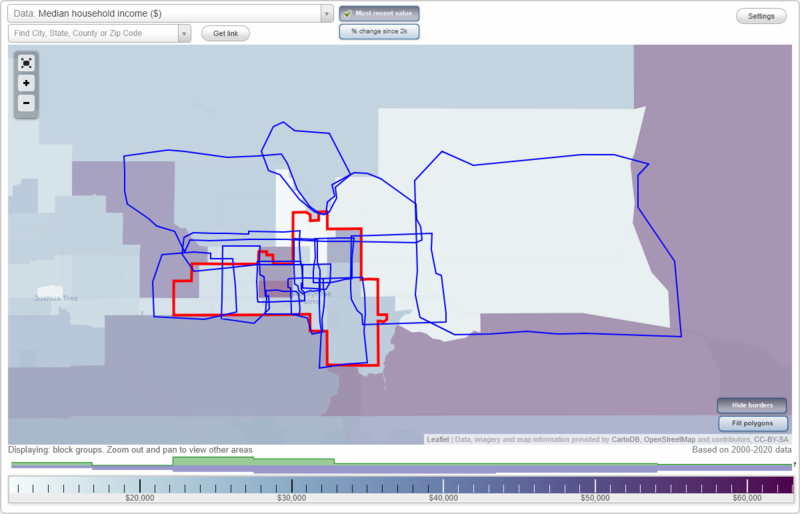
- City boundary
- Neighborhood boundaries
Business Search - 14 Million verified businesses
Neighborhoods:
Adobe, Cambell Hill, Chocolate Drop, Copper Mountain East, Desert Heights, Four Corners, Hansen Area, Harmony Acres, Indian Cove, Sherman Heights, Smoke Tree, The Plaza, Twentynine Palms Base, Wonder ValleyAdobe neighborhood in Twentynine Palms statistics: (Find on map)
Area: 4.322 square miles
Roads and streets: Adobe Rd; Two Mile Rd; Desert Queen Ave; el Paseo Dr; Oasis Ave; Desert Knoll Ave; Aztec Ave; Bagley Ave; Sun Valley Dr; Sunnyvale Dr; Homestead Dr; Raymond Dr (Raymond Way); Hill Blvd (Bullion Ave); Mesa Dr; Smoke Tree Ave; Desert Trail Dr; White Sands Dr; Calle Todd Ln; Adobe Cir; Playa Vista Dr; Sunnyslope Dr; Palo Verde Ave; Didsbury Rd; Manana Dr; David Way; Ocotillo Ave; Amboy Rd; Sierra Ave; Smith Ranch Rd; Desert Dunes Dr; Bullion Ave; Split Rock Ave; Yucca Ave; Samarkand Dr; Crestview Dr; Siesta Dr; S Slope Dr; Hill Rd; Raymond Way; Lazy Joe Ave; Hillside Ave; Civic Center Dr; Fairview Ave; Fremontia St; Basis St; Howard Way; Playa Vis; Casia Dr; Cholla Dr; The Plaza; Felipe Trl; Desert Trl; Skyview Ln; Oasis Rd; Buena Vista Dr; Cones Airport Rd; Sun Ct; Bagley Dr; Tamarisk Ave.
Other features: Cones Arprt.
Adobe neighborhood detailed profile
Cambell Hill neighborhood in Twentynine Palms statistics: (Find on map)
Area: 5.685 square miles
Roads and streets: Amboy Rd; Mesa Dr; Utah Trl; Two Mile Rd; Diamond Bar Rd; Saddle Horn Rd; Bagdad Hwy; Aztec Ave; Singing Sands Rd; Desert Knoll Ave; Raymond Dr (Double D Ranch); Playa Vista Dr; Michels Rd; Round Up Rd; Araby Ave; Samarkand Dr; N Star Ave; Roundup Way; Broad St; White Sands Dr; Sunmore Pkwy; 75300 (Hubler Ln); Cove View Rd; Luckie Ave; Hook Tree Rd; Flying H Rd; T Anchor Dr; Maude Adams Ave; T-Anchor Dr; Saint Andrews Dr; Crestview Dr; Desert Dunes Dr; Marine Ave; Wainwright Ave; Casia Dr; Cypress Pt; Sherman Hoyt Ave; Felipe Trl; Stirrup Ln; Cam Norte; Cones Airport Rd; Calle Todd Ln.
Other features: Cones Arprt.
Cambell Hill neighborhood detailed profile
Chocolate Drop neighborhood in Twentynine Palms statistics: (Find on map)
Area: 6.333 square miles
Population: 3,462
Population density:
Median household income in 2021:
Median rent in in 2021:
Male vs Females
Median age
Average estimated value of detached houses in 2021 (84.8% of all units):
Most popular occupations of males: service occupations (23.6%); architecture and engineering occupations (13.0%); construction, extraction, and maintenance occupations (12.6%); sales and office occupations (6.0%); material moving occupations (5.5%); management occupations (except farmers) (5.2%); computer and mathematical occupations (3.2%)
Most popular occupations of females: sales and office occupations (31.5%); management occupations (except farmers) (22.0%); service occupations (18.4%); education, training, and library occupations (17.1%); business and financial operations occupations (4.6%); community and social services occupations (3.7%); healthcare practitioners and technical occupations (3.0%)
Highways in this neighborhood: State Hwy 62 (29 Palms Hwy).
Roads and streets: Two Mile Rd; el Paseo Dr; Sunnyslope Dr; Cactus Dr; Mesquite Springs Rd; Morongo Rd; Sunrise Rd; Encelia Ave; Mariposa Ave; Gorgonio Dr; Juanita Dr; Larrea Ave; Lupine Ave; Sunnyvale Dr; Cahuilla Ave; Sun Valley Dr; Samarkand Dr; Datura Ave; Abronia Ave; Chia Ave; Baileya Ave; Daisy Ave; la Buena Tierra Ave; Siesta Dr; Manana Dr; Desert Trail Dr; Cove Vw; Joshua Dr; Split Rock Ave; Mojave Ave; Alpine Ave; Chiverton Dr; Buena Vista Dr; Adobe Cir; Verbena Dr; Barnes Dr; Rose Ellen Ave; Clare Ave; la Luna Ave; Hatch Rd; el Rey Ave; Nicolson Dr; 49 Palms Ave; Laura Ln; Granite Ave; Nicholson Dr; Hillside Ave; Juniper Ave; Stardune Ave; S Twentynine Palms Outerhighway; Todd Ln; Homestead Dr; Bullion Ave; Panorama Ave; Wildcat Way; Star Dune; Lazy Joe Ave; Grande Ave; Fuschia Rd; el Sol Ave; Florida Dr; Fuschia Dr; Mimosa Ave; Stanley Dr; Ruffernell; Estrella Ave; Manzanita Ave; Sunflower Dr; Eucalyptus Ave; Regino St; Pine Ave; Oasis Ave; Mission Ave; Ruffernell Rd; Regina St; Margot Ave; Barlo Vento Ave; Hall Ln; Corta Way; Summit Dr; Skyview Ln; Fortynine Palms Ave; Costa Dr; Twentynine Palms Hwy.
Chocolate Drop neighborhood detailed profile
Area: 6.333 square miles
Population: 3,462
Population density:
| Chocolate Drop: | 547 people per square mile |
| Twentynine Palms: | 496 people per square mile |
Median household income in 2021:
| Chocolate Drop: | $74,048 |
| Twentynine Palms: | $46,887 |
Median rent in in 2021:
| Chocolate Drop: | $855 |
| Twentynine Palms: | $960 |
Male vs Females
| Males: | 1,924 |
| Females: | 1,538 |
Median age
| Males: | 33.2 years |
| Females: | 36.0 years |
Average estimated value of detached houses in 2021 (84.8% of all units):
| Chocolate Drop: | $159,382 |
| California: | $881,672 |
Most popular occupations of males: service occupations (23.6%); architecture and engineering occupations (13.0%); construction, extraction, and maintenance occupations (12.6%); sales and office occupations (6.0%); material moving occupations (5.5%); management occupations (except farmers) (5.2%); computer and mathematical occupations (3.2%)
Most popular occupations of females: sales and office occupations (31.5%); management occupations (except farmers) (22.0%); service occupations (18.4%); education, training, and library occupations (17.1%); business and financial operations occupations (4.6%); community and social services occupations (3.7%); healthcare practitioners and technical occupations (3.0%)
Highways in this neighborhood: State Hwy 62 (29 Palms Hwy).
Roads and streets: Two Mile Rd; el Paseo Dr; Sunnyslope Dr; Cactus Dr; Mesquite Springs Rd; Morongo Rd; Sunrise Rd; Encelia Ave; Mariposa Ave; Gorgonio Dr; Juanita Dr; Larrea Ave; Lupine Ave; Sunnyvale Dr; Cahuilla Ave; Sun Valley Dr; Samarkand Dr; Datura Ave; Abronia Ave; Chia Ave; Baileya Ave; Daisy Ave; la Buena Tierra Ave; Siesta Dr; Manana Dr; Desert Trail Dr; Cove Vw; Joshua Dr; Split Rock Ave; Mojave Ave; Alpine Ave; Chiverton Dr; Buena Vista Dr; Adobe Cir; Verbena Dr; Barnes Dr; Rose Ellen Ave; Clare Ave; la Luna Ave; Hatch Rd; el Rey Ave; Nicolson Dr; 49 Palms Ave; Laura Ln; Granite Ave; Nicholson Dr; Hillside Ave; Juniper Ave; Stardune Ave; S Twentynine Palms Outerhighway; Todd Ln; Homestead Dr; Bullion Ave; Panorama Ave; Wildcat Way; Star Dune; Lazy Joe Ave; Grande Ave; Fuschia Rd; el Sol Ave; Florida Dr; Fuschia Dr; Mimosa Ave; Stanley Dr; Ruffernell; Estrella Ave; Manzanita Ave; Sunflower Dr; Eucalyptus Ave; Regino St; Pine Ave; Oasis Ave; Mission Ave; Ruffernell Rd; Regina St; Margot Ave; Barlo Vento Ave; Hall Ln; Corta Way; Summit Dr; Skyview Ln; Fortynine Palms Ave; Costa Dr; Twentynine Palms Hwy.
Chocolate Drop neighborhood detailed profile
Copper Mountain East neighborhood in Twentynine Palms statistics: (Find on map)
Area: 13.655 square miles
Population: 3,547
Population density:
Median household income in 2021:
Median rent in in 2021:
Male vs Females
Median age
Average estimated value of detached houses in 2021 (100.0% of all units):
Most popular occupations of males: material moving occupations (16.4%); architecture and engineering occupations (11.8%); construction, extraction, and maintenance occupations (11.4%); management occupations (except farmers) (7.5%); transportation occupations (7.2%); computer and mathematical occupations (5.5%); life, physical, and social science occupations (5.3%)
Most popular occupations of females: sales and office occupations (37.7%); education, training, and library occupations (35.0%); service occupations (22.4%); business and financial operations occupations (12.1%); material moving occupations (8.2%); production occupations (5.7%); management occupations (except farmers) (4.9%)
Roads and streets: Mesa Dr; Indian Trl; Cove View Rd; Raymond Dr; Nandina St; Amboy Rd; Hillcrest Dr; Mesquite Springs Rd; Lear Ave; Shoshone Valley Rd; Timothy Ave; Los Olivos Ave; Morongo Rd; Agua Ave; Pearl Springs Ave; Bluegrass Ave; Ramona Dr; Indian Cove Rd; Pampas Ave; Desert Flower Ave; Hilltop Dr; Romona Rd; Taco Dr; Alfalfa Ave; Papoose Trl; Los Oavos Ave (Mountain Rd, Cove View Rd); Knoll Dr; Desert Heights Dr; Golden Arrow Trl; Nandina St (Michael Way); Bellerue Rd; Foley Dr; Mark Dr; Lupine Ave; Cassia St; Canyon Rd; Giant Rock Rd; Meldora Ave; Bermuda Rd; Mountain View Dr; Carodean Rd; Freemantle St; Wilson Way; Fremontia St; Emerald St; Alpine Ave; Dichondra Ave; Datura Ave; la Buena Tierra Ave; el Portal Ave; Sunrise Rd (Hillcrest Dr); Mantonya Rd; Indian Rd; Moonglow Rd; Datura Rd; Lazy Joe Ave; Morrissey Ln; Cove Vw; Diamond Bar Rd; Barnes Rd; Thompson Way; Abronia Ave; Bermuda Ave; Baileya Ave; Aqua Ave; Lori Ln; Selby Trl; Desert View Rd; Watson Way (Desert View Rd); Pine Spring Ave; el Ranchero Dr; Marks Ave; Raymond Rd; Rock Springs Ave; Rock Springs Rd; Ramona Rd; Hill Rd; Encelia Ave; Golden Arrow Rd; Turquoise Rd; Brian Trl; Jason Dr; Knoll Rd.
Copper Mountain East neighborhood detailed profile
Area: 13.655 square miles
Population: 3,547
Population density:
| Copper Mountain East: | 260 people per square mile |
| Twentynine Palms: | 496 people per square mile |
Median household income in 2021:
| Copper Mountain East: | $55,479 |
| Twentynine Palms: | $46,887 |
Median rent in in 2021:
| Copper Mountain East: | $895 |
| Twentynine Palms: | $960 |
Male vs Females
| Males: | 1,592 |
| Females: | 1,955 |
Median age
| Males: | 36.6 years |
| Females: | 26.4 years |
Average estimated value of detached houses in 2021 (100.0% of all units):
| Copper Mountain East: | $167,171 |
| California: | $881,672 |
Most popular occupations of males: material moving occupations (16.4%); architecture and engineering occupations (11.8%); construction, extraction, and maintenance occupations (11.4%); management occupations (except farmers) (7.5%); transportation occupations (7.2%); computer and mathematical occupations (5.5%); life, physical, and social science occupations (5.3%)
Most popular occupations of females: sales and office occupations (37.7%); education, training, and library occupations (35.0%); service occupations (22.4%); business and financial operations occupations (12.1%); material moving occupations (8.2%); production occupations (5.7%); management occupations (except farmers) (4.9%)
Roads and streets: Mesa Dr; Indian Trl; Cove View Rd; Raymond Dr; Nandina St; Amboy Rd; Hillcrest Dr; Mesquite Springs Rd; Lear Ave; Shoshone Valley Rd; Timothy Ave; Los Olivos Ave; Morongo Rd; Agua Ave; Pearl Springs Ave; Bluegrass Ave; Ramona Dr; Indian Cove Rd; Pampas Ave; Desert Flower Ave; Hilltop Dr; Romona Rd; Taco Dr; Alfalfa Ave; Papoose Trl; Los Oavos Ave (Mountain Rd, Cove View Rd); Knoll Dr; Desert Heights Dr; Golden Arrow Trl; Nandina St (Michael Way); Bellerue Rd; Foley Dr; Mark Dr; Lupine Ave; Cassia St; Canyon Rd; Giant Rock Rd; Meldora Ave; Bermuda Rd; Mountain View Dr; Carodean Rd; Freemantle St; Wilson Way; Fremontia St; Emerald St; Alpine Ave; Dichondra Ave; Datura Ave; la Buena Tierra Ave; el Portal Ave; Sunrise Rd (Hillcrest Dr); Mantonya Rd; Indian Rd; Moonglow Rd; Datura Rd; Lazy Joe Ave; Morrissey Ln; Cove Vw; Diamond Bar Rd; Barnes Rd; Thompson Way; Abronia Ave; Bermuda Ave; Baileya Ave; Aqua Ave; Lori Ln; Selby Trl; Desert View Rd; Watson Way (Desert View Rd); Pine Spring Ave; el Ranchero Dr; Marks Ave; Raymond Rd; Rock Springs Ave; Rock Springs Rd; Ramona Rd; Hill Rd; Encelia Ave; Golden Arrow Rd; Turquoise Rd; Brian Trl; Jason Dr; Knoll Rd.
Copper Mountain East neighborhood detailed profile
Desert Heights neighborhood in Twentynine Palms statistics: (Find on map)
Area: 68.866 square miles
Population: 596
Population density:
Median household income in 2021:
Median rent in in 2021:
Male vs Females
Median age
Most popular occupations of males: service occupations (19.2%); sales and office occupations (16.7%); production occupations (11.4%); education, training, and library occupations (7.5%); material moving occupations (7.2%); transportation occupations (6.7%); construction, extraction, and maintenance occupations (6.0%)
Most popular occupations of females: sales and office occupations (34.0%); service occupations (31.9%); business and financial operations occupations (13.4%); education, training, and library occupations (8.7%); management occupations (except farmers) (3.3%); healthcare practitioners and technical occupations (3.0%); community and social services occupations (1.6%)
Roads and streets: Valle Vista Rd; Indian Trl; Giant Rock Rd; Old Chisholm Trl; Learco Way; Pole Line Rd; Daisy Ln; Sunny Sands Dr; Winters Rd; Brant Crossing Rd; Gemini St; Squaw Rd; Canyon Rd; Rainier Rd; Shoshone Valley Rd; Lear Ave; Cielito Dr; Mesquite Springs Rd; Bullion Mountain Rd; Venus St; Morongo Rd; Meldora Ave; Montezuma Dr; Anaheim Rd (Winters Rd); Coyote Valley Rd; Sunrise Ave (Sunrise Rd); Bourland Pass Rd; Bluegrass Ave; Cleland Rd; Rawlings Ln (Taco Dr); Tortoise Rd (Cherokee Ln); Lynne Ln (Kachina Dr); Kachina Dr; Lucille Ln; Pampas Ave; Sonora Rd; del Oro Rd; Ramona Dr (Rock Springs Rd); Pioneer Trl; Foley Dr; Bagdad Hwy; Mesa Verde Dr; Papoose Trl; Desert Flower Ave; Los Olivos Ave; Pluto St; Moonglow Rd; Bermuda Ave; Saturn Rd (Labram Xing); Blisterback Rd (Sunny Sands Dr); Wilson Way; Alfalfa Ave; Cascade Rd; Enchanted Rd (Copper Moon Ln); Palmyra Dr; Falderman Ave; Dunlap Rd; Good Guys Ln (Kerns Blvd); Mile Square Rd; Magical Ave; Mt Shasta Ave; Hoover Rd (Mars St); Taylor Ln; Mt Lassen Ave; Fascination Ave; Chamus (Jackson); Friendship Ave; Encanto Dr; Ranch Rd; Desert Heights Dr; Applegate Way; Sierra Ave; Adobe Rd; Condor Rd; Moonlight Mesa St; Cady Rd; Encelia Ave; del Rey Rd; Brant Cross Rd; Goodie Ln; Desert Lily St; Valley View Rd; Tortoise Rd; Montezuma Rd; Pioneer Trl (Post Rd); Whitaker Ln; Tepee Rd; Montezume Rd; Kerr Ave; Indian Cove Rd; Hales Dr; Ranier Rd; Valley Mountain Rd (Gammel Rd); Kelsey Blvd (Kelsey Rd); Pinto Mountain Rd; Sherman Hoyt Ave; Utah Trl; Starview Ln; Good Guys Ln; el Noche Rd; Kaiser Dr; Sand Trl; Rodgers Ln; Hennel Ave; Ball Rd; Longview Rd; Decker Ave; Jackrabbit Trl; County Rd; Shoemaker Ln; Monte Vista St; Hoover; Lucille Ln (Leeds Rd); Robinson Dr; Windsong Ave; Copper Moon Ln; Bagdad Outerhighway E; Berkeley Ave; Timbuktu (Montezuma Dr); Hoover Rd; Pampas Ln; Amador Ave; Bjorka Ln; Cypress Rd; Pearl Springs Ave; Mesa Dr; Lincoln Rd; el Portal Ave; Watson Way (Desert View Rd); Moonlight Mesa (Emerald Dr); Normglo Rd; Ramona Rd; (Zinnia Ave); Didsbury Rd; el Noche; Hoyos Rd; Mac Rae Rd; Winfield Rd; Wheeler Rd; Copper Mine Rd; Cahuilla Ave; Saturn Rd; Peter Rabbit Trl; Lupine Ave; Rogers Ln; la Buena Tierra Ave; Highnoon (Yarrow Ln); Bethel Rd; Monte Vis; Carodean Rd; Red Hill Rd; Mount Shasta Ave; Abronia Ave; Datura Rd; Utah Trl W; Desert Knoll Ave; Pearl Springs Ave (Carolina Ave); Rorick Way; Upshur Ave; Highview Trl; Chissum Trl; Emerald Rd; Waylyn; Desert Queen Ave; Gemini Rd; Toga Ave; Lynds Pl; Starlight St; Pipe Line Rd; Montalyo Dr; Mojave Rd; Moose Ranch Rd; Falcon St; Araby Ave; Timbuktu Rd; Wilson Dr; Desert View Rd; Back of Beyond Rd; Palmyra; Kennedy Rd; Berkeley Rd; Miller Ln; Old Chisholm Trl (Haynes Ln); Elephant Walk Rd; Lazy Joe Ave; Mockingbird Ln; Bullion Ave; Katchin; Calexico Ave; Mesquite Dunes Rd; Chisholm Trl; Utah Trl E; Sun View Rd; el Rey Ave; el Sando Rd; Jupiter; Mica Ave; Indian Rd; Palmyra Ln; Grande Ave; Sunrise Way; Peffer Ave; Harabella Ave; Westside Rd (Mesquite Springs Rd); Center Ln; Lejeune Cir; Knoll Dr; Rarick Way (Sunny Sands Rd); Soper Ln; el Bandito; Morgan Rd (Montezuma); Francis Dr; Learco Dr; Crystal View Rd; Rutho Rd; Shooting Star; Orion St; Pinto Mount; Holland Ave (); Donovan Rd; Ikerds Dr; Sunrise Rd; Mount Shasta; Delora Rd; Via Arenosa Rd; Jackson Ln; Jericho Ln; Moonbeam Rd; Shoemaker Way; Mesa Verde Rd; McDonald Rd; Casmalia Dr (Dixie Dr); Sunrise Dr; Regino St; Alpine Ave; Bryce St; Thompson Way; Barbara Ln; Cielito Trl; Cholla Rd; Starlight; Mars Ln; Mack Ln; Choctaw Rd; Timothy; Coyote Vista Rd; Facination Way; Sherman Hoyt Rd; Tilly Ln; Crystal View Dr; Sunview Ave; Moonglow Ave; Donavan; Cedar Ave; Zepher Rd; Pearl Spring Ave; Jackson; Moon Beam Rd; Ivy Ln; Miller Rd; Hillcrest Dr (Abbey Ln); Scogin Ln; Via Arenosa; Bost Ln; Sand Hill Rd; Gundersen Rd; Brant Crossroad; Daly St; el Camino; Peffer Rd; Bywater Ln; Talaui Trl; Chia Ave; Feldspar Ave; Bailey St; Fuller St; Cannon St; Rainbow Canyon Rd; Rock Springs Ave; Shoeshone Ave; Learco Rd; Warren Ln; Jessup Cup; Moonlight Mesa; Rock Springs Rd; Citrus St; Blue Ridge Rd; Garden Rd; Road Runner Dr; Ashurst St; Desert Lily Rd; Orion Dr; Los Olivios; Goettge St; Mountain View Rance Rd; Sterling Rd; West Way; Memory Rd; Bunny Ter (Didsbury Rd, Sandy Ln); Smoke Tree Ave; Golden Arrow Rd; Chapel Highnoon; Moreno Way; Timothy Ave; Cielito; Jackson Rd; Bourland Pass; Henderson St; Sunny Sands Rd; Leaned; Doues Rd (Los Hoyes); Maize Rd; Los Hayes Rd; Argos Rd; 6th St; Delta St; Ikerds Rd; la Buena Tierra; Sunshine Peak Rd; Roadrunner Rd; Dunlap Ave; Pioneer; Palmyra Ln N; Harp Way; Saturn St (Brandt Cross Rd); Crampton Ct; Coyote Ct; Crystal Ct; Neller Rd; Preciado; Cherokee Rd; Mount Lassen Ave; Coyote St; Breezy Ln; Larkspur Rd; Mountain View Ranch Rd; Pioneer Blvd; Kaiser Rd; Back of Beyond Trl; Todd Rd; Cleghorn St; N Star Ave; Westway; Knoll Rd; Presswood Rd; Diamond Back Ct; Koroo Pl (el Rod Pl); Emerald; Sterling; Pearl Springs Rd; Highnoon St; Maumee St; Warbird Way; Lava Ct; Noble Ct; Gypsum Ct; Mesa Ct; Morgan St; Emerson Ct; Prederna Rd.
Other features: Condor Fld.
Other features: Telephone Rd; el Bandido (Flohero Ln).
Desert Heights neighborhood detailed profile
Area: 68.866 square miles
Population: 596
Population density:
| Desert Heights: | 9 people per square mile |
| Twentynine Palms: | 496 people per square mile |
Median household income in 2021:
| Desert Heights: | $47,683 |
| Twentynine Palms: | $46,887 |
Median rent in in 2021:
| Desert Heights: | $1,119 |
| Twentynine Palms: | $960 |
Male vs Females
| Males: | 409 |
| Females: | 186 |
Median age
| Males: | 21.2 years |
| Females: | 21.7 years |
Most popular occupations of males: service occupations (19.2%); sales and office occupations (16.7%); production occupations (11.4%); education, training, and library occupations (7.5%); material moving occupations (7.2%); transportation occupations (6.7%); construction, extraction, and maintenance occupations (6.0%)
Most popular occupations of females: sales and office occupations (34.0%); service occupations (31.9%); business and financial operations occupations (13.4%); education, training, and library occupations (8.7%); management occupations (except farmers) (3.3%); healthcare practitioners and technical occupations (3.0%); community and social services occupations (1.6%)
Roads and streets: Valle Vista Rd; Indian Trl; Giant Rock Rd; Old Chisholm Trl; Learco Way; Pole Line Rd; Daisy Ln; Sunny Sands Dr; Winters Rd; Brant Crossing Rd; Gemini St; Squaw Rd; Canyon Rd; Rainier Rd; Shoshone Valley Rd; Lear Ave; Cielito Dr; Mesquite Springs Rd; Bullion Mountain Rd; Venus St; Morongo Rd; Meldora Ave; Montezuma Dr; Anaheim Rd (Winters Rd); Coyote Valley Rd; Sunrise Ave (Sunrise Rd); Bourland Pass Rd; Bluegrass Ave; Cleland Rd; Rawlings Ln (Taco Dr); Tortoise Rd (Cherokee Ln); Lynne Ln (Kachina Dr); Kachina Dr; Lucille Ln; Pampas Ave; Sonora Rd; del Oro Rd; Ramona Dr (Rock Springs Rd); Pioneer Trl; Foley Dr; Bagdad Hwy; Mesa Verde Dr; Papoose Trl; Desert Flower Ave; Los Olivos Ave; Pluto St; Moonglow Rd; Bermuda Ave; Saturn Rd (Labram Xing); Blisterback Rd (Sunny Sands Dr); Wilson Way; Alfalfa Ave; Cascade Rd; Enchanted Rd (Copper Moon Ln); Palmyra Dr; Falderman Ave; Dunlap Rd; Good Guys Ln (Kerns Blvd); Mile Square Rd; Magical Ave; Mt Shasta Ave; Hoover Rd (Mars St); Taylor Ln; Mt Lassen Ave; Fascination Ave; Chamus (Jackson); Friendship Ave; Encanto Dr; Ranch Rd; Desert Heights Dr; Applegate Way; Sierra Ave; Adobe Rd; Condor Rd; Moonlight Mesa St; Cady Rd; Encelia Ave; del Rey Rd; Brant Cross Rd; Goodie Ln; Desert Lily St; Valley View Rd; Tortoise Rd; Montezuma Rd; Pioneer Trl (Post Rd); Whitaker Ln; Tepee Rd; Montezume Rd; Kerr Ave; Indian Cove Rd; Hales Dr; Ranier Rd; Valley Mountain Rd (Gammel Rd); Kelsey Blvd (Kelsey Rd); Pinto Mountain Rd; Sherman Hoyt Ave; Utah Trl; Starview Ln; Good Guys Ln; el Noche Rd; Kaiser Dr; Sand Trl; Rodgers Ln; Hennel Ave; Ball Rd; Longview Rd; Decker Ave; Jackrabbit Trl; County Rd; Shoemaker Ln; Monte Vista St; Hoover; Lucille Ln (Leeds Rd); Robinson Dr; Windsong Ave; Copper Moon Ln; Bagdad Outerhighway E; Berkeley Ave; Timbuktu (Montezuma Dr); Hoover Rd; Pampas Ln; Amador Ave; Bjorka Ln; Cypress Rd; Pearl Springs Ave; Mesa Dr; Lincoln Rd; el Portal Ave; Watson Way (Desert View Rd); Moonlight Mesa (Emerald Dr); Normglo Rd; Ramona Rd; (Zinnia Ave); Didsbury Rd; el Noche; Hoyos Rd; Mac Rae Rd; Winfield Rd; Wheeler Rd; Copper Mine Rd; Cahuilla Ave; Saturn Rd; Peter Rabbit Trl; Lupine Ave; Rogers Ln; la Buena Tierra Ave; Highnoon (Yarrow Ln); Bethel Rd; Monte Vis; Carodean Rd; Red Hill Rd; Mount Shasta Ave; Abronia Ave; Datura Rd; Utah Trl W; Desert Knoll Ave; Pearl Springs Ave (Carolina Ave); Rorick Way; Upshur Ave; Highview Trl; Chissum Trl; Emerald Rd; Waylyn; Desert Queen Ave; Gemini Rd; Toga Ave; Lynds Pl; Starlight St; Pipe Line Rd; Montalyo Dr; Mojave Rd; Moose Ranch Rd; Falcon St; Araby Ave; Timbuktu Rd; Wilson Dr; Desert View Rd; Back of Beyond Rd; Palmyra; Kennedy Rd; Berkeley Rd; Miller Ln; Old Chisholm Trl (Haynes Ln); Elephant Walk Rd; Lazy Joe Ave; Mockingbird Ln; Bullion Ave; Katchin; Calexico Ave; Mesquite Dunes Rd; Chisholm Trl; Utah Trl E; Sun View Rd; el Rey Ave; el Sando Rd; Jupiter; Mica Ave; Indian Rd; Palmyra Ln; Grande Ave; Sunrise Way; Peffer Ave; Harabella Ave; Westside Rd (Mesquite Springs Rd); Center Ln; Lejeune Cir; Knoll Dr; Rarick Way (Sunny Sands Rd); Soper Ln; el Bandito; Morgan Rd (Montezuma); Francis Dr; Learco Dr; Crystal View Rd; Rutho Rd; Shooting Star; Orion St; Pinto Mount; Holland Ave (); Donovan Rd; Ikerds Dr; Sunrise Rd; Mount Shasta; Delora Rd; Via Arenosa Rd; Jackson Ln; Jericho Ln; Moonbeam Rd; Shoemaker Way; Mesa Verde Rd; McDonald Rd; Casmalia Dr (Dixie Dr); Sunrise Dr; Regino St; Alpine Ave; Bryce St; Thompson Way; Barbara Ln; Cielito Trl; Cholla Rd; Starlight; Mars Ln; Mack Ln; Choctaw Rd; Timothy; Coyote Vista Rd; Facination Way; Sherman Hoyt Rd; Tilly Ln; Crystal View Dr; Sunview Ave; Moonglow Ave; Donavan; Cedar Ave; Zepher Rd; Pearl Spring Ave; Jackson; Moon Beam Rd; Ivy Ln; Miller Rd; Hillcrest Dr (Abbey Ln); Scogin Ln; Via Arenosa; Bost Ln; Sand Hill Rd; Gundersen Rd; Brant Crossroad; Daly St; el Camino; Peffer Rd; Bywater Ln; Talaui Trl; Chia Ave; Feldspar Ave; Bailey St; Fuller St; Cannon St; Rainbow Canyon Rd; Rock Springs Ave; Shoeshone Ave; Learco Rd; Warren Ln; Jessup Cup; Moonlight Mesa; Rock Springs Rd; Citrus St; Blue Ridge Rd; Garden Rd; Road Runner Dr; Ashurst St; Desert Lily Rd; Orion Dr; Los Olivios; Goettge St; Mountain View Rance Rd; Sterling Rd; West Way; Memory Rd; Bunny Ter (Didsbury Rd, Sandy Ln); Smoke Tree Ave; Golden Arrow Rd; Chapel Highnoon; Moreno Way; Timothy Ave; Cielito; Jackson Rd; Bourland Pass; Henderson St; Sunny Sands Rd; Leaned; Doues Rd (Los Hoyes); Maize Rd; Los Hayes Rd; Argos Rd; 6th St; Delta St; Ikerds Rd; la Buena Tierra; Sunshine Peak Rd; Roadrunner Rd; Dunlap Ave; Pioneer; Palmyra Ln N; Harp Way; Saturn St (Brandt Cross Rd); Crampton Ct; Coyote Ct; Crystal Ct; Neller Rd; Preciado; Cherokee Rd; Mount Lassen Ave; Coyote St; Breezy Ln; Larkspur Rd; Mountain View Ranch Rd; Pioneer Blvd; Kaiser Rd; Back of Beyond Trl; Todd Rd; Cleghorn St; N Star Ave; Westway; Knoll Rd; Presswood Rd; Diamond Back Ct; Koroo Pl (el Rod Pl); Emerald; Sterling; Pearl Springs Rd; Highnoon St; Maumee St; Warbird Way; Lava Ct; Noble Ct; Gypsum Ct; Mesa Ct; Morgan St; Emerson Ct; Prederna Rd.
Other features: Condor Fld.
Other features: Telephone Rd; el Bandido (Flohero Ln).
Desert Heights neighborhood detailed profile
Four Corners neighborhood in Twentynine Palms statistics: (Find on map)
Area: 5.186 square miles
Population: 3,939
Population density:
Median household income in 2021:
Median rent in in 2021:
Male vs Females
Median age
Average estimated value of detached houses in 2021 (81.5% of all units):
Most popular occupations of males: service occupations (29.7%); architecture and engineering occupations (15.9%); construction, extraction, and maintenance occupations (15.5%); management occupations (except farmers) (6.8%); sales and office occupations (6.3%); computer and mathematical occupations (3.9%); material moving occupations (2.9%)
Most popular occupations of females: sales and office occupations (31.1%); management occupations (except farmers) (25.0%); service occupations (18.1%); education, training, and library occupations (12.6%); business and financial operations occupations (5.2%); community and social services occupations (4.3%); healthcare practitioners and technical occupations (2.8%)
Highways in this neighborhood: 29 Palms Hwy (State Hwy 62).
Roads and streets: Two Mile Rd; Adobe Rd; Desert Knoll Ave; el Paseo Dr; Sullivan Rd; Cactus Dr; Mesquite Springs Rd; Foothill Dr; Buena Vista Dr; Cottonwood Dr; Sun Valley Dr; National Monument Dr; Sunnyvale Dr; Joshua Dr; Ocotillo Ave; Homestead Dr; Old Dale Rd; Split Rock Ave; Yucca Ave (Tamarisk Ave); Clare Ave; Desert Trail Dr; Bagley Ave; Boling Dr; Sunnyslope Dr; Rocky Rd; Bullion Ave; Tamarisk Ave; Smoke Tree Ave; Margot Ave; Eagle Ln; Gorgonio Dr; Adobe Cir; Palo Verde Ave; Cholla Ave; Marine Ave; Aztec Ave; Baseline Rd; Starlight Dr; Wainwright Ave; Mesquite Ave; Hillside Ave; Pine Ave; Desert Queen Ave; Pinon Dr; Oasis Ave; Munz Rd (Elm Dr); Larrea Ave; Maricopa Dr; Inn Ave; Chemehuevi Dr; Cienega Dr; Joe Davis Dr; Crestview Dr; S Slope Dr; Casita Dr; Mara Ave; Twilight Dr; Verbena Dr; National Park Dr (Palm Vista Dr); Morning Dr; Palm View Ave; Athol Ave; Halsey Ave; Serrano Dr; Mesquite Dr; Cedar Dr; Cedar Ave; Hastings Dr; (Holly Ave); Stanley Dr; Datura Ave; E Court Way; Civic Center Dr; W Court Way; Rose Ellen Ave; Granite Ave; Howard Way; Lazy Joe Ave; Cholla Dr; Alta Loma Dr; Muntz; Corta Way; Summit Dr; The Plaza; Desert Trl; Skyview Ln; Nicholson Dr; Juanita Dr; Sun Ct; Bagley Dr; Costa Dr; Twentynine Palms Hwy.
Four Corners neighborhood detailed profile
Area: 5.186 square miles
Population: 3,939
Population density:
| Four Corners (Downtown): | 760 people per square mile |
| Twentynine Palms: | 496 people per square mile |
Median household income in 2021:
| Four Corners (Downtown): | $74,048 |
| Twentynine Palms: | $46,887 |
Median rent in in 2021:
| Four Corners (Downtown): | $853 |
| Twentynine Palms: | $960 |
Male vs Females
| Males: | 2,260 |
| Females: | 1,679 |
Median age
| Males: | 33.2 years |
| Females: | 36.0 years |
Average estimated value of detached houses in 2021 (81.5% of all units):
| Four Corners (Downtown): | $149,914 |
| California: | $881,672 |
Most popular occupations of males: service occupations (29.7%); architecture and engineering occupations (15.9%); construction, extraction, and maintenance occupations (15.5%); management occupations (except farmers) (6.8%); sales and office occupations (6.3%); computer and mathematical occupations (3.9%); material moving occupations (2.9%)
Most popular occupations of females: sales and office occupations (31.1%); management occupations (except farmers) (25.0%); service occupations (18.1%); education, training, and library occupations (12.6%); business and financial operations occupations (5.2%); community and social services occupations (4.3%); healthcare practitioners and technical occupations (2.8%)
Highways in this neighborhood: 29 Palms Hwy (State Hwy 62).
Roads and streets: Two Mile Rd; Adobe Rd; Desert Knoll Ave; el Paseo Dr; Sullivan Rd; Cactus Dr; Mesquite Springs Rd; Foothill Dr; Buena Vista Dr; Cottonwood Dr; Sun Valley Dr; National Monument Dr; Sunnyvale Dr; Joshua Dr; Ocotillo Ave; Homestead Dr; Old Dale Rd; Split Rock Ave; Yucca Ave (Tamarisk Ave); Clare Ave; Desert Trail Dr; Bagley Ave; Boling Dr; Sunnyslope Dr; Rocky Rd; Bullion Ave; Tamarisk Ave; Smoke Tree Ave; Margot Ave; Eagle Ln; Gorgonio Dr; Adobe Cir; Palo Verde Ave; Cholla Ave; Marine Ave; Aztec Ave; Baseline Rd; Starlight Dr; Wainwright Ave; Mesquite Ave; Hillside Ave; Pine Ave; Desert Queen Ave; Pinon Dr; Oasis Ave; Munz Rd (Elm Dr); Larrea Ave; Maricopa Dr; Inn Ave; Chemehuevi Dr; Cienega Dr; Joe Davis Dr; Crestview Dr; S Slope Dr; Casita Dr; Mara Ave; Twilight Dr; Verbena Dr; National Park Dr (Palm Vista Dr); Morning Dr; Palm View Ave; Athol Ave; Halsey Ave; Serrano Dr; Mesquite Dr; Cedar Dr; Cedar Ave; Hastings Dr; (Holly Ave); Stanley Dr; Datura Ave; E Court Way; Civic Center Dr; W Court Way; Rose Ellen Ave; Granite Ave; Howard Way; Lazy Joe Ave; Cholla Dr; Alta Loma Dr; Muntz; Corta Way; Summit Dr; The Plaza; Desert Trl; Skyview Ln; Nicholson Dr; Juanita Dr; Sun Ct; Bagley Dr; Costa Dr; Twentynine Palms Hwy.
Four Corners neighborhood detailed profile
Hansen Area neighborhood in Twentynine Palms statistics: (Find on map)
Area: 13.574 square miles
Highways in this neighborhood: State Hwy 62 (29 Palms Hwy).
Roads and streets: Utah Trl; Baseline Rd; Sherman Hoyt Ave; el Paseo Dr; Gold Park Rd; Joe Davis Dr; Cable Stop Across Rd (Bullion Mountain Rd); Araby Ave; Wilshire Ave; Two Mile Rd; Sunrise Dr; Starlight Dr; Robin Rd; Sullivan Rd; N Star Ave; Joshua Dr; Bedouin Ave; Old Dale Rd; Alta Loma Dr; Foothill Dr; Twilight Dr; Sahara Ave; Maude Adams Ave; Isleta Rd; Cottonwood Dr; Sunset Dr; Chemehuevi Dr; Morning Dr; Tapia Rd; Mayfair Dr; Saladin Ave; Broad Ave; Serrano Dr; Singing Sands Rd; Palm Vista Dr (National Park Dr); Pinon Dr; Marine Ave; Persia Ave; Hill View Rd; Underhill Rd; Wellock Rd; Wainwright Ave; Mountain Ave; Sheridan Ave; Park Ave; Woodward Ave; Gorgonio Dr; Buena Vista Dr; Rocky Rd; Singing Sands Rd (Broad St); Sage Ave; Luckie Ave; Kellogg Ave; Washington Dr; Indianola Dr; Aladdin Dr; S Slope Dr; Mara Ave; Halsey Ave; Roberts Ave; Elm Ave; Cedar Ave; Broad Rd; Maricopa Dr; Cowan Rd; Gold Park Rd S; Crestview Dr; Cactus Dr; Joe Davis Rd; Cedar Dr; Morning Star Rd; S Twentynine Palms Outerhighway; Charlotte Rd; Starview Ln; Cartier Pl.
Hansen Area neighborhood detailed profile
Harmony Acres neighborhood in Twentynine Palms statistics: (Find on map)
Area: 10.686 square miles
Population: 8,366
Population density:
Median household income in 2021:
Median rent in in 2021:
Male vs Females
Median age
Average estimated value of detached houses in 2021 (83.6% of all units):
Most popular occupations of males: service occupations (29.7%); architecture and engineering occupations (12.4%); construction, extraction, and maintenance occupations (12.0%); management occupations (except farmers) (7.2%); sales and office occupations (7.0%); material moving occupations (5.2%); computer and mathematical occupations (3.1%)
Most popular occupations of females: sales and office occupations (35.1%); management occupations (except farmers) (21.1%); service occupations (20.1%); education, training, and library occupations (10.8%); business and financial operations occupations (3.8%); production occupations (3.6%); community and social services occupations (3.1%)
Highways in this neighborhood: State Hwy 62 (29 Palms Hwy).
Roads and streets: Shoshone Valley Rd; Canyon Rd; Two Mile Rd; Mesa Dr; Sunrise Rd; Hillcrest Dr; Timothy Ave; Cove View Rd; Raymond Dr; Sullivan Rd; el Paseo Dr; Carodean Rd; Bermuda Ave; Desert Quail Dr; Bluegrass Rd; Cottonwood Dr; Fortynine Palms Canyon Rd; Agua Ave; Easy St; Noels Knoll Rd; Pampas Ave; Sherman Rd; Alfalfa Ave; Sunnyslope Dr; Sunrise Ave; Mark Dr; Bermuda Rd; Hilltop Dr; Desert Flower Ave; el Camino Rd; Dichondra Ave; Bluegrass Ave; Valley View Dr; Juanita Dr; Panorama Ave; Bibb Rd; Painted Hill Ave; Desert Dr; Via Allegra; Elk Trl (Barranca St); Meldora Ave; Mountain View Dr; Papoose Trl; Appian Way; S Twentynine Palms Outerhighway; Cactus Dr; Arenoso Trl; Sunnycrest Ln; Foothill Dr; Aqua Ave; Gorgonio Dr; Fuschia Rd; Noel Pl; Regino St; Marks Ave; Raymond Rd; Amboy Rd; Cerrano Dr; Encelia Ave; Old Dale Rd; Desert Heights Dr; Knoll Dr; Base Line Rd; Boling Dr; Baseline Rd; Barlo Vento Ave; Driftwood Dr; Brian Trl; 29 Outer Hwy; Jason Dr; Buena Vista Dr.
Other features: Galleta Ave.
Harmony Acres neighborhood detailed profile
Area: 10.686 square miles
Population: 8,366
Population density:
| Harmony Acres: | 783 people per square mile |
| Twentynine Palms: | 496 people per square mile |
Median household income in 2021:
| Harmony Acres: | $74,048 |
| Twentynine Palms: | $46,887 |
Median rent in in 2021:
| Harmony Acres: | $884 |
| Twentynine Palms: | $960 |
Male vs Females
| Males: | 4,547 |
| Females: | 3,819 |
Median age
| Males: | 33.2 years |
| Females: | 36.0 years |
Average estimated value of detached houses in 2021 (83.6% of all units):
| Harmony Acres: | $150,443 |
| California: | $881,672 |
Most popular occupations of males: service occupations (29.7%); architecture and engineering occupations (12.4%); construction, extraction, and maintenance occupations (12.0%); management occupations (except farmers) (7.2%); sales and office occupations (7.0%); material moving occupations (5.2%); computer and mathematical occupations (3.1%)
Most popular occupations of females: sales and office occupations (35.1%); management occupations (except farmers) (21.1%); service occupations (20.1%); education, training, and library occupations (10.8%); business and financial operations occupations (3.8%); production occupations (3.6%); community and social services occupations (3.1%)
Highways in this neighborhood: State Hwy 62 (29 Palms Hwy).
Roads and streets: Shoshone Valley Rd; Canyon Rd; Two Mile Rd; Mesa Dr; Sunrise Rd; Hillcrest Dr; Timothy Ave; Cove View Rd; Raymond Dr; Sullivan Rd; el Paseo Dr; Carodean Rd; Bermuda Ave; Desert Quail Dr; Bluegrass Rd; Cottonwood Dr; Fortynine Palms Canyon Rd; Agua Ave; Easy St; Noels Knoll Rd; Pampas Ave; Sherman Rd; Alfalfa Ave; Sunnyslope Dr; Sunrise Ave; Mark Dr; Bermuda Rd; Hilltop Dr; Desert Flower Ave; el Camino Rd; Dichondra Ave; Bluegrass Ave; Valley View Dr; Juanita Dr; Panorama Ave; Bibb Rd; Painted Hill Ave; Desert Dr; Via Allegra; Elk Trl (Barranca St); Meldora Ave; Mountain View Dr; Papoose Trl; Appian Way; S Twentynine Palms Outerhighway; Cactus Dr; Arenoso Trl; Sunnycrest Ln; Foothill Dr; Aqua Ave; Gorgonio Dr; Fuschia Rd; Noel Pl; Regino St; Marks Ave; Raymond Rd; Amboy Rd; Cerrano Dr; Encelia Ave; Old Dale Rd; Desert Heights Dr; Knoll Dr; Base Line Rd; Boling Dr; Baseline Rd; Barlo Vento Ave; Driftwood Dr; Brian Trl; 29 Outer Hwy; Jason Dr; Buena Vista Dr.
Other features: Galleta Ave.
Harmony Acres neighborhood detailed profile
Indian Cove neighborhood in Twentynine Palms statistics: (Find on map)
Area: 17.250 square miles
Highways in this neighborhood: State Hwy 62 (29 Palms Hwy).
Roads and streets: Sullivan Rd; Two Mile Rd; Mantonya Rd; Sunnyslope Dr; Cottonwood Dr; Foothill Dr; Shoshone Valley Rd; Indian Cove Rd; Appian Way; Lear Ave; Amboy Rd; Copper Mountain Rd; Whitmore Rd; Whitmoore Rd; Lee Rd (Que Pas); Dorth Pl; Pearl Springs Ave; Desert Quail Dr; Gorgonio Dr; Pine Spring Ave; Siesta Dr; Papoose Trl; Kerns Blvd; Midway Rd; Kirkland Dr; Copper Mesa Rd; Ivanpah Ave; Quail Spring Ave; Bellerue Rd; Peterson Rd; Monte Vista Ave; Sandy Ridge Dr; Hendys Rd; Desert View Rd; Que Pas Ln; Samarkand Dr; Sunny Slope Dr; Los Olivos Ave; Emerald St; Golden Arrow Trl; Copper Mesa Rd (Rotary Way); Robinson Dr; Kerr Ave; Old Dale Rd; Sawanson Rd; Kerns Rd; Gianelli Rd; Bibb Rd; Bermuda Ave; Desert Dr; Pampas Ave; el Rey Ave; Wolfe Rd; Morrissey Ln; Gianneli Rd (Whitmoore Rd); Barnes Rd; Serrano Dr; Twentynine Outerhwy; Twentynine Outerhighway; Rocky Ridge Ranch Rd; Cottonwood Rd; Sunnycrest Ln; Wilson Dr; Jackass Trl; Lee Dr; Alta Loma Dr; Miwok Rd; Cove View Rd (Mountain Rd, Los Oavos Ave); Serrano Rd; Bluegrass Rd; Juanita Dr; Monte Vista Rd; Hollie Way; Cactus Dr; Raymond Dr; Digney Dr; Wolfe Dr; Boling Dr; Baseline Rd; (Delta Rd); Fiesta Rd; Indian Cir; Foothill Rd; (Twentynine Palms Hwy).
Indian Cove neighborhood detailed profile
Sherman Heights neighborhood in Twentynine Palms statistics: (Find on map)
Area: 26.439 square miles
Highways in this neighborhood: State Hwy 62 (29 Palms Hwy).
Roads and streets: Amboy Rd; Two Mile Rd; Cable Stop Across Rd (Bullion Mountain Rd); el Paseo Dr; Mojave Rd; Godwin Rd; Pinto Mountain Rd; Indian Trl; Gammel Rd; Mesa Dr; Sullivan Rd; Gopher Grove Ln; Baseline Rd; Cactus Jack Ave; Foothill Dr; Raymond Dr; Allen Ave; Thunder Rd; Samarkand Dr; Diamond Bar Rd; Via Arenosa; Normglo Rd; Mesa Rd; Feldspar Ave; Moonlight Rd; Garden Rd; White Sands Dr; Charlotte Rd; Easy St; Buena Vista Dr; McKinnon Rd; Primrose Ln; Marilane Ave; Moonlight; Hennel Ave; Falderman Ave; Prairie Dog Ave; Didsbury Rd; Mica Ave; Via Arenosa Rd; S Slope Rd; Sunrise Rd; Desert Trl; Gillette Rd; Sunvale Rd; Joshua Dr; Francis Dr; Cactus Jack Rd; Joe Davis Dr; Lazy Joe Rd; Didsbury Ln (Smokey Ln); Gorgonio Dr; Colaw Rd; Beaver Trail Rd; Peter Rabbit Trl; Frazier Rd; Road Runner Rd; Mountain Ave; Sunrise Way; Moon Way; Elkhorn Dr; Sullivan Rd (Houston Ln); Roadrunner Dr; Isleta Rd; Macs Rd; Callie Todd Rd; Tapia Rd; Vis Bonita; Saphire Rd; Foothill Rd; Siesta Dr; S Slope Dr; Base Line Rd; Ackina; Borax Ave; Becker Ln; Jethro Rd; Primero; Trl End; Thunderbi; Bunny Ter (Didsbury Rd, Sandy Ln); Francis Rd; Maynard Ave; Basalt Rd; Pinto Mountain; Government Rd; Polane Dr; Via Areenosa; Trails End Ln; Primero Ln.
Other features: Twentynine Palms Arprt.
Sherman Heights neighborhood detailed profile
Smoke Tree neighborhood in Twentynine Palms statistics: (Find on map)
Area: 2.680 square miles
Population: 3,131
Population density:
Median household income in 2021:
Median rent in in 2021:
Male vs Females
Median age
Average estimated value of detached houses in 2021 (84.1% of all units):
Most popular occupations of males: service occupations (37.4%); management occupations (except farmers) (10.0%); sales and office occupations (9.0%); architecture and engineering occupations (8.1%); construction, extraction, and maintenance occupations (7.9%); material moving occupations (7.2%); education, training, and library occupations (6.6%)
Most popular occupations of females: sales and office occupations (41.2%); service occupations (22.9%); management occupations (except farmers) (17.4%); production occupations (6.3%); material moving occupations (4.5%); education, training, and library occupations (4.1%); business and financial operations occupations (2.0%)
Highways in this neighborhood: State Hwy 62 (29 Palms Hwy).
Roads and streets: Sullivan Rd; Cactus Dr; Old Dale Rd; Gorgonio Dr; Juanita Dr; Hatch Rd; Clare Ave; Datura Ave; Mesquite Springs Rd; Foothill Dr; Morongo Rd; Joshua Dr; Alpine Ave; Margot Ave; el Rey Ave; el Sol Ave; Manzanita Ave; Stardune Ave; Estrella Ave; Eucalyptus Ave; Mission Ave; 49 Palms Ave; Verbena Dr; Juniper Ave; Mojave Ave; Mariposa Ave; Rose Ellen Ave; la Buena Tierra Ave; Buena Vista Dr; Cahuilla Ave; Lupine Ave; Larrea Ave; Nicolson Dr; Cottonwood Dr; Munz Rd (Elm Dr); Nicholson Dr; Boling Dr; Star Dune; Encelia Ave; la Luna Ave; Aspen Dr; Stanley Dr; Daisy Ave; Abronia Ave; Chia Ave; Baileya Ave; Muntz; Corta Way; Fortynine Palms Ave; Twentynine Palms Hwy.
Smoke Tree neighborhood detailed profile
Area: 2.680 square miles
Population: 3,131
Population density:
| Smoke Tree: | 1,168 people per square mile |
| Twentynine Palms: | 496 people per square mile |
Median household income in 2021:
| Smoke Tree: | $81,143 |
| Twentynine Palms: | $46,887 |
Median rent in in 2021:
| Smoke Tree: | $958 |
| Twentynine Palms: | $960 |
Male vs Females
| Males: | 1,615 |
| Females: | 1,515 |
Median age
| Males: | 31.9 years |
| Females: | 39.7 years |
Average estimated value of detached houses in 2021 (84.1% of all units):
| Smoke Tree: | $145,282 |
| California: | $881,672 |
Most popular occupations of males: service occupations (37.4%); management occupations (except farmers) (10.0%); sales and office occupations (9.0%); architecture and engineering occupations (8.1%); construction, extraction, and maintenance occupations (7.9%); material moving occupations (7.2%); education, training, and library occupations (6.6%)
Most popular occupations of females: sales and office occupations (41.2%); service occupations (22.9%); management occupations (except farmers) (17.4%); production occupations (6.3%); material moving occupations (4.5%); education, training, and library occupations (4.1%); business and financial operations occupations (2.0%)
Highways in this neighborhood: State Hwy 62 (29 Palms Hwy).
Roads and streets: Sullivan Rd; Cactus Dr; Old Dale Rd; Gorgonio Dr; Juanita Dr; Hatch Rd; Clare Ave; Datura Ave; Mesquite Springs Rd; Foothill Dr; Morongo Rd; Joshua Dr; Alpine Ave; Margot Ave; el Rey Ave; el Sol Ave; Manzanita Ave; Stardune Ave; Estrella Ave; Eucalyptus Ave; Mission Ave; 49 Palms Ave; Verbena Dr; Juniper Ave; Mojave Ave; Mariposa Ave; Rose Ellen Ave; la Buena Tierra Ave; Buena Vista Dr; Cahuilla Ave; Lupine Ave; Larrea Ave; Nicolson Dr; Cottonwood Dr; Munz Rd (Elm Dr); Nicholson Dr; Boling Dr; Star Dune; Encelia Ave; la Luna Ave; Aspen Dr; Stanley Dr; Daisy Ave; Abronia Ave; Chia Ave; Baileya Ave; Muntz; Corta Way; Fortynine Palms Ave; Twentynine Palms Hwy.
Smoke Tree neighborhood detailed profile
The Plaza neighborhood in Twentynine Palms statistics: (Find on map)
Area: 2.313 square miles
Roads and streets: Two Mile Rd; Adobe Rd; Aztec Ave; Utah Trl; Desert Knoll Ave; Playa Vista Dr; Oasis Ave; Homestead Dr; Joe Davis Dr; Desert Trail Dr; Luckie Ave; Wainwright Ave; White Sands Dr; Sunnyvale Dr; Calle Todd Ln; Sunnyslope Dr; Smoke Tree Ave; Palo Verde Ave; Marine Ave; Bagley Ave; Desert Dunes Dr; Sun Valley Dr; Crestview Dr; Manana Dr; Samarkand Dr; Ocotillo Ave; Siesta Dr; el Paseo Dr; S Slope Dr; Halsey Ave; Michels Rd; Howard Way; Playa Vis; Casia Dr; Cholla Dr; The Plaza; Felipe Trl; Desert Trl; N Star Ave; Bagley Dr.
Other features: Cones Arprt.
The Plaza neighborhood detailed profile
Twentynine Palms Base neighborhood in Twentynine Palms statistics: (Find on map)
Area: 16.850 square miles
Population: 97
Population density:
Median household income in 2021:
Median rent in in 2021:
Male vs Females
Median age
Most popular occupations of males: service occupations (19.2%); sales and office occupations (16.7%); production occupations (11.4%); education, training, and library occupations (7.5%); material moving occupations (7.2%); transportation occupations (6.7%); construction, extraction, and maintenance occupations (6.0%)
Most popular occupations of females: sales and office occupations (34.0%); service occupations (31.9%); business and financial operations occupations (13.4%); education, training, and library occupations (8.7%); management occupations (except farmers) (3.3%); healthcare practitioners and technical occupations (3.0%); community and social services occupations (1.6%)
Roads and streets: del Valle Dr; Rainbow Canyon Rd; Mesquite Springs Rd; Bagdad Hwy; Sturgis Rd; Berkeley Ave; Boonies Blvd; Brown Rd; Rourke Rd; Griffin Rd; Utah Trl W; Falcon St; 1st St; Mineral St; 5th St; Bullion Dr; 4th St; 3rd St; 6th; 8th St; Agate Rd; Adobe Rd; Upshur Ave; Bemis Rd; 7th St; Cottontail Rd; Smoketree Ave; Berkeley Rd; 10th St; 9th St; 2nd St; Desert Ave; Westside Rd (Mesquite Springs Rd); Lejeune Cir; Jasmine Dr; Elm Dr; Gold Dr; Copper Dr; Lead Dr; Silver Dr; Cactus Dr; Saddleback Ave; Calcite Rd; Ironwood Dr; Palm Dr; Plant St; Date St; Fir St; Daly St; Gatehill St; Mirage Dr; Oleander Dr; Bailey St; Fuller St; Cannon St; Grevilla Dr; Eucalyptus Dr; Cocos Ave; Beach Pl; Ash Dr; Hemlock Dr; Road Runner Dr; Ashurst St; Goettge St; Monument Ln; Henderson St; Larkspur Ct; Truax Dr; Sagebrush Ct; Hidalgo Ln; Cholla Ln; Brant Cross Rd; Coyote Ct; Desert View Ct; Brant Crossing Rd; Coyote St; Morongo Rd; Yucca Cir; Diamond Back Ct; Koroo Pl (el Rod Pl); Holly St; Mesquite Ct; Mountain View Ct; Prospect Ct; Condor Rd.
Other features: Condor Fld.
Twentynine Palms Base neighborhood detailed profile
Area: 16.850 square miles
Population: 97
Population density:
| Twentynine Palms Base (Marine Corps Air Ground Combat Center): | 6 people per square mile |
| Twentynine Palms: | 496 people per square mile |
Median household income in 2021:
| Twentynine Palms Base (Marine Corps Air Ground Combat Center): | $47,683 |
| Twentynine Palms: | $46,887 |
Median rent in in 2021:
| Twentynine Palms Base (Marine Corps Air Ground Combat Center): | $1,119 |
| Twentynine Palms: | $960 |
Male vs Females
| Males: | 66 |
| Females: | 30 |
Median age
| Males: | 21.2 years |
| Females: | 21.7 years |
Most popular occupations of males: service occupations (19.2%); sales and office occupations (16.7%); production occupations (11.4%); education, training, and library occupations (7.5%); material moving occupations (7.2%); transportation occupations (6.7%); construction, extraction, and maintenance occupations (6.0%)
Most popular occupations of females: sales and office occupations (34.0%); service occupations (31.9%); business and financial operations occupations (13.4%); education, training, and library occupations (8.7%); management occupations (except farmers) (3.3%); healthcare practitioners and technical occupations (3.0%); community and social services occupations (1.6%)
Roads and streets: del Valle Dr; Rainbow Canyon Rd; Mesquite Springs Rd; Bagdad Hwy; Sturgis Rd; Berkeley Ave; Boonies Blvd; Brown Rd; Rourke Rd; Griffin Rd; Utah Trl W; Falcon St; 1st St; Mineral St; 5th St; Bullion Dr; 4th St; 3rd St; 6th; 8th St; Agate Rd; Adobe Rd; Upshur Ave; Bemis Rd; 7th St; Cottontail Rd; Smoketree Ave; Berkeley Rd; 10th St; 9th St; 2nd St; Desert Ave; Westside Rd (Mesquite Springs Rd); Lejeune Cir; Jasmine Dr; Elm Dr; Gold Dr; Copper Dr; Lead Dr; Silver Dr; Cactus Dr; Saddleback Ave; Calcite Rd; Ironwood Dr; Palm Dr; Plant St; Date St; Fir St; Daly St; Gatehill St; Mirage Dr; Oleander Dr; Bailey St; Fuller St; Cannon St; Grevilla Dr; Eucalyptus Dr; Cocos Ave; Beach Pl; Ash Dr; Hemlock Dr; Road Runner Dr; Ashurst St; Goettge St; Monument Ln; Henderson St; Larkspur Ct; Truax Dr; Sagebrush Ct; Hidalgo Ln; Cholla Ln; Brant Cross Rd; Coyote Ct; Desert View Ct; Brant Crossing Rd; Coyote St; Morongo Rd; Yucca Cir; Diamond Back Ct; Koroo Pl (el Rod Pl); Holly St; Mesquite Ct; Mountain View Ct; Prospect Ct; Condor Rd.
Other features: Condor Fld.
Twentynine Palms Base neighborhood detailed profile
Wonder Valley neighborhood in Twentynine Palms statistics: (Find on map)
Area: 146.751 square miles
Highways in this neighborhood: State Hwy 62 (29 Palms Hwy).
Roads and streets: Amboy Rd; Indian Trl; Pole Line Rd; Steeg Rd; Two Mile Rd; Mesa Dr; Pipe Line Rd; Valle Vista Rd; Godwin Rd; Pipeline Rd; Eddie Albert Rd; Ironage Rd; Shelton Rd; Wilson Rd; Barbara Ln; Shadow Mountain Rd; Chadwick Rd; Pioneer Rd; Blower Rd; Midway Rd; Raymond Dr; Zelda Ln; Danby Rd; Meriwether Rd; New Ironage Rd; Star Ln; Bristol Ave; Virginia Rd; South (Sandale Rd); Schooler Rd; Samarkand Dr; Carey Rd; Marks Rd; Naborly Rd; Witt Dr (Indian Trl); Screech Owl Rd; Kern Rd; Brown Rd; Allen Ave; Lincoln Rd; Hendricks Dr; Gayley Ln; Nevada Trl; Hill Rd; el Paseo Dr; Sullivan Rd; Sunrise Way (Garden Rd); Parker Rd; Mesa View Ln; Henry Rd; Sunlight Rd; S Amboy Rd; Nevin Rd; Caroline Ln; Encanto Dr; Encanto Rd; Chantilly Rd; Easy St; Jojoba Dr (Shelton Rd); Hollywood Ln E; Gillespie Rd; Damascus Rd; Dale Vista Rd; McKinnon Rd; Kuhns Rd (Schooler Rd); Boutwell Rd; Sand-Dale Rd; Gehr Rd; Gaedke Ln; Iron Age Peak Rd; Sunrise Way; Harvest Trl; Thompson Rd; Ranger Rd; Morgan Rd; Ed Dee Rd; Paxton; Calle de Oro Rd; Tony Rd; Valle Vista Rd (Gilbert Rd); Mesa Rd; Lori Lisa Rd; Diamond Bar Rd; Jade Ln (Larrea Ln); Jennifer Ln; Don Rd; Mangels Rd; Lanes Ln; Ward Ln; Leaches Ln; Cll de Oro; Compadre Ln; Hayfield Ln; Mtn View Rd; Anza Ave; Moody Ln; Queen Anne Rd; Montgomery Dr; Bonnie Dunes Rd; (Stormy Rd); Melody Ln; Oasis Pkwy; Chapultepec Rd; el Paseo Rd; Wikiup Rd; Sundown Ln (Sullivan Rd); Valle Vis; Barbara Rd; Star (Pipe Line Rd); Base Line Rd; Gentry Rd; Gillette Rd; Pioneer; Sunvale Rd; Mustang Rd; Norman Rd; Fairview; Sampson Ave; Maya Rada Rd; Baylis Rd; Jade Ave; Sun Val; Warner; Helen St; Valley Vis; John Mary Ln; Macs Rd; Moritz; McCombie Rd; Campbell Rd (); South St; Finery; Kelly Rd; Misty Trl; Twilight Dr; Palm Rd; Idle Ln; Sunset; Ironwood; Julie Dr; Cadiz Ave; Don's Rd; Fi-Lox-See Rd; Cortese Ave; Beaver Trail Rd; Lori Lisa Dr; Edwards Ville Rd; Wades Dr; Raven Roost Rd; Artemecia Ln; Hap Rd; Desert Trail Dr; Palm Dr; Old Miner's Rd; Foothill Dr; Nablee Rd; Cholla; Raven Roost; Bauman Dr; Baseline Rd; Leila Ln; Honey Do Ln (Kirkwood Trl); Old Dale Trl; Kathy Dr; Cll de Muzik; Road Runner Rd; Oasis Ln; Galardia Rd; Sand Canyon Dr; Panorama Dr; Glamis Rd; N Shady Ln; Turner Rd; Moon Way; Sullivan Rd (Houston Ln); Julie Ln; Ranger; Stoner Way; Firefly Ln; Sandale Rd; Blackmer Ln; Little Rd; Sampson Ln; Wach; Morning Star Rd; Wollmer Dr; Shannon Rd E; Walker Rd; Shannon Dr; Meriweather Rd; Playa Rd; Mil Gor Rd; Didsbury Rd; Vreeken Rd; Ferrell Rd; Thompson; Government Rd; Bellking Rd; Callie Todd Rd; Moon Trl; Joshua Dr; Moonlight Rd; Vis Bonita; Tin Ride Pink; Gayley; Darlene Dr; Peridio Ln (Period Ln); Saphire Rd; Moritz Rd; Betty Ln; Sunset Dr; Grimm Ave; Ackina; Montgomery Rd; Crown Rd; Ramona Dr; Gaedke Dr; Uriel Way; el Camino Rd; Old Ironage Rd; Queen Anne Dr; Becker Ln; Woody Ln; Lighter Rd; Hollywood Ln; Marcoux Ln; Angeles Rd; Sheephole Vw; Gold Crown Rd; Serinity Rd; Kirkwood Trl; McAndrew; Nordyke Rd; Naborly; Lilac Rd; Kathy Ave; Ruby Rd; Lori Dr; San Joaquin Ln; Craig Knoll; Licon Rd; Julia Ln; Lazy F Rd; Sunburst Ave; Shaw; Marks; Morrison; Oasis Rd; Bristol Rd; Trl End; Thunderbi; Blue Bock Rd; Morgan; Gladstone Rd; Kathryn Ln; Fairview Ln; Calle de Muzik Rd; Eddie Albert Dr; Denivelle Rd; South Rd; Mae Flores Dr; Fairview Rd; Catherine St; Hickory Ln; Dons Rd; Aspen Dr; Desert Villa; Radley Rd; Marin Dr; Virginia Ln; Hedricks Dr; Mariposa Rd; Samarkind Dr; el Grande Rd; Sandpit Ranch Rd; Fred Rd; Boom Boom Rd; Happy's Trl; McCombie Ln; Dale Trl; Iron Peak Rd; Bell King Ln; Trails End Ln; Jade; Chantilly Dr; Dale Vis; Salt Well Rd; Gaedke Rd; Oleander Ave.
Other features: Old Ironage Rd (Old Dale Rd); Sandy Claws Ln; Thisistle Dr.
Wonder Valley neighborhood detailed profile