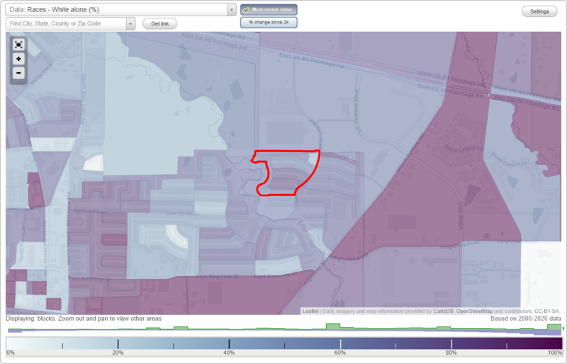
Samuell Parks Farms West neighborhood in Mesquite, Texas (TX), 75149 detailed profile
Settings
X

Business Search - 14 Million verified businesses
Area: 0.060 square miles
City-data.com crime index for city in 2020 (higher means more crime):
| City: | 322.7 |
| U.S. average: | 219.5 |
Roads and streets:
Wheatfield Dr
Length: 0.40 miles
Directions: E-W, SE-NW, SW-NE
Address range: 1200 to 1599
Directions: E-W, SE-NW, SW-NE
Address range: 1200 to 1599
Garden Trl
Length: 0.21 miles
Directions: E-W, N-S, SE-NW, SW-NE
Address range: 1000 to 1189
Directions: E-W, N-S, SE-NW, SW-NE
Address range: 1000 to 1189
Smokehouse St (Smokehouse Ln)
Length: 0.19 miles
Directions: E-W, SE-NW
Address range: 1300 to 1499
Directions: E-W, SE-NW
Address range: 1300 to 1499
Wheatfield Ct
Length: 0.05 miles
Directions: N-S, SE-NW
Address range: 1500 to 1599
Directions: N-S, SE-NW
Address range: 1500 to 1599