Franklin, Maine

Franklin: One Tree, Blueberry Fields

Franklin: Georges Pond Hill Blueberry Fields

Franklin: Bottle Tree Hooper Rd.
- add
your


Submit your own pictures of this town and show them to the world
- OSM Map
- General Map
- Google Map
- MSN Map

Population change since 2000: +8.2%
 |
| Males: 729 | |
| Females: 754 |
| Median resident age: | 44.6 years |
| Maine median age: | 43.0 years |
Zip codes: 04634.
| Franklin: | $58,535 |
| ME: | $69,543 |
Estimated per capita income in 2022: $34,899 (it was $17,188 in 2000)
Franklin town income, earnings, and wages data
Estimated median house or condo value in 2022: $220,803 (it was $77,100 in 2000)
| Franklin: | $220,803 |
| ME: | $290,600 |
Mean prices in 2022: all housing units: $379,336; detached houses: $396,802; townhouses or other attached units: $600,716; in 2-unit structures: $274,479; in 3-to-4-unit structures: $212,346; in 5-or-more-unit structures: $146,369; mobile homes: $158,183; occupied boats, rvs, vans, etc.: $16,454
Detailed information about poverty and poor residents in Franklin, ME
Compare current foreclosures near Franklin, ME:
| Photo | Address | Area | Beds / Baths | Price | Details |
|---|---|---|---|---|---|

|
#1
Gouldsboro Point Rd
Gouldsboro, ME 04607
|
988 sq. feet
|
1 baths 3 beds |
show details | |

|
#2
Earles Way
Hancock, ME 04640
|
- sq. feet
|
- baths - beds |
show details | |

|
#3
Mariaville Rd
Ellsworth, ME 04605
|
- sq. feet
|
- baths - beds |
show details | |

|
Check over 1 million property listings on Foreclosure.com!
|
browse all offers | |||

- 1,43496.7%White alone
- 151.0%Two or more races
- 120.8%American Indian alone
- 100.7%Asian alone
- 90.6%Hispanic
- 30.2%Black alone

Races in Franklin detailed stats: ancestries, foreign born residents, place of birth
According to our research of Maine and other state lists, there were 4 registered sex offenders living in Franklin, Maine as of April 19, 2024.
The ratio of all residents to sex offenders in Franklin is 371 to 1.
 Recent articles from our blog. Our writers, many of them Ph.D. graduates or candidates, create easy-to-read articles on a wide variety of topics.


 | Affordable small house in Franklin; $179K; colors ugh! (22 replies) |
| Thinking of relocating to kinda sorta rural Maine (17 replies) |
| Questions for those that relocated to Maine. (40 replies) |
| Considering moving to Maine (10 replies) |
| Maine weather thread (3207 replies) |
| The best place to live in Maine. (394 replies) |
Latest news from Franklin, ME collected exclusively by city-data.com from local newspapers, TV, and radio stations
Ancestries: United States (19.6%), English (18.6%), Irish (11.8%), French (5.7%), German (5.6%), Scottish (4.7%).
Current Local Time: EST time zone
Incorporated on 01/24/1825
Elevation: 74 feet
Land area: 36.7 square miles.
Population density: 40 people per square mile (very low).

41 residents are foreign born (2.0% Europe, 0.6% Asia).
| This town: | 3.0% |
| Maine: | 2.9% |
| Franklin town: | 1.3% ($980) |
| Maine: | 1.5% ($1,417) |
Nearest city with pop. 50,000+: Portland, ME  (119.7 miles , pop. 64,249).
Nearest city with pop. 200,000+: Boston, MA (212.5 miles , pop. 589,141).
Nearest city with pop. 1,000,000+: Bronx, NY (386.1 miles , pop. 1,332,650).
Nearest cities:
Latitude: 44.59 N, Longitude: 68.23 W
Area code: 207


Single-family new house construction building permits:
- 2022: 14 buildings, average cost: $123,200
- 2021: 9 buildings, average cost: $179,900
- 2020: 4 buildings, average cost: $150,000
- 2019: 8 buildings, average cost: $58,700
- 2018: 9 buildings, average cost: $57,700
- 2017: 5 buildings, average cost: $121,100
- 2016: 7 buildings, average cost: $87,100
- 2015: 10 buildings, average cost: $102,300
- 2014: 13 buildings, average cost: $66,700
- 2013: 10 buildings, average cost: $76,200
- 2012: 5 buildings, average cost: $81,900
- 2011: 5 buildings, average cost: $81,900
- 2010: 7 buildings, average cost: $81,900
- 2009: 7 buildings, average cost: $81,900
- 2008: 8 buildings, average cost: $81,900
- 2007: 12 buildings, average cost: $118,000
- 2006: 15 buildings, average cost: $118,000
- 2005: 17 buildings, average cost: $118,000
- 2004: 19 buildings, average cost: $118,000
- 2003: 18 buildings, average cost: $118,000
- 2002: 17 buildings, average cost: $118,000
- 2001: 16 buildings, average cost: $118,000
- 2000: 14 buildings, average cost: $118,000
- 1999: 8 buildings, average cost: $91,700
- 1998: 8 buildings, average cost: $91,700
- 1997: 7 buildings, average cost: $91,700


| Here: | 5.1% |
| Maine: | 3.4% |


- Construction (13.1%)
- Health care (9.9%)
- Accommodation & food services (7.6%)
- Agriculture, forestry, fishing & hunting (7.3%)
- Educational services (5.8%)
- Public administration (3.8%)
- Transportation equipment (3.8%)

- Construction (22.5%)
- Agriculture, forestry, fishing & hunting (10.0%)
- Transportation equipment (7.3%)
- Public administration (4.3%)
- Motor vehicle & parts dealers (3.6%)
- Arts, entertainment, recreation (3.6%)
- Food & beverage stores (3.3%)

- Health care (18.0%)
- Accommodation & food services (14.1%)
- Educational services (8.9%)
- Finance & insurance (5.9%)
- Professional, scientific, technical services (5.6%)
- Agriculture, forestry, fishing & hunting (4.3%)
- Department & other general merchandise stores (4.3%)

- Building and grounds cleaning and maintenance occupations (5.7%)
- Driver/sales workers and truck drivers (5.5%)
- Other sales and related occupations, including supervisors (4.6%)
- Carpenters (4.4%)
- Fishing, hunting, and forestry occupations (4.1%)
- Electrical equipment mechanics and other installation, maintenance, and repair workers, including supervisors (3.6%)
- Other office and administrative support workers, including supervisors (3.2%)

- Driver/sales workers and truck drivers (10.0%)
- Carpenters (8.5%)
- Fishing, hunting, and forestry occupations (7.9%)
- Electrical equipment mechanics and other installation, maintenance, and repair workers, including supervisors (7.0%)
- Other sales and related occupations, including supervisors (4.9%)
- Construction traders workers except carpenters, electricians, painters, plumbers, and construction laborers (4.9%)
- Vehicle and mobile equipment mechanics, installers, and repairers (4.6%)

- Building and grounds cleaning and maintenance occupations (8.2%)
- Other office and administrative support workers, including supervisors (4.6%)
- Secretaries and administrative assistants (4.6%)
- Nursing, psychiatric, and home health aides (4.3%)
- Other healthcare support occupations (4.3%)
- Information and record clerks, except customer service representatives (4.3%)
- Other sales and related occupations, including supervisors (4.3%)
Average climate in Franklin, Maine
Based on data reported by over 4,000 weather stations


(lower is better)

Air Quality Index (AQI) level in 2023 was 61.9. This is about average.
| City: | 61.9 |
| U.S.: | 72.6 |

Carbon Monoxide (CO) [ppm] level in 2023 was 0.172. This is significantly better than average. Closest monitor was 14.6 miles away from the city center.
| City: | 0.172 |
| U.S.: | 0.251 |


Sulfur Dioxide (SO2) [ppb] level in 2023 was 0.0636. This is significantly better than average. Closest monitor was 14.6 miles away from the city center.
| City: | 0.0636 |
| U.S.: | 1.5147 |

Ozone [ppb] level in 2023 was 36.4. This is about average. Closest monitor was 14.6 miles away from the city center.
| City: | 36.4 |
| U.S.: | 33.3 |


Particulate Matter (PM2.5) [µg/m3] level in 2023 was 4.90. This is significantly better than average. Closest monitor was 14.6 miles away from the city center.
| City: | 4.90 |
| U.S.: | 8.11 |
Earthquake activity:
Franklin-area historical earthquake activity is significantly above Maine state average. It is 81% smaller than the overall U.S. average.On 10/16/2012 at 23:12:25, a magnitude 4.7 (4.7 ML, Depth: 10.0 mi, Class: Light, Intensity: IV - V) earthquake occurred 138.6 miles away from Franklin center
On 4/20/2002 at 10:50:47, a magnitude 5.3 (5.3 ML, Depth: 3.0 mi, Class: Moderate, Intensity: VI - VII) earthquake occurred 269.5 miles away from the city center
On 4/20/2002 at 10:50:47, a magnitude 5.2 (5.2 MB, 4.2 MS, 5.2 MW, 5.0 MW) earthquake occurred 270.6 miles away from the city center
On 1/19/1982 at 00:14:42, a magnitude 4.7 (4.5 MB, 4.7 MD, 4.5 LG) earthquake occurred 183.6 miles away from Franklin center
On 10/7/1983 at 10:18:46, a magnitude 5.3 (5.1 MB, 5.3 LG, 5.1 ML) earthquake occurred 305.8 miles away from the city center
On 10/3/2006 at 00:07:38, a magnitude 3.7 (3.7 MD, Depth: 6.2 mi, Class: Light, Intensity: II - III) earthquake occurred 15.8 miles away from the city center
Magnitude types: regional Lg-wave magnitude (LG), body-wave magnitude (MB), duration magnitude (MD), local magnitude (ML), surface-wave magnitude (MS), moment magnitude (MW)
Natural disasters:
The number of natural disasters in Hancock County (18) is near the US average (15).Major Disasters (Presidential) Declared: 11
Emergencies Declared: 6
Causes of natural disasters: Floods: 9, Storms: 8, Snows: 5, Blizzard: 1, Heavy Rain: 1, Hurricane: 1, Ice Storm: 1, Landslide: 1, Snowfall: 1, Wind: 1, Winter Storm: 1, Other: 2 (Note: some incidents may be assigned to more than one category).
Hospitals and medical centers near Franklin:
- BIRCHWOOD LIVING CENTER (Hospital, about 10 miles away; ELLSWORTH, ME)
- COLLIER'S REHAB AND NURSING CTR (Nursing Home, about 10 miles away; ELLSWORTH, ME)
- COURTLAND REHAB AND LIVING CENTER (Nursing Home, about 11 miles away; ELLSWORTH, ME)
- SONOGEE ESTATES (Nursing Home, about 13 miles away; BAR HARBOR, ME)
- SONOGEE REHABILITATION AND LIVING CENTER (Nursing Home, about 13 miles away; BAR HARBOR, ME)
- MOUNT DESERT ISLAND HOSPITAL Critical Access Hospitals (about 15 miles away; BAR HARBOR, ME)
Colleges/universities with over 2000 students nearest to Franklin:
- University of Maine (about 31 miles; Orono, ME; Full-time enrollment: 8,931)
- Husson University (about 33 miles; Bangor, ME; FT enrollment: 2,421)
- University of Maine at Augusta (about 80 miles; Augusta, ME; FT enrollment: 3,204)
- University of Maine at Farmington (about 95 miles; Farmington, ME; FT enrollment: 2,036)
- Southern Maine Community College (about 119 miles; South Portland, ME; FT enrollment: 4,666)
- University of Southern Maine (about 121 miles; Portland, ME; FT enrollment: 6,647)
- Saint Joseph's College of Maine (about 124 miles; Standish, ME; FT enrollment: 2,010)
User-submitted facts and corrections:
- WNSX is no longer owned by Clear Channel, it now belongs to Stony Creek Broadcasting. added by Bill DaButler
Points of interest:
Notable locations in Franklin: Franklin Historical Society Building (A), Franklin Volunteer Fire Department (B). Display/hide their locations on the map
Churches in Franklin include: Franklin Baptist Church (A), Franklin United Methodist Church (B). Display/hide their locations on the map
Cemeteries: Abbott Cemetery (1), Bayview Cemetery (2), East Franklin Cemetery (3), Williams Cemetery (4). Display/hide their locations on the map
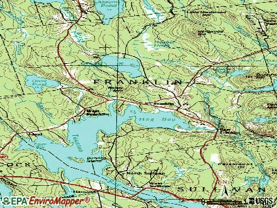
Lakes, reservoirs, and swamps: Clark Pond (A), Duck Pond (B), Georges Pond (C), Great Pond (D), Little Pond (E), Mill Pond (F), Donnell Pond (G), Hooper Heath (H). Display/hide their locations on the map
Streams, rivers, and creeks: Alder Brook (A), West Brook (B), Swan Brook (C), Johnnys Brook (D), Rocky Brook (E), Long Pond Brook (F), Springer Creek (G), Old Meadow Brook (H), Mill Brook (I). Display/hide their locations on the map
Park in Franklin: Franklin Memorial Park (1). Display/hide its location on the map
Drinking water stations with addresses in Franklin and their reported violations in the past:
FRANKLIN WATER DEPT (Population served: 525, Groundwater):Past monitoring violations:
- Water Quality Parameter M/R - Between APR-2011 and JUN-2011, Contaminant: Lead and Copper Rule. Follow-up actions: St Compliance achieved (MAY-12-2011), St Public Notif requested (AUG-22-2011), St Formal NOV issued (AUG-22-2011), St Public Notif received (JUN-29-2012)
- Water Quality Parameter M/R - Between JAN-2011 and MAR-2011, Contaminant: Lead and Copper Rule. Follow-up actions: St Compliance achieved (APR-27-2011), St Formal NOV issued (2 times from AUG-19-2011 to AUG-19-2011), St Public Notif requested (AUG-19-2011), St Public Notif received (JUN-29-2012)
- Initial Tap Sampling for Pb and Cu - In JUL-11-2004, Contaminant: Lead and Copper Rule. Follow-up actions: St Public Notif requested (FEB-23-2005), St Violation/Reminder Notice (FEB-23-2005), St Public Notif received (JUN-16-2005), St Compliance achieved (SEP-06-2005)
| This town: | 2.3 people |
| Maine: | 2.3 people |
| This town: | 63.0% |
| Whole state: | 62.9% |
| This town: | 11.3% |
| Whole state: | 9.4% |
Likely homosexual households (counted as self-reported same-sex unmarried-partner households)
- Lesbian couples: 0.8% of all households
- Gay men: 0.3% of all households
| This town: | 15.9% |
| Whole state: | 10.9% |
| This town: | 3.7% |
| Whole state: | 4.1% |
11 people in other noninstitutional group quarters in 2000
For population 15 years and over in Franklin:

- Never married: 18.9%
- Now married: 61.8%
- Separated: 1.0%
- Widowed: 7.8%
- Divorced: 10.6%
For population 25 years and over in Franklin:
- High school or higher: 83.7%
- Bachelor's degree or higher: 16.4%
- Graduate or professional degree: 5.0%
- Unemployed: 7.7%
- Mean travel time to work (commute): 32.2 minutes


| Here: | 9.9 |
| Maine average: | 11.2 |


Graphs represent county-level data. Detailed 2008 Election Results
Religion statistics for Franklin, ME (based on Hancock County data)


| Religion | Adherents | Congregations |
|---|---|---|
| Mainline Protestant | 4,691 | 58 |
| Catholic | 2,523 | 9 |
| Evangelical Protestant | 1,288 | 23 |
| Other | 820 | 11 |
| None | 45,096 | - |
Food Environment Statistics:
| Here: | 6.01 / 10,000 pop. |
| Maine: | 2.80 / 10,000 pop. |
| Hancock County: | 1.69 / 10,000 pop. |
| State: | 2.20 / 10,000 pop. |
| Hancock County: | 4.89 / 10,000 pop. |
| Maine: | 5.75 / 10,000 pop. |
| Hancock County: | 21.61 / 10,000 pop. |
| Maine: | 11.02 / 10,000 pop. |
| Hancock County: | 7.4% |
| Maine: | 8.2% |
| This county: | 25.4% |
| Maine: | 25.0% |
Strongest AM radio stations in Franklin:
- WDEA (1370 AM; 5 kW; ELLSWORTH, ME; Owner: CUMULUS LICENSING CORP.)
- WZON (620 AM; 5 kW; BANGOR, ME; Owner: THE ZONE CORPORATION)
- WABI (910 AM; 5 kW; BANGOR, ME; Owner: CLEAR CHANNEL BROADCASTING LICENSES, INC.)
- WSKW (1160 AM; 10 kW; SKOWHEGAN, ME; Owner: MOUNTAIN WIRELESS, INCORPORATED)
- WRKO (680 AM; 50 kW; BOSTON, MA; Owner: ENTERCOM BOSTON LICENSE, LLC)
- WEEI (850 AM; 50 kW; BOSTON, MA; Owner: ENTERCOM BOSTON LICENSE, LLC)
- WBZ (1030 AM; 50 kW; BOSTON, MA; Owner: INFINITY BROADCASTING OPERATIONS, INC.)
- WTME (780 AM; 10 kW; RUMFORD, ME; Owner: MOUNTAIN VALLEY BROADCASTING, INC.)
- WCRN (830 AM; 50 kW; WORCESTER, MA; Owner: CARTER BROADCASTING CORPORATION)
- WNNZ (640 AM; 50 kW; WESTFIELD, MA; Owner: CLEAR CHANNEL BROADCASTING LICENSES, INC.)
- WNZS (1340 AM; 1 kW; VEAZIE, ME; Owner: WATERFRONT COMMUNICATIONS INC.)
- WKOX (1200 AM; 50 kW; FRAMINGHAM, MA; Owner: CAPSTAR TX LIMITED PARTNERSHIP)
- WALE (990 AM; 50 kW; GREENVILLE, RI; Owner: NORTH AMERICAN BROADCASTING CO., INC.)
Strongest FM radio stations in Franklin:
- WNSX (97.7 FM; WINTER HARBOR, ME; Owner: CLEAR CHANNEL BROADCASTING LICENSES, INC.)
- WLKE (99.1 FM; BAR HARBOR, ME; Owner: CLEAR CHANNEL BROADCASTING LICENSES, INC.)
- WBQI (107.7 FM; BAR HARBOR, ME; Owner: MARINER BROADCASTING, L.P.)
- WWMJ (95.7 FM; ELLSWORTH, ME; Owner: CUMULUS LICENSING CORP.)
- WERU-FM (89.9 FM; BLUE HILL, ME; Owner: SALT POND COMMUNITY B/C COMPANY)
- WMEH (90.9 FM; BANGOR, ME; Owner: MAINE PUBLIC BROADCASTING CORPORATION)
- WEZQ (92.9 FM; BANGOR, ME; Owner: CUMULUS LICENSING CORP.)
- WHCF (88.5 FM; BANGOR, ME; Owner: BANGOR BAPTIST CHURCH)
- WKIT-FM (100.3 FM; BREWER, ME; Owner: THE ZONE CORPORATION)
- WBFB (104.7 FM; BELFAST, ME; Owner: CLEAR CHANNEL BROADCASTING LICENSES, INC.)
- WVOM (103.9 FM; HOWLAND, ME; Owner: CLEAR CHANNEL BROADCASTING LICENSES, INC.)
- WFZX (101.7 FM; SEARSPORT, ME; Owner: CLEAR CHANNEL BROADCASTING LICENSES, INC.)
- WWBX (97.1 FM; BANGOR, ME; Owner: CLEAR CHANNEL BROADCASTING LICENSES, INC.)
TV broadcast stations around Franklin:
- WMEB-TV (Channel 12; ORONO, ME; Owner: MAINE PUBLIC BROADCASTING CORPORATION)
- W66CL (Channel 66; BANGOR, ME; Owner: MS COMMUNICATIONS, LLC)
Franklin fatal accident list:
Jun 15, 2010 00:10 AM, Sr-142, Lat: 44.625175, Lon: -70.475236, Vehicles: 1, Persons: 1, Fatalities: 1, Drunk persons involved: 1
Jul 14, 2010 08:09 AM, Sr-182, Lat: 44.608436, Lon: -68.203211, Vehicles: 1, Persons: 1, Fatalities: 1
Jun 23, 2001 10:20 AM, Sr-182, Vehicles: 2, Persons: 3, Fatalities: 1
Aug 31, 1991 03:50 AM, 182, Vehicles: 1, Persons: 1, Fatalities: 1, Drunk persons involved: 1
- National Bridge Inventory (NBI) Statistics
- 1Number of bridges
- 3ft / 1.4mTotal length
- 616Total average daily traffic
- 30Total average daily truck traffic
- 986Total future (year 2036) average daily traffic
FCC Registered Antenna Towers:
18 (See the full list of FCC Registered Antenna Towers in Franklin)FCC Registered Broadcast Land Mobile Towers:
1- Martins Ridge Road (088058) (Lat: 44.642500 Lon: -68.171139), Type: Tower, Structure height: 99.1 m, Overall height: 104.8 m, Call Sign: WPGC919,
Assigned Frequencies: 154.325 MHz, Grant Date: 09/24/2014, Expiration Date: 12/13/2024, Registrant: Browns Communications, 162 Bangor Road, Ellsworth, ME 04605, Phone: (207) 667-2254, Email:
FCC Registered Microwave Towers:
3- FRANKLIN, 131 Martins Ridge Road (Me16492-A) (Lat: 44.642500 Lon: -68.171139), Type: Ltower, Structure height: 108.2 m, Overall height: 115.8 m, Call Sign: WQFU611,
Assigned Frequencies: 6741.25 MHz, 6735.00 MHz, 6715.00 MHz, Grant Date: 09/13/2016, Expiration Date: 10/06/2026, Certifier: John Doyon, Registrant: Versant Power, 970 Illinois Avenue, Bangor, ME 04402-0932, Phone: (207) 973-2546, Email:
- FRANKLIN, Martins Ridge Road (Lat: 44.642500 Lon: -68.171139), Type: Tower, Structure height: 99.1 m, Overall height: 104.8 m, Call Sign: WQFU612,
Assigned Frequencies: 6728.75 MHz, Grant Date: 09/13/2016, Expiration Date: 10/06/2026, Certifier: John Doyon, Registrant: Versant Power, 970 Illinois Avenue, Bangor, ME 04402-0932, Phone: (207) 973-2546, Email:
- SBA ME16492A, 131 Martins Ridge Road (Me16492-A) (Lat: 44.642500 Lon: -68.171167), Type: Ltower, Structure height: 108.2 m, Overall height: 115.8 m, Call Sign: WRDH568,
Assigned Frequencies: 6226.89 MHz, 6226.89 MHz, 6226.89 MHz, 6226.89 MHz, 6226.89 MHz, 6226.89 MHz, Grant Date: 04/30/2019, Expiration Date: 04/30/2029, Certifier: Jeffrey Mahaney, Registrant: Maine Public Broadcasting Corporation, 1450 Lisbon St., Lewiston, ME 04240-3514, Phone: (207) 404-5112, Email:
FCC Registered Maritime Coast & Aviation Ground Towers:
1- Rfd 1 Box 378 (Lat: 44.617861 Lon: -68.251694), Type: Building, Overall height: 8 m, Call Sign: KHA2,
Assigned Frequencies: 122.900 MHz, 123.100 MHz, Grant Date: 08/03/1995, Expiration Date: 10/04/2000, Cancellation Date: 05/06/2001, Registrant: Civil Air Patrol, Natl Hqtrs Dok 105 S Hansell St, Maxwell Air Force Ba, AL 36112-6332
FCC Registered Amateur Radio Licenses:
17 (See the full list of FCC Registered Amateur Radio Licenses in Franklin)FAA Registered Aircraft:
1- Aircraft: MOONEY M20E (Category: Land, Seats: 4, Weight: Up to 12,499 Pounds, Speed: 127 mph), Engine: LYCOMING I0360 SER (180 HP) (Reciprocating)
N-Number: 6952U, N6952U, N-6952U, Serial Number: 322, Year manufactured: 1964, Airworthiness Date: 04/28/1964, Certificate Issue Date: 04/29/1987
Registrant (Individual): Edwin T Duggan, Po Box 282, Franklin, ME 04634

- 82.0%Fuel oil, kerosene, etc.
- 10.5%Wood
- 5.0%Bottled, tank, or LP gas
- 2.4%Electricity

- 82.1%Fuel oil, kerosene, etc.
- 13.0%Electricity
- 4.9%Bottled, tank, or LP gas
Franklin compared to Maine state average:
- Black race population percentage significantly below state average.
- Hispanic race population percentage significantly below state average.
- Length of stay since moving in significantly above state average.
- Number of rooms per house significantly below state average.
- House age significantly below state average.
- Percentage of population with a bachelor's degree or higher below state average.