Masardis, Maine
Submit your own pictures of this town and show them to the world
- OSM Map
- General Map
- Google Map
- MSN Map

Population change since 2000: -2.4%
 |
| Males: 142 | |
| Females: 107 |
| Median resident age: | 46.9 years |
| Maine median age: | 43.0 years |
Zip codes: 04732.
| Masardis: | $54,582 |
| ME: | $69,543 |
Estimated per capita income in 2022: $30,371 (it was $14,716 in 2000)
Masardis town income, earnings, and wages data
Estimated median house or condo value in 2022: $110,650 (it was $45,700 in 2000)
| Masardis: | $110,650 |
| ME: | $290,600 |
Mean prices in 2022: all housing units: $179,108; detached houses: $185,023; townhouses or other attached units: $218,327; in 2-unit structures: $262,505; in 3-to-4-unit structures: $121,406; in 5-or-more-unit structures: $185,084; mobile homes: $117,009; occupied boats, rvs, vans, etc.: $12,682
Detailed information about poverty and poor residents in Masardis, ME


- 24799.2%White alone
- 10.4%American Indian alone
- 10.4%Two or more races

Races in Masardis detailed stats: ancestries, foreign born residents, place of birth
 Recent articles from our blog. Our writers, many of them Ph.D. graduates or candidates, create easy-to-read articles on a wide variety of topics.


 | Maine Demographics (36 replies) |
| Looking For Ridiculously Remote And Isolated Land (50 replies) |
| High Water (23 replies) |
| small town/villages to relocate to - no military presence (30 replies) |
| Alaska Perspective (50 replies) |
| Favorite Maine Beverages (121 replies) |
Latest news from Masardis, ME collected exclusively by city-data.com from local newspapers, TV, and radio stations
Ancestries: English (35.7%), French (31.0%), Scottish (27.1%), United States (15.3%), Irish (14.9%), German (4.7%).
Current Local Time: EST time zone
Incorporated on 03/21/1839
Elevation: 580 feet
Land area: 38.7 square miles.
Population density: 6.4 people per square mile (very low).

2 residents are foreign born
| This town: | 0.8% |
| Maine: | 2.9% |
| Masardis town: | 0.8% ($381) |
| Maine: | 1.5% ($1,417) |
Nearest city with pop. 50,000+: Portland, ME  (218.0 miles , pop. 64,249).
Nearest city with pop. 200,000+: Boston, MA (319.7 miles , pop. 589,141).
Nearest city with pop. 1,000,000+: Bronx, NY (478.8 miles , pop. 1,332,650).
Nearest cities:
), ), ), )Latitude: 46.52 N, Longitude: 68.37 W
Area code commonly used in this area: 207


Single-family new house construction building permits:
- 2019: 1 building, cost: $40,000
- 2006: 1 building, cost: $171,000
- 2001: 1 building, cost: $121,400


| Here: | 11.4% |
| Maine: | 3.4% |


- Wood products (24.4%)
- Construction (12.2%)
- Agriculture, forestry, fishing & hunting (10.6%)
- Educational services (8.9%)
- Food & beverage stores (8.1%)
- Truck transportation (5.7%)
- Finance & insurance (5.7%)

- Wood products (36.2%)
- Construction (21.7%)
- Agriculture, forestry, fishing & hunting (18.8%)
- Building material & garden equipment & supplies dealers (5.8%)
- Truck transportation (5.8%)
- Public administration (2.9%)
- Rail transportation (2.9%)

- Educational services (20.4%)
- Food & beverage stores (18.5%)
- Finance & insurance (13.0%)
- Health care (13.0%)
- Wood products (9.3%)
- Social assistance (7.4%)
- Truck transportation (5.6%)

- Laborers and material movers, hand (9.8%)
- Construction traders workers except carpenters, electricians, painters, plumbers, and construction laborers (7.3%)
- Driver/sales workers and truck drivers (5.7%)
- Counselors, social workers, and other community and social service specialists (5.7%)
- Preschool, kindergarten, elementary, and middle school teachers (5.7%)
- Other production occupations, including supervisors (4.9%)
- Cashiers (4.1%)

- Laborers and material movers, hand (17.4%)
- Construction traders workers except carpenters, electricians, painters, plumbers, and construction laborers (13.0%)
- Driver/sales workers and truck drivers (10.1%)
- Other production occupations, including supervisors (8.7%)
- Building and grounds cleaning and maintenance occupations (5.8%)
- Law enforcement workers, including supervisors (5.8%)
- Electrical equipment mechanics and other installation, maintenance, and repair workers, including supervisors (5.8%)

- Preschool, kindergarten, elementary, and middle school teachers (13.0%)
- Counselors, social workers, and other community and social service specialists (9.3%)
- Cashiers (9.3%)
- Other sales and related occupations, including supervisors (9.3%)
- Material recording, scheduling, dispatching, and distributing workers (9.3%)
- Bookkeeping, accounting, and auditing clerks (5.6%)
- Secretaries and administrative assistants (5.6%)
Average climate in Masardis, Maine
Based on data reported by over 4,000 weather stations


(lower is better)

Air Quality Index (AQI) level in 2023 was 79.3. This is about average.
| City: | 79.3 |
| U.S.: | 72.6 |

Carbon Monoxide (CO) [ppm] level in 2021 was 0.155. This is significantly better than average. Closest monitor was 20.4 miles away from the city center.
| City: | 0.155 |
| U.S.: | 0.251 |

Nitrogen Dioxide (NO2) [ppb] level in 2022 was 1.41. This is significantly better than average. Closest monitor was 20.4 miles away from the city center.
| City: | 1.41 |
| U.S.: | 5.11 |

Sulfur Dioxide (SO2) [ppb] level in 2022 was 0.0234. This is significantly better than average. Closest monitor was 20.4 miles away from the city center.
| City: | 0.0234 |
| U.S.: | 1.5147 |

Ozone [ppb] level in 2022 was 28.3. This is about average. Closest monitor was 6.2 miles away from the city center.
| City: | 28.3 |
| U.S.: | 33.3 |

Particulate Matter (PM10) [µg/m3] level in 2023 was 19.0. This is about average. Closest monitor was 7.8 miles away from the city center.
| City: | 19.0 |
| U.S.: | 19.2 |

Particulate Matter (PM2.5) [µg/m3] level in 2023 was 6.42. This is better than average. Closest monitor was 20.3 miles away from the city center.
| City: | 6.42 |
| U.S.: | 8.11 |
Earthquake activity:
Masardis-area historical earthquake activity is above Maine state average. It is 86% smaller than the overall U.S. average.On 4/20/2002 at 10:50:47, a magnitude 5.3 (5.3 ML, Depth: 3.0 mi, Class: Moderate, Intensity: VI - VII) earthquake occurred 292.8 miles away from Masardis center
On 7/14/2006 at 09:34:48, a magnitude 3.9 (3.9 MD, Depth: 8.6 mi, Class: Light, Intensity: II - III) earthquake occurred 28.8 miles away from the city center
On 4/20/2002 at 10:50:47, a magnitude 5.2 (5.2 MB, 4.2 MS, 5.2 MW, 5.0 MW) earthquake occurred 294.6 miles away from Masardis center
On 10/16/2012 at 23:12:25, a magnitude 4.7 (4.7 ML, Depth: 10.0 mi, Class: Light, Intensity: IV - V) earthquake occurred 230.7 miles away from the city center
On 10/7/1983 at 10:18:46, a magnitude 5.3 (5.1 MB, 5.3 LG, 5.1 ML) earthquake occurred 340.4 miles away from Masardis center
On 1/19/1982 at 00:14:42, a magnitude 4.7 (4.5 MB, 4.7 MD, 4.5 LG) earthquake occurred 261.6 miles away from the city center
Magnitude types: regional Lg-wave magnitude (LG), body-wave magnitude (MB), duration magnitude (MD), local magnitude (ML), surface-wave magnitude (MS), moment magnitude (MW)
Natural disasters:
The number of natural disasters in Aroostook County (22) is greater than the US average (15).Major Disasters (Presidential) Declared: 13
Emergencies Declared: 9
Causes of natural disasters: Floods: 10, Storms: 8, Snows: 7, Heavy Rains: 2, Blizzard: 1, Hurricane: 1, Ice Storm: 1, Snowfall: 1, Snowstorm: 1, Wind: 1, Winter Storm: 1, Other: 2 (Note: some incidents may be assigned to more than one category).
Colleges/universities with over 2000 students nearest to Masardis:
- University of Maine (about 114 miles; Orono, ME; Full-time enrollment: 8,931)
- Husson University (about 119 miles; Bangor, ME; FT enrollment: 2,421)
- University of Maine at Farmington (about 155 miles; Farmington, ME; FT enrollment: 2,036)
- University of Maine at Augusta (about 166 miles; Augusta, ME; FT enrollment: 3,204)
- Saint Joseph's College of Maine (about 213 miles; Standish, ME; FT enrollment: 2,010)
- Southern Maine Community College (about 219 miles; South Portland, ME; FT enrollment: 4,666)
- University of Southern Maine (about 219 miles; Portland, ME; FT enrollment: 6,647)
Points of interest:
Notable location: Masardis Volunteer Fire Department (A). Display/hide its location on the map
Cemetery: Smith Cemetery (1). Display/hide its location on the map
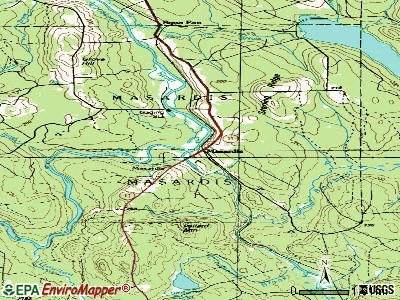
Streams, rivers, and creeks: Scopan Stream (A), Shields Brook (B), Saint Croix Stream (C), Clayton Brook (D), Blackwater River (E). Display/hide their locations on the map
| This town: | 2.3 people |
| Maine: | 2.3 people |
| This town: | 64.5% |
| Whole state: | 62.9% |
| This town: | 8.4% |
| Whole state: | 9.4% |
No gay or lesbian households reported
| This town: | 7.0% |
| Whole state: | 10.9% |
| This town: | 3.0% |
| Whole state: | 4.1% |
For population 15 years and over in Masardis:

- Never married: 25.8%
- Now married: 62.0%
- Separated: 1.3%
- Widowed: 2.2%
- Divorced: 8.7%
For population 25 years and over in Masardis:
- High school or higher: 70.5%
- Bachelor's degree or higher: 9.0%
- Graduate or professional degree: 2.0%
- Unemployed: 14.0%
- Mean travel time to work (commute): 22.1 minutes


| Here: | 8.5 |
| Maine average: | 11.2 |


Graphs represent county-level data. Detailed 2008 Election Results
Religion statistics for Masardis, ME (based on Aroostook County data)


| Religion | Adherents | Congregations |
|---|---|---|
| Catholic | 22,200 | 27 |
| Mainline Protestant | 5,845 | 40 |
| Evangelical Protestant | 4,411 | 51 |
| Other | 957 | 7 |
| Orthodox | 10 | 1 |
| None | 38,447 | - |
Food Environment Statistics:
| Aroostook County: | 4.03 / 10,000 pop. |
| State: | 2.80 / 10,000 pop. |
| Aroostook County: | 0.14 / 10,000 pop. |
| Maine: | 0.14 / 10,000 pop. |
| Here: | 2.22 / 10,000 pop. |
| State: | 2.20 / 10,000 pop. |
| This county: | 7.78 / 10,000 pop. |
| Maine: | 5.75 / 10,000 pop. |
| Here: | 9.17 / 10,000 pop. |
| State: | 11.02 / 10,000 pop. |
| This county: | 11.7% |
| State: | 8.2% |
| Aroostook County: | 27.6% |
| Maine: | 25.0% |
Strongest AM radio stations in Masardis:
- WEGP (1390 AM; 5 kW; PRESQUE ISLE, ME; Owner: DECELLES/SMITH MEDIA, INC.)
- WFST (600 AM; 5 kW; CARIBOU, ME; Owner: NORTHERN BROADCAST MINISTRIES, INC.)
- WREM (710 AM; daytime; 5 kW; MONTICELLO, ME; Owner: ALLAN H WEINER)
- WRKO (680 AM; 50 kW; BOSTON, MA; Owner: ENTERCOM BOSTON LICENSE, LLC)
- WCHP (760 AM; 35 kW; CHAMPLAIN, NY; Owner: CHAMPLAIN RADIO, INC.)
- WEEI (850 AM; 50 kW; BOSTON, MA; Owner: ENTERCOM BOSTON LICENSE, LLC)
- WZON (620 AM; 5 kW; BANGOR, ME; Owner: THE ZONE CORPORATION)
- WNNZ (640 AM; 50 kW; WESTFIELD, MA; Owner: CLEAR CHANNEL BROADCASTING LICENSES, INC.)
- WCRN (830 AM; 50 kW; WORCESTER, MA; Owner: CARTER BROADCASTING CORPORATION)
- WBZ (1030 AM; 50 kW; BOSTON, MA; Owner: INFINITY BROADCASTING OPERATIONS, INC.)
- WSKW (1160 AM; 10 kW; SKOWHEGAN, ME; Owner: MOUNTAIN WIRELESS, INCORPORATED)
- WGY (810 AM; 50 kW; SCHENECTADY, NY; Owner: CLEAR CHANNEL BROADCASTING LICENSES, INC.)
- WTME (780 AM; 10 kW; RUMFORD, ME; Owner: MOUNTAIN VALLEY BROADCASTING, INC.)
Strongest FM radio stations in Masardis:
- WBPW (96.9 FM; PRESQUE ISLE, ME; Owner: CITADEL BROADCASTING COMPANY)
- WQHR (96.1 FM; PRESQUE ISLE, ME; Owner: CITADEL BROADCASTING COMPANY)
- WOZI (101.9 FM; PRESQUE ISLE, ME; Owner: CITADEL BROADCASTING COMPANY)
- WMEM (106.1 FM; PRESQUE ISLE, ME; Owner: MAINE PUBLIC BROADCASTING CORPORATION)
- W274AF (102.7 FM; PRESQUE ISLE, ME; Owner: BANGOR BAPTIST CHURCH)
- WHOU-FM (100.1 FM; HOULTON, ME; Owner: COUNTY COMMUNICATIONS, INC.)
Masardis fatal accident list:
Feb 21, 1996 06:45 AM, 11, Vehicles: 1, Persons: 1, Fatalities: 1
Jun 18, 1995 03:55 PM, 11, Vehicles: 1, Persons: 3, Fatalities: 1, Drunk persons involved: 1
- National Bridge Inventory (NBI) Statistics
- 3Number of bridges
- 52ft / 15.7mTotal length
- 3,210Total average daily traffic
- 515Total average daily truck traffic
- 4,396Total future (year 2036) average daily traffic
FCC Registered Cell Phone Towers:
1 (See the full list of FCC Registered Cell Phone Towers in Masardis)FCC Registered Antenna Towers:
14 (See the full list of FCC Registered Antenna Towers)FCC Registered Broadcast Land Mobile Towers:
1- Lat: 46.546389 Lon: -68.408611, Call Sign: KNBM211,
Assigned Frequencies: 159.105 MHz, 153.875 MHz, Grant Date: 07/11/2022, Expiration Date: 08/13/2032, Registrant: Business Radio Licensing, 30251 Golden Lantern, Suite E # 501, Laguna Niguel, CA 92677, Phone: (949) 348-8510, Fax: (949) 348-8514, Email:
FCC Registered Amateur Radio Licenses:
1- Call Sign: KC1RBD, Licensee ID: L02546864, Grant Date: 04/12/2022, Expiration Date: 04/12/2032, Certifier: Daniel M Higgins Jr, Registrant: Daniel M Higgins Jr, 1407 Masardis Rd, Masardis, ME 04732

- 78.2%Fuel oil, kerosene, etc.
- 21.8%Wood

- 30.0%Fuel oil, kerosene, etc.
- 30.0%No fuel used
- 20.0%Bottled, tank, or LP gas
- 20.0%Wood
Masardis compared to Maine state average:
- Median house value significantly below state average.
- Black race population percentage significantly below state average.
- Hispanic race population percentage significantly below state average.
- Foreign-born population percentage significantly below state average.
- Renting percentage significantly below state average.
- Length of stay since moving in significantly above state average.
- Number of rooms per house significantly below state average.
- House age significantly below state average.
- Percentage of population with a bachelor's degree or higher significantly below state average.