Millbrook, New York

Millbrook: Millbrook Countryside in October
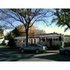
Millbrook: Millbrook Diner
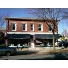
Millbrook: Reardon Briggs Hardware
Millbrook: Tuxis Self Storage
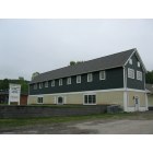
Millbrook: Tuxis Self Storage

Millbrook: Bobcat at the Trevor Zoo in Millbrook, NY
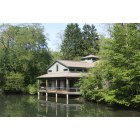
Millbrook: Trevor Zoo in Millbrook, NY

Millbrook: View from the Rooftop; Millbrook, New York
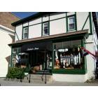
Millbrook: Millbrook 1
- add
your
Submit your own pictures of this village and show them to the world
(10.6% for White Non-Hispanic residents, 32.7% for Black residents, 40.0% for Hispanic or Latino residents, 51.5% for two or more races residents)
Detailed information about poverty and poor residents in Millbrook, NY
Millbrook tourist attractions:
- Innisfree Garden - Millbrook, NY - Garden and Lake
- Cary Institute of Ecosystem Studies - Millbrook, New York - An Education on Ecosystems
- Orvis Sandanona Shooting Grounds - Millbrook, NY - Sporting Clays, Fly Fishing, and More
- Trevor Zoo - Millbrook, New York - small private zoo with 180 animals on 6 acres
| Here: | 3.6% |
| New York: | 4.4% |

- Health care (16.4%)
- Educational services (9.9%)
- Professional, scientific, technical services (7.8%)
- Construction (6.9%)
- Accommodation & food services (6.2%)
- Public administration (5.8%)
- Administrative & support & waste management services (4.4%)

- Construction (12.8%)
- Professional, scientific, technical services (10.2%)
- Health care (9.1%)
- Educational services (7.8%)
- Accommodation & food services (7.5%)
- Broadcasting & telecommunications (5.3%)
- Public administration (5.1%)

- Health care (24.1%)
- Educational services (12.2%)
- Public administration (6.5%)
- Religious, grantmaking, civic, professional, similar organizations (6.2%)
- Administrative & support & waste management services (5.9%)
- Professional, scientific, technical services (5.4%)
- Accommodation & food services (4.8%)

- Other management occupations, except farmers and farm managers (8.8%)
- Secretaries and administrative assistants (5.2%)
- Preschool, kindergarten, elementary, and middle school teachers (4.3%)
- Driver/sales workers and truck drivers (3.3%)
- Information and record clerks, except customer service representatives (3.2%)
- Sales representatives, services, wholesale and manufacturing (2.9%)
- Retail sales workers, except cashiers (2.8%)

- Other management occupations, except farmers and farm managers (8.0%)
- Driver/sales workers and truck drivers (6.4%)
- Engineers (5.3%)
- Electrical equipment mechanics and other installation, maintenance, and repair workers, including supervisors (5.3%)
- Sales representatives, services, wholesale and manufacturing (5.1%)
- Computer specialists (4.0%)
- Building and grounds cleaning and maintenance occupations (3.5%)

- Secretaries and administrative assistants (10.8%)
- Other management occupations, except farmers and farm managers (9.6%)
- Preschool, kindergarten, elementary, and middle school teachers (6.5%)
- Information and record clerks, except customer service representatives (4.8%)
- Child care workers (4.8%)
- Counselors, social workers, and other community and social service specialists (4.2%)
- Bookkeeping, accounting, and auditing clerks (4.2%)
Average climate in Millbrook, New York
Based on data reported by over 4,000 weather stations


|
|
(lower is better)

Air Quality Index (AQI) level in 2023 was 82.0. This is about average.
| City: | 82.0 |
| U.S.: | 72.6 |

Carbon Monoxide (CO) [ppm] level in 2022 was 0.149. This is significantly better than average. Closest monitor was 13.8 miles away from the city center.
| City: | 0.149 |
| U.S.: | 0.251 |

Nitrogen Dioxide (NO2) [ppb] level in 2015 was 2.27. This is significantly better than average. Closest monitor was 2.5 miles away from the city center.
| City: | 2.27 |
| U.S.: | 5.11 |

Sulfur Dioxide (SO2) [ppb] level in 2022 was 0.109. This is significantly better than average. Closest monitor was 2.5 miles away from the city center.
| City: | 0.109 |
| U.S.: | 1.515 |

Ozone [ppb] level in 2023 was 30.1. This is about average. Closest monitor was 2.5 miles away from the city center.
| City: | 30.1 |
| U.S.: | 33.3 |

Particulate Matter (PM10) [µg/m3] level in 2022 was 9.49. This is significantly better than average. Closest monitor was 20.5 miles away from the city center.
| City: | 9.49 |
| U.S.: | 19.21 |

Particulate Matter (PM2.5) [µg/m3] level in 2022 was 4.86. This is significantly better than average. Closest monitor was 13.1 miles away from the city center.
| City: | 4.86 |
| U.S.: | 8.11 |
Tornado activity:
Millbrook-area historical tornado activity is above New York state average. It is 26% smaller than the overall U.S. average.
On 5/29/1995, a category F4 (max. wind speeds 207-260 mph) tornado 31.6 miles away from the Millbrook village center killed 3 people and injured 24 people and caused between $5,000,000 and $50,000,000 in damages.
On 8/28/1973, a category F4 tornado 37.1 miles away from the village center killed 4 people and injured 36 people and caused between $5,000,000 and $50,000,000 in damages.
Earthquake activity:
Millbrook-area historical earthquake activity is significantly above New York state average. It is 68% smaller than the overall U.S. average.On 10/7/1983 at 10:18:46, a magnitude 5.3 (5.1 MB, 5.3 LG, 5.1 ML, Class: Moderate, Intensity: VI - VII) earthquake occurred 153.4 miles away from Millbrook center
On 4/20/2002 at 10:50:47, a magnitude 5.3 (5.3 ML, Depth: 3.0 mi) earthquake occurred 188.5 miles away from Millbrook center
On 4/20/2002 at 10:50:47, a magnitude 5.2 (5.2 MB, 4.2 MS, 5.2 MW, 5.0 MW) earthquake occurred 186.7 miles away from the city center
On 8/23/2011 at 17:51:04, a magnitude 5.8 (5.8 MW, Depth: 3.7 mi) earthquake occurred 350.2 miles away from the city center
On 1/19/1982 at 00:14:42, a magnitude 4.7 (4.5 MB, 4.7 MD, 4.5 LG, Class: Light, Intensity: IV - V) earthquake occurred 159.3 miles away from the city center
On 1/16/1994 at 01:49:16, a magnitude 4.6 (4.6 MB, 4.6 LG, Depth: 3.1 mi) earthquake occurred 158.5 miles away from Millbrook center
Magnitude types: regional Lg-wave magnitude (LG), body-wave magnitude (MB), duration magnitude (MD), local magnitude (ML), surface-wave magnitude (MS), moment magnitude (MW)
Natural disasters:
The number of natural disasters in Dutchess County (19) is greater than the US average (15).Major Disasters (Presidential) Declared: 12
Emergencies Declared: 6
Causes of natural disasters: Storms: 5, Floods: 4, Hurricanes: 4, Blizzards: 2, Snowstorms: 2, Winter Storms: 2, Power Outage: 1, Water Shortage: 1, Other: 3 (Note: some incidents may be assigned to more than one category).

Hospitals and medical centers in Millbrook:
- CARDINAL HAYES HOME FOR CHILDREN, INC (NORTH AVE PO BOX CHHC)
- DUTCHESS COUNTY HLTH CLOSED (OAK SUMMIT ROAD)
Other hospitals and medical centers near Millbrook:
- LIFESPIRE, INC (Hospital, about 3 miles away; WOODSIDE, NY)
- NEW HORIZONS RESOURCES, INC. (Hospital, about 5 miles away; PLEASANT VALLEY, NY)
- TACONIC DDSO (Hospital, about 7 miles away; WASSAIC, NY)
- CARDINAL HAYES HOME FOR CHILDREN, INC (Hospital, about 8 miles away; PLEASANT VALLEY, NY)
- CARDINAL HAYES HOME FOR CHILDREN, INC (Hospital, about 8 miles away; SALT POINT, NY)
- LUTHERAN CENTER AT POUGHKEEPSIE INC (Nursing Home, about 9 miles away; POUGHKEEPSIE, NY)
- VICTORY LAKE NURSING CENTER (Nursing Home, about 9 miles away; HYDE PARK, NY)
Airports and heliports located in Millbrook:
- Sky Acres Airport (44N) (Runways: 1, Itinerant Ops: 24,000, Local Ops: 24,000, Military Ops: 300)
- Johnson Landing Strip Airport (11NY) (Runways: 1)
- Lightning Tree Farm Heliport (4NK7)
- State Police Troop K Heliport (7NY5)
Amtrak stations near Millbrook:
- 14 miles: POUGHKEEPSIE (41 MAIN ST.) . Services: partially wheelchair accessible, enclosed waiting area, public restrooms, public payphones, snack bar, paid short-term parking, paid long-term parking, call for car rental service, taxi stand, public transit connection.
- 17 miles: RHINECLIFF-KINGSTON (RHINECLIFF, HUTTON & CHARLES STS.) . Services: ticket office, partially wheelchair accessible, enclosed waiting area, public restrooms, public payphones, vending machines, free short-term parking, free long-term parking, call for car rental service, taxi stand.
Colleges/universities with over 2000 students nearest to Millbrook:
- Dutchess Community College (about 12 miles; Poughkeepsie, NY; Full-time enrollment: 6,554)
- Vassar College (about 13 miles; Poughkeepsie, NY; FT enrollment: 2,469)
- Culinary Institute of America (about 13 miles; Hyde Park, NY; FT enrollment: 3,869)
- Marist College (about 14 miles; Poughkeepsie, NY; FT enrollment: 5,536)
- Bard College (about 20 miles; Annandale-On-Hudson, NY; FT enrollment: 3,137)
- State University of New York at New Paltz (about 21 miles; New Paltz, NY; FT enrollment: 7,319)
- Ulster County Community College (about 24 miles; Stone Ridge, NY; FT enrollment: 2,207)
Public high school in Millbrook:
- MILLBROOK HIGH SCHOOL (Students: 401, Location: 70 CHURCH ST, Grades: 9-12)
Private high school in Millbrook:
- MILLBROOK SCHOOL (Students: 270, Location: 131 MILLBROOK SCHOOL RD, Grades: 9-12)
Public elementary/middle schools in Millbrook:
- MILLBROOK MIDDLE SCHOOL (Students: 288, Location: 43 ALDEN PL, Grades: 6-8)
- ALDEN PLACE ELEMENTARY SCHOOL (Students: 280, Location: 41 ALDEN PL, Grades: 3-5)
- ELM DRIVE ELEMENTARY SCHOOL (Students: 245, Location: 12 ELM DR, Grades: KG-2)
Private elementary/middle schools in Millbrook:
- ST JOSEPH SCHOOL (Students: 147, Location: 25 ST JOSEPH DR, Grades: PK-8)
- DUTCHESS DAY SCHOOL (Students: 133, Location: 415 ROUTE 343, Grades: PK-8)
Points of interest:
Notable locations in Millbrook: Millbrook Golf Course (A), Halcyon Hall (B), Washington Town Hall (C), Hayes Memorial Library (D), Millbrook Free Library (E), Millbrook Village Town Hall (F), Millbrook Fire Department (G). Display/hide their locations on the map
Churches in Millbrook include: Saint Joseph's Roman Catholic Church (A), Lyall Memorial Federated Church (B), Grace Episcopal Church (C), Church Alliance of Millbrook (D). Display/hide their locations on the map
Cemetery: Nine Partners Cemetery (1). Display/hide its location on the map
Lake: Dieterich Pond (A). Display/hide its location on the map
Streams, rivers, and creeks: Mill Brook (A). Display/hide its location on the map
Hotel: Cottonwood Motel (7 Fowler Road).
Courts: Washington Town - Justice Court (Reservoir Drive), Millbrook Village - Justice Court (Merritt Avenue).
Drinking water stations with addresses in Millbrook and their reported violations in the past:
CHELSEA COVE HOMES (Population served: 1,440, Groundwater):Past monitoring violations:MILLBROOK VINEYARDS (Address: 26 WING ROAD , Population served: 27, Groundwater):
- 38 regular monitoring violations
Past health violations:MILLBROOK TRAINING CENTER (Population served: 25, Groundwater):
- MCL, Acute (TCR) - In AUG-2012, Contaminant: Coliform. Follow-up actions: St Boil Water Order (SEP-04-2012), St Formal NOV issued (SEP-04-2012), St Compliance achieved (OCT-10-2012)
Past health violations:EXPRESS MART ROUTE 44 (Address: 3820 ROUTE 44 , Population served: 25, Groundwater):
- MCL, Acute (TCR) - In DEC-2013, Contaminant: Coliform. Follow-up actions: St Boil Water Order (DEC-16-2013), St Formal NOV issued (DEC-16-2013), St Compliance achieved (JAN-10-2014)
Past health violations:Past monitoring violations:
- MCL, Acute (TCR) - In SEP-2006, Contaminant: Coliform. Follow-up actions: St Boil Water Order (SEP-01-2006), St Formal NOV issued (SEP-01-2006), St Intentional no-action (OCT-12-2006), St Compliance achieved (JUN-01-2009)
- 218 regular monitoring violations
| This village: | 2.1 people |
| New York: | 2.6 people |
| This village: | 56.0% |
| Whole state: | 63.5% |
| This village: | 5.4% |
| Whole state: | 6.8% |
Likely homosexual households (counted as self-reported same-sex unmarried-partner households)
- Lesbian couples: 0.6% of all households
- Gay men: 0.1% of all households
3 people in other noninstitutional facilities in 2010
7 people in homes for the mentally retarded in 2000
Banks with branches in Millbrook (2011 data):
- Bank of Millbrook: Bank Of Millbrook at 3263 Franklin Avenue, branch established on 1891/05/18. Info updated 2011/01/13: Bank assets: $184.6 mil, Deposits: $160.7 mil, local headquarters, positive income, 4 total offices, Holding Company: Millbrook Bank System, Inc.


| Here: | 10.5 |
| New York average: | 13.9 |


Graphs represent county-level data. Detailed 2008 Election Results
Religion statistics for Millbrook, NY (based on Dutchess County data)


| Religion | Adherents | Congregations |
|---|---|---|
| Catholic | 111,112 | 22 |
| Mainline Protestant | 20,556 | 87 |
| Evangelical Protestant | 12,799 | 69 |
| Other | 10,970 | 28 |
| Black Protestant | 2,898 | 11 |
| Orthodox | 854 | 5 |
| None | 138,299 | - |
Food Environment Statistics:
| This county: | 3.42 / 10,000 pop. |
| New York: | 4.13 / 10,000 pop. |
| Here: | 0.10 / 10,000 pop. |
| New York: | 0.06 / 10,000 pop. |
| Here: | 1.16 / 10,000 pop. |
| New York: | 0.92 / 10,000 pop. |
| This county: | 2.63 / 10,000 pop. |
| New York: | 1.68 / 10,000 pop. |
| Dutchess County: | 10.33 / 10,000 pop. |
| State: | 8.82 / 10,000 pop. |
| Dutchess County: | 8.1% |
| New York: | 8.2% |
| This county: | 24.4% |
| New York: | 23.8% |
| Dutchess County: | 13.4% |
| New York: | 15.6% |
Health and Nutrition:
| Here: | 50.7% |
| State: | 50.1% |
| This city: | 46.8% |
| New York: | 48.1% |
| Millbrook: | 28.2 |
| New York: | 28.5 |
| Here: | 22.4% |
| State: | 20.3% |
| This city: | 9.5% |
| State: | 11.1% |
| Here: | 6.9 |
| State: | 6.8 |
| Millbrook: | 34.0% |
| New York: | 33.4% |
| Here: | 54.9% |
| New York: | 56.5% |
| Millbrook: | 76.3% |
| State: | 80.2% |
More about Health and Nutrition of Millbrook, NY Residents
| Local government employment and payroll (March 2022) | |||||
| Function | Full-time employees | Monthly full-time payroll | Average yearly full-time wage | Part-time employees | Monthly part-time payroll |
|---|---|---|---|---|---|
| Streets and Highways | 3 | $21,627 | $86,508 | 0 | $0 |
| Other Government Administration | 2 | $10,622 | $63,732 | 9 | $5,796 |
| Police Protection - Officers | 0 | $0 | 6 | $15,688 | |
| Totals for Government | 5 | $32,249 | $77,398 | 15 | $21,484 |
Millbrook government finances - Expenditure in 2017 (per resident):
- Construction - Water Utilities: $12,000 ($8.26)
- Current Operations - Regular Highways: $319,000 ($219.70)
Health - Other: $258,000 ($177.69)
General - Other: $244,000 ($168.04)
Sewerage: $242,000 ($166.67)
Water Utilities: $217,000 ($149.45)
Local Fire Protection: $136,000 ($93.66)
Police Protection: $85,000 ($58.54)
Financial Administration: $82,000 ($56.47)
Central Staff Services: $46,000 ($31.68)
General Public Buildings: $34,000 ($23.42)
Judicial and Legal Services: $24,000 ($16.53)
Protective Inspection and Regulation - Other: $11,000 ($7.58)
Solid Waste Management: $2,000 ($1.38)
- General - Interest on Debt: $42,000 ($28.93)
- Intergovernmental to Local - Other - Financial Administration: $5,000 ($3.44)
- Other Capital Outlay - Regular Highways: $168,000 ($115.70)
Water Utilities: $29,000 ($19.97)
Local Fire Protection: $23,000 ($15.84)
Police Protection: $19,000 ($13.09)
General - Other: $2,000 ($1.38)
Sewerage: $2,000 ($1.38)
- Total Salaries and Wages: $382,000 ($263.09)
- Water Utilities - Interest on Debt: $1,000 ($0.69)
Millbrook government finances - Revenue in 2017 (per resident):
- Charges - Sewerage: $264,000 ($181.82)
- Local Intergovernmental - Other: $433,000 ($298.21)
General Local Government Support: $56,000 ($38.57)
- Miscellaneous - Rents: $68,000 ($46.83)
General Revenue - Other: $51,000 ($35.12)
Special Assessments: $30,000 ($20.66)
Interest Earnings: $22,000 ($15.15)
Donations From Private Sources: $4,000 ($2.75)
Fines and Forfeits: $1,000 ($0.69)
- Revenue - Water Utilities: $268,000 ($184.57)
- State Intergovernmental - General Local Government Support: $9,000 ($6.20)
Other: $4,000 ($2.75)
- Tax - Property: $905,000 ($623.28)
Public Utilities Sales: $93,000 ($64.05)
Other License: $13,000 ($8.95)
Millbrook government finances - Debt in 2017 (per resident):
- Long Term Debt - Outstanding Unspecified Public Purpose: $1,168,000 ($804.41)
Beginning Outstanding - Unspecified Public Purpose: $716,000 ($493.11)
Issue, Unspecified Public Purpose: $500,000 ($344.35)
Retired Unspecified Public Purpose: $48,000 ($33.06)
- Short Term Debt Outstanding - Beginning: $321,000 ($221.07)
End of Fiscal Year: $301,000 ($207.30)
Millbrook government finances - Cash and Securities in 2017 (per resident):
- Bond Funds - Cash and Securities: $425,000 ($292.70)
- Other Funds - Cash and Securities: $1,649,000 ($1135.67)
Businesses in Millbrook, NY
- Chevrolet: 1
- UPS: 1
Strongest AM radio stations in Millbrook:
- WEOK (1390 AM; 5 kW; POUGHKEEPSIE, NY)
- WNNZ (640 AM; 50 kW; WESTFIELD, MA; Owner: CLEAR CHANNEL BROADCASTING LICENSES, INC.)
- WTIC (1080 AM; 50 kW; HARTFORD, CT; Owner: INFINITY RADIO OPERATIONS INC.)
- WGHQ (920 AM; 5 kW; KINGSTON, NY; Owner: CLEVELAND RADIO LICENSES, LLC)
- WFAN (660 AM; 50 kW; NEW YORK, NY; Owner: INFINITY BROADCASTING OPERATIONS, INC.)
- WMCA (570 AM; 50 kW; NEW YORK, NY; Owner: SALEM MEDIA OF NEW YORK, LLC)
- WABC (770 AM; 50 kW; NEW YORK, NY; Owner: WABC-AM RADIO, INC.)
- WCBS (880 AM; 50 kW; NEW YORK, NY; Owner: INFINITY BROADCASTING OPERATIONS, INC.)
- WOR (710 AM; 50 kW; NEW YORK, NY; Owner: BUCKLEY BROADCASTING CORPORATION)
- WGY (810 AM; 50 kW; SCHENECTADY, NY; Owner: CLEAR CHANNEL BROADCASTING LICENSES, INC.)
- WGNY (1220 AM; 10 kW; NEWBURGH, NY; Owner: SUNRISE BROADCASTING LLC)
- WKZE (1020 AM; daytime; 2 kW; SHARON, CT; Owner: JOHNSON DEVELOPMENT, INC.)
- WINS (1010 AM; 50 kW; NEW YORK, NY; Owner: INFINITY BROADCASTING OPERATIONS, INC.)
Strongest FM radio stations in Millbrook:
- WRNQ (92.1 FM; POUGHKEEPSIE, NY; Owner: CLEAR CHANNEL BROADCASTING LICENSES, INC.)
- WQQQ (103.3 FM; SHARON, CT; Owner: THE RIDGEFIELD BROADCASTING CORPORATION)
- WPDH (101.5 FM; POUGHKEEPSIE, NY; Owner: CUMULUS LICENSING CORP.)
- W206AW (89.1 FM; PAWLING, NY; Owner: SOUND OF LIFE, INC.)
- WFNP (88.7 FM; ROSENDALE, NY; Owner: STATE UNIVERSITY OF NEW YORK)
- WRHV (88.7 FM; POUGHKEEPSIE, NY; Owner: WMHT EDUCATIONAL TELECOMMUNICATIONS)
- WCZX (97.7 FM; HYDE PARK, NY; Owner: CUMULUS LICENSING CORP.)
- WKZE-FM (98.1 FM; SALISBURY, CT; Owner: JOHNSON DEVELOPMENT, INC.)
- WRRB (96.9 FM; ARLINGTON, NY; Owner: CUMULUS LICENSING CORP.)
- WBWZ (93.3 FM; NEW PALTZ, NY; Owner: CLEVELAND RADIO LICENSES, LLC)
- WRWD-FM (107.3 FM; HIGHLAND, NY; Owner: CLEVELAND RADIO LICENSES, LLC)
- W292CM (106.3 FM; POUGHKEEPSIE, NY; Owner: JOHN KATONAH)
- WSPK (104.7 FM; POUGHKEEPSIE, NY; Owner: 6 JOHNSON ROAD LICENSES, INC.)
- WAMK (90.9 FM; KINGSTON, NY; Owner: W A M C)
- WFGB (89.7 FM; KINGSTON, NY; Owner: SOUND OF LIFE, INC.)
- WFKP (99.3 FM; ELLENVILLE, NY; Owner: CLEAR CHANNEL BROADCASTING LICENSES, INC.)
- WBPM (94.3 FM; KINGSTON, NY; Owner: CONCORD MEDIA GROUP, INC.)
- WDBY (105.5 FM; PATTERSON, NY; Owner: CUMULUS LICENSING CORP.)
- W218AV (91.5 FM; WARREN, CT; Owner: MONROE BOARD OF EDUCATION)
- WAMQ (105.1 FM; GREAT BARRINGTON, MA; Owner: WAMC)
TV broadcast stations around Millbrook:
- WTBY (Channel 54; POUGHKEEPSIE, NY; Owner: TRINITY BROADCASTING OF NEW YORK, INC.)
- WTIC-TV (Channel 61; HARTFORD, CT; Owner: TRIBUNE TELEVISION COMPANY)
- W11BJ (Channel 11; HARTFORD, CT; Owner: COMMUNICATIONS SITE MANAGEMENT LLC)
- WTXX (Channel 20; WATERBURY, CT; Owner: WTXX INC.)
- WVIT (Channel 30; NEW BRITAIN, CT; Owner: OUTLET BROADCASTING, INC)
- WUVN (Channel 18; HARTFORD, CT; Owner: ENTRAVISION HOLDINGS, LLC)
- WEDH (Channel 24; HARTFORD, CT; Owner: CONNECTICUT PUBLIC BROADCASTING, INC.)
- WRNN-TV (Channel 62; KINGSTON, NY; Owner: WRNN-TV ASSOCIATES LIMITED PARTNERSHIP)
- Millbrook, New York
- Fatal accident count30
- Vehicles involved in fatal accidents42
- Fatal accidents involving drunk persons:5
- Fatalities30
- Persons involved in fatal accidents58
- Pedestrians involved in fatal accidents3
- New York average
- Fatal accident count24695
- Vehicles involved in fatal accidents36500
- Fatal accidents involving drunk persons6248
- Fatalities26609
- Persons involved in fatal accidents59537
- Pedestrians involved in fatal accidents6175
- National Bridge Inventory (NBI) Statistics
- 2Number of bridges
- 10ft / 2.9mTotal length
- $3,669,000Total costs
- 4,164Total average daily traffic
- 243Total average daily truck traffic
- 5,829Total future (year 2038) average daily traffic
FCC Registered Antenna Towers:
2- R. Allen Smith, 1/4 Mile South Of Millbrook Reservoir (Lat: 42.619389 Lon: -75.365694), Type: 54.8, Overall height: 54.8 m, Registrant: County Of Chenango, Mbeck301@adelphia.Net, , Norwi-ch, Phone: (607) 337-1862
- R. Allen Smith, 1/4 Mile South Of Millbrook Reservoir (Lat: 42.619389 Lon: -75.365694), Type: 54.8, Overall height: 54.8 m, Registrant: County Of Chenango, Mbeck301@adelphia.Net, , Norwi-ch, Phone: (607) 337-1862
FCC Registered Broadcast Land Mobile Towers:
6- Chestnut Ridge Rd S Hammond Rd (Lat: 41.749250 Lon: -73.627361), Call Sign: KZQ566,
Assigned Frequencies: 154.695 MHz, 155.505 MHz, 155.565 MHz, Grant Date: 01/15/2021, Expiration Date: 03/11/2031, Registrant: New York State Police, 1220 Washington Ave, Bldg 22, Albany, NY 12226-2252, Phone: (518) 457-9466, Fax: (518) 457-5676, Email:
- Off Rt 82 To Camby Rd To Flint Rd (Lat: 41.728972 Lon: -73.660139), Structure height: 15 m, Call Sign: WNVZ207, Licensee ID: L00064154,
Assigned Frequencies: 154.625 MHz, Grant Date: 04/10/1996, Expiration Date: 04/15/2001, Cancellation Date: 06/17/2001, Registrant: Millbrook Meadows, Flint Rd, Millbrook, NY 12545, Phone: (914) 677-8550
- Lat: 41.776389 Lon: -73.701111, Call Sign: WPYH532,
Assigned Frequencies: 461.612 MHz, Grant Date: 08/12/2003, Expiration Date: 08/12/2013, Cancellation Date: 10/12/2013, Certifier: Anthony W Frenzel, Registrant: Radio Licensing Services, 4700 Se International Way, Milwaukie, OR 97222, Phone: (503) 794-3787, Fax: (503) 794-3759
- 131 Millbrook School Road (Lat: 41.846250 Lon: -73.618278), Type: Bant, Structure height: 14 m, Overall height: 17 m, Call Sign: WQRT416,
Assigned Frequencies: 462.750 MHz, Grant Date: 07/23/2013, Expiration Date: 07/23/2023, Cancellation Date: 09/23/2023, Certifier: Robert W Connolly, Registrant: Visiplex, Inc., 1287 North Barclay Boulevard, Buffalo Grove, IL 60089, Phone: (847) 229-0250, Fax: (847) 229-0259, Email:
- Lat: 41.791333 Lon: -73.597250, Call Sign: WRBL704,
Assigned Frequencies: 451.337 MHz, 451.412 MHz, 456.337 MHz, 456.387 MHz, 456.412 MHz, Grant Date: 04/23/2018, Expiration Date: 04/23/2028, Certifier: Michael Marsal, Registrant: Diversified Electronics, 309 C Agnew, Forest Park, GA 30298, Phone: (404) 391-7148, Email:
- Lat: 41.856556 Lon: -73.620111, Call Sign: WREQ483,
Assigned Frequencies: 464.375 MHz, 469.375 MHz, Grant Date: 11/28/2019, Expiration Date: 11/28/2029, Certifier: Alan Tousignant, Registrant: New York Communications Co. Inc., 53 W. Cedar St., Poughkeepsie, NY 12601, Phone: (845) 471-5520, Fax: (845) 471-5593, Email:
FCC Registered Microwave Towers:
3- MILLBROOK, Chestnut Ridge (Lat: 41.750083 Lon: -73.628500), Type: Tower, Structure height: 45.7 m, Call Sign: WQNG707,
Assigned Frequencies: 11325.0 MHz, 5945.20 MHz, 5974.85 MHz, 11325.0 MHz, 5945.20 MHz, 5974.85 MHz, 11325.0 MHz, 5945.20 MHz, 5974.85 MHz, 11325.0 MHz... (+4 more), Grant Date: 01/09/2021, Expiration Date: 02/01/2031, Certifier: Richard M Lacouette, Registrant: Nycomco, 53 West Cedar Street, Poughkeepsie, NY 12601, Phone: (845) 471-5520, Fax: (845) 471-5593, Email:
- AL33XC435, 19 Haight Ave. (Lat: 41.790806 Lon: -73.691833), Type: Tank, Structure height: 27.4 m, Overall height: 30.5 m, Call Sign: WQQP557, Licensee ID: L01744207,
Assigned Frequencies: 11225.0 MHz, 11225.0 MHz, 11225.0 MHz, 11265.0 MHz, 11265.0 MHz, 11265.0 MHz, Grant Date: 02/07/2013, Expiration Date: 02/07/2023, Cancellation Date: 02/02/2023, Certifier: David Werblow, Registrant: Sprint Spectrum LLC
- CHESTNUT RDG, 12 Hammond Hill Road (Lat: 41.750056 Lon: -73.628528), Type: Mtower, Structure height: 45.7 m, Overall height: 46.9 m, Call Sign: WQRS388,
Assigned Frequencies: 11095.0 MHz, Grant Date: 06/22/2023, Expiration Date: 07/17/2033, Certifier: John Monday, Registrant: Att&t Services, Inc., 208 S Akard St, 20f, Dallas, TX 75202, Phone: (855) 699-7073, Email:
FCC Registered Amateur Radio Licenses:
22 (See the full list of FCC Registered Amateur Radio Licenses in Millbrook)FAA Registered Aircraft:
4- Aircraft: WACO QCF (Category: Land, Seats: 3, Weight: Up to 12,499 Pounds, Speed: 79 mph), Engine: CONT MOTOR W670 SERIES (250 HP) (Reciprocating)
N-Number: 11478, N11478, N-11478, Serial Number: 3559, Year manufactured: 1932, Airworthiness Date: 05/07/1970, Certificate Issue Date: 09/14/2001
Registrant (Individual): Daniel J Taylor, 895 Chestnut Ridge Rd, Millbrook, NY 12545 - Aircraft: PIPER J-3C (Category: Land, Seats: 2, Weight: Up to 12,499 Pounds, Speed: 54 mph), Engine: CONT MOTOR A&C75 SERIES (75 HP) (Reciprocating)
N-Number: 70371, N70371, N-70371, Serial Number: 17355, Year manufactured: 1946, Airworthiness Date: 07/22/1955, Certificate Issue Date: 06/25/2004
Registrant (Individual): Daniel J Taylor, 895 Chestnut Ridge Rd, Millbrook, NY 12545 - Aircraft: ENSTROM 280FX (Category: Land, Seats: 3, Weight: Up to 12,499 Pounds), Engine: LYCOMING HIO-360-F1AD (190 HP) (Reciprocating)
N-Number: 776HC, N776HC, N-776HC, Serial Number: 2127, Year manufactured: 2007, Airworthiness Date: 01/02/2007, Certificate Issue Date: 05/20/2009
Registrant (LLC): Cyclic Aviation LLC, 89 Killearn Rd, Millbrook, NY 12545 - Aircraft: ECLIPSE AVIATION CORP EA500 (Category: Land, Engines: 2, Seats: 6, Weight: Up to 12,499 Pounds), Engine: P&W CANADA PW610F-A (950 Pounds of Thrust) (Turbo-fan)
N-Number: 568EA, N568EA, N-568EA, Serial Number: 000168, Year manufactured: 2008, Airworthiness Date: 04/18/2008, Certificate Issue Date: 06/16/2008
Registrant (Corporation): Transport Partners LLC, Po Box 1179, Millbrook, NY 12545
| Home Mortgage Disclosure Act Aggregated Statistics For Year 2009 (Based on 1 partial tract) | ||||
| B) Conventional Home Purchase Loans | C) Refinancings | |||
|---|---|---|---|---|
| Number | Average Value | Number | Average Value | |
| LOANS ORIGINATED | 1 | $294,730 | 2 | $219,650 |
| APPLICATIONS APPROVED, NOT ACCEPTED | 0 | $0 | 0 | $0 |
| APPLICATIONS DENIED | 0 | $0 | 1 | $492,270 |
| APPLICATIONS WITHDRAWN | 0 | $0 | 1 | $273,470 |
| FILES CLOSED FOR INCOMPLETENESS | 0 | $0 | 0 | $0 |
Detailed HMDA statistics for the following Tracts: 2000.00


2002 - 2018 National Fire Incident Reporting System (NFIRS) incidents
- Fire incident types reported to NFIRS in Millbrook, NY
- 43868.8%Structure Fires
- 13921.8%Outside Fires
- 538.3%Mobile Property/Vehicle Fires
- 71.1%Other
 According to the data from the years 2002 - 2018 the average number of fires per year is 37. The highest number of fire incidents - 57 took place in 2015, and the least - 7 in 2010. The data has a declining trend.
 When looking into fire subcategories, the most reports belonged to: Structure Fires (68.8%), and Outside Fires (21.8%).
| Most common first names in Millbrook, NY among deceased individuals | ||
| Name | Count | Lived (average) |
|---|---|---|
| Mary | 74 | 82.1 years |
| John | 57 | 76.9 years |
| William | 49 | 77.4 years |
| Anna | 33 | 82.9 years |
| Helen | 32 | 83.0 years |
| Margaret | 32 | 85.0 years |
| Robert | 28 | 72.0 years |
| James | 27 | 75.0 years |
| George | 26 | 76.9 years |
| Elizabeth | 25 | 80.3 years |
| Most common last names in Millbrook, NY among deceased individuals | ||
| Last name | Count | Lived (average) |
|---|---|---|
| Smith | 14 | 74.6 years |
| Johnson | 11 | 83.8 years |
| Wing | 11 | 77.1 years |
| Ciferri | 10 | 85.3 years |
| Rotunno | 8 | 81.8 years |
| Kelly | 8 | 67.7 years |
| Briggs | 8 | 85.2 years |
| Cummings | 7 | 70.9 years |
| Manzi | 7 | 76.4 years |
| Booth | 7 | 71.6 years |

- 65.0%Fuel oil, kerosene, etc.
- 28.5%Electricity
- 4.2%Bottled, tank, or LP gas
- 2.3%Utility gas

- 56.6%Fuel oil, kerosene, etc.
- 17.7%Bottled, tank, or LP gas
- 13.5%Electricity
- 12.1%Utility gas
Millbrook compared to New York state average:
- Unemployed percentage significantly below state average.
- Black race population percentage significantly below state average.
- Hispanic race population percentage significantly below state average.
- Median age above state average.
- Foreign-born population percentage significantly below state average.

|
|
Total of 104 patent applications in 2008-2024.


