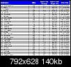
I got bored one day and made up an approximate drive time chart using Google. All of the times are from Starting from Denver, NC (28037) so obviously if you're in South Charlotte there's gonna be a difference depending on which direction you're headed.
And here's an older post, it uses Microsoft Streets 2006 software but the time estimates are way off but a fun little picture nonetheless. Charlotte, NC is starting point for the map below.
Quote:
Originally Posted by MysteryMT

I used Microsoft Streets and Maps 2006 and created a drive time map.
Four Circles were created:
060 Minutes - Red
120 Minutes - Green
180 Minutes - Blue
240 Minutes - Purple
Attachment 58726
This is assuming a start point right in the middle of Charlotte and "normal" driving speeds.
I haven't driving these routes, but it appears Wilmington (198 miles), Myrtle Beach (201 miles) & Charleston (209 miles) represent the closest beaches to Charlotte. |

 Please register to participate in our discussions with 2 million other members - it's free and quick! Some forums can only be seen by registered members. After you create your account, you'll be able to customize options and access all our 15,000 new posts/day with fewer ads.