Please register to participate in our discussions with 2 million other members - it's free and quick! Some forums can only be seen by registered members. After you create your account, you'll be able to customize options and access all our 15,000 new posts/day with fewer ads.
NEW ORLEANS
Jefferson Parish, LA excl. District #1 - 338,451 - 111
Orleans Parish, LA - 390,144 - 169
Plaquemines Parish, LA excl. District #1 and #9 - 20,740 - 283
St. Bernard Parish, LA excl. District E - 37,949 - 22
St. Charles Parish, LA - 52,773 - 278
St. John the Baptist Parish, LA - 43,242 - 214
St. Tammany Parish, LA - 260,419 - 845
Tangipahoa Parish, LA - 134,758 - 791
NEW YORK
Bergen County, NJ - 932,202 - 233
Essex County, NJ - 798,975 - 126
Hudson County, NJ - 672,391 - 46
Middlesex County, NJ - 825,062 - 309
Nassau County, NY - 1,356,924 - 285
New York City, NY - 8,336,817 - 300
Passaic County, NJ - 501,826 - 186
Rockland County, NY - 325,789 - 173
Suffolk County, NY only Brookhaven Township and points West - 1,338,062 - 565
Union County, NJ - 556,341 - 103
Westchester County, NY - 967,506 - 431
TOTAL POPULATION - 16,611,895 Land Area: 2,749
Remember that these are based on the 2019 ACS counts, so the 2020 Census numbers would be much higher and the real population in this area is closer to 17.5 million
MIAMI
Broward County, FL excl. Conservation CCD - 1,952,778 - 404
Indian River County, FL excl. Fellsmere CCD - 137,526 - 117
Martin County, FL excl. Indiantown CCD - 139,463 - 134
Miami-Dade County, FL excl. Everglades CCD - 2,710,289 - 970
Monroe County, FL excl. Cape Sable CCD - 74,209 - 123
Palm Beach County, FL excl. CCDs of Belle Glades, Glades, and Western Community - 1,428,291 - 591
St. Lucie County, FL excl. West St. Lucie CCD - 322,168 - 208
TOTAL POPULATION - 6,764,724 Land Area: 2,547
Extremely impressive numbers for Miami. The Everglades really do take away from just how dense the metro is.
The following rant is directed at the Census Bureau, not at you, OP. It really frosts me how they've defined the Miami CSA. It extends a ridiculously huge distance up and down the coast, all the way to and including Indian River County to the north, and Monroe County to the south. The driving distance via I-95 from the northernmost community of Sebastian down to Miami is a whopping 164 miles. And, going the other way, the driving distance from Miami to Key West via U.S. 1 is 166 miles. How can any strand of cities be considered a single area when their extremities are separated by 330 miles?
This way-long distance between Sebastian and Key West is equivalent to the driving distance between Los Angeles and San Jose, or between Boston and Philadelphia, or between Chicago and St. Louis. Does anyone think that those respective city-pairs belong in the same Census region? It doesn't make sense! Miami to West Palm Beach, I can see the logic there. But anyone who's ever driven I-95 in South Florida knows that this region (the Gold Coast) feels distinct from the one to the north (the Treasure Coast), with PGA Blvd. being the point where you really feel the divide.
OK, rant over. OP, I'm impressed with the amount of effort you're putting into this. It'll make for some very interesting comparisons, I'm sure.
I’ll say, Houston is probably done a disservice for including all of Harris County, Montgomery had nearly half a million and the soon to be 2nd largest city in the MSA, in Conroe. Galveston County is small and compact by the western third is empty land. As in only farms and basically not a single neighborhood.
I feel like at minimum The Woodlands and Pearland CCDs if possible
Should be included and far NW Harris county excluded. The issue is NW Harris Count ymight include to substantial a part of suburban Cypress.
Mobile County and Washington County: 2700 Sq Miles
Mobile County AL: 414,399 - 1,644
Washington County AL: 15,389 - 1,089
Or Mobile County and Baldwin County (around and south of I-10): ~2600 Sq Miles
Mobile County Al: 414,399 - 1,644
Baldwin County (part): 202,836 - ~1000 Sq Miles
I’ll say, Houston is probably done a disservice for including all of Harris County, Montgomery had nearly half a million and the soon to be 2nd largest city in the MSA, in Conroe. Galveston County is small and compact by the western third is empty land. As in only farms and basically not a single neighborhood.
I feel like at minimum The Woodlands and Pearland CCDs if possible
Should be included and far NW Harris county excluded.
Yeah, this first round is a rule-of-thumb, and I'll go back later and see if I can get more juice for the squeeze. Already did that with Dallas and managed to add another 300,000 by trading away Outer Collin for Central Denton County.
The issue is the unit of measurement for large counties is the CCD, and Montgomery County is actually less dense than Northwest Harris. As in 3x less dense.
And the CCD with Conroe-The Woodlands isn't much better.
So if there's juice to squeeze, it wouldn't be by subtracting Harris. I'd have to see if there's a way to add the The Conroe-Woodlands CCD and subtract elsewhere, possibly Northeast Harris and La Marque-Hitchcock CCD, but that still puts me over 2,750. There's definitely some configuration that adds to Houston, but it requires me to remove the Rosenberg CCD as well.
Harris is just way too big to be having 4.2 million people in two CCDs. But adding The Conroe-Woodlands CCD and subtracting the 3 CCDs above would fit under 2,750 and add 200,000 to Houston's tally.
Last edited by manitopiaaa; 09-27-2021 at 07:56 PM..
I’ll say, Houston is probably done a disservice for including all of Harris County, Montgomery had nearly half a million and the soon to be 2nd largest city in the MSA, in Conroe. Galveston County is small and compact by the western third is empty land. As in only farms and basically not a single neighborhood.
I feel like at minimum The Woodlands and Pearland CCDs if possible
Should be included and far NW Harris county excluded. The issue is NW Harris Count ymight include to substantial a part of suburban Cypress.
I was going alphabetically, but apparently need to go back to elementary school since I forgot 'L' comes before 'M' and 'N'
LAS VEGAS
Clark County, NV - Las Vegas CCD only - 1,953,370 - 479
TOTAL POPULATION - 1,953,370 Land Area: 479
Las Vegas is a unique case because Clark County only has 2 CCDs: the inner one with almost everybody in less than 500 square miles, and the outer one with 228,634 in 7,013 square miles. So there is no possible way to be within 10% of 2,500 square miles. But as going under is preferable to going over, then the Las Vegas Valley only CCD wins out by itself.
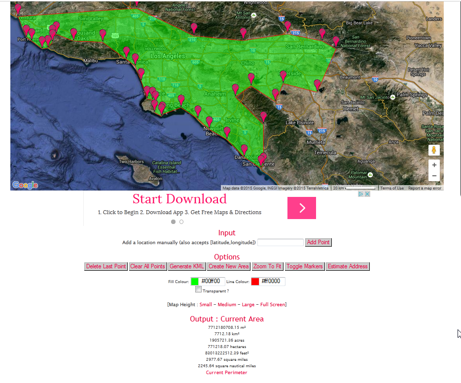
LOS ANGELES
Los Angeles County excl. the 4 CCDs of Agoura Hills, Newhall, North Antelope, and South Antelope - 9,310,659 - 1,542
Orange County excl. Mission Viejo, Silverado CCDs - 2,935,756 - 572
Riverside County - only Riverside CCD - 487,233 - 162
San Bernardino County - only Ontario, San Bernardino CCDs - 1,518,081 - 449
TOTAL POPULATION - 14,251,729 Land Area: 2,725
The numbers above are a bit restrictive, since some of LA's most populous CCDs - incl. San Fernando Valley and Los Angeles CCD - still include empty mountains. Those combine for about 400 square miles of the 2,725.
Without that 400 taken up, you could add Simi Valley CCD, Thousand Oaks CCD, Norco CCD, Mission Viejo CCD, Yucaipa Valley CCD, and Corona CCD which total 420 square miles and have an additional 910,811 people. So a fairer estimate would be 15,162,540. Los Angeles isn't too far behind New York.
The following rant is directed at the Census Bureau, not at you, OP. It really frosts me how they've defined the Miami CSA. It extends a ridiculously huge distance up and down the coast, all the way to and including Indian River County to the north, and Monroe County to the south. The driving distance via I-95 from the northernmost community of Sebastian down to Miami is a whopping 164 miles. And, going the other way, the driving distance from Miami to Key West via U.S. 1 is 166 miles. How can any strand of cities be considered a single area when their extremities are separated by 330 miles?
This way-long distance between Sebastian and Key West is equivalent to the driving distance between Los Angeles and San Jose, or between Boston and Philadelphia, or between Chicago and St. Louis. Does anyone think that those respective city-pairs belong in the same Census region? It doesn't make sense! Miami to West Palm Beach, I can see the logic there. But anyone who's ever driven I-95 in South Florida knows that this region (the Gold Coast) feels distinct from the one to the north (the Treasure Coast), with PGA Blvd. being the point where you really feel the divide.
OK, rant over. OP, I'm impressed with the amount of effort you're putting into this. It'll make for some very interesting comparisons, I'm sure.
Over 90% of the people in the Miami CSA live Miami to West Palm Beach though. The other 10% are probably just representing South Florida hard. Census Bureau knows whats up
Please register to post and access all features of our very popular forum. It is free and quick. Over $68,000 in prizes has already been given out to active posters on our forum. Additional giveaways are planned.
Detailed information about all U.S. cities, counties, and zip codes on our site: City-data.com.

 Please register to participate in our discussions with 2 million other members - it's free and quick! Some forums can only be seen by registered members. After you create your account, you'll be able to customize options and access all our 15,000 new posts/day with fewer ads.