Please register to participate in our discussions with 2 million other members - it's free and quick! Some forums can only be seen by registered members. After you create your account, you'll be able to customize options and access all our 15,000 new posts/day with fewer ads.
In other words - liberals have to resort to distorting maps to gain any traction - just as they do with the truth - bend and twist it to make it "fit" their ideology.
Isn't it interesting that in either case - they are rarely successful in substance - but can borrow the gullible minds of a few to occasionally win an election?
Pretty dishonest - if you ask me.
Why do people vote for these liberal clowns?
In other words, repugnicans cannot accept FACTS, no matter how they are presented.
People elect the President, not land masses. The linked maps show where the people are and how they voted.
From the FAQ: Where are Alaska and Hawaii? Not on the maps. I know. Sorry. There are some technical problems with non-contiguous cartograms that make it difficult to produce nice maps. Frequently asked questions
And, the creator of the maps: Mark Newman, Department of Physics and Center for the Study of Complex Systems, University of Michigan
Email: mejn@umich.edu
Updated: November 8, 2012
And they are safe because they have low rates of minorities. The most unsafe states have high minority populations which have, unfortunately, a high propensity for crime. If one were to be pragmatic one might assume that this is why the whites in those states vote conservative.
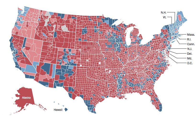
For the ignorant. This map should kill the red state/blue state argument.
How does that kill the red state/blue state argument? Looks to me like a sea of red rural areas, with splotches of blue (mostly urban areas) that turn some states blue.
Please register to post and access all features of our very popular forum. It is free and quick. Over $68,000 in prizes has already been given out to active posters on our forum. Additional giveaways are planned.
Detailed information about all U.S. cities, counties, and zip codes on our site: City-data.com.

 Please register to participate in our discussions with 2 million other members - it's free and quick! Some forums can only be seen by registered members. After you create your account, you'll be able to customize options and access all our 15,000 new posts/day with fewer ads.


 How does that kill the red state/blue state argument? Looks to me like a sea of red rural areas, with splotches of blue (mostly urban areas) that turn some states blue.
