Please register to participate in our discussions with 2 million other members - it's free and quick! Some forums can only be seen by registered members. After you create your account, you'll be able to customize options and access all our 15,000 new posts/day with fewer ads.
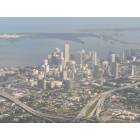
I've made a new map - based on the launch of the successful Neighborhood-O-Meter I did for Miami-Dade - covering all neighborhoods and Cities within Broward County rated by general quality of life/desirability.
The link to it is at the end on this opening post. This should be useful to a great number of people relocating or thinking of relocating (or already living here in SoFL) to somewhere within Broward.
Notes: Input/comments to make further updates soon on the map are very appreciated. It's a Beta project.
Additionally, if you can't see all the areas in the map at the same time on the link at the end of the post, just Copy (right click on the link and Copy) and Paste the following link on the Google Maps Search and click on Search (or click Enter - both ways work): https://maps.google.com/maps/ms?ie=U...e91c0ce9b49c06 (Only click on this link itself if you wish to download the map in KML format, this way you can also see it on Google Earth) Otherwise, you can just go through the pages and see the neighborhoods page by page, by clicking Previous and Next down in the Map Description.
Remember people that this is still not a final project (will be soon - probably in the next few weeks / also I'll be sending a petition to the Moderator to make it into a Sticky later as I did with the Miami-Dade one) and may/probably has multiple faults and slight issues for now.
As a whole, this map is pretty accurate and I don't see any major faults. Great job!
Some of the minor errors I can think of...bear with me, the list is long.
Sunrise-Sunrise Lakes retirement area should be blue. Not a great looking area but mainly a peaceful area full of retirees.
On the other hand, area of run down rental housing west of Nob Hill Road and north of Sunset Strip in Sunrise should be a yellow. That is also the only section west of University deserving of yellow.
Plantation-The light blue area around Broward Mall is an emerging solid green area due to some mid/high rise housing developments being built there.
Lauderhill/Lauderdale Lakes/Tamarac- the single family home area between Oakland Park Blvd, Commercial Blvd, the turnpike and the first fringe of rental housing off of State Road 7 is a solid blue.
Same for the area between the canal and 44th street east of State Road 7.
The whole of Inverrary should be light green. I know Lauderhill has a "reputation", but Inverrary is fine and very well maintained.
Pembroke Pines- The Chapel Trail area of Pembroke Pines should be dark green, especially if sections of Towngate are dark green. Either that, or set the whole west of Dykes Road/north of I-75 area as dark green, and Towngate/Spring Valley as solid green.
Davie-The blue areas of western Davie should not extend beyond the mobile home parks. I was very surprised to see Harmony Lakes as a "blue" neighborhood. The exception is the single family neighborhoods next to Western High School which should be light green or possibly blue. Also, Forest Ridge and southward is possibly deserving of dark green.
Triangular "blue" zone off of Davie Road extension should be orange. It's pretty bad back there.
Downtown Davie area should be yellow.
Miramar- SOUTH of the turnpike should be yellow. Looks nice, but very crime prone.
Sherman Circle area of Miramar should be a yellow. It looks OK and you could live safely there if you had to, but it's packed full of Section 8 housing and has lots of drug activity.
Also noticed in that same area that the last blocks off of County Line are yellow. I see no reason for this as those are nice blocks that could border on "light green" as can that whole section.
Also, I would go with Orange between Dixie and 95, and red for Royal Poinciana. Royal Poinciana is a tad worse than the current "red" area.
Yellow area around Eco golf course should be light green. Quaint, nice neighborhood.
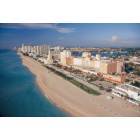
441 corridor should be yellow, not red. It's ugly but there are worse crime areas. It's definitely not worse than Liberia which is (accurately) ranked orange.
Dania- The area that you have labeled as Dania Beach (west) should be a blue without question.
Hallandale- Blue area east of US1 is an easy light green.
Coral Springs- Riverside Drive corridor between Wiles and Sample should be yellow, and the rest of the square between there Rock Island Road and University Drive should be blue.
There is also no reason to make that area off of the Sawgrass Expressway near Atlantic Blvd any lighter than solid green.
Unincorporated- Melrose Park/Broward Estates should be blue and yellow, respectively.
Cooper City- Should be solid green across the board except for the area labeled "just east of Flamingo Road" which is labeled perfectly and the areas along 90th Ave which are also ranked pretty well.
I have to look through some other areas a little more but this is what I see for now. Great job!
Already did most changes Compelled, great tips, thank you. Take a look, see if the changes are proper. And if you've got more of them, please post it here.
The only minor details; Cooper City I mostly changed only besides a worse looking, with increased poverty rate and sex offenders near its south end as light green. And I believe both Melrose Park and Broward Estates should be yellow, due to both neighborhoods having very similar avg. home prices, avg. income, percentage of people with very low incomes (poverty rate), sex offenders, etc. The Plantation light blue is just to mean that's mostly (in this case) non-residential, it doesn't stand for much, only that's near (above or below) average and it will depend on the surrounding areas - which I'll put on the description as I did in the Miami-Dade. Sunrise Lakes will have to technically remain in yellow due to a very high number or persons living in poverty/near poverty and below avg. aspect; even being a peaceful area with loads of retired people.
Now Hollywood, I put the 441 Corridor orange; it really is a troubled area with high poverty and high crime rate for an only somewhat dense area; and the I-95 to Dixie area remains red, for basically the same reasons as the 441 corridor, but even worse off.
The questions I have is that I didn't really get the Riverside corridor update, the stats and looks for the area aren't really that bad (at all, mostly). I changed a little the surroundings, see if it's fine - good enough. And Royal Poinciana is really that bad? It's just NW of the Young's circle area.
It may be because I'm looking on my phone, but I'm not sure what all the colors mean. I don't see a key.
I know the darker green is the best through to green. And yellow and red are worst. But where do purple and blue fit in?
Thanks!
Oh, it's most probably the phone. I've experienced issues when looking it through the phone as well. The best way to make it work on a phone - which is what I'm doing - is to either do, depending on the phone OS, as follows:
( Note: To everybody else wanting to look the map through a phone or tablet properly, here's the instructions: )
Android: Download the app KMLZ to Earth from the Google's Play Store (and Google Earth Mobile - also Play Store), and then click on the link at the first post here right in the middle of it (the one to download in Google Earth's format), afterwards you open it through the app downloaded and it will appear nicely on Google Earth (it just won't have the keys to the colors and description - both Android and iPhones/iPads - unfortunately).
iPhone & iPad: Download the Google Earth app from the App Store, and then come back here to click on the middle link to download the file and open it with Google Earth (I only have an iPad, so I don't know if it will work on the iPhone - any problems, download the KML Viewer app and use it to open the file and see on Google Earth).
Standard Phones: The only current way is through Google Maps itself - loading with issues unfortunately.
If you still have issues, just reply me here. And thanks for the support!
Coral Springs: The Riverside Drive and Woodside Drive corridors between Sample and Wiles are bad (its actually unincorporated) and should be yellow, possibly orange. Make the corridors orange and extend yellow to between 75th ave and 73rd way. 73rd way toward Rock Island (and that piece east of Rock Island) could actually be standard green.
Between Coral Ridge Drive and 110th ave and from Wiles down to 39th should be yellow and then 39th east to Coral Springs Drive (and that one block east) blue.
There's a part of Coral Ridge Drive on the eastside, south of Sample that should be yellow.
The blue on Royal Palm between Coral Ridge and Coral Springs Drive should be yellow and can turn the piece east of Coral Springs Drive light blue.
Behind the walk towards Mullins Park staying north of Royal Palm could be standard green.
The Visconti condos on the southwest corner of Atlantic and Ramblewood should at most be blue.
Just some suggestions, hope this helps as it looks like a good project.
Well described, although I wouldn't rank any section of Coral Springs worse than yellow. The Riverside corridor is definitely yellow worthy, but the other areas balance out to be blue IMO.
And after looking at the map, here are some other things I noticed
North Lauderdale- Lots of odd light green spots. Rank them as blue. They are fine but not above average.
The yellow zone between McNab Road and Bailey Road should be a blue, except for the area of duplexes between 64th Ave and 70th way
Miramar- The dropoff of neighborhood quality between 64th Ave and 62nd (east Miramar) occurs as one gets closer to Pembroke Road. I would start the blue area south of 27th Street (being conservative) and extend it all the way to County Line.
Coconut Creek- Wynmoor retirement community and surrounds should be at least light green. That is a very well maintained community and the neighborhoods off of Copans in the Township are yet another step up.
Sunshine Drive is getting rough. It's yellow worthy.
Hollywood- I noticed that Driftwood Acres was changed from blue to yellow. Driftwood acres is fine, it should be blue. It's a blue collar area of basic but decently maintained homes.
Sunrise- Blue is a much fairer rating. The reason for a high reported poverty rate in Sunrise Lakes is because virtually all of the residents are on fixed incomes collecting social security checks. It's similar to Century Village which is a tiny bit nicer (gated) and currently ranked light green. While there is some poverty, most people are doing OK. The community itself is also decently maintained in terms of landscaping and condition of the buildings. I see no reason for it to remain yellow.
Pembroke Pines- I noticed that you have one of the nicest parts of Silver Lakes and sections of Chapel Trail ranked lower than parts of Towngate. The dark green area should just extend west of the Spring Valley community and span from the Pembroke Pines city limit to Pines Blvd except for the trailer park west of US 27 which should be blue.
Cooper City- The unchanged light green area on the southeast end is home to the brand new Monterra development, the affluent Diamond Head development and large 1970s homes on some of the largest plots of land in Cooper City. If anything, this area should be DARK green.
Again, thanks for this great resource and all of the time you have put into it. I tried doing a similar map but it is not an easy project at all!
Last edited by compelled to reply; 04-24-2013 at 09:42 AM..
Please register to post and access all features of our very popular forum. It is free and quick. Over $68,000 in prizes has already been given out to active posters on our forum. Additional giveaways are planned.
Detailed information about all U.S. cities, counties, and zip codes on our site: City-data.com.

 Please register to participate in our discussions with 2 million other members - it's free and quick! Some forums can only be seen by registered members. After you create your account, you'll be able to customize options and access all our 15,000 new posts/day with fewer ads.