Please register to participate in our discussions with 2 million other members - it's free and quick! Some forums can only be seen by registered members. After you create your account, you'll be able to customize options and access all our 15,000 new posts/day with fewer ads.
The metro area includes St. Charles County (which the Illinois does touch), Jefferson County, and on the Illinois side Calhoun County, Madison County, Jersey County, St. Clair County, and Monroe County. The metro area is a sufficient definition to say which rivers touch a city. Many others on here are referring to metro areas. In fact, St. Louis is often referred to as the meeting of the great rivers (Illinois, Mississippi, and Missouri)
But the OP asked about cities, not metro areas. I was just staying within the parameters of the question, which some posters seem to have a problem with.
The River Des Peres is a river, no matter what you call it today...it was once a river as much on the surface as any. Much of it is submerged underground, but you can very clearly see its valley going along the train tracks and down McCausland, Ellendale, and Wabash Ave. If you include the whole St. Louis metro area, you can add the Illinois River as a fifth.
Okay, it's a manmade river. A canal. A big ditch. It was dug by hand as a huge public works project. If that's a river, so be it.
Location: Jefferson City 4 days a week, St. Louis 3 days a week
2,709 posts, read 5,094,873 times
Reputation: 1028
Quote:
Originally Posted by 1greatcity
Okay, it's a manmade river. A canal. A big ditch. It was dug by hand as a huge public works project. If that's a river, so be it.
It's not a manmade river!!! That river was here when French settlers first arrived in St. Louis. It was modified by man, that is true, but it was a natural river. Some of the river is actually still unmodified.
Washington, DC -
-The Potomac River (during the summer I kayak downtown DC every Saturday from Jack's Boathouse in Georgetown!!!)
-Anacostia River
-Patuxent River (nearby in Maryland)
Phoenix.............. Ummmmm.........
-The Salt River (but umm...) & I guess that Tempe Town Lake is really part of a river... All I know is I just found out you can canoe and kayak at Tempe Town Lake.
-I guess there's a Rio Solado somewhere near because of Rio Solado Golf Course...
-And, I know there's a canal nearby (Scottsdale) but I'm not sure what the name is. Nice place to jog though.
Atlanta.........Ummm.....
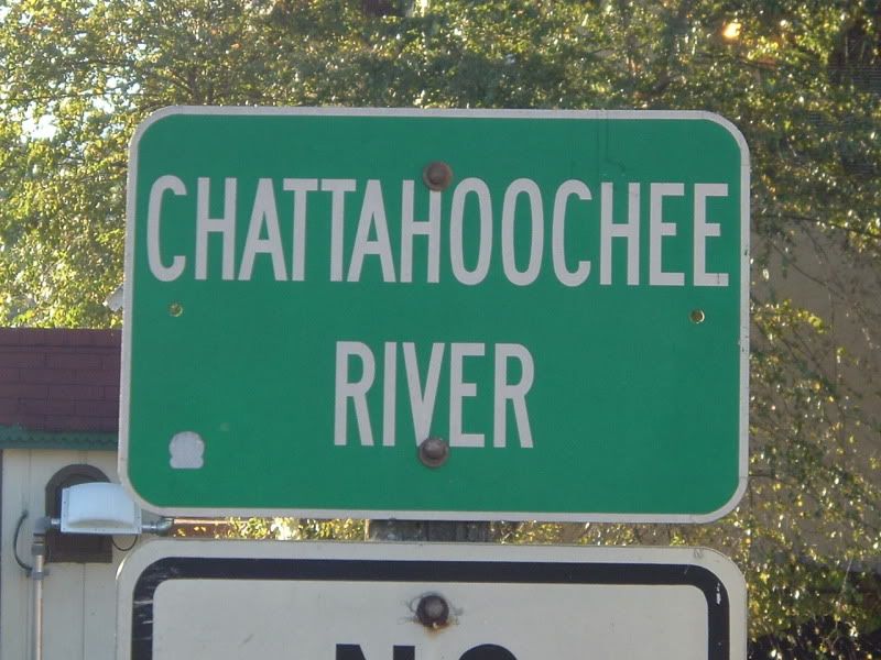
-OH YEAH, that Chattahoochee River, Creek thing... Nice. I hear you can ride down "The Hooch" in a tube.
Toronto's major rivers are the Humber River and Don River, and there's Etobicoke Creek and the Rouge River that form the East and West borders of the city (more or less). Other major ones are Mimico Creek and Highland Creek. Some of the big rivers split have significant tributaries too with deep valleys and large ravine/park systems.
Don River: Taylor Creek, East Don, West Don
Humber River: Black Creek, West Humber, East Humber
Outside city limits in the metro area:
Going West, there's Cooksville Creek, the Credit River, Joshua Creek, Morrison Creek, Sixteen Mile Creek, Fourteen Mile Creek, Bronte Creek
Going East there are about 3-4 major creeks but I'm not really familiar with that part of the metro area.
The biggest ones in the Toronto and it's Western suburbs are the Credit and Humber, followed by the Rouge and Don Rivers and Sixteen Mile and Bronte Creeks.
Mouth of Humber River from wikipedia:
Credit River near it's river mouth by Krysta Carver:
Don River from City of Toronto website:
In terms of rivers the size of the Ohio, there aren't any, but there's a lot of smaller ones that can be seen quite well in satellite imagery of Toronto.
Please register to post and access all features of our very popular forum. It is free and quick. Over $68,000 in prizes has already been given out to active posters on our forum. Additional giveaways are planned.
Detailed information about all U.S. cities, counties, and zip codes on our site: City-data.com.

 Please register to participate in our discussions with 2 million other members - it's free and quick! Some forums can only be seen by registered members. After you create your account, you'll be able to customize options and access all our 15,000 new posts/day with fewer ads.