Welcome to City-Data.com Forum!
U.S. CitiesCity-Data Forum Index
Go Back   City-Data Forum > U.S. Forums > General U.S.
 [Register]
Please register to participate in our discussions with 2 million other members - it's free and quick! Some forums can only be seen by registered members. After you create your account, you'll be able to customize options and access all our 15,000 new posts/day with fewer ads.
View detailed profile (Advanced) or search
site with Google Custom Search

Search Forums  (Advanced)
Reply Start New Thread
 
Old 11-10-2017, 11:10 PM
 
Location: Erie, PA
486 posts, read 595,728 times
Reputation: 685

Advertisements

Which state or states of the US, in your opinion, have the weirdest shape? Not necessarily the most unique shape or most recognizable (Texas), but jus an odd shape in general.


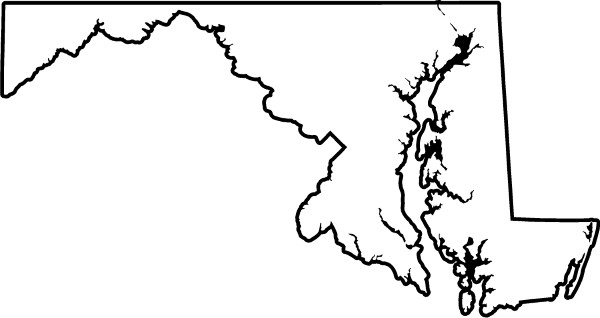
My pick is Maryland.


The state has always looked weird to me on a map. Maybe it's because, to me, it looks like the states surrounding Maryland (WV, VA, PA, DE) were drawn first and the leftover land was just made a state (I know it didn't happen that way lol).


Another thing about MD that looks weird? The 1.83 mile section between the MD/PA border and the MD/WV border. Don't get me wrong, MD is great, just shaped weird IMHO.


Reply With Quote Quick reply to this message

 
Old 11-10-2017, 11:18 PM
 
Location: PHX -> ATL
6,311 posts, read 6,721,267 times
Reputation: 7167
Maryland should've gotten Virginia's eastern shore, that whole peninsula is just weird.

Other than Maryland, West Virginia and Michigan.
Reply With Quote Quick reply to this message
 
Old 11-10-2017, 11:22 PM
 
Location: WA Desert, Seattle native
9,398 posts, read 8,737,965 times
Reputation: 8807
Idaho has a strange shape. But it wasn't always that way. Politics, gold, and greed changed it all.

https://www.tetonvalleynews.net/news...a0668f7a2.html
Reply With Quote Quick reply to this message
 
Old 11-11-2017, 12:26 AM
BMI
 
Location: Ontario
7,456 posts, read 7,210,605 times
Reputation: 6115
Maybe not weird but I like Nevada’s angle from the Colorado River down at 35N up to Lake Tahoe.

Also Oklahoma is like a pot with handle...it’s panhandle,
a panhandle so skinny,it’s like why bother, give it to Texas
Reply With Quote Quick reply to this message
 
Old 11-11-2017, 04:58 AM
 
Location: The canyon (with my pistols and knife)
14,169 posts, read 22,579,875 times
Reputation: 17323
West Virginia has a pretty unusual shape too. It extends farther north than Pittsburgh, farther south than Richmond, almost as far east as Rochester, and almost as far west as Columbus. It has two "panhandles" as well.
Reply With Quote Quick reply to this message
 
Old 11-11-2017, 07:56 AM
 
Location: Windsor Ontario/Colchester Ontario
1,784 posts, read 2,195,565 times
Reputation: 2284
Michigan! The lower peninsula is shaped like a mitten.
Reply With Quote Quick reply to this message
 
Old 11-11-2017, 09:17 AM
 
Location: City of North Las Vegas, NV
12,600 posts, read 9,336,365 times
Reputation: 3486
Hawaii could be described unusual being a group of islands and so can Alaska but I will go with Maryland
Reply With Quote Quick reply to this message
 
Old 11-11-2017, 09:41 AM
 
14,198 posts, read 11,440,782 times
Reputation: 38762
Michigan. It can't help its mitten shape, but the whole upper peninsula part should belong to Wisconsin. The way it's separated is weird.
Reply With Quote Quick reply to this message
 
Old 11-11-2017, 11:11 AM
 
Location: Green Country
2,842 posts, read 2,751,717 times
Reputation: 4675
Maryland was my guess before even coming into the thread.

West Virginia's panhandles make it very ugly.

Alaska's Juneau-Ketchikan Peninsula is also impossibly ugly.
Reply With Quote Quick reply to this message
 
Old 11-11-2017, 11:21 AM
 
Location: Green Country
2,842 posts, read 2,751,717 times
Reputation: 4675
Quote:
Originally Posted by Prickly Pear View Post
Maryland should've gotten Virginia's eastern shore, that whole peninsula is just weird.

Other than Maryland, West Virginia and Michigan.
Or just unite Maryland, Virginia, West Virginia and DC into a 'Capitol Region' state of 16,940,527 people in 73,296 square miles of land. It would still barely crack the Top 20 states by area.

Do the same for New England. 62,688 square miles and 14,735,525 people.

Give Delaware and Southern Jersey to Pennsylvania. Give the rest to New York.

Merge states together so that no state has less than <10 million people and aim for 25 states.

A lot of the funky shapes in Maryland/WV are historical in nature and there's no reason they should still remain valid. West Virginia wanted Harpers Ferry because it wanted a piece of the Chesapeake and Ohio Canal and didn't want Virginia to have a piece of the Baltimore and Ohio Railroad.

None of those have been valid for 100+ years. So why should WV still have these weird appendages?
Reply With Quote Quick reply to this message
Please register to post and access all features of our very popular forum. It is free and quick. Over $68,000 in prizes has already been given out to active posters on our forum. Additional giveaways are planned.

Detailed information about all U.S. cities, counties, and zip codes on our site: City-data.com.


Reply
Please update this thread with any new information or opinions. This open thread is still read by thousands of people, so we encourage all additional points of view.

Quick Reply
Message:

Over $104,000 in prizes was already given out to active posters on our forum and additional giveaways are planned!

Go Back   City-Data Forum > U.S. Forums > General U.S.

All times are GMT -6.

© 2005-2024, Advameg, Inc. · Please obey Forum Rules · Terms of Use and Privacy Policy · Bug Bounty

City-Data.com - Contact Us - Archive 1, 2, 3, 4, 5, 6, 7, 8, 9, 10, 11, 12, 13, 14, 15, 16, 17, 18, 19, 20, 21, 22, 23, 24, 25, 26, 27, 28, 29, 30, 31, 32, 33, 34, 35, 36, 37 - Top