Minnesota, Iowa, Missouri, Arkansas, Louisiana: Are They In The East or The West? (live, cities)
Please register to participate in our discussions with 2 million other members - it's free and quick! Some forums can only be seen by registered members. After you create your account, you'll be able to customize options and access all our 15,000 new posts/day with fewer ads.
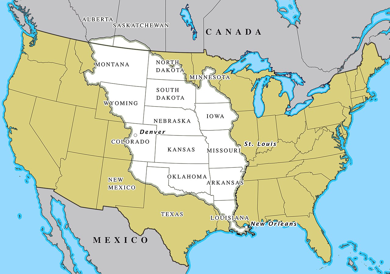
We've all heard of "the Chef" (the outline made by the states on the Western flank of the Mississippi River), but in the Great East/West battle, where do they fall?
There's the argument that the divider between East/West is the Mississippi River, hence the Gateway Arch in Saint Louis welcoming you to the West. Even Wikipedia states that the Eastern U.S. is the part East of the Mississippi River.
Yet cities like Kansas City market themselves as "a strategic starting point for the American West" and, of course, the Oregon Trail begins at the Western boundary of Missouri, not the Eastern one. Further, geographically, the middle point in the continental U.S. is closer to Kansas City than to Saint Louis.
So where do you place these 5 States: East or West?
(You can also split the baby: for example, I think Minnesota and Louisiana are east because their capitals - Saint Paul/Baton Rouge - are east of the Mississippi River).
Last edited by manitopiaaa; 09-10-2021 at 04:14 PM..
The Mississippi river is a convenient barrier to use for the divide but the real divide is the dry line which lies between the 98th and 100th meridian. Unfortunately the dry line doesn't follow a straight path but it is consistently between those two lines all the way from Mexico to Canada.
Last edited by eddie gein; 09-10-2021 at 04:25 PM..
I'd argue they aren't part of either. Parts of the Midwest could go to the east, Arkansas and Missouri could go to the west, Louisiana is more gulf oriented.
The Mississippi river is a convenient barrier to use for the divide but the real divide is the dry line which lies between the 98th and 100th meridian. Unfortunately the dry line doesn't follow a straight path but it is consistently between those two lines all the way from Mexico to Canada.
I like to use Colorado's eastern border, then draw it up and down. I would use the 100th meridian, but certainly not somewhere anywhere east of that.
The only one that feels even slightly western is Minnesota, and that's more about its lower population density and protected forests (and Minneapolis being a newer-feeling, growing city) than about culture or geography/topography.
I would say there’s some parts of western of MN that feel maybe a bit outside of the orbit the rest of the Eastern USA and considering the Minnesota had basically the largest post-trail of tears Native American conflict and that a lot of the state was settled after the civil war, I’d the possibility of MN being more on the western side of things but at the time, St. Paul and Minneapolis to a lesser extent feel a lot more eastern. Though I’ve heard that some people consider Minneapolis the first city of the west and St. Paul the last city of the east.
Also again even though I think they are overall maybe a bit more eastern, cities like Omaha and Kansas City still feel very different compared to cities on the Mississippi like Dubuque, St. Louis etc, so maybe there’s an argument there for some Missouri River based locations being westernish.
The Mississippi river is a convenient barrier to use for the divide but the real divide is the dry line which lies between the 98th and 100th meridian. Unfortunately the dry line doesn't follow a straight path but it is consistently between those two lines all the way from Mexico to Canada.
This is what I’d go with.
Having lived in Missouri and Arkansas, even the western parts, it was never western really. Maybe in the extreme western boarders like Kansas City where there is some old west history. 10 miles to the east, not so much.
Please register to post and access all features of our very popular forum. It is free and quick. Over $68,000 in prizes has already been given out to active posters on our forum. Additional giveaways are planned.
Detailed information about all U.S. cities, counties, and zip codes on our site: City-data.com.

 Please register to participate in our discussions with 2 million other members - it's free and quick! Some forums can only be seen by registered members. After you create your account, you'll be able to customize options and access all our 15,000 new posts/day with fewer ads.