Please register to participate in our discussions with 2 million other members - it's free and quick! Some forums can only be seen by registered members. After you create your account, you'll be able to customize options and access all our 15,000 new posts/day with fewer ads.
We just went up this past weekend and got on in Asheville kinda by the mall, and headed south towards Rosman. It wasn't the most scenic "from the vehicle" but all the lookouts were amazing. It was only my first time though so I am anxious to hear other routes
I'm not sure, but I think our route may be what was mentioned above in reverse... We usually take US Hwy 276 up through Greenville County past Caesar's Head (well worth a stop along the way), through & past Brevard, NC up to the BRP. On US 276 past Brevard, you'll pass Sliding Rock & Looking Glass Falls, both also worth a stop.
Take BRP east/northeast towards Asheville. IIRC, this stretch of the Parkway contains its highest point. There's also a lodge/motel with a cool gift shop & restaurant that serves a wonderful country lunch with a great view right on the Parkway. Once back in the Asheville area, follow the signs back to I-26, and you're barely an hour away from Greenville!
We just went up this past weekend and got on in Asheville kinda by the mall, and headed south towards Rosman. It wasn't the most scenic "from the vehicle" but all the lookouts were amazing. It was only my first time though so I am anxious to hear other routes
If you take the parkway from South to North you will get the best views because the views will be mostly on your right. Just Google the Blue Ridge Parkway and you can get a very nice printable map of all the "mile posts" and the places to get on and off. It's about a 400 mile drive that I've done at least 3 times... but never try the parkway after mid October. If you take the Parkway from Waynesville, that is a pretty drive as well.
Some of the nicest views are north of Asheville into VA. Awesome. And get on and off, especially at the Folk Art Center, and at Craggy Gardens etc. If you don't get on and off you might get car sick. Seriously.
From Asheville to Mt. Mitchell (and beyond if you have time) is pretty. We came home from Boone and Blowing Rock that way last Fall once the Parkway opened back up at Mt. Michell. It had been closed. If you would like a little hike, go a little ways beyond Mt. Mitchell to Crabtree Falls. Another poster suggested printing the map, and you should do that. Have fun!
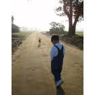
My favorite is Black Balsam Knob 8 miles south of Mt. Pisgah. Gives you access to several treeless balds with views of 4 states. (short 1/2 mile Hike) Elevation here is around 6000'-6200'ft. I have never been their when it was above 80 degrees. Here are a few pictures from a previous trip.
If you take the parkway from South to North you will get the best views because the views will be mostly on your right. Just Google the Blue Ridge Parkway and you can get a very nice printable map of all the "mile posts" and the places to get on and off. It's about a 400 mile drive that I've done at least 3 times... but never try the parkway after mid October. If you take the Parkway from Waynesville, that is a pretty drive as well.
Some of the nicest views are north of Asheville into VA. Awesome. And get on and off, especially at the Folk Art Center, and at Craggy Gardens etc. If you don't get on and off you might get car sick. Seriously.
For the ultimate drive, do it by motorcycle.
Why not take the BRP after mid-October?
If you are looking for beauty, that is peak season. Of course, if you are trying to get somewhere in a hurry, the BRP is never the ideal route.
If you are looking for beauty, that is peak season. Of course, if you are trying to get somewhere in a hurry, the BRP is never the ideal route.
Why not after mid October? because as the weather gets colder, conditions change quickly and it can get icey at the higher elevations, and heavy fog can find you stranded at times until it clears which could keep you there overnight. Everyone should check with the Parkway website for weather conditions up there. The Parkway is closed at times based on driving conditions which can be far different than where you start out from at a lower elevation. Always check the Parkway website or call a ranger station to find out if there are any areas that are closed. It's no fun to drive for long distance, only to have to turn around and go back, or get off and on again in between mileposts. Check this website for more comments on conditions in the fall. It IS gorgeous, but always check before going up in the fall. I wish more people would pay attention to conditions at times. Two years ago there was a husband and wife that literally went over the edge on an icey spot (no guard rails in many places) and luckily their SUV caught on a tree, they were not found until 24 hrs. later.
My favorite is Black Balsam Knob 8 miles south of Mt. Pisgah. Gives you access to several treeless balds with views of 4 states. (short 1/2 mile Hike) Elevation here is around 6000'-6200'ft. I have never been their when it was above 80 degrees. Here are a few pictures from a previous trip.
Make sure you scroll to the bottom of the page too. Just look for my user name..
Awesome pics. Thanks for sharing.
Thanks everyone for your suggestions. I did go to the BRP website and saw the maps which were helpful but I wasn't sure which route would be most scenic.
I know whichever way I went in the Fall would be pretty but not sure about this time of year. It's supposed to be rainy this weekend so we'll probably head up on Monday.
North from Asheville has: Folk art center and parkway destination center/headquarters. Rattle snake lodge, Craggy Gardens, Mt. Mitchell, Crabtree falls, Linville falls and caverns (depending on how far up you go), and Little Switzerland. You can get off at little Switzerland and take 226 back down (or 221 from linville) to marion to hop back on 40 and come back.
South of Asheville has: NC arboretum and Bent creek forest. Mt. Pisgah trails, Inn, and resturant, and then you could take 276 south which has the cradle of forestry, moore cove falls, sliding rock, looking glass falls, and other pretty little stops. From there you could go to Brevard and then come back either on 64 or continue down 276 past ceasers head/mnt bridge wilderness are to sc 11.
SO it really comes down to what do you want more... views or waterfalls. For views I'd say craggy gardens can't be beat. For waterfalls, obviously you'd want south as Transylvania county is "land of the waterfalls."
ALSO you don't need to print a map, you can stop at the Parkway visitors center in asheville and get a really nice fold out one to keep. The rangers can also help answer up to date info about cool things happening or road conditions. If you aren't familiar with the area, I'd suggest doing that.
Please register to post and access all features of our very popular forum. It is free and quick. Over $68,000 in prizes has already been given out to active posters on our forum. Additional giveaways are planned.
Detailed information about all U.S. cities, counties, and zip codes on our site: City-data.com.

 Please register to participate in our discussions with 2 million other members - it's free and quick! Some forums can only be seen by registered members. After you create your account, you'll be able to customize options and access all our 15,000 new posts/day with fewer ads.