Please register to participate in our discussions with 2 million other members - it's free and quick! Some forums can only be seen by registered members. After you create your account, you'll be able to customize options and access all our 15,000 new posts/day with fewer ads.
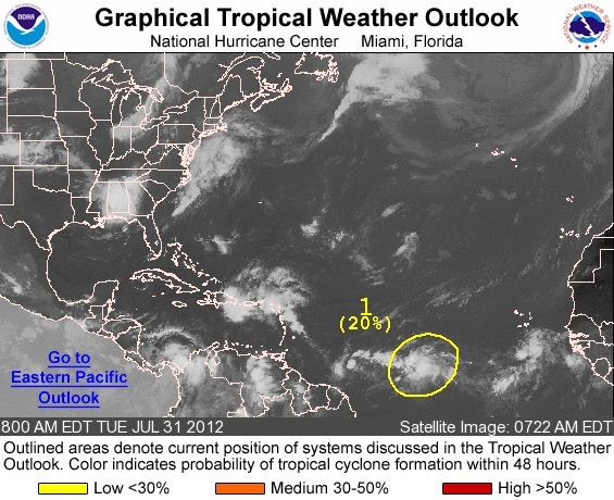
A WEAK AREA OF LOW PRESSURE ASSOCIATED WITH A TROPICAL WAVE LOCATED
ABOUT 1150 MILES WEST-SOUTHWEST OF THE CAPE VERDE ISLANDS CONTINUES
TO PRODUCE DISORGANIZED SHOWER AND THUNDERSTORM ACTIVITY.
ENVIRONMENTAL CONDITIONS APPEAR CONDUCIVE FOR SOME GRADUAL
DEVELOPMENT OF THIS LOW OVER THE NEXT FEW DAYS. THIS SYSTEM HAS A
LOW CHANCE...20 PERCENT...OF BECOMING A TROPICAL CYCLONE DURING THE
NEXT 48 HOURS AS IT MOVES WESTWARD AT 10 TO 15 MPH.
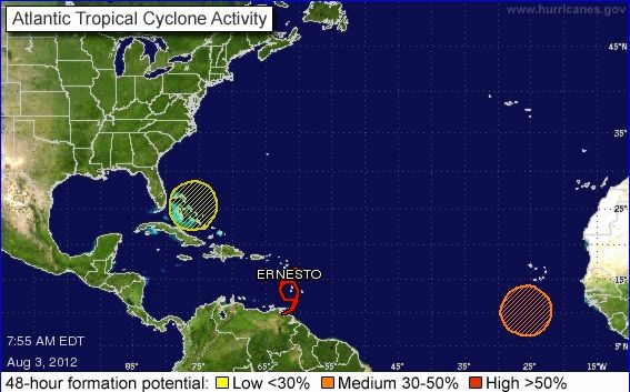
Now a "High Chance" (60%) this disturbance developing. Looks like we'll probably see Ernesto pretty soon. It's been over a month since we've had a tropical storm, I'm pretty surprised that there was nothing at all in July but four storms in May and June. Here is some info on Invest 99L.
This is pretty strange but funny to me. In July, we have absolutely no activity at all, not even any disturbances. But as soon as August 1st arrives, we get a tropical depression, and now even more activity behind Ernesto. It's funny how it goes from very quiet to very active just like that, and just because it's August and the "active part of the season" has begun.
This is pretty strange but funny to me. In July, we have absolutely no activity at all, not even any disturbances. But as soon as August 1st arrives, we get a tropical depression, and now even more activity behind Ernesto. It's funny how it goes from very quiet to very active just like that, and just because it's August and the "active part of the season" has begun.
Amazing what shear and SAL does..
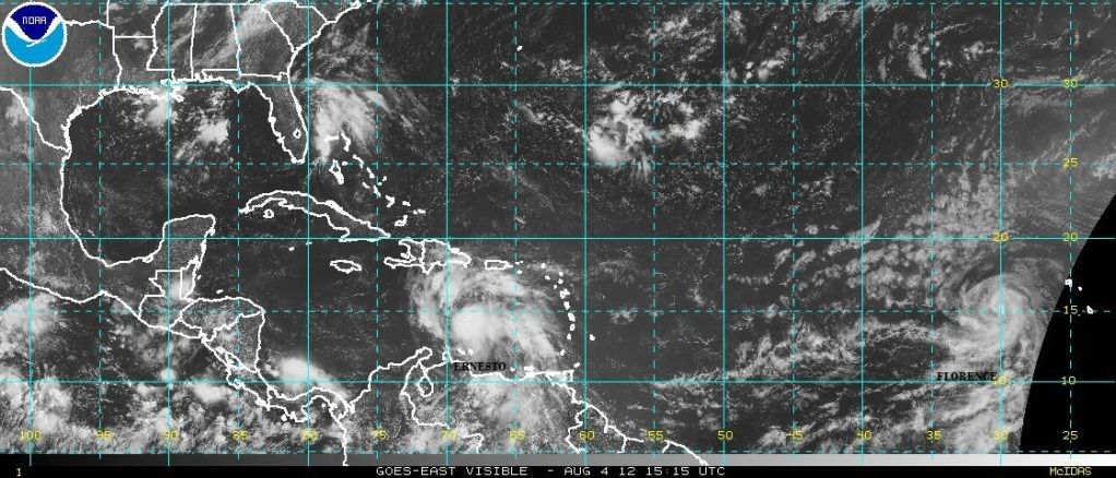
Current Satellite view shows the activity in the Atlantic. Ernesto has some nice outflow to it. (its breathing)
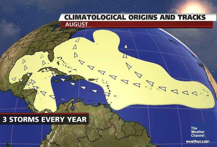
Ernesto and Florence are following the typical August tracks. Ernesto stayed south of the islands so its going towards the Gulf. Florence wont stay south (plus it developed farther East) so it will follow one of the north paths.
yeah looks like Florence is doomed to waste away in the middle of the Atlantic. Ernesto still has a chance to do some damage but still a difficult path
Please register to post and access all features of our very popular forum. It is free and quick. Over $68,000 in prizes has already been given out to active posters on our forum. Additional giveaways are planned.
Detailed information about all U.S. cities, counties, and zip codes on our site: City-data.com.

 Please register to participate in our discussions with 2 million other members - it's free and quick! Some forums can only be seen by registered members. After you create your account, you'll be able to customize options and access all our 15,000 new posts/day with fewer ads.